


HIKING OF THE SERRE DE GRENOUILLET
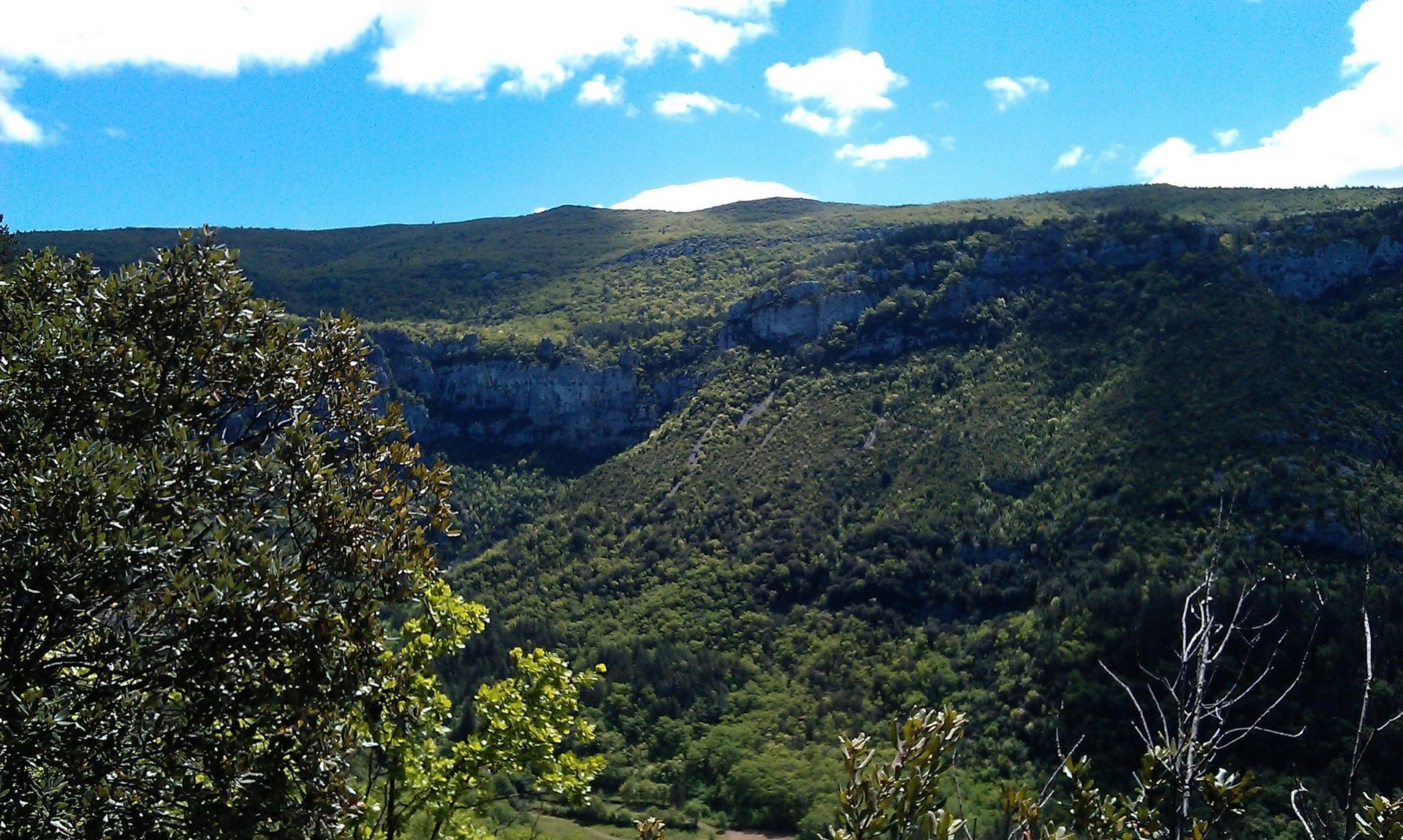
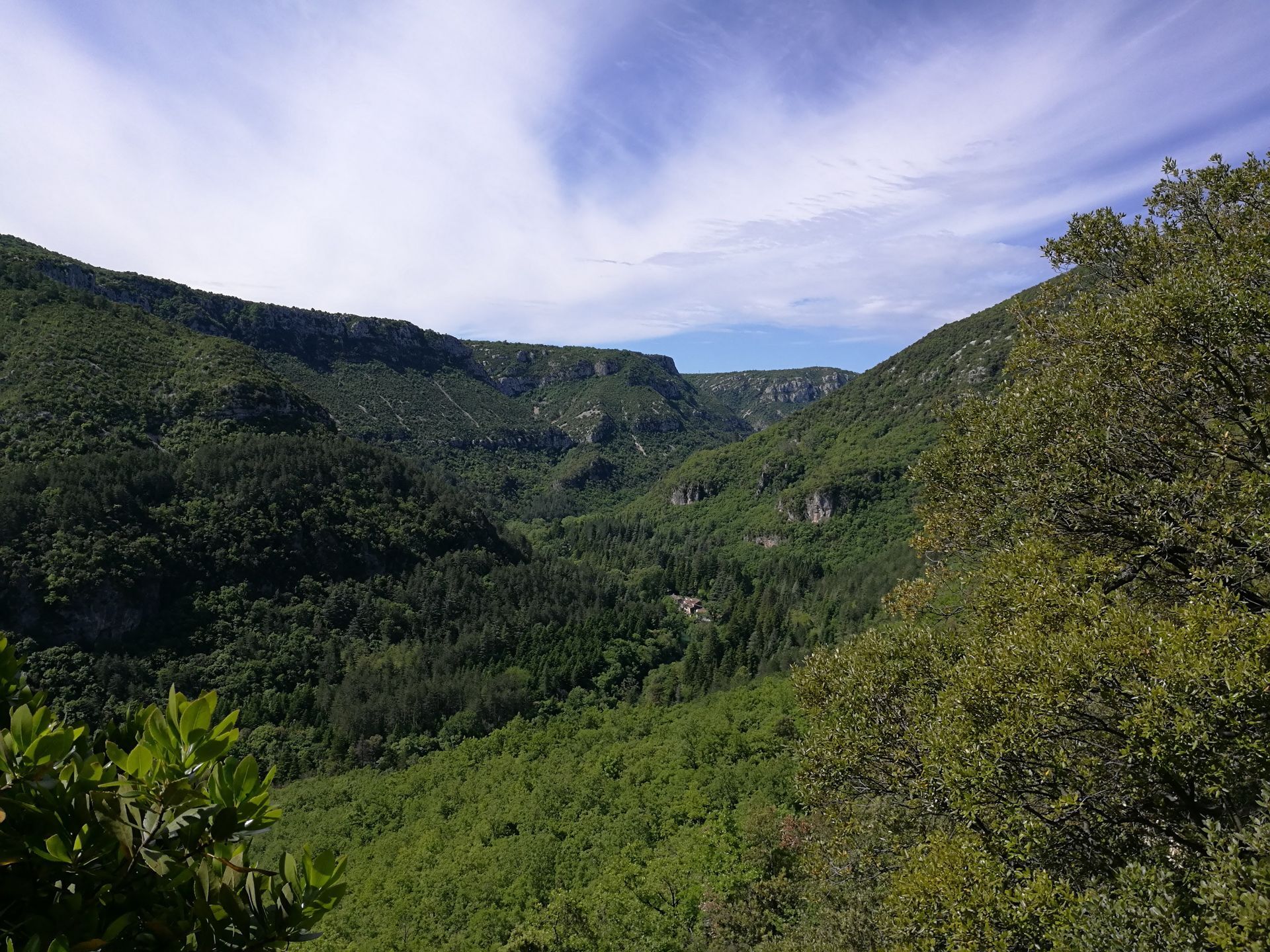
Starting from the Le Grenouillet forest house, this route gently climbs the foothills of the Blandas causse and offers striking views over the Vis valley.

1
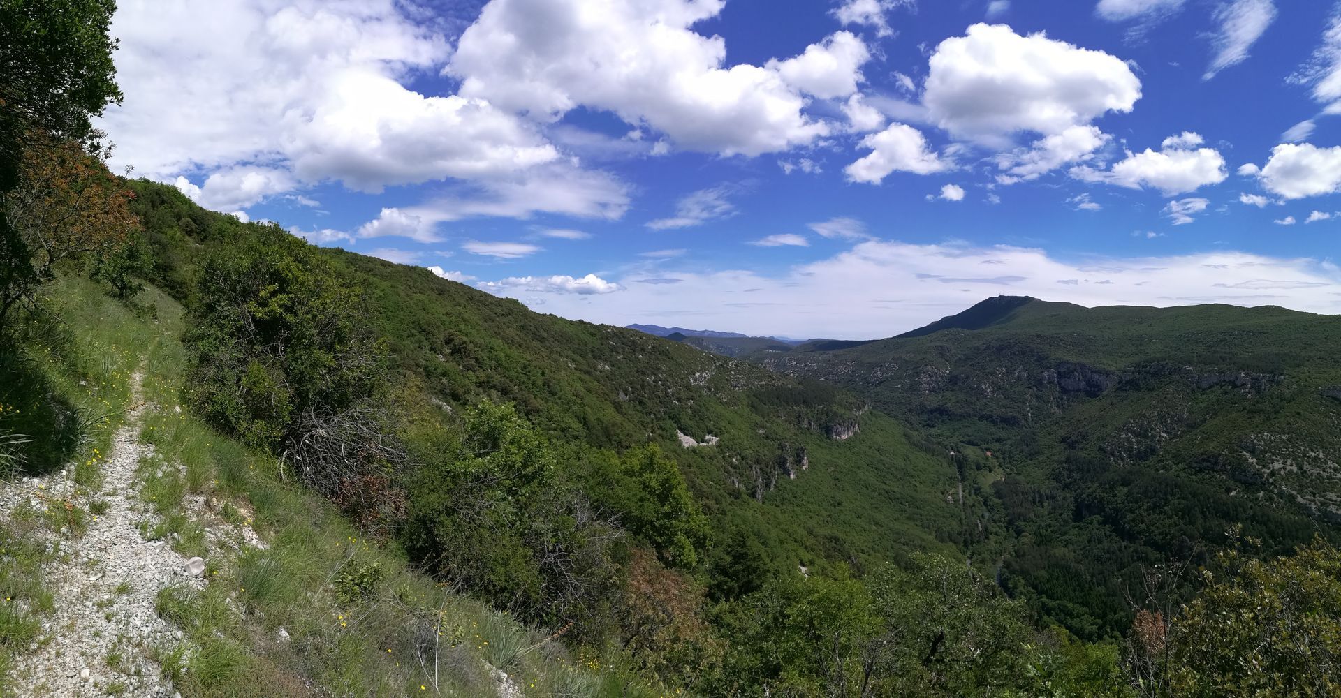
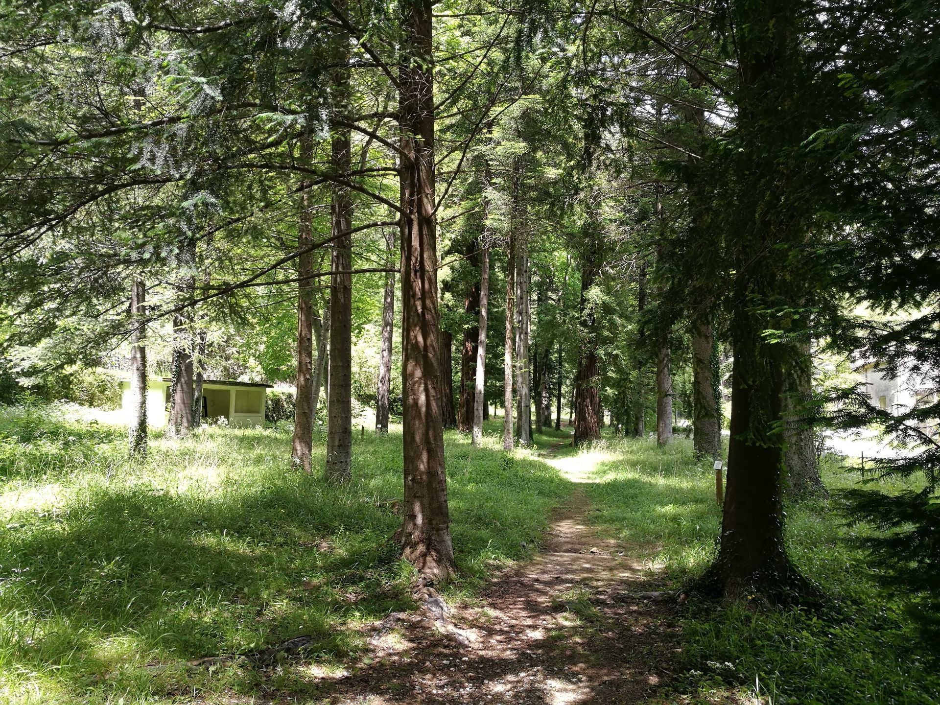
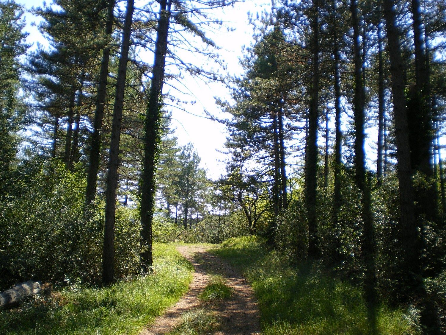
From the parking lot, enter the arboretum (sequoias, macluras: Osage oranges) and reach an old building. Climb 50 m, step over the intermittent stream to the right and continue through the fir forest along the path that rises steadily. Continue in the state forest populated by oaks and ashes, cross two narrow passages (caution: stay alert) and after several switchbacks (viewpoint over the Vis valley), reach a scree area.
2
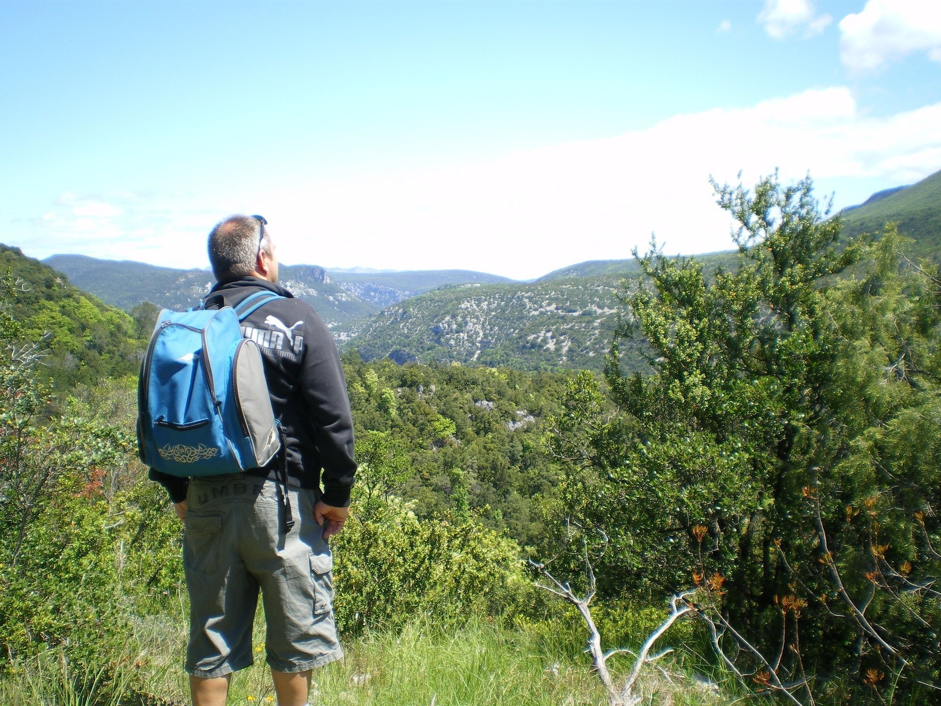
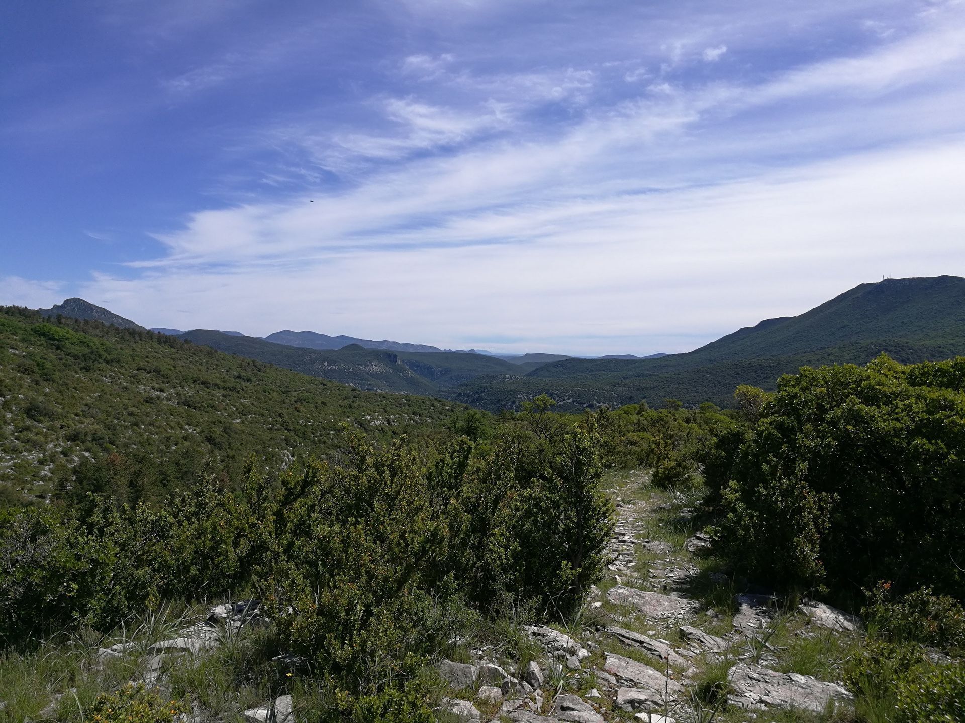
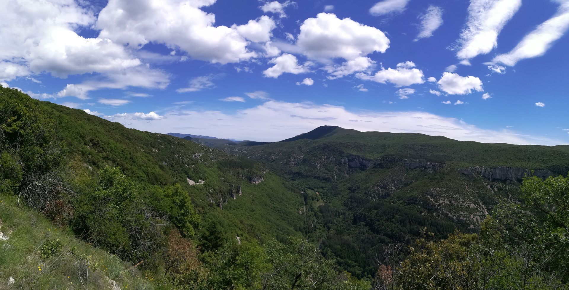
Turn right, cross the scree under the cliffs, then climb left by the winding path (asphodels, daffodils, and dwarf irises in spring) along the ridge line. At the edge of an oak wood, leave a path on the left and climb to a track. > Possibility to access the jasse (remarkable shelter, viewpoint over the Blandas causse): continue along the track for 200 m (yellow triangle marking).
3
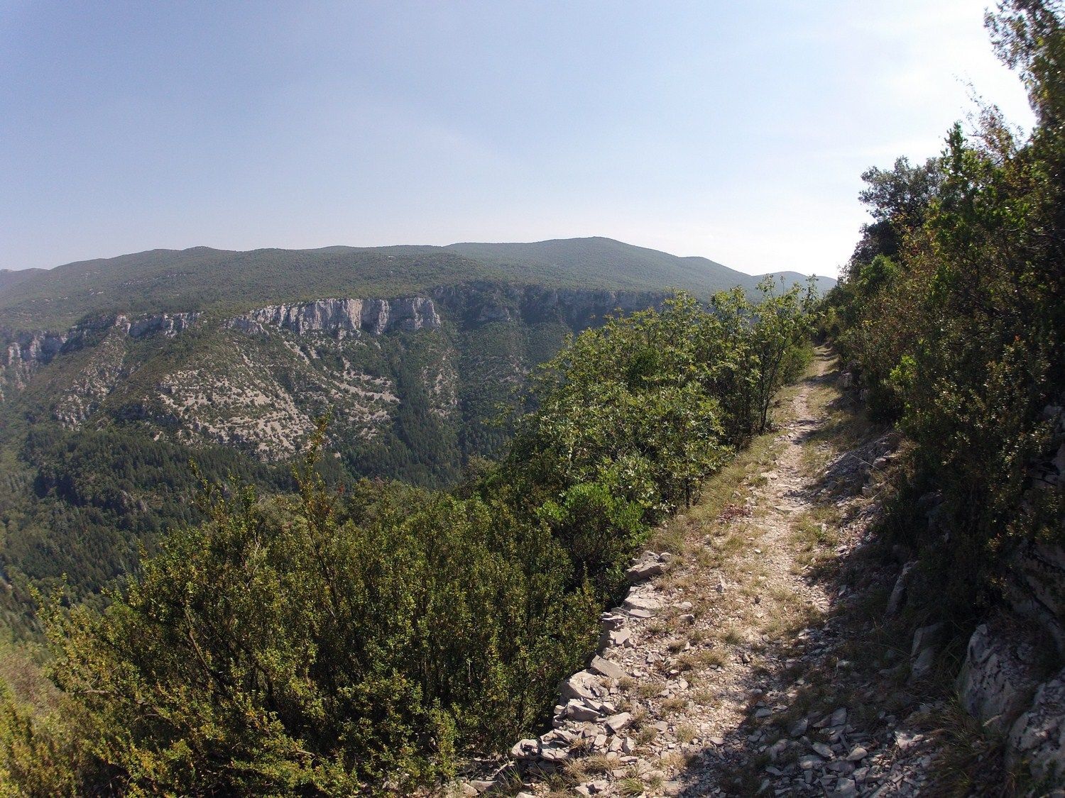
Take the track to the left. It descends and turns into a path. Continue on the balcony path over the Vis valley. It descends gently through scree and reaches a crossroads.
4
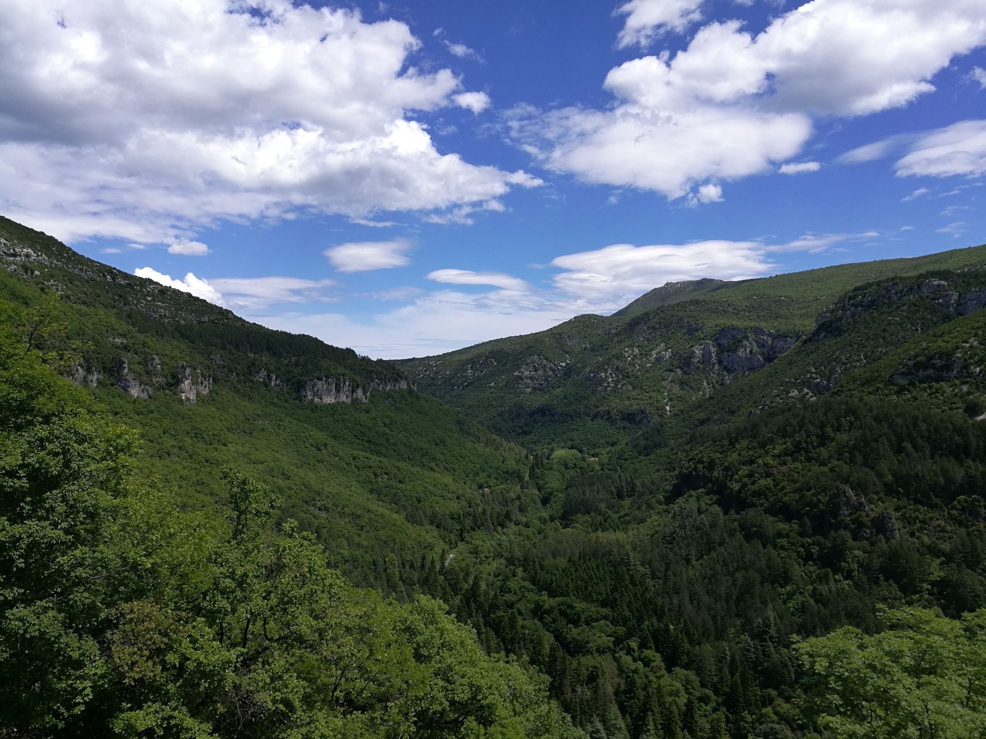
Descend the steep slope to the right through the scree. Continue along the zigzagging path and find denser and more humid vegetation (underwood, boxwood) before returning to the starting point.
Yellow PR
+33 4 67 67 76 36
DEPARTMENTAL COUNCIL OF HÉRAULT SPORTS AND NATURE DIRECTION
PDESI
Priljubljeni izleti v okolici
-
CIRQUE DE NAVACELLES AND MOULINS DE LA FOUX HIKING TRAILS
srednjaPohodništvo 9.73 km -
RANDONNEE DE PEYRE MARTINE
srednjaPohodništvo 15.4 km -
NAVACELLES HIKE - CAUSSE AND VIS GORGES
srednjaPohodništvo 19.6 km -
HIKE FROM DRY VALLEYS TO SOTCHS
srednjaPohodništvo 11.5 km -
HIKING TOUR IN THE HEART OF THE CAUSSE - GR® DE PAYS TOUR DU LARZAC MÉRIDIONAL
srednjaPohodništvo 56.7 km -
LA SERANNE PONTEL HIKE
srednjaPohodništvo 17.5 km -
HIKE OF NOTRE-DAME-DU-LIEU-PLAISANT
srednjaPohodništvo 11.1 km -
MEDIEVAL ROUTE BETWEEN SÉRANNE AND SAINT-GUILHEM MOUNTAINS
Motorno kolo 43.7 km -
TOUR DU LARZAC MÉRIDIONAL INTÉGRAL - GR® DE PAYS TOUR DU LARZAC MÉRIDIONAL
srednjaPohodništvo 104.3 km -
4.0
CYCLE LOOP No.4 - THE HÉRAULT GORGES AND THE COL DES LAVAGNES
srednjaKolesarjenje 53.3 km

Pohodništvo in sledenje


Ne zamudite ponudb in navdiha za naslednje počitnice
Vaš e-poštni naslov je bil dodan na poštni seznam.