


TOUR DU LARZAC MÉRIDIONAL INTÉGRAL - GR® DE PAYS TOUR DU LARZAC MÉRIDIONAL
WARNING: temporary route changes- (information April 2025): following a trail collapse on the GR® 7, the route is impassable through the Vis gorges between St-Maurice-Navacelles and the hamlet of Navacelles....
This hike is a synthesis of the 3 loops of the GR® de Pays Tour du Larzac Méridional crossing the Larzac plateau between Hérault and Aveyron. 5 days of hiking for a great journey in a territory listed as a UNESCO World Heritage Site (Causses and Cévennes, cultural landscape of Mediterranean Agropastoralism), and within the perimeter of the Grands Causses Regional Natural Park.
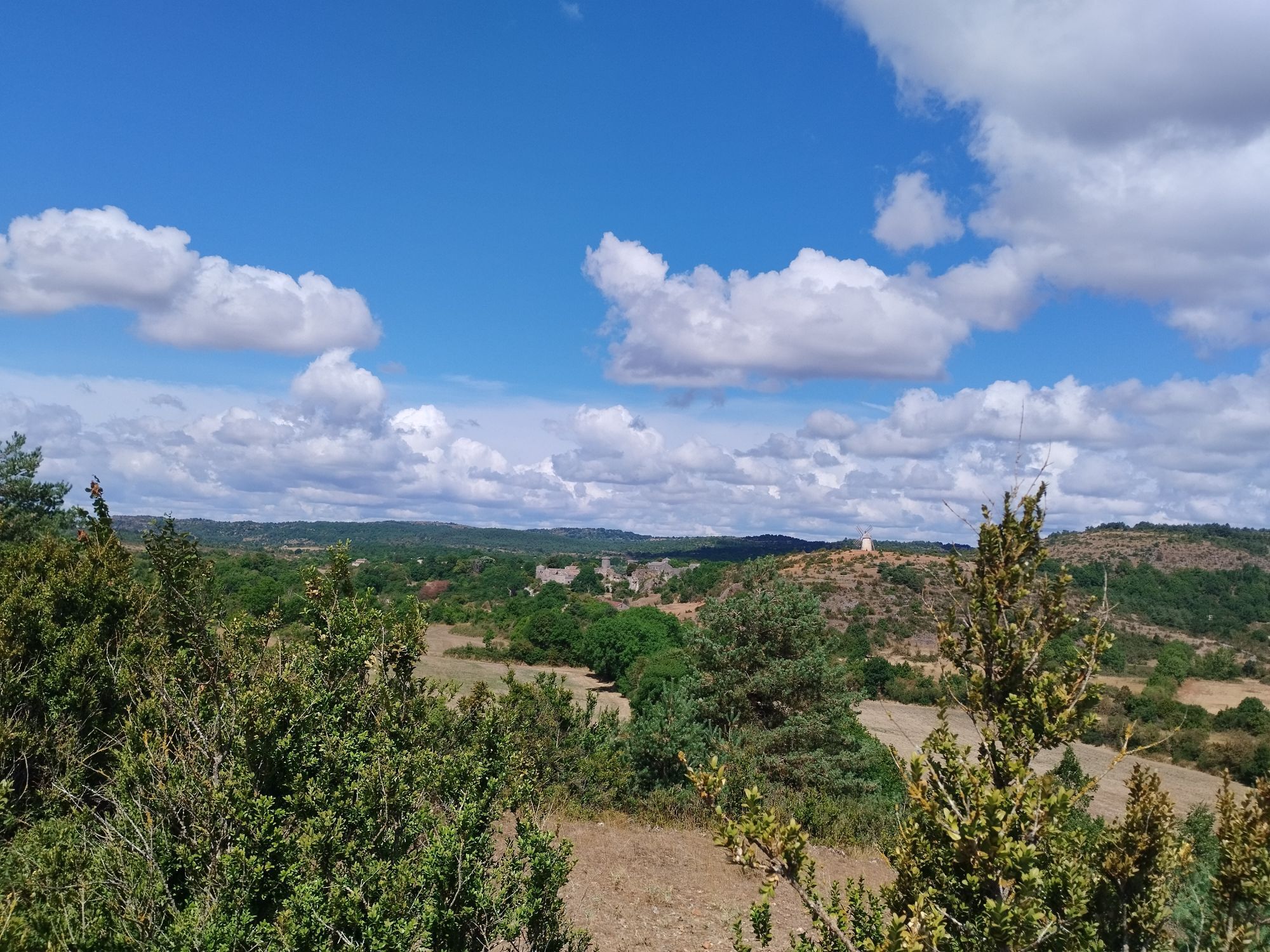
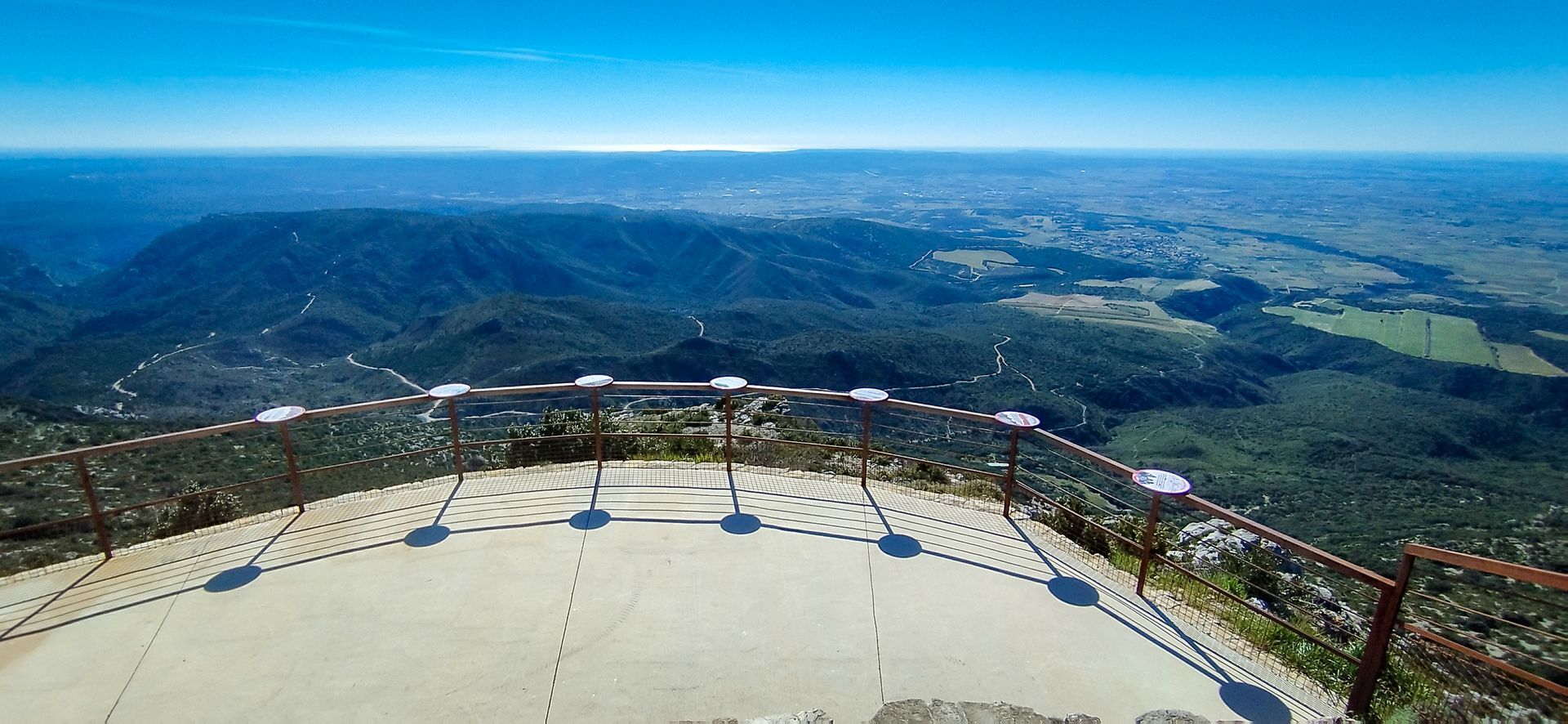
The route takes hikers through remarkable natural sites, including the Cirque de Navacelles, labeled Grand Site de France, where the Vis river has carved a spectacular meander. Walking on the Larzac allows the discovery of geological formations of the Terres d'Hérault Geopark (gorges and cliffs, sotchs and limestone causses): at the summit of Mont Saint-Baudille, the orientation table offers an exceptional panorama over the Geopark and the whole Hérault.
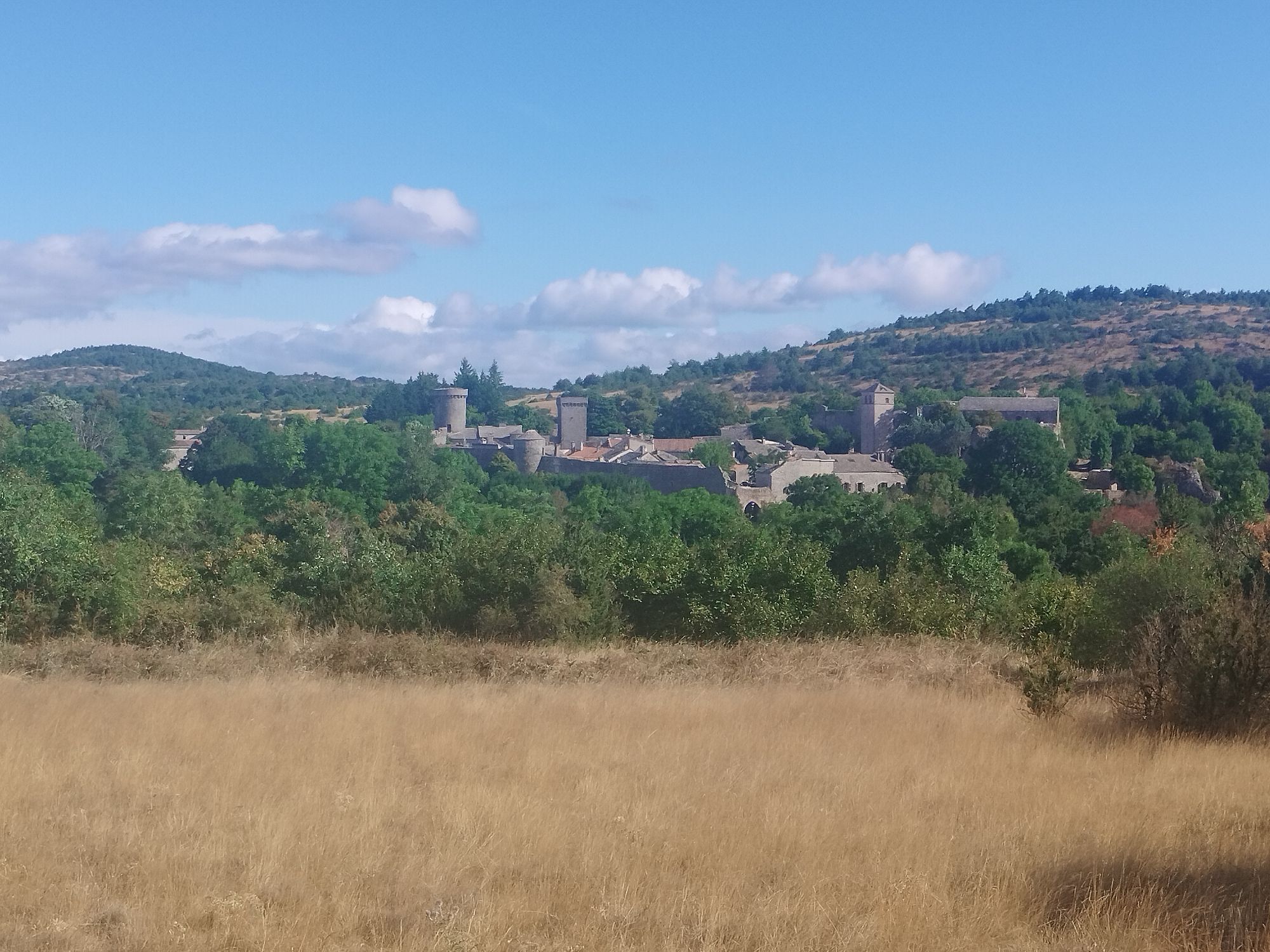
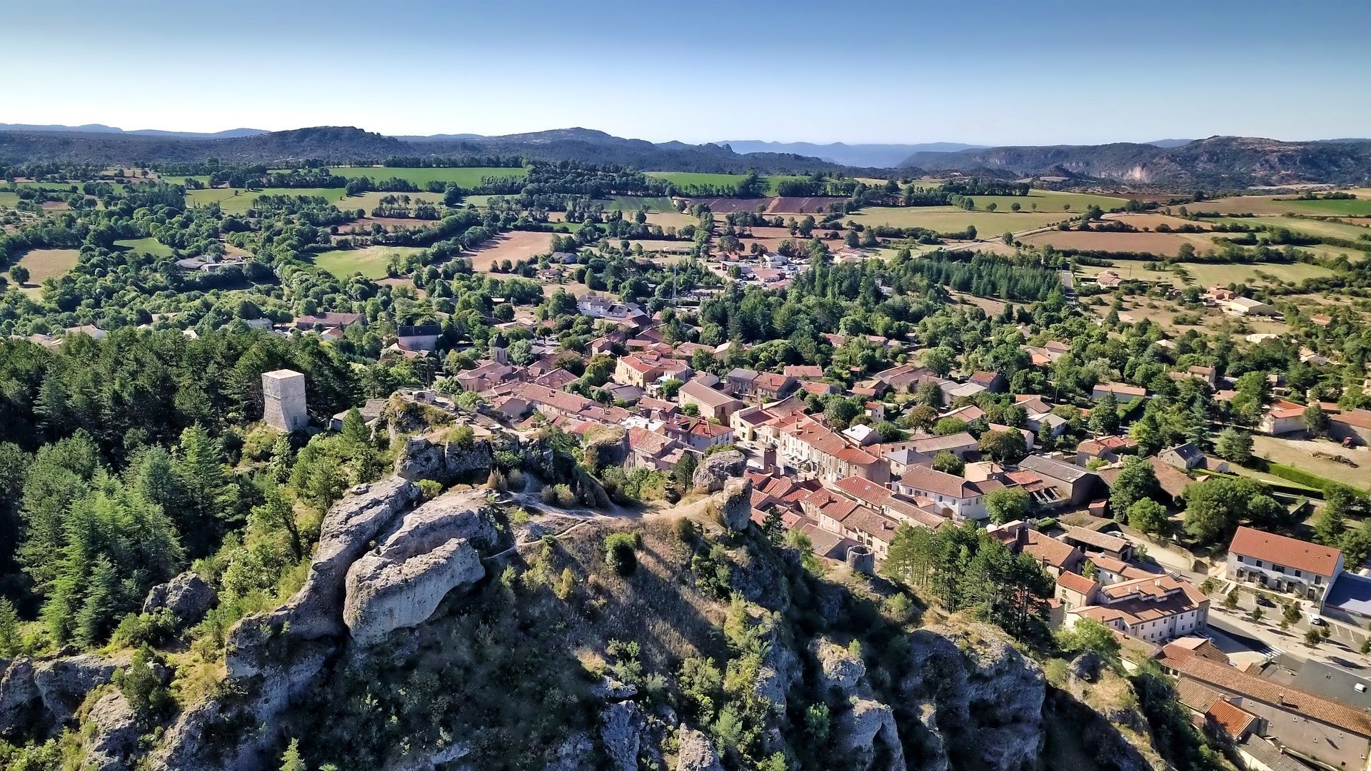
Picturesque villages punctuate the route, allowing discovery stops: Le Caylar, Soubès, Navacelles, Vissec, Sorbs, Saint-Pierre-de-la Fage, la Vacquerie... On the last stage, visiting the fortified Templar City of La Couvertoirade is a must.


1
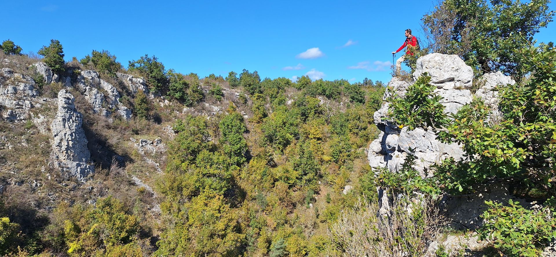
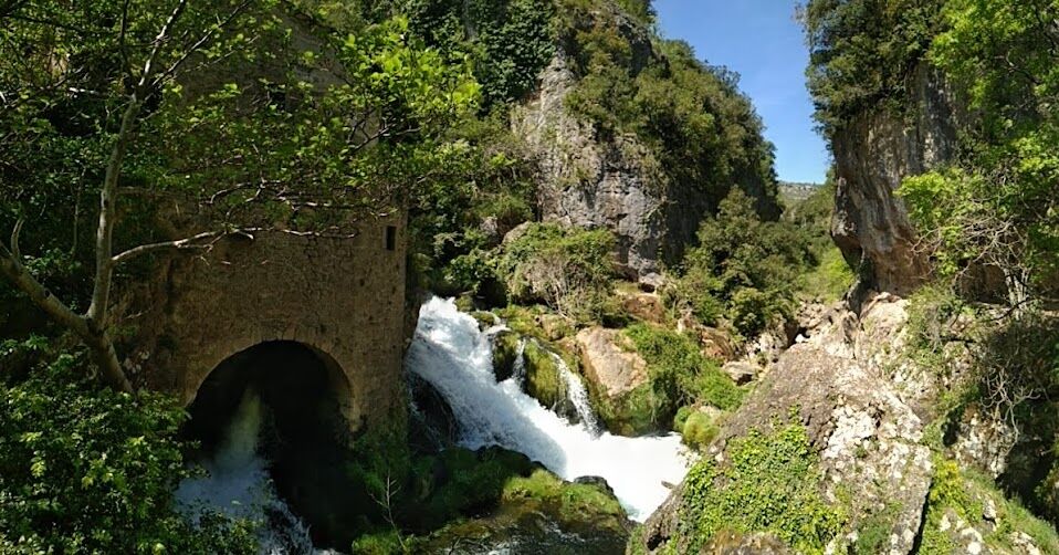
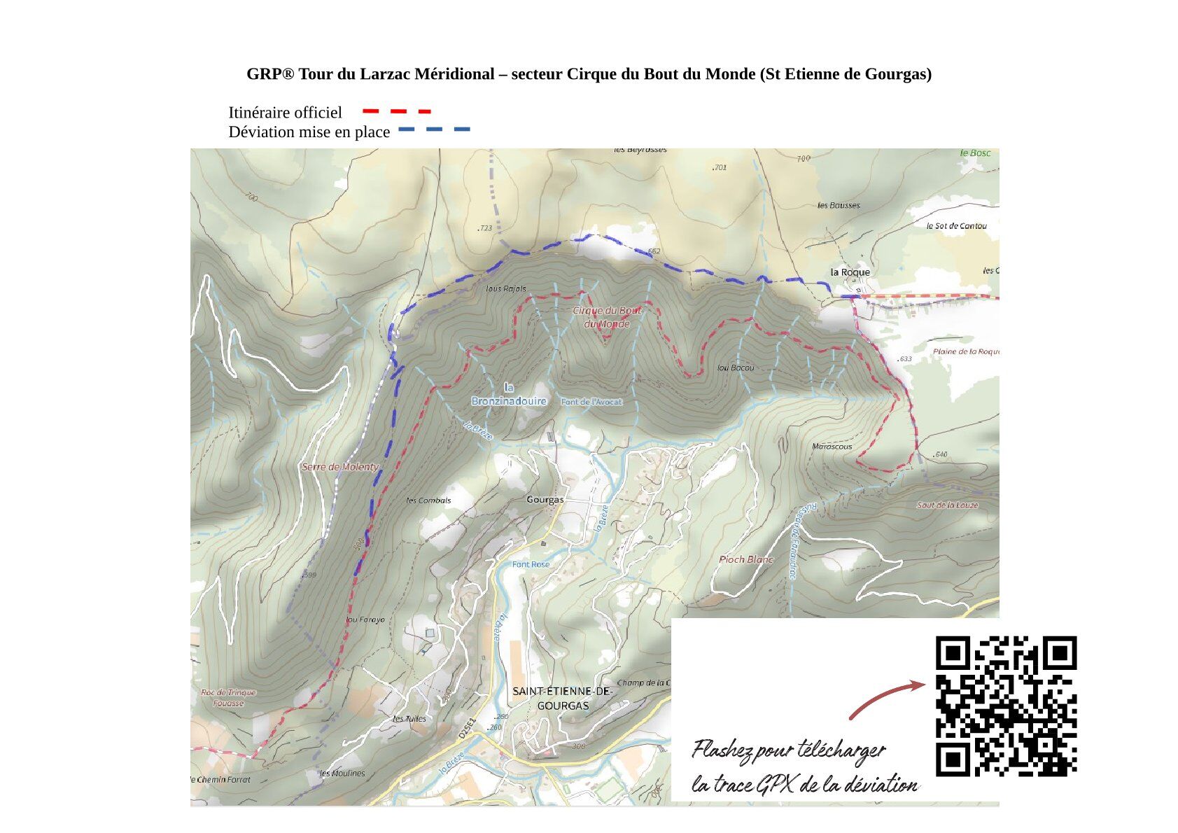
From Le Caylar to the hamlet of La Roque (Warning November 2025) A landslide is present in this sector. Be careful: a temporary route modification is in place, but it is not yet marked on the ground. The detour is shown on the last photo of the sheet. From the central square of Le Caylar, famous for its sculpted tree, take the Quai street eastward and follow the common markings of the GRP, the PR Sud Larzac and the GR 71. At the sports grounds, leave the PR and continue on the GRP and GR 71 markings. At the intersection with the RD 9 (Saint-Pierre road), turn right then left onto the RD 155E2 (towards Camp Rouch / les Barasquettes). After 4 km, before the hamlet of les Barasquettes, turn right onto a grassy track. Continue for 8.5 km following the common markings of GR 71 and GRP until Soubès. At Soubès, go around the schools (view of the castle) and continue left following the markings of GRP and PR Camin Farrat ascending eastward on the heights of the village. Continue for 2.5 km: on the paved ascent, leave on the right the first 2 intersections linked to the PR Cirque du Bout du Monde. 100 m after the second intersection, leave the paved ascent and the PR Camin Farrat to take the GRP right (path under the cliffs of the Cirque du Bout du Monde). After reaching the plateau, the route reaches the hamlet of La Roque. 22.5 km / +680m / -750m
2
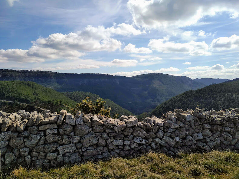
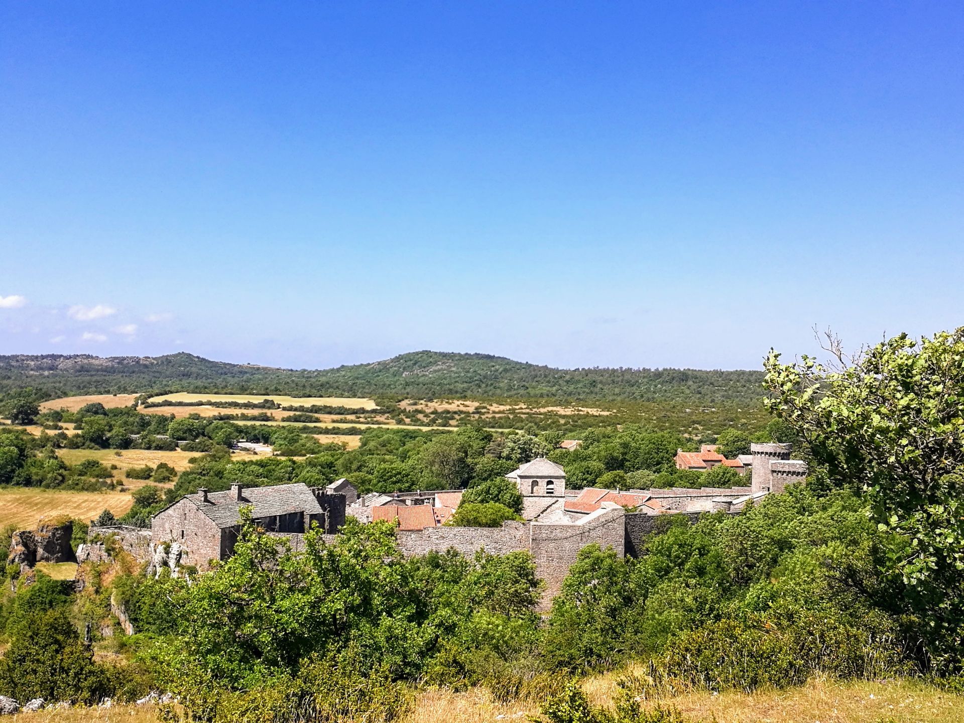
From the hamlet of La Roque to Mas Aubert From the hamlet of La Roque, follow the GRP Tour du Larzac Méridional for 2.5 km to Saint-Pierre-de-la-Fage. The route follows the edge of the cliffs and offers beautiful views of the Parlatges forest. Arrival at Saint-Pierre-de-la-Fage is marked by a beautiful mill. Continue straight and before the Temple, take the GRP marking to the right passing then in front of the church. Head towards the forest in a south-east direction following the common markings of the GRP and Passa Meridia. After 1 km, continue straight south leaving the Passa Meridia marking. After 500 m the route merges with the PR Notre-Dame de Parlatges. Continue south for 1 km. At the intersection with the GR 7, the GRP route continues southeast towards Mont Saint-Baudille, following Passa Meridia and GR 74 for 7 km. Shortly before the summit of Baudille (parking), the route turns left onto a section shared with the PR Mont Saint-Baudille and Passa Meridia. It is worth making a detour to admire the exceptional panorama from the Baudille orientation table (600 m round trip following PR and GR 74 markings). From the Baudille parking, the GRP follows the Passa Meridia route northwest on the flanks of the Séranne for 6 km, with panoramic views of the Saint-Guilhem mountains, the Hérault valley and Pic-Saint-Loup. The GRP leaves Passa Meridia to the right to reach the road and the hamlet of Lavagnes. The common route of the GRP and GR 74 leads to the Mas Aubert lodge, 700 m past Lavagnes. 19.5 km / +444m / -530m
3
Mas Aubert – Saint-Maurice-Navacelles From Mas Aubert, the route gradually climbs on the flanks of the Séranne and continues onto the plateau (shared route for 5 km with the PR Séranne – Pontel, GR de Pays Tours in the Grand Pic Saint-Loup, and GR 74). Near an old farmhouse, leave the PR to the right and continue toward the Cirque de la Séranne for 2 km. At the Cirque de la Séranne pass (intersection with the PR Peyre Martine), descend left into the valley towards the Natges, following the shared marking with GR 74. Continue right in the Natges valley to reach Rancas and Ranquet, 6 km after the pass. At Ranquet, the GRP and GR 74 route joins the PR des Rajols for 3 km. In sight of Saint-Maurice-Navacelles, follow the GRP right for 600 m to reach the village by a path leading to the hikers' parking. 17 km / +560m / -500m
4
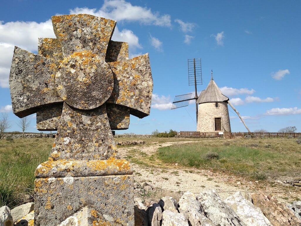
Saint-Maurice-Navacelles – Vissec From the parking, climb towards D 25 and cross it. Reach the calvary square, go around the castle on the right and leave Saint-Maurice-Navacelles to find the GR de Pays Tour du Larzac Méridional northbound (Cirque de Navacelles) following GR 7. Until Navacelles, the route also shares the PR Navacelles, Causse and Gorges de la Vis. Continue 10 km on the common section of GR 7 and PR to the hamlet of Navacelles: after 2 km on the causse, the route descends into the Vis gorges and continues to the hamlet overlooking the Vis. At the hamlet of Navacelles, do not cross the medieval bridge, and stay on the GRP for 8.5 km to Vissec. The route is common with PR Cirque de Navacelles and Moulins de la Foux up to the junction with the Moulins de la Foux: a detour to visit the site is recommended (200 m round trip by PR). 19 km / +570m / -550m
5
After the stage in Vissec, resume the GRP TLM west of the village for 800 m. The route becomes common with PR Regagnas for 1 km. At Camp d'Alton, join the PR des Vallées sèches to Sotchs. The GRP follows it turning right towards Sotchs for 2.5 km. After regaining the plateau, leave the PR and turn left (access to Sotch de Robert) and continue following GRP markings for 2 km. You will find the PR route shortly before a lavogne to cross Sorbs. Shortly after Sorbs church, at the statue of Notre Dame de Sorbs (PR starting parking), leave the PR to continue straight following the GRP for about 5 km towards Saint-Michel-d'Alajou. At the intersection of GRP loops before entering Saint-Michel d’Alajou, turn right northwest (La Couvertoirade) on a route common with Passa Meridia (green markers) for 2.5 km. At Cros, leave Passa Meridia marking: the GRP follows PR Sud Larzac for 6.5 km northwest to La Couvertoirade. At the ramparts of La Couvertoirade, after taking time to visit the village (fortified Templar city), head due south for 5.5 km on the GRP, still common with PR Sud Larzac, to return to Le Caylar. Back in Le Caylar, take time to climb the Roc Castel viewpoint (360° panorama over Larzac), and share a friendly drink in the village’s central square, famous for its sculpted Elm tree. 27.5 km / +720m / -400m
Our favourite stages, over 5 days: - Day 1: Le Caylar / Hamlet of La Roque (22.5 km / +680m / -750m) - Day 2: La Roque / Mas Aubert (19.5 km / +444m / -530m) - Day 3: Mas Aubert / Saint-Maurice-Navacelles (17 km / +560m / -500m) - Day 4: Saint-Maurice - Vissec via the Cirque de Navacelles (19 km / +570m / -550m) - Day 5: Vissec - Le Caylar, via La Couvertoirade (27.5 km / +720m / -400m)
The first stage being long, although not difficult, we advise you to arrive in Le Caylar the day before and spend the night there to start your hike early the next day. The last stage of 27.5 km can be split into 2, by adding a night in La Couvertoirade (20 km from Vissec). This allows a 6th day of relaxation, with a visit to La Couvertoirade and Le Caylar and an easy short hike of 7 km between the 2 villages.
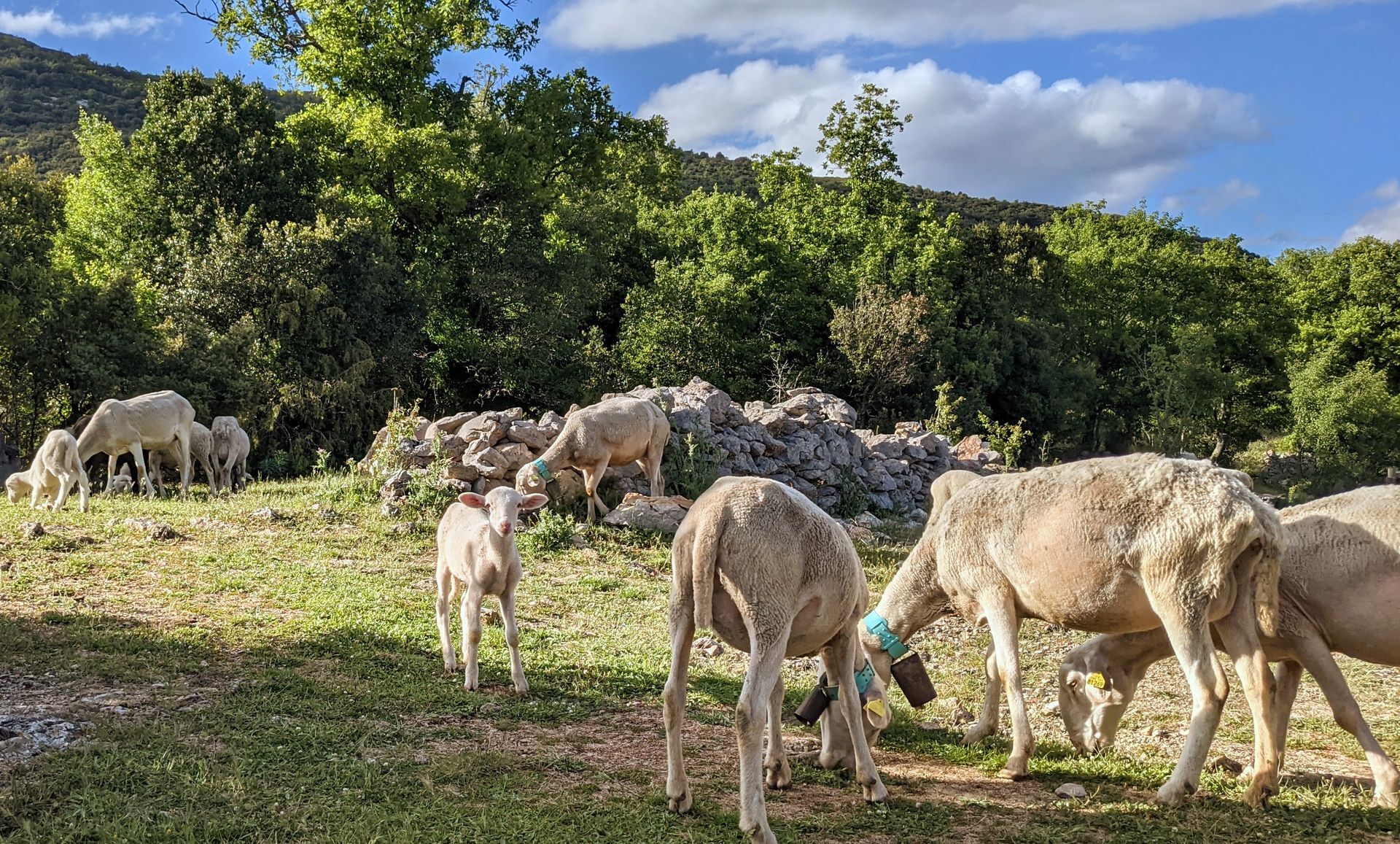
This route crosses pastoral areas: herds and guardian dogs are present most of the year, please close gates carefully. In the presence of livestock guardian dogs, adopt the right behavior: - Stay calm, do not threaten or pet them, - Keep your dogs on a leash, and do not carry them, - Keep a safety distance of 30 meters.
Yellow and red GR de pays
+33 4 67 88 86 44
Lodévois and Larzac Tourist Office
GRP - FFR
Priljubljeni izleti v okolici
- 4.0
CYCLE LOOP No.4 - THE HÉRAULT GORGES AND THE COL DES LAVAGNES
srednjaKolesarjenje 53.3 km CIRQUE DE NAVACELLES AND MOULINS DE LA FOUX HIKING TRAILS
srednjaPohodništvo 9.73 km- 4.0
HIKE OF THE GRÉZAC PLATEAU
srednjaPohodništvo 14.0 km RANDONNEE DE PEYRE MARTINE
srednjaPohodništvo 15.4 kmHIKING OF THE FENESTRETTES
srednjaPohodništvo 10.4 kmNAVACELLES HIKE - CAUSSE AND VIS GORGES
srednjaPohodništvo 19.6 kmHIKE FROM DRY VALLEYS TO SOTCHS
srednjaPohodništvo 11.5 kmHIKING TOUR IN THE HEART OF THE CAUSSE - GR® DE PAYS TOUR DU LARZAC MÉRIDIONAL
srednjaPohodništvo 56.7 kmCORNICHES DE LAUROUX HIKE
srednjaPohodništvo 13.8 kmHIKING OF THE SERRE DE GRENOUILLET
srednjaPohodništvo 7.70 km

Pohodništvo in sledenje


Ne zamudite ponudb in navdiha za naslednje počitnice
Vaš e-poštni naslov je bil dodan na poštni seznam.