Route B - Pas d'Enfer
svetloba
Pridobite to turo v svoj mobilni telefon
Route B - Pas d'Enfer
svetloba
Trailrunning
7.06
km
Skenirajte kodo QR in začnite navigacijo v aplikaciji bergfex.

Pohodništvo in sledenje


Route B - Pas d'Enfer
svetloba
Razdalja
7.06
km
Trajanje
01:33
h
Ascent
321
hm
Morska gladina
735 -
1,080
m
Prenos skladbe
Route B - Pas d'Enfer
svetloba
Trailrunning
7.06
km
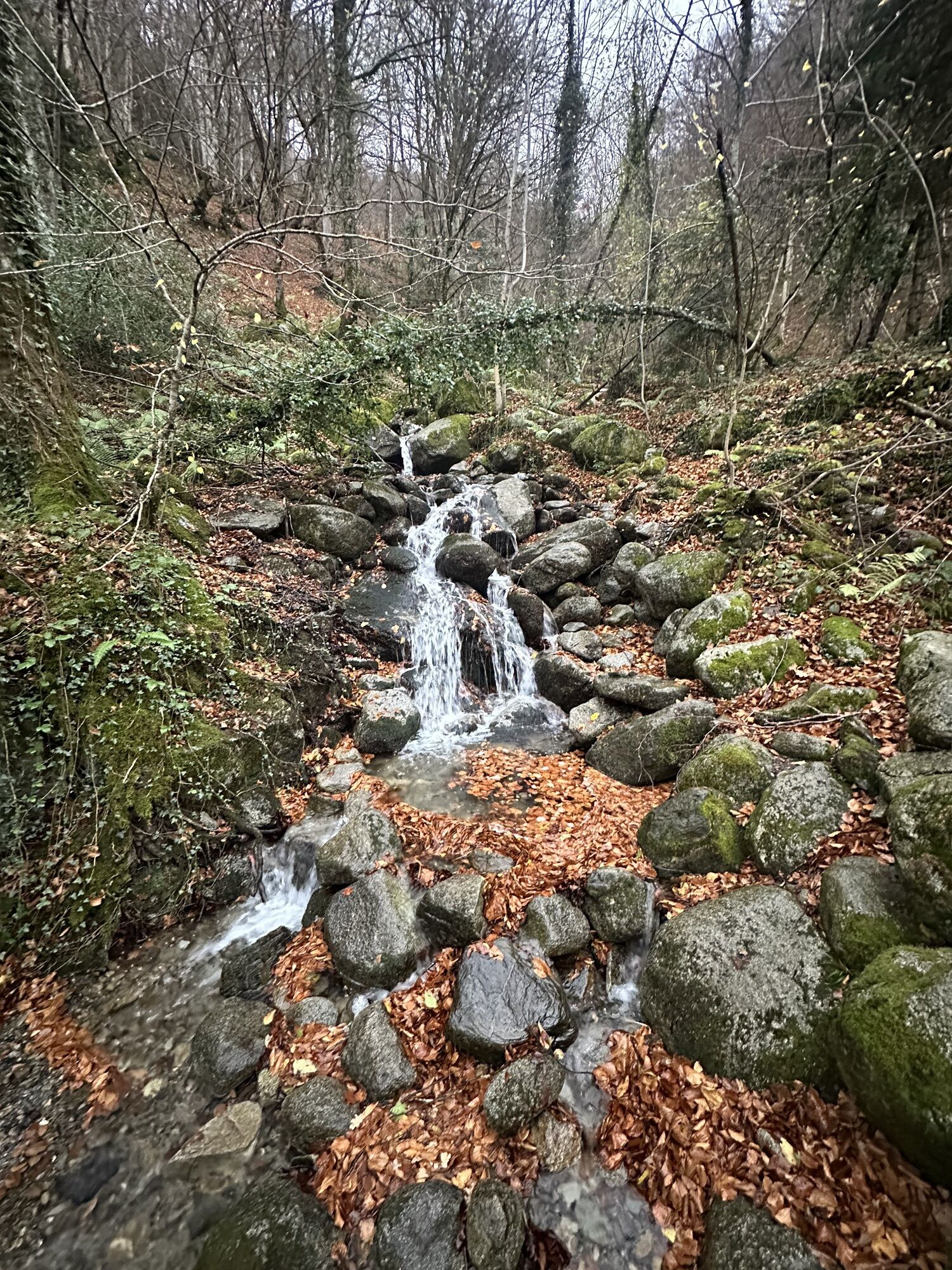
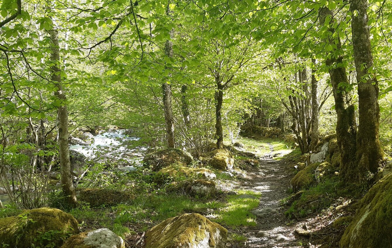
Some rounded stones allow you to work on your foot placement. The steep climb of Pas d’Enfer teaches you how to handle steep slopes. Don't hesitate to walk to conserve your breath during the ascent. 2.25...
Opis
Some rounded stones allow you to work on your foot placement. The steep climb of Pas d’Enfer teaches you how to handle steep slopes. Don't hesitate to walk to conserve your breath during the ascent. 2.250km of forest trail allows you to lengthen your stride. Finally, a passage taken downhill requires more attention to negotiate the uneven ground.
https://www.openrunner.com/route-details/17366588
https://www.openrunner.com/route-details/17366588
Pot
Aulus-les-Bains
(751 m)
Vas
0.7 km
Le Pas d'Enfer
(932 m)
Koridor/teren
3.0 km
Sources Thermales d'Aulus
(744 m)
Vhod v jamo
6.8 km
Aulus-les-Bains
(751 m)
Vas
7.0 km
Pot
Route B - Pas d'Enfer
svetloba
Trailrunning
7.06
km
La Goulue
(737 m)
Restavracija
0.1 km
Aulus-les-Bains
(751 m)
Vas
0.7 km
Le Pas d'Enfer
(932 m)
Koridor/teren
3.0 km
Sources Thermales d'Aulus
(744 m)
Vhod v jamo
6.8 km
Aulus-les-Bains
(751 m)
Vas
7.0 km
Avtor
Zagotavlja Ariège Pyrénées Tourismus
Za ogled Route B - Pas d'Enfer poskrbi outdooractive.com.

Še ni pregledov
Priljubljeni izleti v okolici
-
5.0
Étang de Guzet by the Ars waterfall
težkoPohodništvo 12.3 km -
Montcalm and the Pique d'Estats
težkoPohodništvo 17.4 km -
Cyclosport circuit 7 - The five passes
težkoCestno kolo 104.2 km -
Circuit cyclosport 11 - Le cyclotour de l'Ariège - Etape 2 de Castillon-en-Couserans à Auzat
težkoCestno kolo 84.0 km -
5.0
Blue Pond
svetlobaPohodništvo 9.90 km -
Ars waterfall
svetlobaPohodništvo 8.64 km -
GR®10 - The great crossing of the Pyrenees
težkoPohodništvo 278.3 km -
Hors catégorie stage 100% Ariège tour de France - circuit n°12
težkoCestno kolo 103.7 km -
Circuit cyclotourisme - Au tour du pic des trois seigneurs
težkoCestno kolo 74.2 km -
Le Col d'Agnès - circuit n°5
težkoCestno kolo 106.8 km

Pohodništvo in sledenje

Zaradi več kot 550.000 predlogov izletov, podrobnih zemljevidov in intuitivnega načrtovanja poti je aplikacija obvezna oprema za vse ljubitelje narave.

Ne zamudite ponudb in navdiha za naslednje počitnice
Naročite se na novice
Napaka
Zgodila se je napaka. Prosimo, poskusite znova.
Zahvaljujemo se vam za prijavo
Vaš e-poštni naslov je bil dodan na poštni seznam.
Izleti po vsej Evropi
Avstrija
Švica
Nemčija
Italija
Slovenija
Francija
Nizozemska
Belgija
Poljska
Lihtenštajn
Češka
Slovaška
Španija
Chorvátsko
Bosna in Hercegovina
Luksemburg
Andora
පෘතුගාලය
අයිස්ලන්තය
එක්සත් රාජධානිය
අයර්ලන්තය
ග්රීසිය
ඇල්බේනියාව
North Macedonia
Malta
Norway
Montenegro
Moldova
කොසෝවො
හන්ගේරියානු සමුහාණ්ඩුව
San Marino
රුමේනියාව
එස්ටෝනියා
ලැට්වියාව
බෙලාරස්
සයිප්රස්
Lithuania
Serbia
බල්ගේරියාව
Monaco
ඩෙන්මාර්කය
Sweden
ෆින්ලන්තය