







Circular route Tracouet
Stopnja težavnosti: S0
The route starts at the sports center of Haute-Nendaz and leads through lovely hamlets, forests, and alpine pastures before you reach the Balavaux forest with its 250 hundred-year-old larches and the wild...
The route starts at the sports center of Haute-Nendaz and leads through lovely hamlets, forests, and alpine pastures before you reach the Balavaux forest with its 250 hundred-year-old larches and the wild place Maretse. Treat yourself to a break at Lac de Tracouet before tackling the last elevation gain to the mountain station. At the top, enjoy a breathtaking view over the Rhone valley and the Bernese Alps. At the Tracouet restaurant, you can refuel before the descent back to Haute-Nendaz.

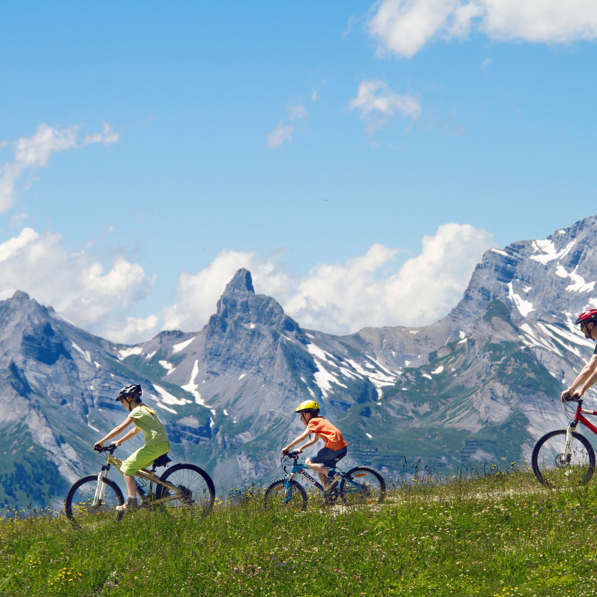
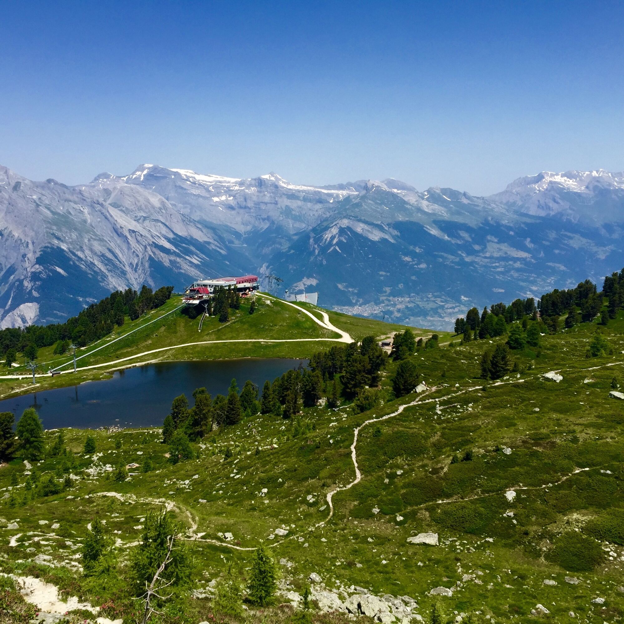

The route to Tracouet starts at the sports center of Haute-Nendaz, from where you follow sign 132. On the Route des Crettaux, you head towards Tsamandon. After 500 meters, leave this road and turn left onto a forest path. Follow this path to Prarion. From here, the ascent continues to Alp Balavaud with its famous larches. Then continue to Tracouet and Lac Noir. Once at the top, you have truly earned the wonderful view and a break at the restaurant. After resting, take on the sporty descent and follow sign 133. You now ride to the right of the chairlift and follow the main path. At the crossroads, go straight towards Sofleu. The route continues on the main path, and after a short counter-ascent, you enjoy one last well-deserved descent back to the village.
Da
Da
Da
Da
Our recommendation: Technically perfect bike, helmet, gloves, and bell, appropriate clothing depending on the weather (always with you: rain protection), drink and snacks.
The mountains, a place of joy to share and respect. The mountain world is a place to meet and experience unforgettable moments together – whether by bike or on foot. For all users to benefit, it is essential to share this space with respect for nature and agriculture. Respectful behavior allows everyone to enjoy their leisure activities under the best conditions. Learn about recommendations and rules.
Assess your own abilities and fitness well. Riding the various routes is always at your own risk.
From the Sion-Ouest motorway exit, you reach Nendaz after 15 kilometers.
Nendaz can be reached by bus from Sion train station in about 30 minutes. Regular train connections from Geneva or Bern/Visp to Sion. Remember to reserve a place for your mountain bike via the SBB Mobile app or at sbb.ch.
Four parking garages are available in Haute-Nendaz.
S0
Further information
NendazIt is possible to take the gondola to Tracouet. The route is also ideal for e-bikers.
Pridobite vpogled Vedno v živo na mestu z več kot 9.500 spletnimi kamerami. bergfex Kot uporabnik Pro si lahko zdaj ogledate ustrezne spletne kamere za številne izlete v aplikaciji izleti iz. Tako si lahko neposredno ogledate trenutne razmere. Priljubljeni izleti v okolici
- 4.6
From Saillon to the Farinet suspension bridge
srednjaPohodništvo 7.86 km - 5.0
Sentier des bouquetins
srednjaPohodništvo 8.73 km - 4.7
Cleuson Dam
srednjaPohodništvo 11.5 km From Savoleyres to the mountain lake Lac des Vaux
srednjaPohodništvo 14.0 km- 5.0
Tour de l'éboulement des Diablerets
svetlobaPohodništvo 6.52 km Tour du Grand Chavalard
srednjaPohodništvo 14.9 km- 4.0
Tripon - Brac – Ancien Bisse du Torrent Neuf – St. Marguerite – Torrent Neuf – Prafirmin - St. Germain
svetlobaPohodništvo 12.9 km - 4.5
The Larches of Balavaux
svetlobaPohodništvo 11.0 km - 5.0
Tour de La Seya hike
srednjaPohodništvo 8.09 km - 4.0
Sentier des Chamois
težkoPohodništvo 11.6 km
Pohodništvo in sledenje


Ne zamudite ponudb in navdiha za naslednje počitnice
Vaš e-poštni naslov je bil dodan na poštni seznam.





