







From Saillon to the Farinet suspension bridge

Stopnja težavnosti: T1
Since June 2001, the Salentze Gorge can be comfortably crossed via a 92-meter-long, extremely light, and well-integrated suspension bridge. From there, hikers enjoy a breathtaking view of the Rhone valley...
Since June 2001, the Salentze Gorge can be comfortably crossed via a 92-meter-long, extremely light, and well-integrated suspension bridge. From there, hikers enjoy a breathtaking view of the Rhone valley plain, the vineyard, as well as the slopes and peaks surrounding the valley. The famous peace dove by Hans Erni, mounted on the rock in the middle of the bridge, watches over the fearless walkers who dare to look into the abyss. The dizzying suspension bridge, 136 meters above the gorge where Farinet died, is the destination of a hike that starts in the heart of Saillon village and passes through many popular spots linked to the history of the coin forger. It is accessible via the Saillon vineyard or from the "Les Places" bus stop on the road to Ovronnaz.

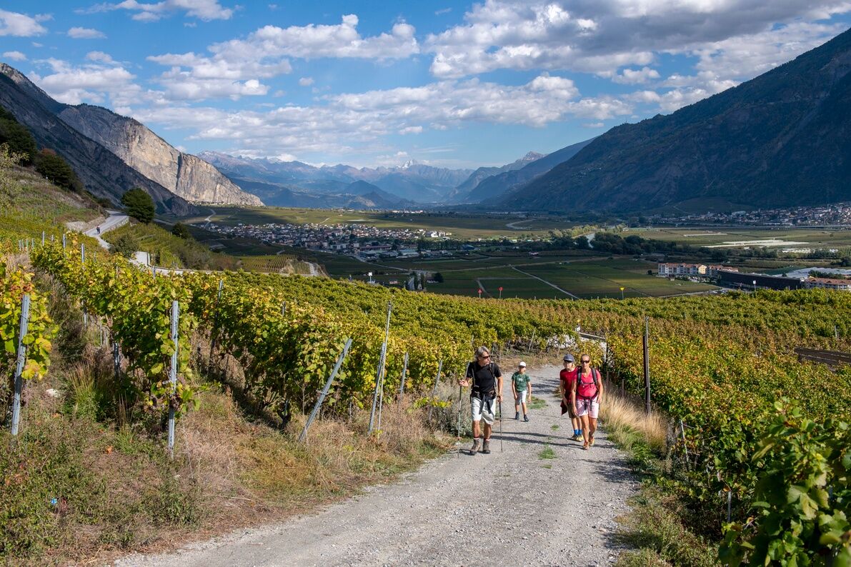
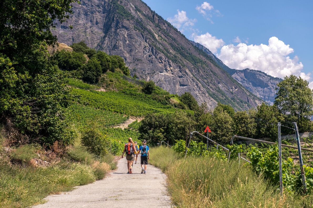
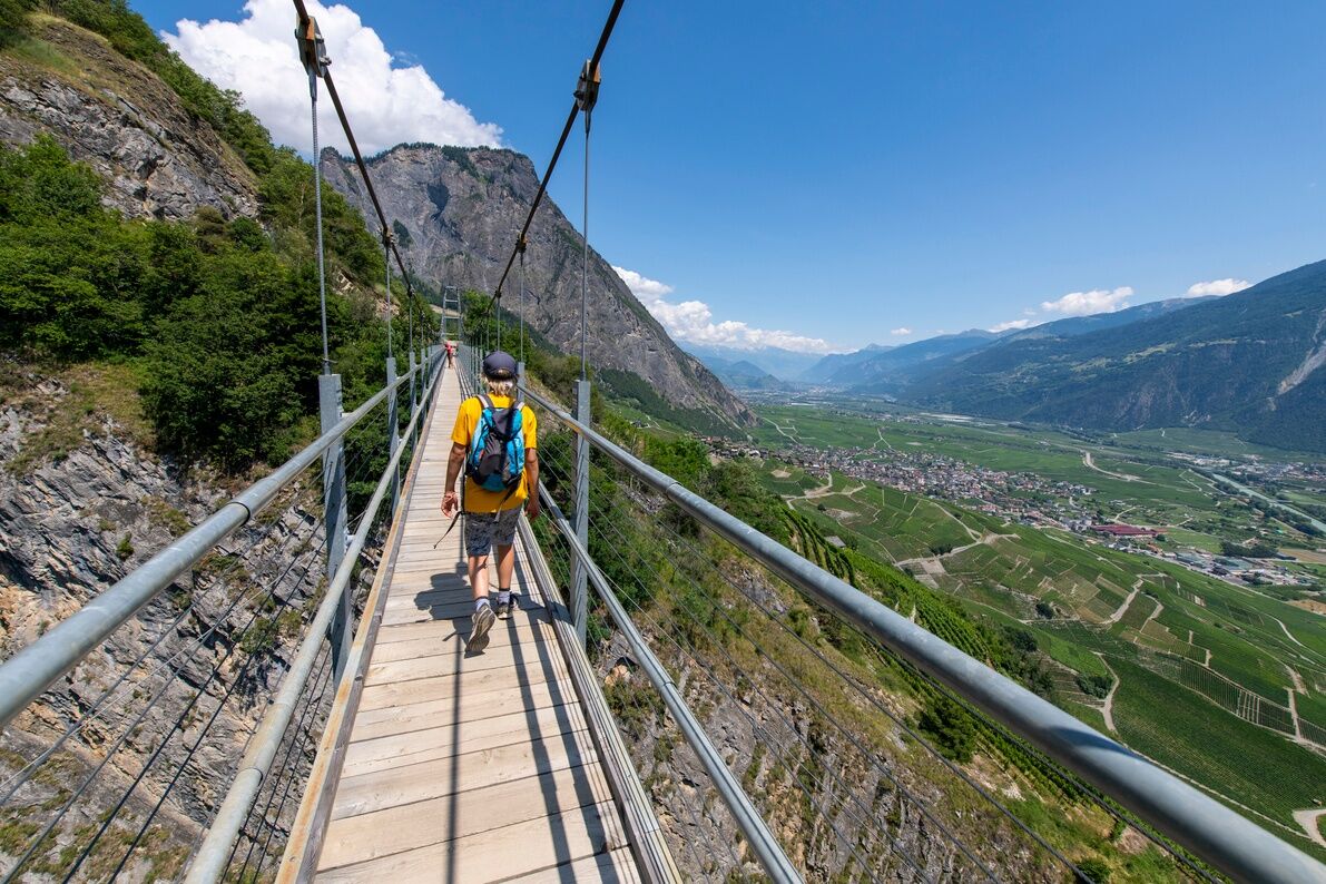
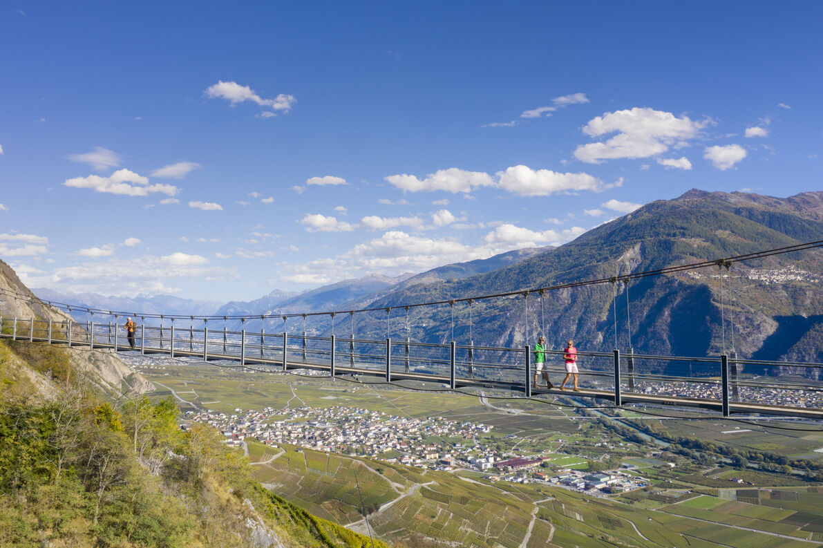
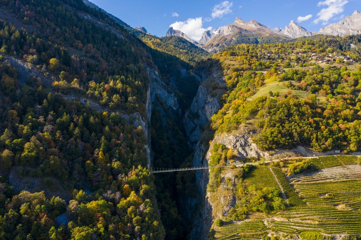
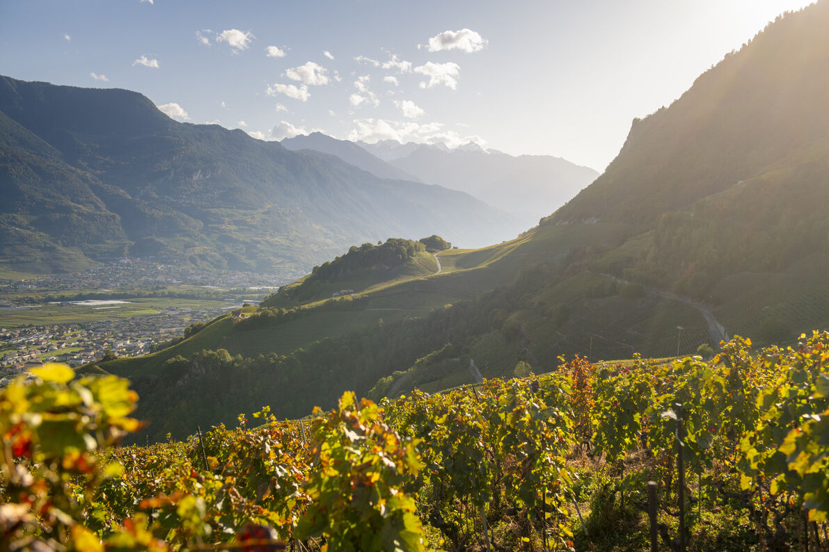

From Place Farinet, take the path near the playground that climbs between the vineyards. At the top of this first slope, turn left and pass a pottery workshop before entering the village through the Porte du Four. Walk up the paved alley, then through the Porte de Fully and continue uphill to the last houses of the village. 50 meters after the fountain, follow the path that leads steeply uphill. At the next crossroads, turn right and follow the yellow hiking signs. Then walk uphill through the vineyards until you reach the paved road that branches right. Go through a wooden gate and continue hiking through the forest until you reach the pedestrian bridge, which you cross while enjoying the view of the Salentze Gorge. The return trip is by the same route or on the other side via Montagnon and Produit, following the hiking signs. For this, walk on the gravel road to the hamlet of Les Places. At the height of the parking lots, a yellow sign directs you downwards.
We recommend:
Good footwear Weather-appropriate clothing: always carry a waterproof vest Headwear Sunscreen Water bottle Picnic Camera Binoculars (optional) Hiking poles (optional) Printout of the hiking route (click "Print" to download)For certain hikes:
SwimsuitThe mountains, a place of joy to share and respect. The mountain world is a place to meet and experience unforgettable moments together – whether by bike or on foot. For all users to benefit, it is essential to share this space with respect for nature and agriculture. Respectful behavior allows everyone to engage in their leisure activities under the best conditions. Find out about recommendations and rules. Right on the way
Assess your own abilities and fitness well. Using the various routes is generally at your own risk.
For all hikes:
Carry a map with you. Download the complete description of the hiking trail with a large-scale map by clicking "Print" at the top right of the page. Use only marked hiking trails and observe all signposts and instructions – for your own safety, to protect grazing animals and out of respect for wildlife. Close gates after passing through. Be considerate of other path users, plants, and animals.For mountain hikes:
Carry additional sun protection. UV rays in high altitudes can be very strong, even in cloudy weather. Plan your hike carefully: consider the required fitness level of all participants, weather forecasts, and seasonal dependencies. Weather conditions can change very quickly and without warning in the mountains. Appropriate clothing and sufficient provisions (food and drink) are very important. In unsettled weather, it is better to turn back early.For high alpine hikes:
Inform your family about your hiking route. If possible, avoid being alone on the trail. Do not go onto glaciers without a mountain guide. Observe warning signals indicating danger on riverbanks, along watercourses below dams and reservoirs: water levels can rise quickly and without warning.Follow the A9 motorway and take exit 23 (Saxon) coming from Martigny or exit 24 (Riddes) coming from Brig and drive towards Saillon.
Take bus 311 from the Sion, Martigny, or Riddes train stations to the "Saillon Collombeyres" stop. Place Farinet is a two-minute walk from the stop.
At the "Leytron ancienne poste" stop, take bus 312 to Les Places if you want to shorten your hike. You then walk 15 minutes on a flat road to the pedestrian bridge.
Park your vehicle at the free Place Farinet parking lot at the foot of the village or at the Parking des Remparts in the village.
T1
More information about the destination can be found here:
SaillonStop at the Farinet vineyard and the Tête du Géant to explore these sights.


Spletne kamere s turneje



Priljubljeni izleti v okolici
- 4,5
Tour de l'éboulement des Diablerets
svetlobaPohodništvo 6,52 km - 4,7
Cleuson Dam
srednjaPohodništvo 11,5 km Tour du Grand Chavalard
srednjaPohodništvo 14,9 kmFrom Savoleyres to the mountain lake Lac des Vaux
srednjaPohodništvo 14,0 km- 4,0
Tripon - Brac – Ancien Bisse du Torrent Neuf – St. Marguerite – Torrent Neuf – Prafirmin - St. Germain
svetlobaPohodništvo 12,9 km - 4,5
The Larches of Balavaux
svetlobaPohodništvo 11,0 km - 5,0
Tour de La Seya hike
srednjaPohodništvo 8,09 km - 4,6
Les Diablerets- Villars - Gryon
srednjaSmučanje 51,8 km Via Farinetta
težkoVia ferrata 6,41 km- 3,5
The Ahornweg « La Voie des Erables »
težkoPohodništvo 9,66 km

Pohodništvo in sledenje


Ne zamudite ponudb in navdiha za naslednje počitnice
Vaš e-poštni naslov je bil dodan na poštni seznam.





