


Wildnistrail Buchensteig
Stopnja težavnosti: T2

Stage 1 - Anzenbach - Wilder Graben (approx. 1 hour)
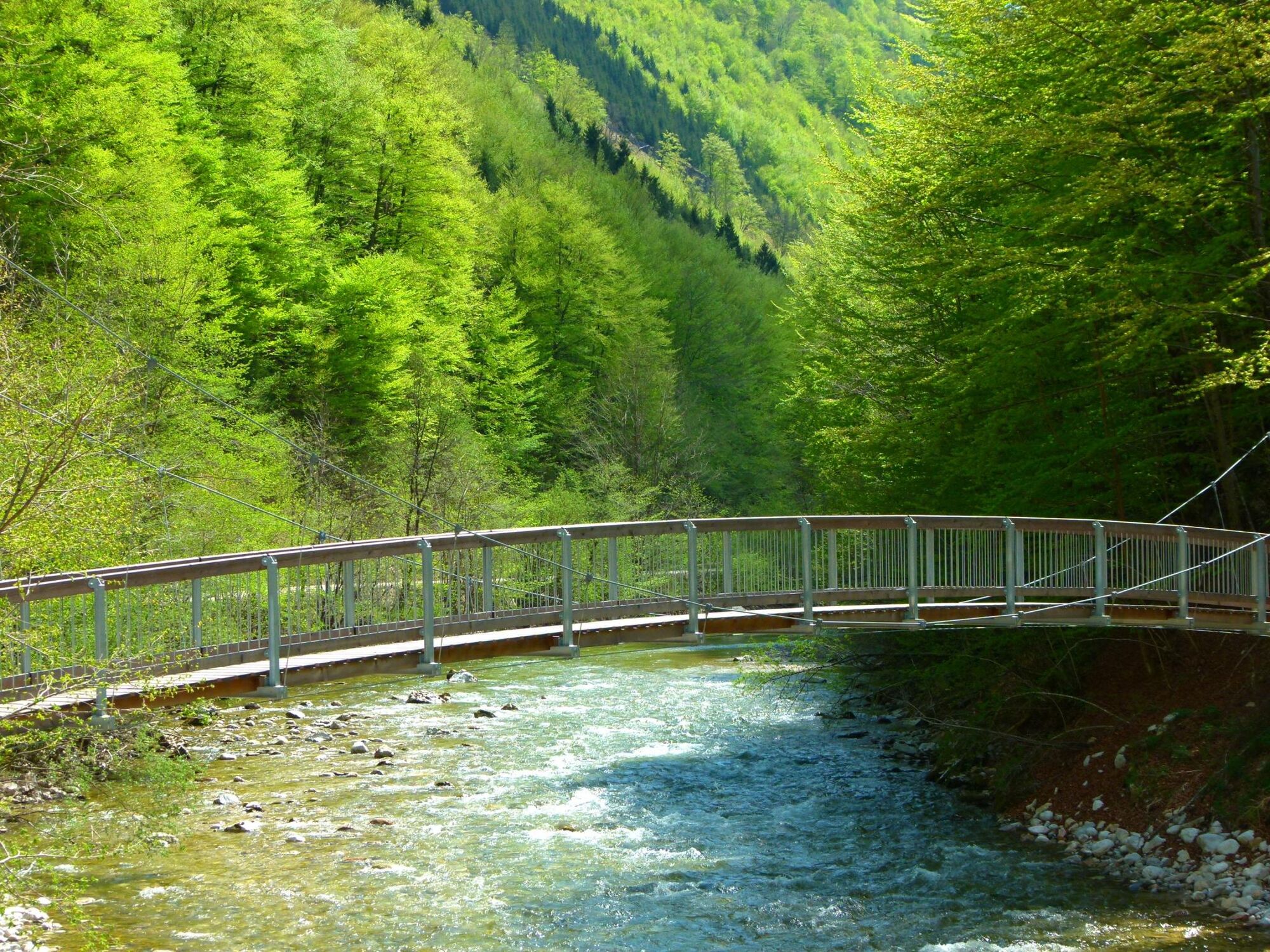
Immediately after the barrier at the Anzenbach parking lot, the trail begins to the left in a large loop towards Hintergebirge. Right at the start, we...
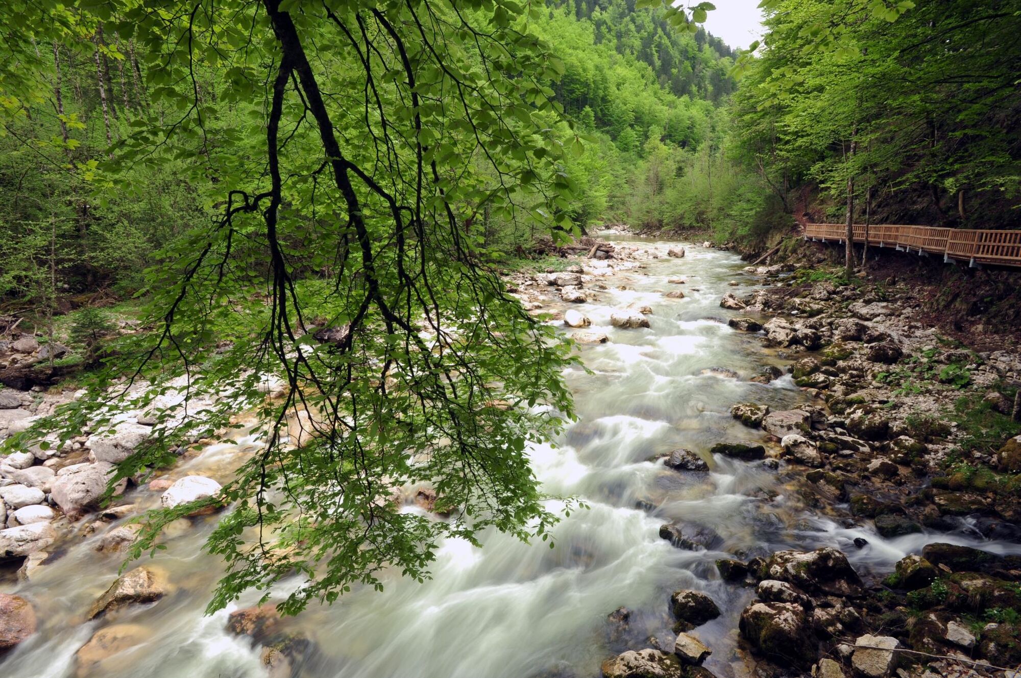
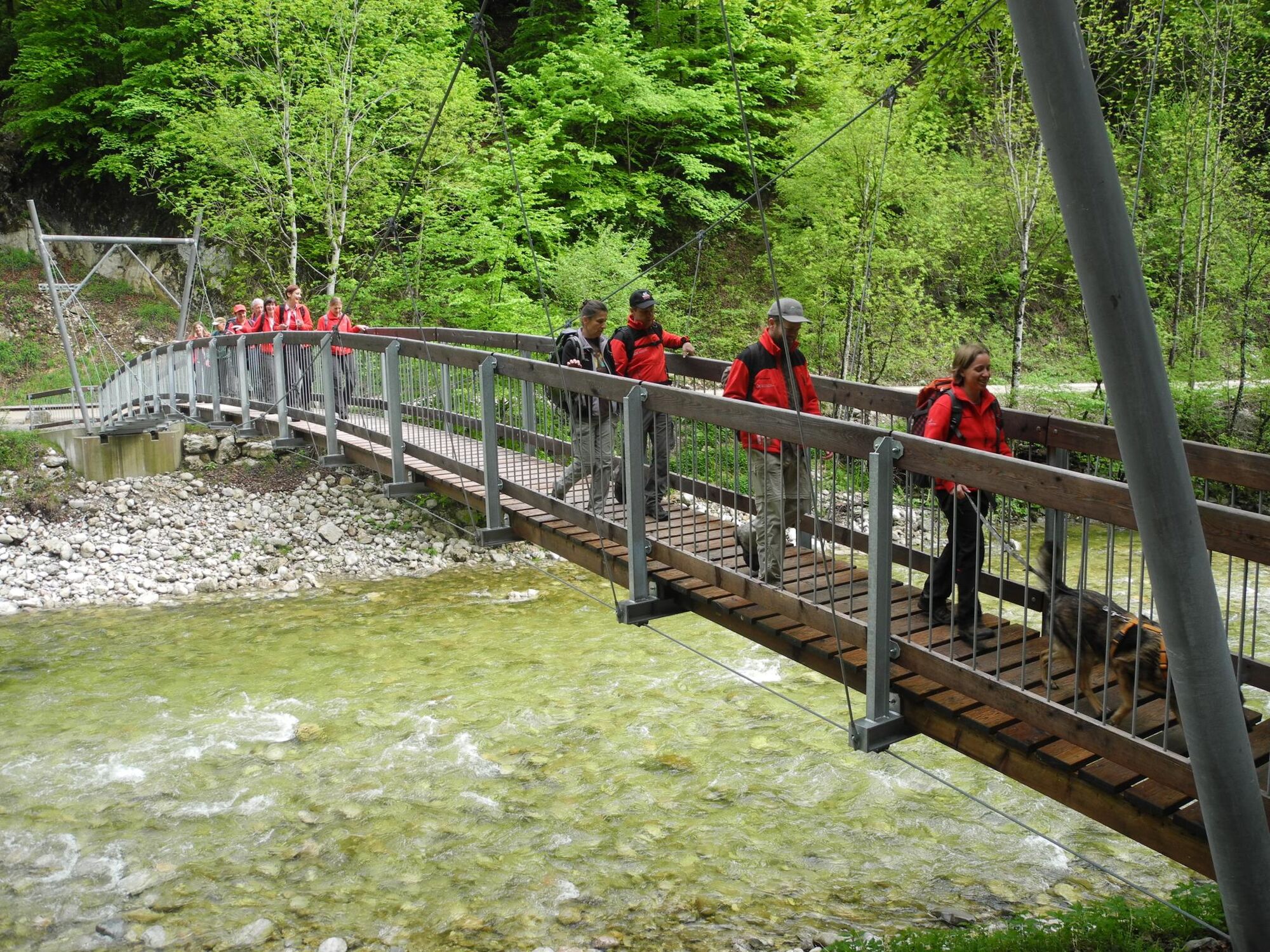
Immediately after the barrier at the Anzenbach parking lot, the trail begins to the left in a large loop towards Hintergebirge. Right at the start, we enter a mix of beech and spruce forest, which gradually turns into a pristine beech forest. After about 15 minutes, we reach the suspension bridge over the stream.
Stage 2 - Wilder Graben - Große Klaushütte - (approx. 2 hours)
From the wooden bridge, we follow the gravel road Wilder Graben about 100 meters downhill to the start of the second stage of the Buchensteig on the right side of the road. The first few minutes go slightly uphill, but then the path runs almost flat.
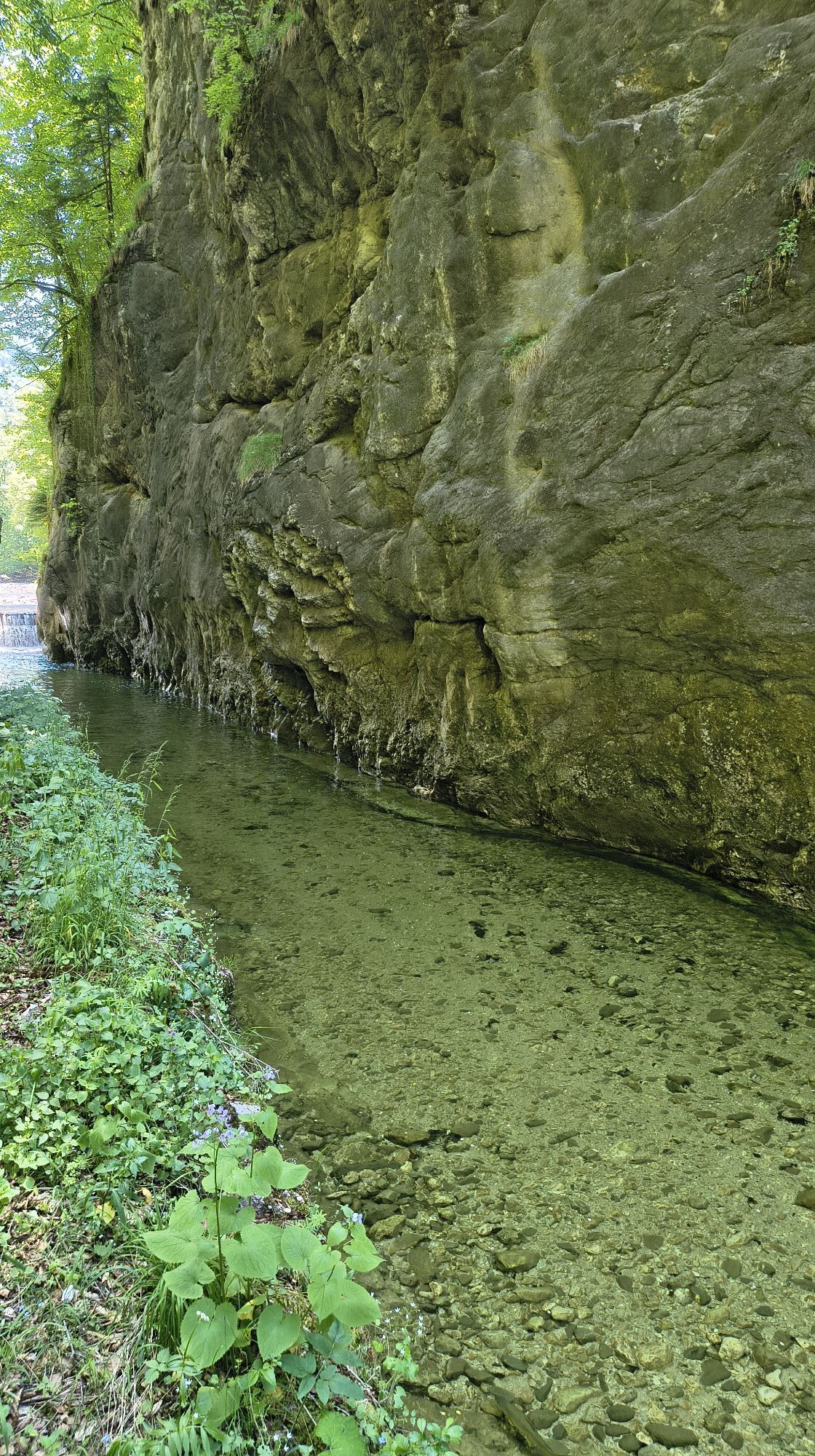
After about half an hour, you cross the first of three water-carrying ditches, which can swell into rushing wild streams after heavy rain. The path gradually descends, allowing you to clearly see the Hintergebirgsradweg on the other side of the stream. After a short ascent, the path leads to a peninsula-like plateau (walking time to this point approx. 1 hour from Wilder Graben).
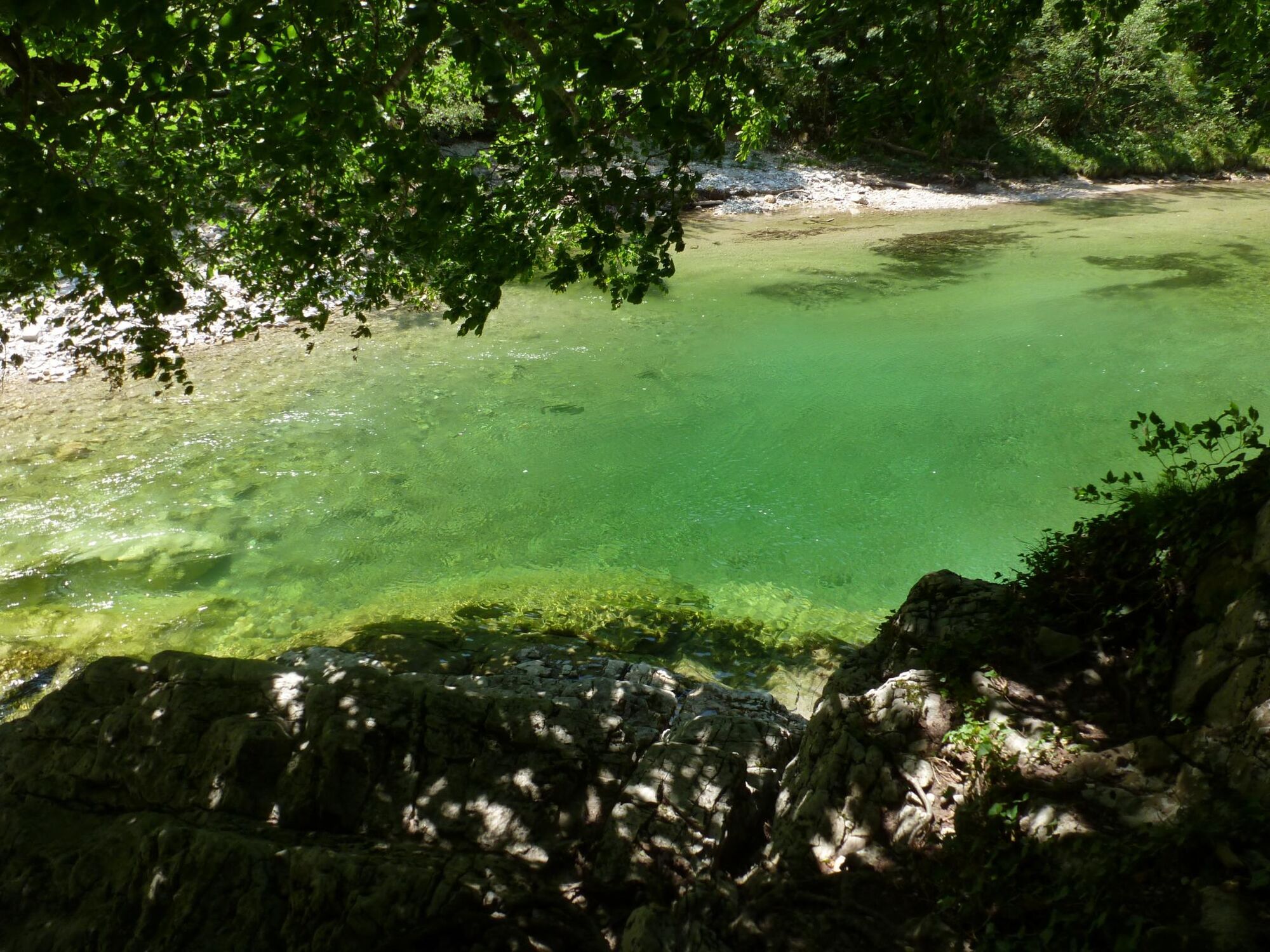
Gradually, the path approaches the stream until after 10 minutes you reach an area called Wasserboden, where there is a wooden boardwalk along which you can easily walk beside the shore. Immediately afterwards, you cross the Kohlersgraben via a second, shorter wooden boardwalk. Here, the Begsteigersteig branches off towards Ebenforstalm. The Buchensteig continues straight on to the junction with the gravel road and further to the Rabenbach bridge. Here, you cross the Großer Bach and walk the last stretch (about 15-20 minutes) upstream along the Hintergebirgsradweg past the Große Klause to the Große Klaushütte.
For the return route to the parking lot at the Anzenbach barrier, the Hintergebirgsradweg is recommended.

Da
T2
Priljubljeni izleti v okolici
- 4,9
Ennser Hut - Almkogel (from Bamacher car park)
srednjaPohodništvo 3,53 km - 4,6
Schoberstein (from Molln)
srednjaPohodništvo 3,63 km - 4,8
Steinerner Jäger (1185m) und Schieferstein (1206m) ab Parkplatz Hochhabichler
srednjaPohodništvo 4,46 km - 3,9
Wasserklotz
srednjaPohodništvo 5,81 km - 4,7
GROSSRAMING Bamacher, Burgspitz, Almkogel, Ennshütte 20240730
srednjaPohodništvo 10 km - 4,7
Hoher Nock von Rettenbach Rettenbach, Windischgarsten,
srednjaPohodništvo 11,5 km - 4,6
Pfaffenmauer - Schoberstein - Gipfel der Lust Gasthof Klausriegler, Oberösterreich/Österreich
srednjaPohodništvo 9,72 km - 4,5
Ternberg -Schoberstein
srednjaPohodništvo 6,60 km - 4,7
Steinerner Jäger (1185m) und Schieferstein (1206m) ab Parkplatz Hack
težkoPohodništvo 8,58 km - 4,6
Gamsstein (1275m) und Gschwendtalm ab Parkplatz Brunnbach
srednjaPohodništvo 7,37 km
Pohodništvo in sledenje


Ne zamudite ponudb in navdiha za naslednje počitnice
Vaš e-poštni naslov je bil dodan na poštni seznam.