

© TVB Pyhrn-Priel/Sulzbacher

© TVB Pyhrn-Priel/Sulzbacher
Datumi turnej
5,81km
980
- 1.460m
476hm
04:30h
- Kratek opis
-
Rot- einfache Bergwanderung auf Forststraßen und guten Stiegen, im Gipfelbereich ist jedoch Trittsicherheit und Schwindelfreiheit erforderlich.
- Težavnost
-
srednja
- Ocenjevanje
-
- Izhodiščna točka
-
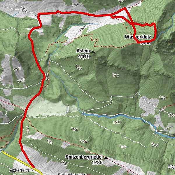
Parkplatz bei Almhütte Zickerreith
www.pyhrn-priel.net/de/sommer/2693272... - Pot
-
ZickerreithAhornsattel3,9 kmWasserklotz (1.505 m)4,8 km
- Najboljša sezona
-
janfebmaraprmajjunjulavgsepoktnovdec
- Najvišja točka
- 1.460 m
- Počitek/Umik
-
Zickerreith, Hanslalm, Puglalm und Karlhütte
- Gradivo za zemljevid
-
Wanderkarte Pyhrn-Priel erhätlich in allen Pyhrn-Priel Tourismusbüros!

GPS Downloads


Razmere na poti
Asfalt
Gramoz
Meadow
Forest
Rock
Razkrita stran
Več izletov v regijah
-
Gesäuse
2223
-
Steyr und die Nationalpark Region
1369
-
Rosenau am Hengstpaß
428


")


