


Toivanjoki paddling route
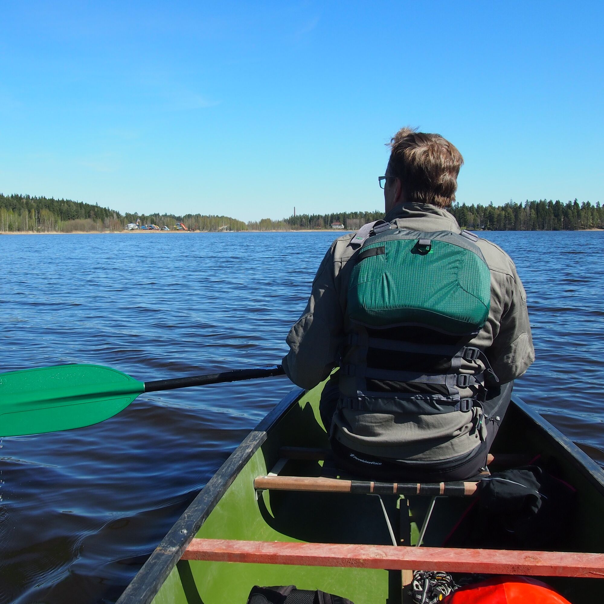
The Toivanjoki paddling route is located in Janakkala and its length is 8.7 km. The slowly flowing and wide channel Toivanjoki is a birder's dream destination. Binoculars are recommended, as a variety...
The Toivanjoki paddling route is located in Janakkala and its length is 8.7 km. The slowly flowing and wide channel Toivanjoki is a birder's dream destination. Binoculars are recommended, as a variety of water birds are guaranteed. In spring, at the beginning of the growing season, you can see far over the reed beds and in the middle of the marsh you can, for example, watch cranes walk slowly.
Watch the introduction video of the Toivanjoki paddling route from this link.
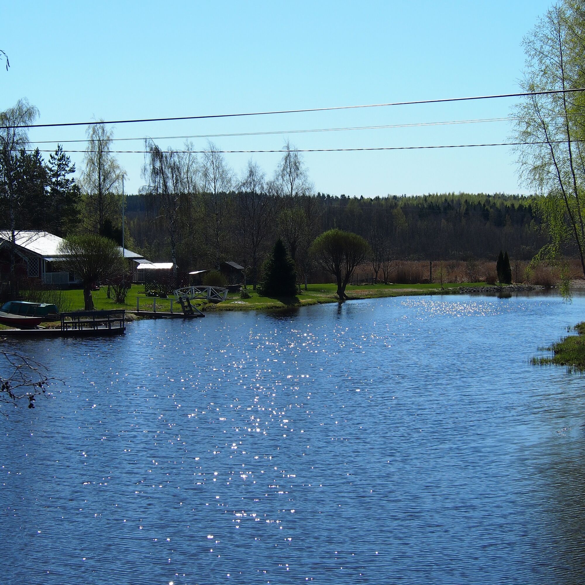
The length of the Toivanjoki paddling route is 8.7 km. The calmly flowing channel can be paddled in both directions, but if you choose the downstream direction, the natural starting point is the Lepokallio boat and swimming shore on Kesijärvi. In addition to a parking area and toilet facilities, the beach also has a picnic table.
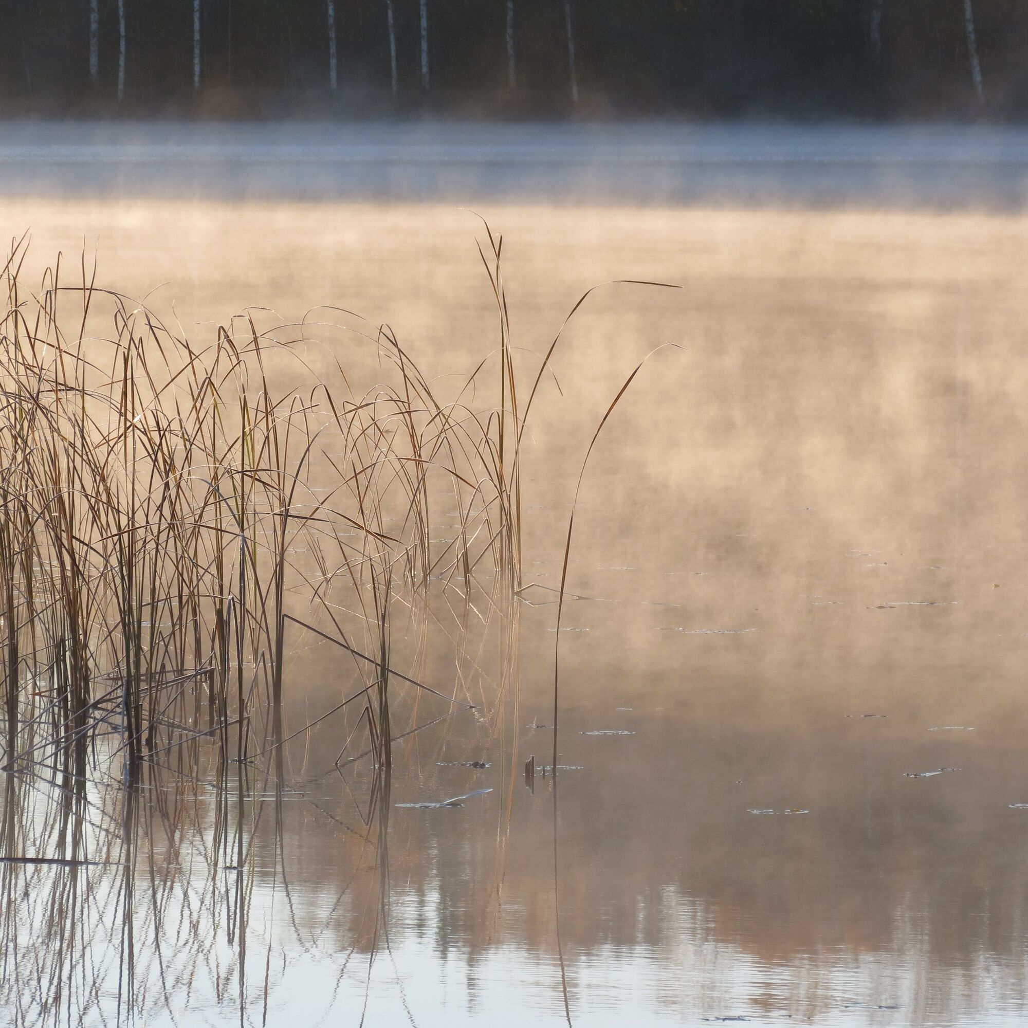
Leaving from Lepokallio boat shore, it is easy to head towards the power lines under which Toivanjoki flows. Only about a quarter of an hour paddling along the eastern shore of Kesijärvi is needed before the drain starts, and on the way you can also admire the old brick factory surroundings. The mouth of Toivanjoki opens as a wide channel and it flows slowly throughout the journey.
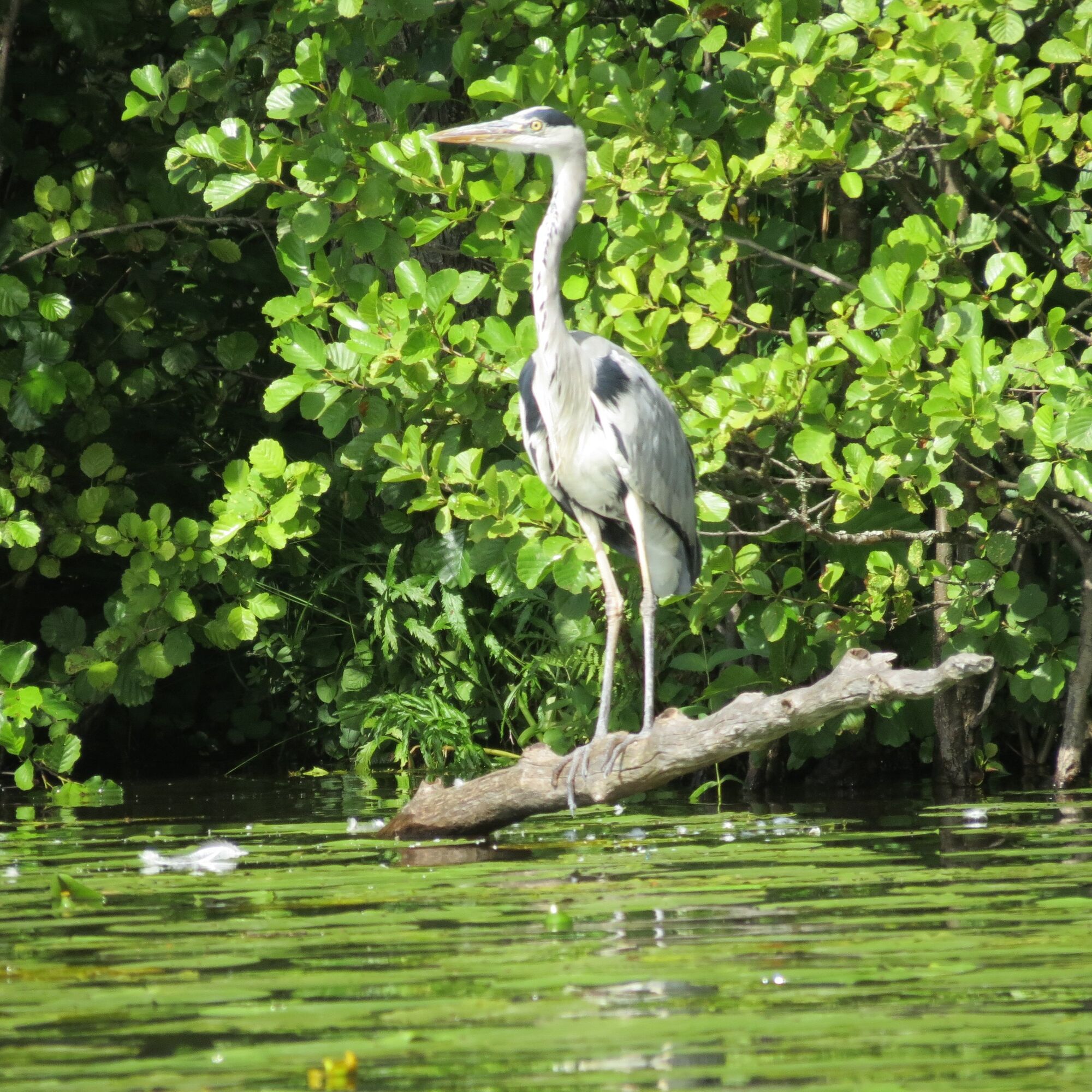
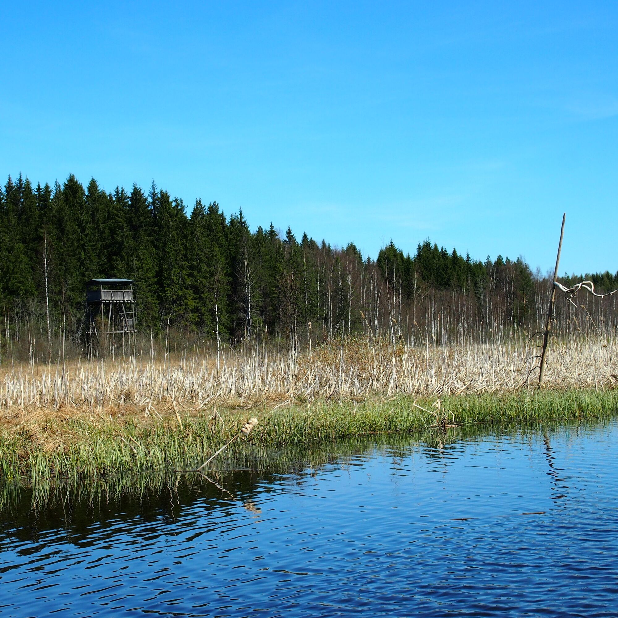
The greatest bird diversity is found at the protected Toivanjoki bird wetland, recognizable by a tall bird tower standing at the edge of the forest. Additional open water areas were dug in the marshy wetland in 2014 to provide sheltered nesting and feeding areas for birds. In addition to the crane, you can spot for example the black-crowned night heron, curlew or marsh harrier at the wetland.
Rest spots are scarce on Toivanjoki. About halfway along the route there is a charming wooden bridge where it is easy to pull the canoe ashore. The broad railings of the bridge make a nice place to sit, eat snacks and enjoy a summer day and the stunning river scenery.
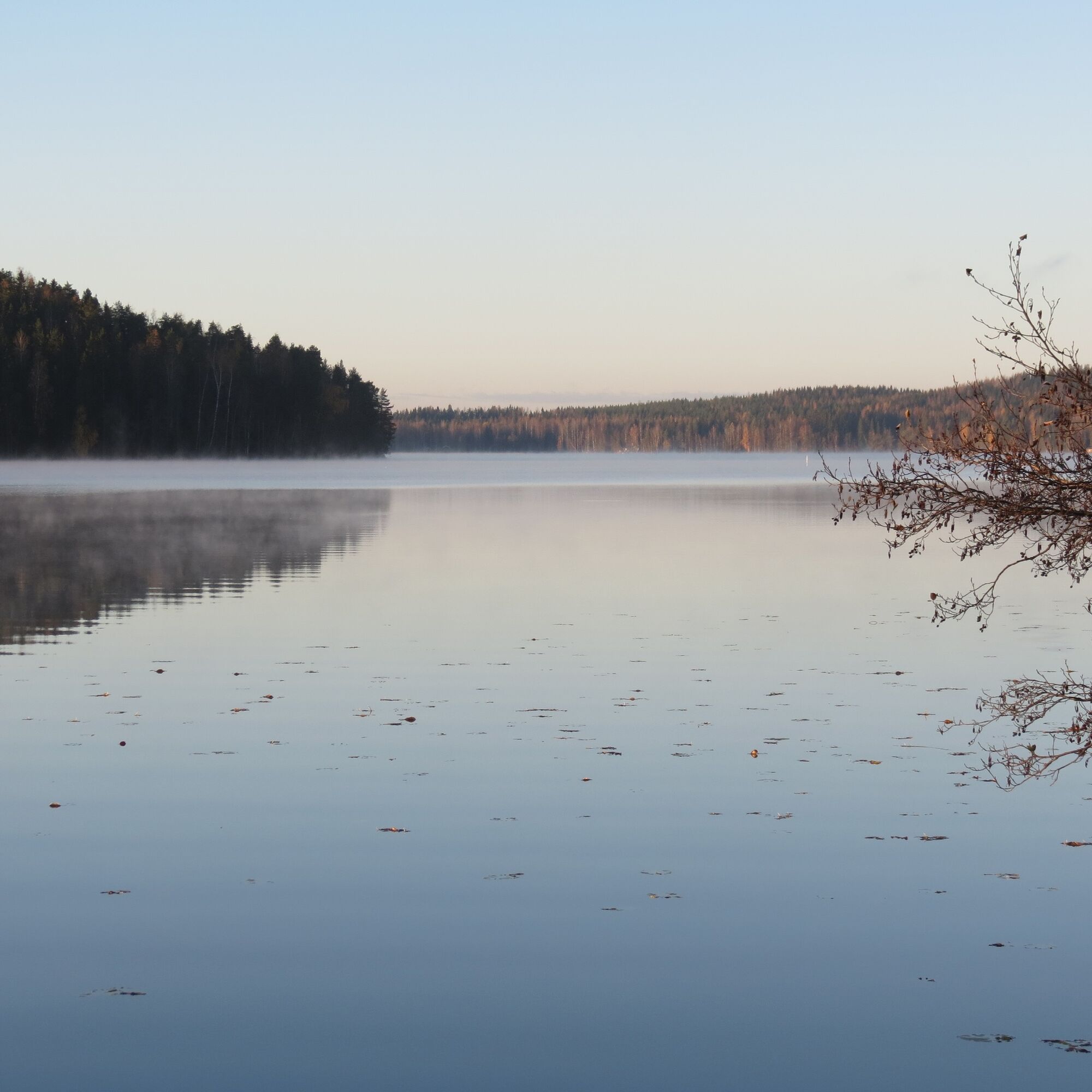
After the bird wetland, the forest edges steepen and on the right side of the river rises the majestic rock wall, Takalankallio. Shortly thereafter the river joins part of the Kuosarinlahti bay of Alasjärvi. After paddling a bit further, the wide open water of Alasjärvi unfolds ahead and Puuhamaa amusement park is easily distinguishable on the opposite shore. Also visible well on the lake is the beautiful yellow manor building of Tervaniemi, as well as the final point of the paddling route, Suruton swimming shore. Near the shore, there is a lean-to shelter where you can rest a moment before carrying the canoe uphill to the beach parking lot.
Da
Paddling services:
Multievent Oy
SUP board rental:
Tervakosken Suruton Oy
More information about the route:
Digitrail.fi
The Toivanjoki paddling route is suitable for good beginners and families. The river can be paddled in both directions or you can return to your starting point thanks to the gentle current. The route is navigable during the entire open water season.
The paddling route can be started from Kesijärvi or Alasjärvi. Lepokallio boat shore at Kesijärvi: turn from road 54 towards Tervakoski, from the Launonen junction 1 km along Vähikkäläntie towards Tervakoski, left on Suviniementie for 2 km and then right for 250 m (an unsigned junction). Suruton shore at Alasjärvi: from Tervakoski center, turn left from Vähikkäläntie onto Tervajoentie, immediately after crossing the river onto Tammiranta park road, and then right onto Alasjärventie. Suruton shore is located about 1.5 km from Tervakoski center.
Parking is available at Lepokallio boat shore on Kesijärvi and Suruton shore on Alasjärvi.
The paddling time on the route is approximately 2-3 hours and it is easy in difficulty. The paddling route can be followed using the DigiTrail app.
Priljubljeni izleti v okolici
-
Hämeen Ilvesreitti Riihimäki Kormu-Poronpolku 45.3 km
težkoMountainbike 44.3 km -
Pikku-Sisu route 12 km
svetlobaKolesarjenje 12.1 km -
Turenki-Kolmilammi Esker trail 15 km
Pohodništvo 14.9 km -
Hämeen Ilvesreitti Riutta-Hirvijärvi 30 km
Pohodništvo 30.0 km -
Paalijärvi Hämeen Ilvesreitti
Pohodništvo 10.2 km -
Riihimäki Kormu-Poronpolku 45.3km
težkoPohodništvo 44.1 km -
Keskusta - Tikkurilan kirkko - Malmimäki - Tampere
svetlobaKolesarjenje na dolge razdalje 253.9 km -
Punkantienristeys - Riihimäki - Suokylä
svetlobaPohodništvo 3.54 km -
Hausjärvi - Apilisto
srednjaPohodništvo 10.3 km -
Hausjärvi - Turkhauta
srednjaPohodništvo 8.01 km
Pohodništvo in sledenje


Ne zamudite ponudb in navdiha za naslednje počitnice
Vaš e-poštni naslov je bil dodan na poštni seznam.