


206 Rofna Lantsch/Lenz


The starting point of this approximately five-kilometer circular route is the municipality building of Lantsch/Lenz. From there, the route leads through the beautiful "Tgampi" neighborhood and further...
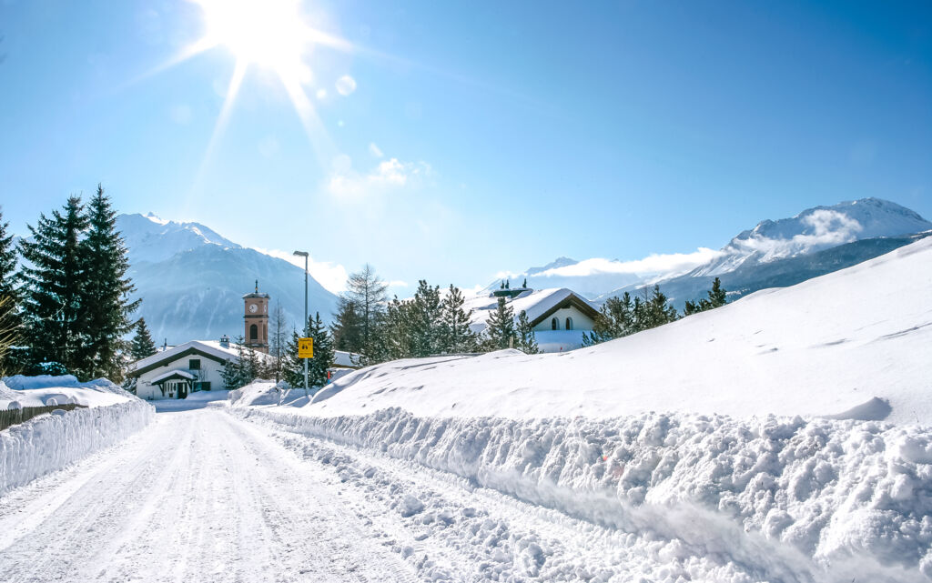
The starting point of this approximately five-kilometer circular route is the municipality building of Lantsch/Lenz. From there, the route leads through the beautiful "Tgampi" neighborhood and further to the Roland Arena, where international cross-country skiing and biathlon competitions regularly take place.
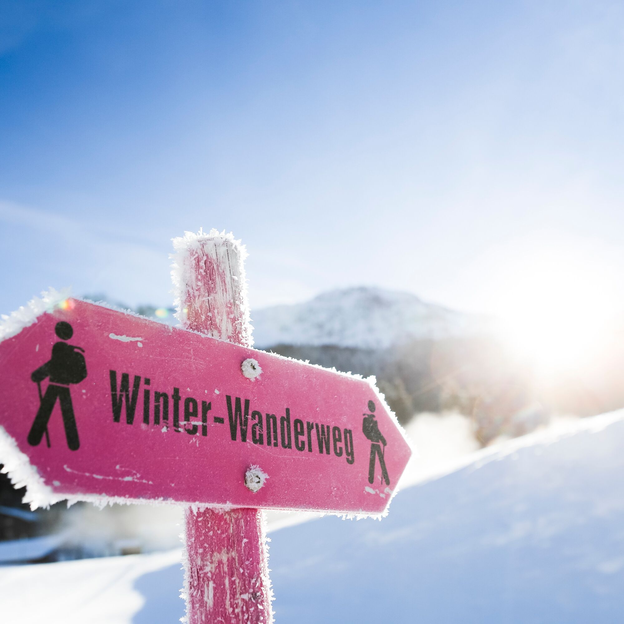
There, the cantonal road is crossed and the winter hiking trail is followed up to the height of Rofna. The gently ascending hike to Rofna mostly runs through a snow-covered forest landscape. At the top, a magnificent panorama of the Oberhalbstein and Heinzenberg awaits.
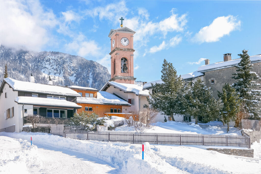
From Rofna, the descent leads into open terrain to the Lenzer ski lift and then back to the village. The sights of Lantsch/Lenz include three churches, with the Marienkirche considered especially worth seeing. The cemetery with its wrought-iron grave crosses is counted among the most beautiful in Europe. In addition, two well-preserved washing and baking houses can be visited, providing insight into the village's past culture.

The starting point of this approximately five-kilometer circular route is the municipality building of Lantsch/Lenz. From there, the route leads through the beautiful "Tgampi" neighborhood and further to the Roland Arena Lenzerheide. There, the cantonal road is crossed and the winter hiking trail is followed up to the height of Rofna. From Rofna, the descent leads into open terrain to the Lenzer ski lift and then back to the village.
Da
From Basel and Zurich - Chur-Süd (exit no. 17) - Lenzerheide - Lantsch/Lenz.
From Milan - Lugano - San Bernardino Tunnel - Thusis - Chur (Lenzerheide exit) - Lenzerheide - Lantsch/Lenz.
Arrive by train to Chur, then transfer directly to the Postauto Graubünden buses (182) and reach Lenzerheide within 30 minutes and another ten minutes to Lantsch/Lenz.
Parking spaces opposite the municipality building Lantsch/Lenz.
The fire pit in Rofna is also freely available for use in winter. The evening sun can be enjoyed here for a particularly long time.
Priljubljeni izleti v okolici
-
Alp Sanaspans - Rothorn
težkoPohodništvo 13.6 km -
5.0
Arosa-Hörnli-Urdenfürrgli-Alp Scharmoin-Lenzerheide
srednjaPohodništvo 15.3 km -
5.0
202 High-level path Tgantieni
težkoZimsko pohodništvo 12.3 km -
5.0
Piz Scalottas - Brambrüesch
srednjaPohodništvo 16.6 km -
3.0
207 Mittelberg Parpan
srednjaZimsko pohodništvo 7.07 km -
5.0
Globi hiking trail
srednjaTematska pot 7.20 km -
Rundtour Lenzerheide
srednjaPohodništvo 14.9 km -
521 Era Vedra
srednjaSnežni čevlji 2.82 km -
201 Heidsee route
svetlobaZimsko pohodništvo 5.49 km -
Churwalden - Windegga - Fuulberg - Stätzerhorn
srednjaTrailrunning 13.2 km
Pohodništvo in sledenje


Ne zamudite ponudb in navdiha za naslednje počitnice
Vaš e-poštni naslov je bil dodan na poštni seznam.