


National Park: Fuorcla Val dal Botsch
Stopnja težavnosti: T3
A varied pass hike that connects two regions of the Swiss National Park with different character. Besides the diverse alpine flora, the magnificent view from the 2677 m a.s.l. Fuorcla Val dal Botsch pass...
A varied pass hike that connects two regions of the Swiss National Park with different character. Besides the diverse alpine flora, the magnificent view from the 2677 m a.s.l. Fuorcla Val dal Botsch pass height, the alluvial fans in the rear Val Plavna, the Hexenkopf, and the possibility of observing deer in Val Mingèr await nature lovers.
Note: Dogs are not allowed in the Swiss National Park, not even on a leash. Further information and all protection regulations can be found at nationalpark.ch/schutzbestimmungen.


From the starting point at the National Park Hotel Il Fuorn and the Il Fuorn postbus stop (P6) (1794 m a.s.l.), the hike follows the first section of the nature trail (details in the route description "Margunet").
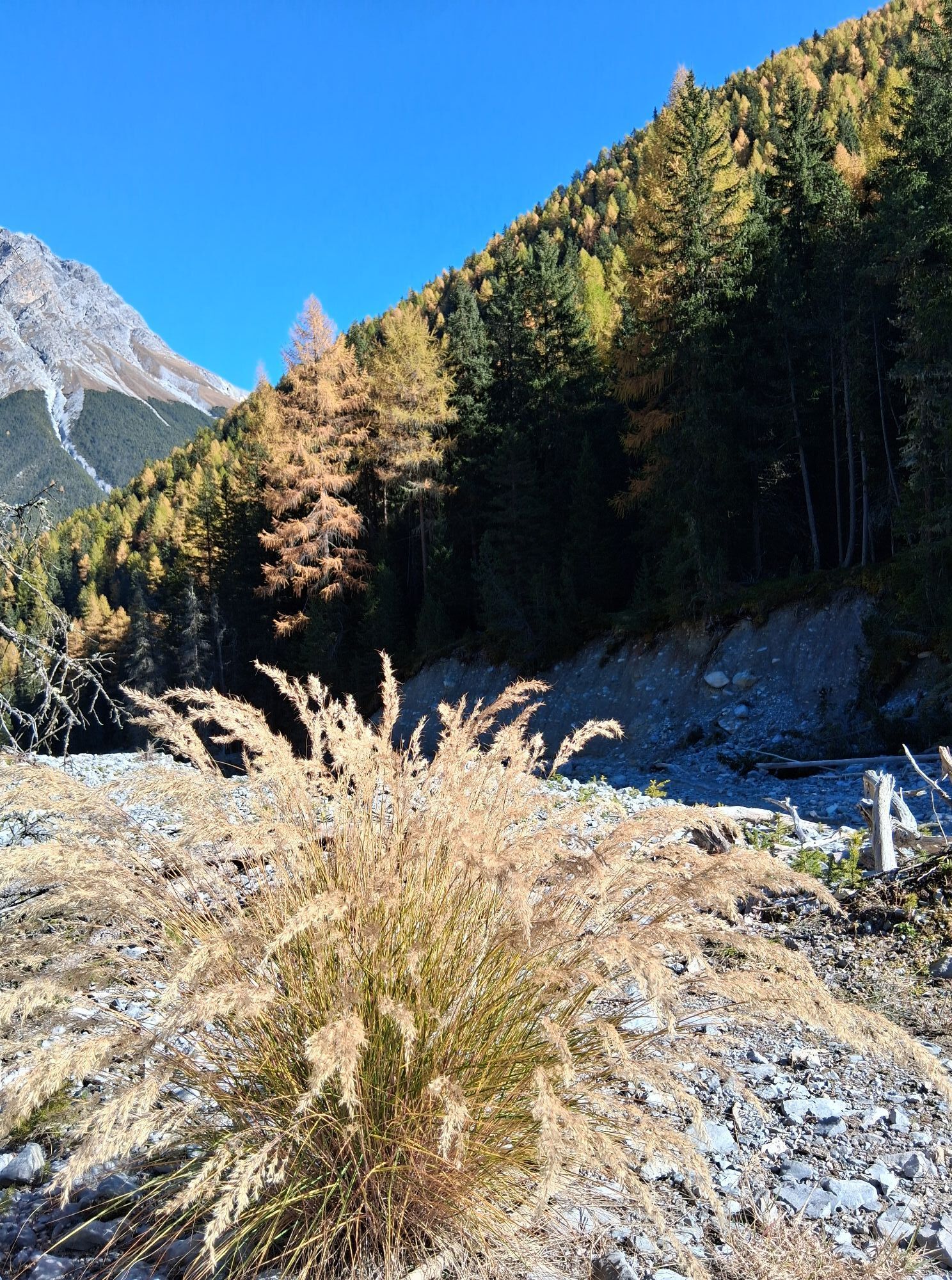
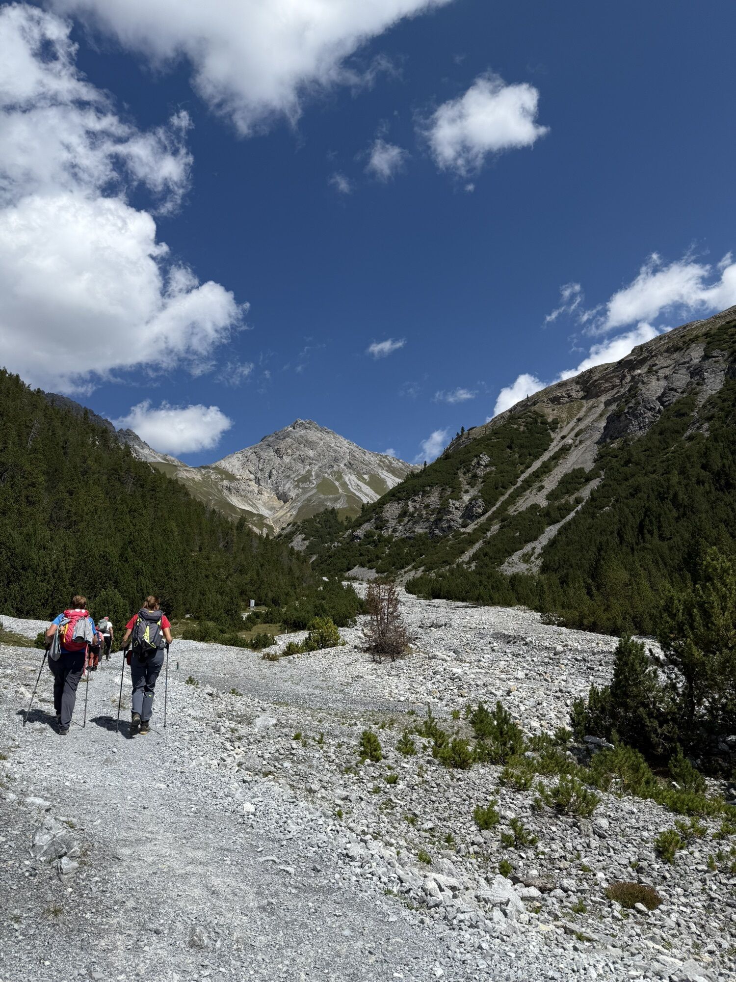
From the former parking lot 7 (no postbus stop!) the route turns away from the Ofenpass road and ascends through the dense forest of the Val dal Botsch. Passing the Val dal Botsch rest area, which is almost completely covered with debris, and along the roaring Ova da Val dal Botsch, the path continues uphill to a junction (2176 m a.s.l.).
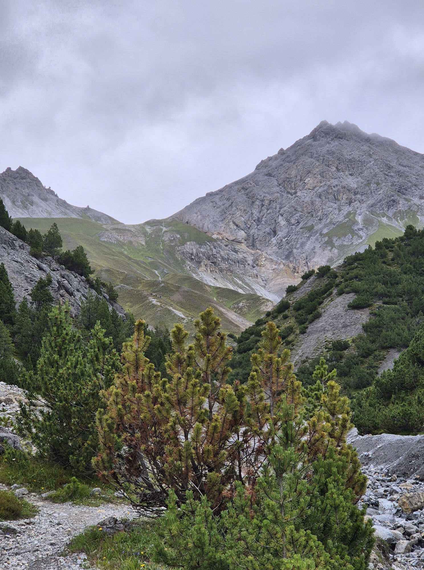
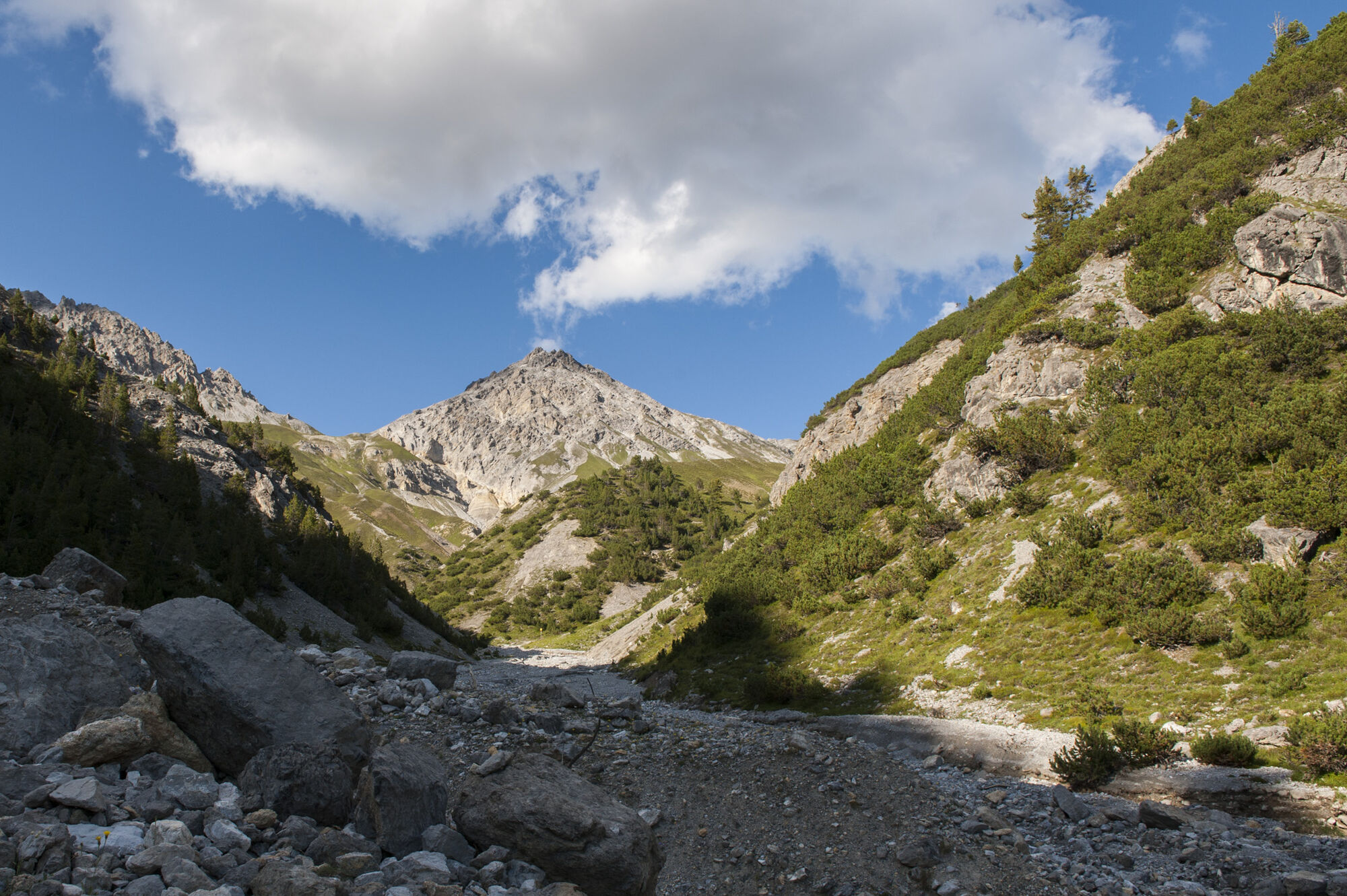
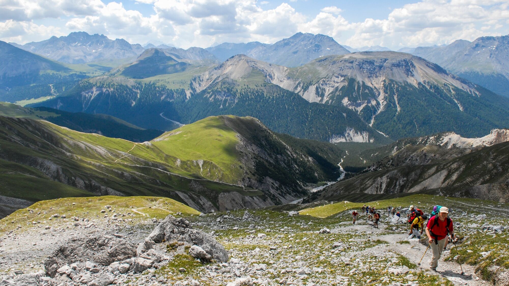
The path to the east would lead to the Margunet viewpoint, but our route turns north and changes into a zigzag path that crosses flower-rich meadows and gains 400 vertical meters in a short time. The higher the path climbs, the more magnificent the view becomes, stretching south to the Bernina massif and east to the Ortler and Stelvio Pass. Just before the Fuorcla, a circular sinkhole can be seen beside the path, a funnel created when rock underground is dissolved and the resulting cavities collapse.
Reaching the pass crossing (2677 m a.s.l.), the view also opens to the north, towards the Pisoc chain, the distinctive peak of Piz Plavna Dadaint, and the valley floor of Val Plavna.
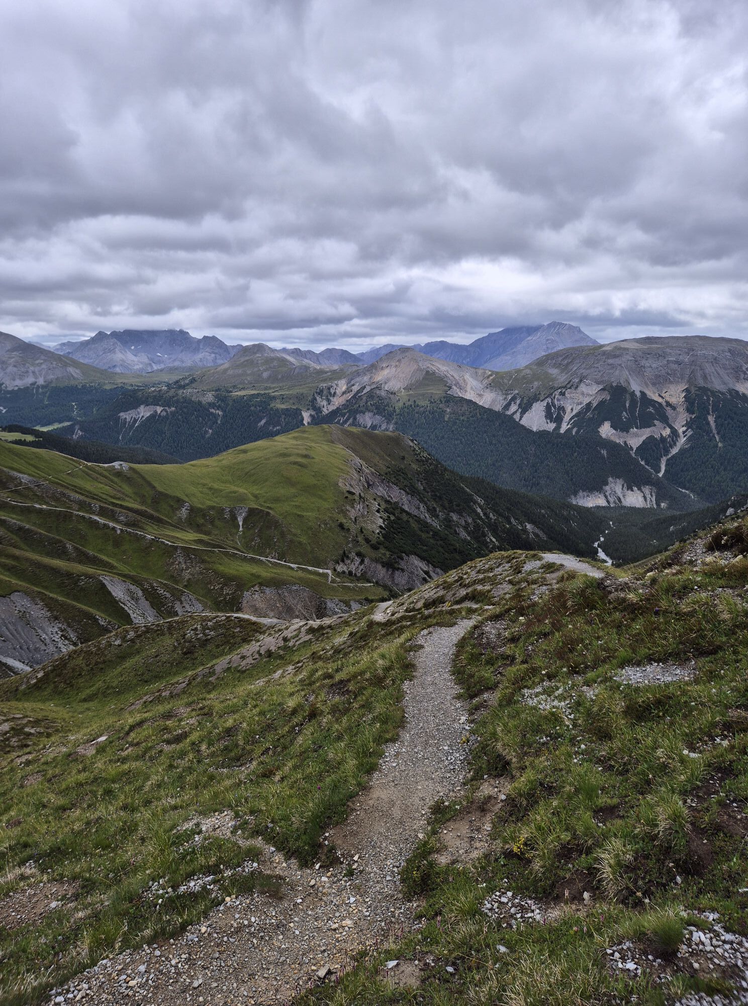
The route now leaves the National Park and passes through huge debris fields, first downhill and then slightly uphill to the Sur il Foss crossing (2317 m a.s.l.). From here the path dives into Val Mingèr and again runs within the National Park. This section is detailed in the route description "Val Mingèr."
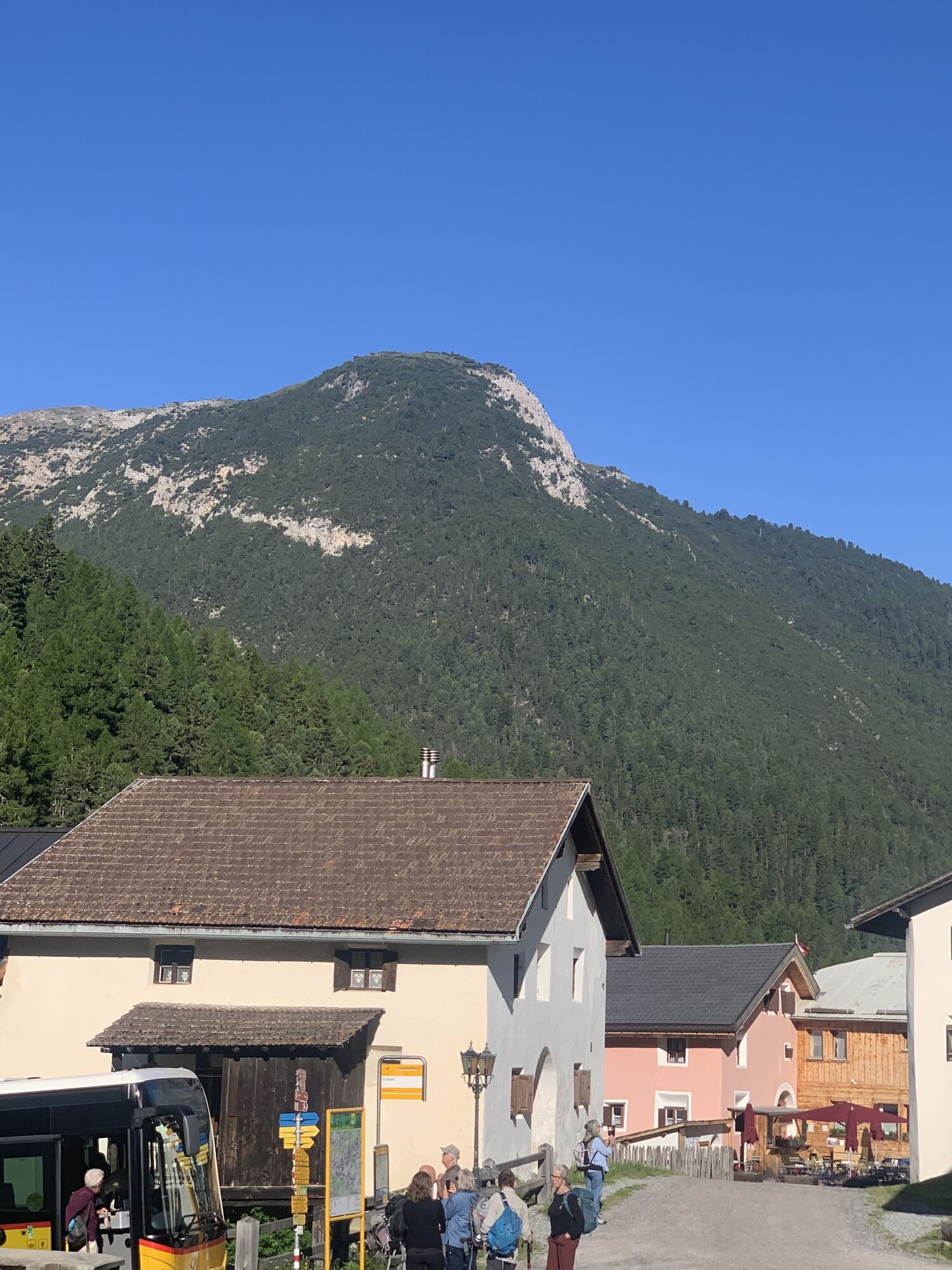
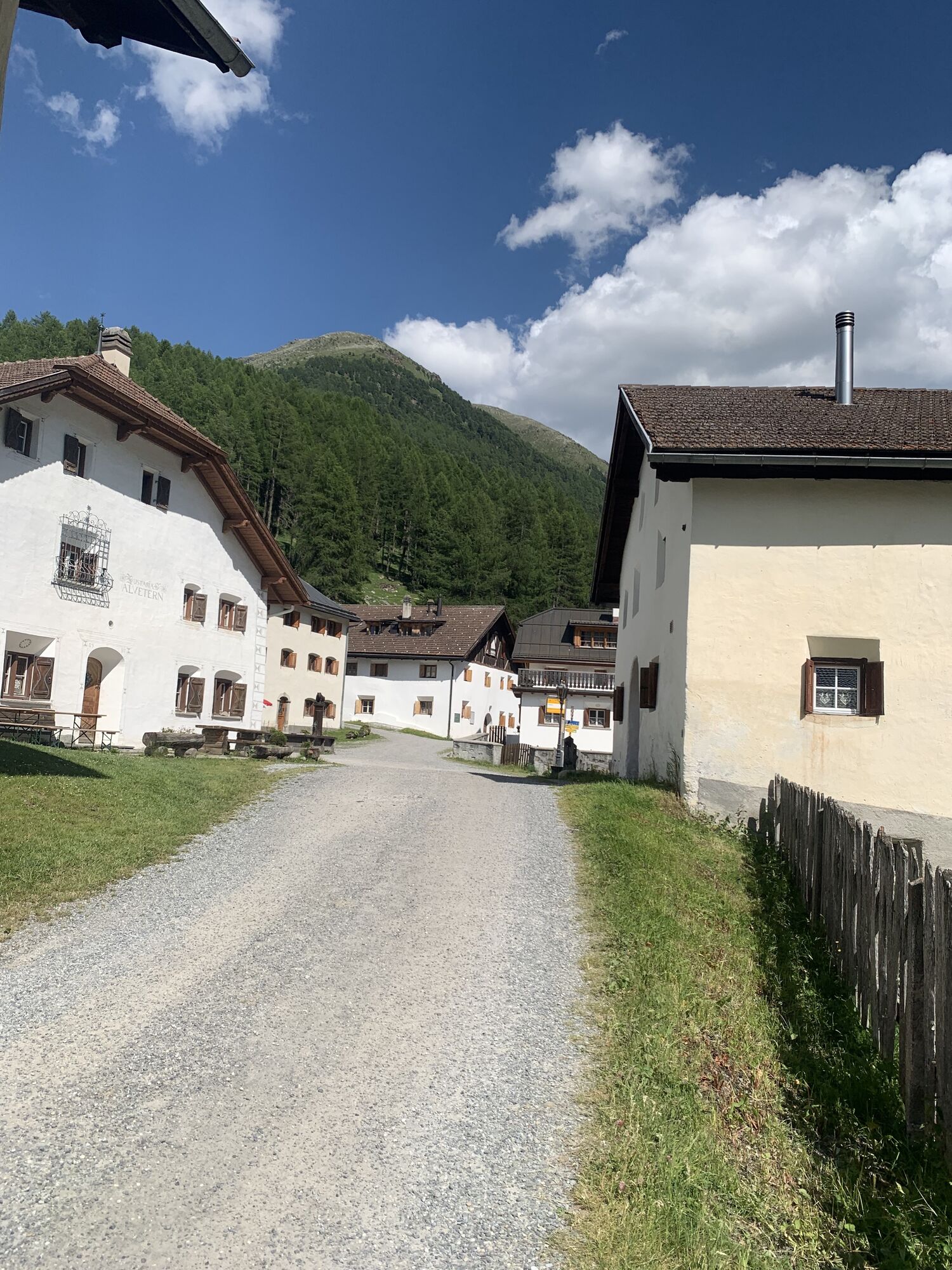
At Pradatsch (1654 m a.s.l.), the route flows into Val S-charl. There is the possibility to take the postbus to Scuol here. However, the route continues southeastward, north of the road. Passing the Schmelzra, the renovated administration building of the former S-charl mines and today's mining and bear museum, the path ends at the postbus stop in the picturesque village of S-charl (1810 m a.s.l.).
Da
Hiking boots, warm clothing, sun and rain protection, hiking poles as needed, binoculars recommended.
Mountain hike (white-red-white). Steep debris field on descent from the Fuorcla towards Val Plavna. In spring and autumn, snow can be expected here. Sure-footedness required.
Emergency call:
144 Emergency, First Aid
1414 Mountain rescue REGA
112 International emergency call
From the north: via Landquart – Klosters with car shuttle through Vereina tunnel (Selfranga – Sagliains) or via Flüela Pass into the Lower Engadin on H27
From the east: via Landeck / Austria towards St. Moritz on H27
From the south: via Reschen Pass (Nauders – Martina) into the Lower Engadin on H27
From Zernez on Ofenpass road towards Val Müstair to parking lot 6
From Val Müstair via Ofenpass towards Zernez to parking lot 6
By Rhaetian Railway (from Chur, Prättigau, Upper and Lower Engadin) hourly (partly half-hourly) to Zernez
From Zernez by postbus towards Müstair-Mals hourly to Il Fuorn (P6)
Free parking at the train station, in the village, and at the National Park visitor center in Zernez.
Free parking at parking lot 6 on the Ofenpass road
T3

Priljubljeni izleti v okolici
- 4.0
National Park: Margunet
svetlobaPohodništvo 7.76 km National Park: Murtersattel
srednjaPohodništvo 7.66 kmGuarda – Chamonna Tuoi – Furcletta – Alp Valmala – Ardez
srednjaPohodništvo 21.0 km- 4.5
Tarasp Fontana – Sparsels – Lai Nair (circular route)
svetlobaPohodništvo 7.67 km - 4.8
National Park: Grimmels (circular hike)
svetlobaPohodništvo 6 km - 4.0
Prui – Piz Clünas – Alp Laret – Ftan
srednjaPohodništvo 13.6 km - 4.0
Schellen-Ursli-Trail
srednjaTematska pot 3.53 km - 5.0
National Park: Mot Tavrü
srednjaPohodništvo 12.0 km - 5.0
Munt la Schera - Nationalpark
srednjaPohodništvo 13.1 km - 5.0
San Jon – Chamonna Lischana (return)
srednjaPohodništvo 12.0 km
Pohodništvo in sledenje


Ne zamudite ponudb in navdiha za naslednje počitnice
Vaš e-poštni naslov je bil dodan na poštni seznam.