







Jean Bolot Circuit
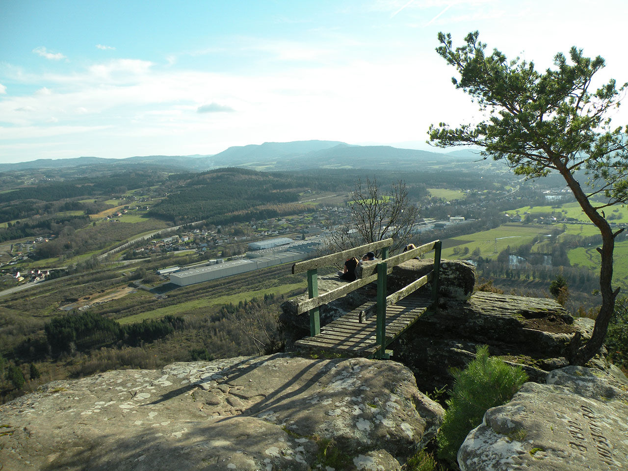
Very beautiful views over the Meurthe, Rabodeau, and Plaine Valleys.


Start from the First Sapinière (access from Raon l'Etape).
After passing under the RN 59 through the tunnel, take the forest road on the left that runs along the bypass of Raon l'Etape then turn right onto the path leading to the Second Sapinière (Etival-Clairefontaine).
Continue on the path that leads to the Pierre d'Appel via the corniche route if desired. After circling the Pierre d'Appel, return toward the TV relay and then follow the path toward the Trace Pass, passing the Roche du Bouc and the Docteur Baudot rock formations.
After the Trace Pass, follow the forest road to the right then take the Roman Road that climbs on the right. Before reaching the summit, turn left toward the Faucompierre rocks and the German Cemetery.
After crossing the République road, continue on the forest road that leads directly to the parking at the First Sapinière.
Points of interest along the route:
- the Pierre d'Appel: altitude 492 m, a rock that forms the eastern end of the former fortified enclosure of the Côte de Répy (Celtic camp) with very beautiful views over the Meurthe, Rabodeau, and Plaine Valleys. The Pierre d'Appel is named after the alarm signals that warned the local people.
- Roche du Bouc and Docteur Baudot rock
- Ancient Roman Road
- Faucompierre rocks
- German Cemetery
Marking: red ring
Clothing suited to the season and conditions (cold, warm, wet, etc.)
Hiking shoes adapted to the terrain (even for children!)
Hiking poles (useful for stability and to relieve joints)
Mobile phone and spare battery
Before setting off:
Check the general and local weather, ensuring there is no precipitation
Inform yourself about the approach hike, itinerary height, duration, possible escape routes (IGN map, GPS, guidebook, etc.)
Assess possible risks by consulting mountain professionals, refuges, lodgings
Inform someone close of your objective and contact them if changes occur: departure and return times, number of participants with each person's phone number, vehicle(s), parking
Avoid going alone, use equipment compliant with the activity, adjusted and in good condition, headlamp, complete first aid kit, survival blanket, etc.
In case of problem, call 112 (European emergency number)
Raon-l'Etape 88372
Ter Fluo Gare de Raon-l'étape
Raon-l'Etape 88372
Free parking on site
MAIRIE DE SAINT JEAN D'ORMONT 88210 SAINT JEAN D ORMONT 03 29 58 95 84
Priljubljeni izleti v okolici
-
5.0
Pierre Percée - 7 rouge
srednjaMountainbike 28.6 km -
The GR® de Pays of the Déodatie (Northern Loop) - Grandes Echappées Vosgiennes
težkoPohodništvo v daljavo 134.1 km -
Greenway of the Rabodeau valley
srednjaCestno kolo 13.2 km -
Panoramic loop of the Plaine valley
srednjaPohodništvo 12.4 km -
Randonnée pédestre - Massif de la Madeleine - M1
srednjaPohodništvo 5.52 km -
Circuit of the Haute Pierre
srednjaPohodništvo 10.7 km -
Heritage trail 17: The 3 abbeys
srednjaCestno kolo 28.5 km -
The Ormont Massif
srednjaPohodništvo 7.12 km -
Celles sur Plaine - 3 rouge
težkoMountainbike 25.8 km -
Le chemin des abbayes
težkoPohodništvo 10.7 km
Pohodništvo in sledenje


Ne zamudite ponudb in navdiha za naslednje počitnice
Vaš e-poštni naslov je bil dodan na poštni seznam.





