







The Ormont Massif
Route O2: Paradis / Roche des Fées / Sapin Sec / Roche du Chapeau. Marking: Yellow cross / green mark / yellow diamond. Duration: 2h.

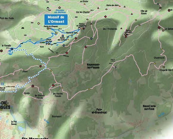
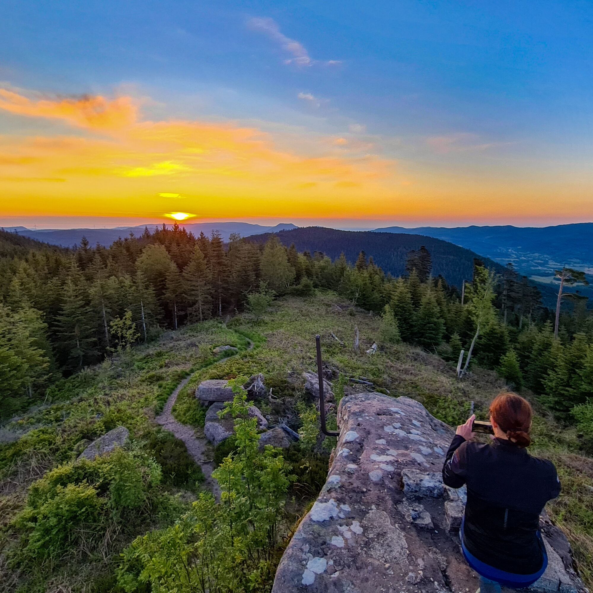

The route: From Saint-Dié-des-Vosges, drive the D82 towards Nayemont-les-Fosses until the exit of the hamlet of Dijon, then turn left towards the Pointe du Paradis via the "Résidence Abel Ferry" road for 1.8 km. Leave the car near the Paradis kiosk. Take the green mark path (GR 533) which, after crossing the Bellevue forest path, leads in 35 minutes to the Roche des Fées (alt. 751 m), passing by the Grand Lançoir (cross below erected in the 19th century in memory of an accident that occurred there). Continue on the green mark path towards the Roche des Cailloux (alt. 857 m, television relay), then the Roche du Hoff to arrive at Sapin Sec 30 minutes later (alt. 899 m, orientation table, highest point of the entire Saint-Dié-des-Vosges area). Return to the Sapin Sec pass (forest shelter with table and benches), and, turning your back to the rock, take the Bois du Roy path, marked with a green mark, which descends towards the Molières. Leave this green mark path 100 m lower at the "Place à tourner" to take the yellow cross marked path to the left, which leads in 15 minutes to the Roche du Chapeau (alt. 799 m, beautiful view over Saint-Dié-des-Vosges). Continue on this yellow cross path, then continue to the left with this path ascending towards the Roche des Fées and, at the next fork, turn right, going down the green mark GR 533 path (yellow diamond: Sentier des Ducs). Follow this path to the Bellevue crossroads, cross the forest road where you find again our green mark path that goes straight down through the Grande Creuse and brings us to the car waiting at the Paradis lodge. Return to Saint-Dié-des-Vosges, either via the hamlet of Dijon as on the way out, or via the hamlet of Robache and D 49.
Clothing adapted to the season and conditions (cold, hot, humid…)
Hiking boots suitable for the terrain (even for children!)
Hiking poles (useful for stability and to relieve joints)
Mobile phone and spare battery
Check the general and local weather ensuring the absence of precipitation. Get information on the approach walk, route elevation, duration, possible escape routes (IGN map, GPS, guidebook, etc.)
Assess possible risks by consulting mountain professionals, refuge, lodges
Inform a close contact of your goal and contact them in case of change: departure and return times, number of participants with each phone number, vehicle(s), parking
Avoid going alone, use equipment compliant with the activity practice, adjusted and in good condition, headlamp, complete first aid kit, survival blanket, etc.
In case of emergency, contact 112.
Saint-Dié
Saint-Dié TER Fluo station
www.fluo.eu
-
TOURIST OFFICE OF SAINT DIE DES VOSGES
6, quai du Maréchal Leclerc
88100 SAINT DIE DES VOSGES
03 29 42 22 22
www.vosges-portes-alsace.fr
Priljubljeni izleti v okolici
Hike Mountain Inn des Cîmes (Climont Route) - Towards a 360° view
srednjaPohodništvo 6.04 kmWalk Farm Inn Graine Johé "Walk between two valleys"
srednjaPohodništvo 3.36 kmPromenade of the Roche des Fées
srednjaPohodništvo 6.70 kmHiking route H06: The summit of Voyemont
srednjaPohodništvo 9.83 kmGreenway of the Rabodeau valley
srednjaCestno kolo 13.2 kmAurélien in the Vosges in 3 days from Munster - day 3
srednjaPohodništvo v daljavo 16.6 kmMountains, vineyards and castles in Alsace and the Vosges Massif
težkoJahanje 154.9 kmRandonnée pédestre - Massif de la Madeleine - M1
srednjaPohodništvo 5.52 kmThe heights of Steige and the Climont
srednjaPohodništvo 13.1 kmCircuit of the Haute Pierre
srednjaPohodništvo 10.7 km
Pohodništvo in sledenje


Ne zamudite ponudb in navdiha za naslednje počitnice
Vaš e-poštni naslov je bil dodan na poštni seznam.





