


Tour to the Back Langenbach Valley
Stopnja težavnosti: 1
From the Schönmünzach S-Bahn stop you initially pass the Schönmünzach stop location, cross the Murg, and then turn right into Schifferstraße. You then always follow the hiking signs towards Zwickgabel...
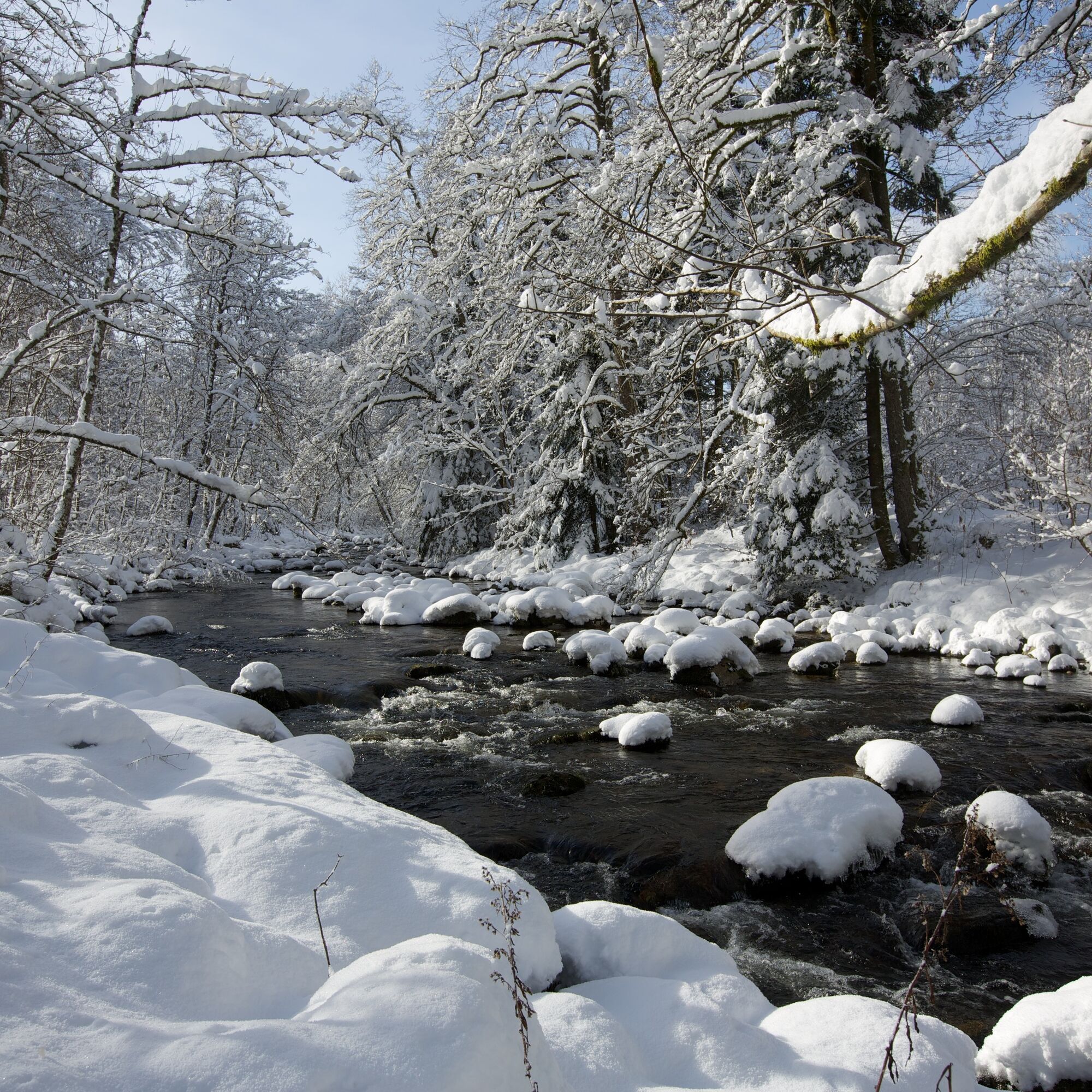
From the Schönmünzach S-Bahn stop you initially pass the Schönmünzach stop location, cross the Murg, and then turn right into Schifferstraße. You then always follow the hiking signs towards Zwickgabel or Hinterlangenbach. The cleared hiking path runs the entire time parallel to the Schönmünz along Zwickgabel to Hinterlangenbach. Enjoy always having the river by your side, which provides orientation but also contributes to a harmonious and calm atmosphere.

Da
On all cleared forest paths, there can be a risk of slipping and ice.
The hiking information center offers ice claws for rent. More information at www.baiersbronn.de/verleih
We recommend having poles with you or attaching spikes to your shoes for this stretch to avoid slipping despite the carefully cleared path.
Please check beforehand in the current trail closures or at the Baiersbronn Hiking Information Center whether the trail is open. Tel.: +49 7442 8414-66.
Winter is a time of rest for nature and animals. For an enjoyable winter sports experience, we especially ask you to support us by observing the rules of conduct, staying on the paths and avoiding noise.
Bus stop Schönmünzach or Hinterlangenbach
Please check the departure times before starting the hike.
P&R parking Schönmünzach S-Bahn stop
1
We recommend taking the bus for the return trip, as the double distance is only feasible for quick hikers on a winter day.
From Hinterlangenbach there is only limited possibility to take the bus back to Schönmünzach.
Please check the departure times before starting the hike.
Priljubljeni izleti v okolici
-
4.7
Kniebiser Heimatpfad - Wandern mit Genuss
svetlobaPohodništvo 9.07 km -
3.9
Schnapsbrunnenweg 2
srednjaPohodništvo 12.8 km -
5.0
Ottenhöfen - Eichkopf - Karlsruher Grat
srednjaPohodništvo 13.7 km -
4.0
Sankenbachwasserfälle und Glasmännlehütte am Stöckerkopf
srednjaPohodništvo 12.8 km -
5.0
Naturgewalten-Tour
Pohodništvo 15.6 km -
5.0
Bannwald-Tour
Pohodništvo 13.3 km -
5.0
Schnapsbrunnenweg 1
svetlobaPohodništvo 7.45 km -
4.7
premium hiking trail Enzquellenpfad
srednjaPohodništvo 19.9 km -
5.0
Kniebis-Sankenbachwasserfälle-Sankenbachsee
srednjaPohodništvo 7.98 km -
4.8
Ottenhöfen - Mühlenweg
srednjaPohodništvo 13.4 km
Pohodništvo in sledenje


Ne zamudite ponudb in navdiha za naslednje počitnice
Vaš e-poštni naslov je bil dodan na poštni seznam.