


Schnapsbrunnenweg 2
Fotografije naših uporabnikov
-

 © TeresaUstvarjeno na 25.10.2025
 -
 © Volki F.Ustvarjeno na 19.05.2025
 -
 © Volki F.Ustvarjeno na 19.05.2025
 -
 © Volki F.Ustvarjeno na 19.05.2025
 -
 © Volki F.Ustvarjeno na 19.05.2025
 -
 © Volki F.Ustvarjeno na 19.05.2025
 -
 © Noreen (NoKe)Ustvarjeno na 30.03.2025
 -
 © Noreen (NoKe)Ustvarjeno na 30.03.2025
 -
 © Noreen (NoKe)Ustvarjeno na 30.03.2025


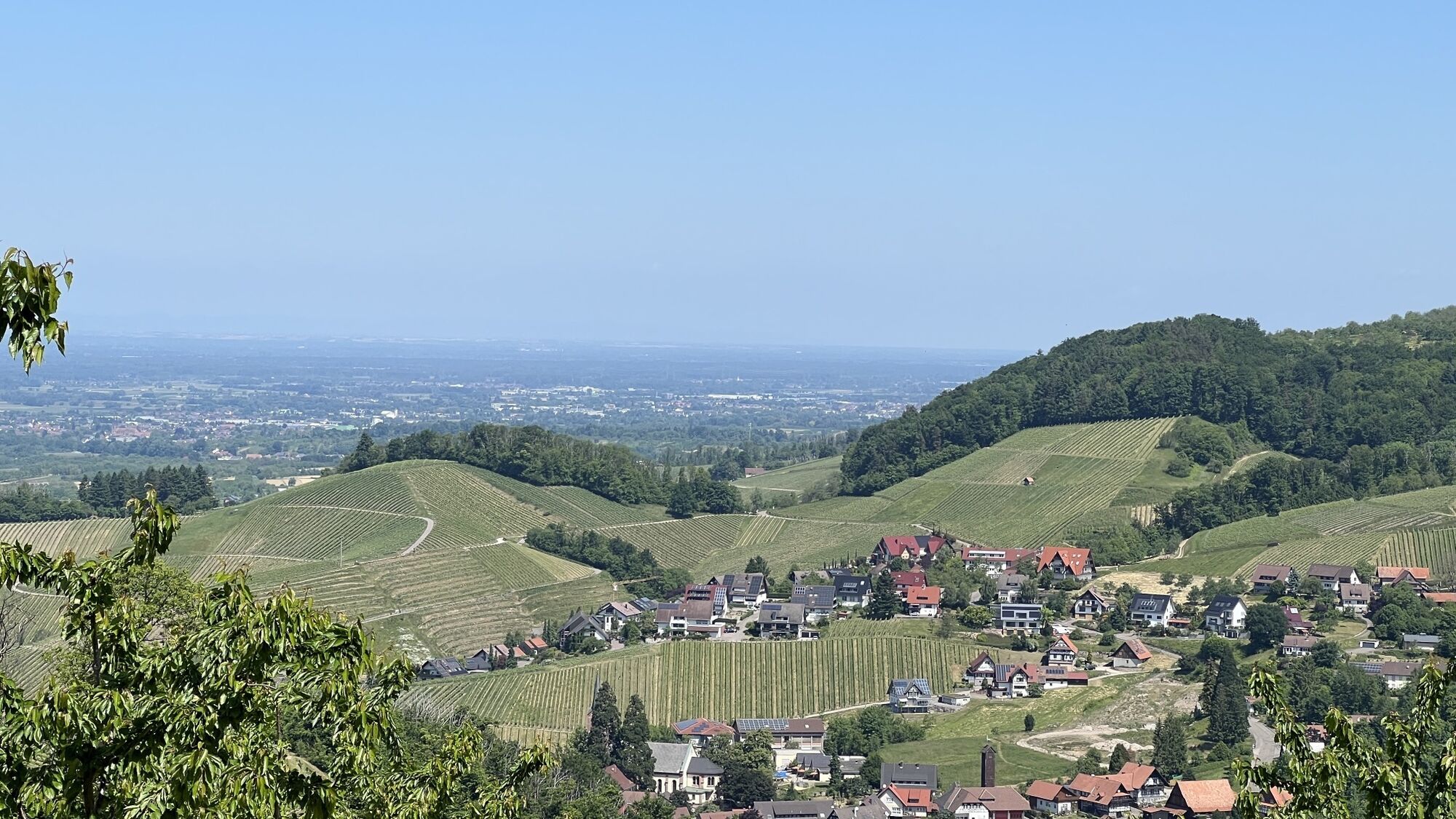


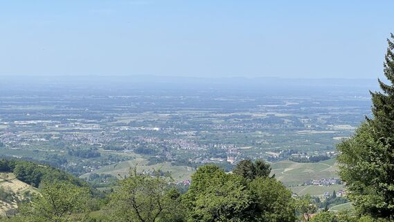
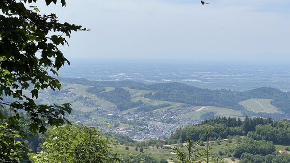
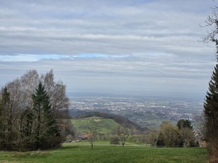
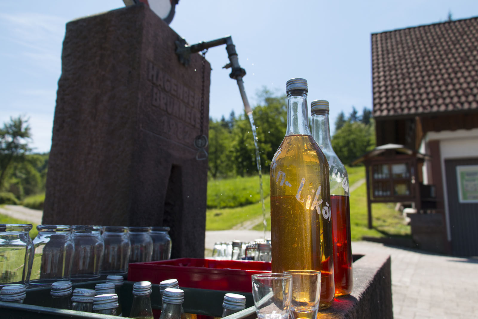
Cars need petrol, horses need oats, and hikers?
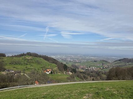
They refresh themselves on a hiking route at one of the Schnapsbrunnen in Sasbachwalden. More than 10 Schnapsbrunnen are spread across the entire district,...
Cars need petrol, horses need oats, and hikers?
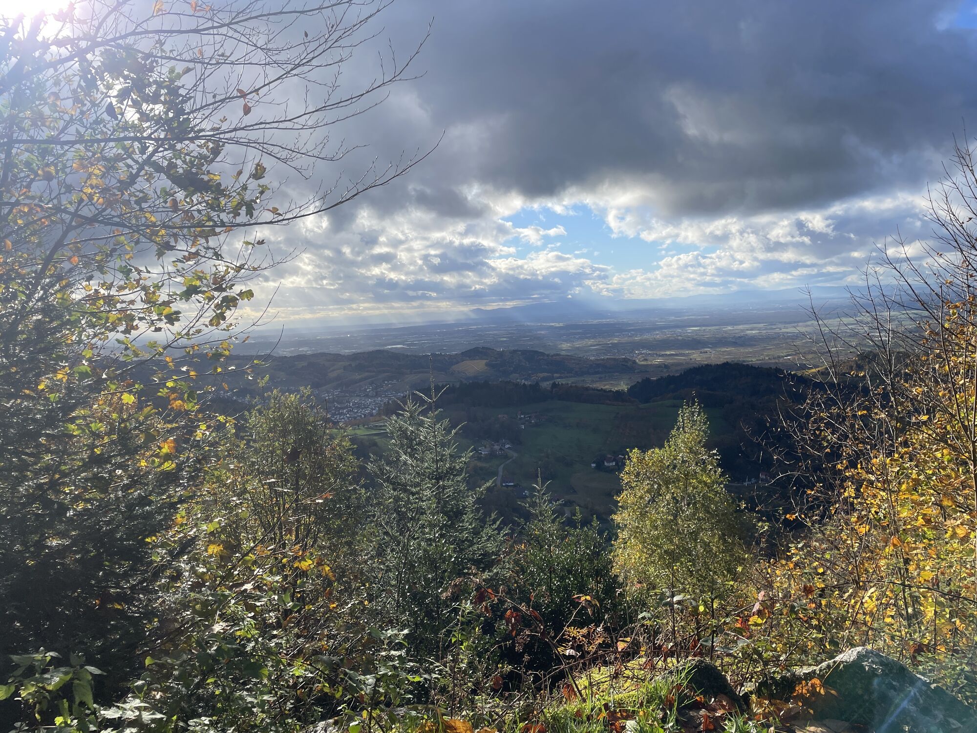
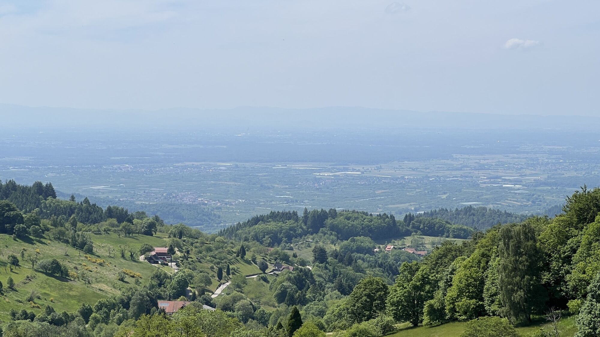
They refresh themselves on a hiking route at one of the Schnapsbrunnen in Sasbachwalden. More than 10 Schnapsbrunnen are spread across the entire district, divided into a northern (7 km) and a southern (12 km) circular hiking trail. At these fountains, located at beautiful viewpoints, cold mountain spring water continuously flows to cool the drinks stored inside. There is something for every taste: high-proof spirits from own production such as schnapps, liqueurs, and cider, but also non-alcoholic drinks for children are present at most Schnapsbrunnen. Here, every hiker can serve themselves for a small fee and continue their hike refreshed and strengthened.
This hiking route is also a so-called permanent hiking trail of the German Volkssport Association (DVV). Members of the association receive their start card at Höfner Stübl at the miniature golf course. Have fun, DVV members!

Start at the swimming pool parking lot
Walk across the large parking lot toward the miniature golf course and around the building
Keep right toward the street "In den Höfen"
There, turn right, cross the country road and follow the signs "Auf der Eck"
After a detour to the local Schnapsbrunnen, go back a bit to Grieseneck and turn right toward Kestenhalde, Birkenhöf, Wolfersberg
Pass the Schnapsbrunnen at Dolle Frieders Straußenwirtschaft
At Hagenberg, you will find the next Schnapsbrunnen with a great view
Continue toward Schönbüch / Haus Peduzzi and from there via "Hinterer Wasen" and "Katzensteiner Hof"
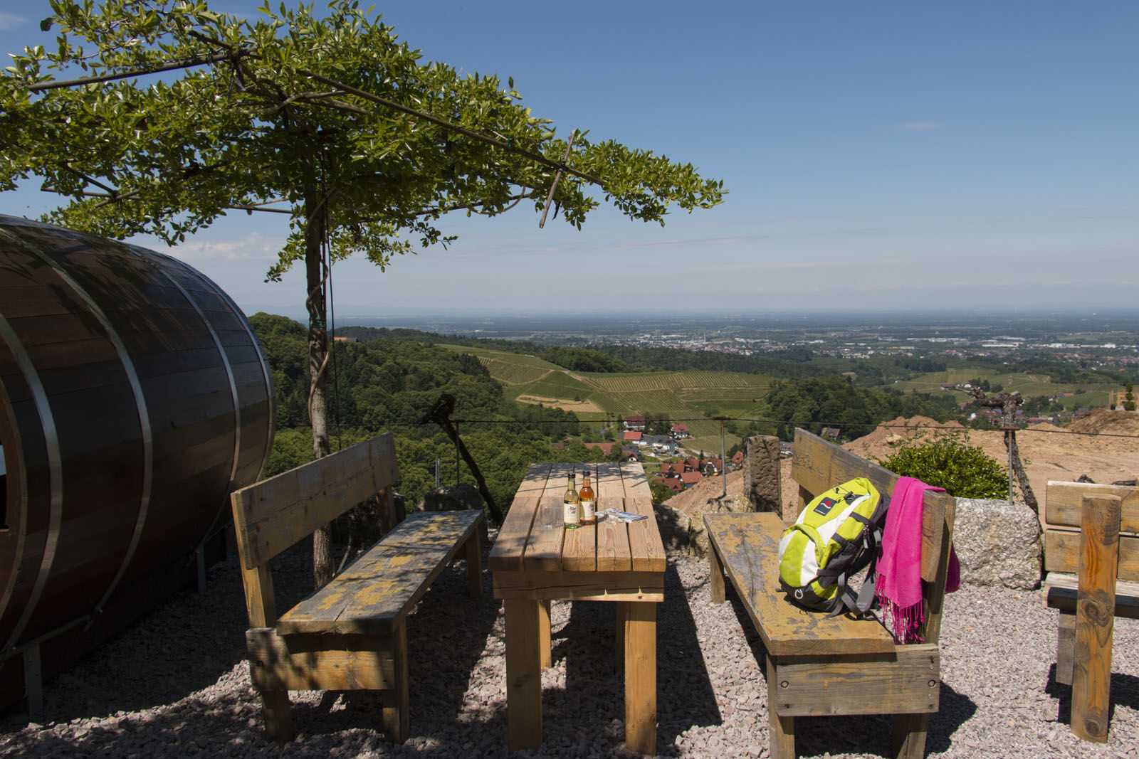
Now follow the signs to Brigittenschloss (Sandgrube). Our path leads below the castle ruins. However, a detour to the ruins with its magnificent view into the valley is definitely worthwhile
Back on the path, hike toward Schlossberg.
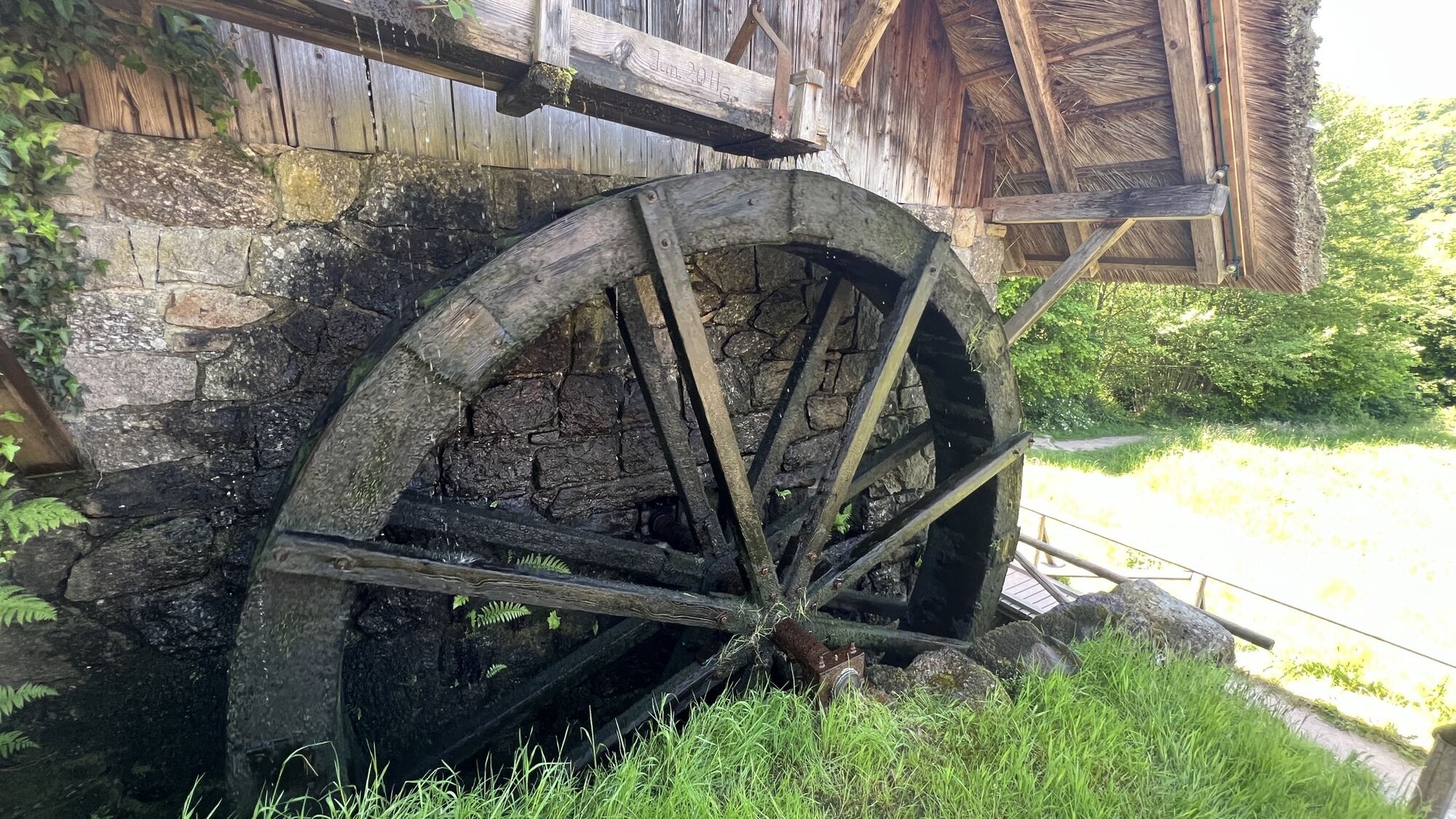
At Hotel Restaurant Im Spinnerhof, behind the house near the large mushroom oven, is the next Schnapsbrunnen. There are also dining options in the beer garden with a fantastic view.
Continue to the country road, the L86.
Now go downhill left along the country road, past the left curve at the Naturpark-Augenblick viewpoint Hörchenberg
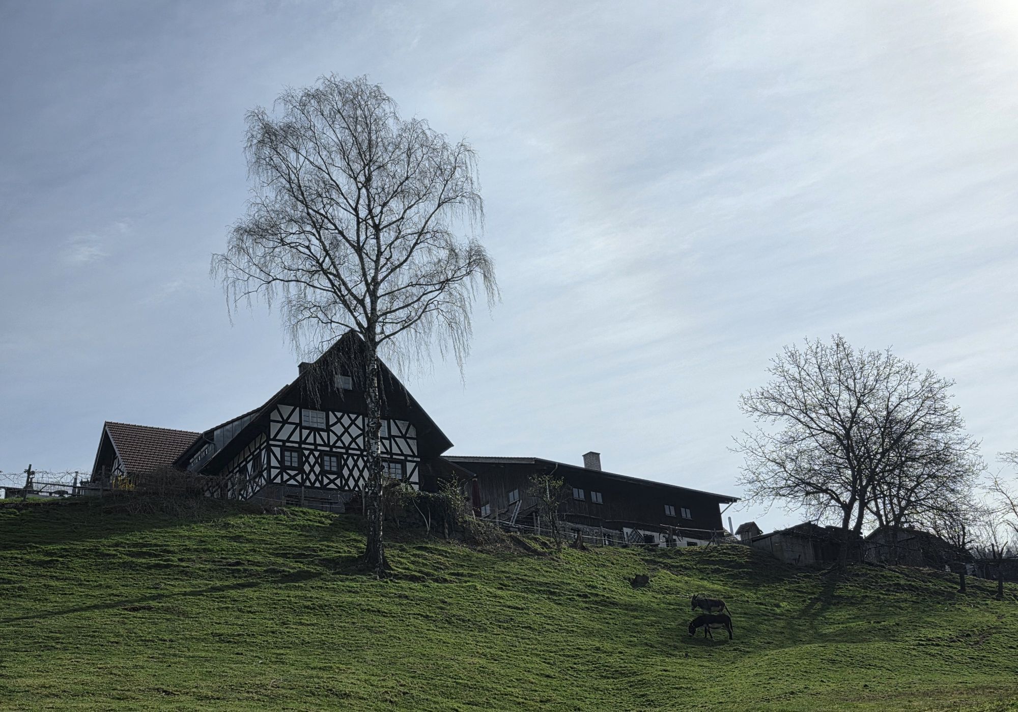
Then, the path leads right through a small forest area to Hof Wild (overnight stay in a wine barrel). The next Schnapsbrunnen awaits here.
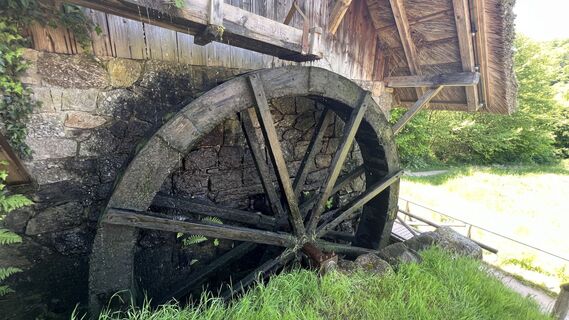
Continue the hike toward Straubenhöfmühle.
Cross the road above the mill and reach the Schnapsbrunnen Maier at Straubenhöfmühle.
After the stop, return below the mill along the path by the "Wilden Sasbach."
You come back via "In den Höfen" to the miniature golf course and finally back to the starting point.
Good footwear recommended
Coming from Achern, follow the L86 towards Schwarzwaldhochstraße. You enter the village of Sasbachwalden and pass the Alde Gott Winzer Schwarzwald eG. After about 800 meters, turn left into the swimming pool parking lot.
Bus line 400/423 stop: Sparkasse / Gaishölle
Use the public swimming pool parking lot. Fee required (day ticket: from 3 hours = 4 euros)
Dejavnosti na poti
-

Sasbachwalden, Regierungsbezirk Freiburg/Deutschland
05.04.2026 – Pohodništvo -
Schnapsbrunnenweg 2
07.03.2026 – Pohodništvo -

Sasbachwalden, Regierungsbezirk Freiburg/Germany
05.03.2026 – Pohodništvo -
Sasbachwalden, Regierungsbezirk Freiburg/Allemagne
25.10.2025 – Pohodništvo -
Sasbachwalden, Regierungsbezirk Freiburg/Deutschland
03.10.2025 – Pohodništvo -

Sasbachwalden, Regierungsbezirk Freiburg/Deutschland
29.08.2025 – Pohodništvo
Priljubljeni izleti v okolici
-
4.0
Gertelbacher Wasserfälle
težkoPohodništvo 18 km -
5.0
Bannwald-Tour
Pohodništvo 13.3 km -
5.0
Schnapsbrunnenweg 1
svetlobaPohodništvo 7.45 km -
4.4
Lautenbacher Hexensteig
težkoPohodništvo 15.3 km -
4.0
Seibelseckle Wildsee
srednjaPohodništvo 13.0 km -
Ruhestein - Schliffkopf - Ruhestein
srednjaPohodništvo 9.95 km -
Hundseck - Hochkopf - Hornisgrinde Bühlertal, Baden-Württemberg
svetlobaPohodništvo 15.5 km -
4.0
Genießer-Tour
Pohodništvo 17.2 km -
Von Herrenwies über Sand und Bühlerhöhe zur Badener Höhe Forbach, Baden-Württemberg
svetlobaPohodništvo 13.6 km -
5.0
Vom Golfplatz B.B. zur Y-Burg, und über die Fischteiche zurück
srednjaPohodništvo 9.84 km
Pohodništvo in sledenje


Ne zamudite ponudb in navdiha za naslednje počitnice
Vaš e-poštni naslov je bil dodan na poštni seznam.