







Burgenweg 7 From Engen to Hegaublick

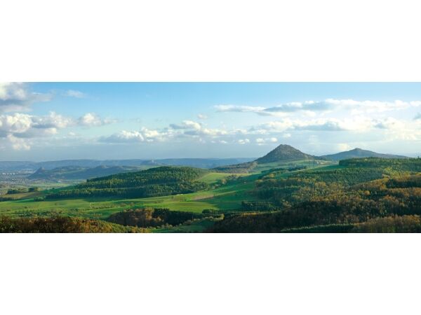
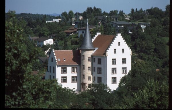
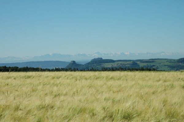
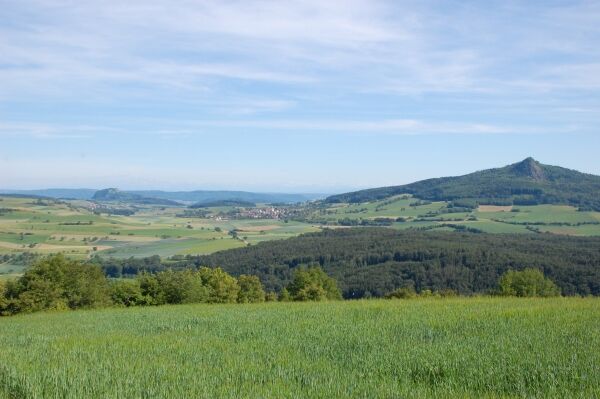

You start your hike at the train station and after crossing the L191, walk along Ballenbergstraße and then turn left into Hewenstraße. At the hospital parking lot, turn right and then left into Ludwig-Fink-Straße. Above the parking lot, take the connecting path to the street Zum Franzosenwäldle. The asphalt path turns into a gravel path. Pass the playground and continue straight ahead. At the intersection of asphalt and gravel paths, keep right. Continue straight and then turn right. You leave the forest and walk downhill, first turning left and then right on the asphalt path. At the chapel, turn right uphill into the forest. Continue along the Roman path into the forest to the Napoleonseck. Here you can see the entire Hegau with its mountains: Hohenkrähen (642m), Hohenhewen (844m), Hohentwiel (688m) and Hohenstoffeln (838+844m). Continue straight into the forest until shortly before the forest edge, then turn right. At the next junction, turn left until you reach a paved road, where you turn right. The path goes uphill into the forest. After a short woodland stretch, leave the forest and the paved road, then turn right onto a field path and walk straight downhill into the village of Stetten (750m). Pass the church and walk out of the village towards Geisingen. Shortly behind the village, before the last house, a small path turns left uphill into the forest. In the forest, turn left and then right at the next junction. Cross the next gravel path and continue uphill to the ruins of Neuhewen (867m, note: ruins closed!). The summit of the conical Neuhewen is formed by a basalt chimney, which has pierced the surrounding Nagelfluh rock. You have an especially good view of the landscape forms of the Hegau from the nearby «Hegaublick». A small path toward Hegaublick leads you to a junction. From there, go slightly left downhill. On the gravel path, first left, then right and right again over a small wooden bridge. You are back at the K6129 and hike towards the intersection with the L191. Cross it and walk past the hiking parking lot about 400m on the road. Turn right onto a field path. After a short forest section, hike on the "old road" towards Zimmerholz. For a long time, you have a wonderful view of the Hegau and the town of Engen. Further downhill, you reach the L191, which you cross. Danger spot!!! After crossing the road, turn right and follow this road to a crossroads. There, turn right and reach Zimmerholz (584m), where you turn left and then right into Riedstraße. Walk straight ahead and stay on the asphalt path towards Engen. Pass the campsite and the outdoor pool. Pass the Gaugelmühle restaurant and continue to the L191. There, keep right, cross it and go through the underpass to the train station. From there, go right and reach the old town of Engen.
The route is very easily accessible by the regional train Seehas.
Recommended literature: leaflet «Engen - Walk through the old town», available free of charge at the Engen Tourist Information.
Variant A: At the chapel, turn right and then left again. At the next junction, turn right and enter the forest. Continue straight ahead and then turn left. At the next intersection of asphalt path/gravel path, continue straight. Across open terrain, continue into a wooded area, past the playground, down the street Zum Franzosenwäldle. Go straight on the connecting path to the hospital parking lot. Below the parking lot, turn left and then right again into Ballenbergstraße. Past the LIDL market, take the same route as at the beginning of our hike back to the train station and into the old town of Engen.
Pridobite vpogled
Vedno v živo na mestu z več kot 9.500 spletnimi kamerami. bergfex Kot uporabnik Pro si lahko zdaj ogledate ustrezne spletne kamere za številne izlete v aplikaciji izleti iz. Tako si lahko neposredno ogledate trenutne razmere.
Priljubljeni izleti v okolici
-
4.8
"Hegauer Kegelspiel" Alter Postweg
srednjaPohodništvo 9.26 km -
3.3
"Hegauer Kegelspiel" Wannenberg hike
srednjaPohodništvo 9.35 km -
5.0
"Hegauer Kegelspiel" Stettener Panoramaweg
srednjaPohodništvo 7.62 km -
5.0
Vulkansee Höwenegg Rundweg
svetlobaPohodništvo 7.05 km -
4.5
SchweizMobil 593: Nordspitze Panoramaweg
srednjaPohodništvo 13.7 km -
2.8
"Hegauer Kegelspiel" Hewensteig
srednjaPohodništvo 6.23 km -
5.0
"Hegauer Kegelspiel" Hohentwieler
srednjaPohodništvo 7.21 km -
Aacher Geißbock
srednjaPohodništvo 13.4 km -
5.0
Hegau Waterfall Route
srednjaPohodništvo 9.28 km -
5.0
Volcanic path Hohentwiel
srednjaPohodništvo 4.63 km
Pohodništvo in sledenje


Ne zamudite ponudb in navdiha za naslednje počitnice
Vaš e-poštni naslov je bil dodan na poštni seznam.





