


Saastal Trekking
Stopnja težavnosti: T4

The Saastal Trekking offers everything a nature lover desires. Stunning views of the Saas mountain villages and the 4000-meter mountain world, spectacular trail sections, and a cozy mountain hotel for...
The Saastal Trekking offers everything a nature lover desires. Stunning views of the Saas mountain villages and the 4000-meter mountain world, spectacular trail sections, and a cozy mountain hotel for overnight stays.
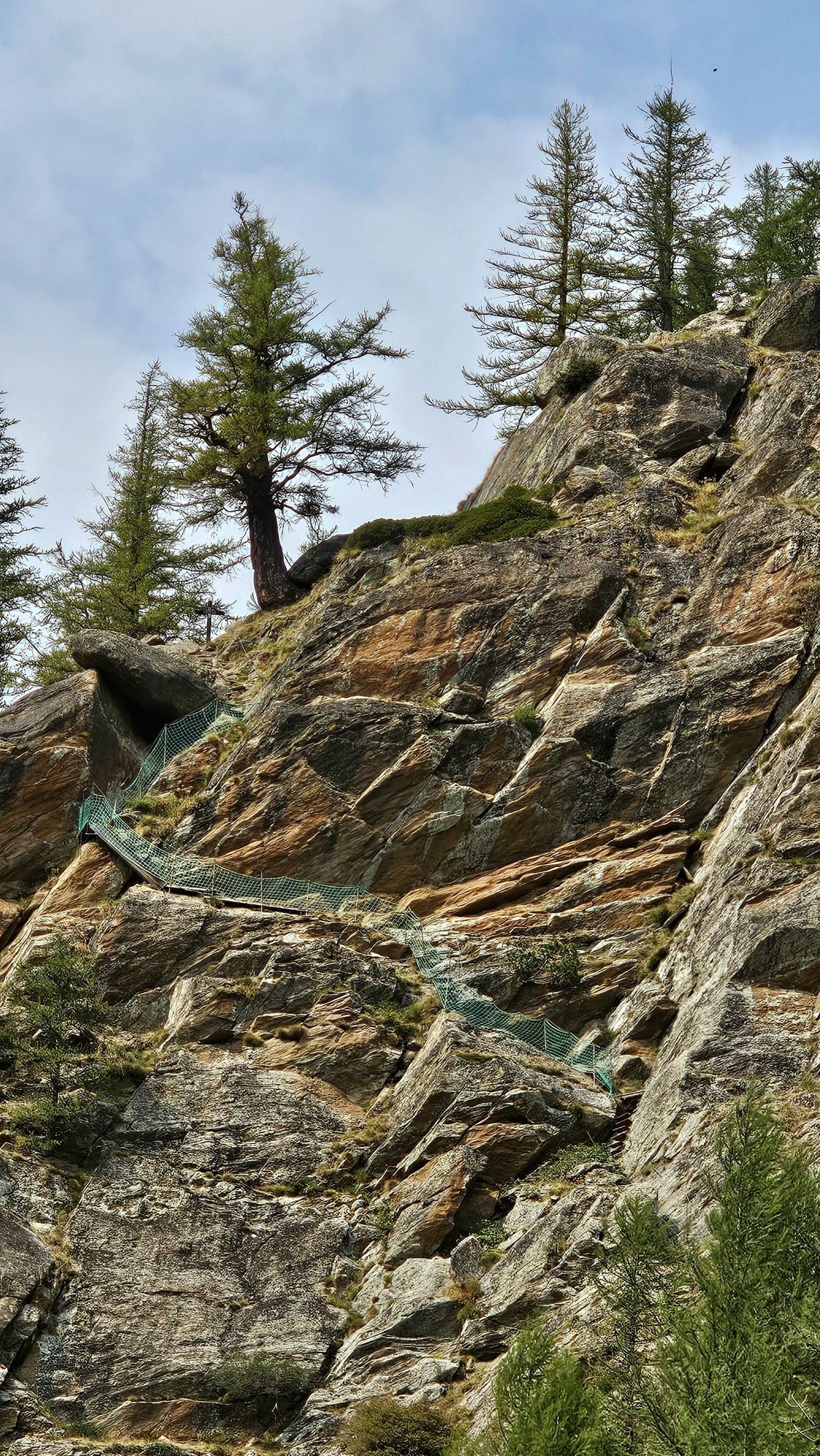
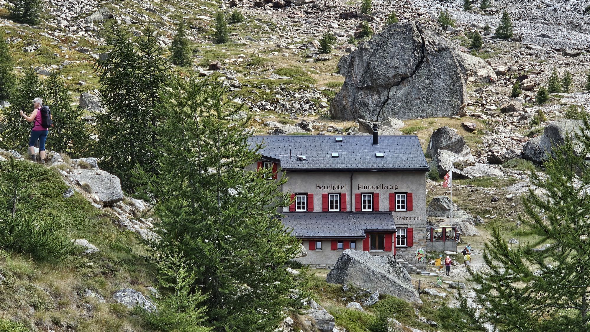
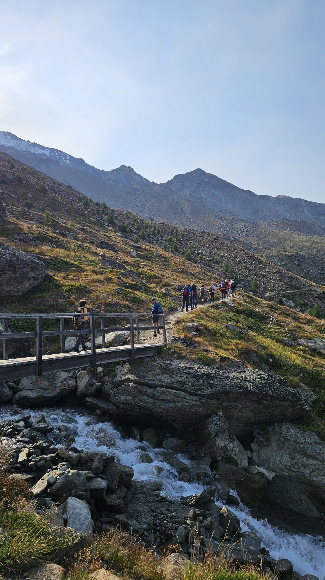
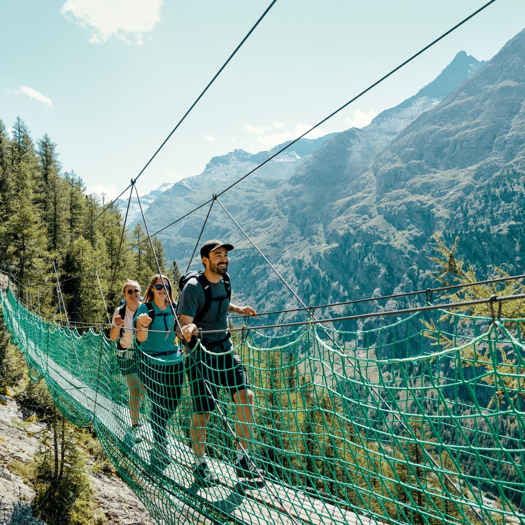
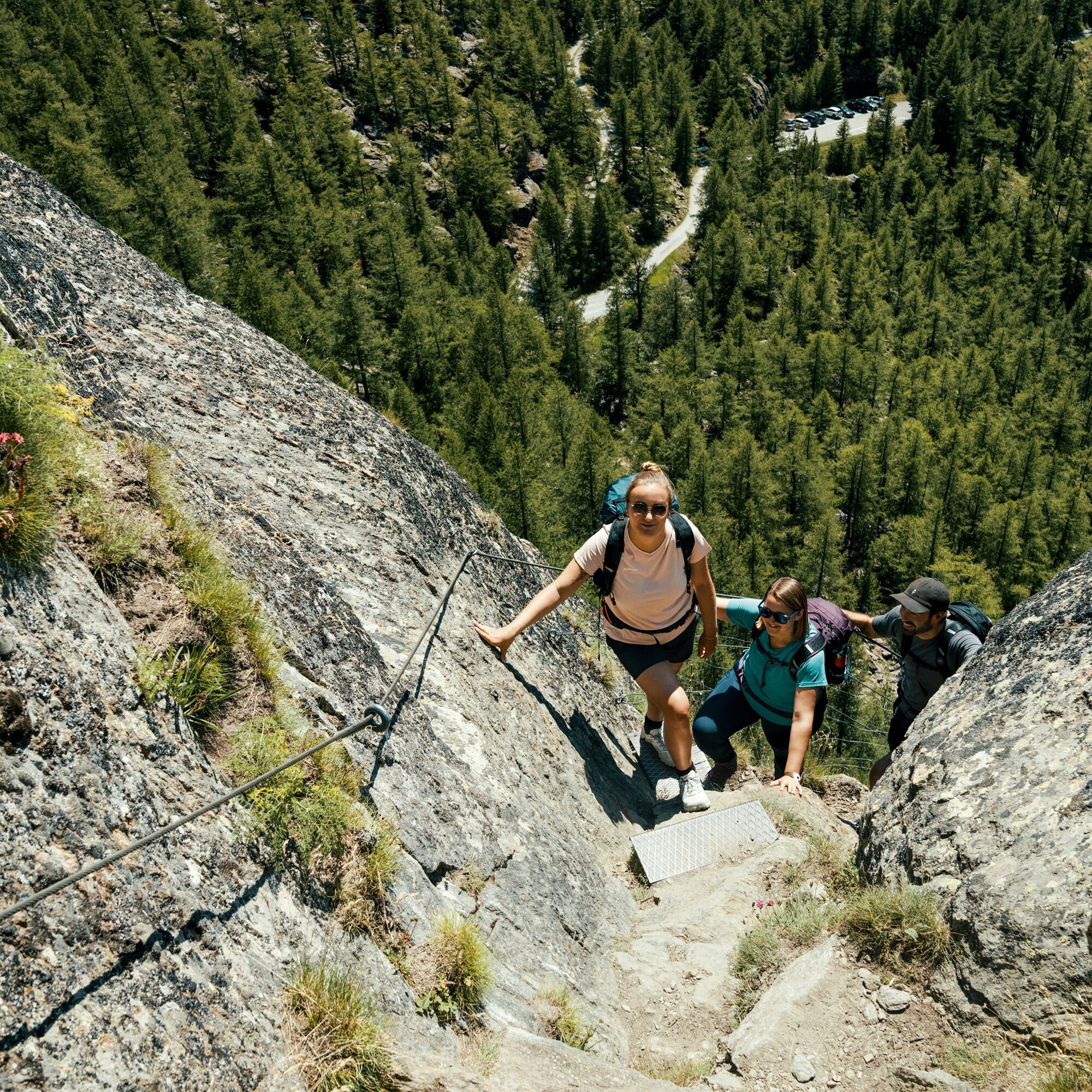
Day 1: The route starts at Furggstalden and leads via the adventure route to the Almagelleralp. The absolute highlight on this section are the two suspension bridges (60 m and 45 m). There are several well-secured rock passages. Alongside the creek, it continues to the Almagelleralp.
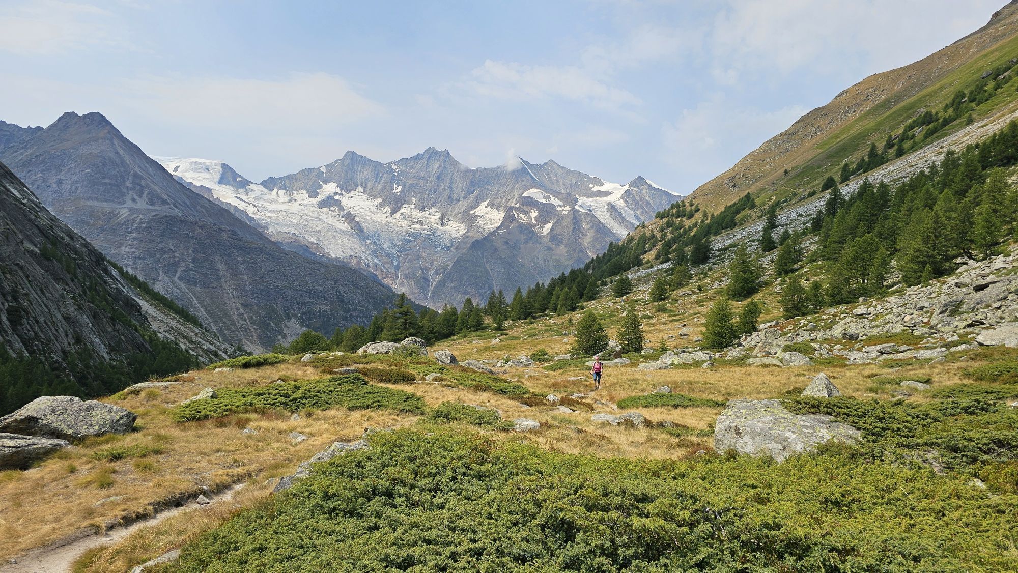
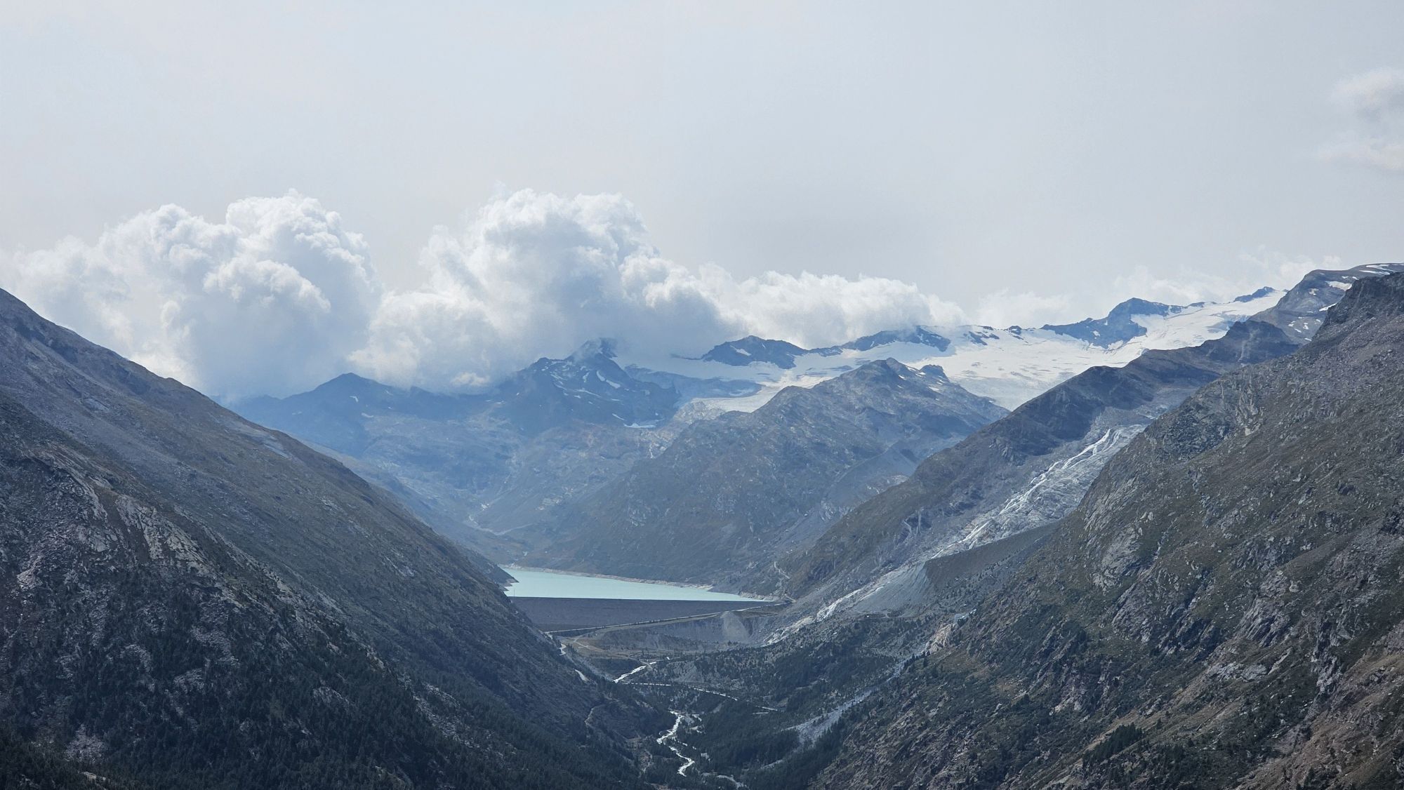
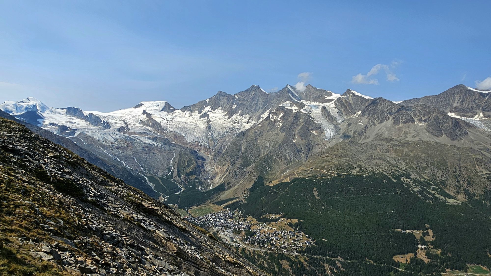
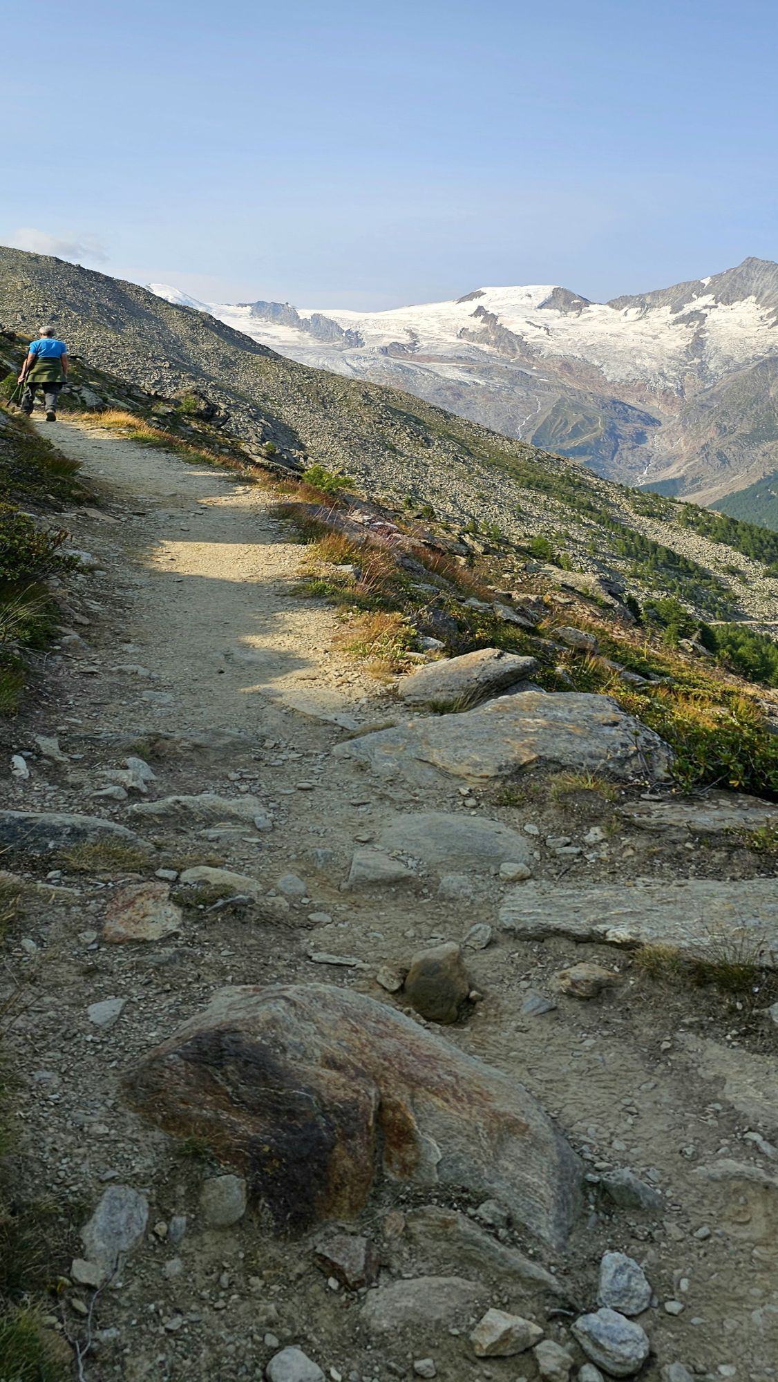
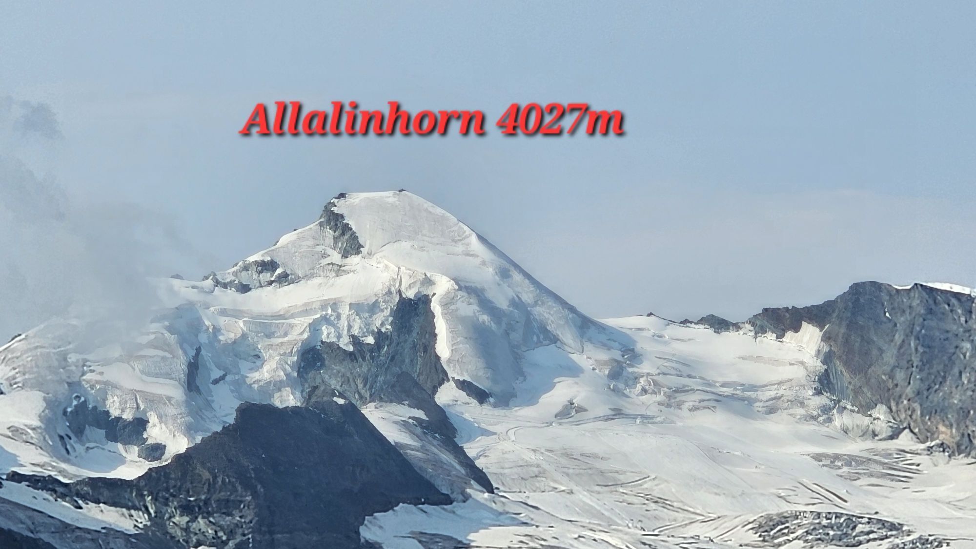
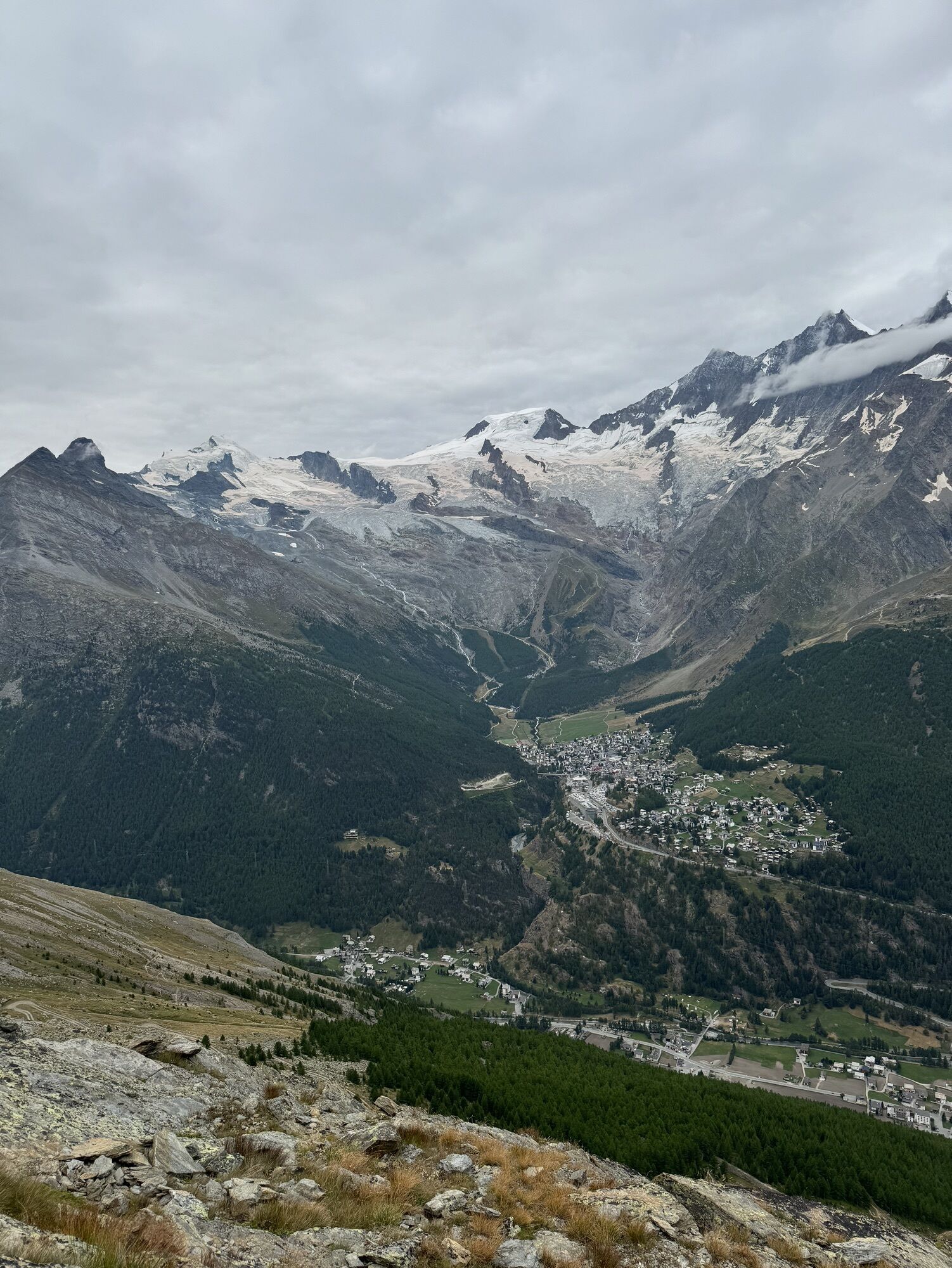
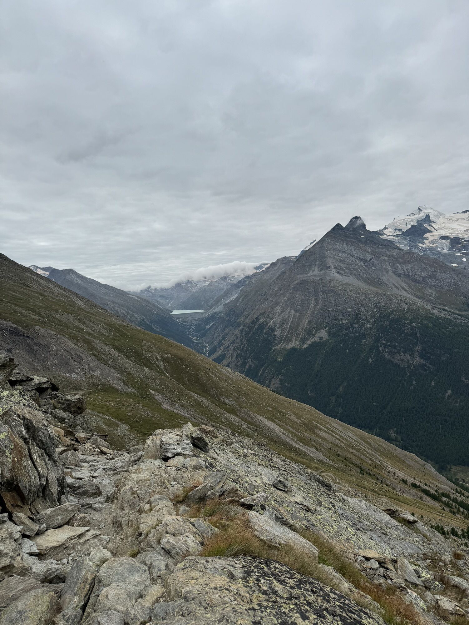
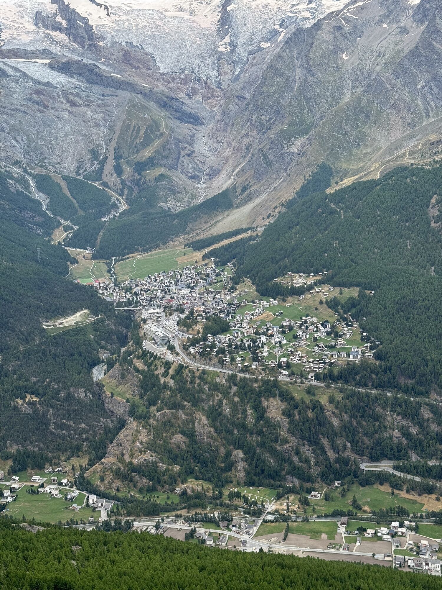
Day 2: The next day continues via the Almageller high route to Kreuzboden. The first part climbs over the mountainside up to the height of "Weissflüe" and then continues on the same height to the north. The breathtaking view of the highest mountains in Switzerland is a constant companion. At "Triftgrätji" probably the most beautiful view of the hike awaits: the view from the Mattmark reservoir to Stalden! Then the path follows the alpine flower promenade to Kreuzboden.
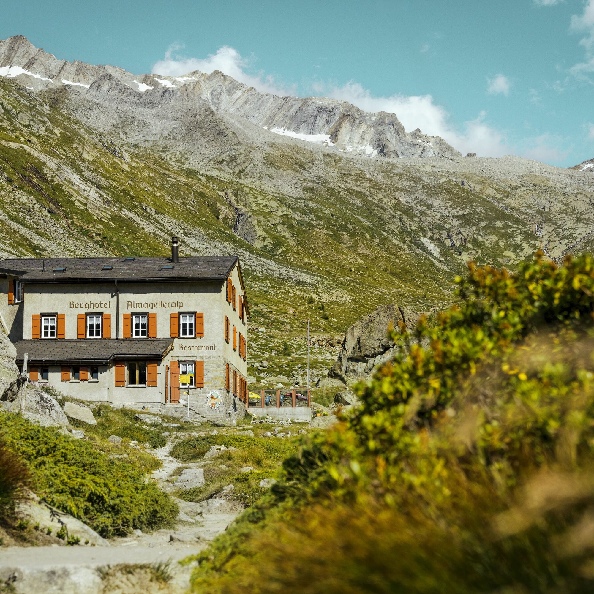
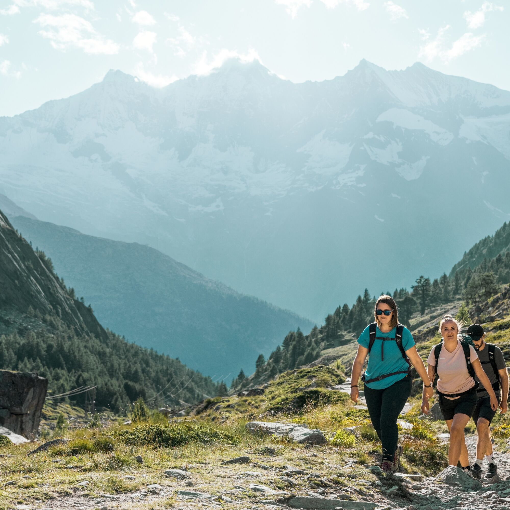
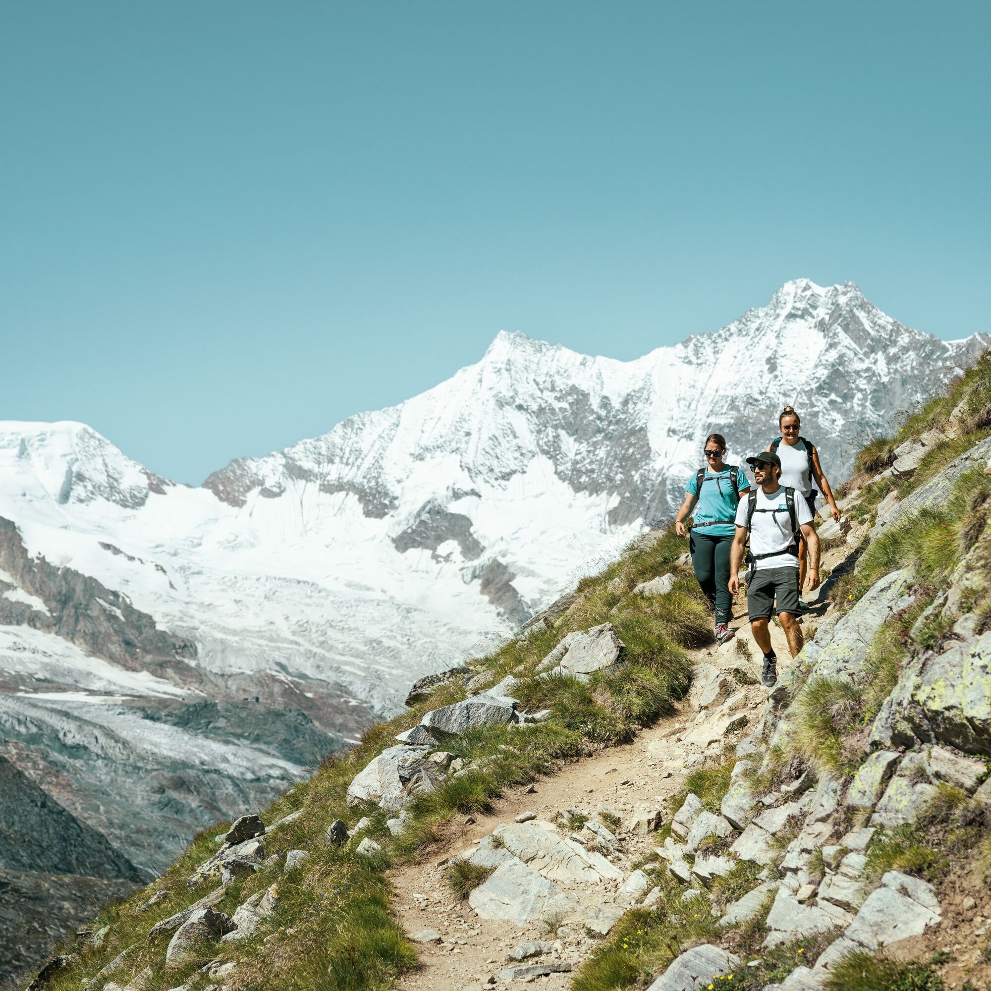
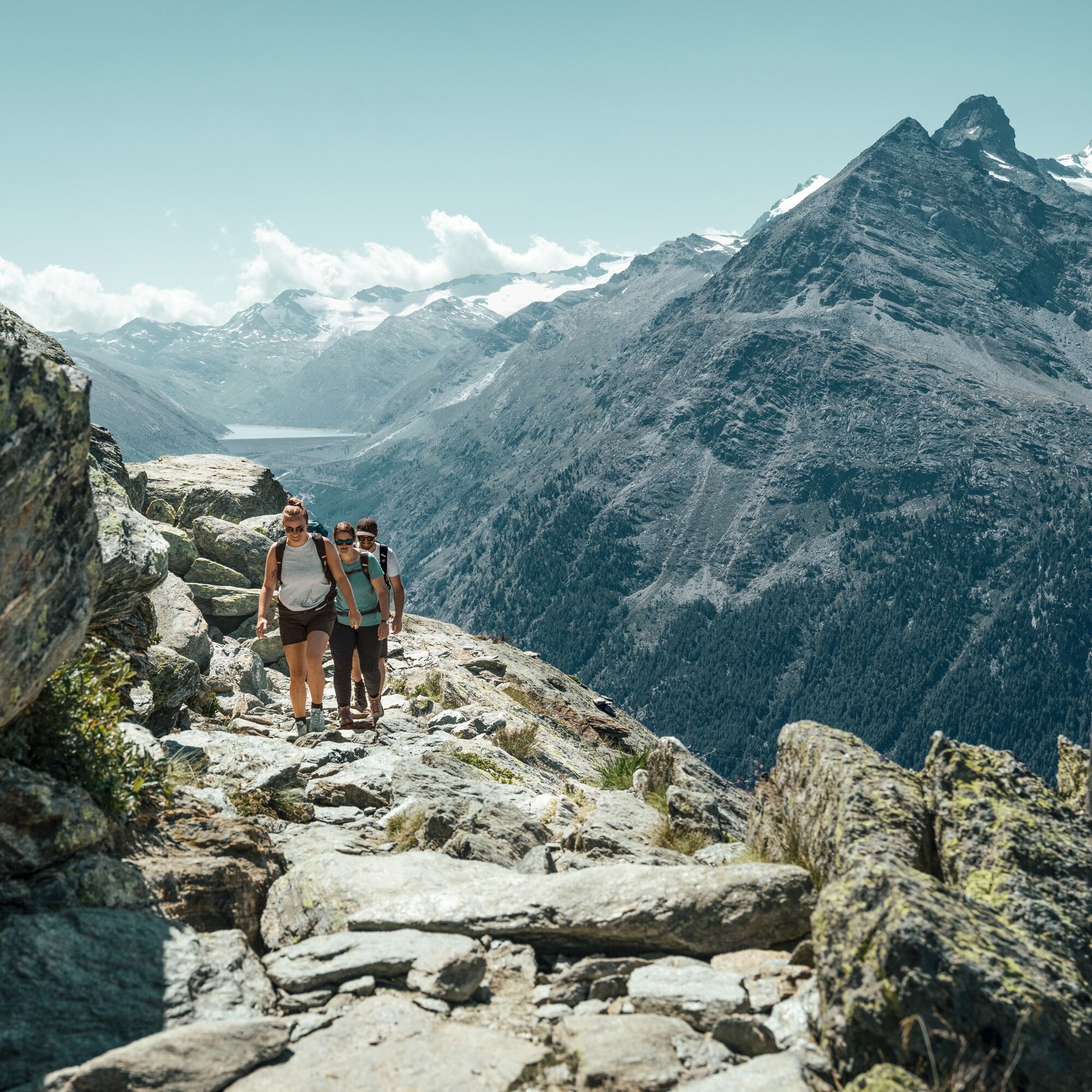
Furggstalden - adventure route - Chüelbrunnji - Almagelleralp - Weissflüe - Hehbord - Triftgrätji - Kreuzboden
Da
Good footwear
Outdoor clothing: Always carry a waterproof jacket
Sun protection
Fluids and provisions
Trekking poles (optional)
Navigation tool
First aid kit
Use of winter hiking trails and information on this website is at your own risk. Conditions on site might cause route changes.
Use only marked hiking trails and follow all signs and instructions – for your own safety, to protect domestic animals, and to avoid disturbing wildlife.
Be considerate of other trail users and the landscape. Take your waste and that of others with you.
Carry sun protection. UV rays at high altitude can be very strong, even in cloudy weather.
Plan your hike carefully: consider the required fitness of all participants, weather forecasts, and seasonal conditions.
Weather conditions in the mountains can change very quickly and without warning. Appropriate clothing and sufficient provisions (food and drink) are very important. Turn back early in bad weather.
Do not venture onto glaciers without a mountain guide.
Heed warning signs indicating dangers.
Inform third parties about your hike and, if possible, never go alone.• Pay attention to the opening times of mountain lifts.
The Saastal is easily and conveniently accessible by car from all directions, whether from Switzerland or abroad. From the north, reach us via Bern through the Lötschberg car shuttle. From the east, you come via the Furka Pass or the Furka car shuttle. From the south, we are reachable via the Simplon Pass or Simplon car shuttle, and from the west, you drive via Lausanne along the Rhone Valley to Visp and from there towards Saas-Fee.
From Visp, drive south towards Saas-Fee. At the "Killerhof" roundabout to Stalden, take the second exit towards Saas-Fee. In Saas-Grund, turn left after the church towards Saas-Almagell.
Take the SBB train to Visp and change there to the PostBus towards Saas-Fee (bus 511). In Saas-Grund at the Post stop, change to the PostBus towards Saas-Almagell (bus 513). Get off at the Dorfplatz stop.
Large parking lot after the Postplatz.
T4
Saastal Tourismus AG
Obere Dorfstrasse 2
3906 Saas-Fee
Tel.: +41 (0)27 958 18 58
E-Mail: info@saas-fee.ch
www.saas-fee.ch
Bergbahnen Hohsaas AG
Seilbahnstrasse 18
3910 Saas-Grund
Tel.: +41 27 958 15 80
E-Mail: info@hohsaas.ch
www.hohsaas.ch
Berghotel Almagelleralp
Anthamatten Urs
3905 Saas-Almagell
Tel.: +41 79 613 79 85
E-Mail: info@almagelleralp.ch
www.almagelleralp.ch
The route can be extended with an overnight stay at the Weissmieshütte or the Gsponer high route.

Priljubljeni izleti v okolici
- 4.9
Allalinhorn vom Mittelallalin über Normalweg
srednjaVisokogorska tura 6.15 km - 3.3
Europaweg Grächen - Europahütte - Zermatt
težkoPohodništvo 39.9 km - 3.6
Höhenweg Kreuzboden - Almagelleralp - Saas-Almagell
Pohodništvo 9.74 km - 3.5
Waldweg Saas-Fee - Saas-Almagell
Pohodništvo 2.83 km - 3.8
Höhenweg Saas-Fee - Grächen
Pohodništvo 12.0 km - 5.0
Weissmies Südgrat von Saas Almagell
srednjaVisokogorska tura 20.5 km - 5.0
Marmot mountain path Spielboden
srednjaPohodništvo 3.89 km - 5.0
Via ferrata Jägihorn
težkoVia ferrata 6.14 km - 3.5
Saas-Fee - Gemsweg - Hannig - Plattjen
Pohodništvo 6.89 km - 5.0
Ibex path
srednjaPohodništvo 9.02 km
Pohodništvo in sledenje


Ne zamudite ponudb in navdiha za naslednje počitnice
Vaš e-poštni naslov je bil dodan na poštni seznam.