


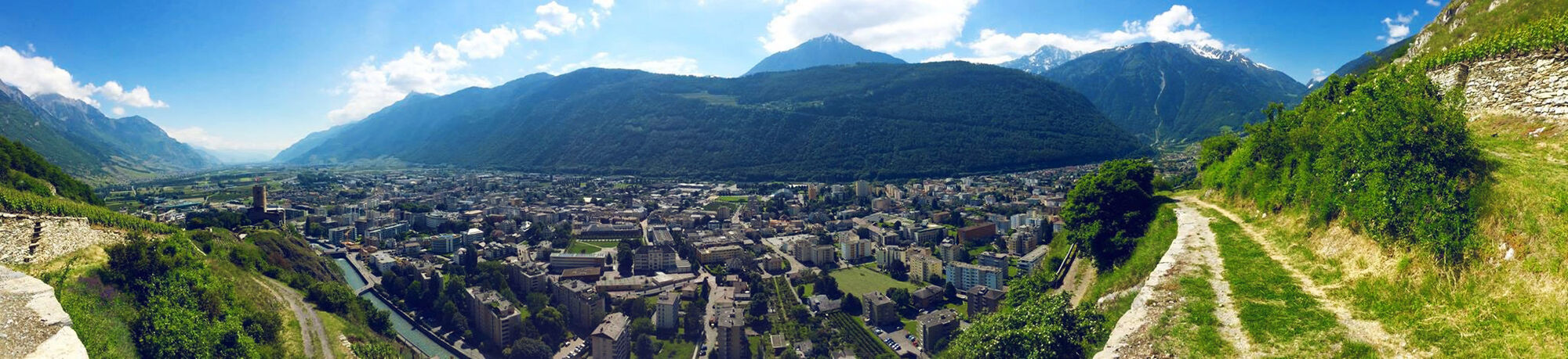
Vineyard terrace hike in Martigny
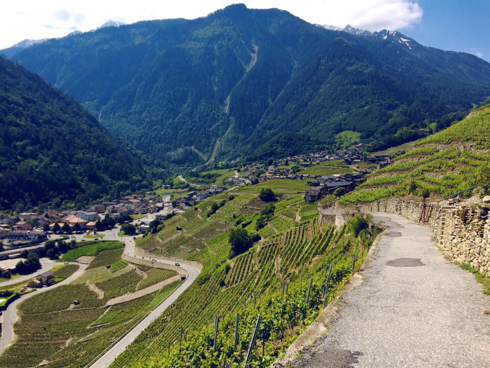
Vines have been cultivated above Martigny for generations. Due to the steep terrain, they are planted in terrace form and maintained by hand. The circular hike is equipped with information boards that...
Vines have been cultivated above Martigny for generations. Due to the steep terrain, they are planted in terrace form and maintained by hand. The circular hike is equipped with information boards that introduce visitors to the wine culture.
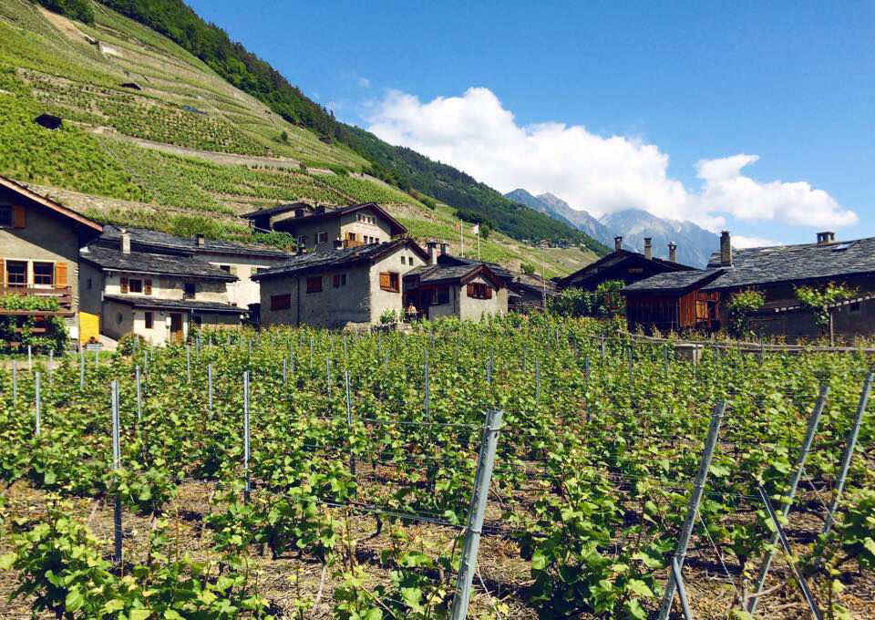
Along the way, you pass the medieval Batiaz Castle. Climb the castle tower for a 360° panoramic view. At the southern turning point of the round hike, the wine village Plan Cerisier awaits with its traditional wooden chalets. One of these chalets is today the smallest museum in Switzerland – regularly exhibiting works by local artists.
The return path leads along the Dranse back to the town of Martigny.
Highlights of the route:
Batiaz Castle with weapons from earlier times in the castle garden and its observation tower. Plan Cerisier – beautiful, original wine village with the smallest museum in Switzerland in a wooden chalet. In Martigny, several sights are within walking distance: Barryland (Museum of St. Bernard dogs), Fondation Giannada (art museum, local Roman finds, and sculpture garden), Roman amphitheater, Crystal Museum (Musée des Sciences de la Terre), Manoir art center.
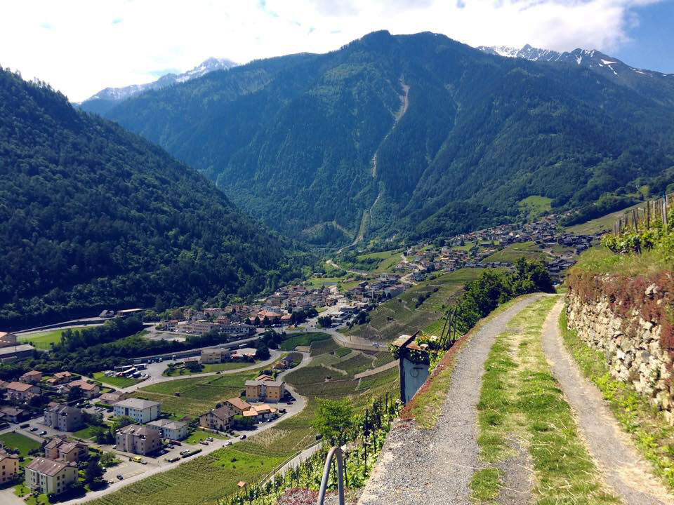
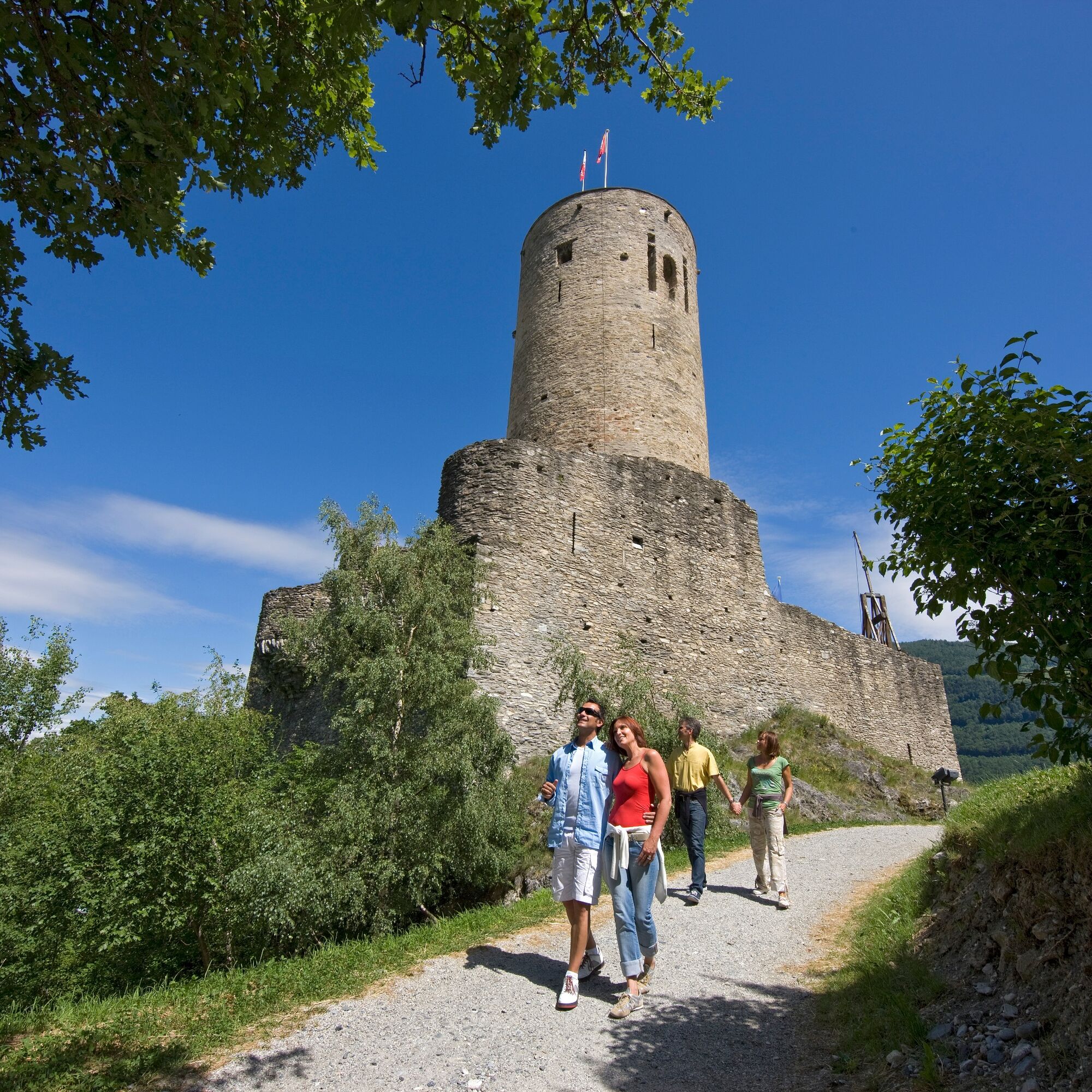
Cross the Dranse over the historic wooden bridge and follow the road to the right to reach the foot of the rocks below Batiaz Castle. The path zigzags through the rocks up to the castle.
The subsequent ascent leads through the vineyard terraces, partly on rocky ground, partly on the farmers' paths. At the junction with the road to the Col de la Forclaz, the highest point is reached. The path then descends to Plan Cerisier, where a break for refreshment awaits.
Through the lower vines, you walk back to the valley floor, where you return along the Dranse to the starting point at the wooden bridge in Martigny.
Da
We recommend:
Good footwear Weather-dependent clothing: always carry a waterproof vest Headgear Sun protection Water bottle Picnic Camera Binoculars (optional) Hiking poles (optional) Printout of the hiking route (click "Print" to download)For certain hikes:
SwimsuitThe mountains, a place of joy to share and respect. The mountain world is a place to meet and experience unforgettable moments together – whether by bike or on foot. For everyone to benefit, it is essential to share this space with respect towards nature and agriculture. Respectful behavior enables all to enjoy their leisure activities under the best conditions. Inform yourself about recommendations and rules. Assess your own skills and fitness well. Using the various routes is always at your own risk.
For all hikes:
Carry a map with you. Download the complete description of the hiking route with a large-scale map by clicking "Print" at the top right of the page. Use only marked hiking trails and follow all signs and instructions – for your own safety, to protect grazing animals, and out of respect for wildlife. Close gates after passing through. Behave considerately towards other trail users, plants, and animals.For mountain hikes:
Carry additional sun protection. UV rays at high altitudes can be very strong, even in cloudy weather. Plan your hike carefully: consider the required fitness level of all participants, weather forecasts, and seasonal conditions. Weather conditions in the mountains can change very quickly and without warning. Appropriate clothing and sufficient provisions (food and drink) are very important. In unstable weather, it is better to turn back early.For high alpine hikes:
Inform your family about your hiking route. If possible, avoid going alone. Do not venture onto glaciers without a mountain guide. Observe warning signs indicating dangers at riverbanks, along watercourses below dams and reservoirs: water levels can rise quickly and without warning.Motorway A9, exit 21 Martigny-Fully. Access Martigny city center via Avenue de Fully.
Regular train connections from Brig or Lausanne to Martigny. The hike starts about 800m from the train station. Timetables for trains and postbuses can be found at sbb.ch.
Public parking near the starting point. Follow the local parking guidance system in Martigny.
More information about the destination can be found here:
MartignyCross the Dranse towards the end of the route and visit the Fondation Louis Moret art museum.
Priljubljeni izleti v okolici
- 5.0
From Saillon to the Farinet suspension bridge
srednjaPohodništvo 7.86 km - 5.0
Sentier de Salanfe
srednjaPohodništvo 12.8 km - 5.0
Huts of Orny and Trient
težkoPohodništvo 13.4 km From Savoleyres to the mountain lake Lac des Vaux
srednjaPohodništvo 14.0 kmTour du Grand Chavalard
srednjaPohodništvo 14.9 km- 3.5
Lac d'Emosson - Gorge de la Veudale - Col de la Terrasse - Lac du Vieux Emosson zurück nach Lac d'Emosson
srednjaPohodništvo 14.3 km - 5.0
Tour de La Seya hike
srednjaPohodništvo 8.09 km Via Farinetta
težkoVia ferrata 6.41 kmSentier des Sens La Tzoumaz (Path of the Senses)
svetlobaPohodništvo 5.42 km- 4.0
Six blanc depuis Cabine
srednjaSmučarska tura 5.85 km

Pohodništvo in sledenje


Ne zamudite ponudb in navdiha za naslednje počitnice
Vaš e-poštni naslov je bil dodan na poštni seznam.