


Gspon Panorama Route
The tourist and car-free village of Gspon is easily accessible by cable car from Stalden. Several hiking routes such as the panorama route start and end in Gspon. Also located here are the two highest...
The tourist and car-free village of Gspon is easily accessible by cable car from Stalden. Several hiking routes such as the panorama route start and end in Gspon. Also located here are the two highest water ferries in Switzerland still in operation, as well as the highest football pitch in Europe.

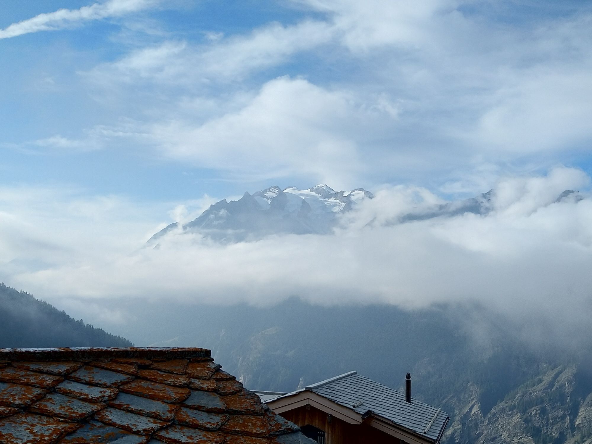
You can conveniently reach the sunny high plateau of car-free Gspon by cable car. A landmark worth seeing there is the St. Anna Chapel from 1691 with its baroque carved altar. In the background rises the majestic Balfrin. The Gspon mountain station is the start and end point of this panoramic circular hiking trail. First, head north and follow the signs for Gspon Panorama Route. Along the way, you will pass the highest football pitch in Europe. After about 1 km, turn right and follow the path eastward, northeastward, then southeastward and finally northward through Sädolti, Breiti, Chiebodme, Häüschbiele, Sänntum, Bleike, and Scheidbode back to Gspon. Along the way, enjoy the forest landscape and the fantastic panoramic views of the large Aletsch Glacier, the distinctive Bietschhorn, and the Mischabel group.
Da
Sturdy footwear, sun protection, provisions, and water
Coming from Brig, take the A9 towards Lausanne / Sion / Lötschberg and continue on Route 9 (signs to Lausanne / Sion). At the roundabout, take the third exit (Talstrasse) and follow the road. After crossing the river, turn right into Bielmatte and left into Bahnhofstrasse. You have reached the Stalden mountain station. From here you can take the cable car to Gspon.
Take the bus to Stalden and from there take the cable car. The Gspon cable car runs every half hour daily.
A visit to the mountain restaurant Alpenblick Gspon rounds off this hike.
Spletne kamere s turneje

Priljubljeni izleti v okolici
-
3.6
Höhenweg Kreuzboden - Almagelleralp - Saas-Almagell
Pohodništvo 9.74 km -
3.5
Waldweg Saas-Fee - Saas-Almagell
Pohodništvo 2.83 km -
5.0
Moosalp Panoramaweg
svetlobaPohodništvo 6.36 km -
3.8
Höhenweg Saas-Fee - Grächen
Pohodništvo 12.0 km -
5.0
Weissmies Südgrat von Saas Almagell
srednjaVisokogorska tura 20.5 km -
5.0
Marmot mountain path Spielboden
srednjaPohodništvo 3.89 km -
5.0
Via ferrata Jägihorn
težkoVia ferrata 6.14 km -
CIRCULAR HIKE MASSEGGA SUSPENSION BRIDGE
svetlobaPohodništvo 6.44 km -
3.5
Saas-Fee - Gemsweg - Hannig - Plattjen
Pohodništvo 6.89 km -
5.0
Ibex path
srednjaPohodništvo 9.02 km
Pohodništvo in sledenje


Ne zamudite ponudb in navdiha za naslednje počitnice
Vaš e-poštni naslov je bil dodan na poštni seznam.