


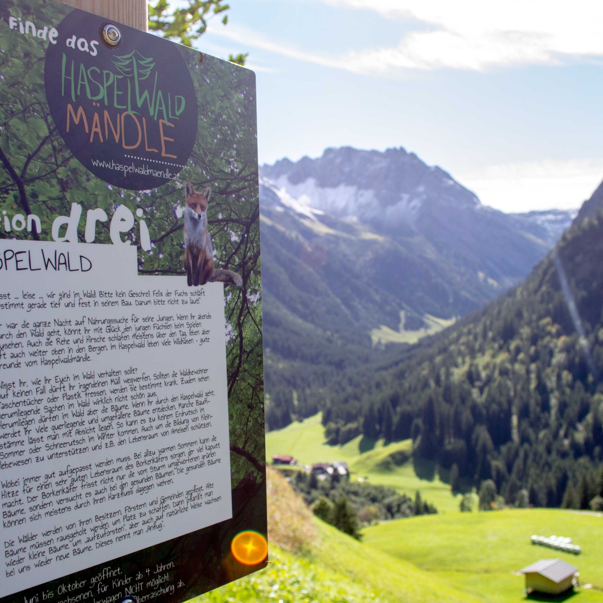
Find the Haspelwaldmändle
Stopnja težavnosti: T2
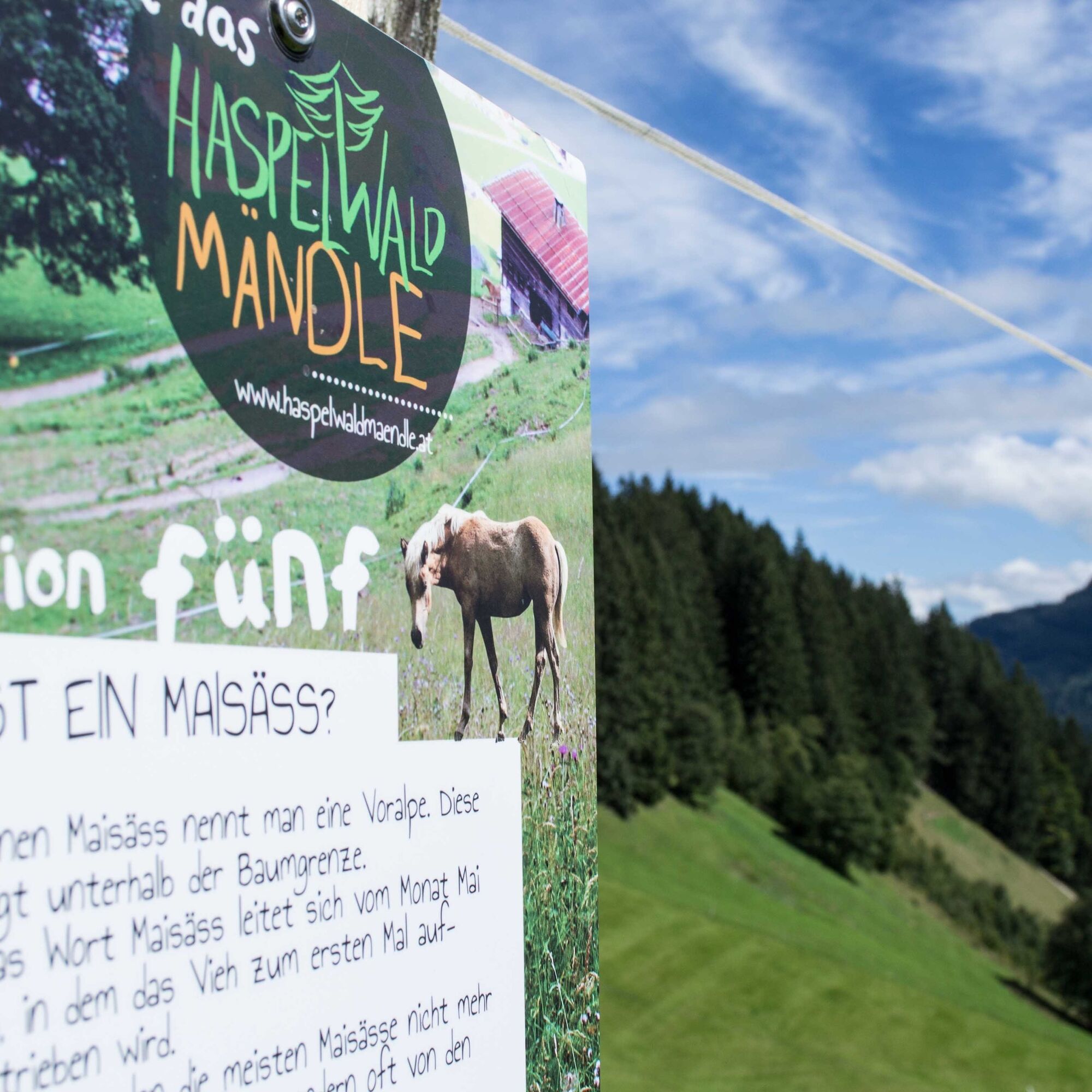
On this themed hike, families with children from 4 years old search for the Haspelwaldmändle, which hides in the forest area of the same name below the Walmendingerhorn. On the way to find the Haspelwaldmändle,...
On this themed hike, families with children from 4 years old search for the Haspelwaldmändle, which hides in the forest area of the same name below the Walmendingerhorn. On the way to find the Haspelwaldmändle, 6 information signs with exciting information about the forest and its animal inhabitants are passed. Using this information on the hiking trail, the puzzle at the end of the hike at the Bühlalpe can also be easily solved.
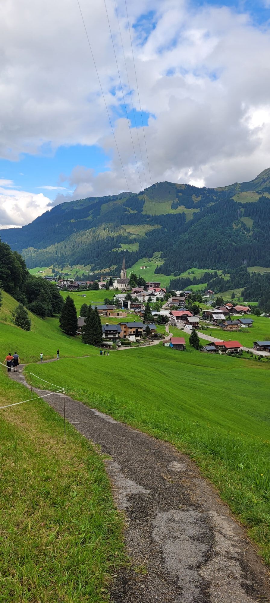
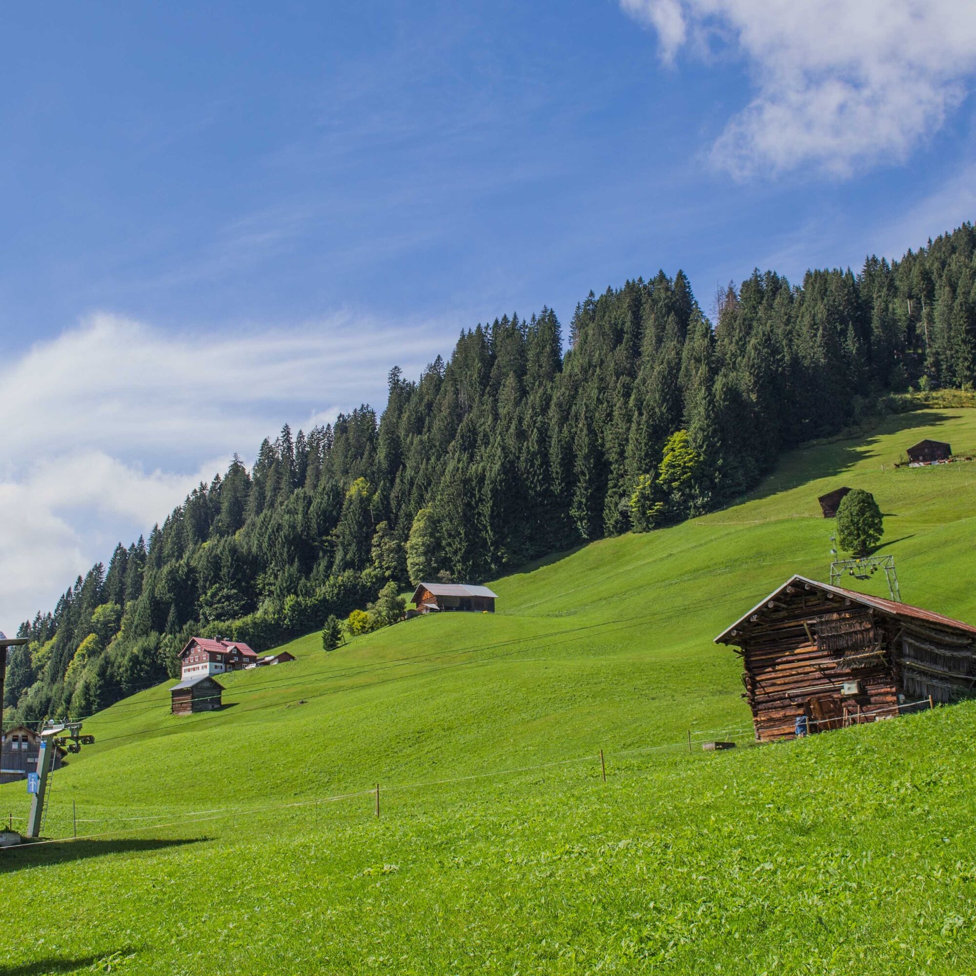
The experience hike leads from Mittelberg past the Maisäß lift and along the Stützeweg. Shortly before the hamlet of Erlenboden is the first information sign. From there up the winding asphalt path and on the Haspelwaldweg. Before entering the forest, the third information sign stands. Through the forest area and across a clearing past several stations to the Gasthof Bühlalpe. Those who can solve the puzzle about the Haspelwaldmändle will find a little surprise here. From there initially on a familiar route over an asphalted serpentine path through shaded fern forest and mountain meadows over the Hofstatt back to Mittelberg.
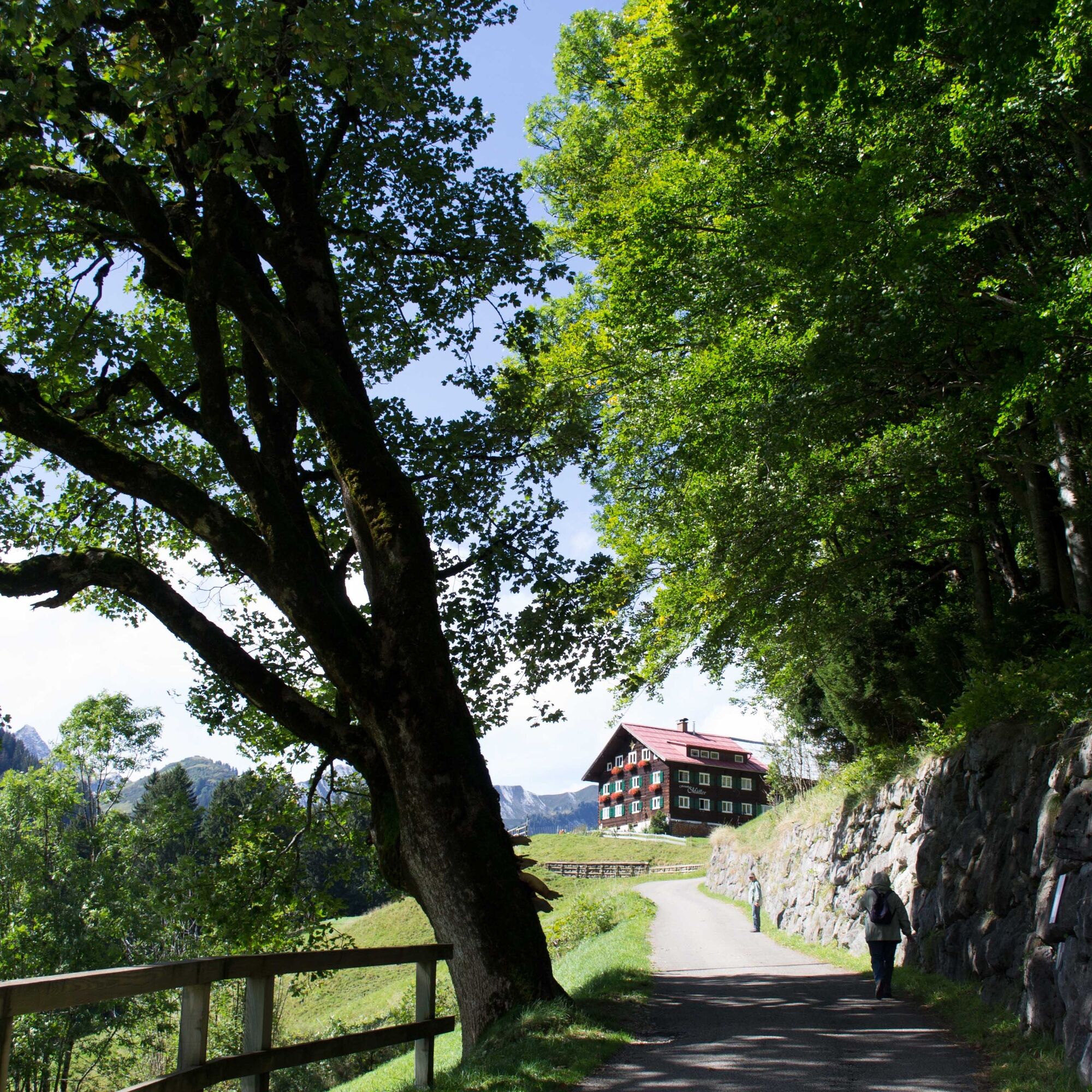
Mittelberg - Maisäß lift - Stützeweg - Erlenboden - Haspelwaldweg - Gasthof Bühlalpe - Hofstatt - Mittelberg
Da
Weather-appropriate clothing and sturdy footwear.
The path is not suitable for strollers.
144 Alpine emergencies Vorarlberg
112 European emergency number (works with any mobile phone/network)
Most routes from Germany converge in Ulm and continue on the A7. At the Allgäu motorway junction via the A980 section to the Waltenhofen exit and on the four-lane B19 via Sonthofen and Oberstdorf into the Kleinwalsertal. From Austria (Vorarlberg) and Switzerland, you reach the Kleinwalsertal via the Bregenzerwald (Hittisau) – Riedbergpass – Fischen – Oberstdorf. From Tirol, the fastest way is via the A7 to Kempten and then on the B19 towards Oberstdorf. No motorway vignette is required for the trip into the valley.
Starting point of the route: Walserbus line 1, Mittelberg bus stop
Paid parking lots at Moos parking lot or at the Walmendingerhornbahn.
T2
More information about the themed trail can be found at www.haspelwaldmaendle.at .
There is an exciting book about the Haspelwaldmändle, which is available directly at the Bühlalpe or from Anke Drechsel in the Chrömle "Beautiful things made of felt" opposite the Walserhaus in Hirschegg.
Spletne kamere s turneje
Bergstation Kanzelwandbahn Riezlern
Hahnenköpflebahn Bergstation / Ifenbergbahn
Hirschegg - Naturhotel Chesa Valisa
Zaferna Bergstation
Mindelheimer Hütte
Riezlern - Kinderland
Wildentalhütte
Mittelberg - Naturhotel Lärchenhof
Plattform - Schirmbar Riezlern
Hirschegg - Hotel Walserhof
Hirschegg - Hotel Birkenhöhe
Hirschegg - Hotel Sonnenberg
Mittelberg Bödmen - Hotel Alte Krone
Riezlern - Hotel Erlebach
Mittelberg - Haus Walser Berge
Kanzelwand / Fellhorn
Mittelberg - Bergpension Starzelhaus
Warth-Schröcken - Widdersteinhütte
Mittelberg - Gästehaus Otto Fritz
Bannholzhof
Bannholzhof
Kleinwalsertal
Riezlern - Landhaus Evi
Hirschegg - Hotel Birkenhöhe
Kleinwalsertal - Ifenbahn
Kleinwalsertal - Kanzelwandbahn
Ideallift
Naturhotel Chesa Valisa
Ferienhaus Oberwiese
Gästehaus Panorama
Alpenwald
Haus Berg & Tal / Hirschegg
Hotel Alpensonne
Hotel Alpenstüble
Kesslerlift
Mittelberg
Parsennbahn - Kleinwalsertal
Priljubljeni izleti v okolici
- 5.0
Gerstruben - zum historischen Bergbauerndorf
srednjaPohodništvo 12.8 km - 4.4
Mountain tour over the Fellhorn ridge
srednjaPohodništvo 8.24 km - 4.4
Circular hike through the Bärgunttal
srednjaPohodništvo 4.75 km - 4.7
Widderstein Runde von Baad
srednjaPohodništvo 15.8 km - 4.5
Winterwanderung ins Oytal
srednjaZimsko pohodništvo 10.1 km - 4.9
E5 - 1. Etappe: Oberstdorf - Kemptner Hütte
svetlobaPohodništvo v daljavo 7.80 km - 4.6
Breitachklamm Rundweg (Alpe Dornach)
srednjaPohodništvo 7.65 km - 4.2
Hiking through the Schwarzwassertal via Melköde to the Schwarzwasserhütte
srednjaPohodništvo 4.94 km - 4.2
Kanzelwand- Fellhorn- Kanzelwand
svetlobaPohodništvo 7.60 km - 4.8
Biberkopf
težkoPohodništvo 7.70 km
Pohodništvo in sledenje


Ne zamudite ponudb in navdiha za naslednje počitnice
Vaš e-poštni naslov je bil dodan na poštni seznam.