


Etappe 6: Alpina Antica Trail | ET6: Going - Kirchberg in Tirol
Fotografije naših uporabnikov
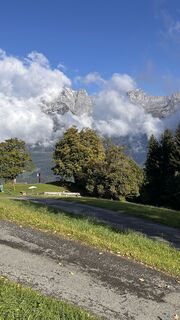
 © Jutta SteinbergerUstvarjeno na 01.10.2025
 © Andreas P. 1Ustvarjeno na 18.09.2025
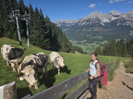 © Andreas P. 1Ustvarjeno na 18.09.2025
 © Rolf MattesUstvarjeno na 09.07.2025
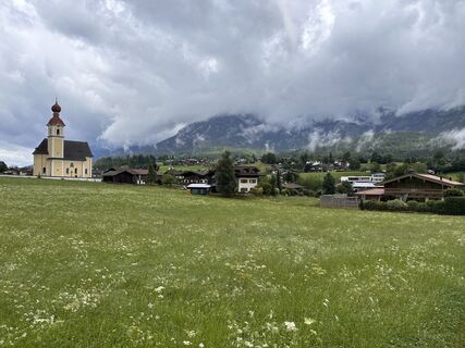 © Rolf MattesUstvarjeno na 09.07.2025
 © Rolf MattesUstvarjeno na 09.07.2025
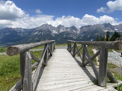
 © ChrisDian SinnUstvarjeno na 24.06.2024
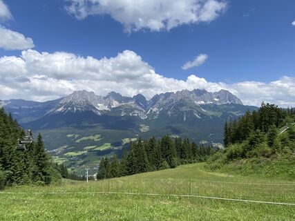 © ChrisDian SinnUstvarjeno na 24.06.2024
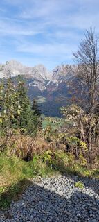
 © TerracanUstvarjeno na 23.10.2022
 © Stefan BoonUstvarjeno na 29.01.2026
 © Stefan BoonUstvarjeno na 29.01.2026
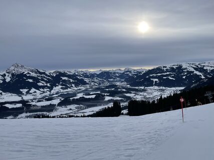 © Christian FrankUstvarjeno na 15.01.2026
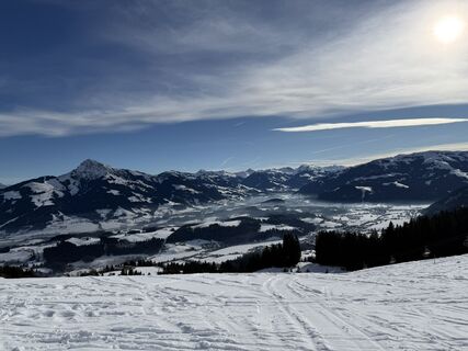
 © Karsten MarquordtUstvarjeno na 14.01.2026
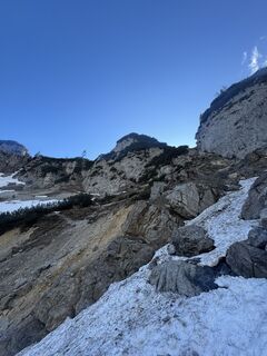 © Stuart WalkerUstvarjeno na 17.04.2025


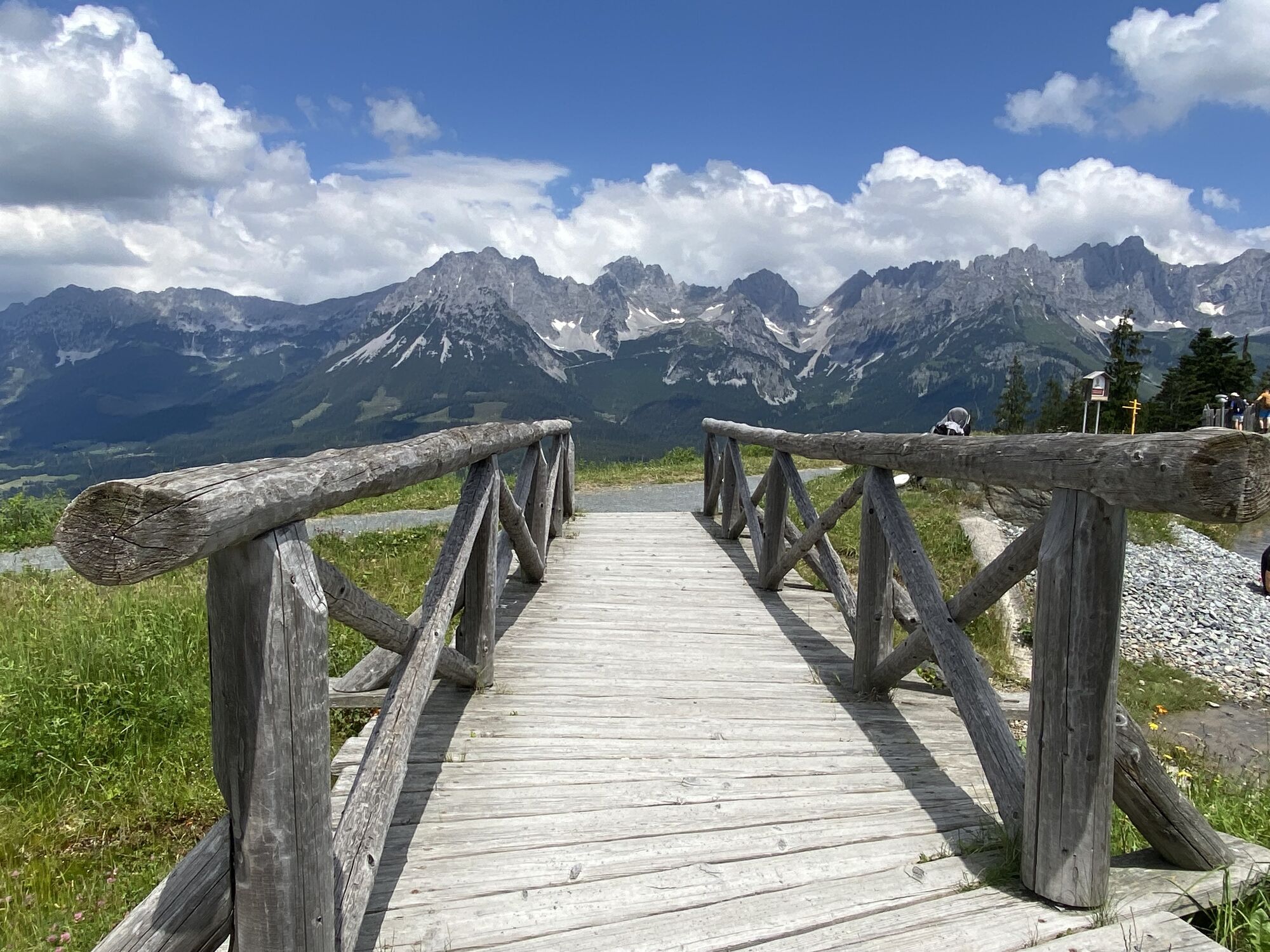

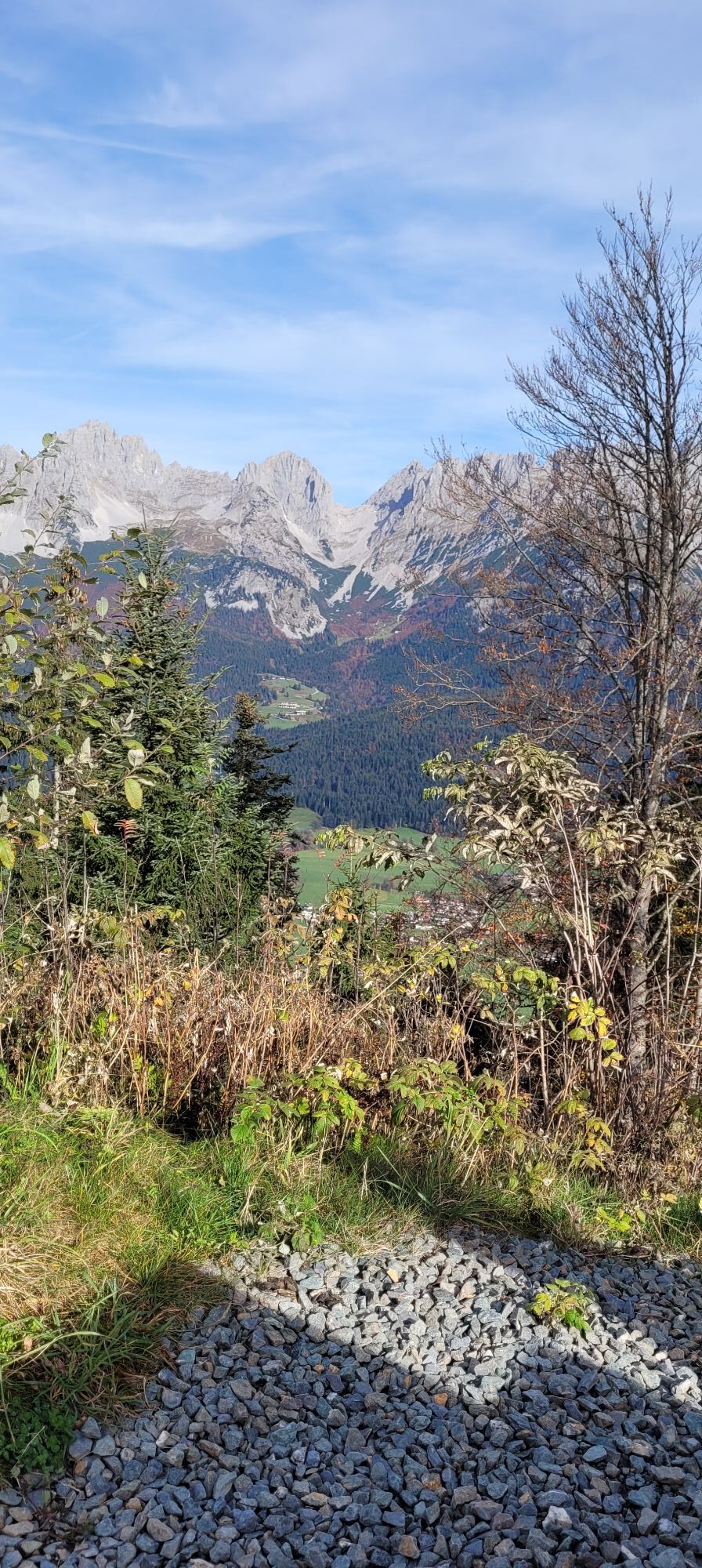
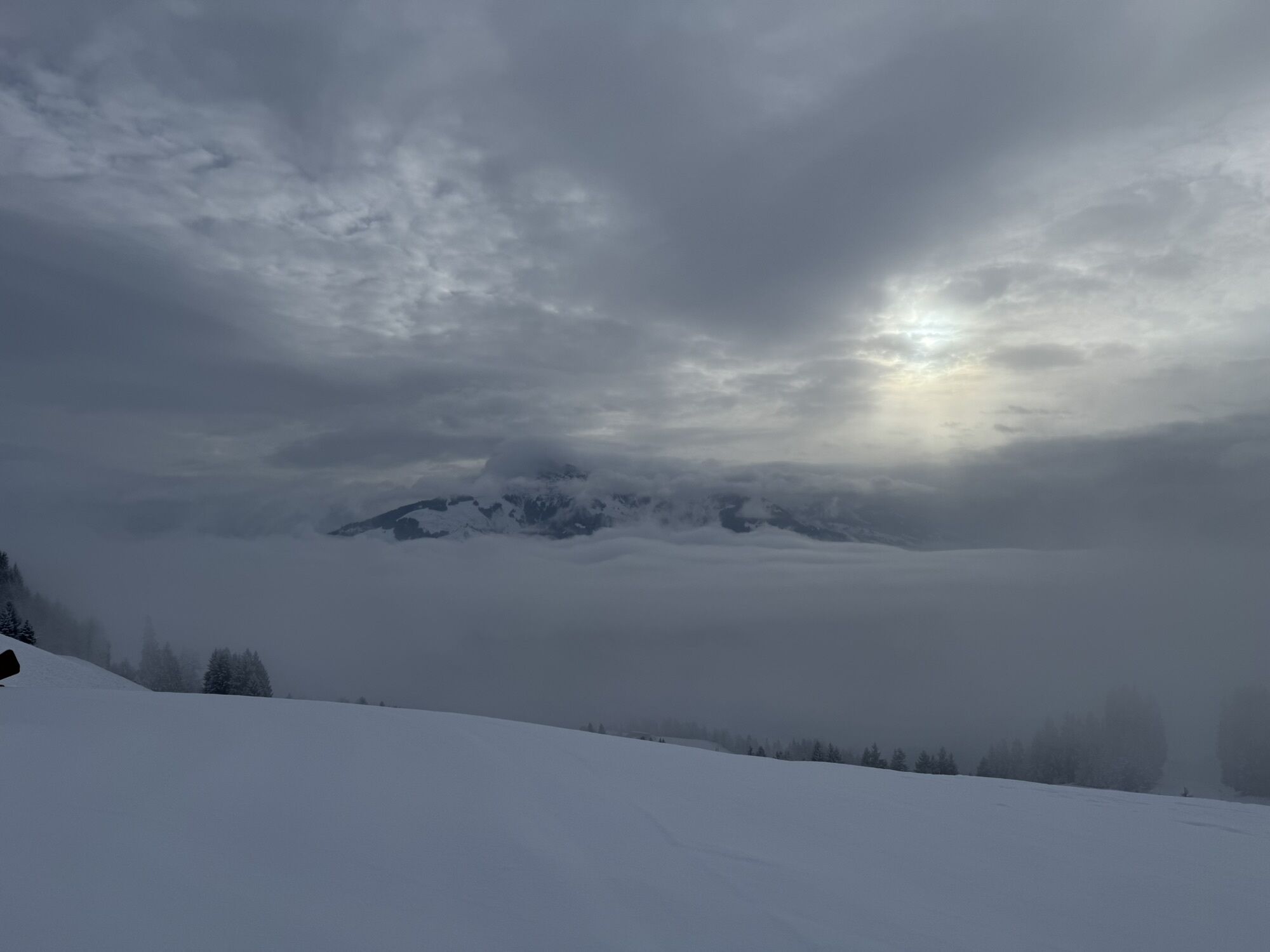


Panoramic high-altitude hike over the Rauer Kopf to Kirchberg in Tirol - and in the middle of it all with the Astbergsee, one of the most famous photo motifs far and wide!
Farsightedness! What you can enjoy...
Farsightedness! What you can enjoy on this stage - namely the fantastic view of the south side of the Wilder Kaiser and the one side and the view of the imposing glacier giants of the Hohe Tauern - was probably no reason for the muleteers of yesteryear to choose this route over the mountains. It is also unknown whether this route was ever used by the muleteers in this form. However, in the past, there were always reasons why traveling salesmen avoided the valley structures on their way through the Alps and hiked over the mountains. Be it because landlords levied high tariffs, or bands of robbers wreaked havoc on the main routes. In any case, you won't regret the high-altitude hike over the Astberg and the Rauer Kopf to the beautiful mountain village of Kirchberg in Tirol!
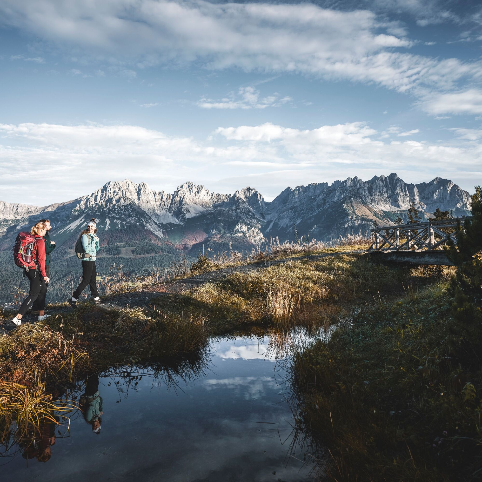
However, you hike past a house on the left over a gravel road towards Astberg/Blattlalm (no. 7). Further up (as well as briefly in between) you use a track and reach (ignoring a turn-off to the left around the Astberg) the hill at the Astberg with the Astbergsee. Although this is a reservoir for the ski area, it offers a fantastic photo opportunity, especially in windless weather: the entire Wilder Kaiser is reflected in this lake. And if you turn around, you will see the glacier-covered three-thousand-metre peaks of the Hohe Tauern.
Past the managed Blattlalm you hike straight ahead on path no. 9 slightly descending over the alpine meadows to the south towards the Rauer Kopf. At a fork in the forest you follow trail no. 9 to the left in the direction of Rauer Kopf, slightly descending to a forest road and on to a small asphalt road. Here turn right, first uphill on asphalt and then downhill on gravel, always following trail no. 9 in the direction of Rauer Kopf until you reach another asphalt road. Over this road to the left in a right-hand curve down to the saddle of the Greiln.
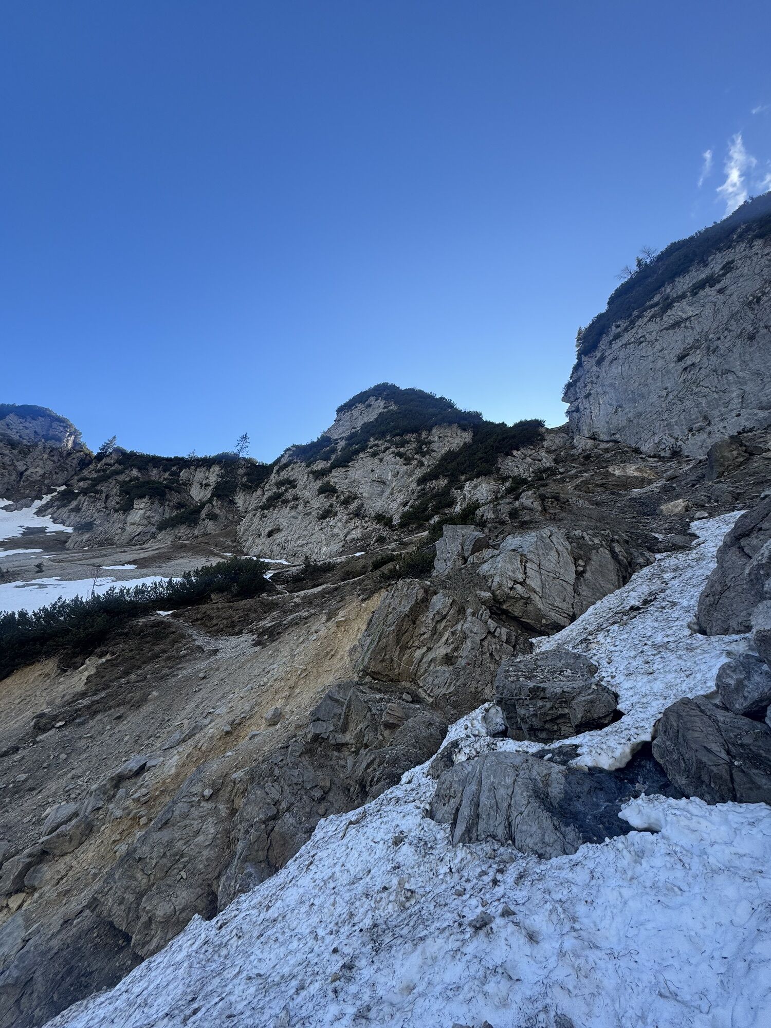
Here a gravel road branches off to the left (Ww. "Rauer Kopf" No. 11), which you follow to the crossroads at the Blinzalm. Here turn right uphill again following the Ww. "Rauer Kopf" (No. 11) on the alpine road past the Höhenangeralm and another alpine hut until a hiking trail leads in a left-hand bend towards "Rauer Kopf" along the alpine slopes to below the saddle west of the Rauer Kopf. From here, a path no. 9 "Rauer Kopf" branches off to the left, which leads to the western ridge of the Rauer Kopf. Ignore the forest road shortly to the left, ignore the hiking trail leading downhill to Kirchberg, but instead choose hiking trail no. 9, which branches off to the left, which takes you over the very beautiful western ridge to the summit of the Rauer Kopf (1,580 m).
You cross the summit and descend a beautiful hiking trail over the eastern ridge of the Rauer Kopf until you meet a forest road after about 15 minutes. Follow this to the left until you reach a forest road junction with many signposts. You hike down the cart path towards Kirchberg, cross the next forest road and follow the cart path below downhill towards Kirchberg until you reach another forest road. Follow this road for a few metres and then turn right along the wide cart path towards Kirchberg through hairpin bends down to the first houses of Sonnberg.
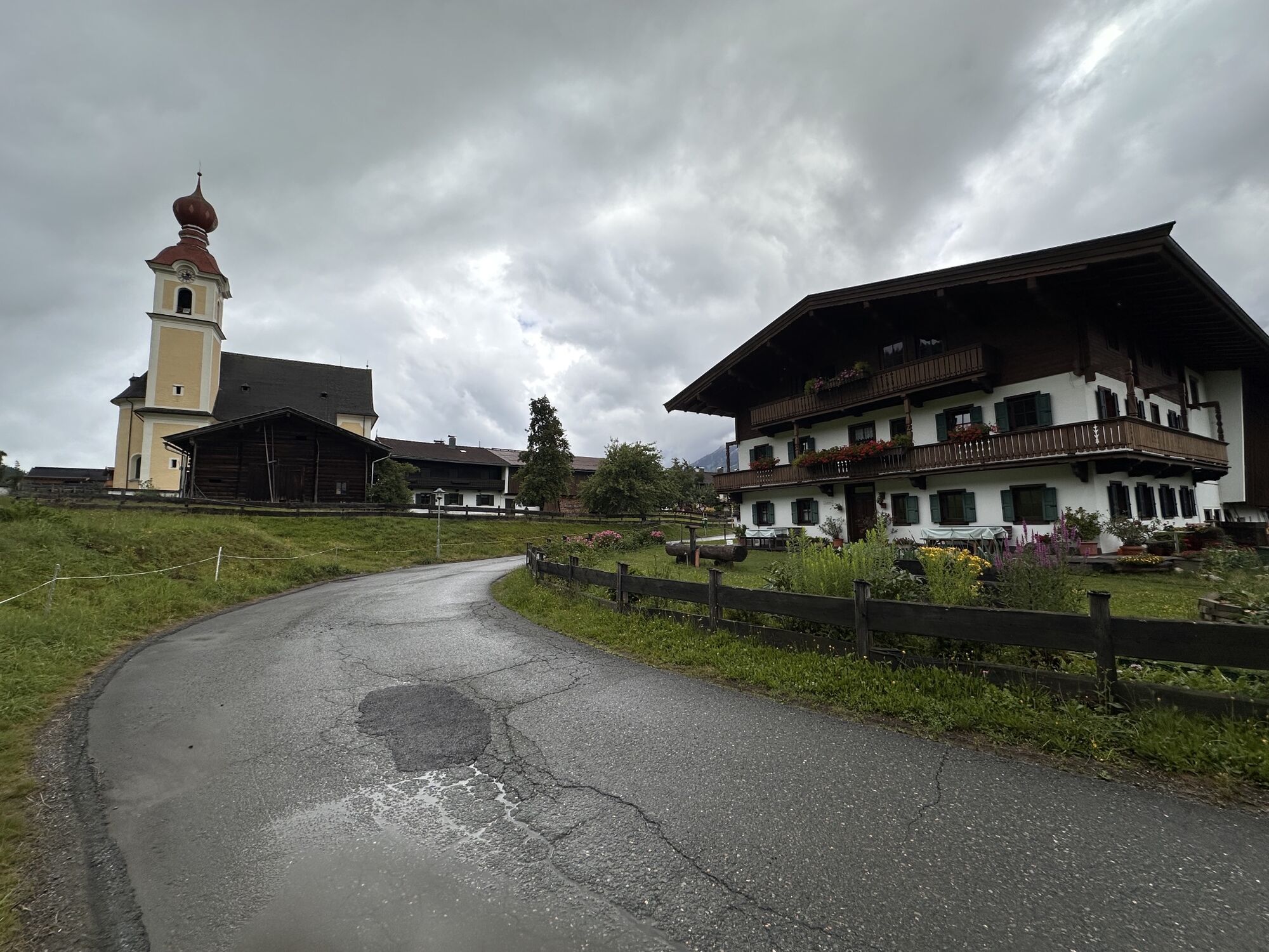
Now take the asphalt road downhill to the left through a hairpin bend and then the next small asphalt road briefly to the left towards "Fragenstätt/Hennleiten". Just behind a house, a steep hiking trail leads down to a farm on the right. Through this and then further down a meadow path to the first houses of a settlement. Turn left down the road, turn right down until a small hiking trail on the left in the direction of "Petersbrünndl" takes you briefly down to a gravel path. You hike it to the right until just before a road and walk parallel to the road along a stream to the left. Now turn right onto the road and continue to an underpass – you are now in Kirchberg. With the help of this you cross under the track and reach a roundabout. Turn right here and take the next street to the left - and you are already in front of your destination, the tourist information office in Kirchberg in Tirol.
Even though this small lake has nothing to do with the theme of hemming and is artificially created, the reflection of the Wilder Kaiser in the lake is one of the most famous photo motifs in the Tiroler lowlands.
Rough head (47.47479380758937, 12.308942788161835)
The crossing of the 1,580 m high Rauer Kopf is the first summit experience on the trail.
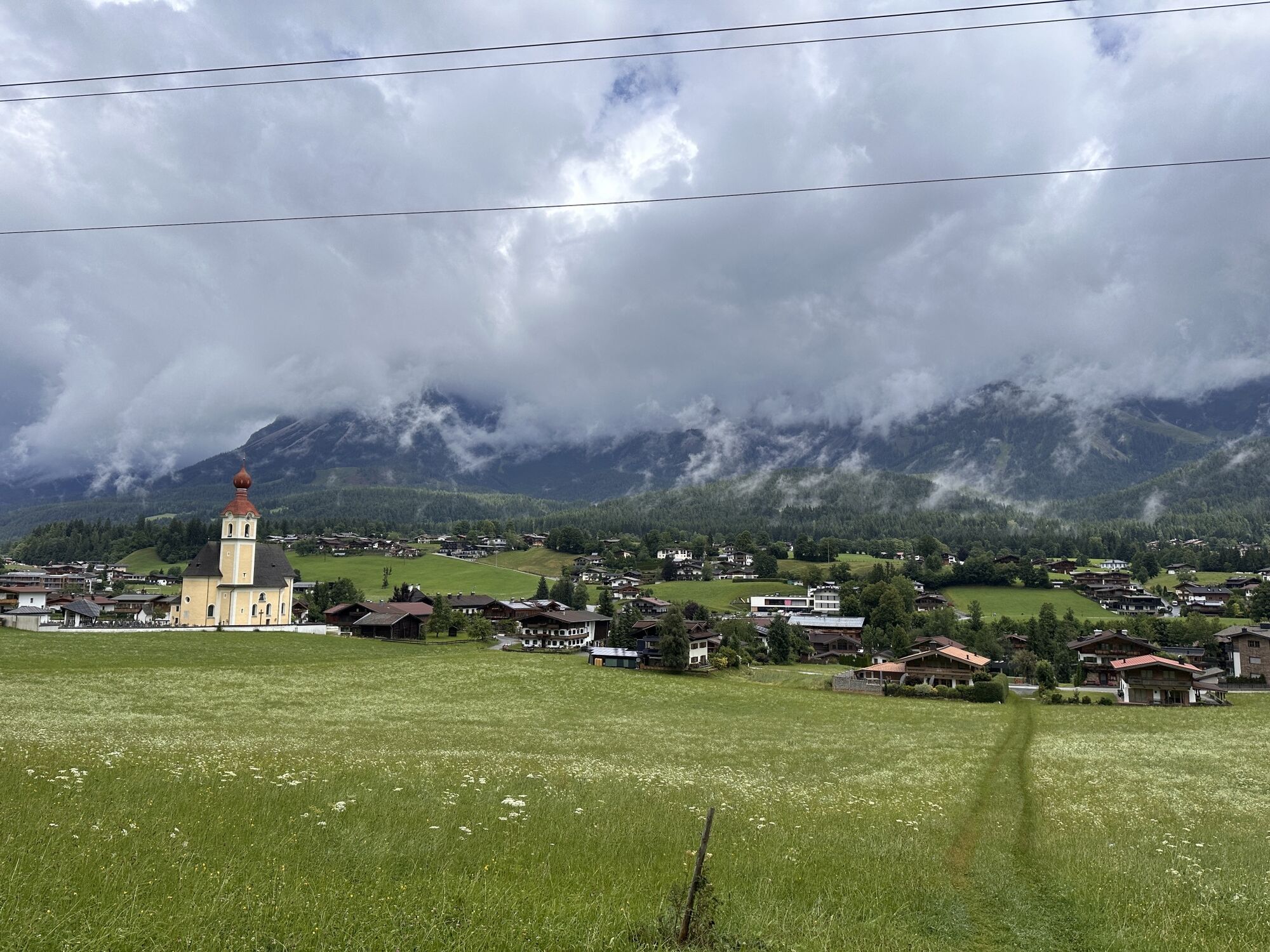
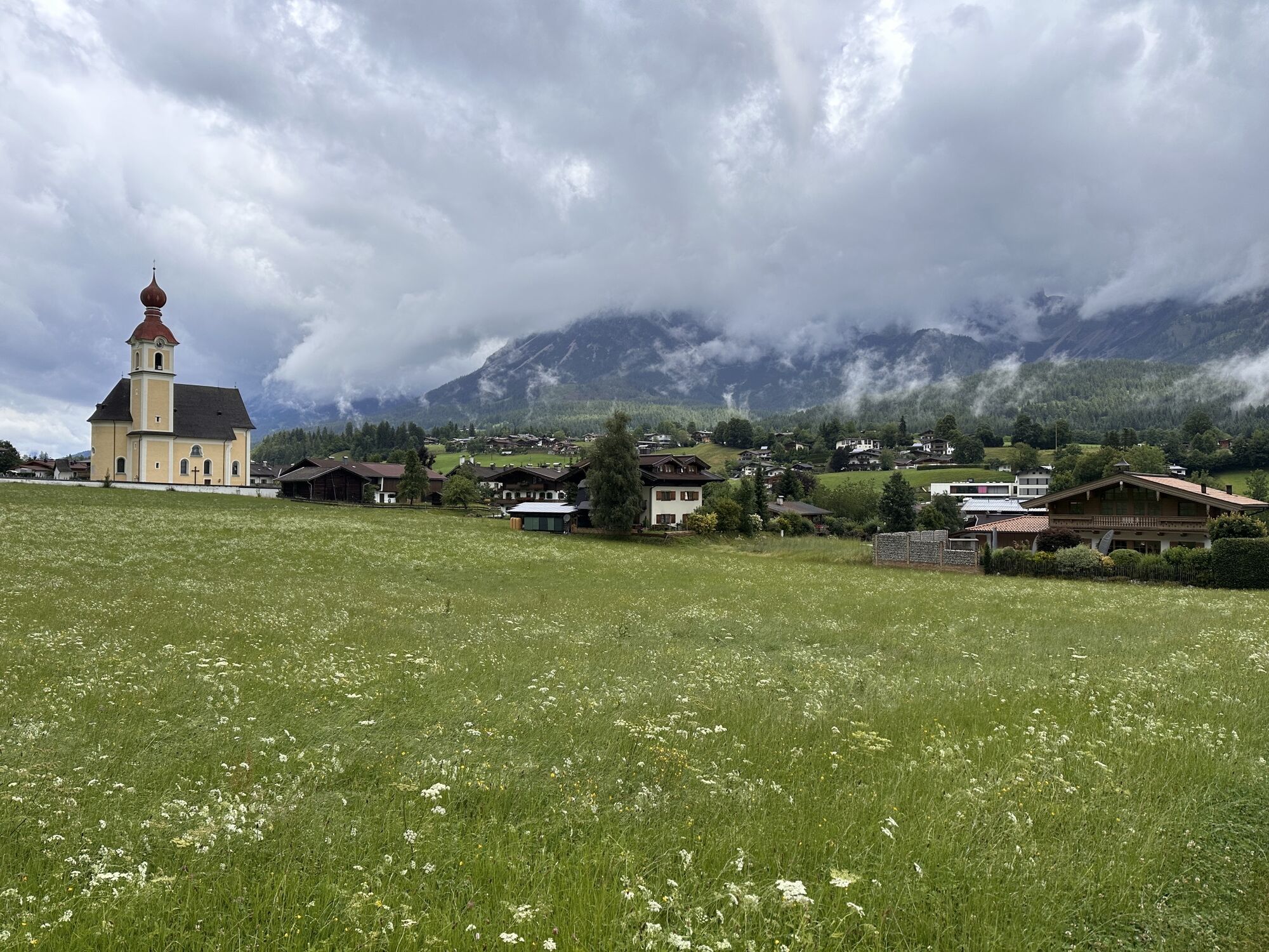
Kirchberg in Tirol (47.44824690901946, 12.313588848314048)
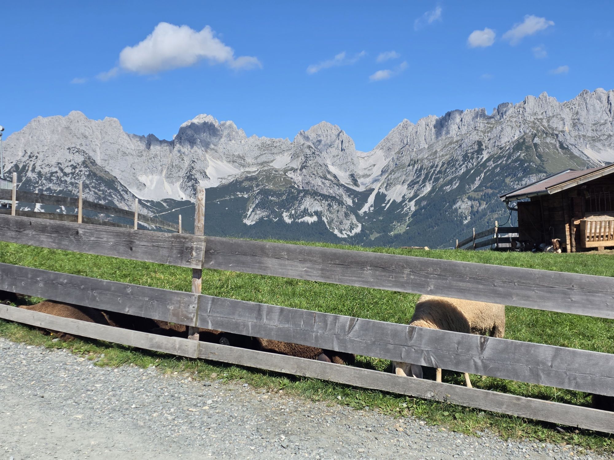
A traditional Tiroler village that has existed for centuries and has been able to preserve its character wonderfully to this day.
Spletne kamere s turneje
Scheffau
Bergstation Hartkaiserbahn
Jochstub'n-See
Hahnenkamm Berg
Hartkaiser II
Ellmau - Maria Heimsuchungskapelle
Going - Ort
Jochbahn Bergstation
Ochsalm
Ochsalm
Ochsalm
Ochsalm
Reith bei Kitzbühel - Hotel Zimmermann
Going - Astberg
Hahnenkamm Bergstation - Blickrichtung NW
Hahnenkamm Bergstation - Blickrichtung NO
Kitzbühel
Zielhaus HKR
Golfplatz Kitzbühel-Schwarzsee-Reith
Kitzbühel - Hahnenkamm
Bergstation Hartkaiserbahn
Bergstation Hartkaiserbahn
Bergstation Hartkaiserbahn
Bergstation Hartkaiserbahn
Bergstation Hartkaiserbahn
Holzalm
Priljubljeni izleti v okolici
- 4,7
Kirchdorf: Zur geheimnisvollen Teufelsgasse
srednjaPohodništvo 7,90 km - 4,9
Streif Wanderweg
srednjaPohodništvo 5,73 km - 4,5
Über Hintersteinersee und Walleralm aufs Hochegg
svetlobaPohodništvo 12,2 km - 4,6
St. Johann in Tirol: Wasserfall & 3 Seen am Kitzbüheler Horn
srednjaPohodništvo 12,7 km - 4,5
Wanderung um den Hintersteinersee
svetlobaPohodništvo 5,29 km - 4,7
Hintersteinersee
srednjaPohodništvo 9,87 km - 4,2
Bergdoktor Wohnhaus "Gruberhof" (Köpfing Hof) Rundeweg-Söll
svetlobaPohodništvo 8,70 km - 4,9
Route 209: Brechhornhaus-Choralpe
težkoMountainbike 24,4 km - 5,0
Kirchdorf: Stripsenjoch Klettersteige
težkoVia ferrata 3,76 km - 5,0
Stripsenjoch Klettersteige/ Rundwanderung von Griesener Alm über Stripsenjochhaus und Feldberg
srednjaVia ferrata 10,2 km

Pohodništvo in sledenje


Ne zamudite ponudb in navdiha za naslednje počitnice
Vaš e-poštni naslov je bil dodan na poštni seznam.