


4-Lakes Route - Längenfeld


This circular hiking trail reflects the colors of water from Caribbean blue to crystal clear to meadow green with its four lakes shimmering in different colors depending on the season. However, attention...
This circular hiking trail reflects the colors of water from Caribbean blue to crystal clear to meadow green with its four lakes shimmering in different colors depending on the season. However, attention should also be paid to the small treasures in and around the lakes.
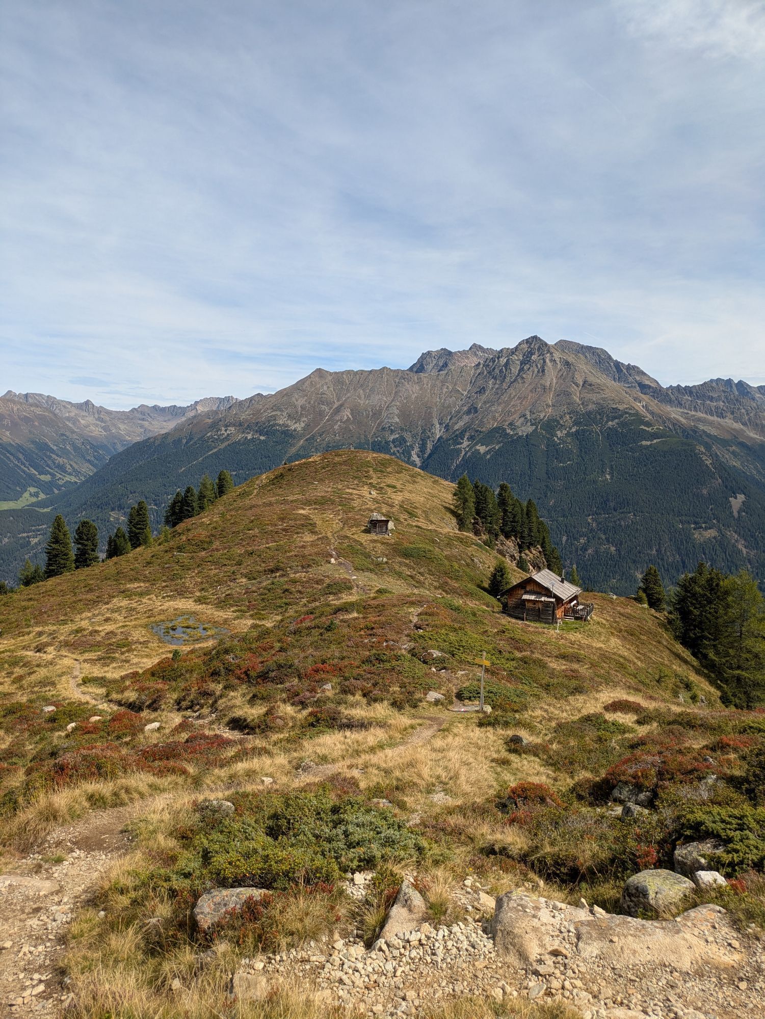
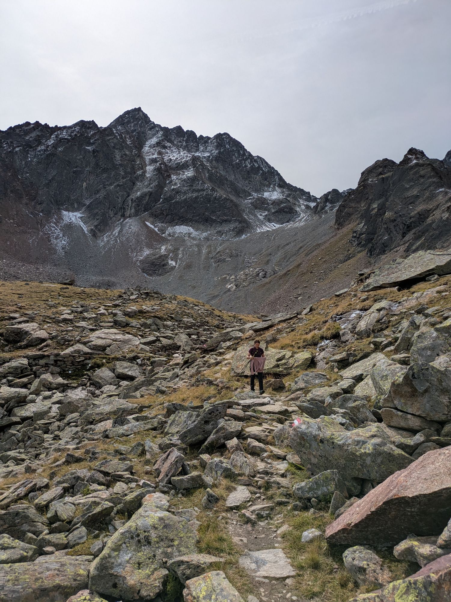
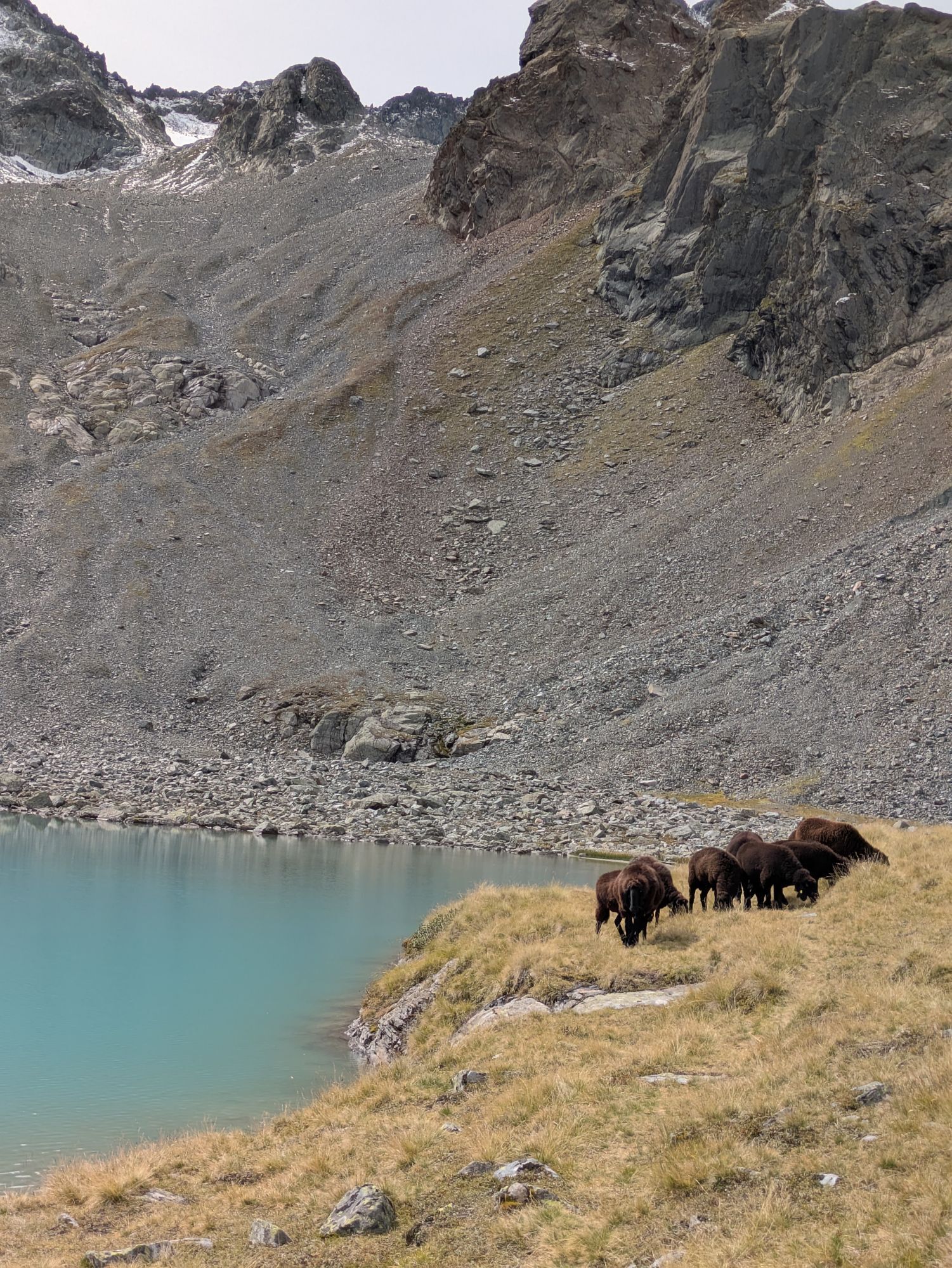
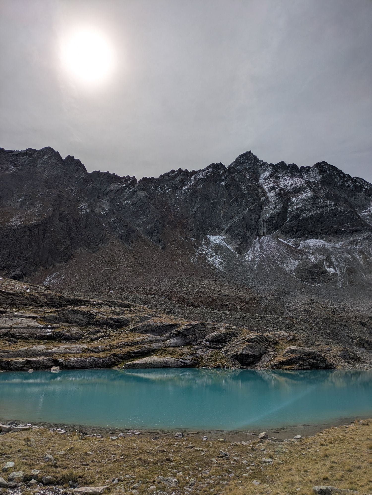
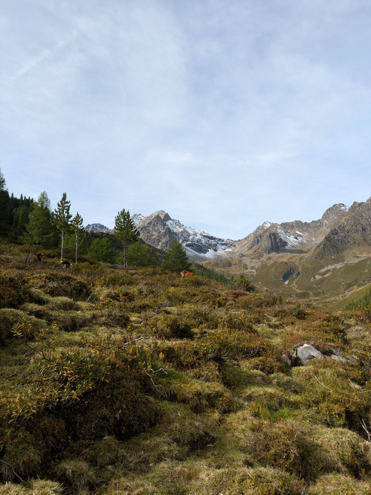
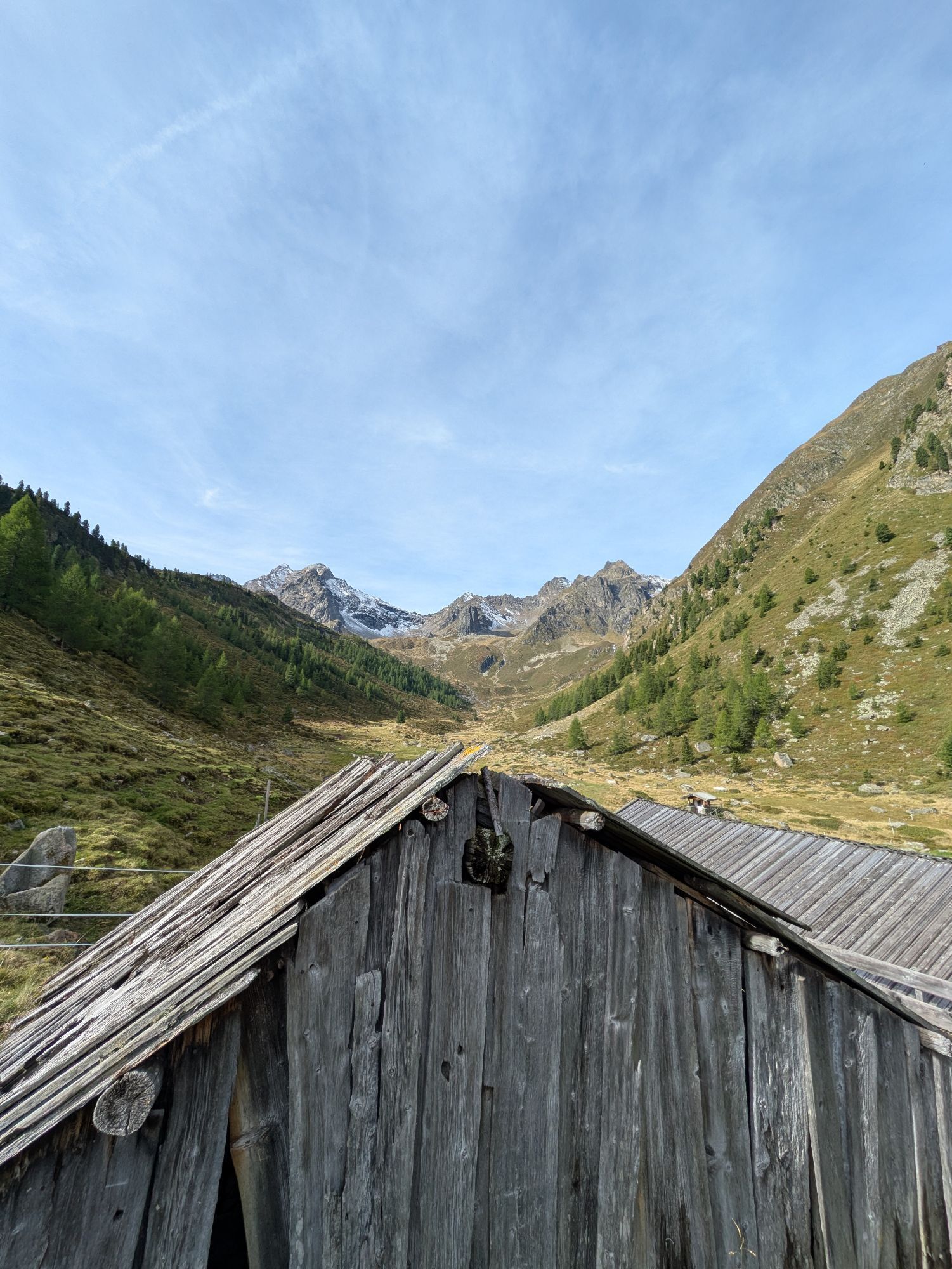
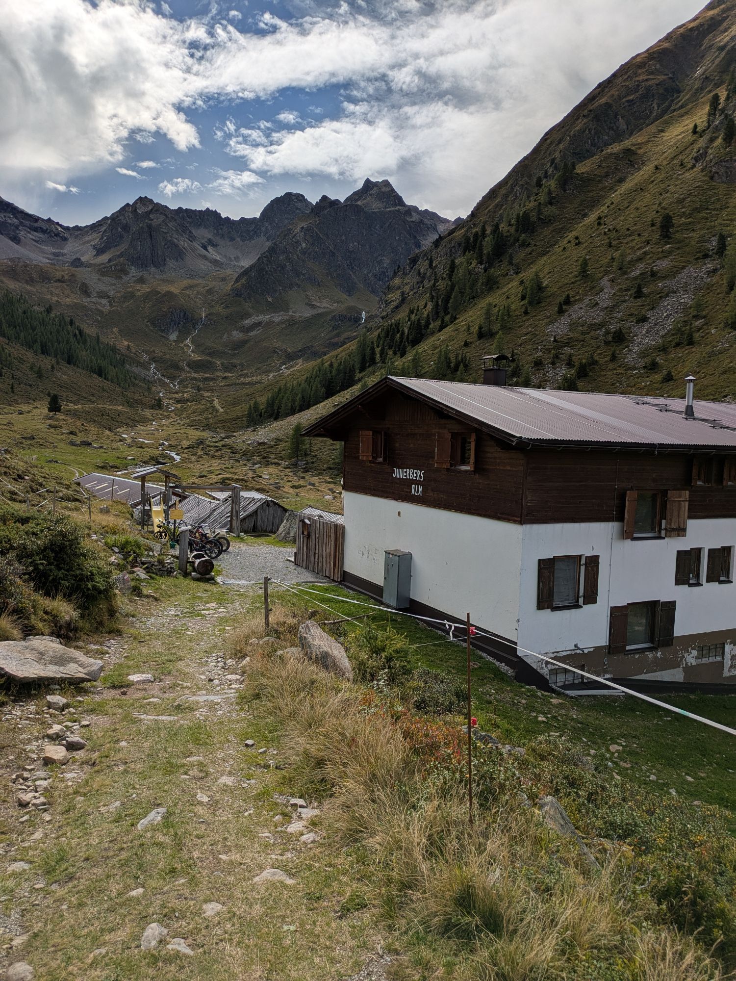
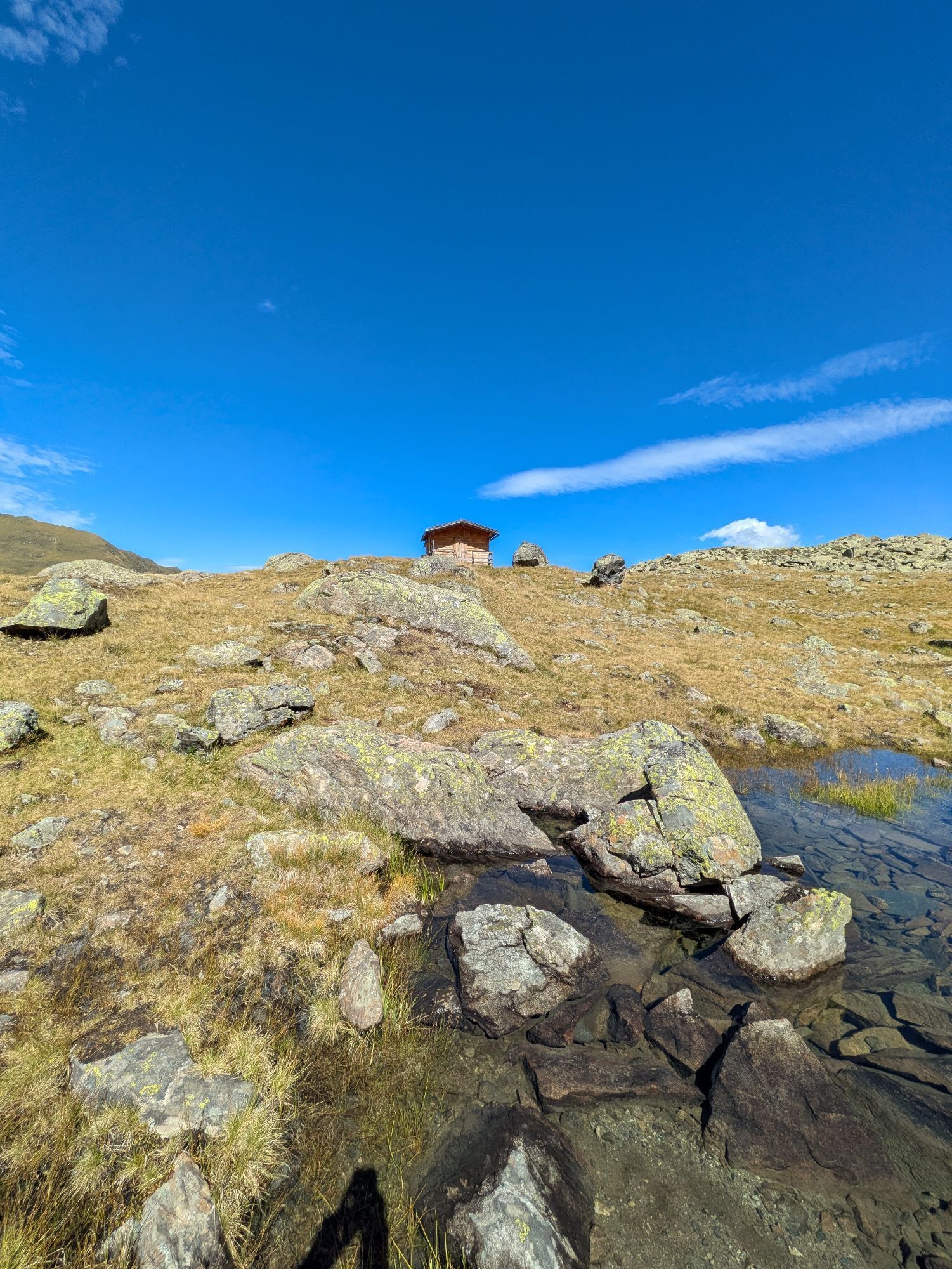
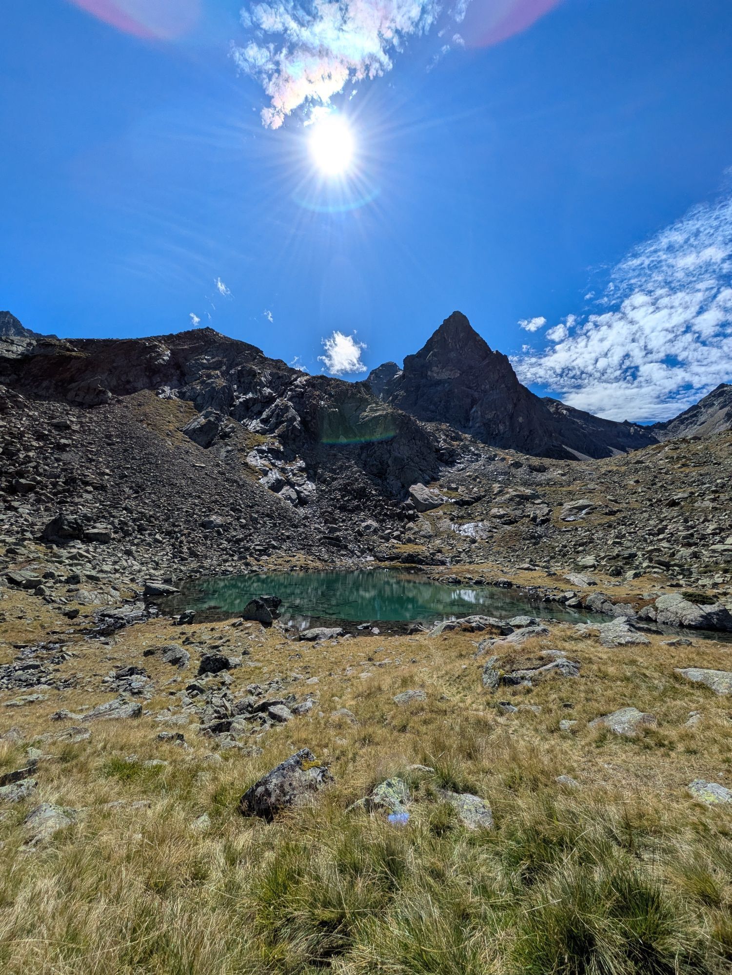
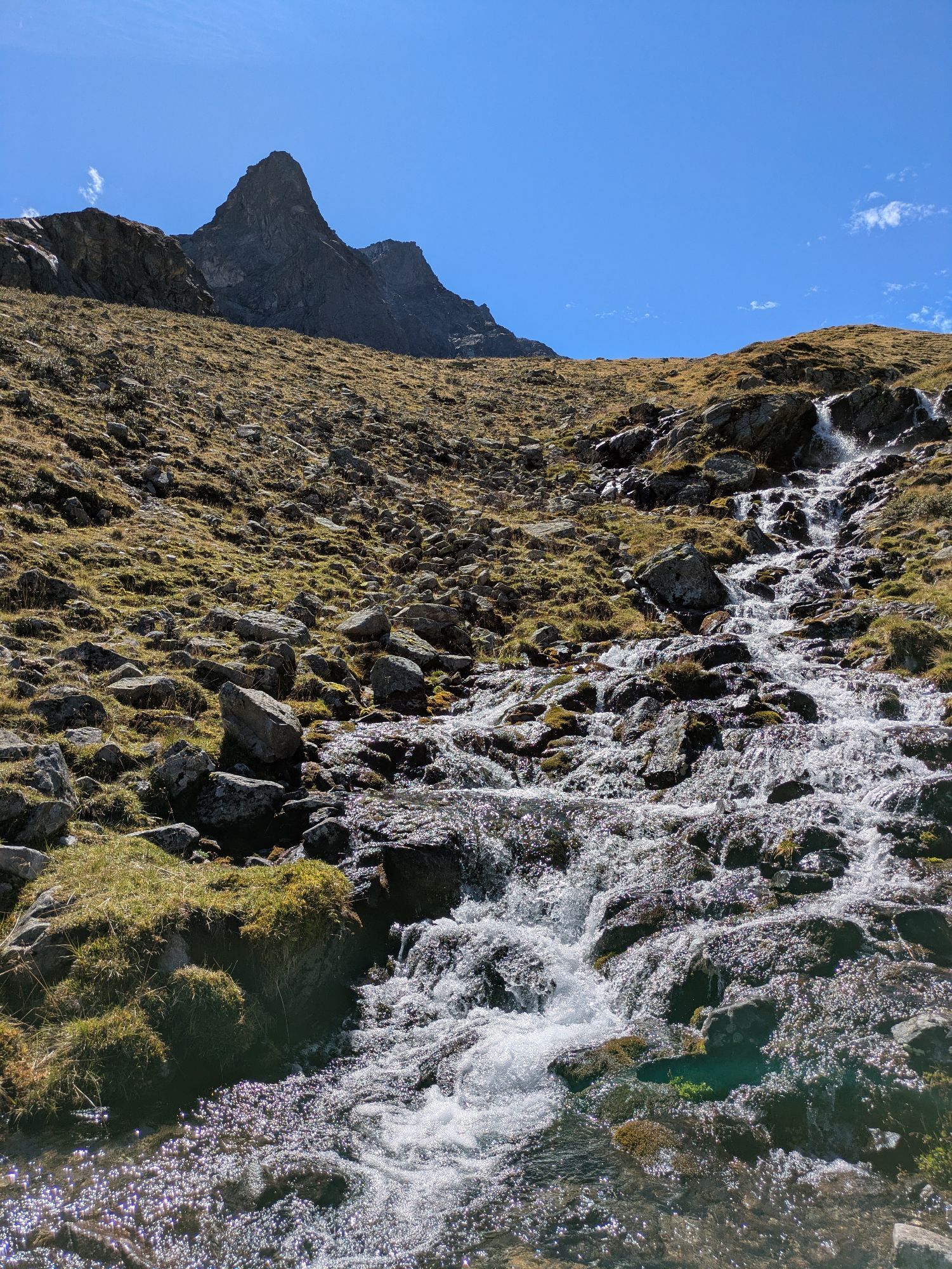
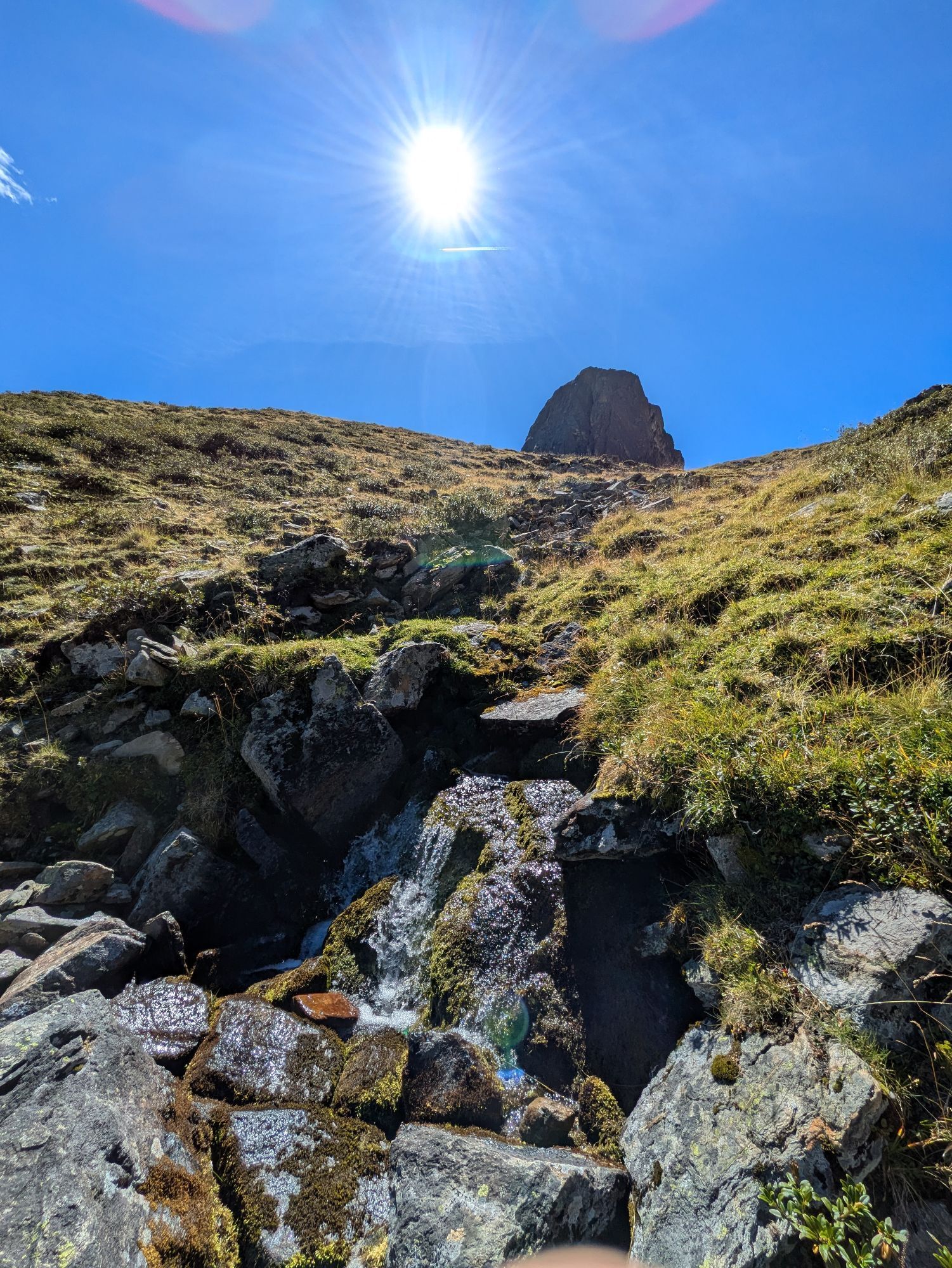
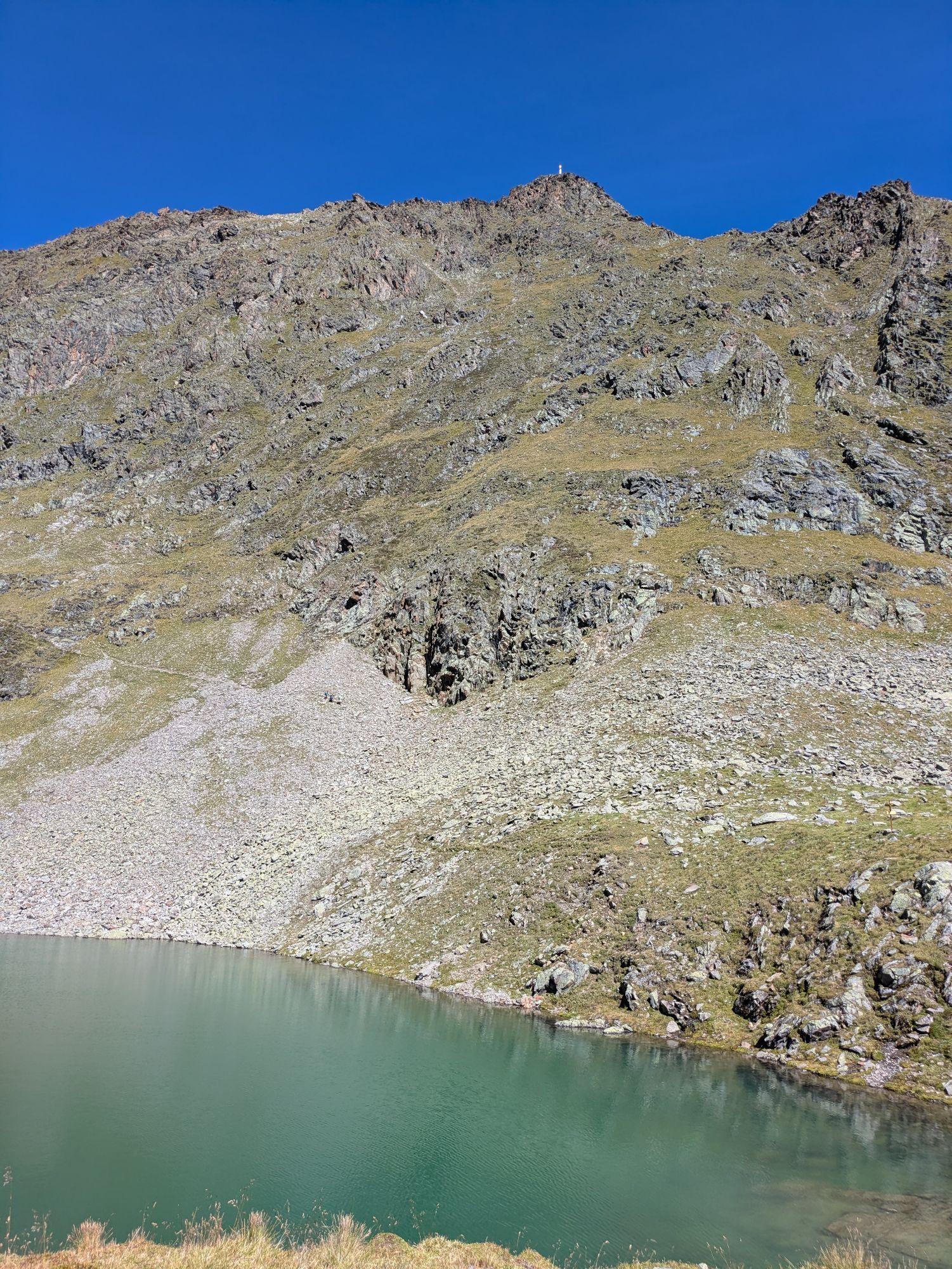
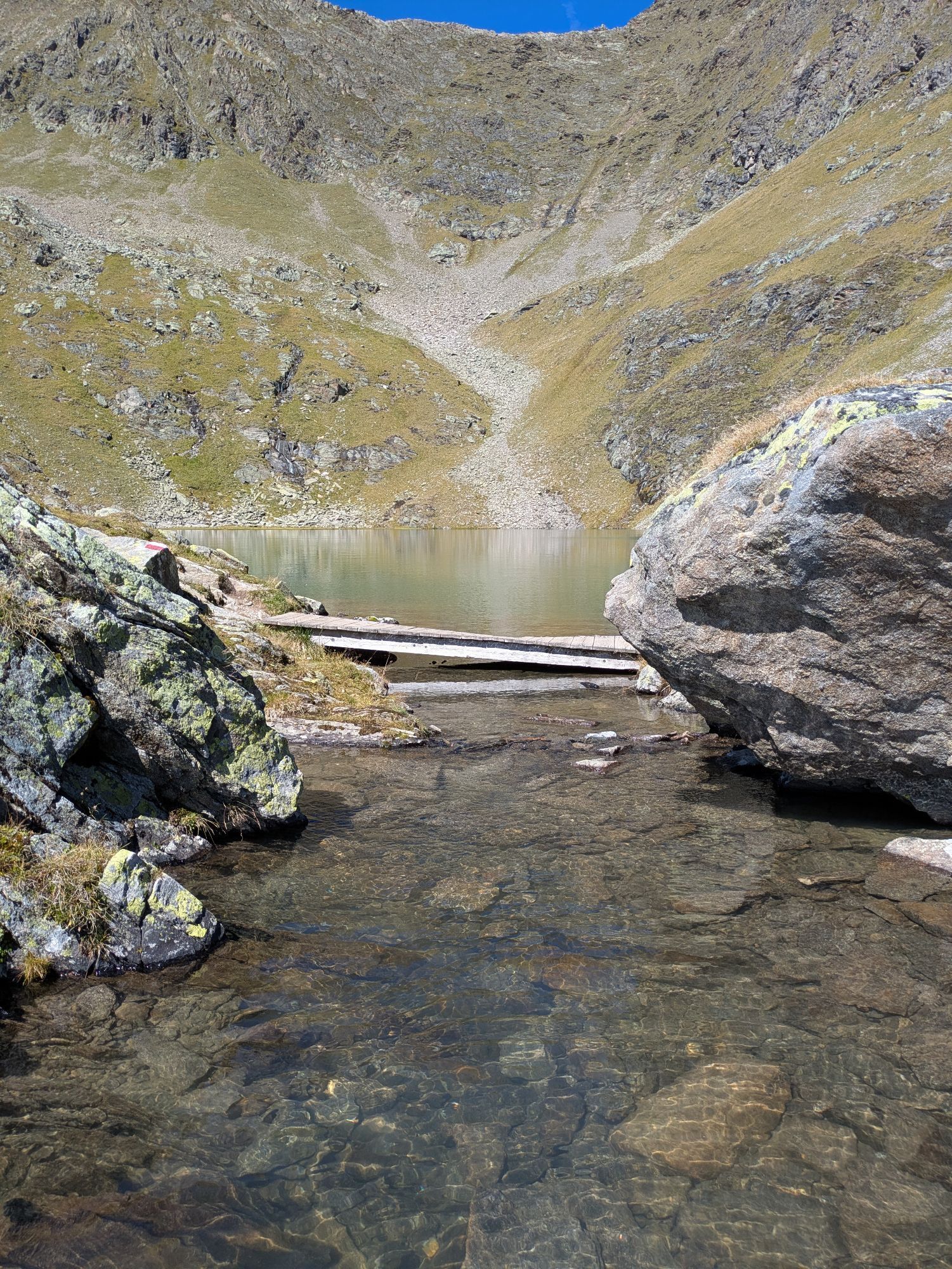
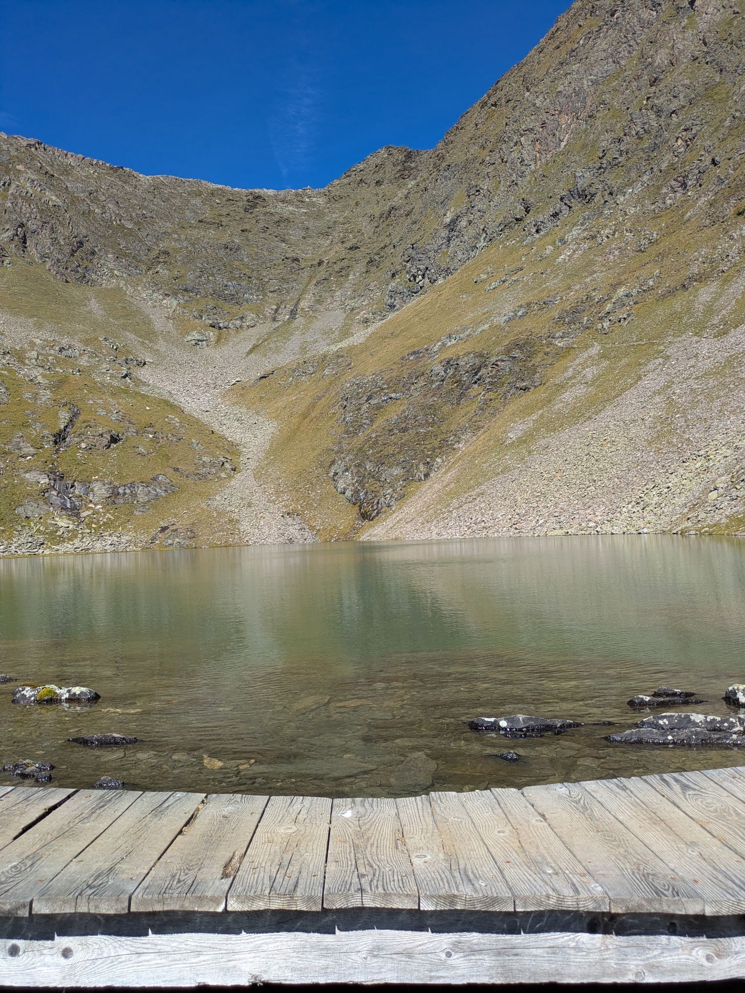
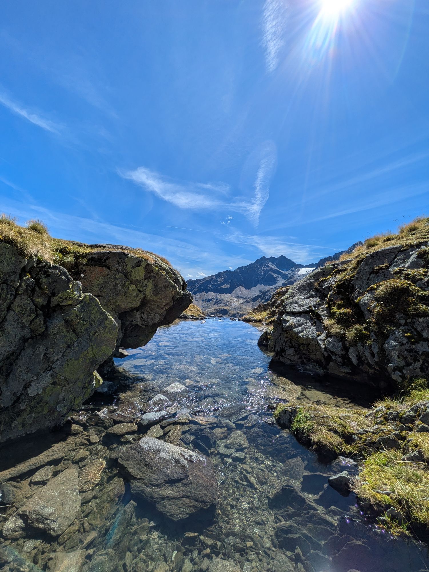
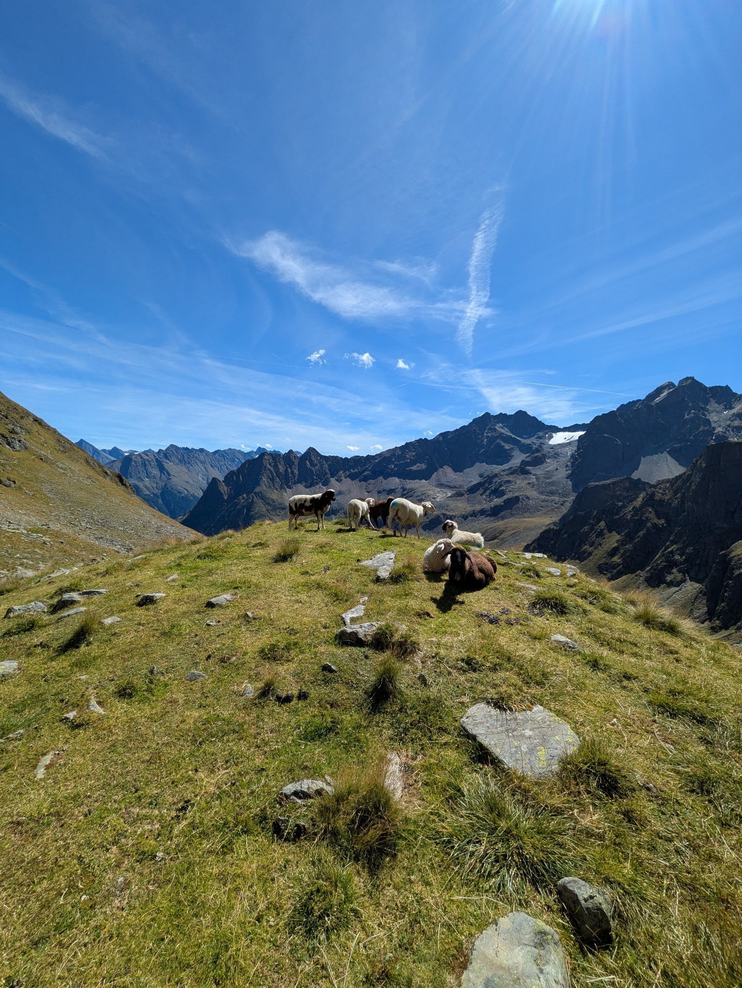
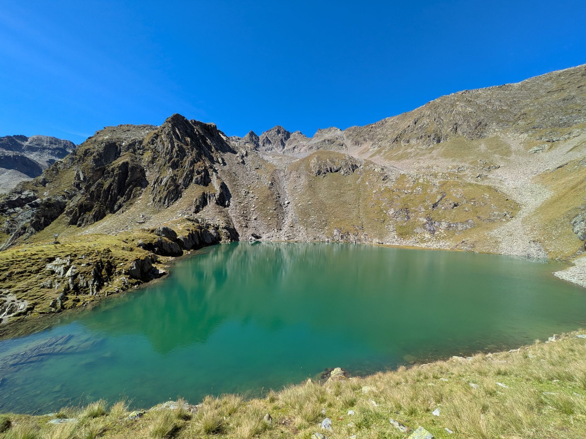
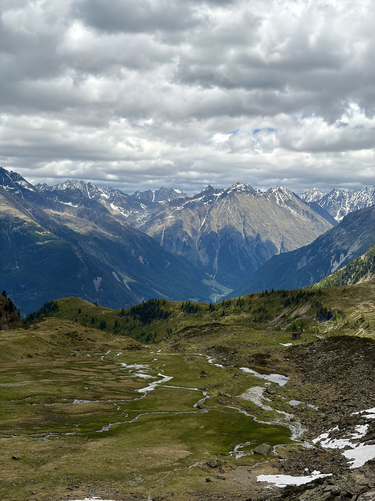
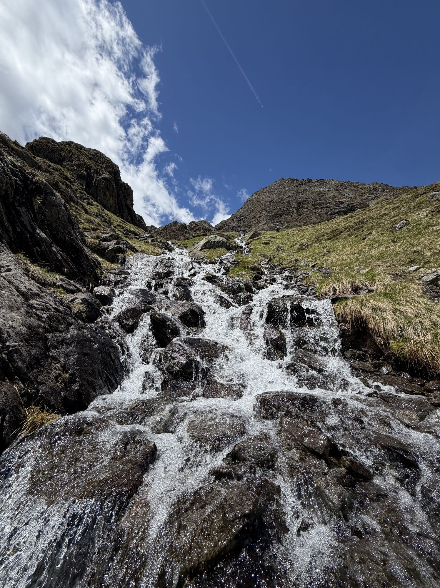
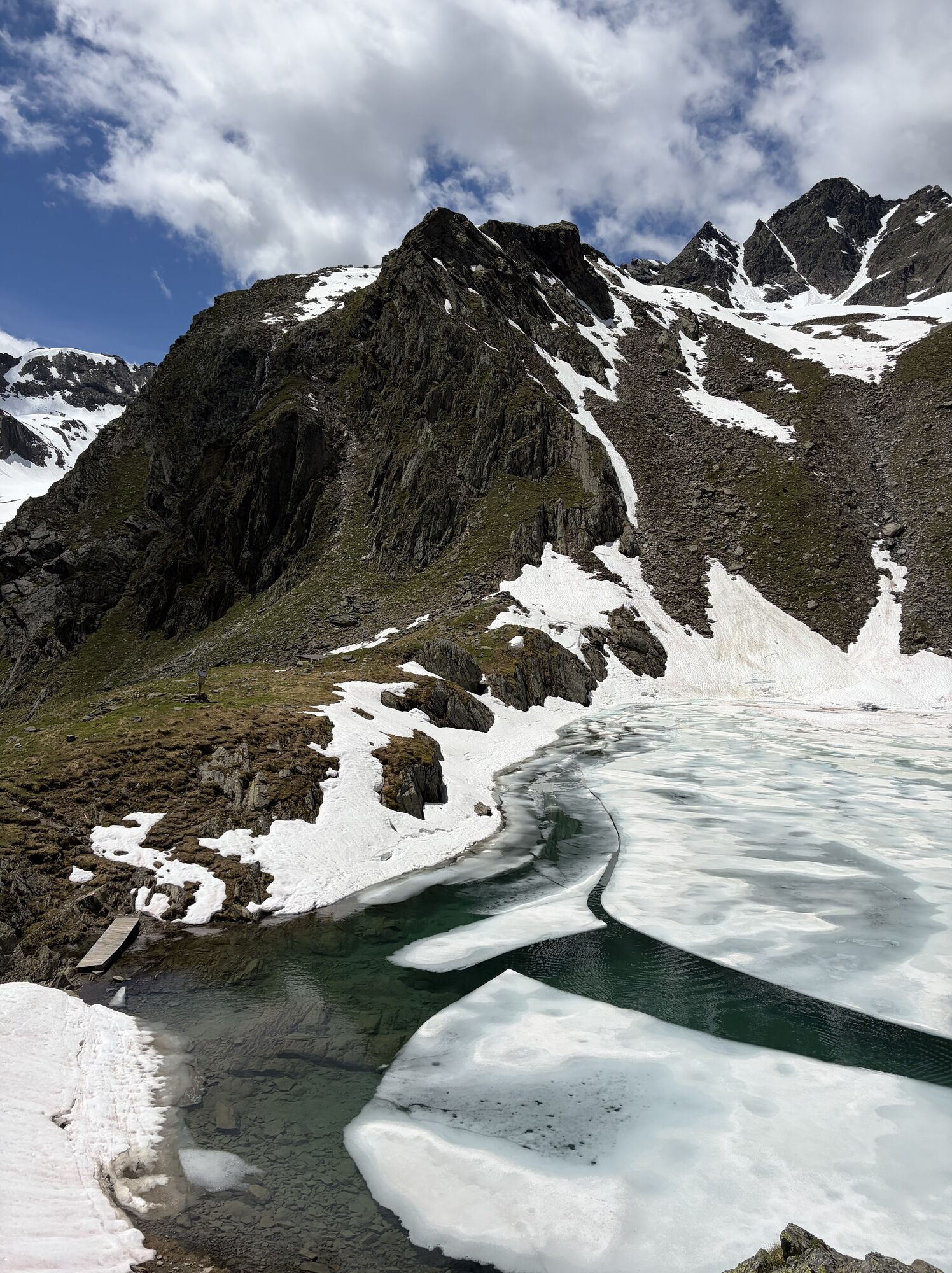
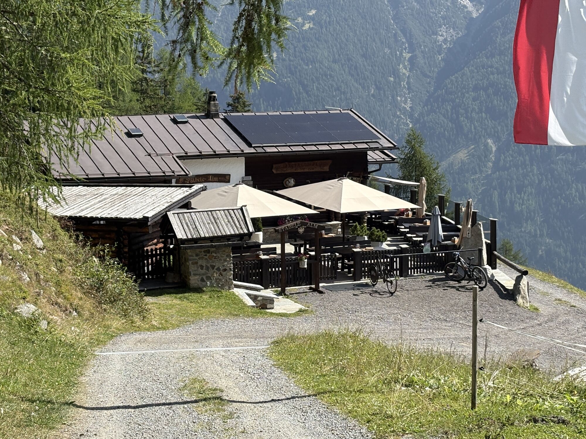
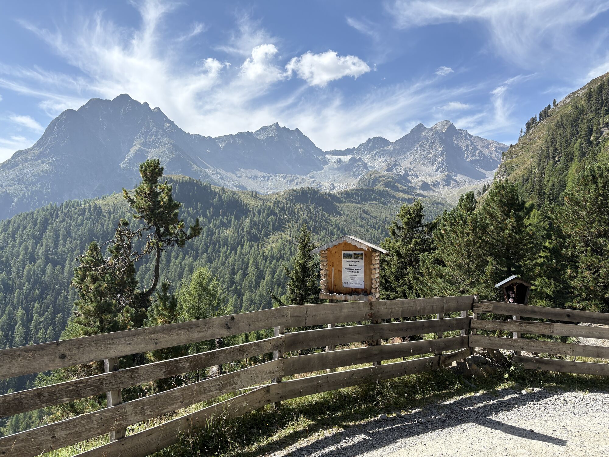
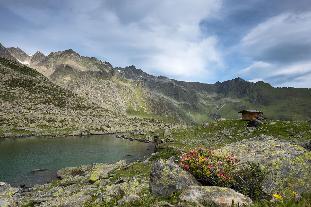
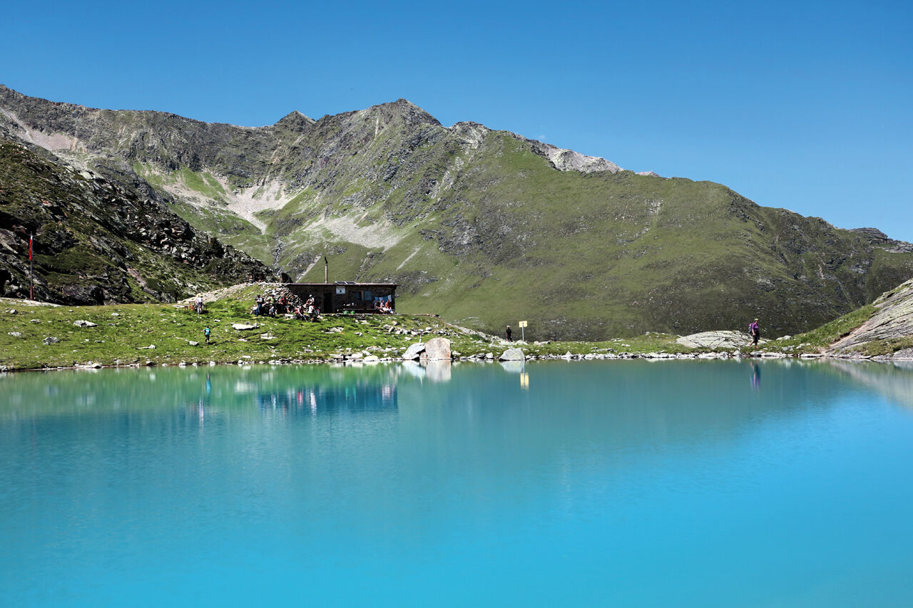
The path leads from the hamlet of Lehn in Längenfeld over a trail to Stabele Alm and past the Leckalm across lush green pastures along a ridge to the first of the four mountain lakes, the Plattachsee. From there you can already see the newly created trail that leads over the Felder Scharte, past the salt licks for the sheep, down steep grassy slopes to a new natural spectacle, the White Lake. It is the largest and deepest of the four lakes and invites you with its milky green color and numerous rest areas for a short relaxing break. Slowly it then continues along a beautiful high path from the White Lake to the somewhat lower situated Lower Spitzig Lake. Nestled in rough mountain landscape, it rests there very quietly and has a calming aura. From there it goes on to the last of the four lakes, the Hauersee. Depending on the season, it shimmers milky green to turquoise. Surrounded by the so-called Fünffingerspitzen, you can once again briefly enjoy the pleasant tranquility of the 2300 meters altitude before you start your descent.
On the way down, you have a fantastic view of the Innerbergtal and the Hauertal on the Hauer ridge towards Innerbergalm. At the tip of this ridge lies the Wöckelwarte, from which you can let your gaze wander over Längenfeld. From there, it goes through an enchanting stone pine forest back to the lush alpine pastures and fields shortly before the Innerbergalm. The descent takes place, as does the ascent, via the trail back to Lehn.

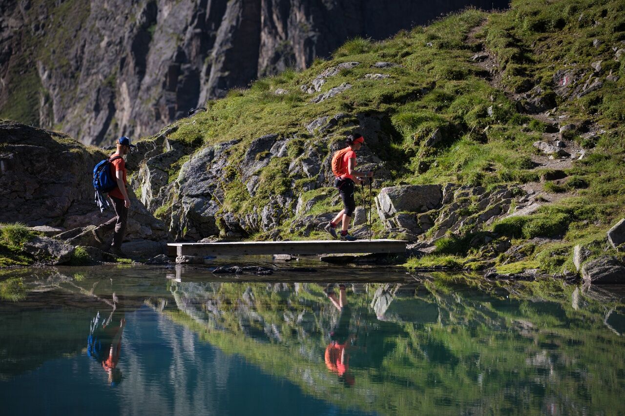
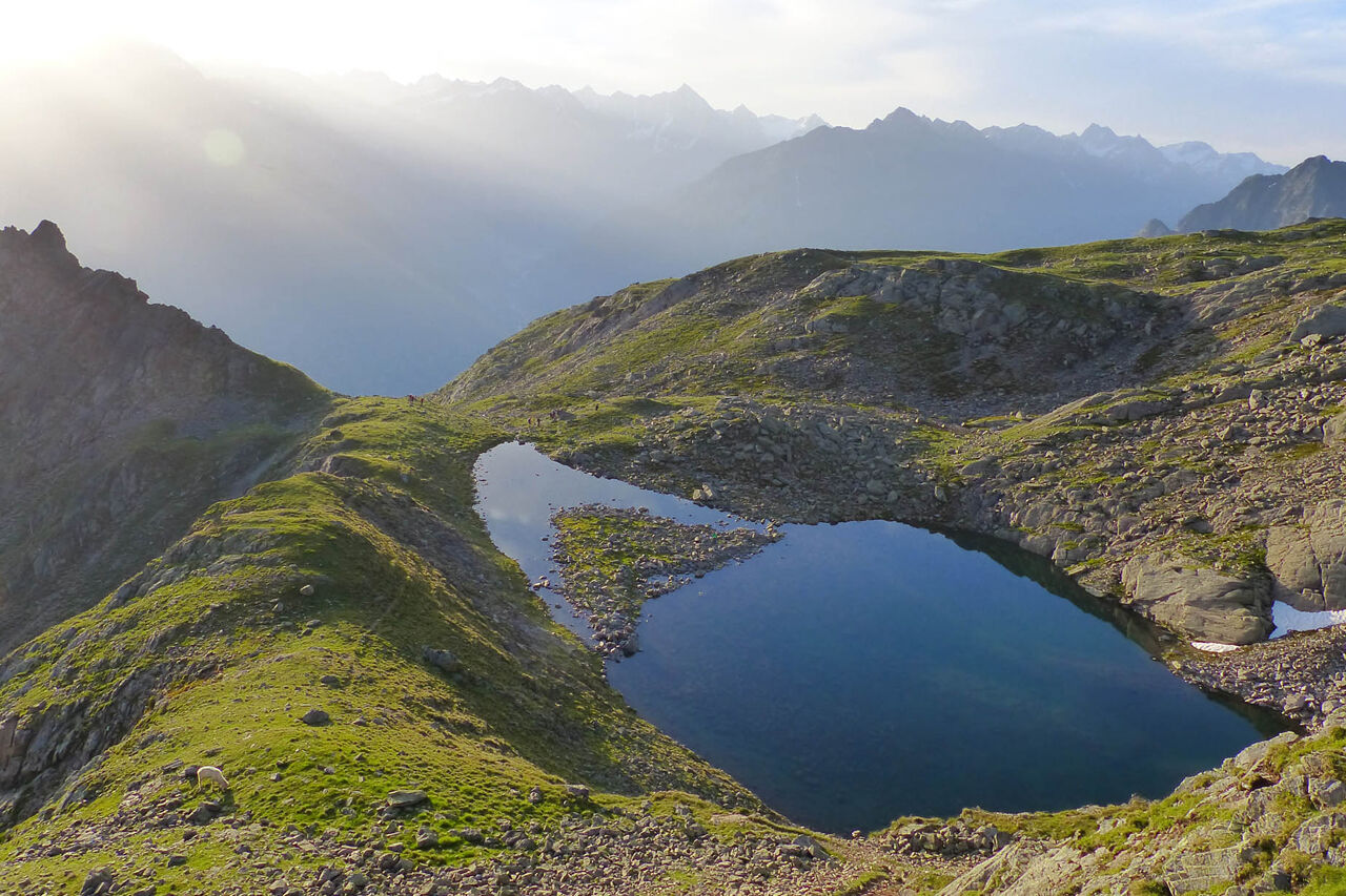
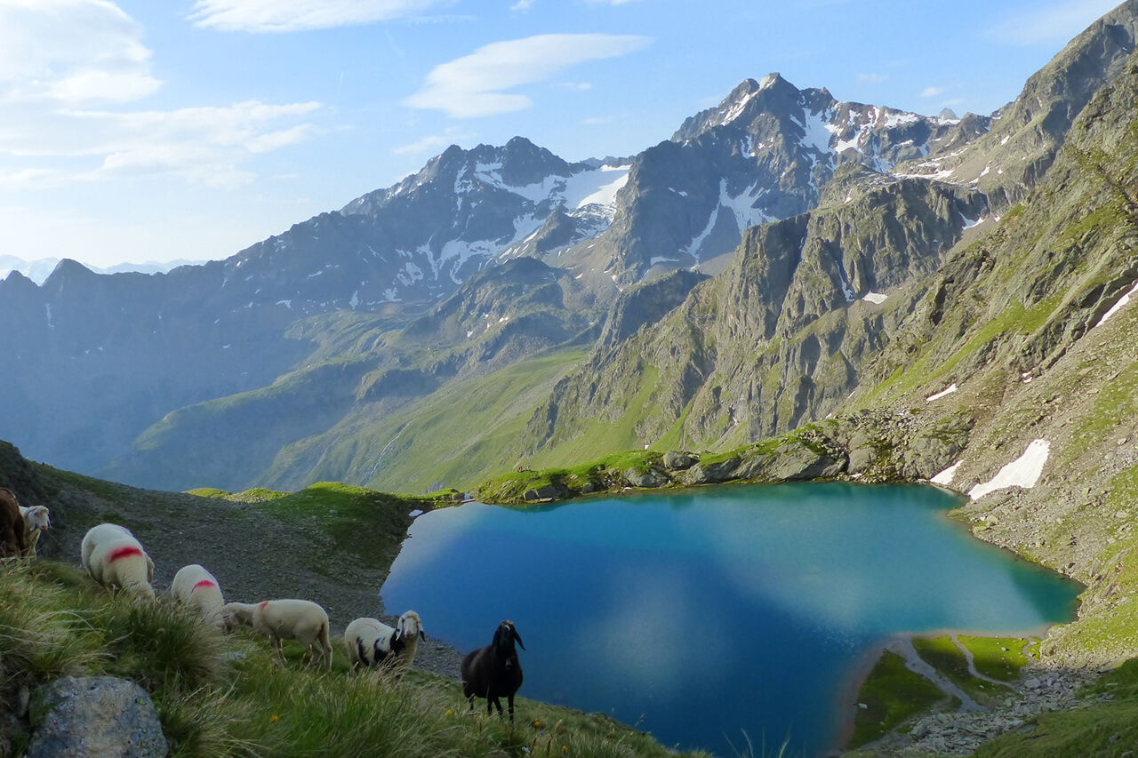
This circular hiking route leads from Längenfeld Lehn to the Leckalm (not managed) across pastureland along a mountain ridge to the first of the four mountain lakes, the Plattachsee. It continues along the newly created trail over the Felder Scharte to the White Lake. It is the largest and deepest of the four lakes. From there, you follow the high path to the lower Spitzig Lake situated below. From there, it goes on to the last of the four lakes, the Hauersee.
On the way back towards Innerbergalm lies the Wöckelwarte, from where you have a wonderful view of Längenfeld.
Appropriate equipment such as breathable and weather-appropriate outdoor clothing is required for all hikes and routes. Carrying a first aid kit, a mobile phone, and possibly a hiking map, as well as sufficient provisions for hikes without catering options, is necessary.
Moderate difficulty mountain path; suitable for sure-footed and experienced mountain hikers; good physical condition, mountain experience, and mountain equipment (see under Equipment) necessary. Please observe the current weather report.
Car travel to the ÖTZTAL
The journey by car takes visitors via the Inn Valley to the valley entrance and further along the Ötztal. In addition to the toll motorway, country roads can also be used. With the route planner, your drive can be quickly and conveniently determined. To the route planner: https://www.google.at/maps
Travel comfortably and safely by train. The final stop and exit point is ÖTZTAL station. Then you travel conveniently and quickly with public bus services or local taxi companies through the entire valley to your desired destination. The current bus timetable is available at: http://fahrplan.vvt.at
The following parking options are available in Längenfeld/Lehn:
Lehn - via ferrata (paid)
More information about hiking in the Ötztal can be found here.
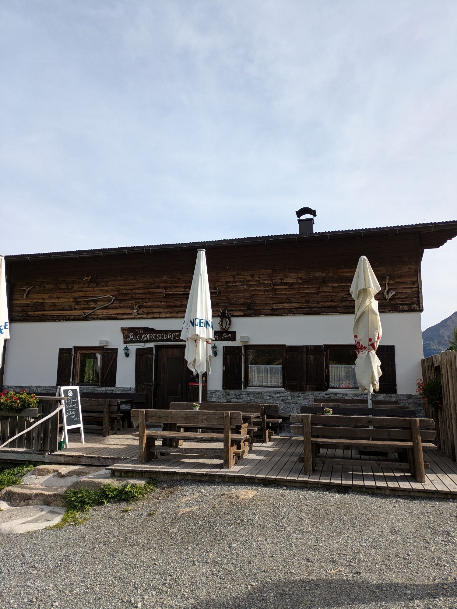
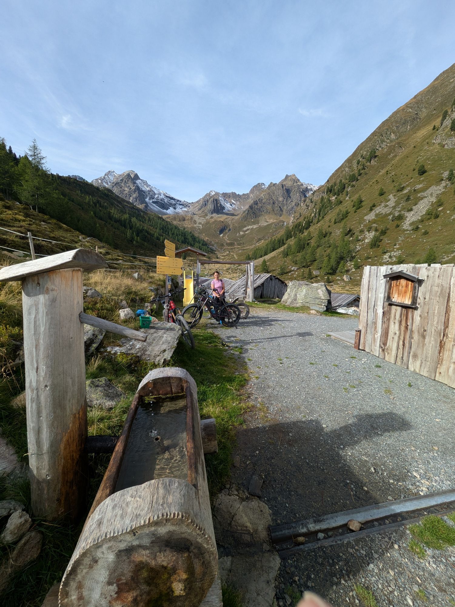
The hut taxi runs every Tuesday during the summer season to the Stabelealm. This saves you a climb of about 2 hours. A reservation is required by Monday 5:00 pm.
https://www.oetztal.com/de/erlebnisse/shop
Spletne kamere s turneje
Niederthai im Ötztal
Niederthai - Alpin Appart
Therme Längenfeld
Therme Längenfeld
Therme Längenfeld
Therme Längenfeld
Längenfeld - Ortsblick
Stuibenfall
Stuibenfall
Stuibenfall
Stuibenfall
Stuibenfall
Umhausen / Hotel Tauferberg
Umhausen / Hotel Tauferberg
Umhausen / Hotel Tauferberg
Umhausen / Hotel Tauferberg
Umhausen / Hotel Tauferberg
Niederthai - Delano
Niederthai - Delano
Umhausen / Hotel Tauferberg
Priljubljeni izleti v okolici
- 4,5
Winnebachsee Hut – Längenfeld/Gries
srednjaPohodništvo 4,74 km - 4,2
Hike Stuibenfall - Umhausen
svetlobaPohodništvo 2,95 km - 4,4
Stuibenfall Umhausen circular hike
svetlobaPohodništvo 9,32 km - 4,4
Rundwanderung Hängebrück3
svetlobaPohodništvo 6,32 km - 4,5
Oetz - Piburger See - Oetz
srednjaPohodništvo 7,16 km - 4,7
Winter circular route Brandalm/Burgstein - Längenfeld 204
srednjaZimsko pohodništvo 5,44 km - 4,3
Amberger Hut - Längenfeld/Gries
srednjaPohodništvo 5,60 km - 4,6
Umhausen - Stuibenfall - Umhausen
srednjaPohodništvo 7,94 km - 4,5
Summit route Weather Cross from Hochoetz
srednjaPohodništvo 3,06 km - 4,7
Circular hike Bergmahderweg - Niederthai
svetlobaPohodništvo 7,60 km
Pohodništvo in sledenje


Ne zamudite ponudb in navdiha za naslednje počitnice
Vaš e-poštni naslov je bil dodan na poštni seznam.