2TälerTrail - Stage 2: From St. Veit to St. Jakob
srednja
Navigacija po spletni strani
Navigacija po spletni strani
Pridobite to turo v svoj mobilni telefon
2TälerTrail - Stage 2: From St. Veit to St. Jakob
srednja
Pohodništvo
14.34
km
Skenirajte kodo QR in začnite navigacijo v aplikaciji bergfex.

Pohodništvo in sledenje


2TälerTrail - Stage 2: From St. Veit to St. Jakob
srednja
Razdalja
14.34
km
Trajanje
06:00
h
Ascent
974
hm
Morska gladina
1,389 -
2,503
m
Prenos skladbe
2TälerTrail - Stage 2: From St. Veit to St. Jakob
srednja
Pohodništvo
14.34
km
Fotografije naših uporabnikov
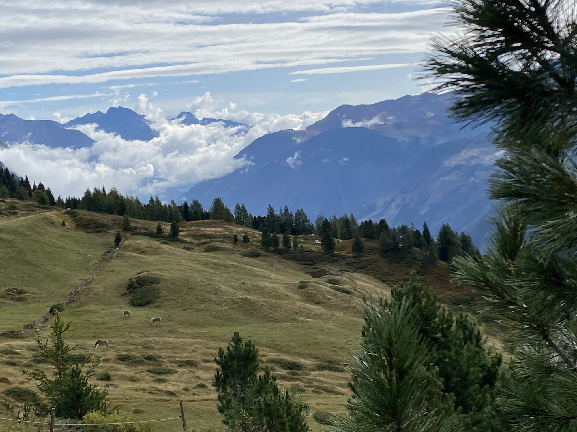
From the village square in St. Veit you walk along the asphalt road to Oberholz until path no. 316 branches off to the left and leads in serpentines through the forest to the snack station Speikbodenhütte....
Opis
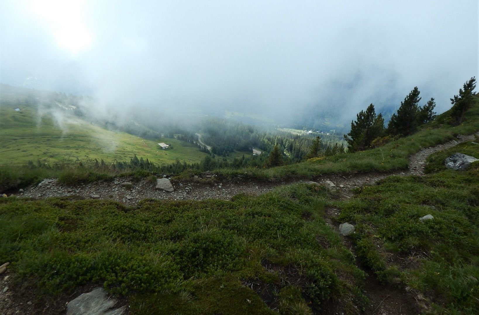
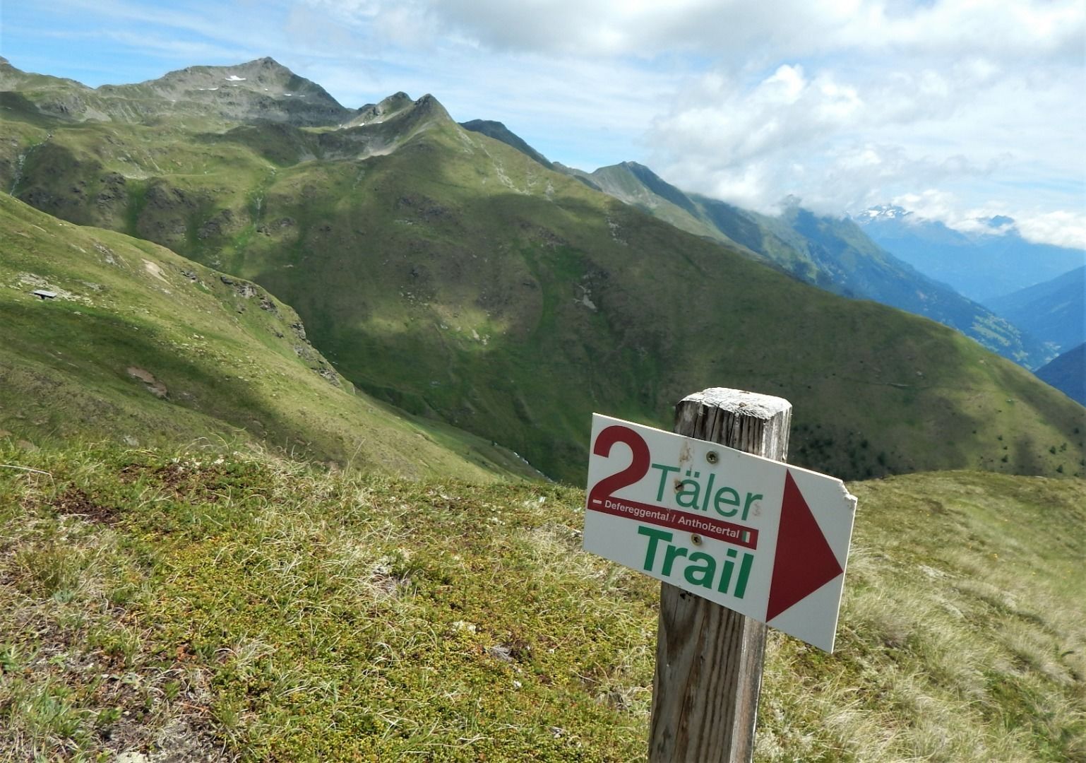
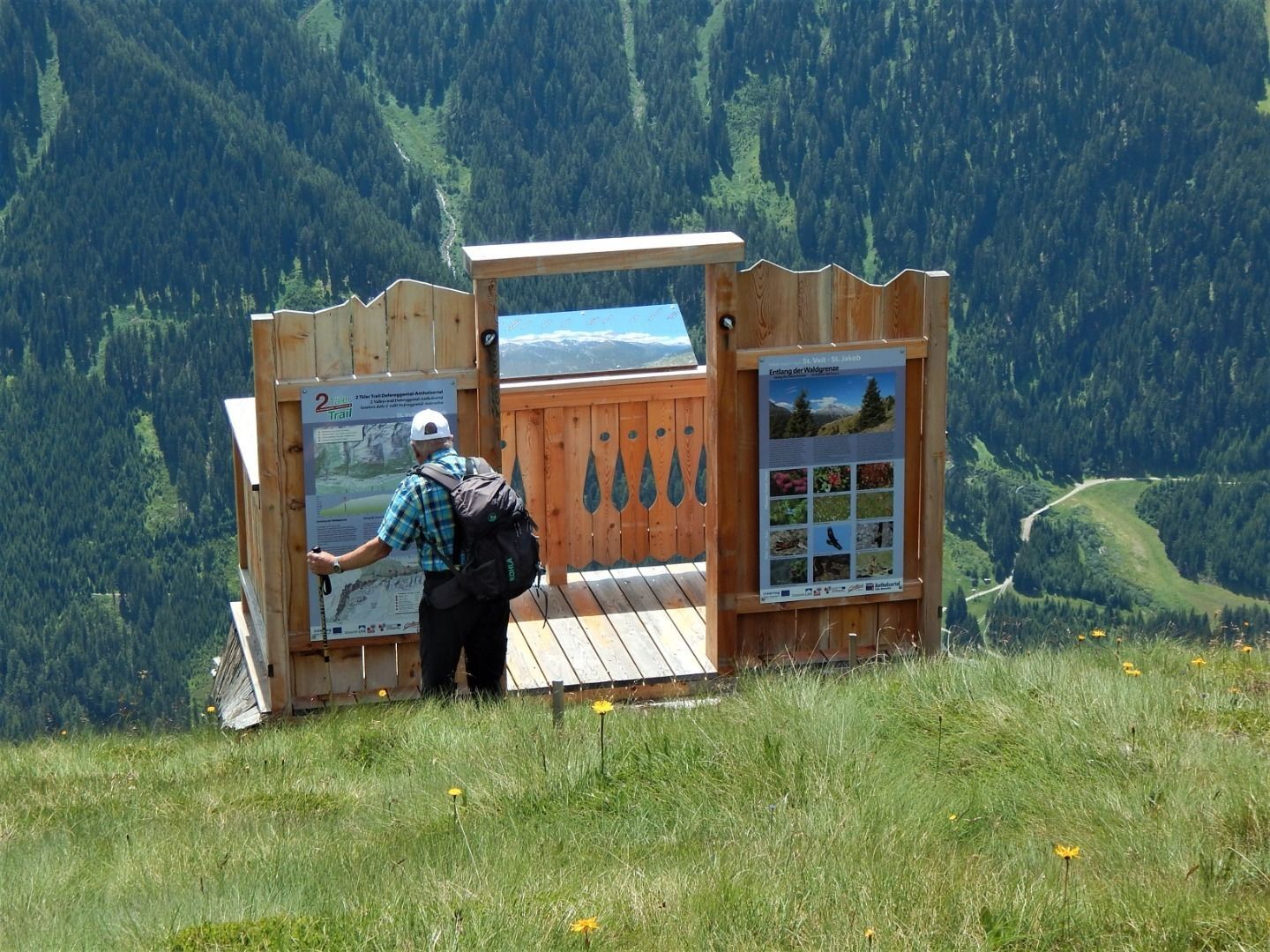
From the village square in St. Veit you walk along the asphalt road to Oberholz until path no. 316 branches off to the left and leads in serpentines through the forest to the snack station Speikbodenhütte. Near the lodge there is also an information platform of the Hohe Tauern National Park. After an extensive rest, take hiking trail 21B to the Gritzer Alm mountain pasture, which invites you to enjoy the magnificent view.
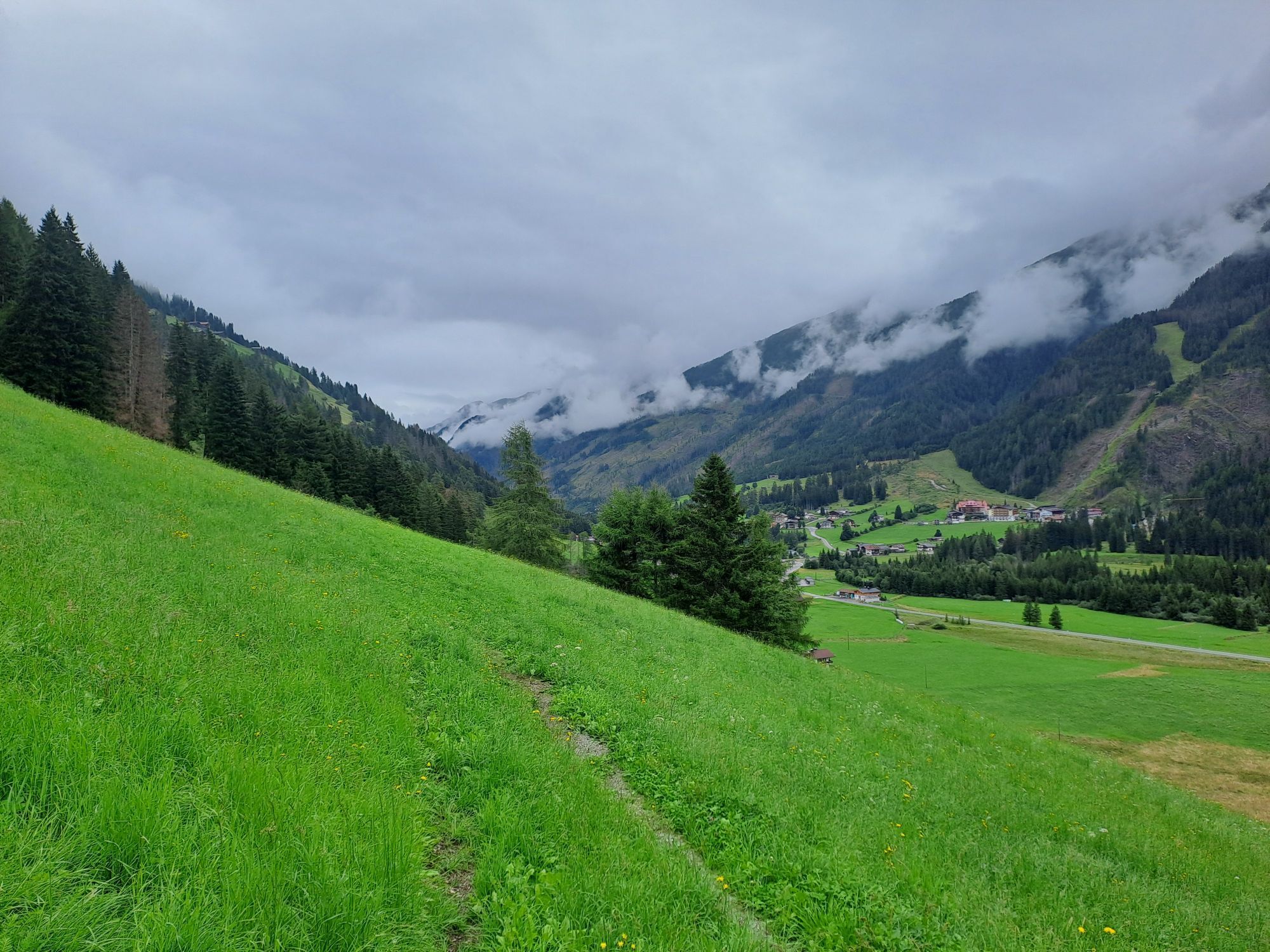
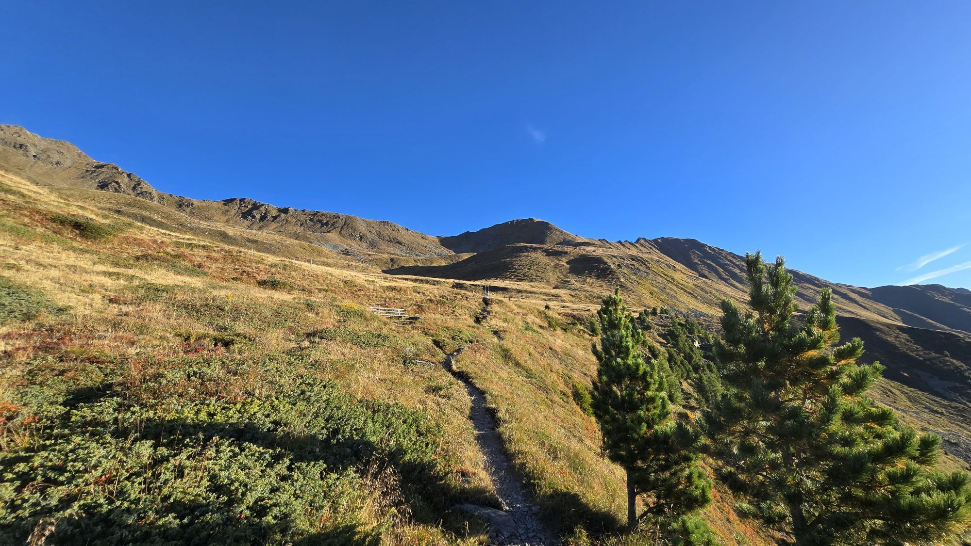
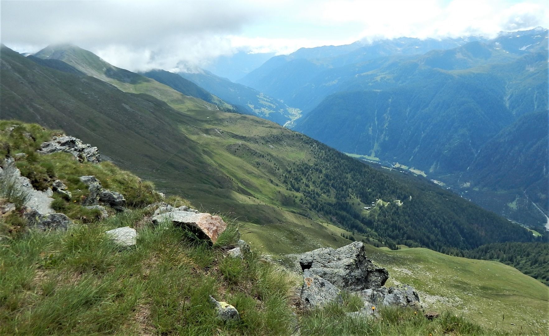
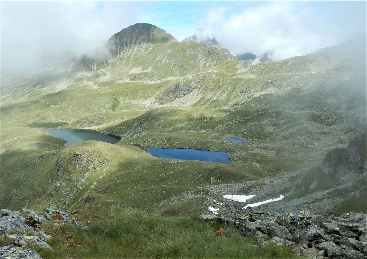
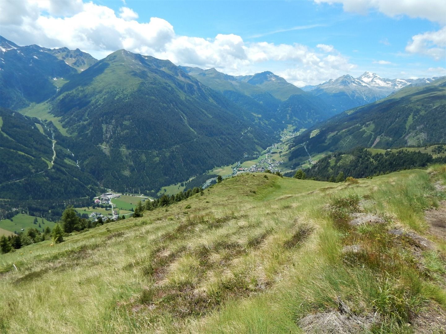
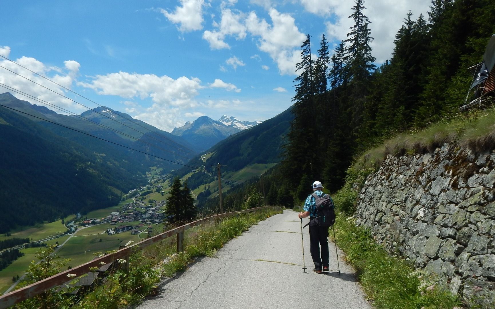
Follow path no. 316 uphill to the tree line and crossroads of paths 316 and 23A and from here take path 23A to the next yellow signpost. From here we continue on the hiking trail 20B with a panoramic crossing of the slope below the Gritzer Hörndl mountain to the lake Gritzer See. The trail then continues westwards, circling the valley on trail no. 315 below the Gasser Hörndl mountain and past the Tögischer Berg, across the Tögischer Berg meadows and the subsequent steep mountain forest down to the hamlet of Tögisch and on towards the valley until you finally reach the stage destination of St. Jakob.
Follow path no. 316 uphill to the tree line and crossroads of paths 316 and 23A and from here take path 23A to the next yellow signpost. From here we continue on the hiking trail 20B with a panoramic crossing of the slope below the Gritzer Hörndl mountain to the lake Gritzer See. The trail then continues westwards, circling the valley on trail no. 315 below the Gasser Hörndl mountain and past the Tögischer Berg, across the Tögischer Berg meadows and the subsequent steep mountain forest down to the hamlet of Tögisch and on towards the valley until you finally reach the stage destination of St. Jakob.
Pot
Pfarrkirche St. Veit
(1,493 m)
Kraj čaščenja
0.0 km
St. Veit in Defereggen
(1,495 m)
Vas
0.0 km
Alpengasthof Pichler
(1,493 m)
Restavracija
0.0 km
Gsaritzen
(1,611 m)
Soseska
0.5 km
Speikbodenhütte
(2,030 m)
Restavracija
2.7 km
Erlach
(1,599 m)
Poravnava
13.2 km
St. Jakob
(1,384 m)
Vas
14.2 km
Pot
2TälerTrail - Stage 2: From St. Veit to St. Jakob
srednja
Pohodništvo
14.34
km
Lourd-Kapelle
(1,493 m)
Kraj čaščenja
0.0 km
Pfarrkirche St. Veit
(1,493 m)
Kraj čaščenja
0.0 km
St. Veit in Defereggen
(1,495 m)
Vas
0.0 km
Alpengasthof Pichler
(1,493 m)
Restavracija
0.0 km
Gsaritzen
(1,611 m)
Soseska
0.5 km
Speikbodenhütte
(2,030 m)
Restavracija
2.7 km
Erlach
(1,599 m)
Poravnava
13.2 km
St. Jakob
(1,384 m)
Vas
14.2 km
Informacije o prihodu
Prihod
Von Huben bis in den Ortskern von St. Veit
Javni prevoz
Bushaltestelle St. Veit Dorf
Parkirišče
Direkt im Ortskern von St. Veit in Defereggen
Še ni pregledov
Priljubljeni izleti v okolici
-
4.8
NaturKraftWeg Umbalfälle
svetlobaTematska pot 5.99 km -
4.5
Circular hike Proßeggklamm
srednjaPohodništvo 8.41 km -
4.8
Stoden - Clarahütte
srednjaPohodništvo 7.12 km -
4.7
Wiesbauerspitze 2.767 m
srednjaPohodništvo 9.66 km -
4.9
Oberhausalm - Jagdhaushütte
svetlobaPohodništvo 14.0 km -
4.2
Seespitze
srednjaPohodništvo 13.7 km -
5.0
Muhs-Panoramaweg
srednjaPohodništvo 14.0 km -
4.9
Circular hike suspension bridge Isel Canyon via "Hohe Bank"
srednjaPohodništvo 8.11 km -
5.0
Kleiner Zunig, Matrei in Osttirol, Österreich Matrei in Osttirol, Österreich
srednjaPohodništvo 12.6 km -
Kreuzspitze, 2.624 m
srednjaPohodništvo 5.27 km

Pohodništvo in sledenje

Zaradi več kot 550.000 predlogov izletov, podrobnih zemljevidov in intuitivnega načrtovanja poti je aplikacija obvezna oprema za vse ljubitelje narave.

Ne zamudite ponudb in navdiha za naslednje počitnice
Naročite se na novice
Napaka
Zgodila se je napaka. Prosimo, poskusite znova.
Zahvaljujemo se vam za prijavo
Vaš e-poštni naslov je bil dodan na poštni seznam.
Izleti po vsej Evropi
Avstrija
Švica
Nemčija
Italija
Slovenija
Francija
Nizozemska
Belgija
Poljska
Lihtenštajn
Češka
Slovaška
Španija
Chorvátsko
Bosna in Hercegovina
Luksemburg
Andora
පෘතුගාලය
අයිස්ලන්තය
එක්සත් රාජධානිය
අයර්ලන්තය
ග්රීසිය
ඇල්බේනියාව
North Macedonia
Malta
Norway
Montenegro
Moldova
කොසෝවො
හන්ගේරියානු සමුහාණ්ඩුව
San Marino
රුමේනියාව
එස්ටෝනියා
ලැට්වියාව
බෙලාරස්
සයිප්රස්
Lithuania
Serbia
බල්ගේරියාව
Monaco
ඩෙන්මාර්කය
Sweden
ෆින්ලන්තය