


2 Lakes Tour - MTB fun around the Tannheimer Tal
Fotografije naših uporabnikov
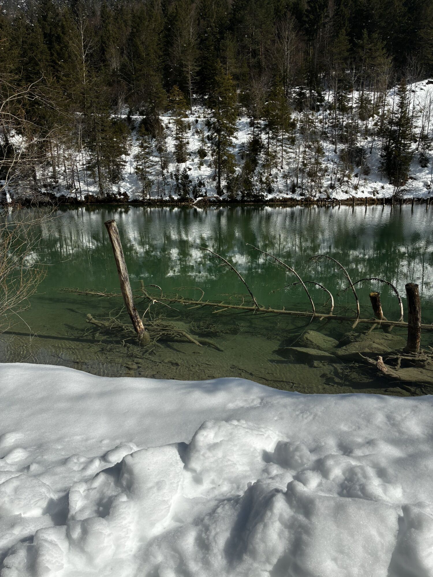
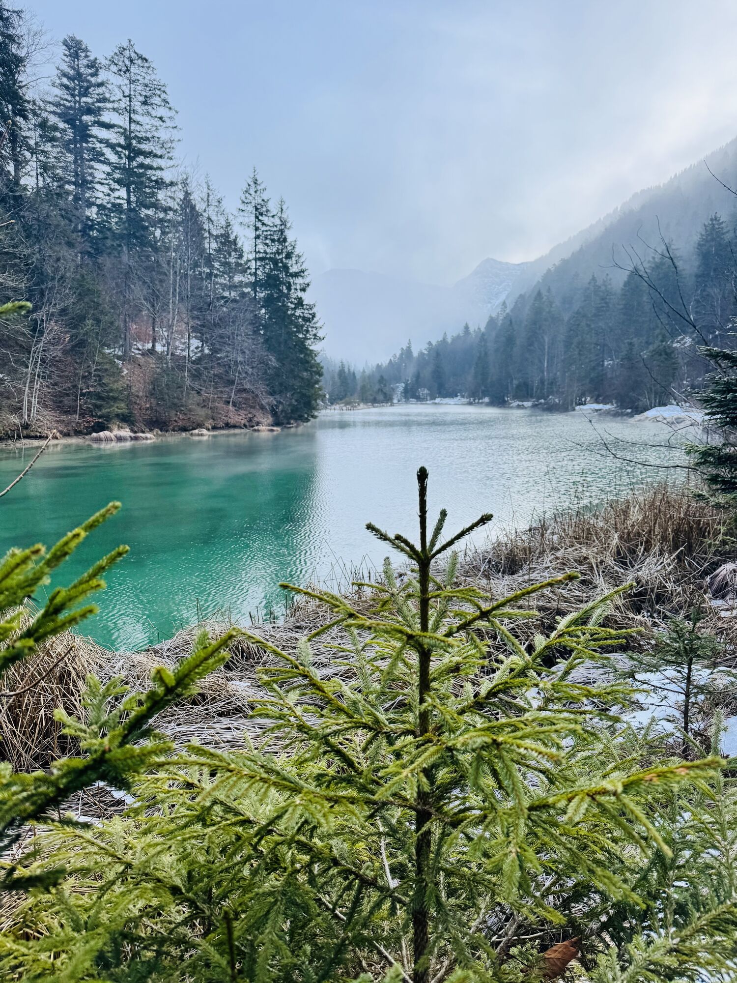
 © Osman Eren UtkuUstvarjeno na 18.04.2026
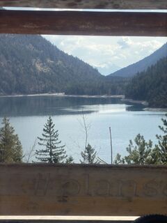 © Osman Eren UtkuUstvarjeno na 18.04.2026
 © Osman Eren UtkuUstvarjeno na 18.04.2026
 © Osman Eren UtkuUstvarjeno na 18.04.2026
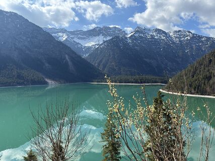 © Osman Eren UtkuUstvarjeno na 18.04.2026
 © Osman Eren UtkuUstvarjeno na 18.04.2026
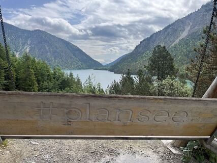
 © Robert.UnterlercherUstvarjeno na 06.06.2025
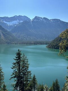
 © Ruth DurachUstvarjeno na 21.09.2024
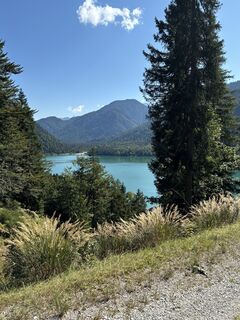 © Ruth DurachUstvarjeno na 21.09.2024
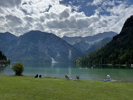
 © ms73Ustvarjeno na 12.08.2023
 © ms73Ustvarjeno na 12.08.2023
 © lotharkoernerUstvarjeno na 09.06.2023
 © lotharkoernerUstvarjeno na 09.06.2023
 © lotharkoernerUstvarjeno na 09.06.2023
 © Robert.UnterlercherUstvarjeno na 21.06.2021
 © Robert.UnterlercherUstvarjeno na 21.06.2021
 © Fiona BerghöferUstvarjeno na 04.04.2023
 © Chriz LudwigUstvarjeno na 25.04.2026
 © Chriz LudwigUstvarjeno na 25.04.2026
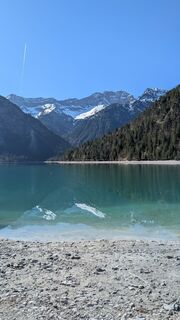 © Chriz LudwigUstvarjeno na 25.04.2026
 © charlène baillesUstvarjeno na 03.04.2026
 © charlène baillesUstvarjeno na 03.04.2026
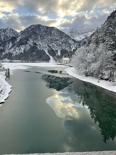 © EmiliobiglerUstvarjeno na 08.01.2026
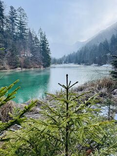 © NaJaUstvarjeno na 23.12.2025
 © Benjamin LöfflerUstvarjeno na 23.07.2025
 © Benjamin LöfflerUstvarjeno na 23.07.2025
 © Benjamin LöfflerUstvarjeno na 23.07.2025
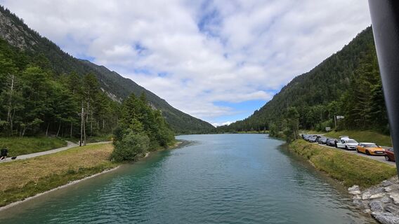 © Benjamin LöfflerUstvarjeno na 23.07.2025
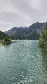 © Benjamin LöfflerUstvarjeno na 23.07.2025
 © Eszter KajtarUstvarjeno na 31.05.2025
 © Sven KrieblinUstvarjeno na 29.12.2024
 © Sven KrieblinUstvarjeno na 29.12.2024
 © Sven KrieblinUstvarjeno na 29.12.2024
 © Sven KrieblinUstvarjeno na 29.12.2024
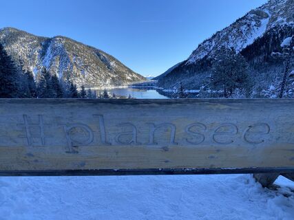 © Sven KrieblinUstvarjeno na 29.12.2024
 © Sven KrieblinUstvarjeno na 29.12.2024
 © Sven KrieblinUstvarjeno na 29.12.2024
 © Sven KrieblinUstvarjeno na 29.12.2024
 © Sven KrieblinUstvarjeno na 29.12.2024
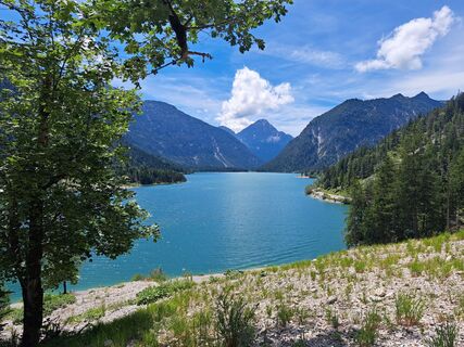
 © Sabine KrohnUstvarjeno na 05.07.2024
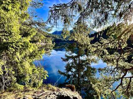
 © Les aventures de GhislainUstvarjeno na 30.12.2023
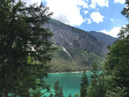
 © YukonmanUstvarjeno na 26.05.2022
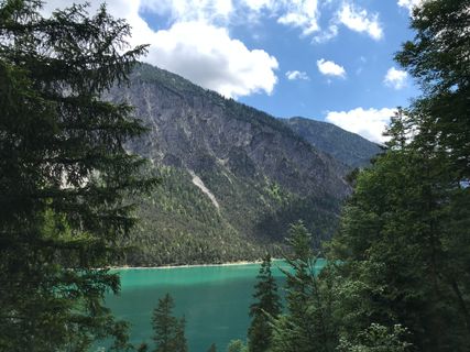 © YukonmanUstvarjeno na 26.05.2022

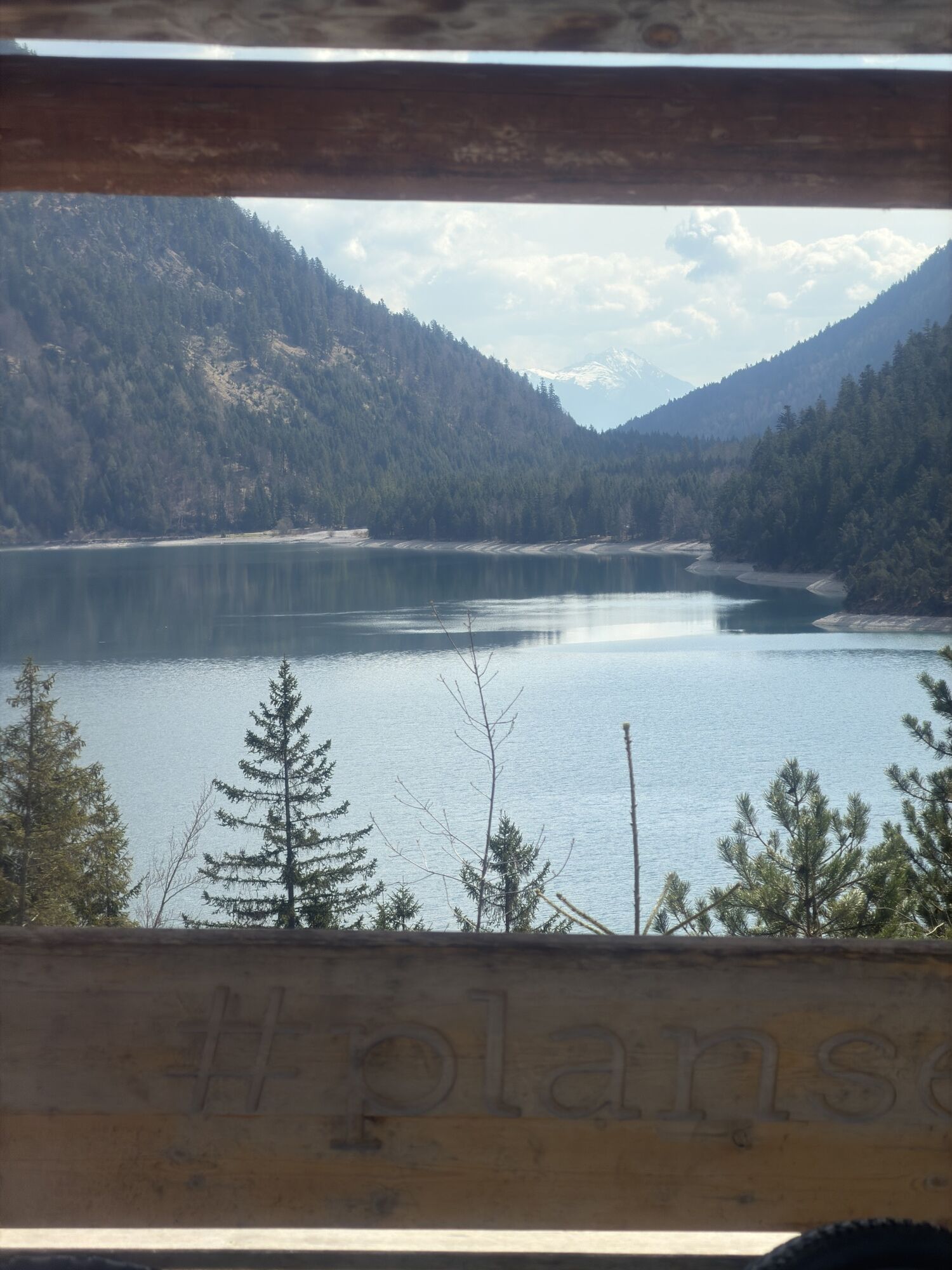
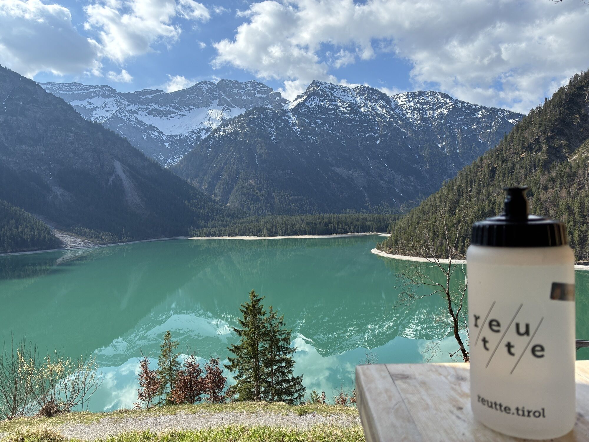
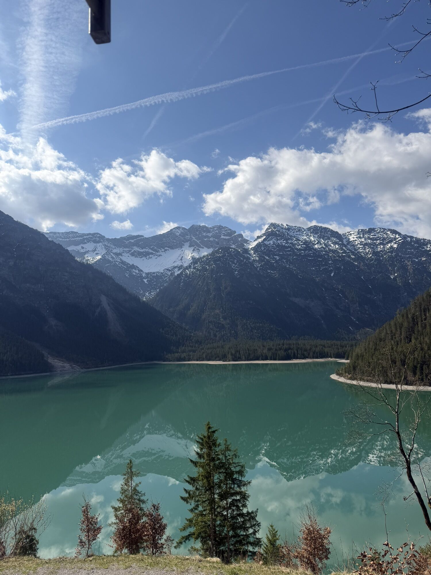
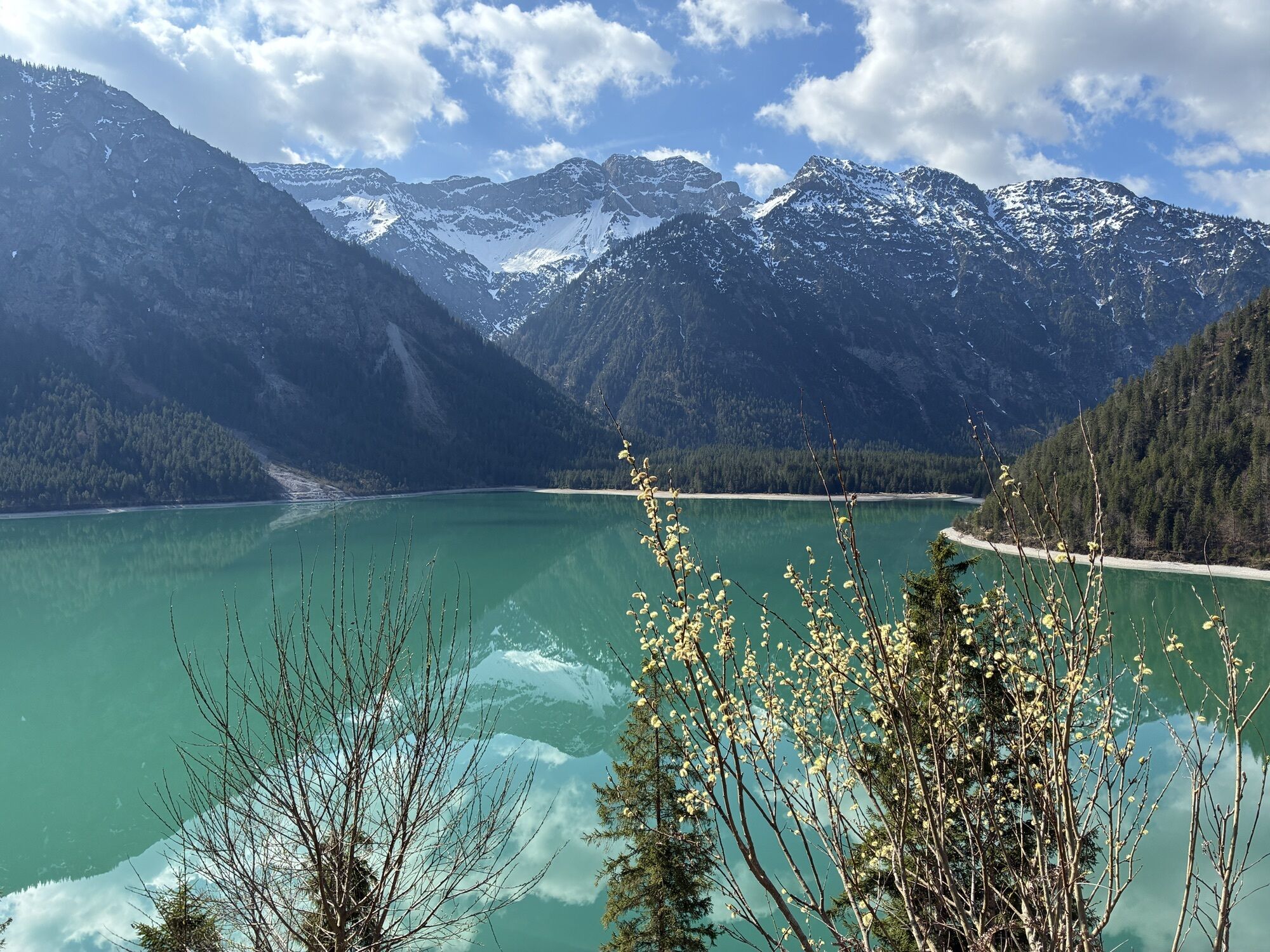
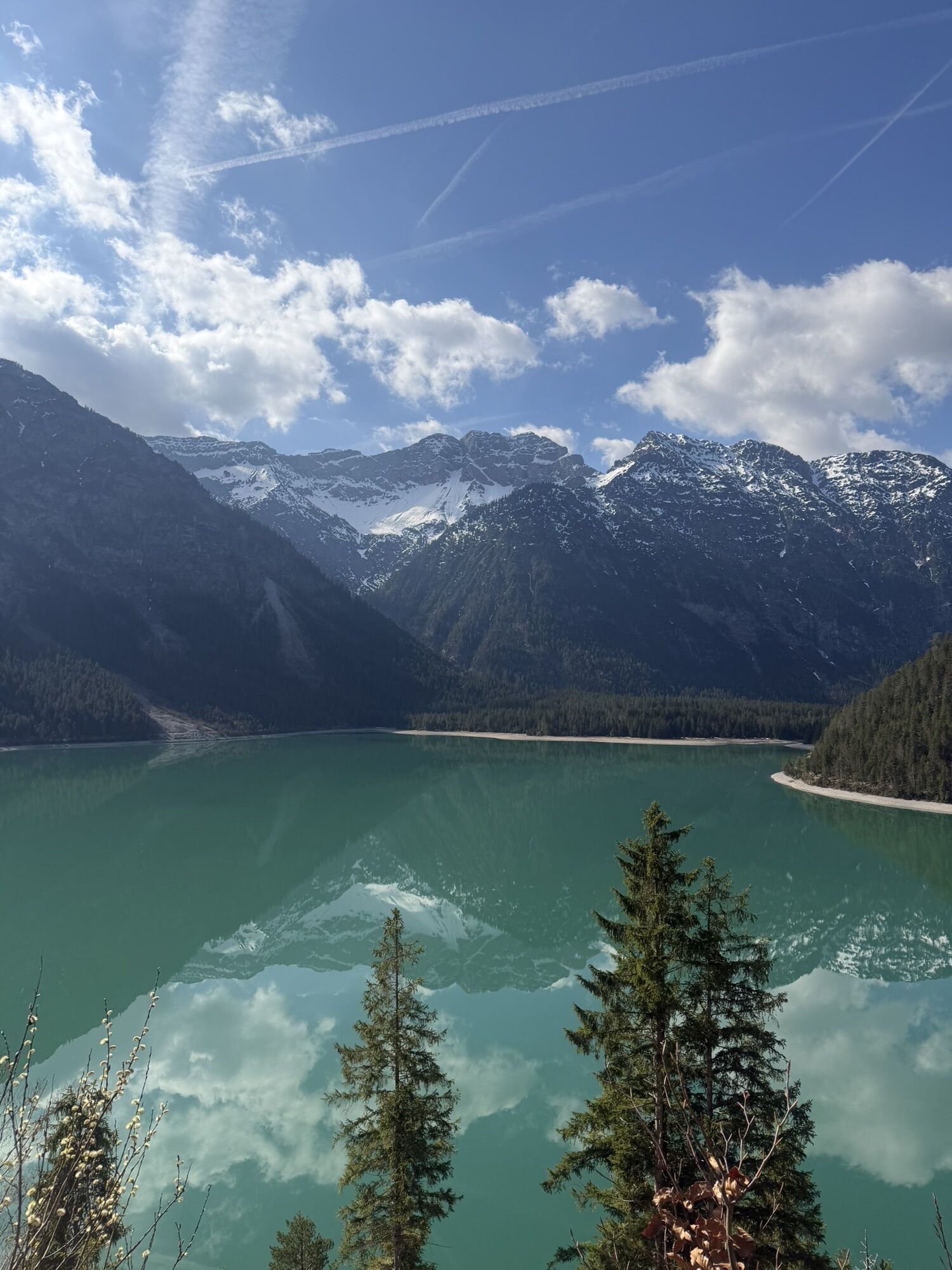


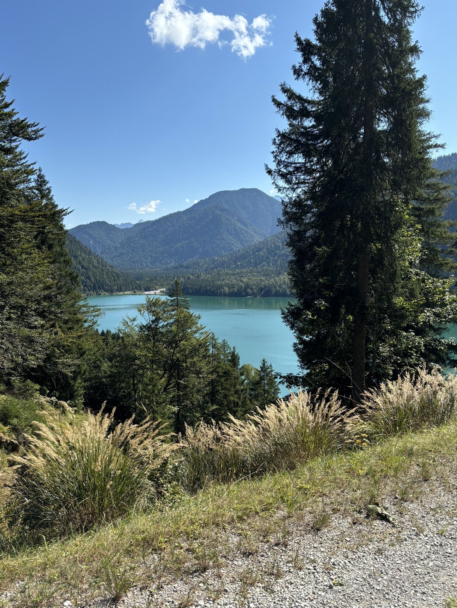

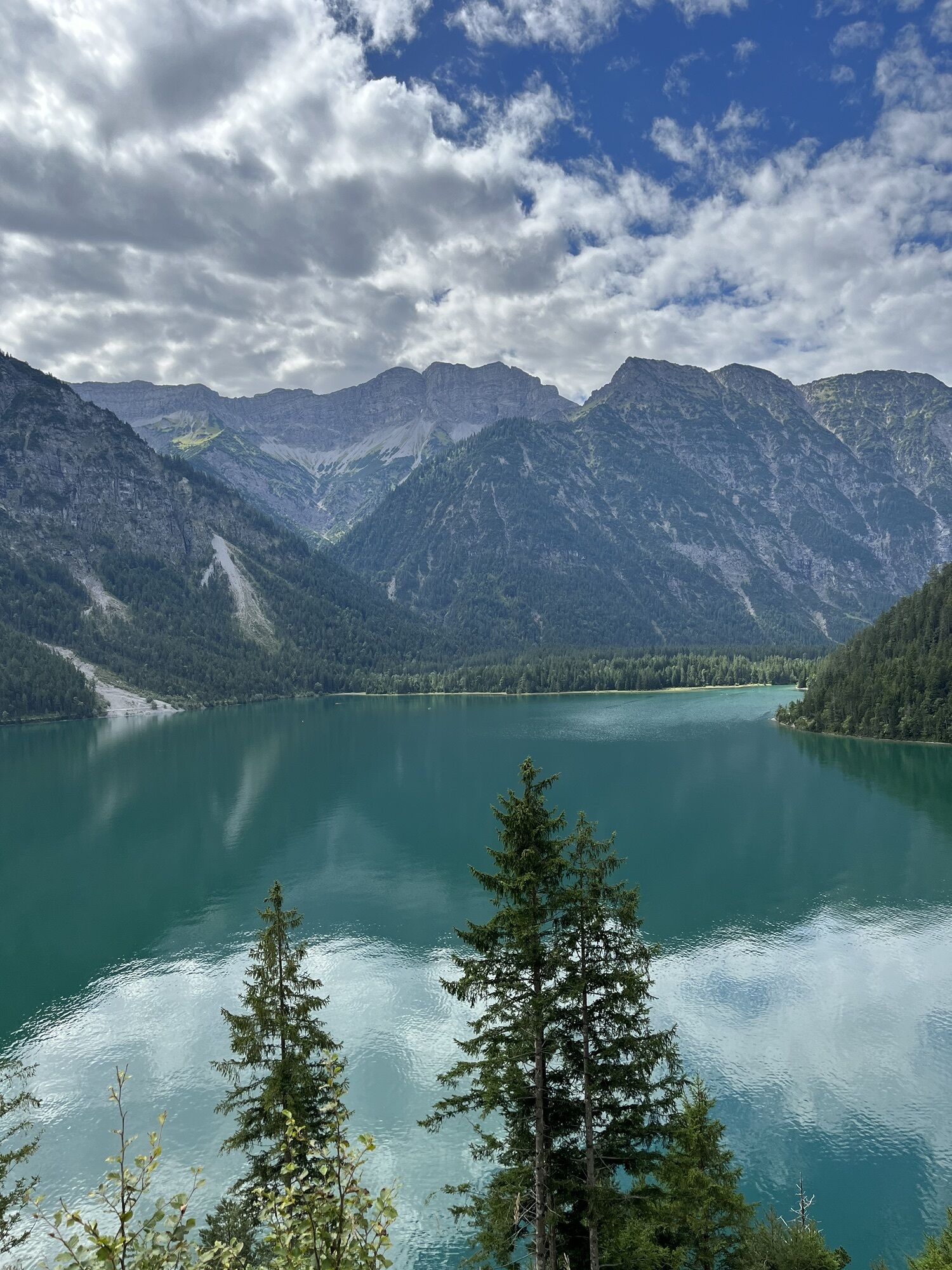
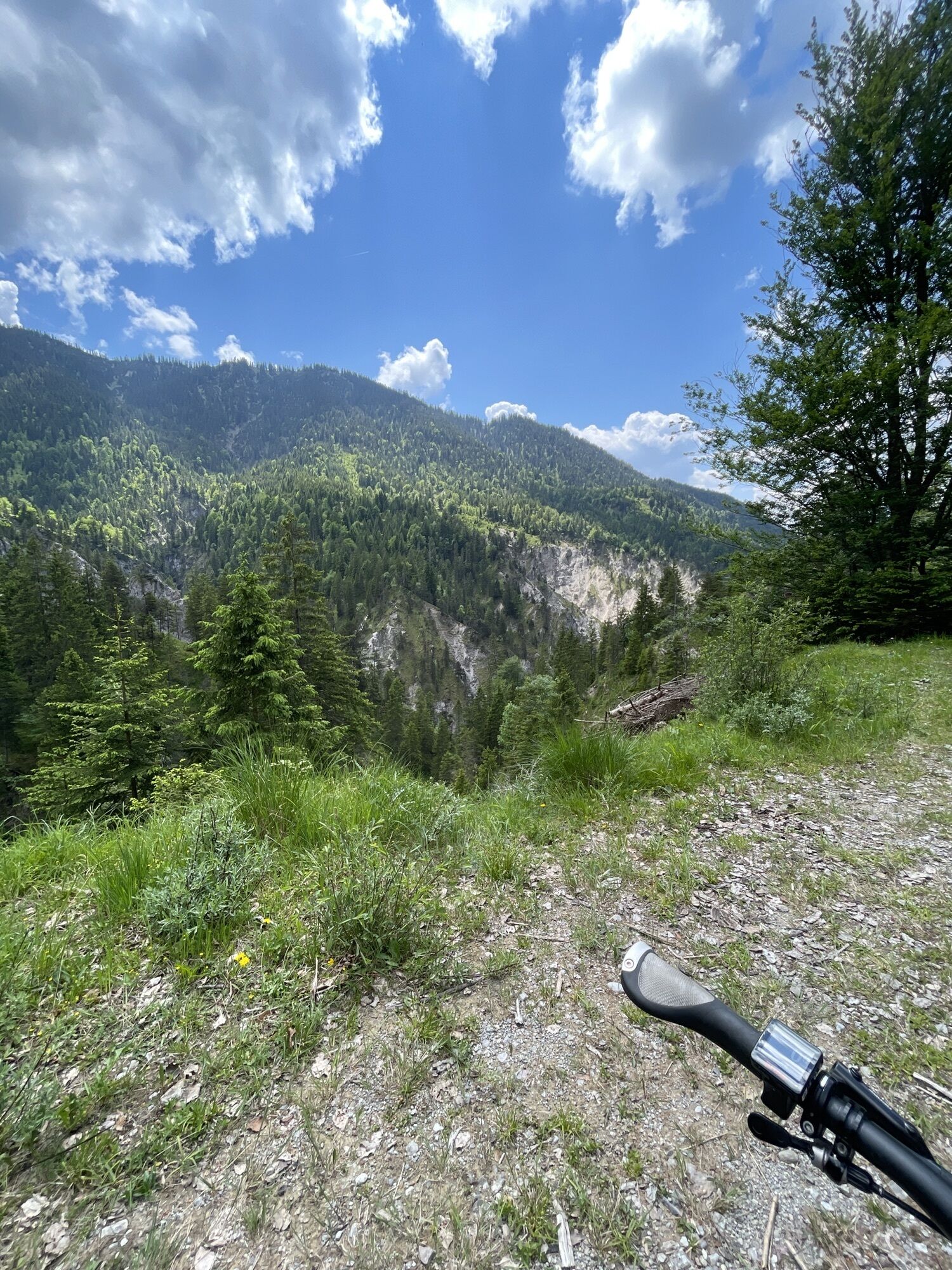
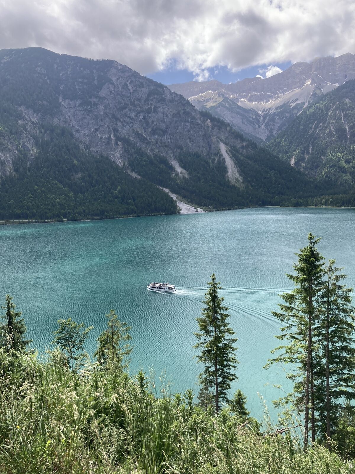
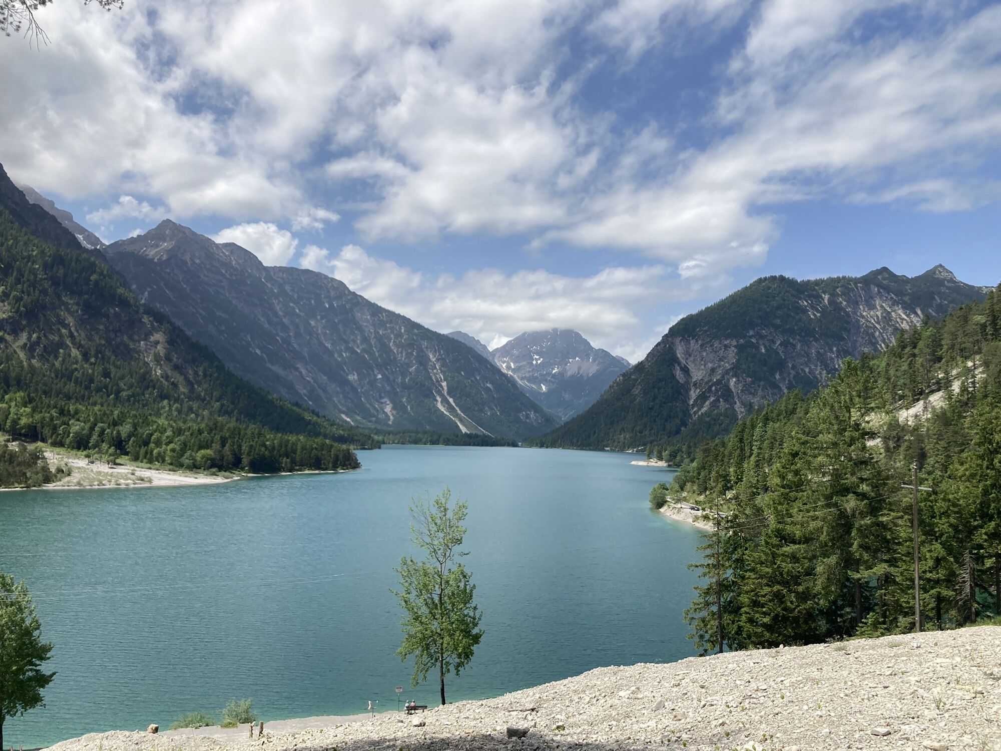
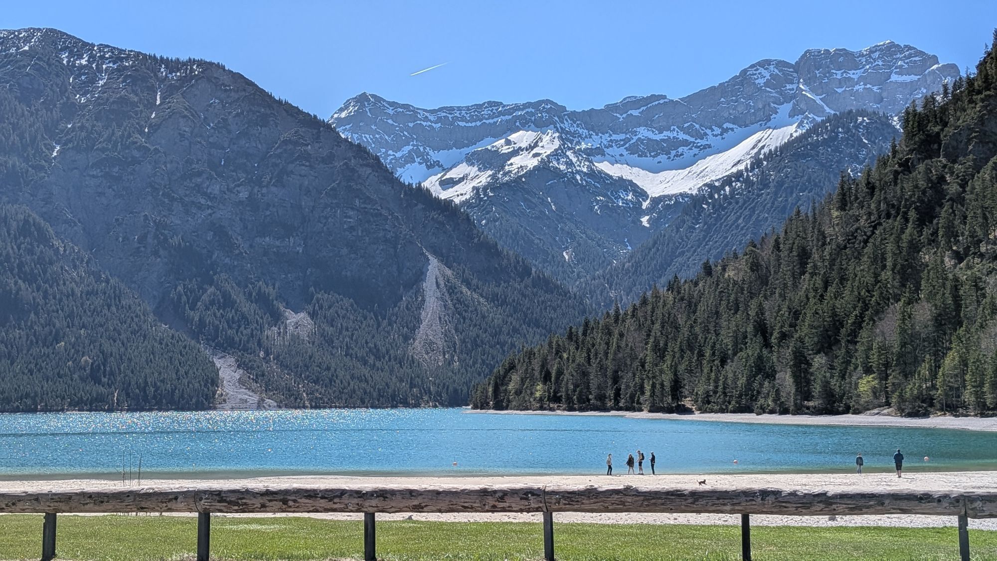
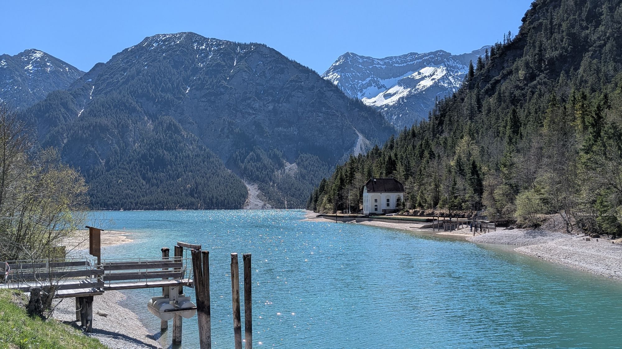
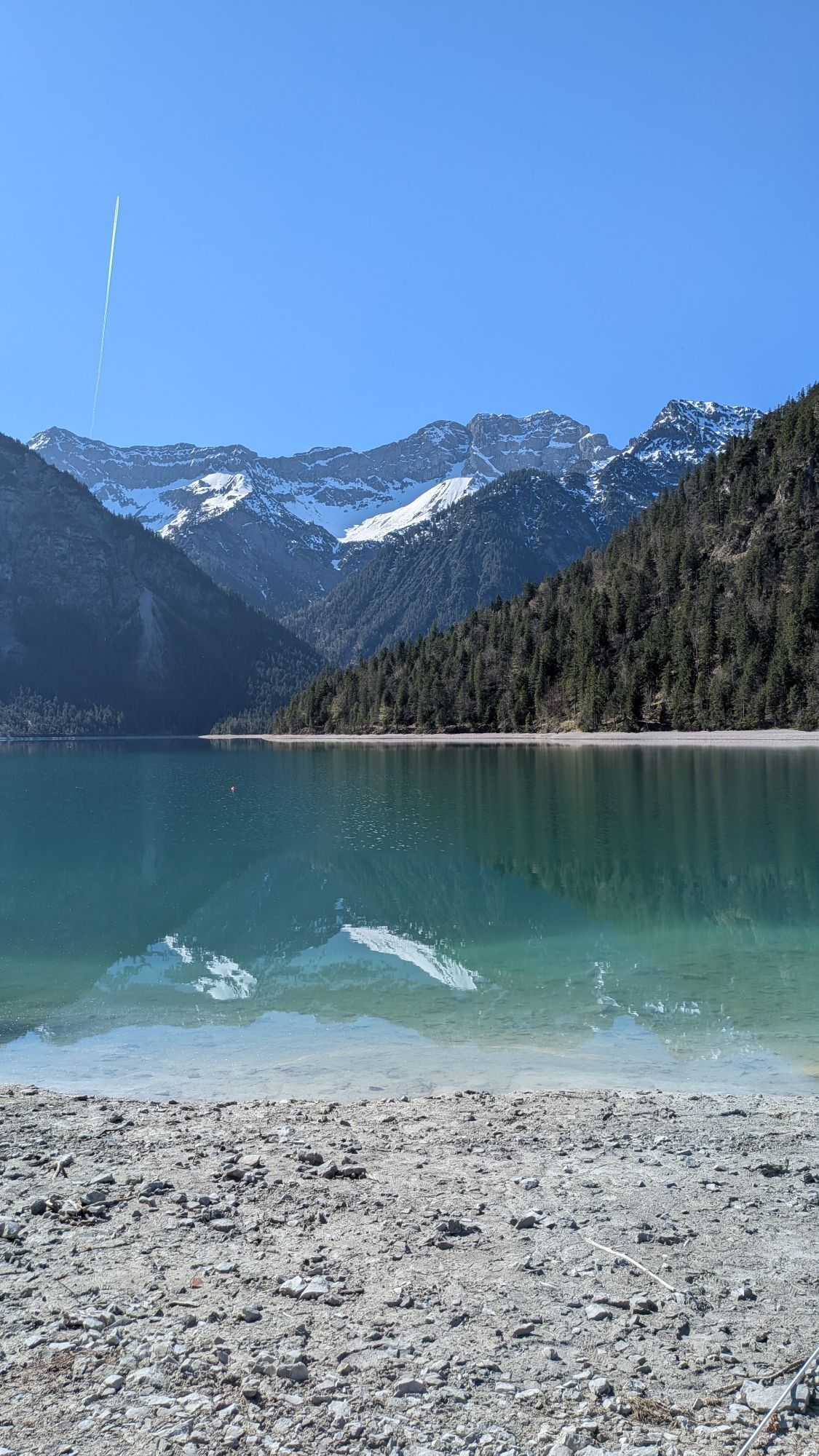


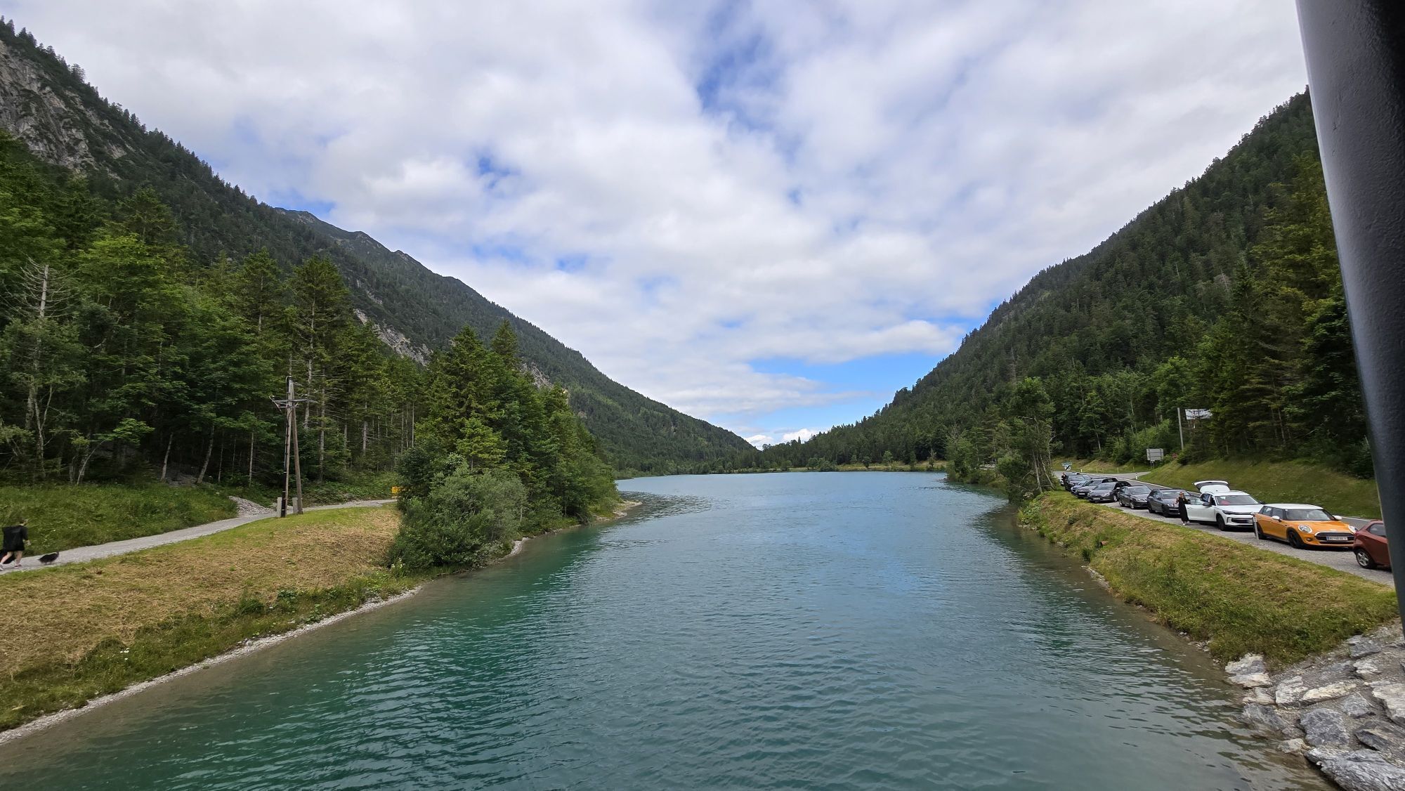
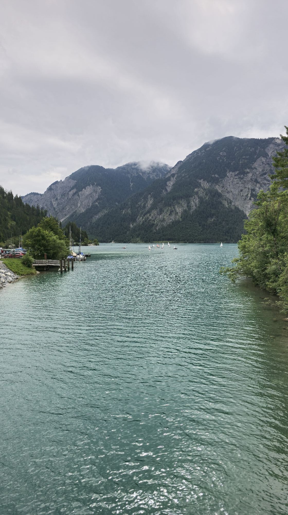
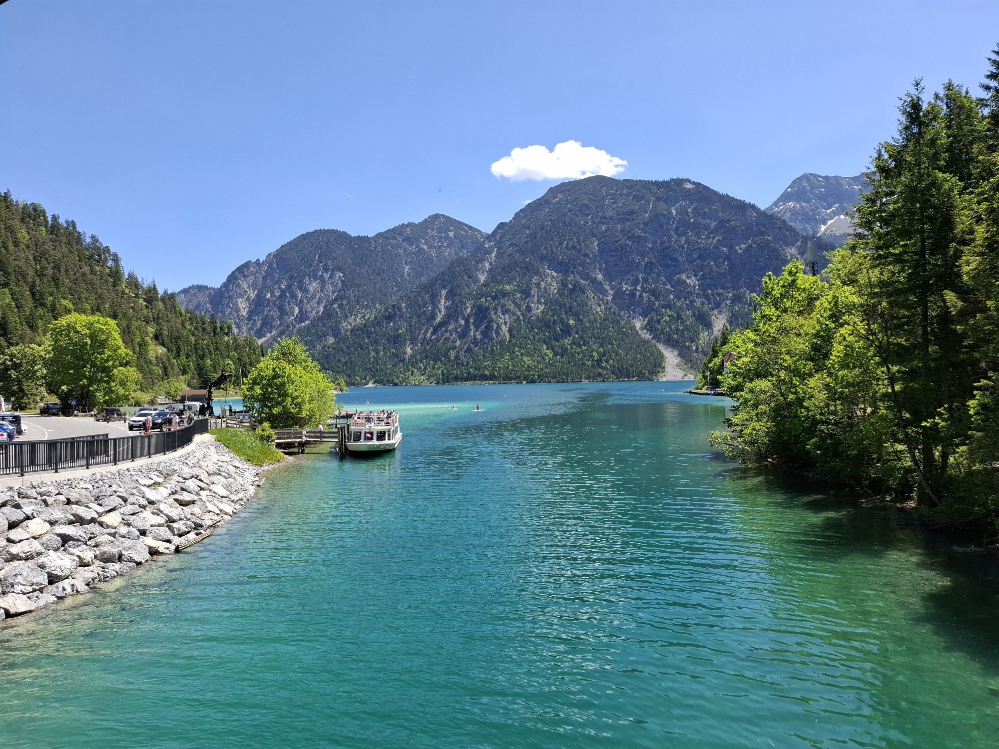
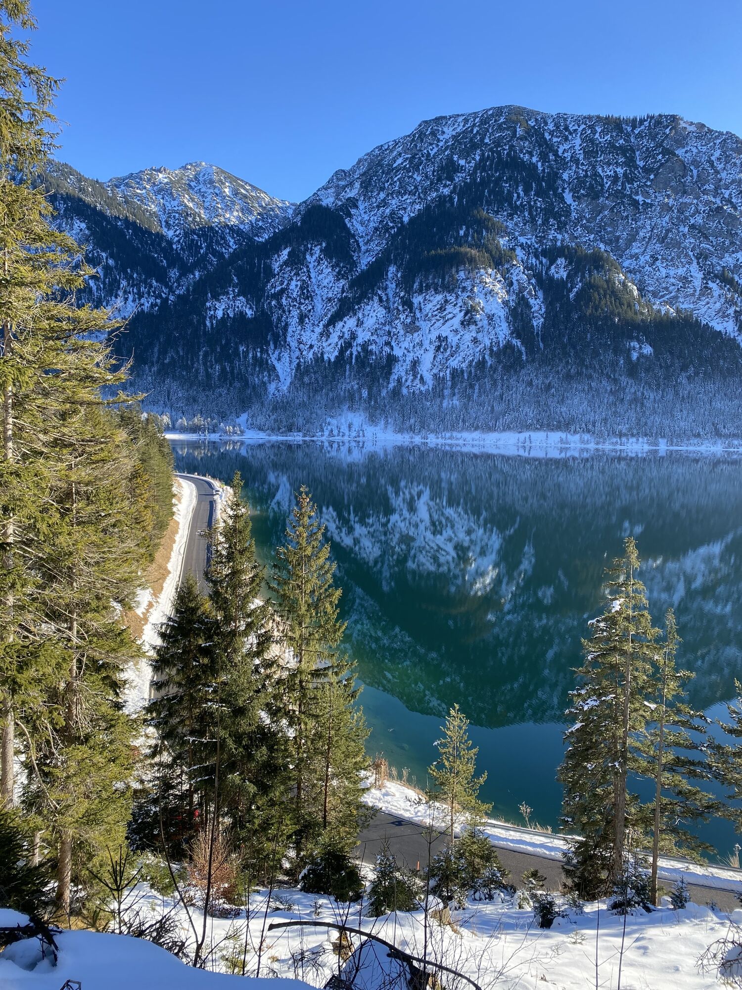


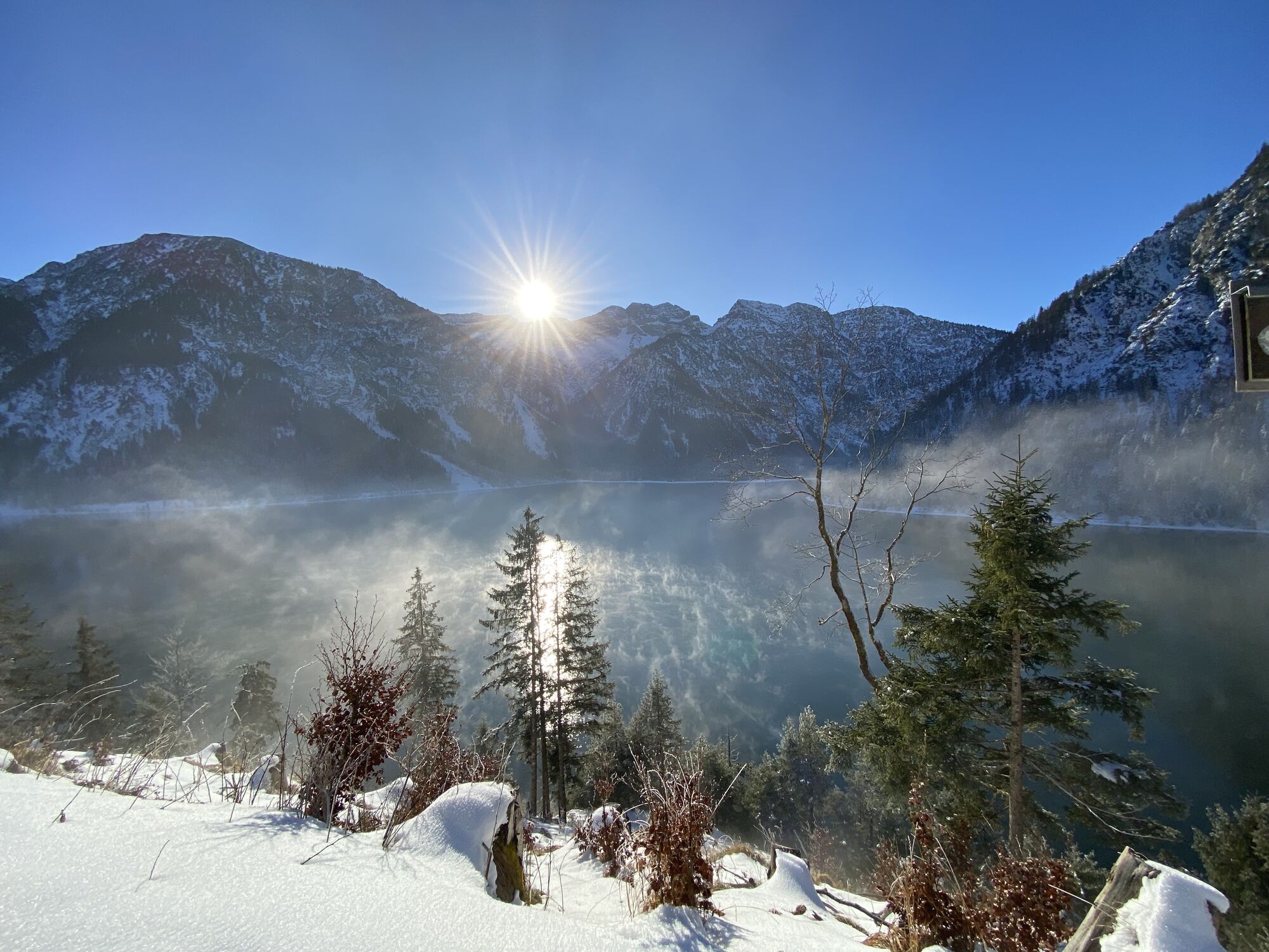


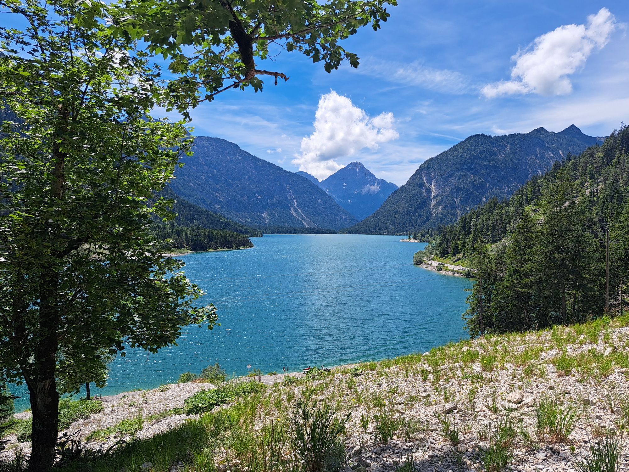

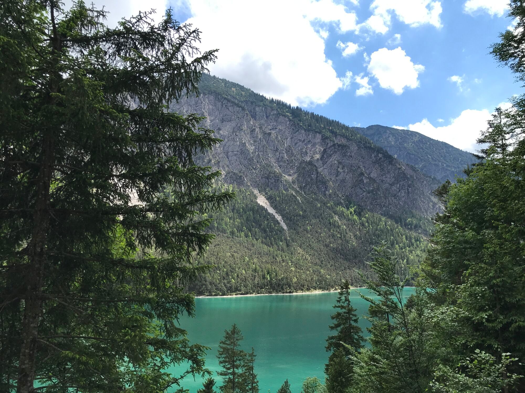
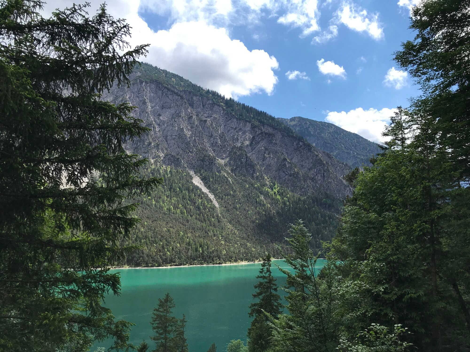
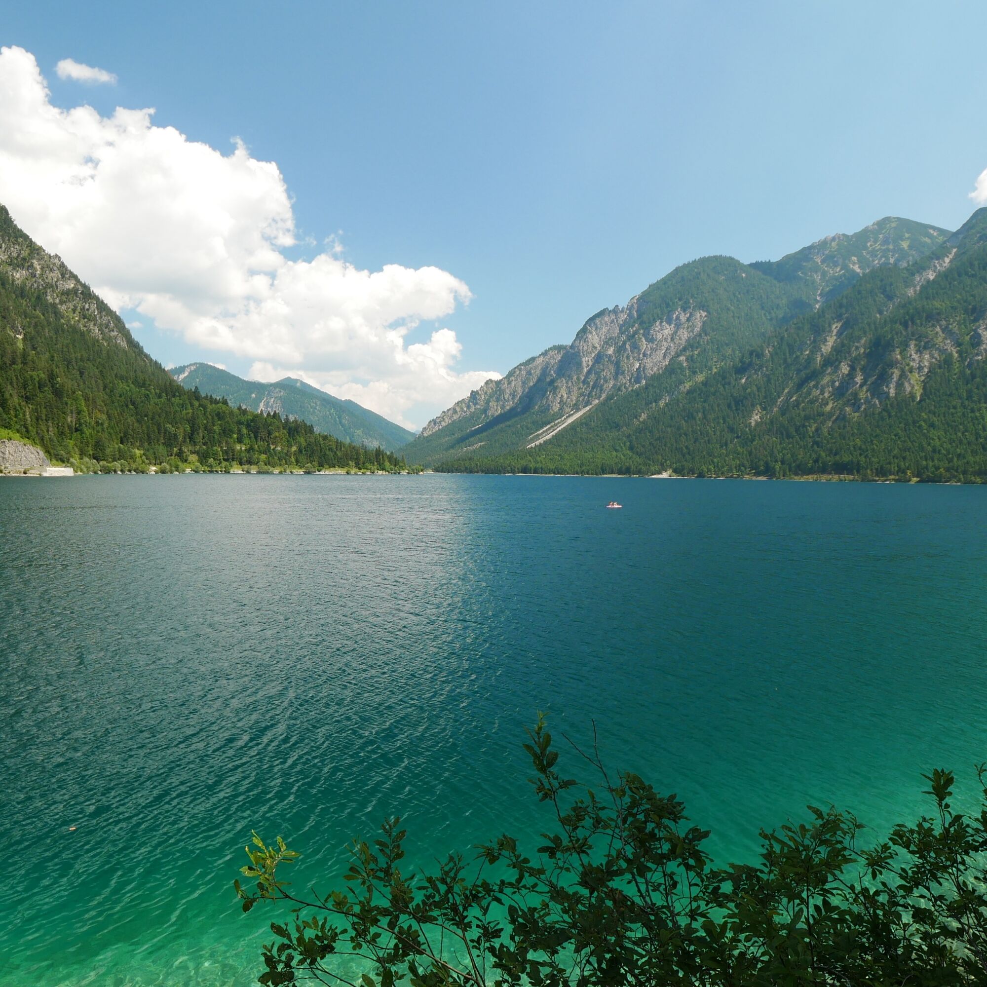
You start the tour directly at the Urisee lake in Reutte. The first part is quite an ascent. At the top, you are treated to a beautiful panorama of the Urisee and Reutte. This is followed by a short pushing...
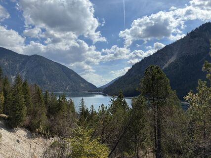
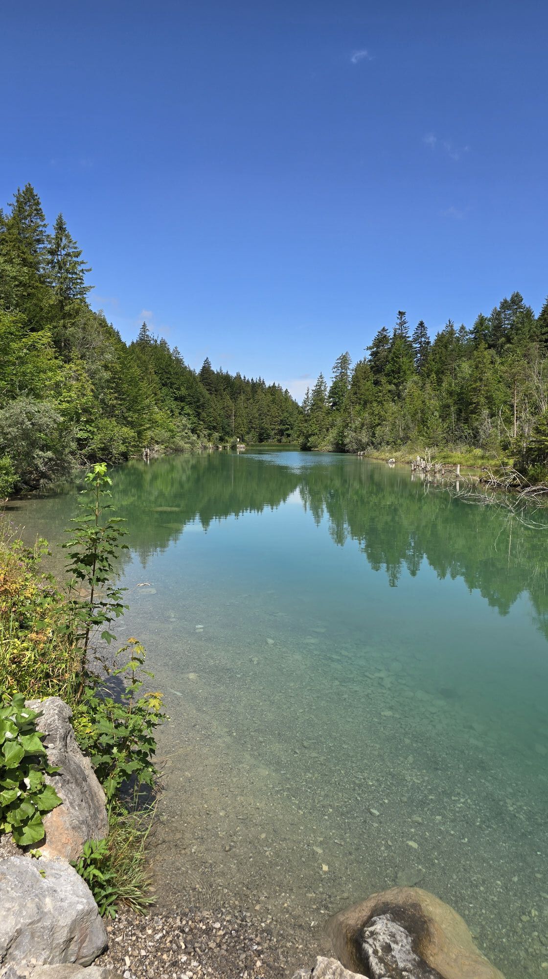
You start the tour directly at the Urisee lake in Reutte. The first part is quite an ascent. At the top, you are treated to a beautiful panorama of the Urisee and Reutte. This is followed by a short pushing section, and after you have conquered another ascent, a seemingly endless, flowing descent follows. After a bend, the forest clears and you get your first glimpse of the Plansee lake, followed by a fabulous section on the high trail above the Plansee lake, parallel to its shore. Slightly elevated, you enjoy ever-changing views of the turquoise-green water and the tour ends after another descent in Reutte at the Urisee. It is so clear that you feel like you are in the Caribbean, but with an Alpine panorama. There is a beach bar on the northern shore where you can park your bike and then plunge into the water.

Es geht erstmal ordentlich bergauf. Oben eröffnet sich dir schonmal ein schönes Panorama über den Urisee und Reutte. Danach folgt eine kurze Schiebepassage.Nachdem du eine weitere Steigung überwunden hast, folgt eine schier endlose, flowige Abfahrt. Nach einer Kurve lichtet sich der Wald und du kannst einen ersten Blick auf den Plansee werfen.Es folgt eine fabelhafte Strecke auf dem Höhenweg über dem Plansee, parallel zu seinem Ufer. Leicht erhöht genießt du immer wechselnde Blicke auf das türkisgrüne Wasser.Die Tour endet nach einer erneuten Abfahrt in Reutte am Urisee. Er ist so klar, dass du dich wie in der Karibik fühlst, nur eben mit Alpenpanorama. Am Nordufer befindet sich eine Strandbar, wo du dein Rad abstellen kannst, um dich anschließend in die Fluten zu stürzen.
Personal equipment must be safe and fit for purpose and meet the relevant technical standards. Every mountain biker is recommended to inform themselves about the planned tours in specialist literature or on site. Complete mountain bike equipment is strongly recommended even for experienced mountain bikers!
It should be noted that there is an increased risk of accidents and injuries in mountain biking. Despite careful tour planning, there is always a basic risk. Tour preparation through endurance sports, appropriate technical training and advanced training as well as personal prudence reduce the risk of accidents and risks. However, please never forget that the weather in the mountains can change very quickly. In Austria, mountain biking is generally prohibited by law on all forest and hiking trails, with the exception of mountain bike trails expressly approved for this purpose. The entrances to forest roads are sometimes marked with no-cycling signs and additional information such as "No cycling". Hiking trails do not have these prohibition signs, but it is still forbidden to ride on them.
Spletne kamere s turneje
Priljubljeni izleti v okolici
- 4,8
Thaneller
srednjaPohodništvo 4,90 km - 4,8
Around Weißensee
svetlobaPohodništvo 6,12 km - 4,1
Drehhütte
svetlobaPohodništvo 3,34 km - 4,7
Yellow Wall Trail, Tegelberg (A)
srednjaVia ferrata 3,65 km - 4,5
Circular hike Dreh- and Rohrkopfhütte
svetlobaPohodništvo 8,76 km - 4,2
Cultural trail Schutzengelweg
srednjaPohodništvo 5,13 km - 3,6
Rundwanderung Plansee
srednjaPohodništvo 9,80 km - 4,9
Tegelberg | Branderschrofen | Neuschwanstein
srednjaPohodništvo 14,8 km - 4,5
Schönjöchl am Plansee
srednjaPohodništvo 7,21 km - 4,5
Rundwanderweg um den Eibsee
svetlobaPohodništvo 6,89 km

Pohodništvo in sledenje


Ne zamudite ponudb in navdiha za naslednje počitnice
Vaš e-poštni naslov je bil dodan na poštni seznam.