Alpe Cava Route
Pohodništvo
Navigacija po spletni strani
Navigacija po spletni strani
Pridobite to turo v svoj mobilni telefon
Alpe Cava Route
Pohodništvo
21.64
km
Skenirajte kodo QR in začnite navigacijo v aplikaciji bergfex.

Pohodništvo in sledenje


Alpe Cava Route
Pohodništvo
Razdalja
21.64
km
Trajanje
09:00
h
Ascent
1,847
hm
Morska gladina
303 -
2,246
m
Prenos skladbe
Alpe Cava Route
Pohodništvo
21.64
km
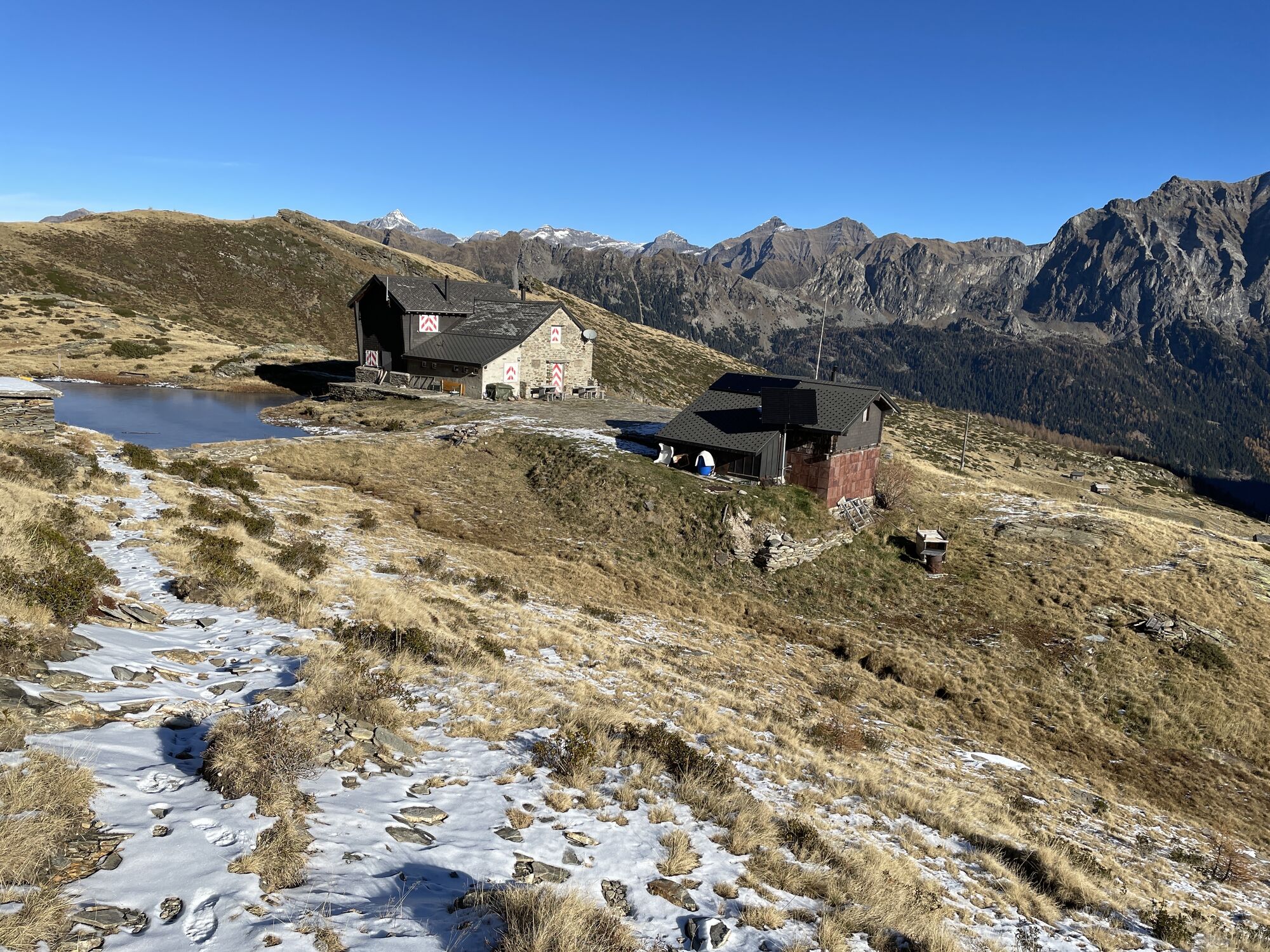
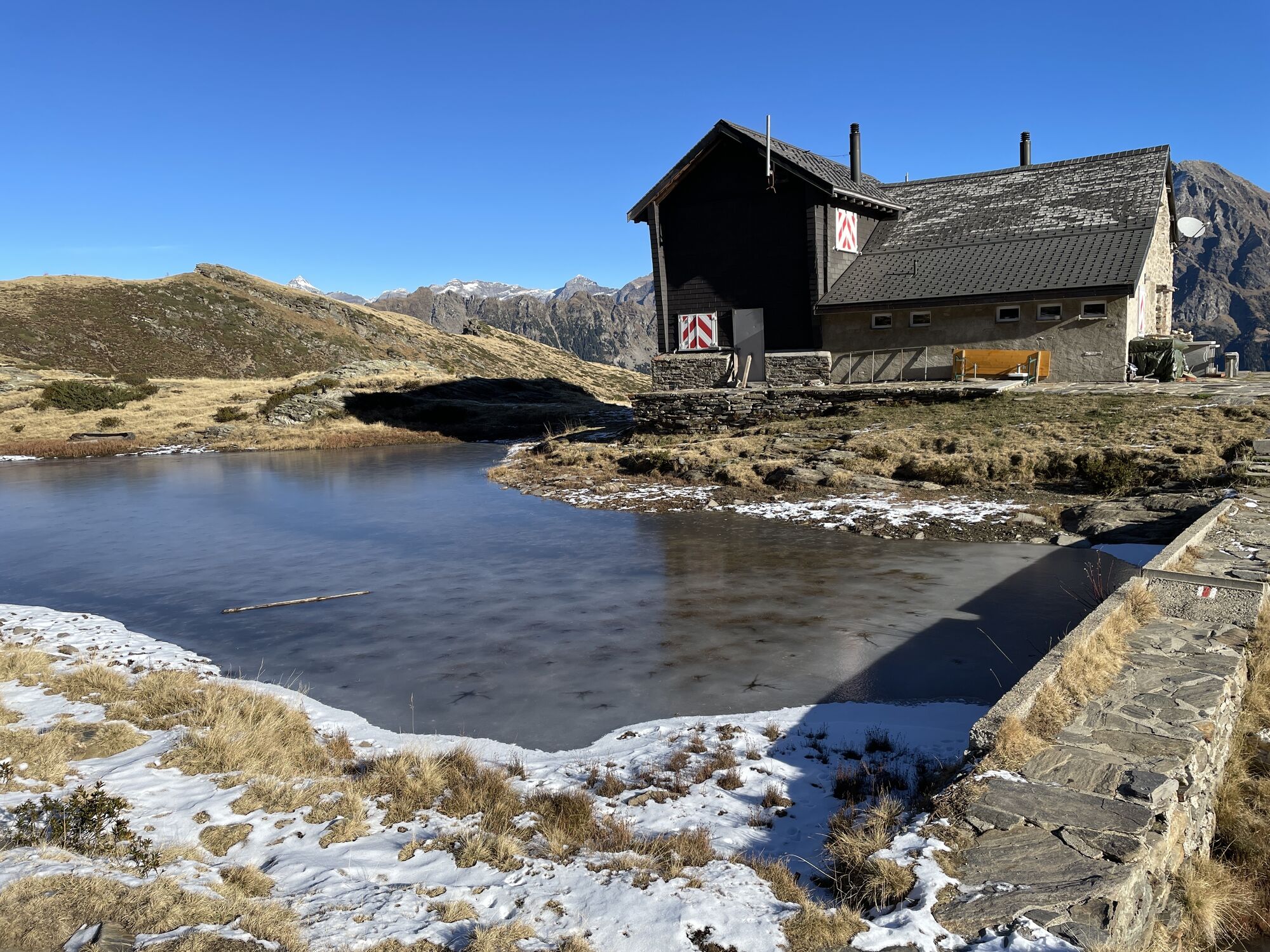
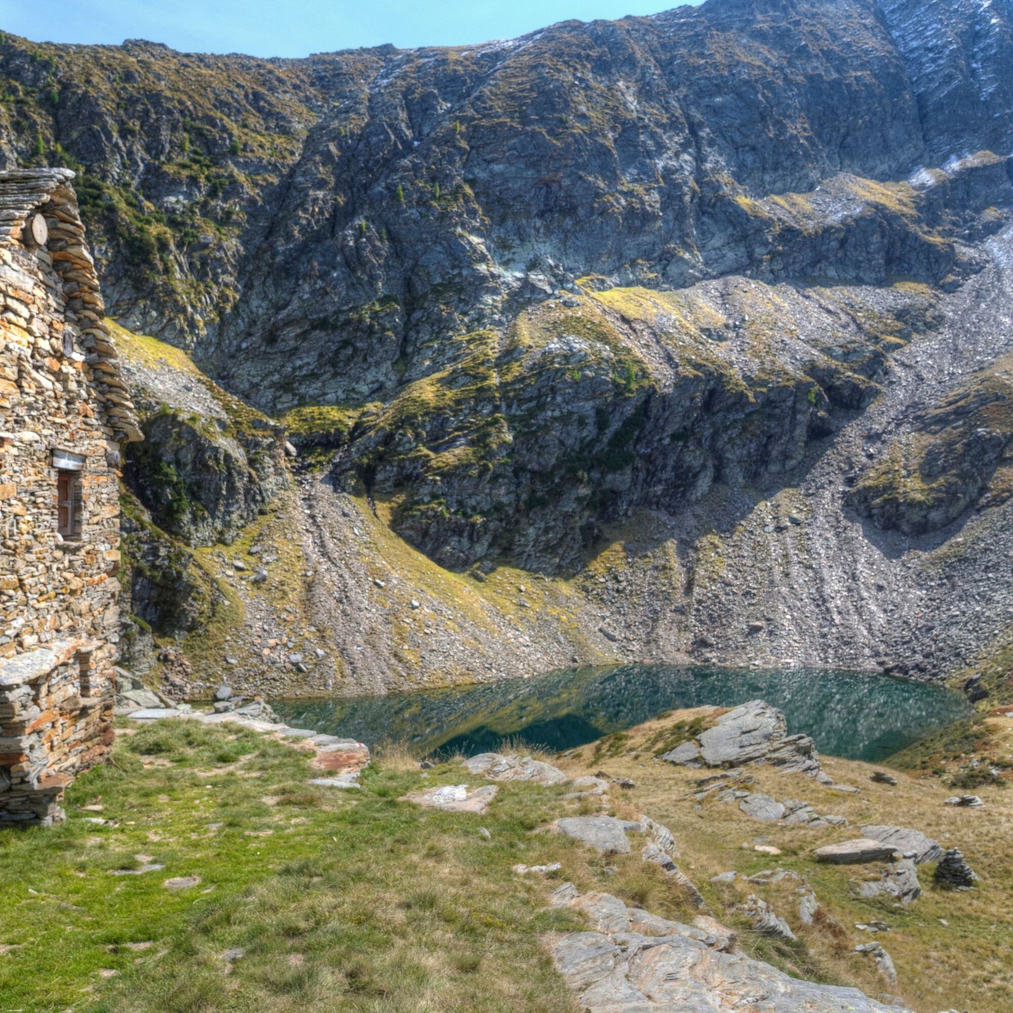
On the second day of the excursion, after spending the night at the Cava hut and admiring the splendid alpine lakes on the alp, you continue towards the Forcarella di Lago, which at 2,260 metres above...
Opis
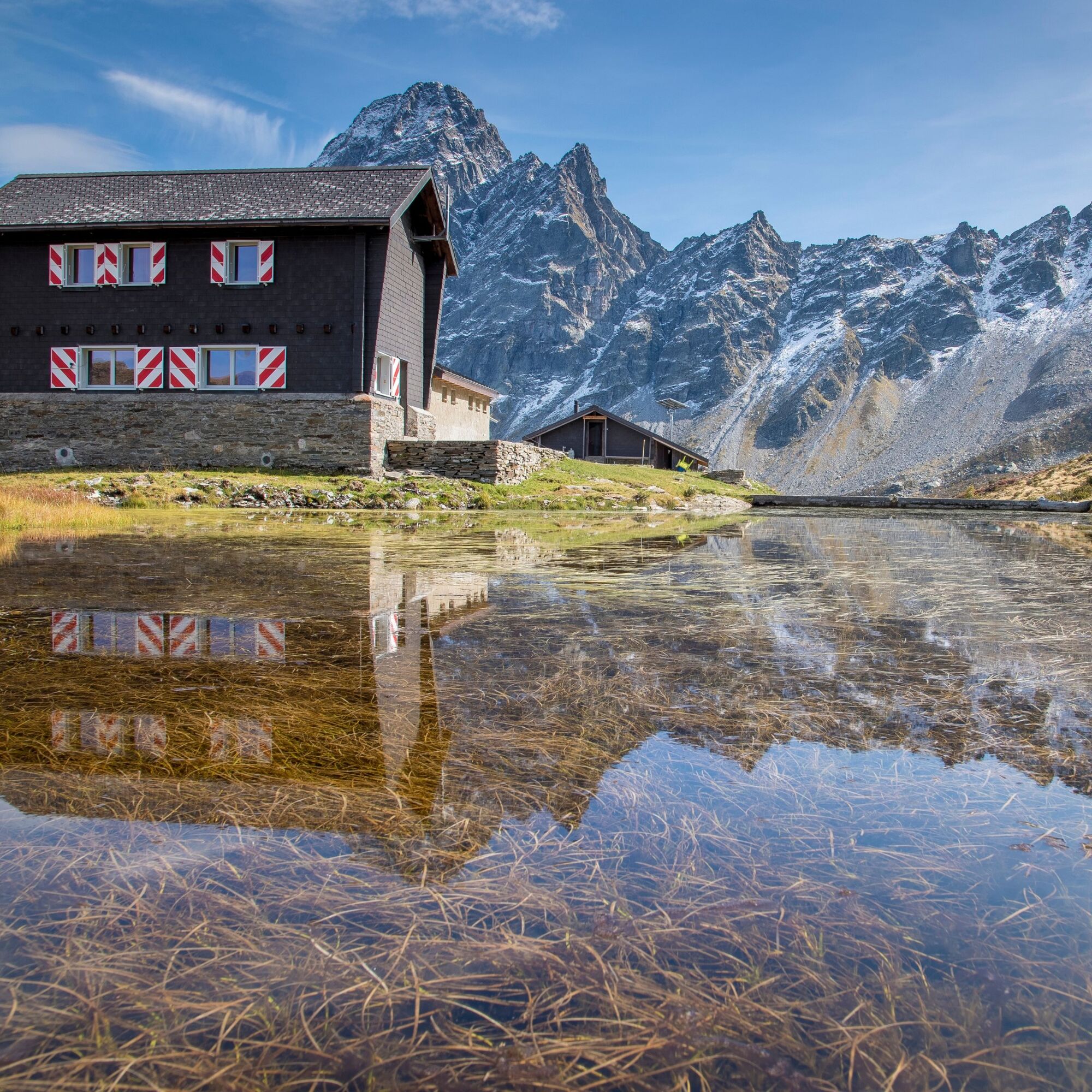
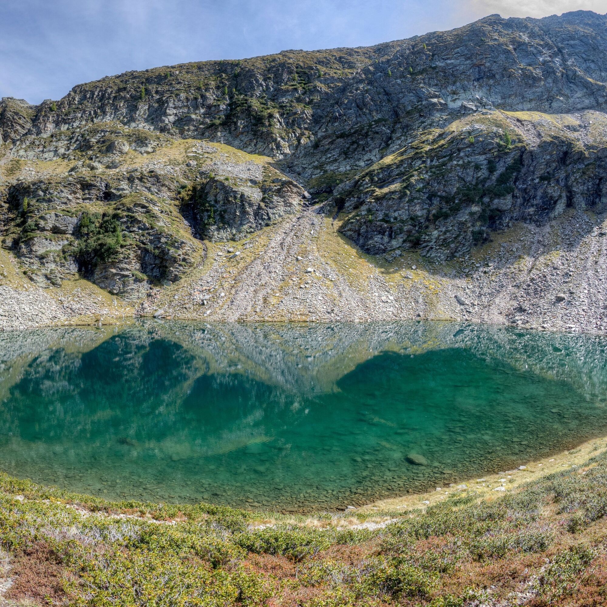
On the second day of the excursion, after spending the night at the Cava hut and admiring the splendid alpine lakes on the alp, you continue towards the Forcarella di Lago, which at 2,260 metres above sea level is the highest point of the excursion. Then descend to the Alpe di Lago to discover a charming lake of the same name, along with a shelter managed by the Patriziato
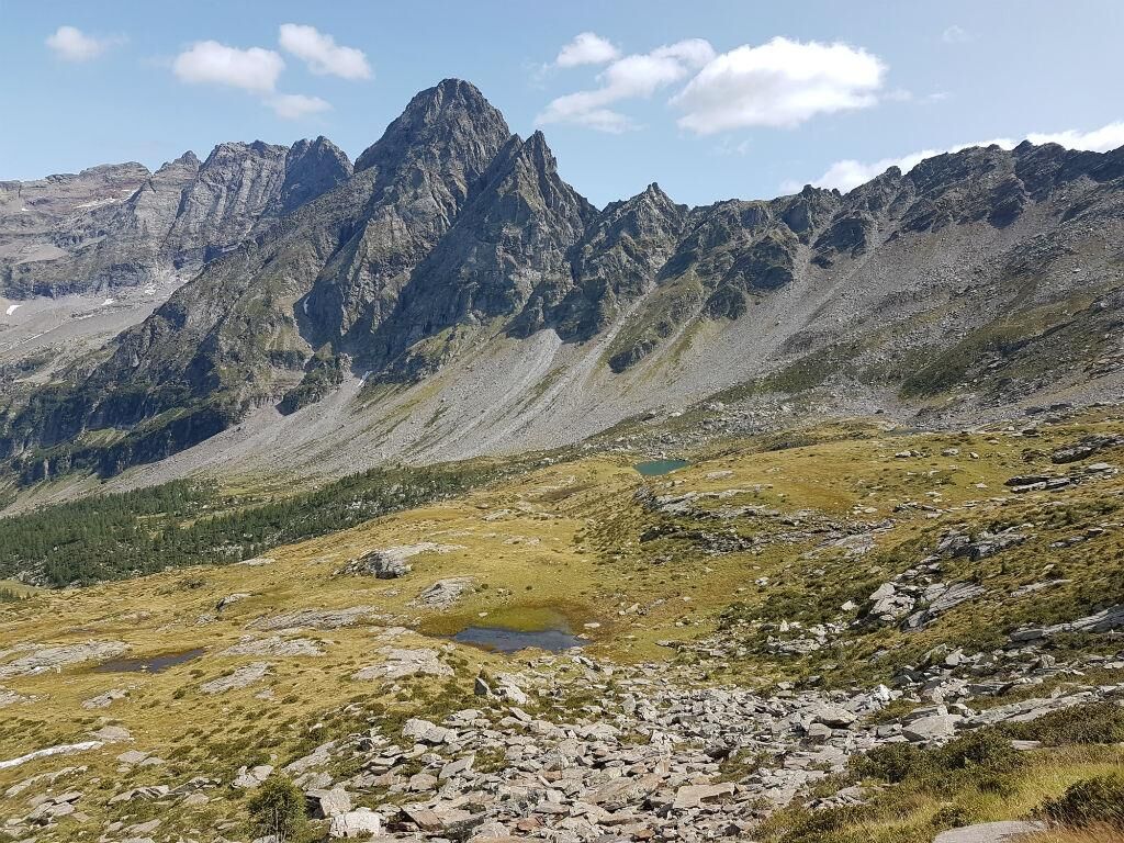
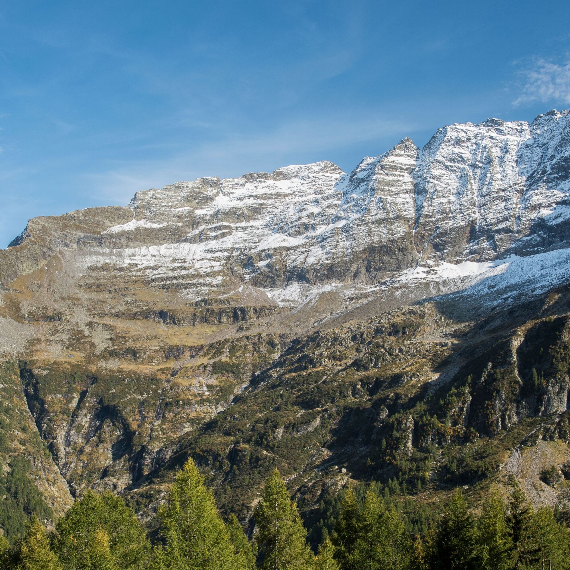
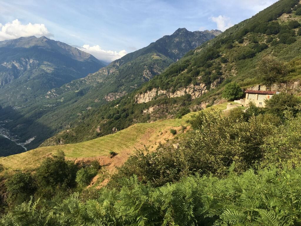
The trail descends to Alpe Pontima, after crossing the stream along the right bank of the valley. The descent continues to Alpe Compiett where, in addition to a Patrician-owned hut, a number of traditional rustic cabins are surrounded by alpine flora. Continue the descent along the Valle Santa Petronilla, which gives its name to the waterfall that cascades down over Biasca, to arrive at Mount Pieisgèra, a true panoramic balcony overlooking Biasca and the Three Valleys.
The final stretch is a trail of steps leading to Mount Fración from where to reach the junction of Fración di sotto, the starting point of the route.
Pot
Biasca
(301 m)
Vas
0.0 km
Chiesa di San Carlo Borromeo
(310 m)
Kraj čaščenja
0.0 km
Alpe di Sprügh
(2,086 m)
Koridor/teren
9.4 km
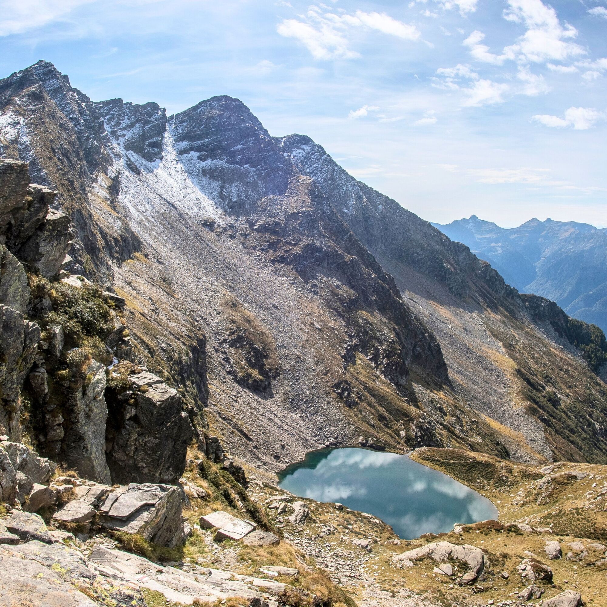
Forcella di Lago
(2,256 m)
Gorsko sedlo
10.0 km
Forcarella di Cava
(2,090 m)
Gorsko sedlo
11.2 km
Svallo
(1,381 m)
Koridor/teren
15.2 km
Chiesa di San Carlo Borromeo
(310 m)
Kraj čaščenja
21.5 km
Pot
Alpe Cava Route
Pohodništvo
21.64
km
Biasca
(301 m)
Vas
0.0 km
Chiesa di San Carlo Borromeo
(310 m)
Kraj čaščenja
0.0 km
Alpe di Sprügh
(2,086 m)
Koridor/teren
9.4 km
Rifugio Alpe di Lago
(2,124 m)
Zatočišče (brez upravljanja)
9.5 km
Alpe di Lago
(2,105 m)
Koridor/teren
9.6 km
Forcella di Lago
(2,256 m)
Gorsko sedlo
10.0 km
Capanna di Cava
(2,066 m)
Zavetišče
10.8 km
Forcarella di Cava
(2,090 m)
Gorsko sedlo
11.2 km
Svallo
(1,381 m)
Koridor/teren
15.2 km
Biasca
(301 m)
Vas
21.5 km
Chiesa di San Carlo Borromeo
(310 m)
Kraj čaščenja
21.5 km
Dodatne informacije in nasveti
Nasveti
The careful planning of a tour will ensure that you also derive the maximum pleasure and enjoyment from it.
Še ni pregledov
Priljubljeni izleti v okolici
Lago di Canée
Pohodništvo 14.2 km- 5.0
Via Alta della Verzasca - 3rd stage: Cornavosa hut - Efra hut
težkoPohodništvo 13.3 km Lago d'Efra Trail
težkoTrailrunning 13.6 kmCima del Simano (2580 m)
Pohodništvo 9 km- 5.0
Cusié > Capanna Quarei > Laghetto dei Cadabi > Alpe di poxxo > Cusié
srednjaPohodništvo 13.0 km Via Alta della Verzasca - 2nd stage: Borgna hut-Cornavosa hut
težkoPohodništvo 8.68 kmGiro delle Tre Valli (SwitzerlandMobile 625)
srednjaPohodništvo 12.1 kmCastle of Serravalle Circuit (SwitzerlandMobile 626)
Pohodništvo 6.17 kmBlenio Valley e-bike route
srednjaKolesarjenje 67.9 kmThe Romanesque church of San Carlo in Negrentino
svetlobaPohodništvo 1.93 km

Pohodništvo in sledenje

Zaradi več kot 550.000 predlogov izletov, podrobnih zemljevidov in intuitivnega načrtovanja poti je aplikacija obvezna oprema za vse ljubitelje narave.

Ne zamudite ponudb in navdiha za naslednje počitnice
Naročite se na novice
Napaka
Zgodila se je napaka. Prosimo, poskusite znova.Zahvaljujemo se vam za prijavo
Vaš e-poštni naslov je bil dodan na poštni seznam.
Izleti po vsej Evropi
Avstrija Švica Nemčija Italija Slovenija Francija Nizozemska Belgija Poljska Lihtenštajn Češka Slovaška Španija Chorvátsko Bosna in Hercegovina Luksemburg Andora පෘතුගාලය අයිස්ලන්තය එක්සත් රාජධානිය අයර්ලන්තය ග්රීසිය ඇල්බේනියාව North Macedonia Malta Norway Montenegro Moldova කොසෝවො හන්ගේරියානු සමුහාණ්ඩුව San Marino රුමේනියාව එස්ටෝනියා ලැට්වියාව බෙලාරස් සයිප්රස් Lithuania Serbia බල්ගේරියාව Monaco ඩෙන්මාර්කය Sweden ෆින්ලන්තය