


Ötztal Trek Stage 9
Stopnja težavnosti: T6
Fotografije naših uporabnikov
-

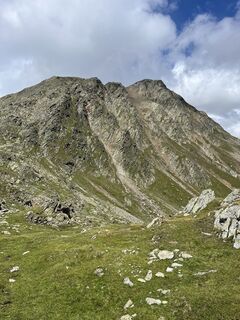
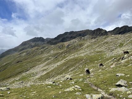
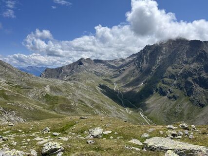
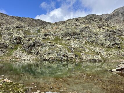
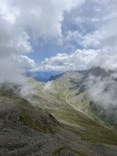
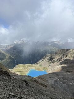
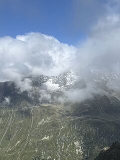
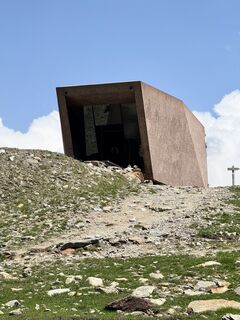
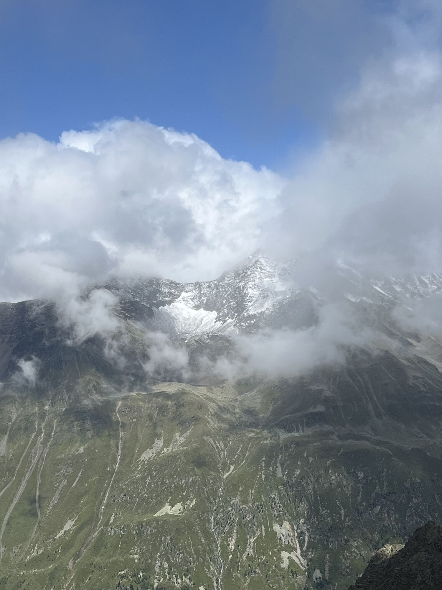
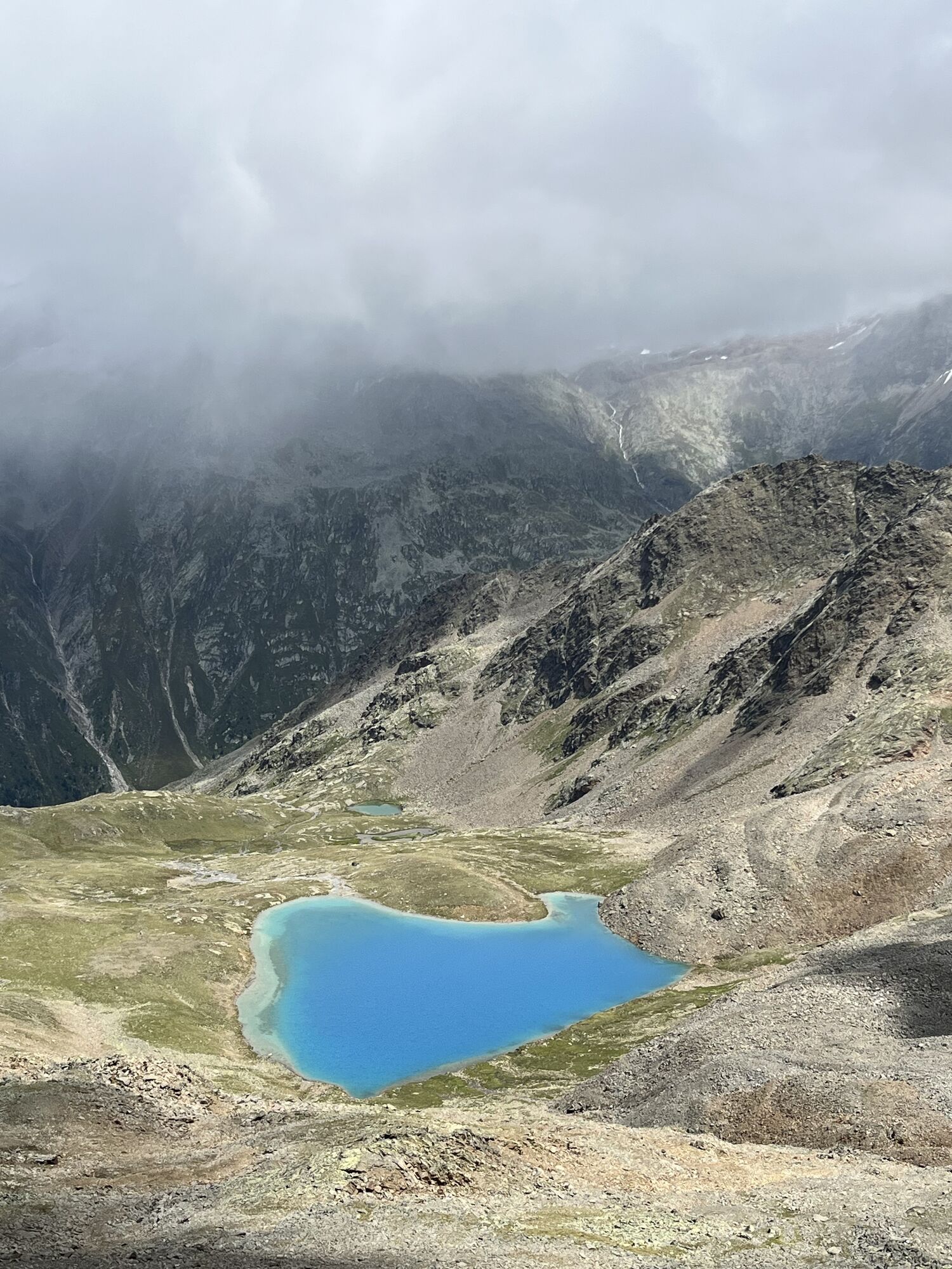
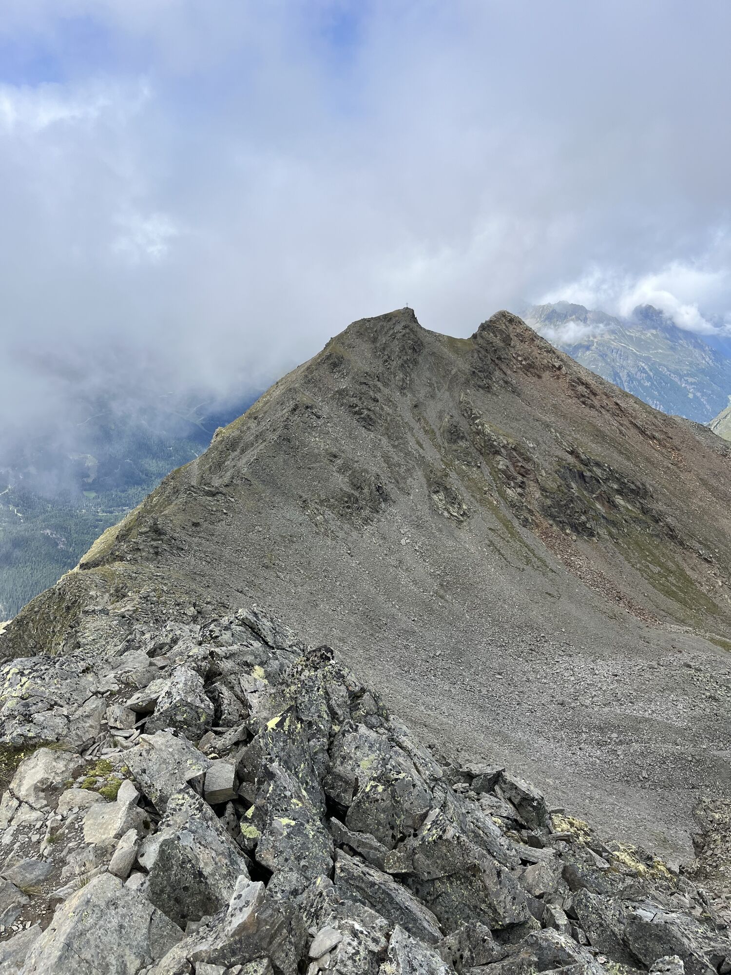
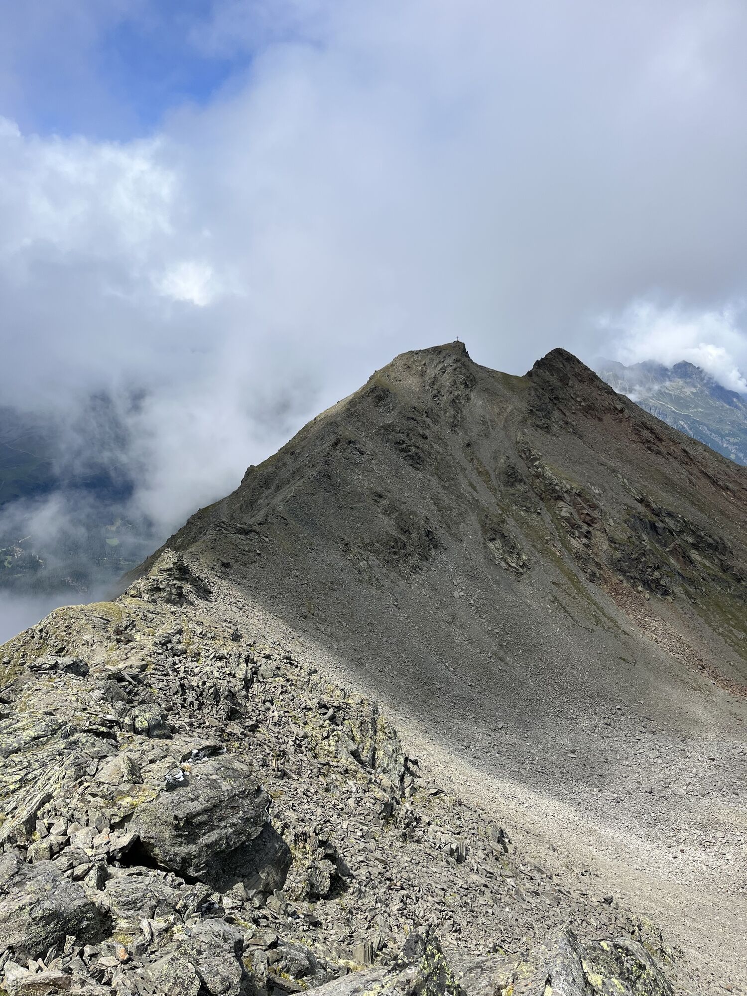
 © Jonas KaufmannUstvarjeno na 29.07.2025
 -
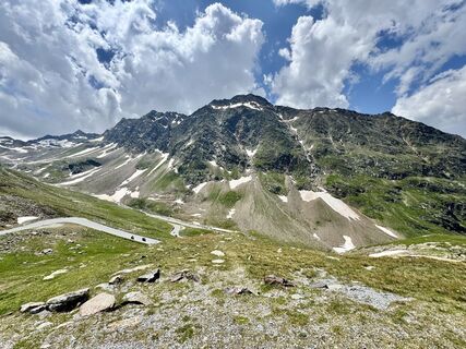
 © Jonas KaufmannUstvarjeno na 29.07.2025
 -
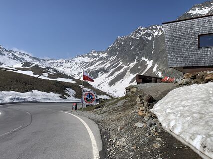
 © Jonas KaufmannUstvarjeno na 29.07.2025
 -
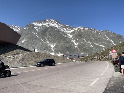
 © Jonas KaufmannUstvarjeno na 29.07.2025
 -
 © Jonas KaufmannUstvarjeno na 29.07.2025
 -
 © Jonas KaufmannUstvarjeno na 29.07.2025
 -
 © Jonas KaufmannUstvarjeno na 29.07.2025
 -
 © Jonas KaufmannUstvarjeno na 29.07.2025
 -
 © Jonas KaufmannUstvarjeno na 29.07.2025
 -
 © Jonas KaufmannUstvarjeno na 29.07.2025
 -
 © Jonas KaufmannUstvarjeno na 29.07.2025
 -
 © Jonas KaufmannUstvarjeno na 29.07.2025
 -
 © Jonas KaufmannUstvarjeno na 29.07.2025
 -
 © Jonas KaufmannUstvarjeno na 29.07.2025
 -
 © Jonas KaufmannUstvarjeno na 29.07.2025
 -
 © Jonas KaufmannUstvarjeno na 29.07.2025
 -
 © Jonas KaufmannUstvarjeno na 29.07.2025
 -
 © Jonas KaufmannUstvarjeno na 29.07.2025
 -
 © Jonas KaufmannUstvarjeno na 29.07.2025
 -
 © Jonas KaufmannUstvarjeno na 29.07.2025
 -
 © Jonas KaufmannUstvarjeno na 29.07.2025
 -

 © PhilippUstvarjeno na 12.08.2024
 -
 © ADV.tirolUstvarjeno na 21.07.2024
 -
 © ADV.tirolUstvarjeno na 21.07.2024
 -
 © ADV.tirolUstvarjeno na 21.07.2024
 -
 © ADV.tirolUstvarjeno na 21.07.2024
 -
 © Werner FögerUstvarjeno na 10.06.2025
 -
 © Werner FögerUstvarjeno na 10.06.2025


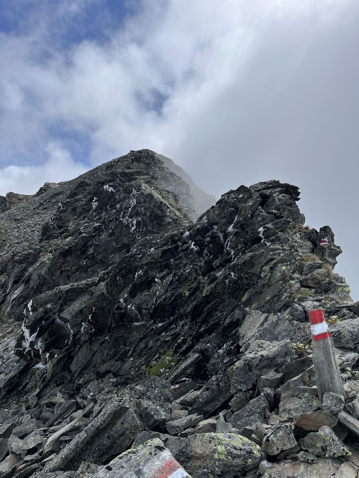
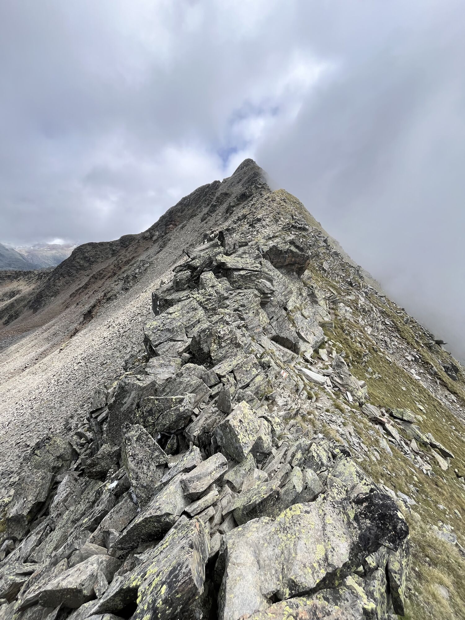


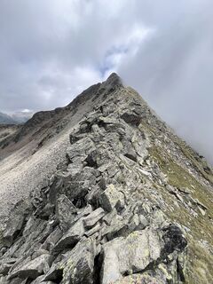
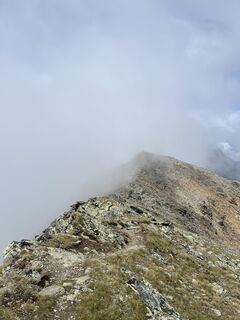
Route: ClimbingRequirements: Step safety, dizziness;Mountain path blackDifficulty: exposed passages on the ridge, stable weather conditions particularly importantEquipment: normal hiking equipmentHuts:...
Route: Climbing
Requirements: Step safety, dizziness;
Mountain path black
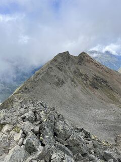
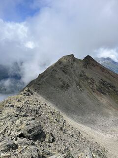
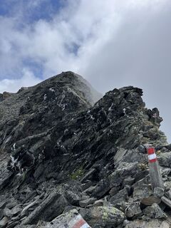
Difficulty: exposed passages on the ridge, stable weather conditions particularly important
Equipment: normal hiking equipment
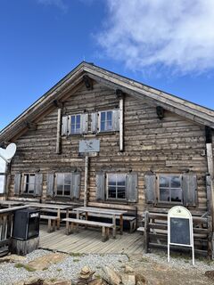
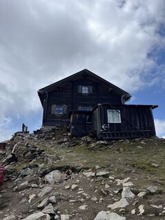
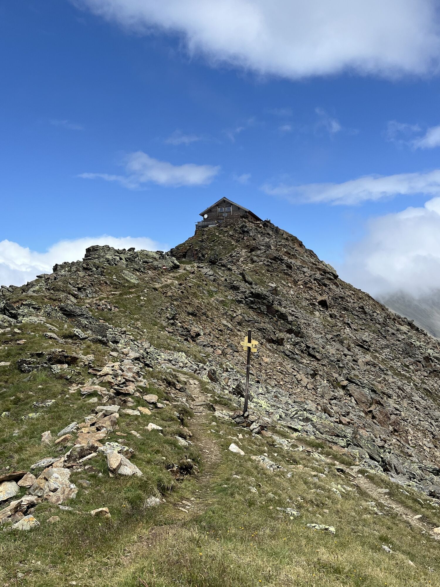
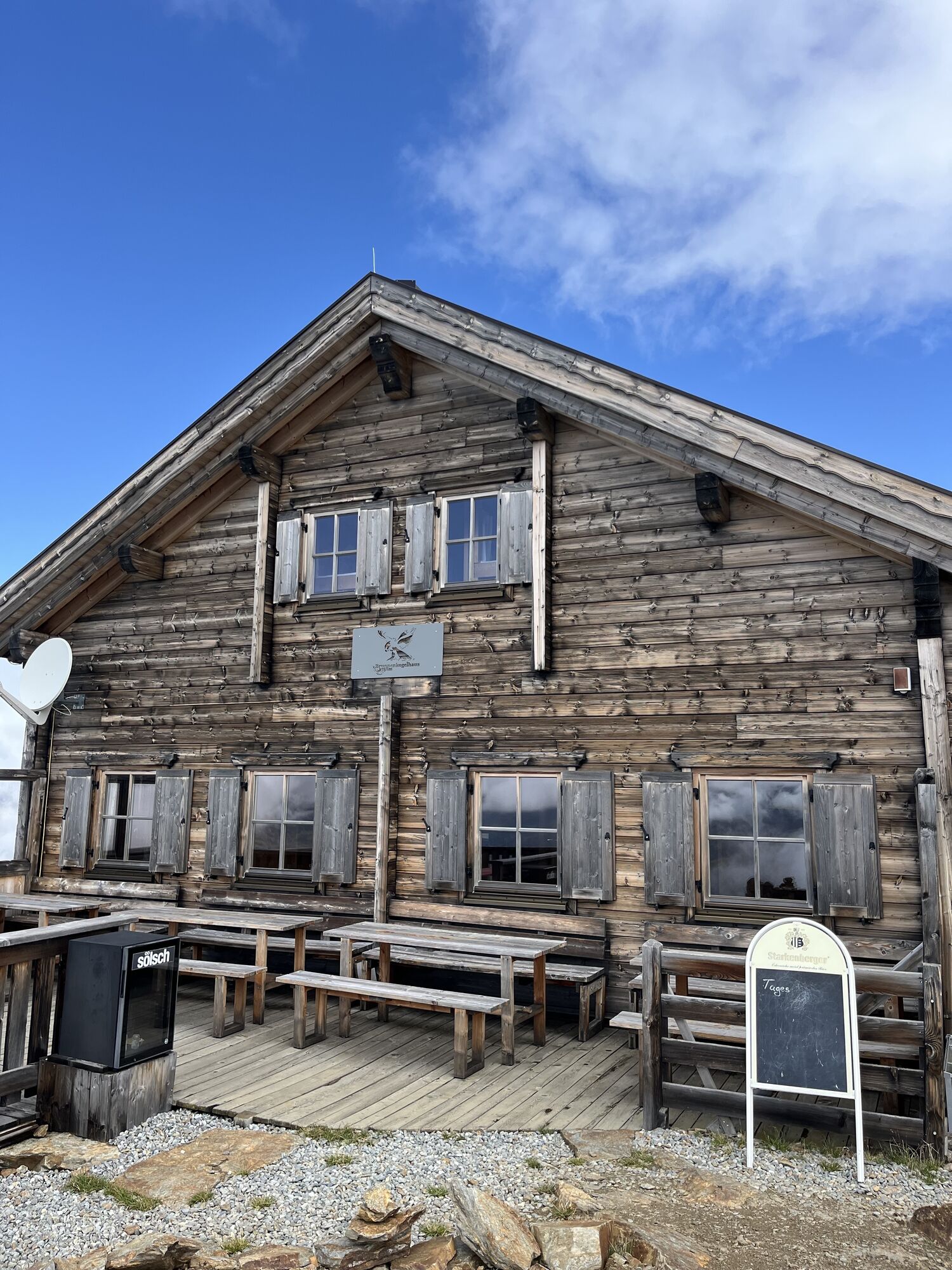
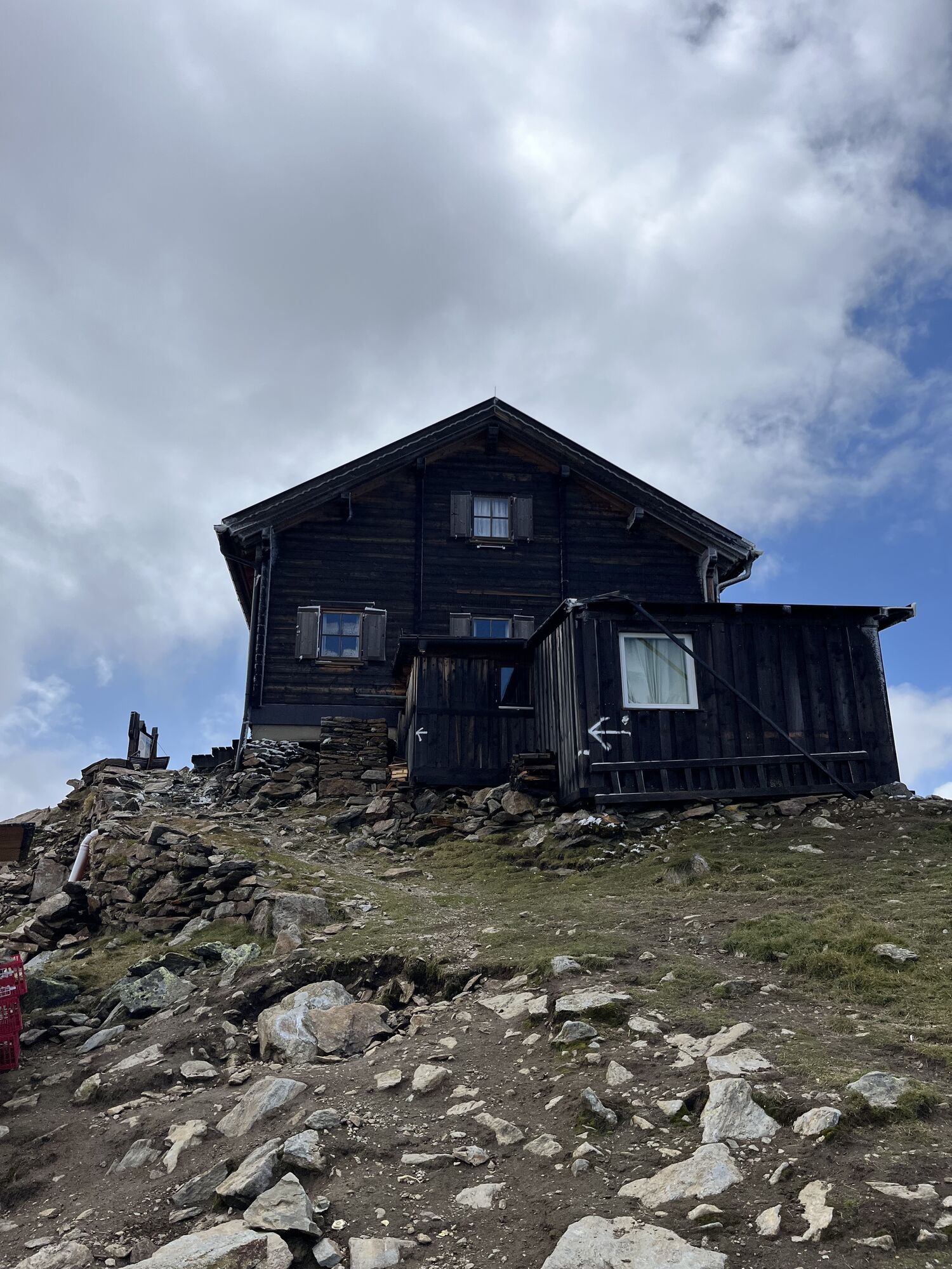
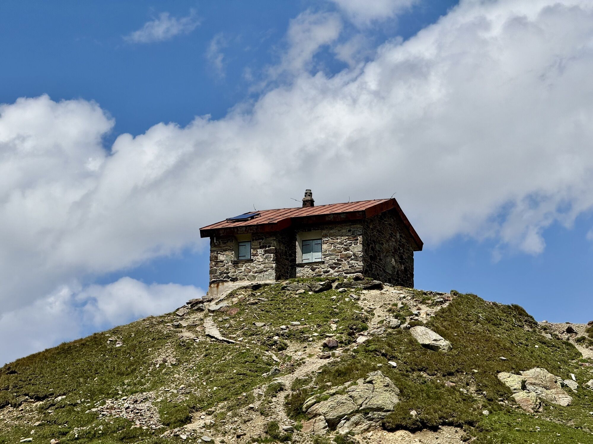
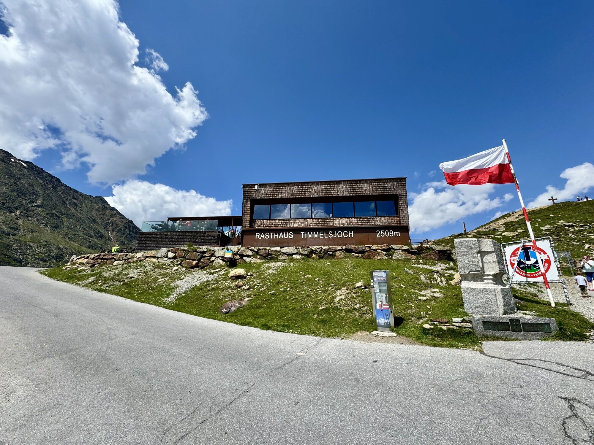
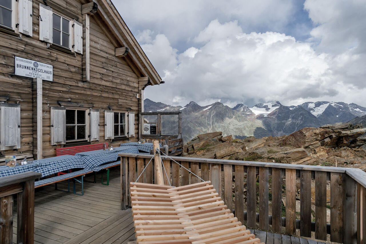
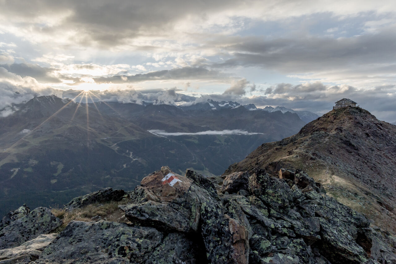
Huts: Brunnenkogelhaus, Rasthaus at the Timmelsjoch (no overnight stay), Gasthaus Hochfirst

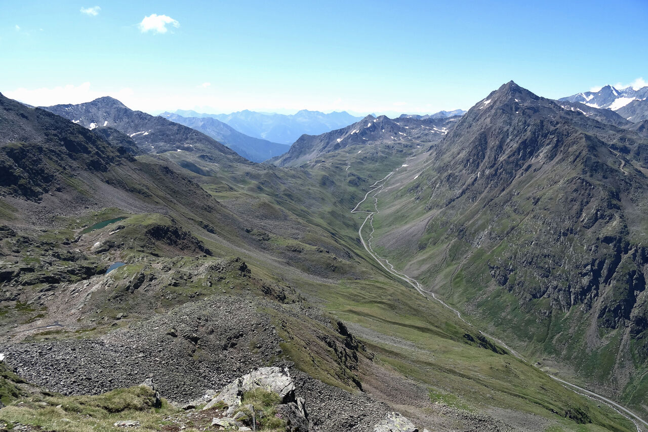

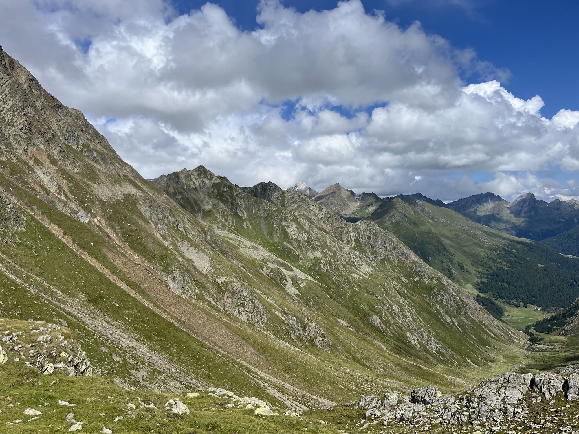
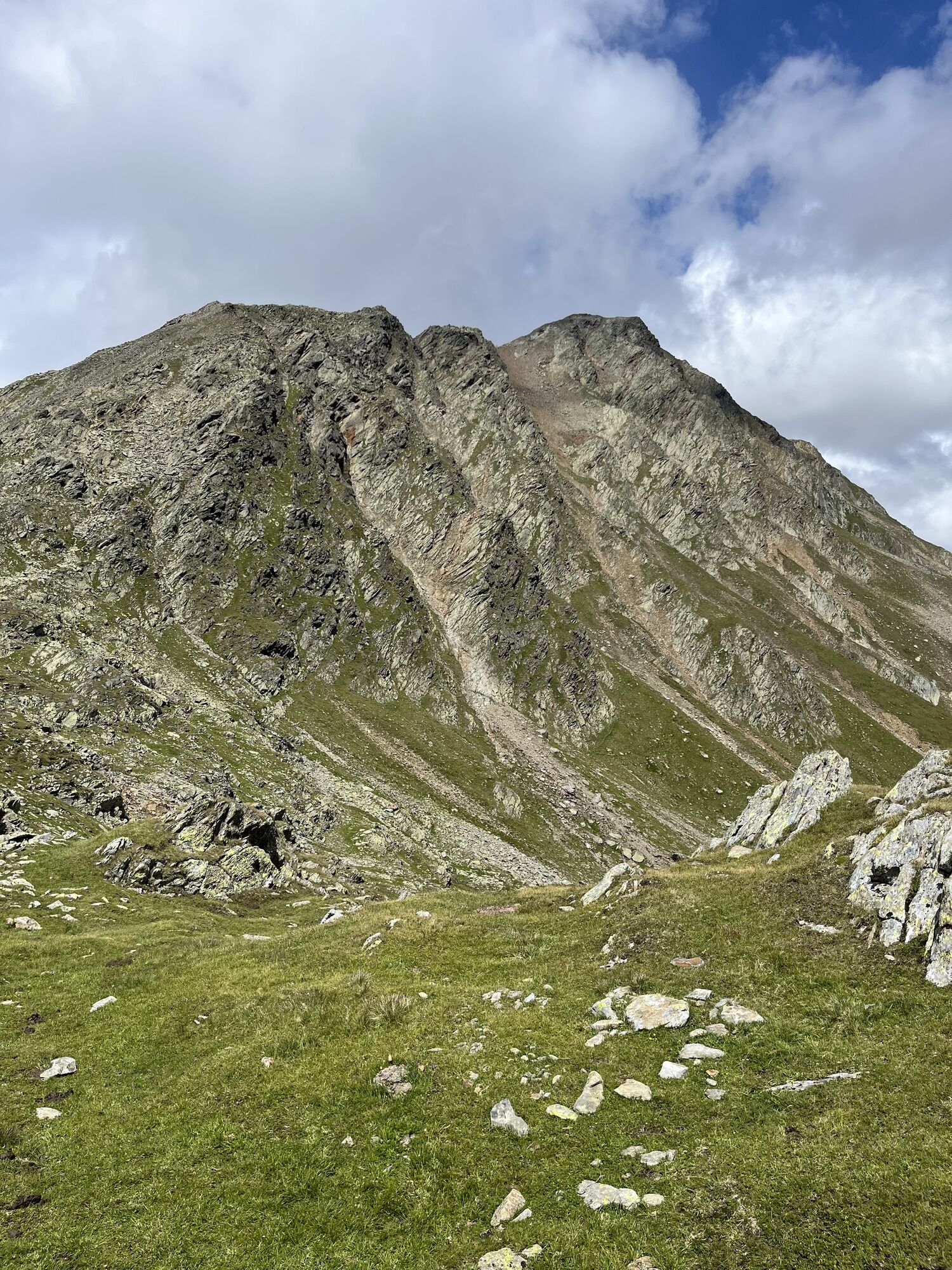
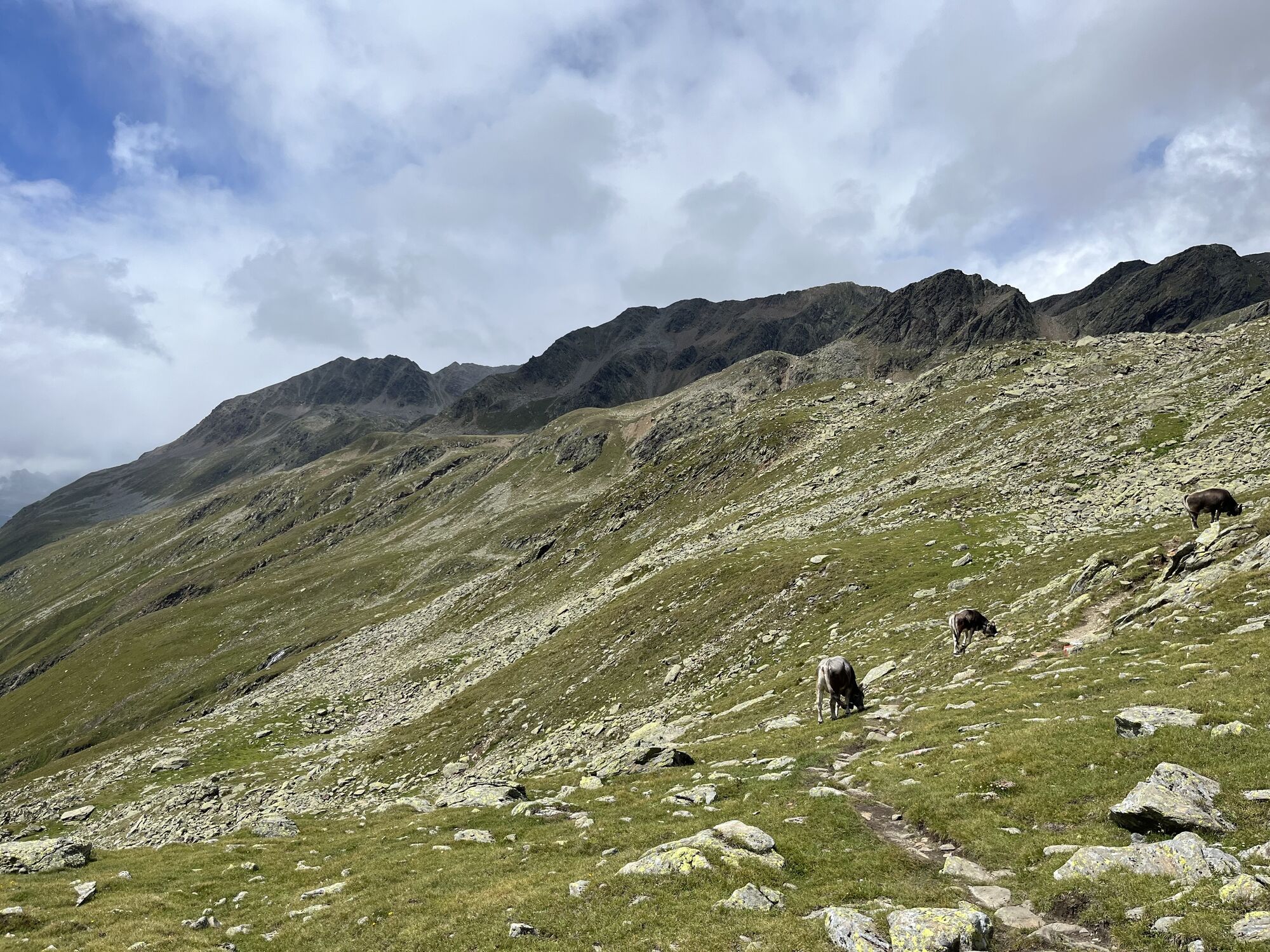
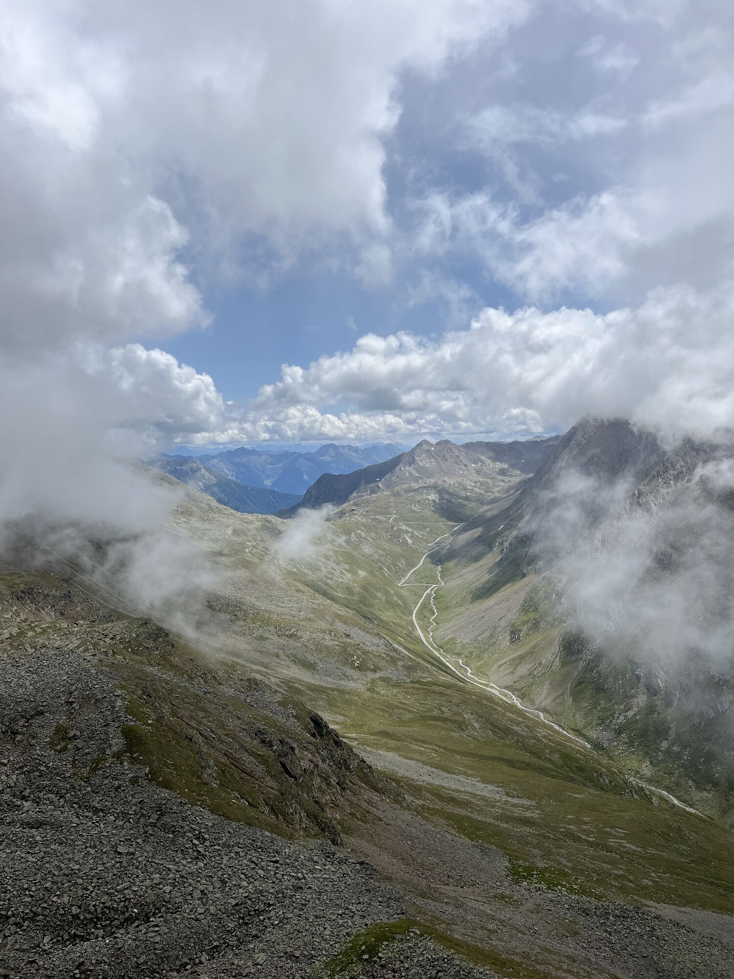
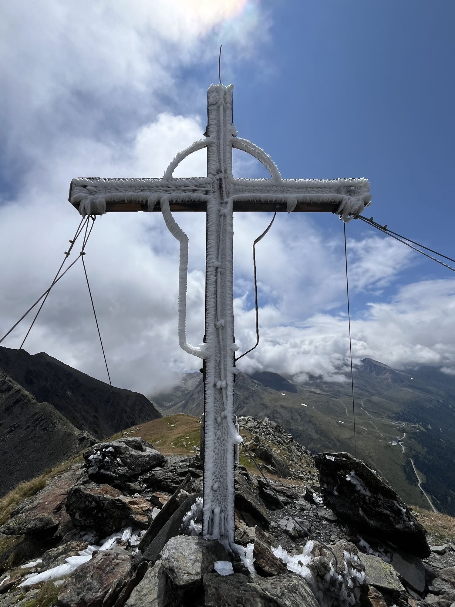
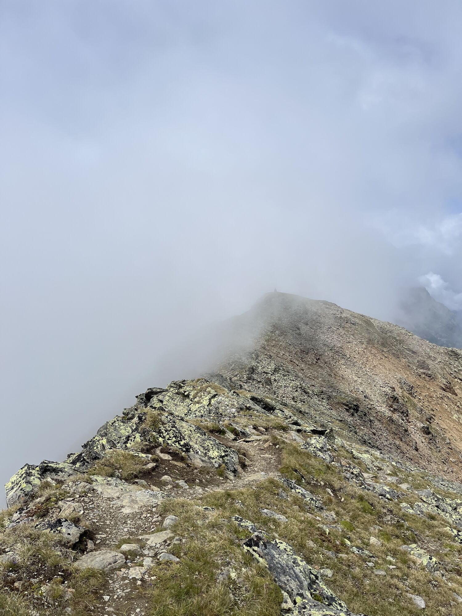
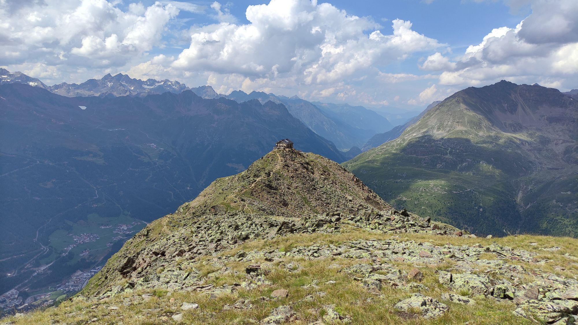
AN EXCEPTIONAL HIGH ELEVATION TRAIL
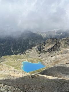
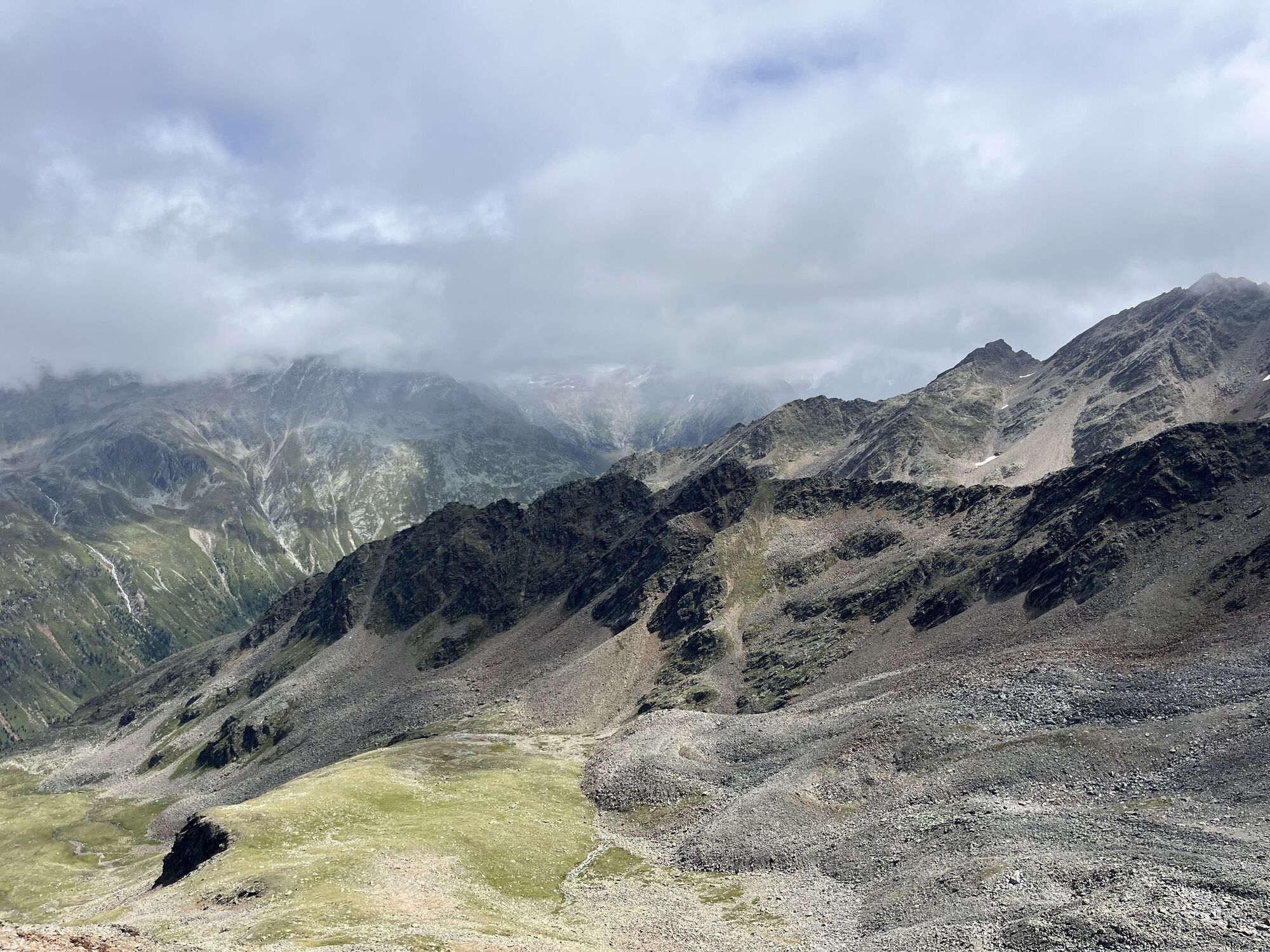
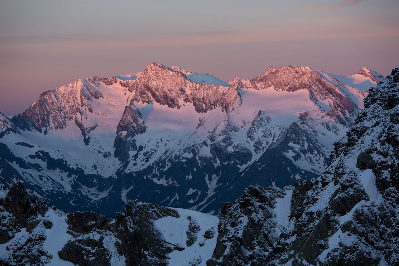
Ascend from Gasthof Hochfirst to Timmelsjoch. From Rasthaus Timmelsjoch the trail leads past several small lakes, gently ascending to Wannenkar. Hiking past Wannenkar, Rötenkar and Wietenkar, you walk in switchbacks through steep, boulder-strewn terrain up to Wannenkarsattel. Follow the constantly climbing ridge trail to Wilde Rötespitz, the tour‘s highest point. Awe-inspiringviews include Ötztal’s Wildspitze, North Tirol’s highest mountain, Weißkugel and Zuckerhütl in the Stubai Alps!
A slightly descending path takes you down to Brunnenkogelhaus at the peak of Vorderer Brunnenkogel. Hiking down to Sölden you take the trail via Brunnenberg Alm (approx. 3.5 h) or Fiegl‘s Hütte in Windachtal (approx. 2 h): here you can take the Windach bus line to Sölden (you save about 2 h). You reach the next stage by public bus from Sölden to Obergurgl.
Appropriate equipment such as breathable suitable outdoor clothes for the weather, is for all hikes and tours necessary. Please bring a first-aid box, a mobile phone, a walking map and if there is no hut on the way a snack and enough to drink.
For high alpine experienced mountaineers that are free from vertigo & surefooted. Excellent physical condition, extensive mountain experience, alpine climbing gear, safety- and orientation guide, good weather conditions recommended. Please pay attention to the current weather report
The car drive to the Ötztal valley. Situated in Tirol, the Ötztal valley set off in southerly direction and is the longest side valley in the Eastern Alps. The journey with the car leads you through the Inntal valley to the entrance of the valley and further on through the valley. Among the toll motorways you can also use the country roads. A route planner will show you the easiest and most convenient way: www.google.at/maps
- Parking garage (center of Obergurgl), chargeable | no parking at night
- Parking garage - bottom station Festkogl, chargeable | no parking at night
T6
... Timmelsjoch is the highest pass crossing of the Eastern Alps?
More details about hiking In Ötztal: www.oetztal.com/hiking
By public bus to Rasthaus Timmelsjoch rest stop (2,509 m) - Brunnenkogelhaus (2,738 m) - descent to Sölden (1,377 m)
Please note that the start and end points are not the same. If possible, take advantage of public transport. Otherwise make sure that you will get back to your car at the end of your hike.
Spletne kamere s turneje
-
Hochgurgl
-
Sölden - Grünwald Resort
-
Top Mountain Crosspoint Hochgurgl
-
Top Mountain Crosspoint Hochgurgl
-
Top Mountain Crosspoint Hochgurgl
-
Top Mountain Crosspoint Hochgurgl
-
Top Mountain Crosspoint Hochgurgl
-
Sölden - Grünwald Resort
-
Top Mountain Crosspoint Hochgurgl
-
Sölden - Gaislachkogelbahn Mittelstation
-
Hochstubaihütte
-
Hochstubaihütte
-
Sölden
-
The Peak Sölden**** Chalets und Appartements
-
Rabenstein im Passeiertal
Priljubljeni izleti v okolici
-
3.1
Tiefenbachglacier - Mountaineering Village Vent
srednjaPohodništvo 10.8 km -
4.7
Wilde Wasser Weg - Fortgeschritten
srednjaPohodništvo 12.0 km -
4.6
Passerschlucht
svetlobaPohodništvo 8.84 km -
4.4
Passerschlucht mit Stieber Wasserfällen, Trentino-Südtirol/Italien
srednjaPohodništvo 9.49 km -
5.0
Dresdner hütte - sulzenauerhütte
srednjaPohodništvo 12.1 km -
3.4
Peerler Lake
srednjaPohodništvo 12.6 km -
4.5
Lake Gaislachsee
srednjaPohodništvo 4.04 km -
5.0
07. 19.07.19 - Langeggbahn-Rotkogel–Schwarzsee-Schwarzkogel-Giggijochbahn
srednjaPohodništvo 6.67 km -
4.5
Nederkogl
težkoPohodništvo 6.22 km -
5.0
Stabele - Brunnenbergalm
srednjaPohodništvo 5.52 km
Pohodništvo in sledenje


Ne zamudite ponudb in navdiha za naslednje počitnice
Vaš e-poštni naslov je bil dodan na poštni seznam.