St. Stefan ob Stainz - Schilcherrundweg (Gundersdorf - Lestein)
srednja
Navigacija po spletni strani
Navigacija po spletni strani
Pridobite to turo v svoj mobilni telefon
St. Stefan ob Stainz - Schilcherrundweg (Gundersdorf - Lestein)
srednja
Pohodništvo
11.83
km
Skenirajte kodo QR in začnite navigacijo v aplikaciji bergfex.

Pohodništvo in sledenje


St. Stefan ob Stainz - Schilcherrundweg (Gundersdorf - Lestein)
srednja
Razdalja
11.83
km
Trajanje
03:35
h
Ascent
492
hm
Morska gladina
352 -
555
m
Prenos skladbe
St. Stefan ob Stainz - Schilcherrundweg (Gundersdorf - Lestein)
srednja
Pohodništvo
11.83
km

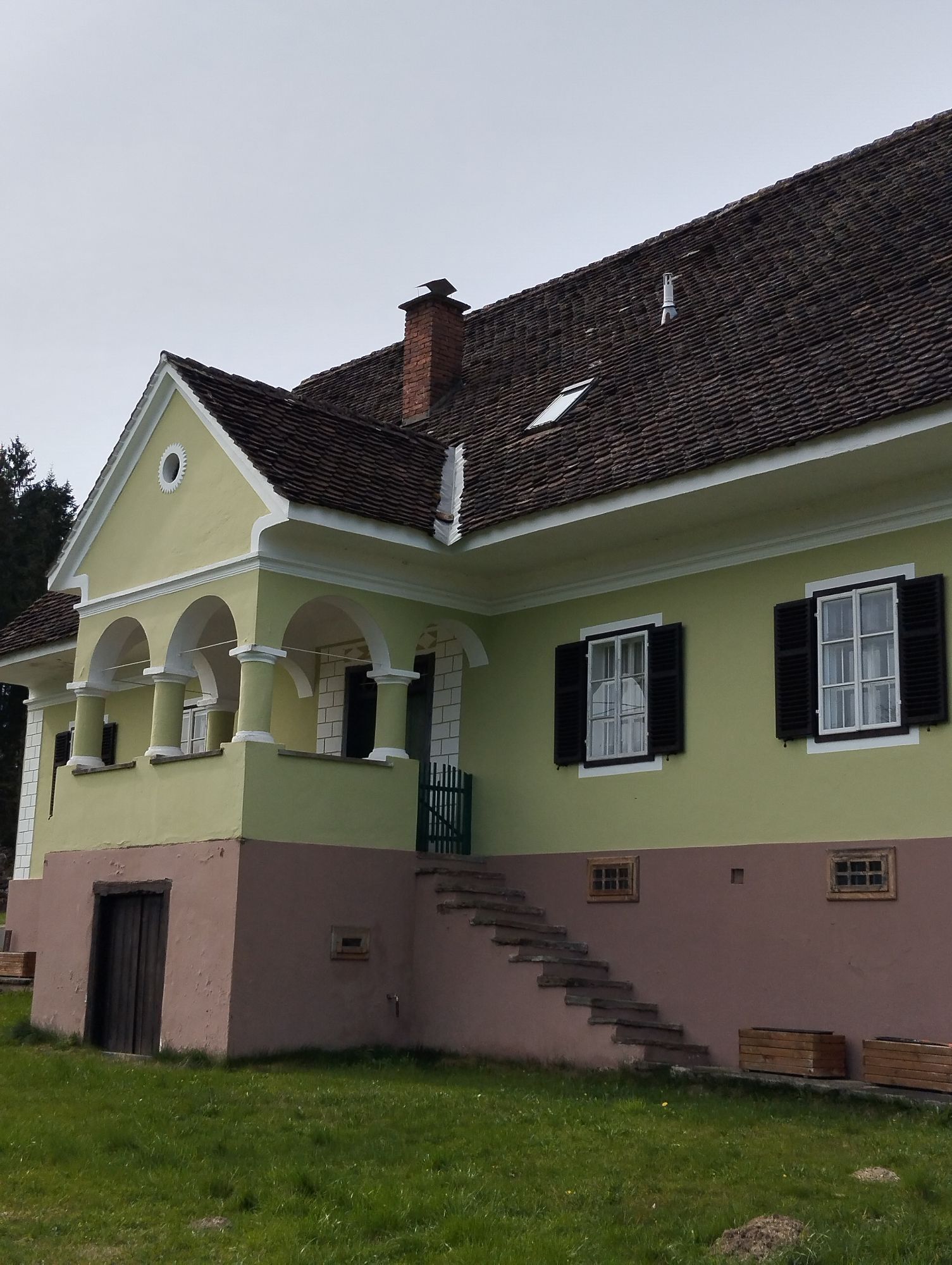
Starting from the main square in St. Stefan, walk in the direction of the primary school in the district of Kirchberg before heading uphill to Gundersdorf. After a short snack, the trail continues via...
Opis
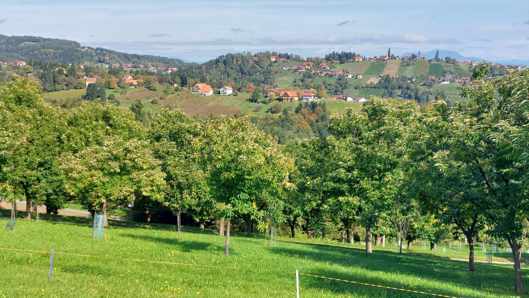
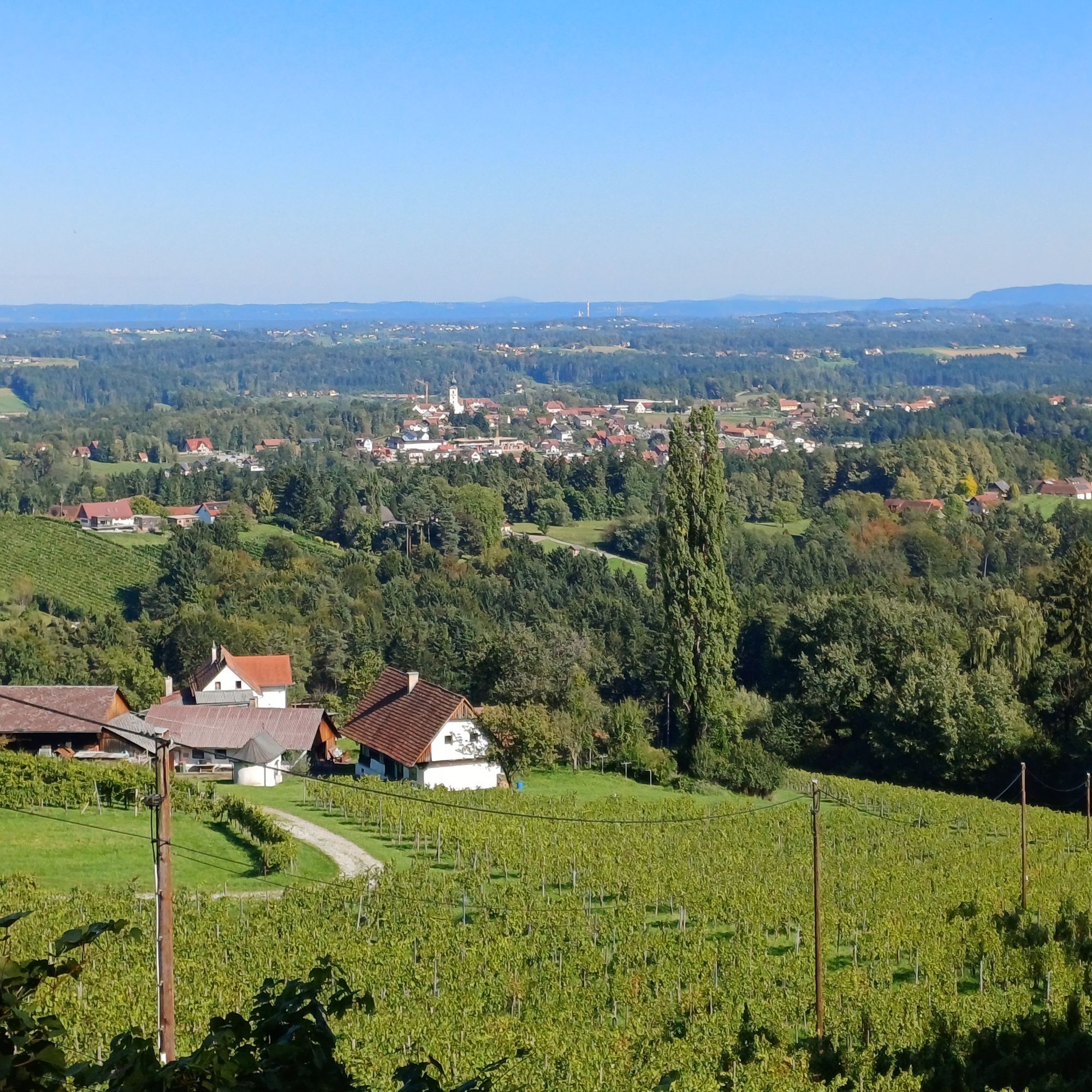
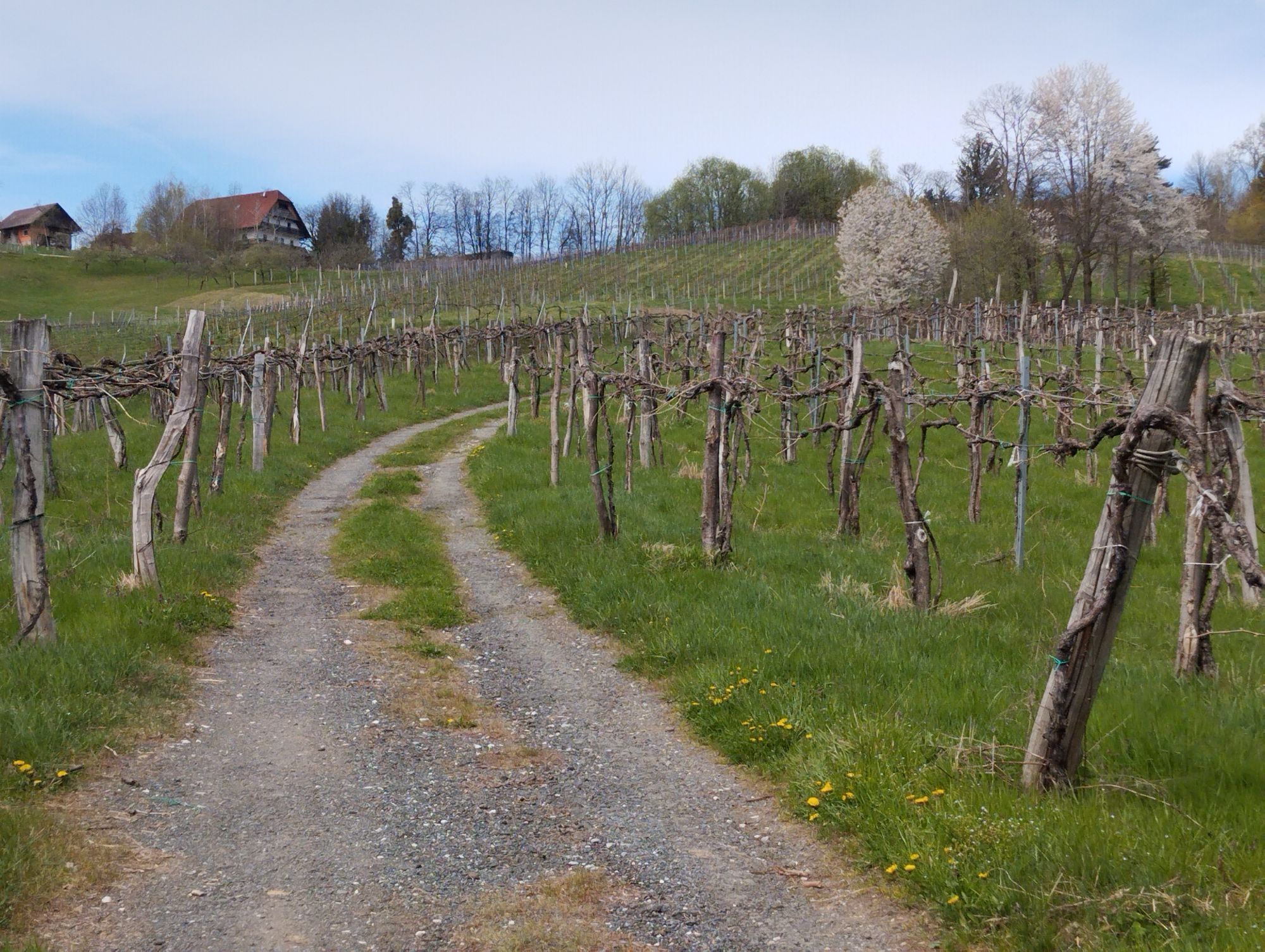
Starting from the main square in St. Stefan, walk in the direction of the primary school in the district of Kirchberg before heading uphill to Gundersdorf. After a short snack, the trail continues via Grubberg to Lestein, where you can enjoy a wonderful view of the Graz and southern Styrian basin. Finally, there is the descent to St. Stefan via Hochgrail and Niedergrail.
Pot
Pfarrkirche Sankt Stefan ob Stainz
(404 m)
Kraj čaščenja
0.0 km
Gundersdorf
(491 m)
Vas
4.1 km
Buschenschank Windisch
(491 m)
Restavracija
4.1 km
Grubberg
(489 m)
Poravnava
5.4 km
Langegg
(594 m)
Poravnava
7.5 km
Pfarrkirche Sankt Stefan ob Stainz
(404 m)
Kraj čaščenja
11.7 km
Pot
St. Stefan ob Stainz - Schilcherrundweg (Gundersdorf - Lestein)
srednja
Pohodništvo
11.83
km
Pfarrkirche Sankt Stefan ob Stainz
(404 m)
Kraj čaščenja
0.0 km
Sankt Stefan ob Stainz
(401 m)
Vas
0.0 km
Landgasthof St.Stefanerhof
(398 m)
Restavracija
0.0 km
Gundersdorf
(491 m)
Vas
4.1 km
Buschenschank Windisch
(491 m)
Restavracija
4.1 km
Gasthaus Florlwirt
(491 m)
Restavracija
4.2 km
Grubberg
(489 m)
Poravnava
5.4 km
Buschenschank Tschankhiasl Weinbau Geiser
(474 m)
Restavracija
5.5 km
Langegg
(594 m)
Poravnava
7.5 km
Greisdorf
(594 m)
Vas
8.5 km
Sankt Stefan ob Stainz
(401 m)
Vas
11.5 km
Pfarrkirche Sankt Stefan ob Stainz
(404 m)
Kraj čaščenja
11.7 km


Zadnji spremljani
danes
Informacije o poti
Primerno za starejše državljane
Da
Prečkanje vode
Da
Strm prehod
Da
Geološki poudarki
Da
Primerno za družine
Da
Vrednotenja
4 Komentarji
Gundi K.
16. අප්. 2026
Schilcherrundweg
Schöner Weg - leider nicht gut beschildert
Dagi
28. අප්. 2024
Eine wirklich schöne, abwechslungsreiche Wanderung durch Mischwälder mit schönen Bächen, Weinberge, Felder und vielen Einkehrmöglichkeiten. Die Höhenmeter und das Profil stimmen bei der Angabe überhaupt nicht, es sind knapp über 500 Höhenmeter.
Vrednotenja
St. Stefan ob Stainz - Schilcherrundweg (Gundersdorf - Lestein)
srednja
Pohodništvo
11.83
km
4.0
5
(6)
4
(3)
3
(0)
2
(0)
1
(2)
4 Komentarji
Gundi K.
16. අප්. 2026
Schilcherrundweg
Schöner Weg - leider nicht gut beschildert
Dagi
28. අප්. 2024
Eine wirklich schöne, abwechslungsreiche Wanderung durch Mischwälder mit schönen Bächen, Weinberge, Felder und vielen Einkehrmöglichkeiten. Die Höhenmeter und das Profil stimmen bei der Angabe überhaupt nicht, es sind knapp über 500 Höhenmeter.
rudi70
13. අප්. 2024
Höhenmeter nicht korrekt.
Die Tour ist zwar schön, aber die Höhenmeterangabe und das Profil sind nicht korrekt. Es sind 492 hm.
Dejavnosti na poti

Gundersdorf, Steiermark/Österreich
16.04.2026 – Pohodništvo
Sankt Stefan ob Stainz, Steiermark/Österreich
16.04.2026 – Pohodništvo
Sankt Stefan ob Stainz, Steiermark/Österreich
16.04.2026 – Pohodništvo
Sankt Stefan ob Stainz, Steiermark/Österreich
16.10.2025 – Pohodništvo
Sankt Stefan ob Stainz, Steiermark/Österreich
21.09.2025 – Pohodništvo
Priljubljeni izleti v okolici
- 4.4
Großofen, Hebalm
svetlobaPohodništvo 10.1 km - 4.6
Filzmoos - Runde, Hebalm
svetlobaPohodništvo 8.28 km - 4.3
Rund um den Hirzmann-Stausee
svetlobaPohodništvo 10.5 km - 3.5
Reinischkogel: Klugbauer - Rundweg
svetlobaPohodništvo 7.02 km - 4.7
Laßnitztalweg – Wanderung "Klause" Deutschlandsberg
srednjaPohodništvo 10.2 km - 3.9
Modriach - Über den Großofen (Großofen-Rundweg)
Pohodništvo 11.4 km - 4.6
Kurze Rundwanderung zum Sporiroaofen, zurück über Klugbauer und Hahnhofhütte
srednjaPohodništvo 11.9 km - 4.1
Sporiroaofen-Rundweg (längere Variante)
srednjaPohodništvo 9.32 km - 4.1
Bad Gams: Greimkogel - Rundweg
srednjaPohodništvo 9.20 km - 3.3
Stainz: Rosenkogel (Spitzkogel)
svetlobaPohodništvo 5.54 km
Pohodništvo in sledenje

Zaradi več kot 550.000 predlogov izletov, podrobnih zemljevidov in intuitivnega načrtovanja poti je aplikacija obvezna oprema za vse ljubitelje narave.

Ne zamudite ponudb in navdiha za naslednje počitnice
Naročite se na novice
Napaka
Zgodila se je napaka. Prosimo, poskusite znova.Zahvaljujemo se vam za prijavo
Vaš e-poštni naslov je bil dodan na poštni seznam.
Izleti po vsej Evropi
Avstrija Švica Nemčija Italija Slovenija Francija Nizozemska Belgija Poljska Lihtenštajn Češka Slovaška Španija Chorvátsko Bosna in Hercegovina Luksemburg Andora පෘතුගාලය අයිස්ලන්තය එක්සත් රාජධානිය අයර්ලන්තය ග්රීසිය ඇල්බේනියාව North Macedonia Malta Norway Montenegro Moldova කොසෝවො හන්ගේරියානු සමුහාණ්ඩුව San Marino රුමේනියාව එස්ටෝනියා ලැට්වියාව බෙලාරස් සයිප්රස් Lithuania Serbia බල්ගේරියාව Monaco ඩෙන්මාර්කය Sweden ෆින්ලන්තය