


Marsh Marigold Route - Cycling in the Drömling
Stopnja težavnosti: 3
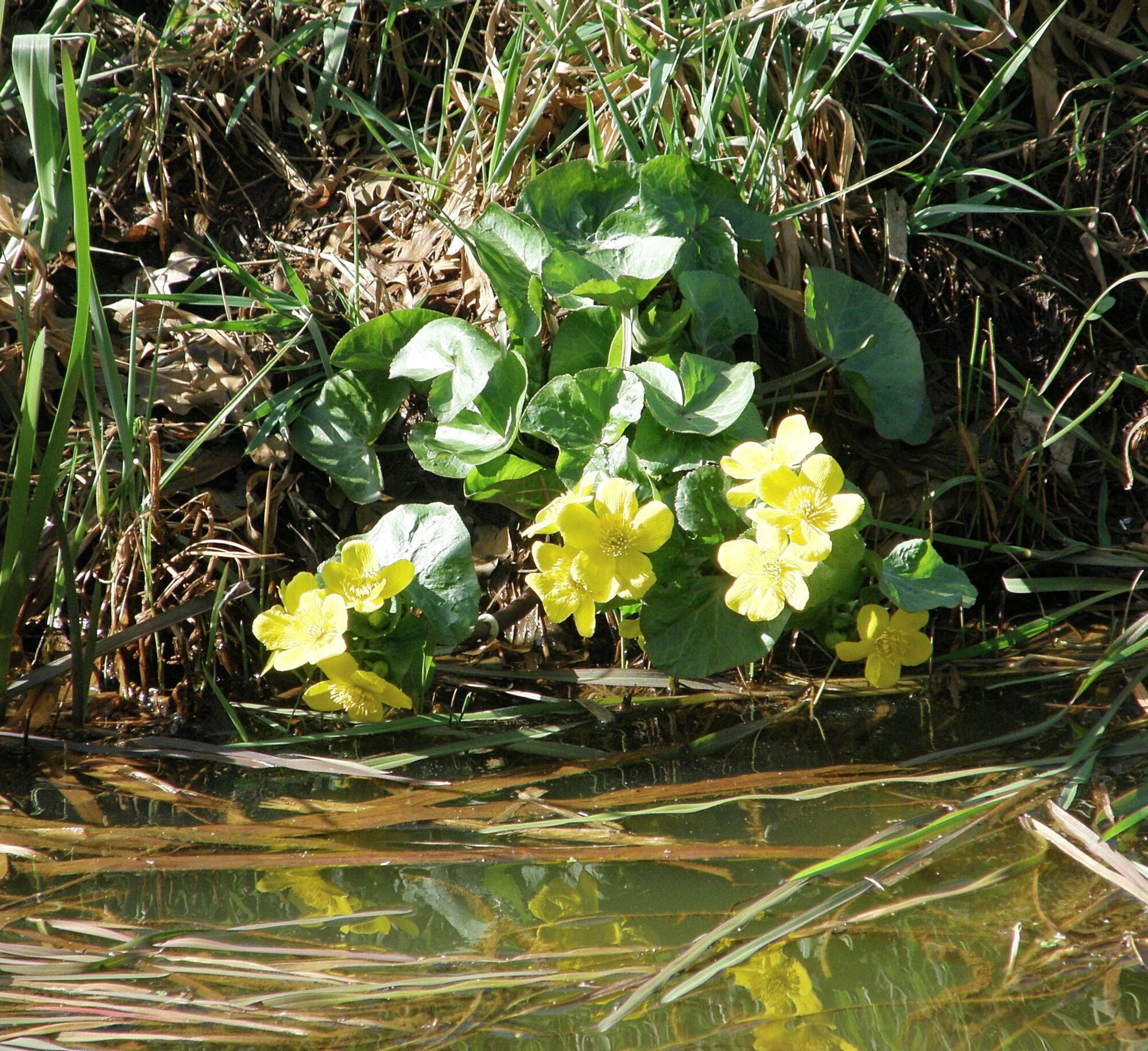
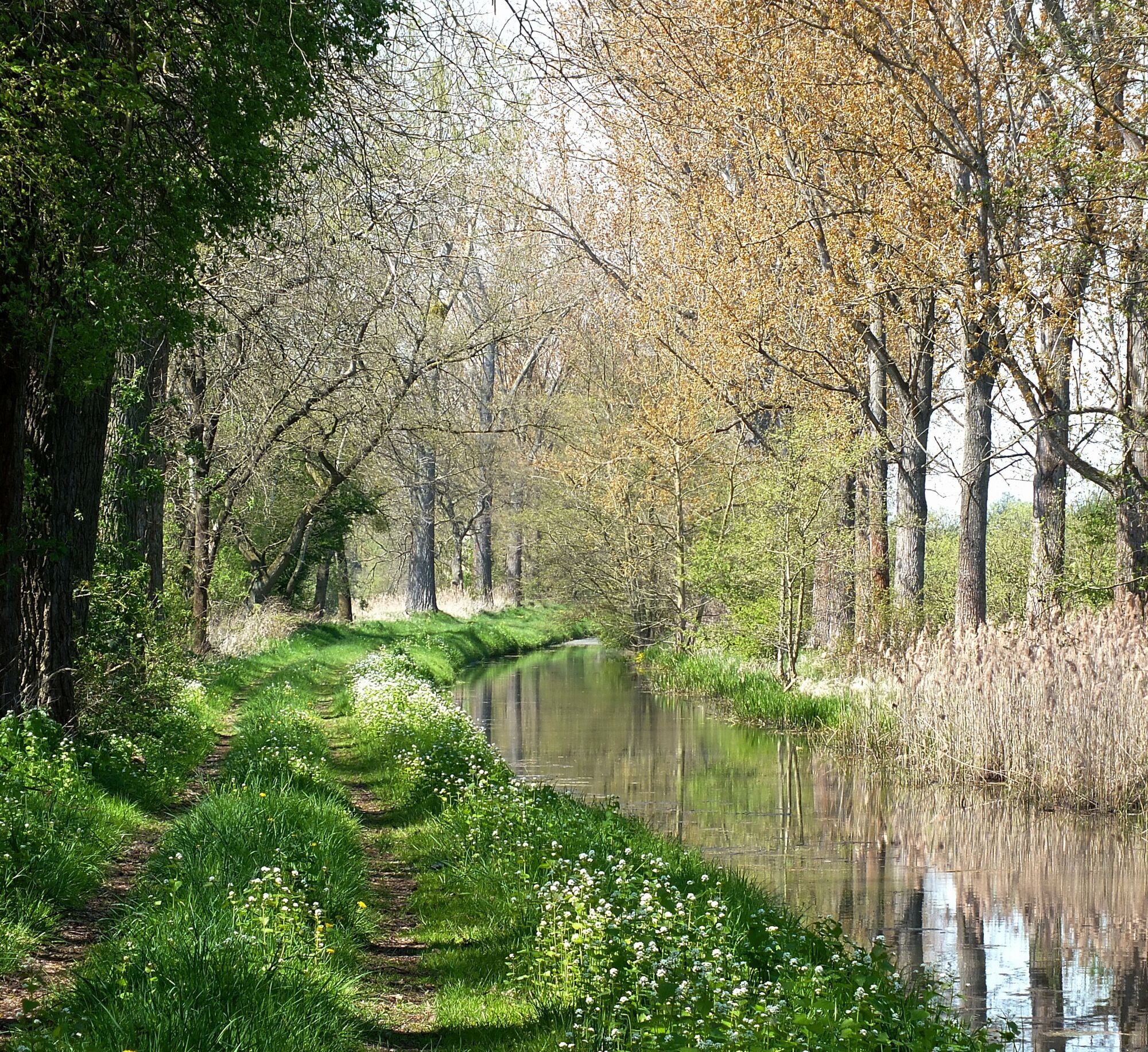
From March to June, marsh marigolds bloom in lush splendor in the Drömling meadows and bathe the landscape in rich yellow. Like all bike paths through the Drömling, it is designed as a circular route....
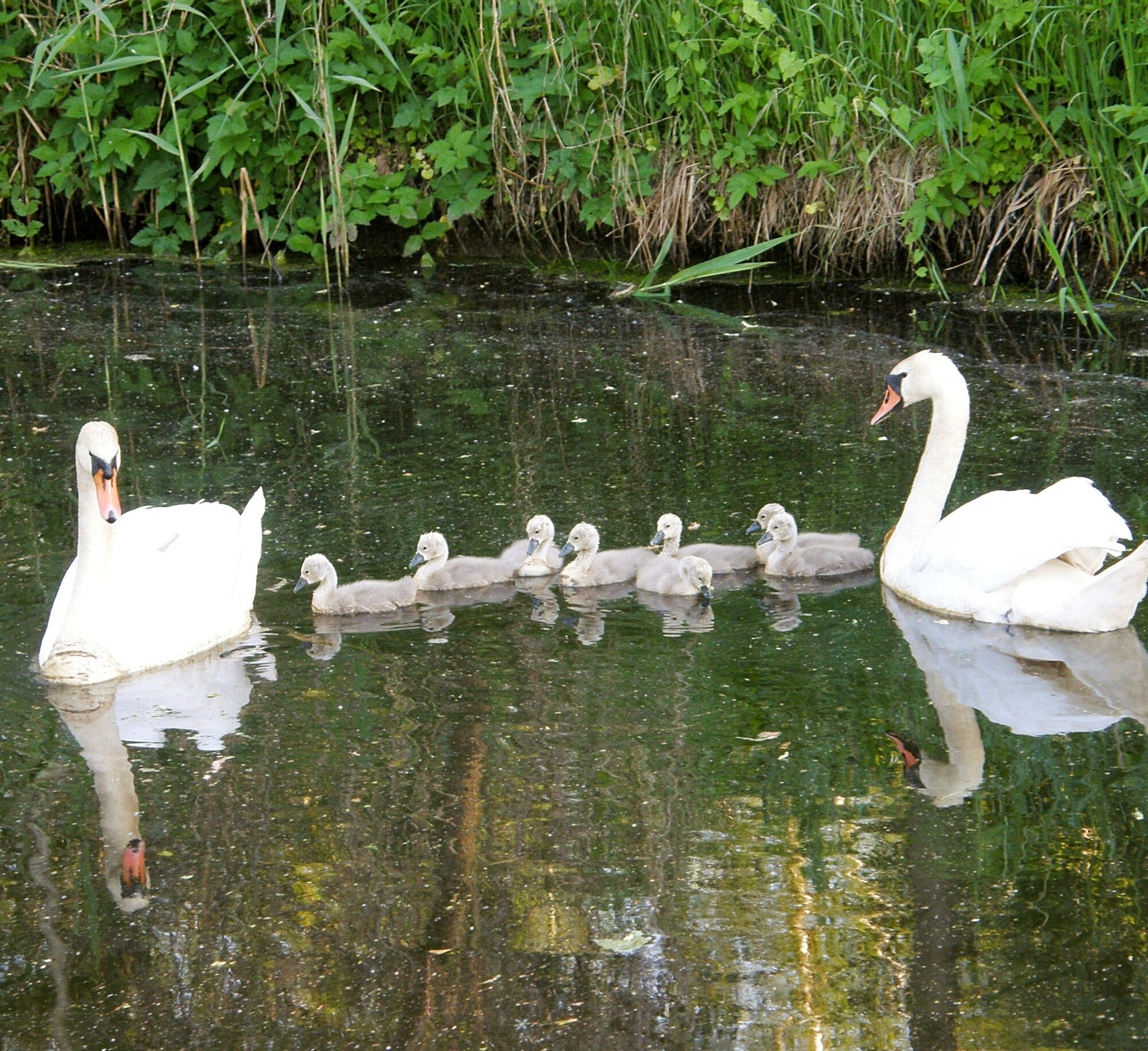
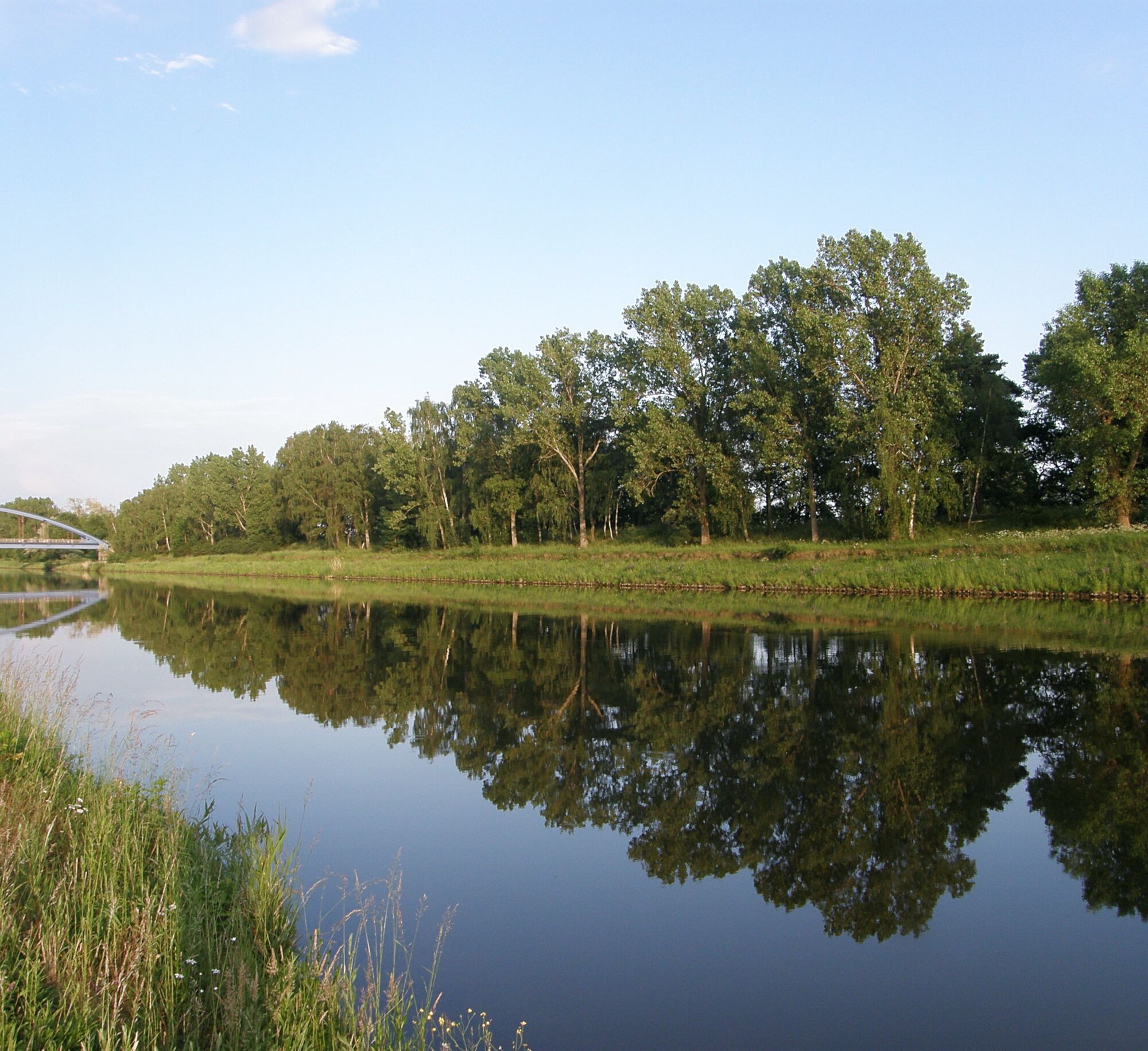
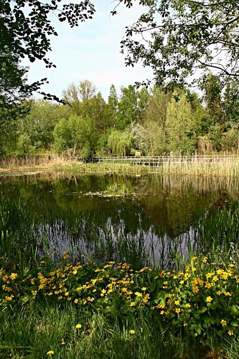
From March to June, marsh marigolds bloom in lush splendor in the Drömling meadows and bathe the landscape in rich yellow. Like all bike paths through the Drömling, it is designed as a circular route. Although the twenty kilometers are partly difficult to ride, this should not discourage cyclists from pedaling them - such intact and scarcely developed nature as the landscape of the Drömling has become rare in Germany. Swan pairs no longer get disturbed while raising their young. In spring and autumn, resting cranes and lapwings populate the area on the bank of the Mittelland Canal by the thousands. The Mittelland Canal is an experience in itself; at over 325 kilometers long, it is the longest artificial waterway in Germany and connects the Rhine and Oder. The information center of the biosphere reserve at Kämkerhorst with its exhibition and its enchanting experiential and educational garden also tells of this.


The starting point is the municipality of Miesterhorst, easily accessible by train and car (B188). Guests are warmly welcomed at Café Andrea at the village entrance and the inn "Zur Schmiede." From the village center with the Peace Oak, we ride a short distance along the B188 towards Wolfsburg. Before the bridge, we leave the road on the left and follow the path until we reach the Wilhelms Canal after three kilometers. A small wooden bridge allows crossing. Rustic tables and benches invite you to relax here, and a memorial stone commemorates the expansion of the Hanover - Berlin high-speed railway.
Field lark song accompanies us on the further route along the Wilhelms Canal to the Kramer Colony. A pair of storks cares for their young here from May to August. We continue to follow the canal with its unique fauna and flora. We do not take the Buschstraße turnoff after about five kilometers, but turn right about one hundred meters further.
The path leads to the Rätzlingen Colony, located idyllically on the Ohre. We follow it through a meadow area to the east. Resting lapwings and cranes can be seen here in hundreds and thousands in spring and autumn. Swans with their young can also often be observed here. After a short time, we reach the road that leads from Miesterhorst to Rätzlingen. Memorial stones at the Ohre bridge recall the drainage of the Drömling in the second half of the 18th century.
We turn right towards Rätzlingen and follow the road to the Mittelland Canal. Before the bridge, we turn left and follow a path parallel to the canal heading east. On the left extends a meadow area richly structured with shrubs. Birds of prey and deer are often observed here. A canal bridge, mainly serving agricultural traffic, offers a view of the newly expanded and widened Mittelland Canal. We continue along its northern side. After about eleven kilometers, we come to the Aller Canal siphon, which leads the water of the Aller Canal under the Mittelland Canal. From now on, we follow the Aller Canal and shortly reach the Drömlingsklause in Piplockenburg. Here you have the opportunity to refresh yourself for the rest of the route.
In the immediate vicinity, an extensive water area with several islands and large shallow-water zones stretches between the Mittelland Canal and the Aller Canal. An important resting place for cranes, geese, and ducks. This water body was created as a compensation measure as part of the canal expansion. Following the path northwards, after thirteen kilometers, we reach the information center of the nature park administration at Kämkerhorst. Only the entrance sign can be seen at the roadside. The building with its exhibition as well as the enchanting experiential and educational garden with its idyllic pond lie behind it. They offer extensive information about the landscape of the Drömling, its flora, and fauna.
The nature trail north of the Ohre leads through one of the most interesting nesting forests of the region. Old stands of oaks and birches dominate this forest area. Numerous display boards inform visitors about aspects of nature and species protection. During our trip, we follow the nature trail a short distance on the left. At the Ohre lock, memorial stones recall the Riedel brothers, who played a significant role in the great Drömling drainage and the associated landscape design.
At the fork in the path, we leave the nature trail turning right and ride straight ahead towards Mieste to the Friedrichskanal. Here, we turn left and follow the canal on an unpaved path to Lenz. From there, the Miesterhorst church tower is clearly visible on the left. We now use the very well-developed bike path along the B188 for about two kilometers back to the starting point of our route: Miesterhorst.
Da
Maps, sun & rain protection, sturdy footwear
The paths are in varying conditions. In some sections, riding is only possible under difficult conditions. The intact and scarcely developed nature should compensate for this.
Miesterhorst is located on the B188 towards Oebisfelde and about 24 km from Gardelegen
- Public bus service with bicycle transport
- Timetable information at: www.insa.de
- Train
- Parking strips within the town
3
A special offer can be found in Piplockenburg, explore the Drömling not only on foot or by bike but also by horse-drawn carriage!
Priljubljeni izleti v okolici
-
Bike route through the Drömling
srednjaKolesarjenje 41.8 km -
Stork Route - Cycling in the Drömling
srednjaKolesarjenje 21.0 km -
Brachvogeltour - Bike Touring in the Drömling
srednjaKolesarjenje 34.9 km -
Bibertour - cycling in the Drömling
srednjaKolesarjenje 28.4 km -
Drömlingsrundweg
srednjaKolesarjenje 131.4 km -
Iron Curtain Trail
težkoKolesarjenje 1,585 km -
Miester Kolonien-Tour im Drömling
srednjaKolesarjenje 57.3 km -
5.0
Velpke - St. Petri - Hotel am Markt - Antalya Grill
svetlobaKolesarjenje 45.4 km -
Velpke
svetlobaPohodništvo 7.67 km -
Breitenrode - Pupn satt pub & Bar - Buchhorst - Kolonie Wassensdorf
srednjaKolesarjenje 49.4 km

Pohodništvo in sledenje


Ne zamudite ponudb in navdiha za naslednje počitnice
Vaš e-poštni naslov je bil dodan na poštni seznam.