


Wine hike: Weisenheim am Berg - Berntal - Kallstadt - Herxheim am Berg
The route leads with no significant climbs from Weisenheim am Berg along the edge of the Haardt to Leistadt. Here begins the entry to the Felsenberg/Berntal nature reserve. You cross the valley cut, past...
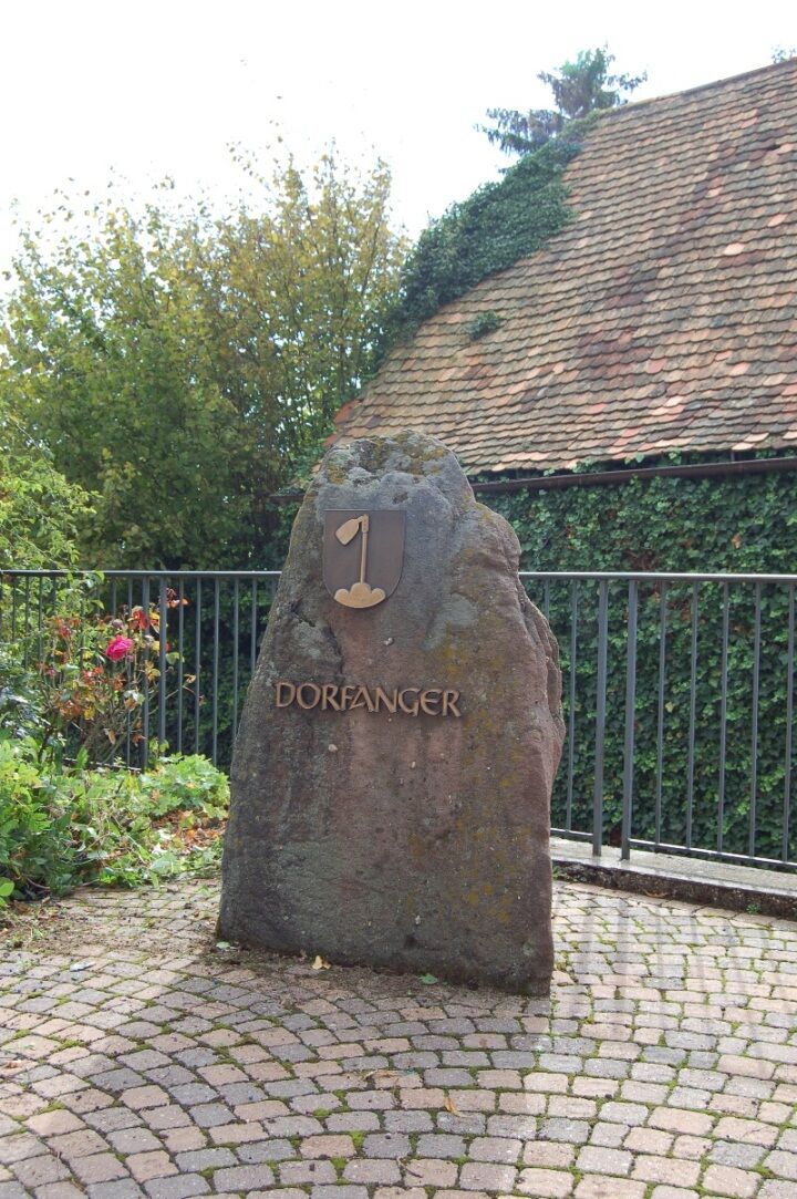
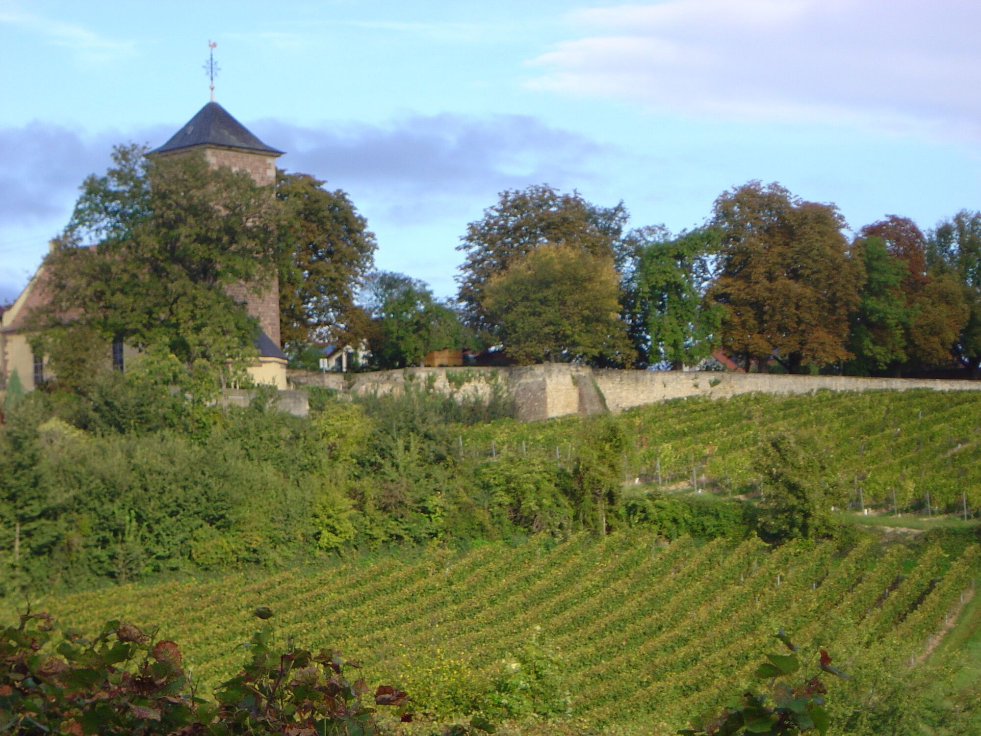
The route leads with no significant climbs from Weisenheim am Berg along the edge of the Haardt to Leistadt. Here begins the entry to the Felsenberg/Berntal nature reserve. You cross the valley cut, past orchards and limestone formations on a natural path. Along the Riesling hiking trail you come to Kallstadt. From here, you hike to Herxheim am Berg. A resting place under old trees with a great view is offered in the castle garden next to St. Jakob's Church. The return trail goes above the Berntal – past the Neolithic karst cave – and through the vineyards back to Weisenheim am Berg.
The hike is not separately signposted.

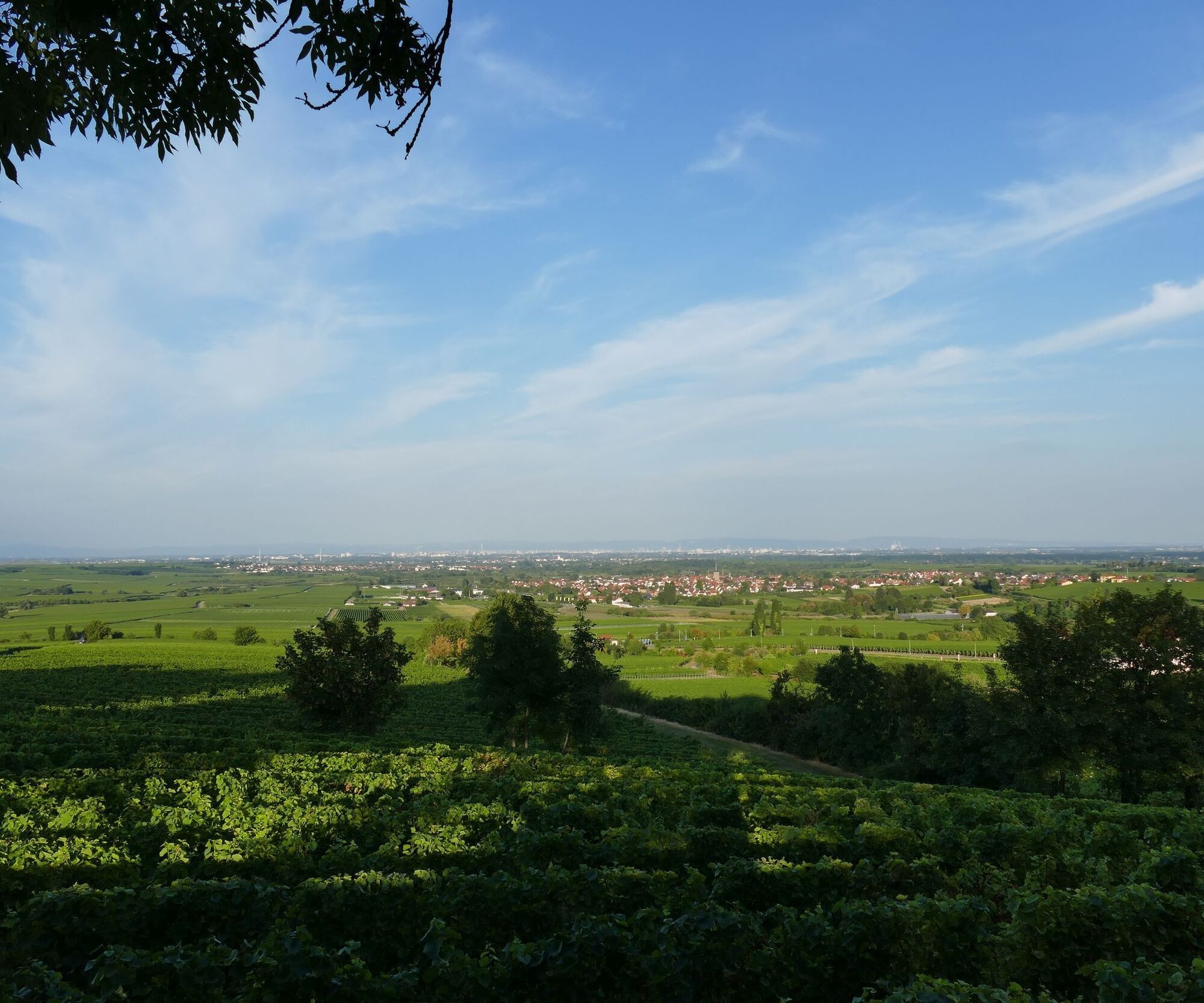
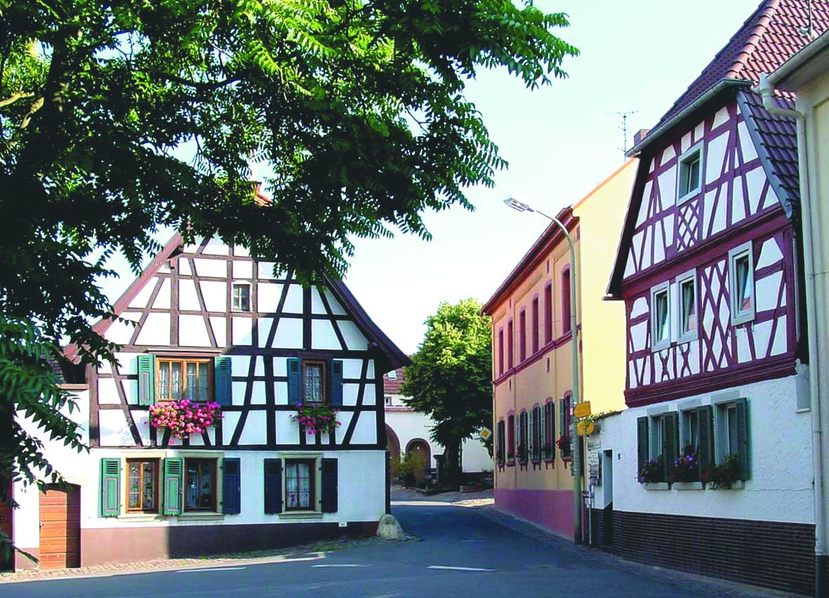
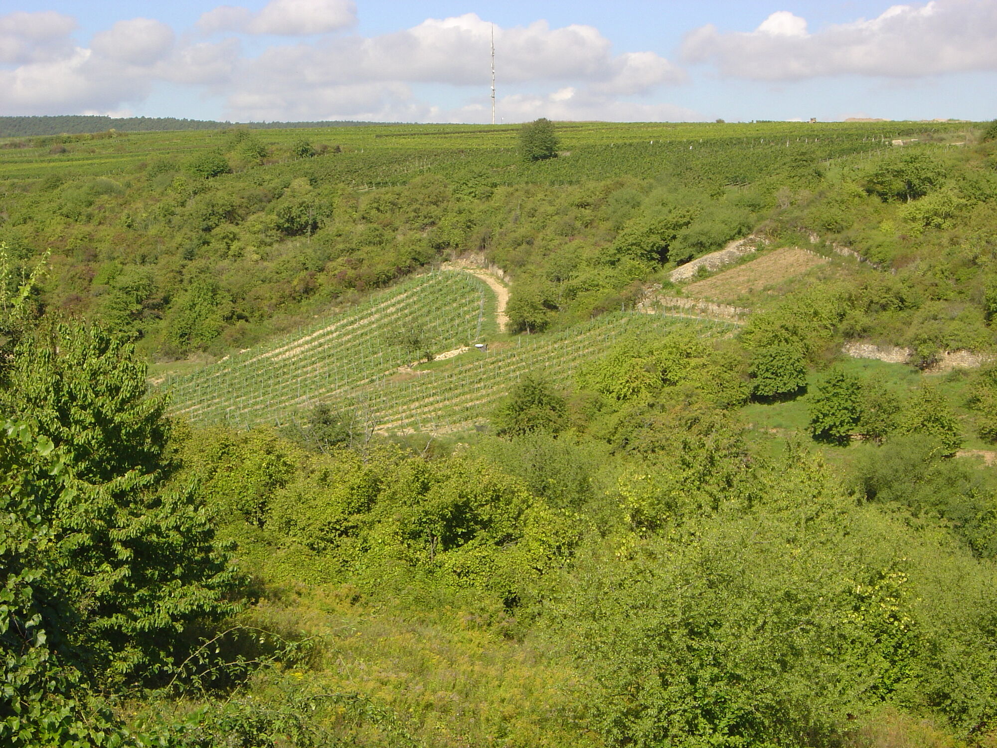
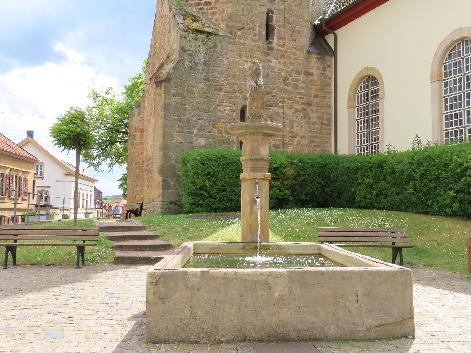
The hike begins at the village square in Weisenheim am Berg. You follow Leistadter Straße to the town exit. Here you turn right into Südtiroler Ring. At the height of Plauser Straße, go left out of the town. You are now on the German Wine Route cycle and hiking path, which you follow southwards to the entrance of Leistadt. Here you cross the country road at the Weidenhof car park and reach the entrance to the Felsenberg/Berntal nature reserve. You hike through the valley cut, past the impressive cliff edge of Felsenberg, through orchards and vineyards to the small bridge. Here, on the left, take the steps up to the Riesling hiking trail (marking: wine glass on blue post), which you follow to the left. The path leads you to the town centre to the square of 100 wines. Here stands the landmark St. Salvator church with the lion fountain, and at the tourist information i-point Kallstadt, you can get assistance with all your questions.
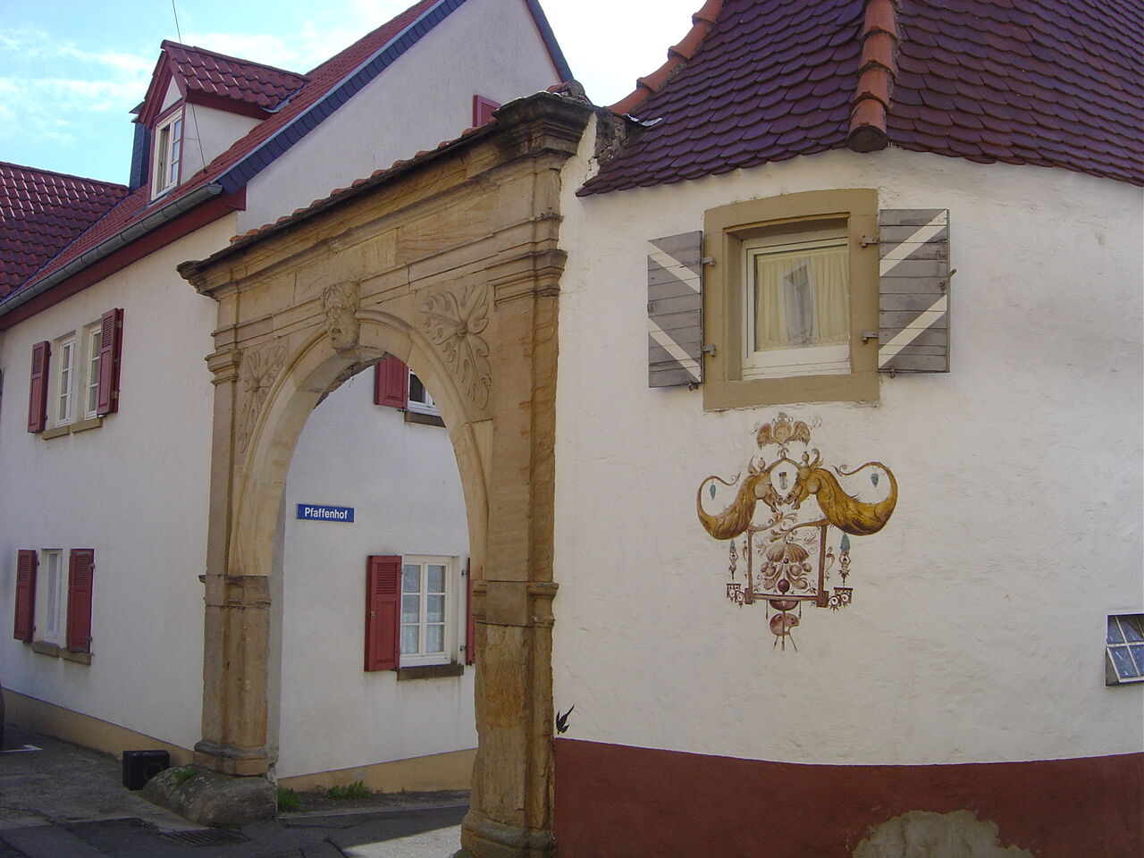
You cross the Wine Route and walk a short distance into Neugasse, then immediately left into Schlittweg until you reach Burgunderweg (marking: wine barrel on blue post). Follow Burgunderweg further north. After about 700 meters it bends to the right. Here is a sign about the bike path to Freinsheim. You follow the paved path to the distinctive Oschelskopf sculpture with a resting area. At Oschelskopf, turn left, then at the next fork immediately left again, and at the next crossroads, right. You now walk directly north again and reach Herxheim am Berg after a short ascent at the eastern town entrance. You go left over the main road uphill into the town and after the bend in the road turn right, passing the village green towards the church. Behind the church, you reach the castle garden with its wonderful view over the Rhine plain. Leave the castle garden on the opposite side and go left along Friedhofstraße to the German Wine Route, passing the Pfaffenhoftor on the left.
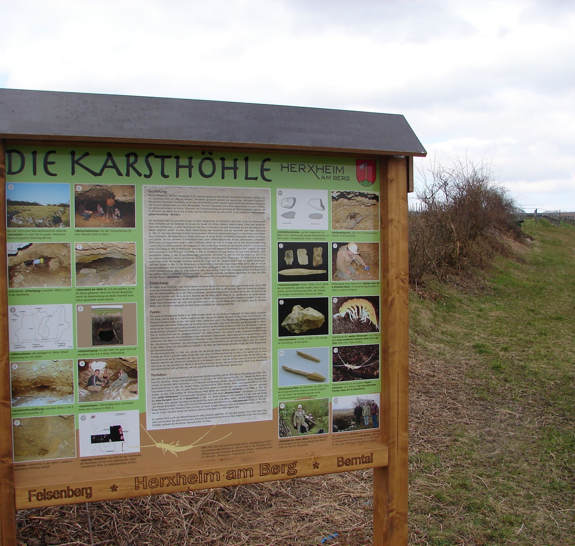
You cross the Wine Route at the traffic lights, go left, turn right into Raiffeisenstraße, and continue to the edge of town. There you turn left from Raiffeisenstraße into the vineyards and at the next junction left again until almost reaching the Wine Route. Here you turn right and follow the path a few meters parallel to the road until it makes a right bend at the stormwater retention basin. You pass the information board about the Herxheim karst cave and walk about 400 meters westwards towards the distant edge of the forest. You then turn right and at the vinotheque at Felsenberg turn left again. After about 300 meters, at the sign with the green cross, turn right and follow the farm track about 600 meters north, then shortly left, right, left in quick succession and walk a short stretch directly west. The paved path turns left again and immediately right and leads to the car park at the town entrance, from where it is just a few steps along Leistadter Straße until you reach the village square again.
Da
Da
Please wear clothing adapted to the weather and good footwear.
The route often runs on so-called farm roads. These are used for agricultural purposes and are driven by tractors and harvesters all year round. We point out that using these paths is at your own risk and ask for mutual consideration in the interest of all. The farm roads may be soiled by agricultural traffic. After rainy days and especially in winter, the paths may be wet and slippery.
From the north:
via the A61 motorway at the Frankenthal junction onto the A6 towards Kaiserslautern. Exit Grünstadt/Deutsche Weinstraße. Continue on B271 (German Wine Route) towards Bad Dürkheim, exit Weisenheim am Berg.
From the south: via the A61 motorway at the Ludwigshafen junction onto the A650 towards Bad Dürkheim. At the end of the motorway, continue on B37. Pass the Bruch industrial area, at the next traffic lights turn right to Ungstein. At the roundabout, take the 3rd exit into the town. After approx. 50 m, turn right onto B271 (German Wine Route), direction Grünstadt. At the traffic lights in Herxheim am Berg, turn left towards Weisenheim am Berg.
Bus line 453 from Bad Dürkheim or Grünstadt to Weisenheim, stop Weisenheim/Bg. - Community centre.
Timetable information www.vrn.de
Follow the parking guidance system in Weisenheim am Berg.
For more information on route tips and the Freinsheim holiday region, visit the Tourist Information i-Punkt Kallstadt, phone: 06322/667838 or at www.urlaubsregion-freinsheim.de.
During and after the hike, you can enjoy the diverse gastronomy in Weisenheim am Berg, Kallstadt, and Herxheim am Berg.
Priljubljeni izleti v okolici
- 4,0
Ganerbenweg - Premium circular hiking route in the Freinsheim holiday region
srednjaPohodništvo 10,5 km - 4,5
From Deidesheim over the Heidenlöcher to Eckkopf
srednjaPohodništvo 14,6 km Wachenheim - Eckkopf - Heidenlöcher - Wachenheim
srednjaPohodništvo 12,8 km- 5,0
Wachenheimer Valleys Route to Oppauer Haus
srednjaPohodništvo 11,7 km - 5,0
Circular route through forest and vineyard: Weisenheim am Berg - "Wine, Forest, Ungeheuer"
srednjaPohodništvo 12,5 km - 5,0
Leininger Castle Trail - Premium hiking trail with audio and video stations
težkoPohodništvo 22,3 km - 4,0
Thomas‘ Waldweinstube über die Wachtenburg
svetlobaPohodništvo 4,81 km - 3,5
Leininger Monastery Trail - Premium hiking trail with audio and video stations
srednjaPohodništvo 15,3 km Palatinate Wine Steig Stage 03 Bad Dürkheim - Deidesheim
srednjaPohodništvo v daljavo 15,2 km- 4,3
Zwei-Burgen Tour Battenberg
srednjaPohodništvo 5,43 km
Pohodništvo in sledenje


Ne zamudite ponudb in navdiha za naslednje počitnice
Vaš e-poštni naslov je bil dodan na poštni seznam.