


Schönborn Weather Educational Trail, Route 1 (red)
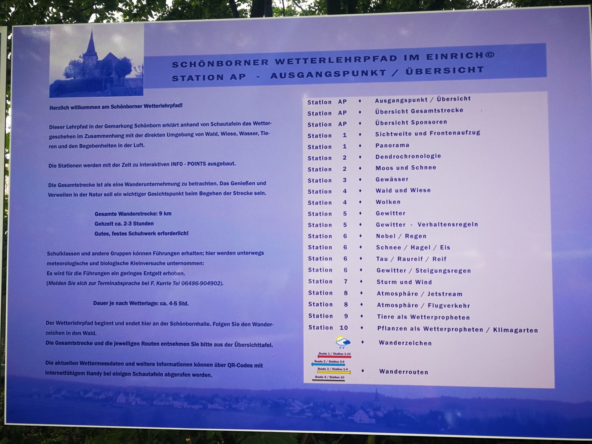
Schönborn Weather Educational Trail in Einrich:
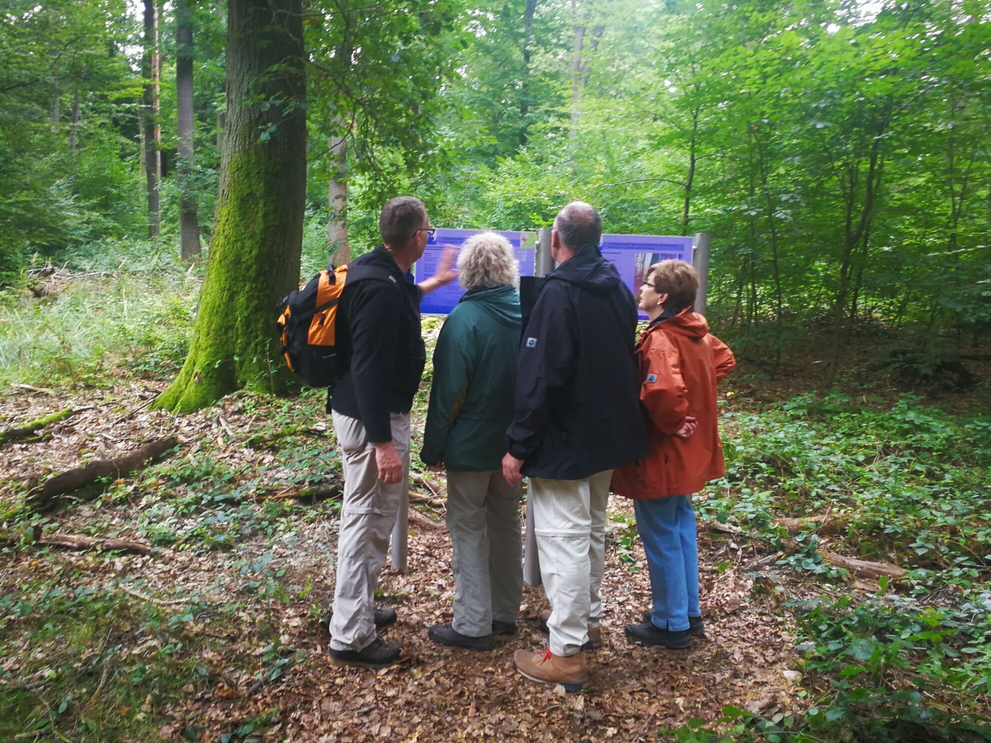
The educational trail describes at several local sign stations the connection between the immediate surroundings of the forest, a body of water, as well...
Schönborn Weather Educational Trail in Einrich:
The educational trail describes at several local sign stations the connection between the immediate surroundings of the forest, a body of water, as well as plants and animals, with the emerging microclimate and the effect on the large-scale weather.
The weather educational trail starts at the sports field/Schönbornhalle; Diezer Straße 40, Schönborn.
At the starting point you will find a flyer with information about the weather educational trail.
Route: sports field/Schönbornhalle, Lohrheimer Eck with panorama sign, biotope, Hühnerkopf, retiree's house, Ergenstein, Gilgesloch, Schönborn, weather station–climate garden, sports field/Schönbornhalle

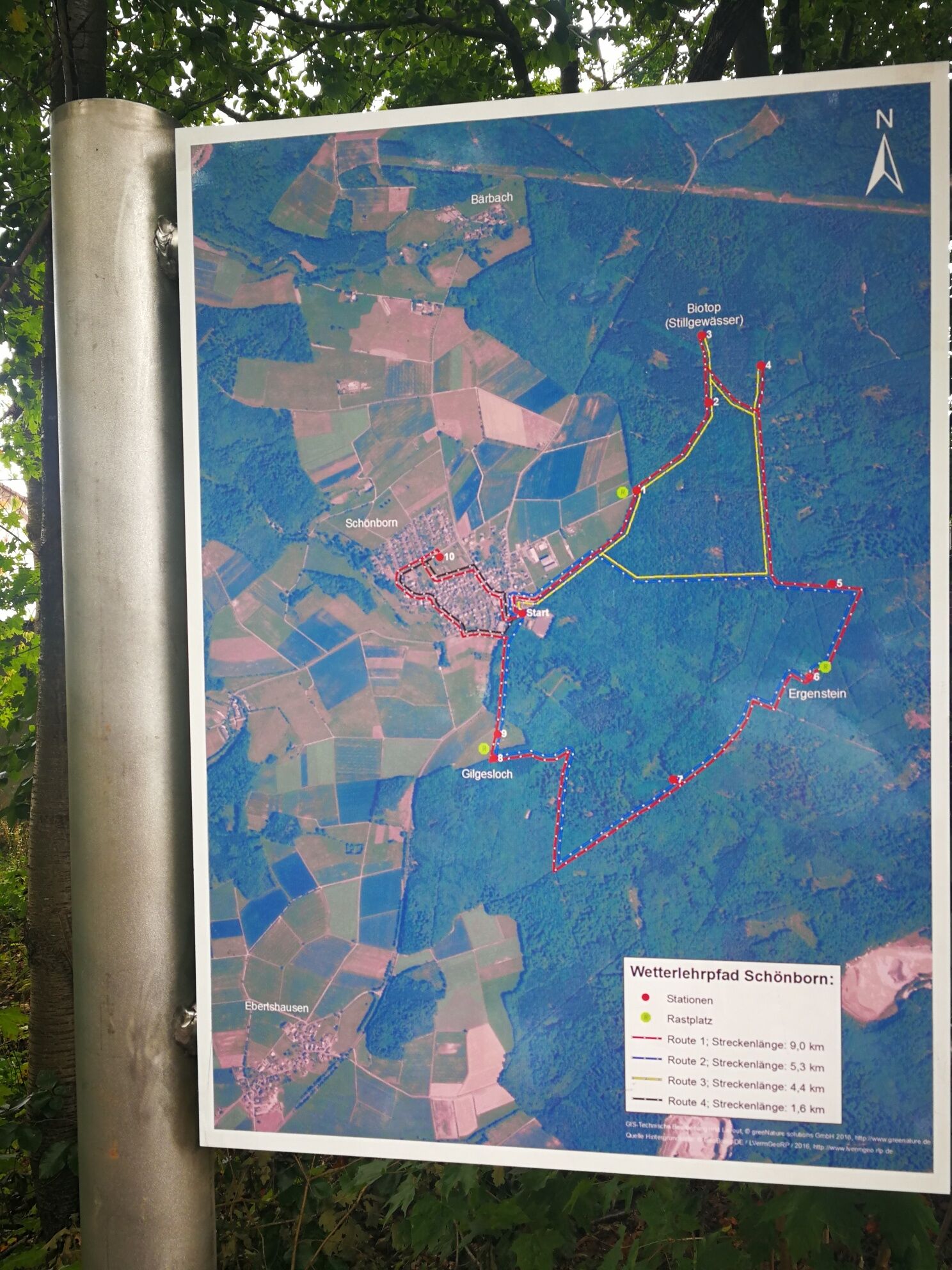
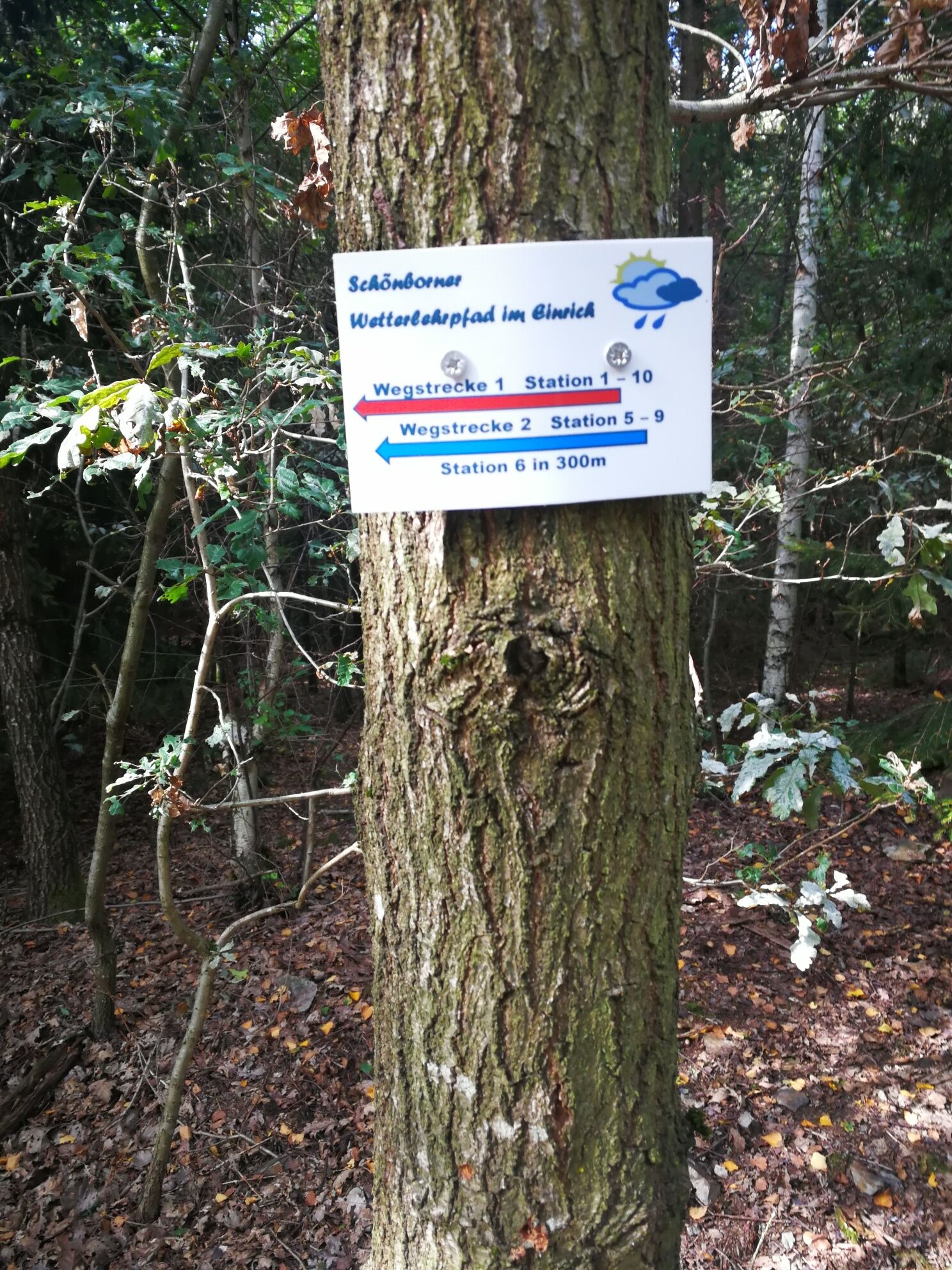
The start of the circular route is the parking lot for the Schönbornhalle and the sports field at the eastern edge of Schönborn. From L 318, a sign points to the parking lot with the “weather educational trail.”
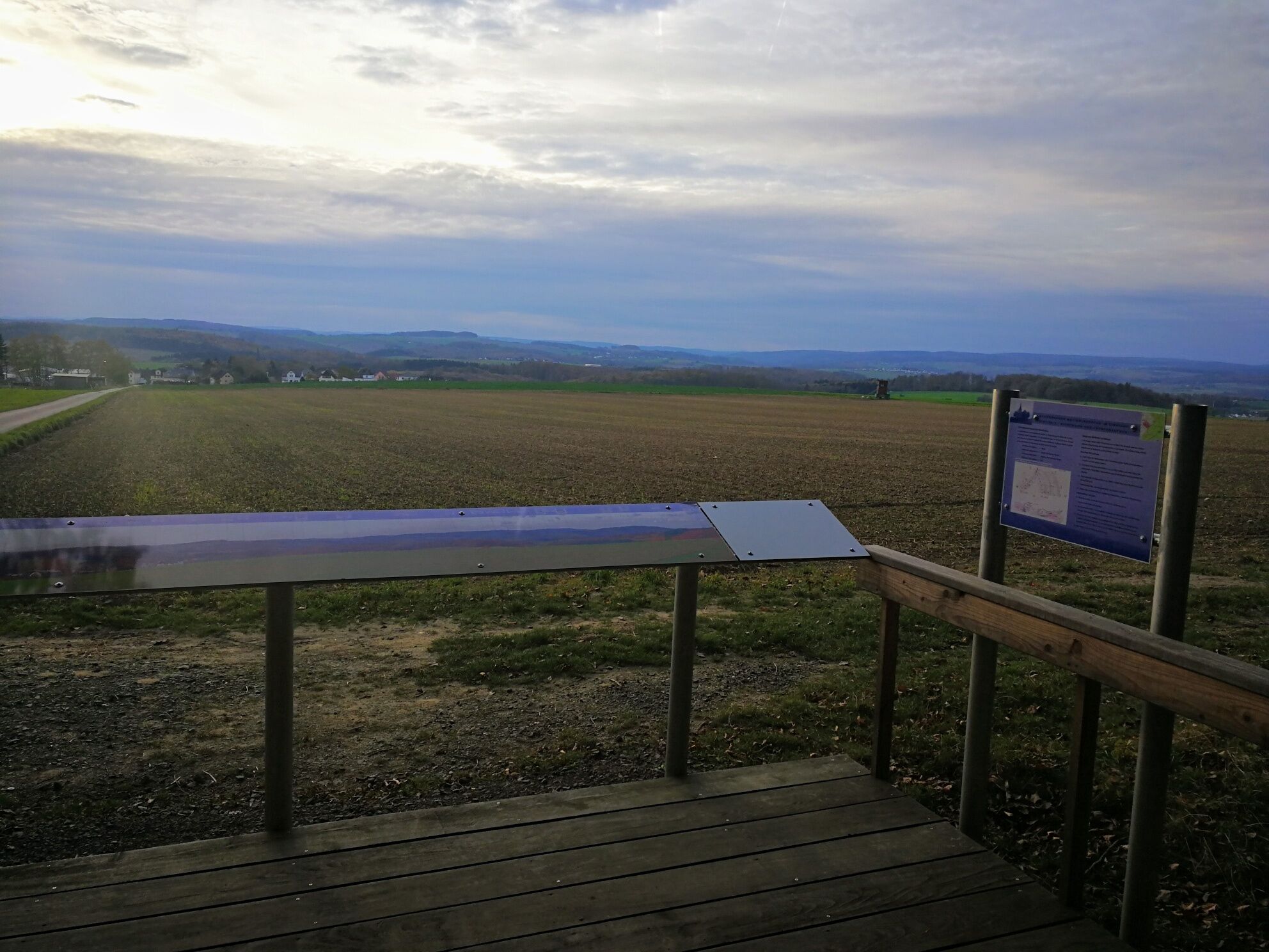
From the parking lot, walk back to the main road/Diezer Straße, keep right and immediately turn right again into Hahnstätter Straße. This short street eventually turns into a meadow path, and you can already see station 1 at the forest edge ahead. “Visibility and frontal approach” along with explanations of the panorama are the theme here. Behind the station, arrows spray-painted on trees mark two path options.
At the end, follow the clear path to the left and reach station 2, where you focus on the annual rings of trees. Using dendrochronology, the interpretation of annual rings, you can research the climate of past times. Moss and snow on tree trunks can help determine directions without a compass.
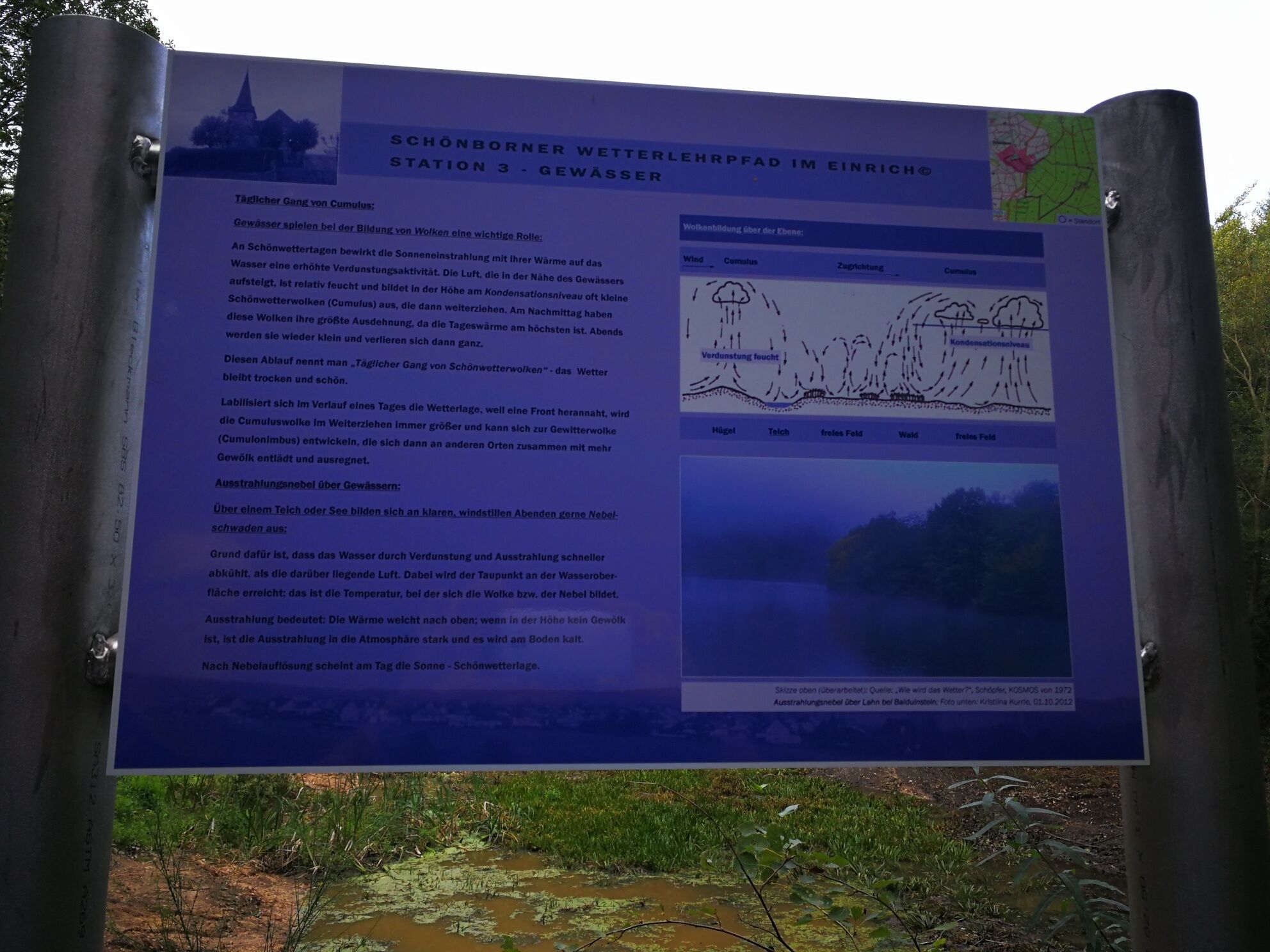
Straight ahead follows station 3, focusing on bodies of water and their importance for cloud formation. However, from the heavily overgrown small pond, one cannot expect significant evaporation or atmospheric effects!
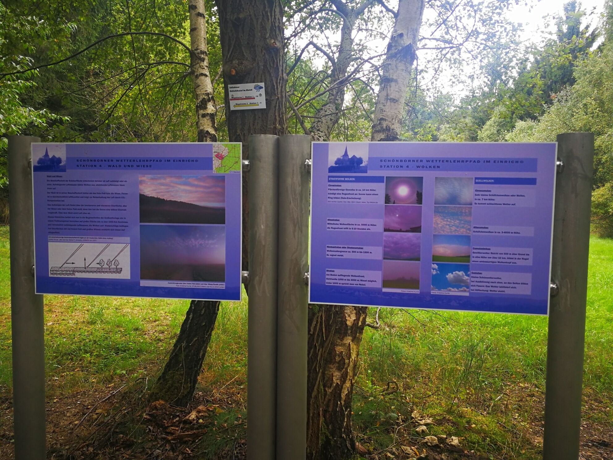
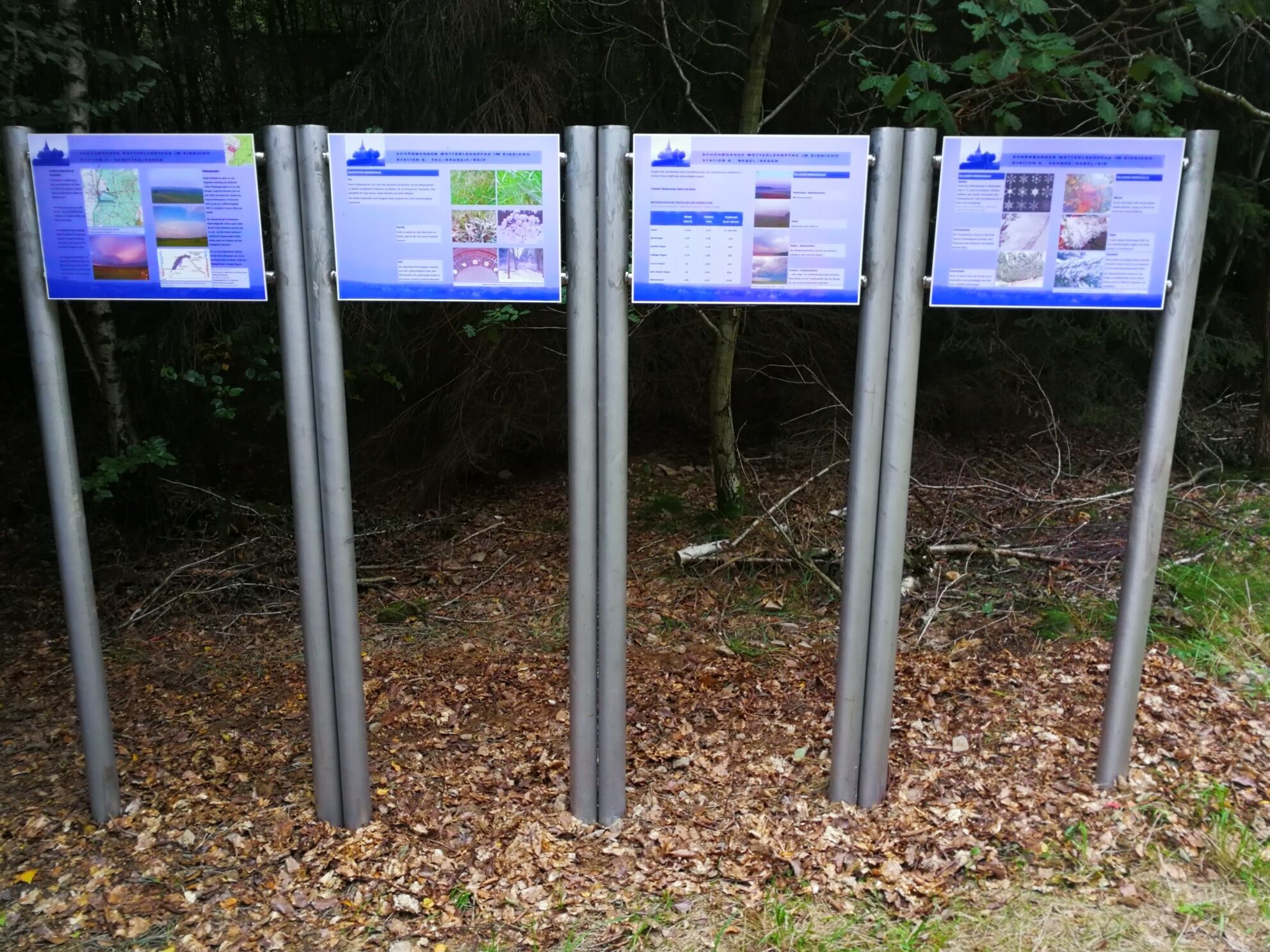
From this station, walk a few steps back and then follow the left path. At the next junction, turn left again and reach station 4. Here, the significance of the earth's surface composition and its vegetation on air masses is explained. A second display panel explains cloud types, but due to the small clearing and tiny sky view here, not much can be observed!
The weather hike returns along the same path, and from the next crossroads, it continues straight ahead and then about one kilometer straight through dense forest. At a junction with a shelter, turn left and proceed through a bare coniferous forest to station 5.
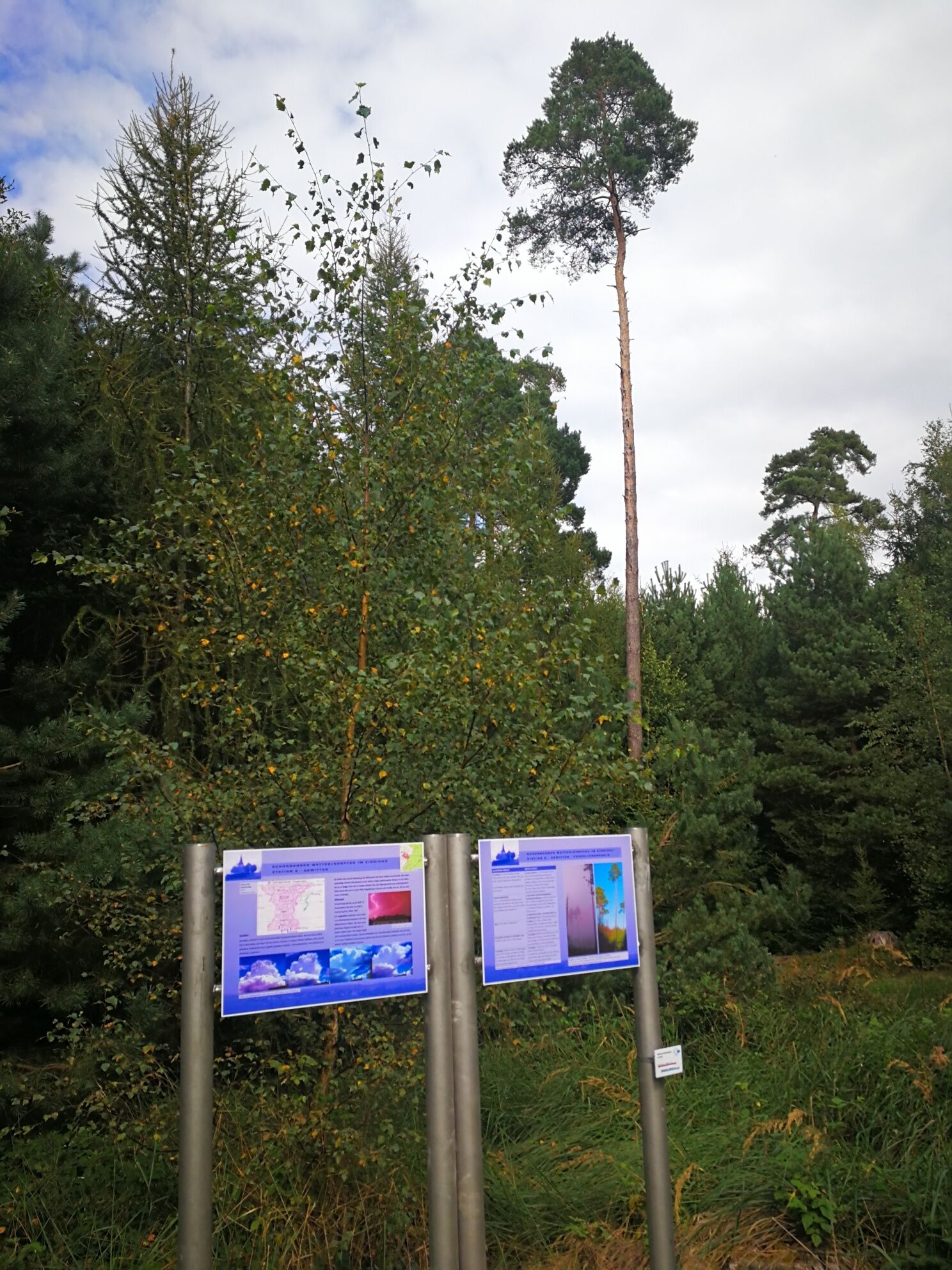
Very useful, if not life-saving, information is provided here about the correct behavior in the landscape during thunderstorms.
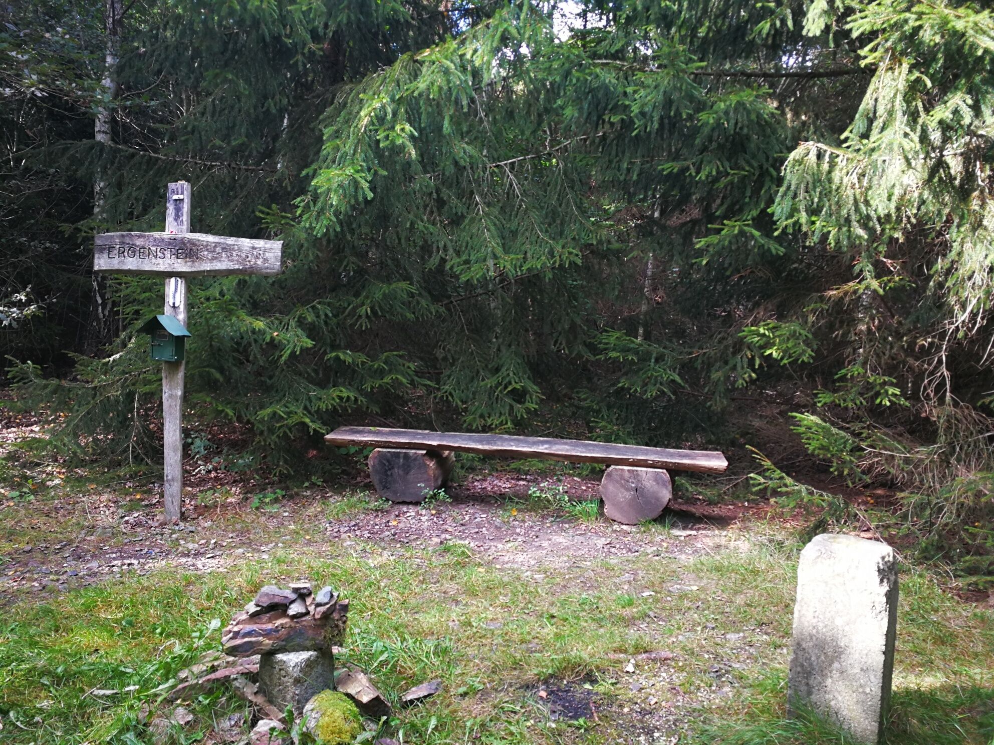
Follow the path further through the forest; after a bend, the grassy path rises slightly, and you reach a resting place. From here, a narrow path behind the rest area leads into the forest, and after a short distance, you stand, without noticing it, on the 419.6 m high summit of the Ergenstein. Then, of course, you descend again, first keeping right, at the next crossing turning left, and head toward a raised hide. To the right of it is station 6, dealing with many common weather phenomena such as fog, rain, snow, hail, and dew.
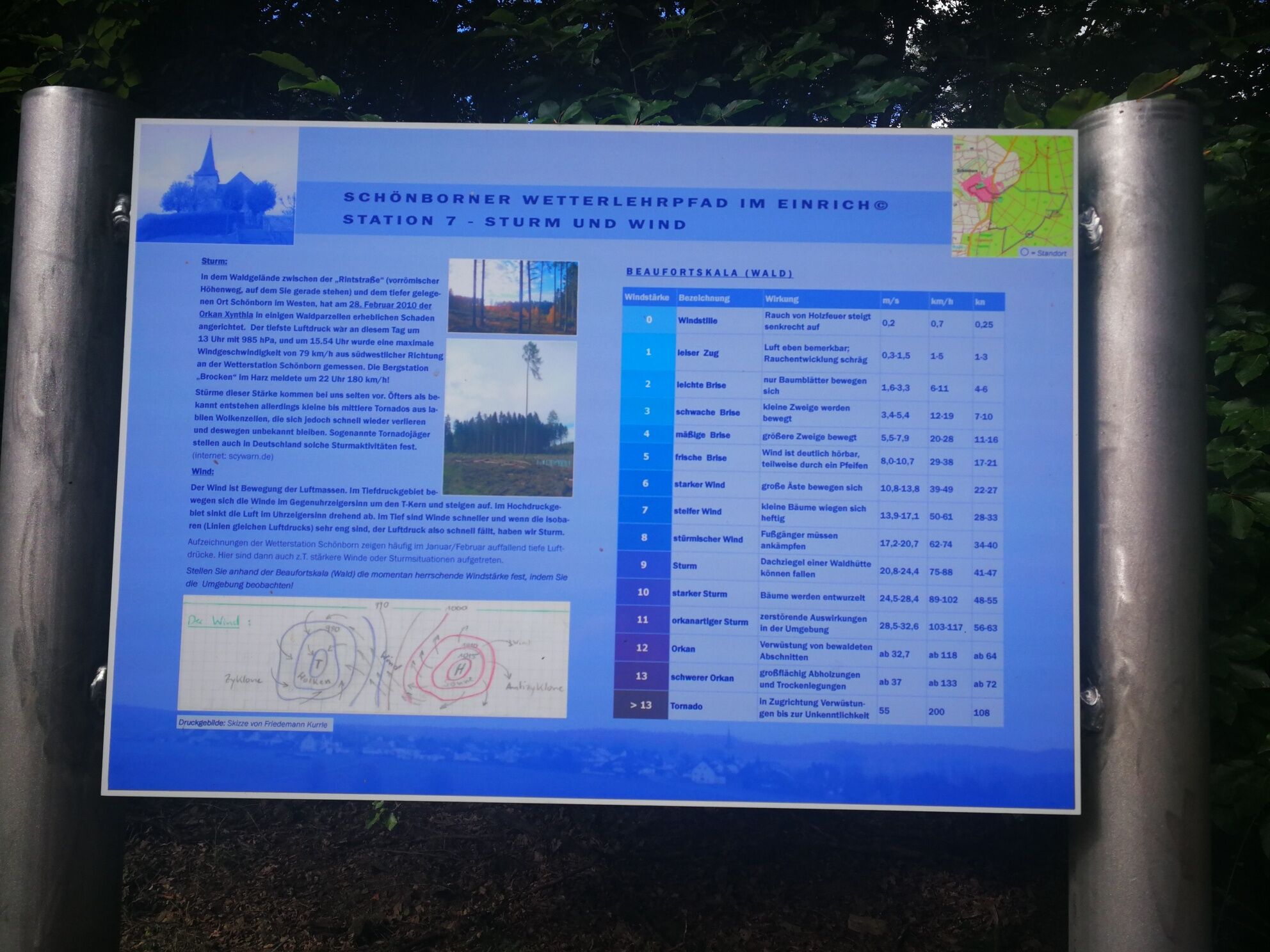
Follow the path, turn left at the next opportunity, and come again onto an endlessly long straight stretch, where around the middle, station 7 offers some variety. Here, you learn about storms and wind. Continue straight on the “forest autobahn,” and at the next crossroads, the southern tip of the circular route is reached. Turn right, remain on the path until it makes a slight right curve.
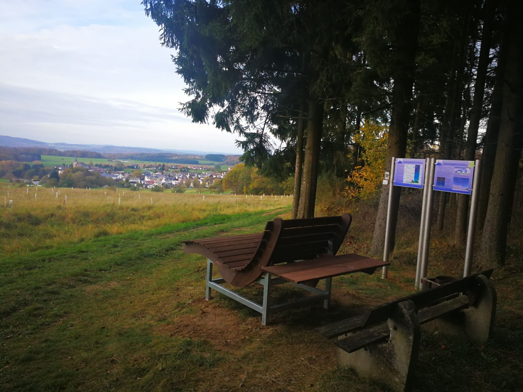
Here the weather educational trail branches off left and leads to a clearing and dead coniferous forest. Finally, you approach another panoramic view—the second on the route. A comfortable hiking lounge at station 8 helps greatly to enjoy the view, and the information boards let thoughts drift high into the atmosphere.
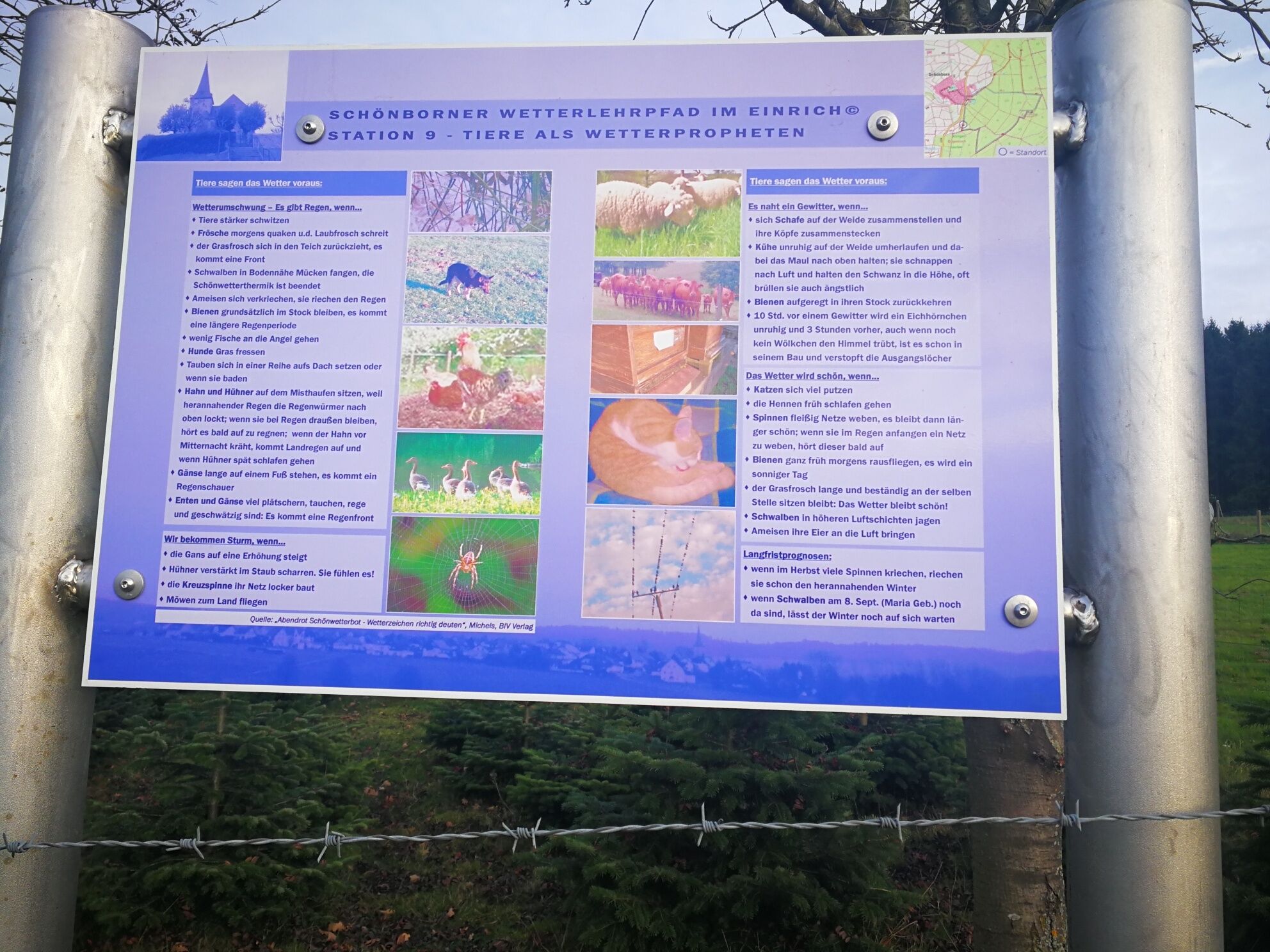
Only a few meters down is station 9, giving examples that some animals are also suitable as weather prophets. Follow the path which soon turns into a forest trail and approach the village on it.
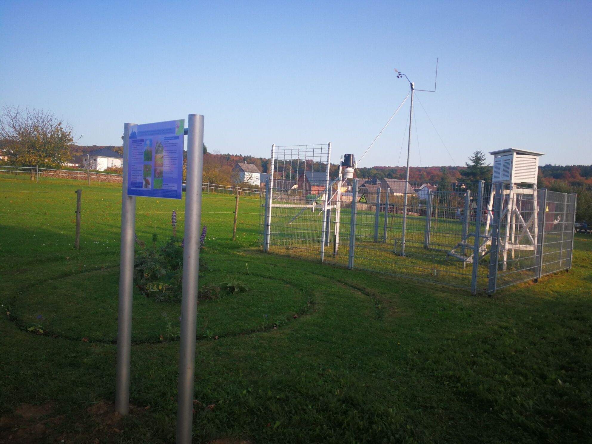
At a car dealer, cross L 318, keep left and immediately turn right toward Bibrich. Because the southern village edge currently has a large construction site and roads are partially closed, aim for the village church and find your way that way. Thus, you reach Ringstraße, where opposite the fire station station 10 can be found. Here you see a professional weather station that provides data to the German Weather Service.
The way back to the parking lot leads back to the next field path on the left, then left again before a long wall, past a chapel onto Schaumburger Straße. Keep right, cross the main road, and then walk along Talstraße back up to L 318/Diezer Straße. At the end, right and the second narrow street on the left is the driveway to the parking lot, the starting point.
Da
Da
Da
Da
Via A3 Limburg an der Lahn, toward Birlenbach/Katzenelnbogen, 56370 Schönborn, Diezer Straße 40, sports field/Schönbornhalle
By train to Limburg an der Lahn or ICE to Limburg Süd, then with bus line 580 (also stops at ICE-Limburg-Süd), then to Schönborn, Diezer Straße stop, buses run hourly.
At the Schönbornhalle
Municipal Association Aar-Einrich
Tourism
Austraße 4
65623 Hahnstätten
tourismus@vg-aar-einrich.de
Internet: www.vg-aar-einrich.de or www.lahn-taunus.de
Geocache: Schoenborner Weather Educational Trail
Meteorological guided tours
Friedemann Kurrle
06486/904902
friedemann.kurrle@gmx.de
Places to eat and overnight accommodations
Priljubljeni izleti v okolici
-
4.7
LahnWeinSteig
težkoPohodništvo 11 km -
5.0
Lahnwanderweg 16th stage upstream Balduinstein - Diez - Limburg
težkoPohodništvo 14.0 km -
Lahnwanderweg 15th stage upstream Limburg - Villmar
težkoPohodništvo 13.4 km -
Lahnwanderweg 17th stage upstream Obernhof - Balduinstein
težkoPohodništvo 19.4 km -
Aartal cycle path
svetlobaKolesarjenje 55.5 km -
5.0
S8 Rundweg
svetlobaPohodništvo 12.2 km -
Lahn Cycle Path 7th Stage upstream Nassau - Diez/Limburg
srednjaKolesarjenje 34.1 km -
Canoe route Lahn from Limburg to Laurenburg
srednjaKajak / Kanu 27.0 km -
Canoe tour Lahn from Runkel to Limburg boat slipway
svetlobaKajak / Kanu 10.5 km -
5.0
Von Nassau über Winden nach Dies und ein Stück Gelbachhöhen-Tour
srednjaE-MTB 28.7 km
Pohodništvo in sledenje


Ne zamudite ponudb in navdiha za naslednje počitnice
Vaš e-poštni naslov je bil dodan na poštni seznam.