







Moselsteig Trail Stage 04: Konz – Trier
This stage is dedicated to the ancient Romans: the starting point in Konz is the former gateway to the city of Trier and also seat of the summer residence of Emperor Valentinian. After crossing the Moselle,...
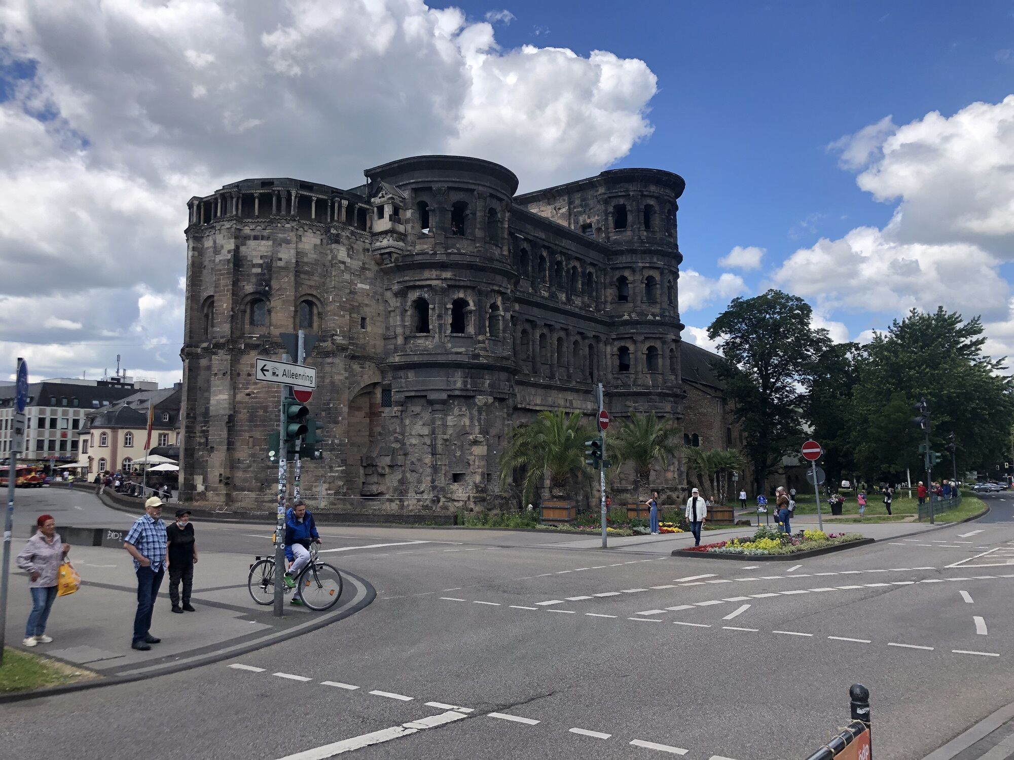
This stage is dedicated to the ancient Romans: the starting point in Konz is the former gateway to the city of Trier and also seat of the summer residence of Emperor Valentinian. After crossing the Moselle, you have the opportunity to make a short detour to the UNESCO World Heritage Site, the Igel Column, a richly decorated Roman burial monument, which, at 23 metres high, is the highest Roman pillar tomb north of the Alps. Despite its proximity to the Moselle city of Trier, this next section of the trail is sure to excite you with its abundance of Nature. A short but steep section of the trail finally leads downhill into the Busental Valley. A link road leads into Germany's oldest city – and to its world-famous and well-preserved Roman buildings and the UNESCO World Heritage Sites, such as the Porta Nigra. This is a university city with a lively and very attractive Old Town.
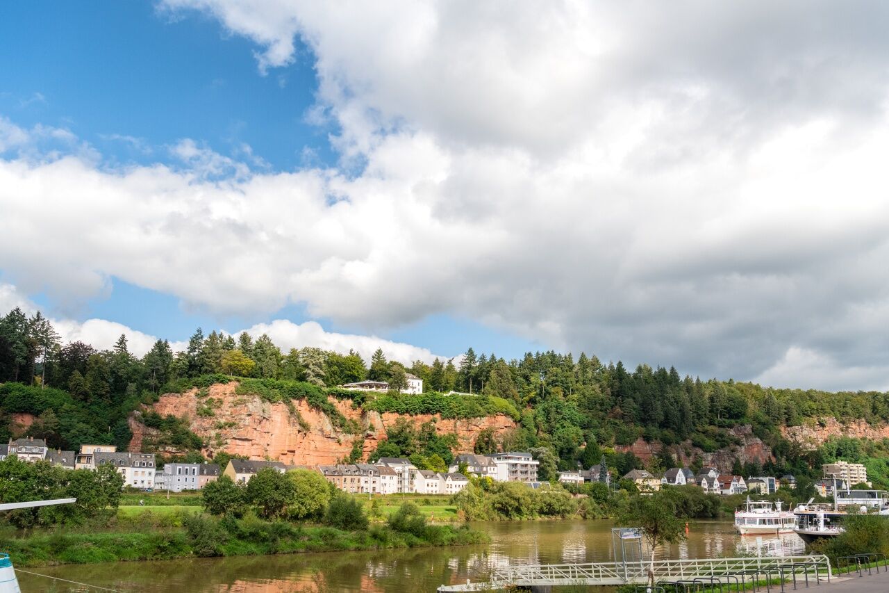

THE Moselsteig Trail crossed the railway line and several roads, before it reaches the Konzer railway bridge at the Kreuz Konz stopping point. This is the first Moselle crossing for all Moselsteig Trail hikers walking the Moselsteig Trail in the direction of the river’s flow. From the bridge, you have a great view of the river in the area of the Saar mouth. Once you arrive at the banks of the Moselle, you have the choice: You can now also take the trail towards Wasserbilligerbrück and visit the impressive Igel Column (Roman grave).
On the way to Zewen, the Moselsteig Trail runs very flat through the river’s floodplain. Pass under the B 49. Next, you need to cross an unrestricted railway crossing (please be very careful here!). At the Wasserbilliger road, the access route branches off towards the town centre. Passing through quiet residential roads the Moselsteig Trail continues uphill to the edge of the forest. Hike the last steep uphill section to the edge of the forest on footpaths.
The trail continues uphill through the closed forest, first moderately steep, and later quite steeply, until you reach the mountain hut at the K 2. The nearby road is not very disturbing, you can rest here. After all you have already covered the majority of the ascent on this leg! After a few metres along the road, the trail continues at a slight incline towards the Zewener Stream; the stream becomes closer and closer to the trail. At half way around the small town district of Herresthal, you will reach a resting place in the midst of cows and horses. Continue on grass paths and arrive at the field for model plane flying on the ridge. Take a look to the south here: A stunning panorama view opens up. You can even see the Löschemer Chapel (on the other side of the Moselle, above Wasserliesch), which is one of the highlights of the Nittel – Konz leg! Continuing over the ridge, you are treated to views of the South Eifel and the Moselle right to the Hunsrück.
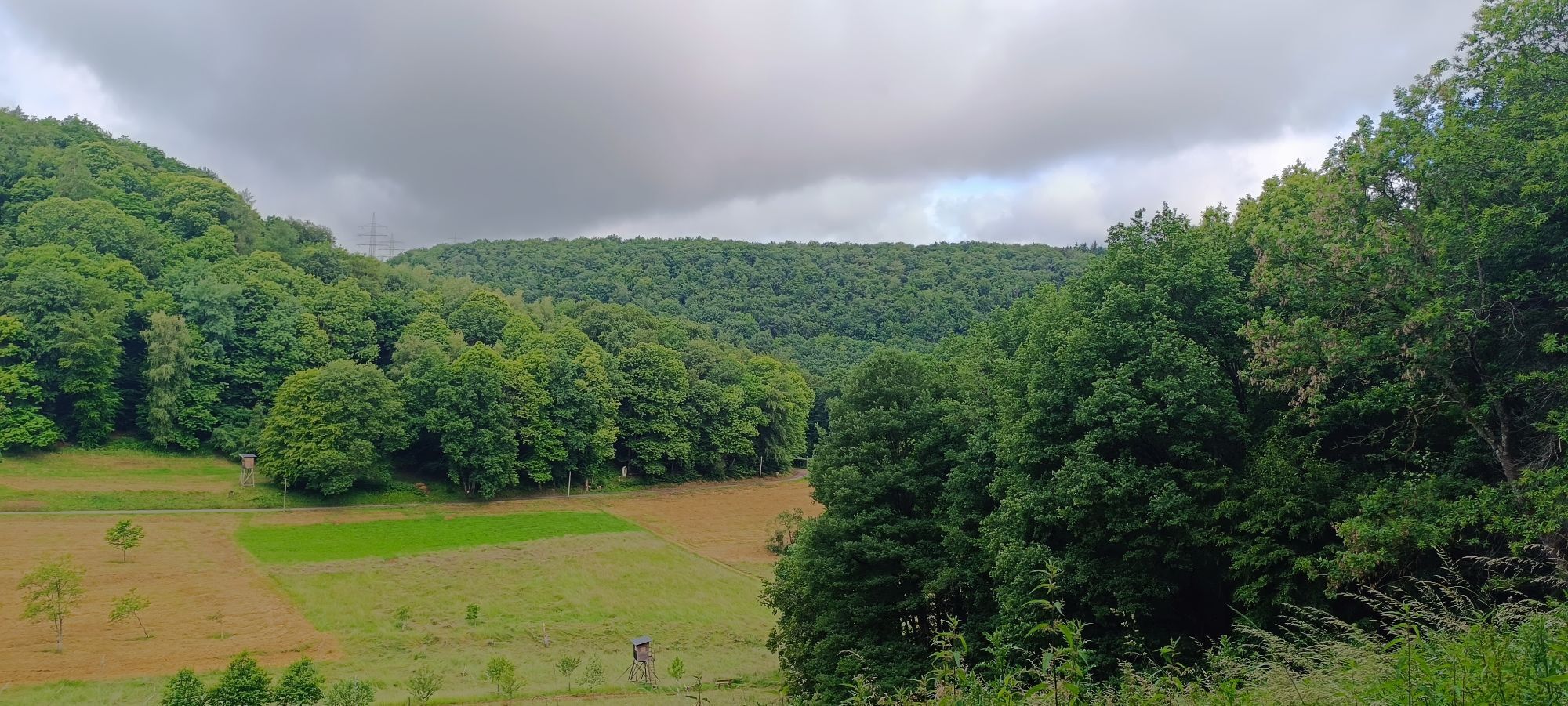
After a road crossing, the Moselsteig Trail continues a short distance on the ridge, and then descends on a tar road at the edge of a large meadow. The section through the forest is quick and easy, as the trail continues without great differences in altitudes in wide loops around the Mohrenkopf. Light beech forests alternate with more dense Douglas fir trees. Some trees have incredible dimensions. This longer forest section ends at the access road to the Trier town district of Markusberg. After a few metres on the access road (inn tip: Café Mohrenkopf), the Moselsteig Trail abruptly changes to a path, which continues at a steep descent across a meadow to arrive at the Busental Valley. This section can be wet, please be careful! The grassy path continues slightly downhill to the picturesque valley. Here you can enjoy absolute tranquillity - so close to the city of Trier!
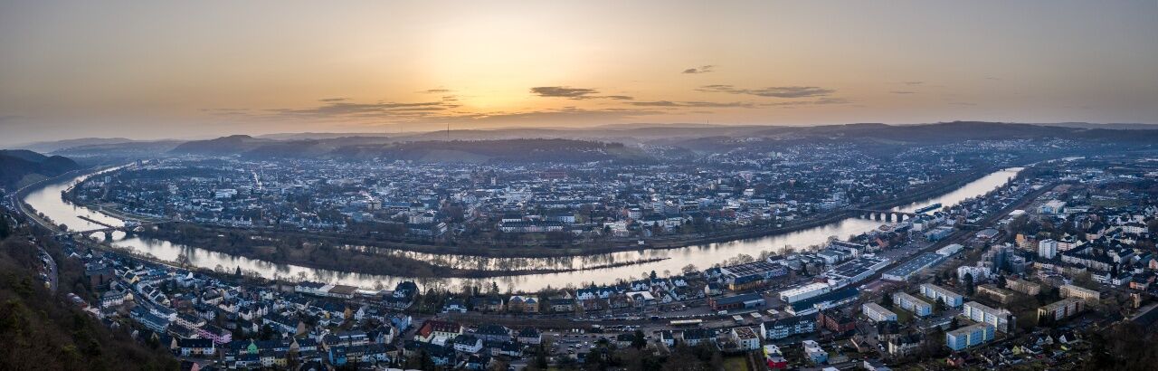
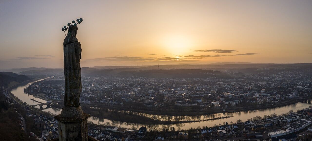
In the forest, continue on a gently sloping path. At a side valley junction, you will arrive at the fork towards the Mariensäule (Mary Column). Here, a detour on the steep and challenging access route is well worth taking, as the area below the Mariensäule (Mary Column) offers one of the probably most beautiful views of the Roman town of Trier! The Moselsteig Trail continues a little further through the forest, before it changes to a grassy bath at the edge of the forest. Ancient fruit trees to the right and left complete the idyllic picture. Cross the Sirzenicher Stream on a footbridge, and you arrive at the Biburger road in Trier-Pallien. (You can take a bus here to the Trier city centre.)
The Moselsteig Trail continues through the university grounds and at the Drachenhaus Park it meets the access route to the city centre. The section to the city centre of the main railway station is a steep descent to the Moselle Bridge. Take your time and enjoy the view of the city. Crossing the Kaiser-Wilhelm Bridge, you quickly arrive at the other Moselle river bank. Now, it’s only a pleasant stroll through the parks of the Alleenring, past the Porta Nigra to the Trier central railway station.
Leisure Map Moselsteig Trail – Map 1: Perl - Trier (Stages 1 - 4), ISBN: 978-3-89637-419-6
Sturdy hiking footwearAppropriate weatherproof hiking gearPicnic lunch
Destination: Trier via the A 602 or the B 51/B 49
There are regular connections. Please note that during the school vacations of Rhineland-Palatinate / Saarland, at weekends and on public holidays there may be restrictions on the frequency! Please refer to the timetable information on the website of the Verkehrsverbund Region Trier (VRT) for the daily timetable: www.vrt-info.de
Trier: There is no free parking at the railway station or in the city centre, although you can use the Weisshauswald hikers' car park
close to the university.
This is a stage for warmer days, as large sections of it lead through shady woodland or along lofty heights.
Pridobite vpogled
Vedno v živo na mestu z več kot 9.500 spletnimi kamerami. bergfex Kot uporabnik Pro si lahko zdaj ogledate ustrezne spletne kamere za številne izlete v aplikaciji izleti iz. Tako si lahko neposredno ogledate trenutne razmere.
Priljubljeni izleti v okolici
-
5.0
Teufelsschlucht eifel
srednjaPohodništvo 21.0 km -
4.5
Basilique Saint-Willibrord - Méchelskierch - Saint-Remi - Honsréck
srednjaPohodništvo 36.8 km -
5.0
Moselsteig stage 05: Trier – Schweich
srednjaPohodništvo v daljavo 20.0 km -
Moselsteig stage 04: Konz – Trier
srednjaPohodništvo v daljavo 21.0 km -
4.0
Moselsteig stage 03: Nittel – Konz
težkoPohodništvo v daljavo 22.5 km -
5.0
Mosel Cycle Path Section 3: From Trier to Mehring
svetlobaKolesarjenje na dolge razdalje 25.4 km -
Traumschleife Manternach - Luxemburg
srednjaPohodništvo 9.64 km -
Mosel Cycle Path Section 2: From Nittel to Trier
svetlobaKolesarjenje na dolge razdalje 24.7 km -
4.5
Bistro Martbusch - Saint-Jean - Maria - Echternach
srednjaPohodništvo 16.1 km -
Schönes Weingebiet Galgenberg Konz, Deutschland
svetlobaPohodništvo 14.4 km
Pohodništvo in sledenje


Ne zamudite ponudb in navdiha za naslednje počitnice
Vaš e-poštni naslov je bil dodan na poštni seznam.





