
Hiking La croix du Collet
težko
Pridobite to turo v svoj mobilni telefon
Hiking La croix du Collet
težko
Snežni čevlji
5.87
km
Skenirajte kodo QR in začnite navigacijo v aplikaciji bergfex.


Pohodništvo in sledenje





Hiking La croix du Collet
težko
Razdalja
5.87
km
Trajanje
04:00
h
Ascent
373
hm
Morska gladina
1,516 -
1,855
m
Prenos skladbe
Hiking La croix du Collet
težko
Snežni čevlji
5.87
km
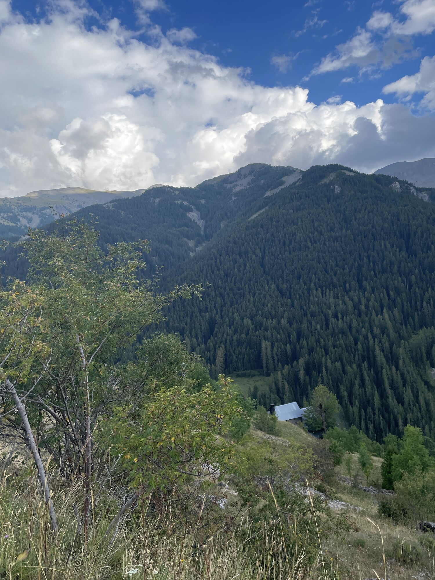
Peaceful stone barns clad in lime and larch cladding roofs mark the initial climb towards the Saint-Sébastien chapel and its bell tower restored in 2012. The impromptu arrival at the collar cross allows...
Opis
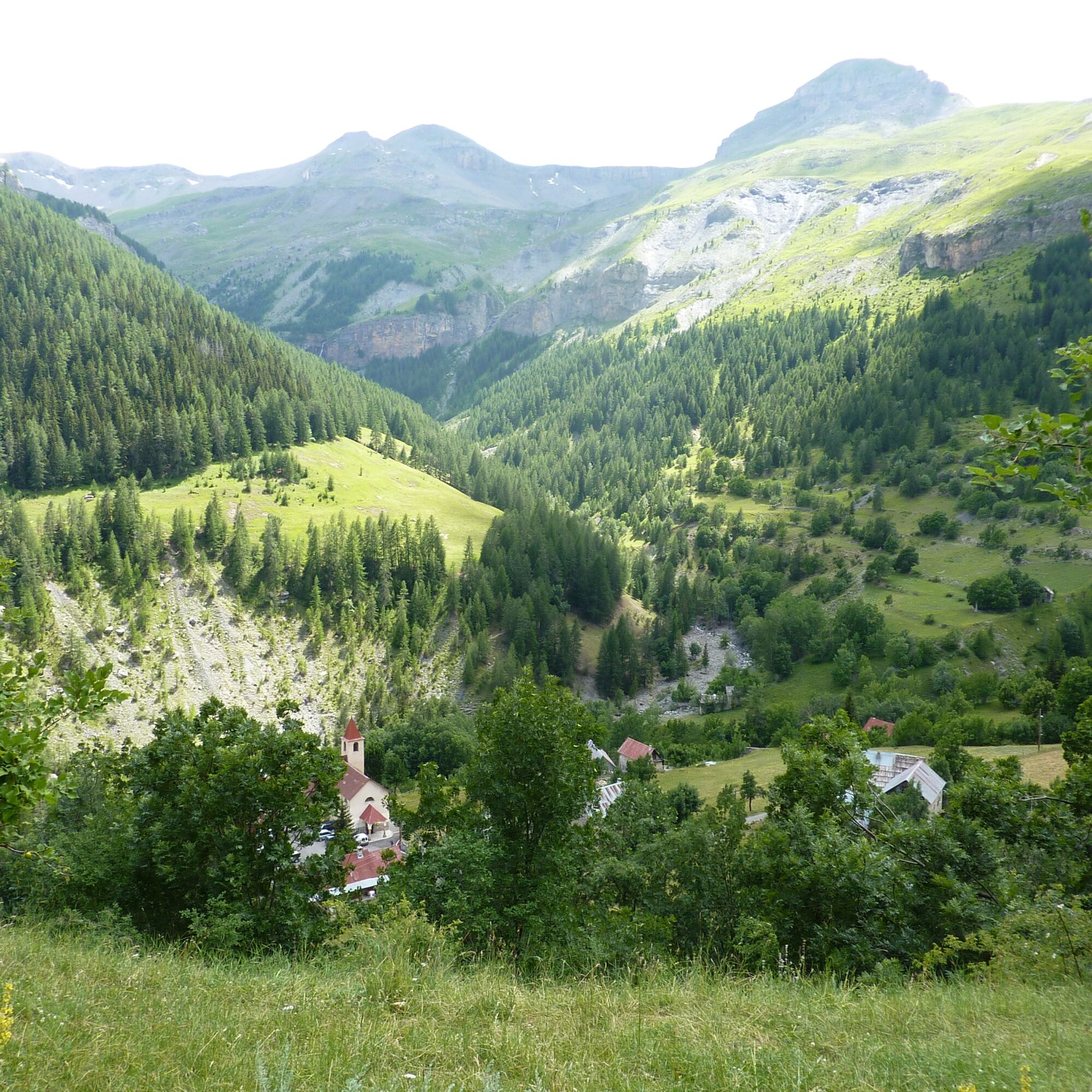
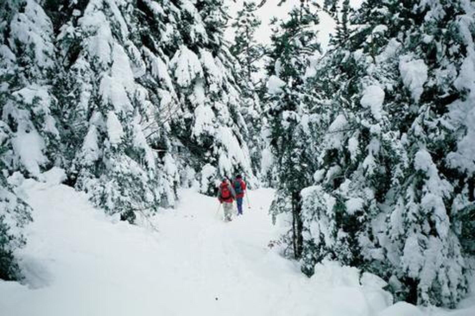
Peaceful stone barns clad in lime and larch cladding roofs mark the initial climb towards the Saint-Sébastien chapel and its bell tower restored in 2012. The impromptu arrival at the collar cross allows the discovery of a magnificent panorama which extends to the south over the Mercantour National Park and in particular the ridge of Mont Mounier, Peyre de Vic and Mont Rougnous, which is articulated on both sides another from the Sallevieille valley whose gentle snowy slopes inspire contemplation. Note that the area visited is a wintering place for ungulates; it will not be uncommon to observe chamois, deer or wild boar there.
Elevation gain: +430 meters / -430 meters
Distance: 6 kilometers round trip
Duration: 4 hours
Recommended period: December to March
Avalanche risk depending on conditions: Simple
Cartography: TOP 25 n° 3639 OT
Itinerary :
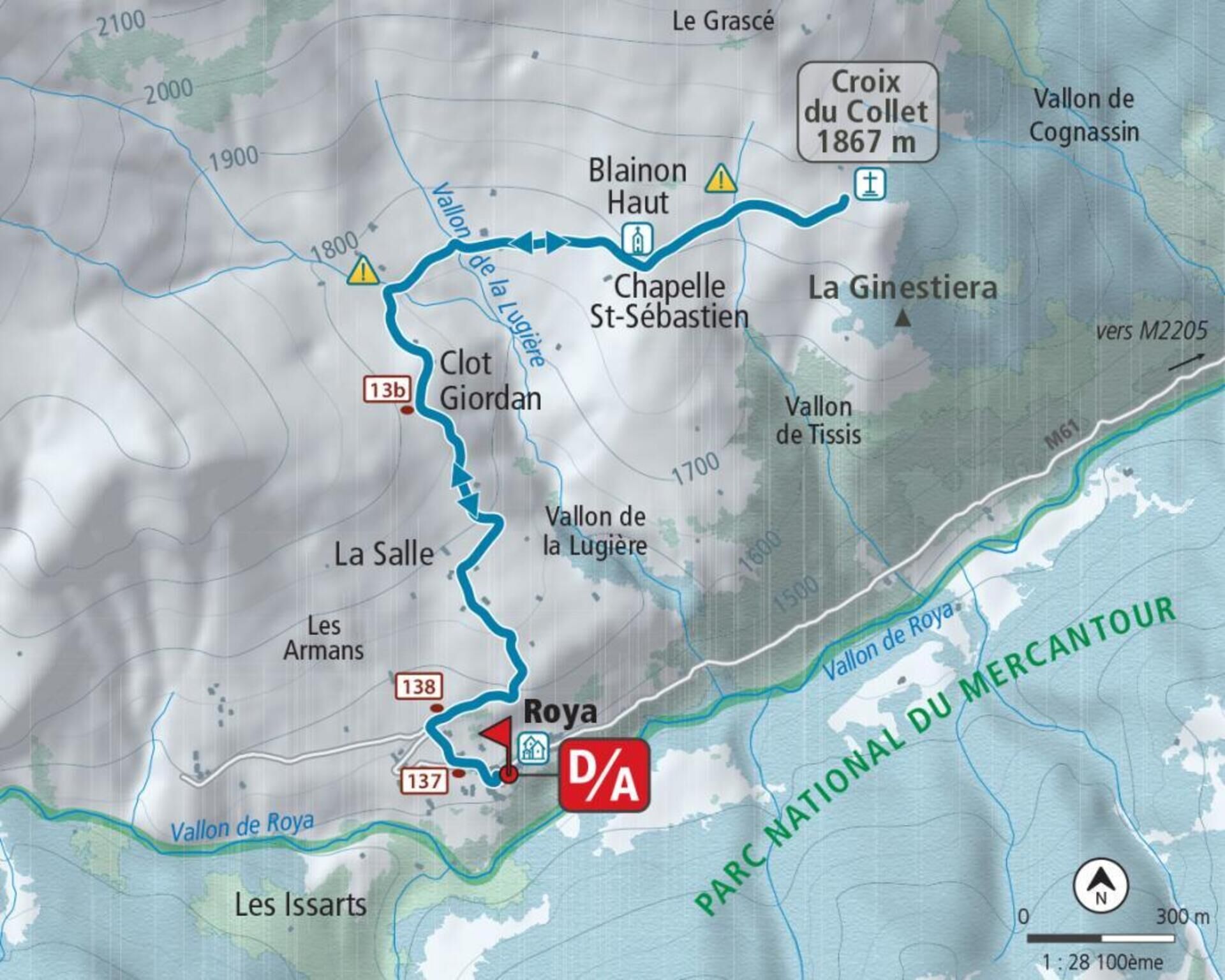
From the place of the hamlet of Roya (1,500 m - b.137) take the small road behind the stopover lodge, to find the path which goes up between the houses until reaching marker 138. Continue by turning right direction the Col du Blainon, and gradually rise to the La Salle plateau and its characteristic barns (1,667 m).
Shortly after, the route arrives at a place called “Clot Giordan” (1,779 m - b.13b); the trace of the snowy path goes off the slope and joins the Lugière valley, which you will have to cross quickly without parking to avoid exposing yourself to the dominant slopes. By a large movement turning towards the east, reach the chapel of Saint-Sébastien (bell tower) and continue in an easterly direction to easily reach the ridge of the collar and its cross (1,867 m), the high point of the route .
The return takes place via the route taken on the outward journey.
Elevation gain: +430 meters / -430 meters
Distance: 6 kilometers round trip
Duration: 4 hours
Recommended period: December to March
Avalanche risk depending on conditions: Simple
Cartography: TOP 25 n° 3639 OT
Itinerary :
From the place of the hamlet of Roya (1,500 m - b.137) take the small road behind the stopover lodge, to find the path which goes up between the houses until reaching marker 138. Continue by turning right direction the Col du Blainon, and gradually rise to the La Salle plateau and its characteristic barns (1,667 m).
Shortly after, the route arrives at a place called “Clot Giordan” (1,779 m - b.13b); the trace of the snowy path goes off the slope and joins the Lugière valley, which you will have to cross quickly without parking to avoid exposing yourself to the dominant slopes. By a large movement turning towards the east, reach the chapel of Saint-Sébastien (bell tower) and continue in an easterly direction to easily reach the ridge of the collar and its cross (1,867 m), the high point of the route .
The return takes place via the route taken on the outward journey.
Pot
Chapelle Saint-Roch
(1,505 m)
Kraj čaščenja
0.0 km
Roya
(1,505 m)
Poravnava
0.0 km
Salos
(1,674 m)
Koridor/teren
0.9 km
Pot
Hiking La croix du Collet
težko
Snežni čevlji
5.87
km
Chapelle Saint-Roch
(1,505 m)
Kraj čaščenja
0.0 km
Roya
(1,505 m)
Poravnava
0.0 km
Gîte de Roya
(1,512 m)
Restavracija
0.0 km
Salos
(1,674 m)
Koridor/teren
0.9 km
Clot-Giordan
(1,774 m)
Koridor/teren
4.3 km
Salos
(1,674 m)
Koridor/teren
5.0 km
Gîte de Roya
(1,512 m)
Restavracija
5.9 km
Roya
(1,505 m)
Poravnava
5.9 km
Avtor
Zagotavlja Metropole Nizza Côte d'Azur
Za ogled Hiking La croix du Collet poskrbi outdooractive.com.


Informacije o poti
Enosmerna tura
Da
Še ni pregledov
Pridobite vpogled
Vedno v živo na mestu z več kot 9.500 spletnimi kamerami. bergfex Kot uporabnik Pro si lahko zdaj ogledate ustrezne spletne kamere za številne izlete v aplikaciji izleti iz. Tako si lahko neposredno ogledate trenutne razmere.
Priljubljeni izleti v okolici
-
4.0
Goldtoni - Alpenbogen A078 Bousiéyas-Roya
srednjaPohodništvo v daljavo 31.3 km -
5.0
Goldtoni - Alpenbogen A107 Refugio Malinvern-Strepeis
srednjaPohodništvo v daljavo 25.9 km -
FFC cycling circuit no. 33: the Tinée cycle path
svetlobaCestno kolo 29.4 km -
5.0
Goldtoni - Alpenbogen A079 Roya-Saint Sauveur sur Tinée
srednjaPohodništvo v daljavo 38.6 km -
Mountain Bike FFC circuit no. 37: Col d'Anelle
težkoMountainbike 11.2 km -
Discovering the Natura 2000 site "Bat site of the Haute-Tinée" - starting from St Etienne de Tinée (sporting level)
srednjaPohodništvo 7.43 km -
VTT FFC circuit no. 57: the Demandols cow barn / Bercha
srednjaMountainbike 22.5 km -
Snowshoe trekking La cabane de la Braisse
težkoSnežni čevlji 10.9 km -
eBike MNCA stage 1: Auron - Saint-Dalmas-le-Selvage
srednjaMountainbike 29.8 km -
Snowshoe trekking Plateau D'Anelle
srednjaSnežni čevlji 7.51 km
Pohodništvo in sledenje

Zaradi več kot 550.000 predlogov izletov, podrobnih zemljevidov in intuitivnega načrtovanja poti je aplikacija obvezna oprema za vse ljubitelje narave.

Ne zamudite ponudb in navdiha za naslednje počitnice
Naročite se na novice
Napaka
Zgodila se je napaka. Prosimo, poskusite znova.
Zahvaljujemo se vam za prijavo
Vaš e-poštni naslov je bil dodan na poštni seznam.
Izleti po vsej Evropi
Avstrija
Švica
Nemčija
Italija
Slovenija
Francija
Nizozemska
Belgija
Poljska
Lihtenštajn
Češka
Slovaška
Španija
Chorvátsko
Bosna in Hercegovina
Luksemburg
Andora
පෘතුගාලය
අයිස්ලන්තය
එක්සත් රාජධානිය
අයර්ලන්තය
ග්රීසිය
ඇල්බේනියාව
North Macedonia
Malta
Norway
Montenegro
Moldova
කොසෝවො
හන්ගේරියානු සමුහාණ්ඩුව
San Marino
රුමේනියාව
එස්ටෝනියා
ලැට්වියාව
බෙලාරස්
සයිප්රස්
Lithuania
Serbia
බල්ගේරියාව
Monaco
ඩෙන්මාර්කය
Sweden
ෆින්ලන්තය





