





Across the bottom of the lake to the sunken church of Mavrovo
A short walk from the parking lot of the sports hall in Mavrovo along unpaved footpaths to the ruins of the old church of Mavrovo. This path and the ruins of the church are accessible only from late summer...
A short walk from the parking lot of the sports hall in Mavrovo along unpaved footpaths to the ruins of the old church of Mavrovo. This path and the ruins of the church are accessible only from late summer when the water level of the lake is low. The trail route changes a bit every year, but as long as you stick to the rough direction, you can safely walk on the drained floodplain. The way back via the road offers additional views of the church and the lake from new perspectives; of course, you can also make your way back via the trails.
With children, it is a real adventure, of course, and with appropriate clothing it is a good option even for rainy days due to the shortness of the tour. Although the collapsed church roof does not protect against moisture, you can always find a dry spot for a rest in the gateways.
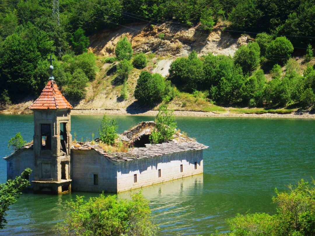

After a detailed exploration of the ruin simply follow the gravel path up to the main road and go back to the starting point.
This path can only be used when the water level of the reservoir is low! Be sure to check the situation beforehand, otherwise you will get wet feet!
Coming from Skopje/Tetovo take the road towards Kichevo and at Novo Selo turn right towards Mavrovo National Park. At the dam turn left and in about 5 minutes drive to the parking lot at the sports hall.
Currently there is no regular bus service to Mavrovo. A cab can be organized from Gostivar or Rostusha.
Large parking lot by the sports hall.
On the way back you can climb up the footpath to Sharkova Cave on the right (10 min, cave is open for guided tours only). At the top you have a good view over the village and the valley.
Priljubljeni izleti v okolici
The rolling hills of Mavrovo: Medenica peak from Galichnik
srednjaPohodništvo 12.7 kmНикифорово - Сандакташ
svetlobaPohodništvo 16.0 kmСв. Кирил и Методиј - Св. Никола - Glamour - Галичник
srednjaPohodništvo v daljavo 32.0 kmЉуботен - Љуботен / Maja e Lubotenit - Пескови / Bistër - Црвена Вода
srednjaPohodništvo v daljavo 188.1 kmГаличник - Селце - Тресонче - Топила
srednjaPohodništvo v daljavo 27.6 kmГаличник - Меденица
srednjaPohodništvo 12.6 kmМаврово - Glamour
svetlobaPohodništvo 5.45 kmМаврово - Св. Никола - Црн Камен - Маврови Анови
težkoŠotolinasto kolo 43.3 kmЛеуново - Glamour - Маврово - Црн Камен
težkoMountainbike 56.2 kmСтража - Сандакташ
težkoPohodništvo 20.9 km
Pohodništvo in sledenje


Ne zamudite ponudb in navdiha za naslednje počitnice
Vaš e-poštni naslov je bil dodan na poštni seznam.





