


Jokireitti
Stopnja težavnosti: 1
Along the 118 km Jokireitti route, there are diverse services for cyclists. The route passes through a cultural-historical yet lively landscape. In addition to cycling, it is possible to admire beautiful...
Stages according to river flow direction:
Sastamala – Huittinen (35 km)
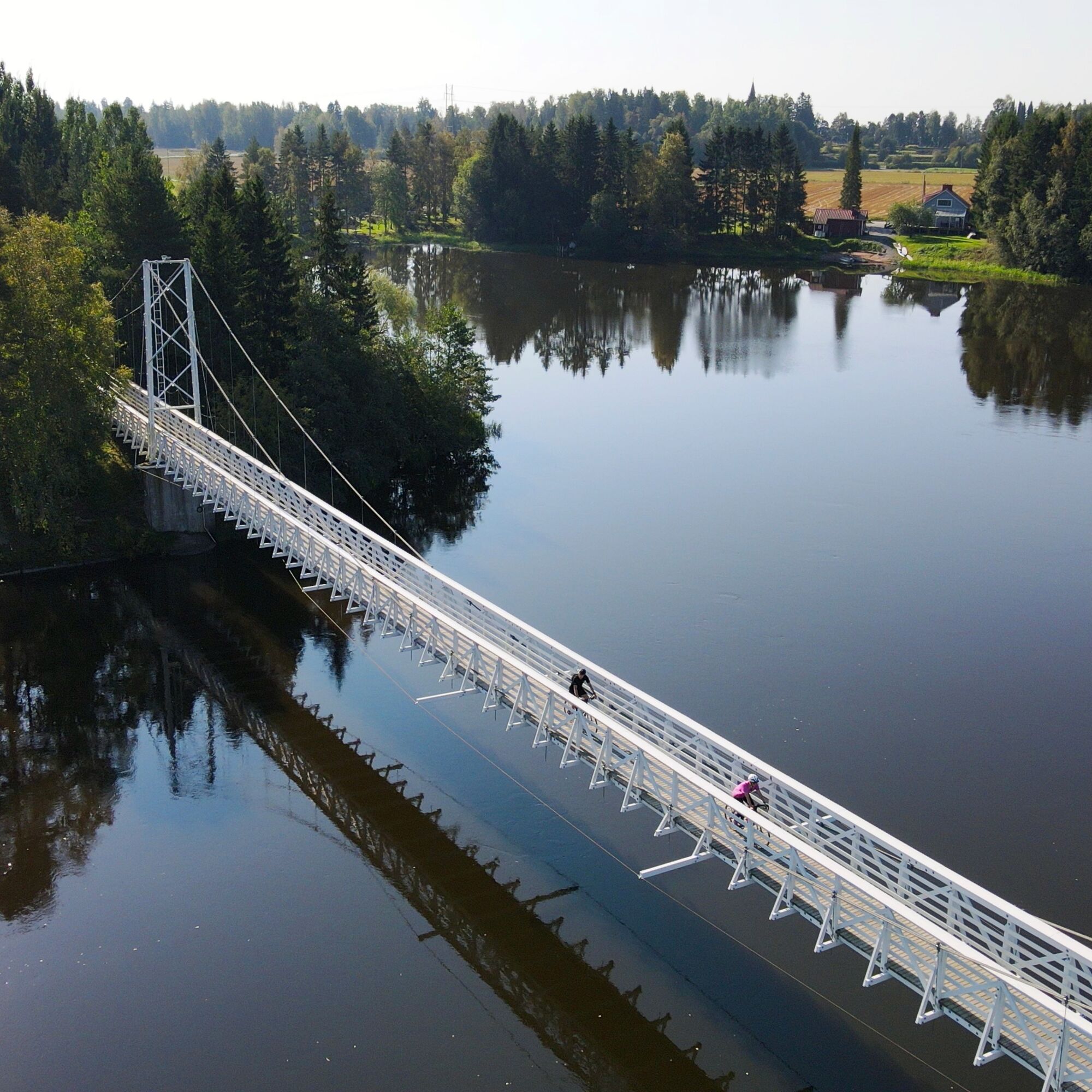
The stage starts from the beautiful Finnish Lakeland and runs peacefully through the countryside. It is possible to cross the river several times along the way, with the most impressive crossing definitely being the stunning suspension bridge of Keikyä. Local food is clearly visible on this stage.
Huittinen – Kokemäki (29 km)
This stage has a lot of gravel-surfaced roads. Riding the stage immerses you in the peace of the countryside and the stunning scenery of the Puurijärvi-Isosuo National Park. This part of the Jokireitti offers beautiful views, pristine nature, and a historical riverside village idyll.
Kokemäki – Pori (53 km)
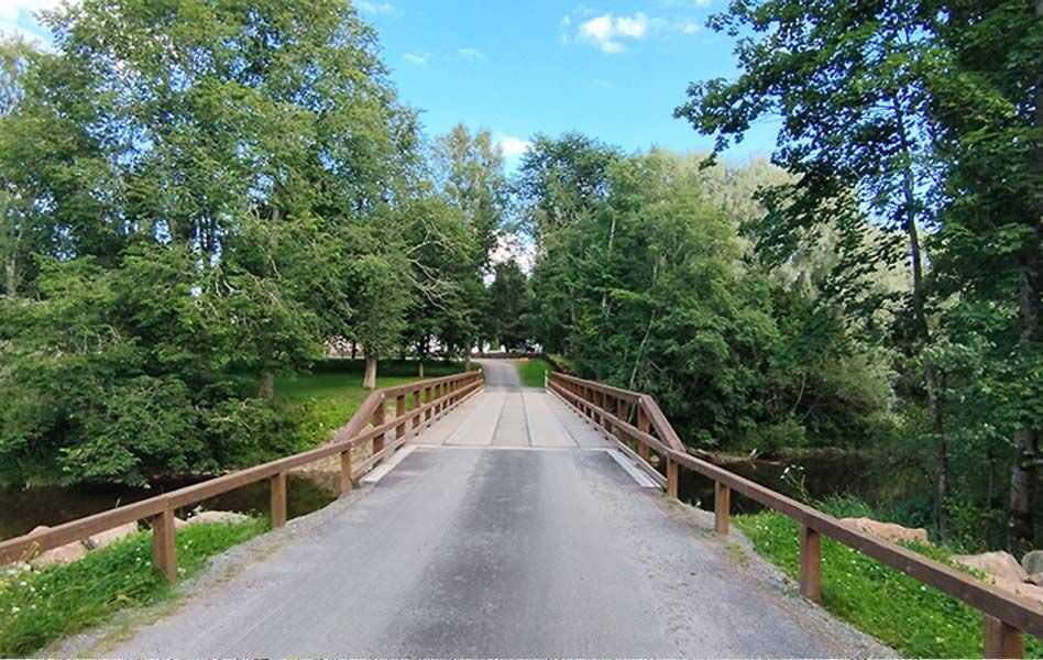
The stage from Kokemäki towards Pori crosses stunning bridges from one riverbank to the other, following scenic riversides and rapids.

The river route connects Järvien Reitit to Eurovelo10 as well as the Selkämeren elämysreitti. The entire route, 118 km long, is mostly very easy and flat, being mainly asphalt surfaced. Part of the route also runs on gravel roads (22 km). The route takes the traveler from one riverside municipality and service to another, naturally divided into clear stages. This is also emphasized by the excellent train connection, as the Tampere-Pori rail link with stations serves the bicycle traveler excellently.
Stage: Sastamala – Huittinen (35 km)
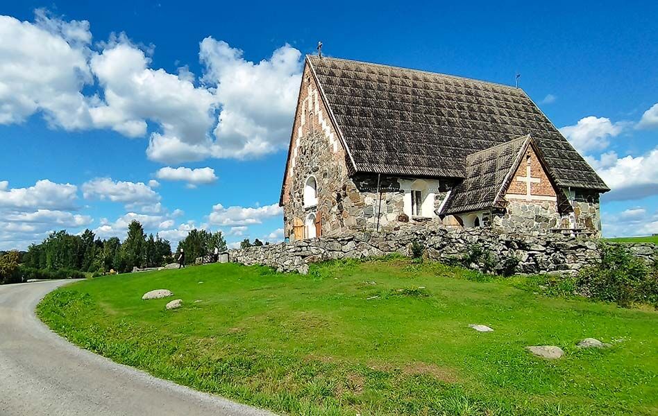
The stage starts from Sastamala, which represents the best of the Finnish Lakeland scenery. The route runs peacefully through the countryside past various experiences. It is possible to cross the river several times along the way, with the most impressive crossing being definitely the stunning suspension bridge in Keikyä. A memorable site is also the old whipping place, the whipping stone. The stage offers several delicious services from berry farms to local food shops. If you have the energy, it is worth making a small side trip north of Huittinen to Ripovuori (approx. 1.5 km one way). From the Leijonankita lean-to you can perhaps see the Kokemäki River best. Huittinen has all city services and diverse accommodation options. The city is known for its food production. Huittinen also offers great opportunities to get to the river for paddling and experiencing the river up close.
Stage: Huittinen – Kokemäki (29 km)
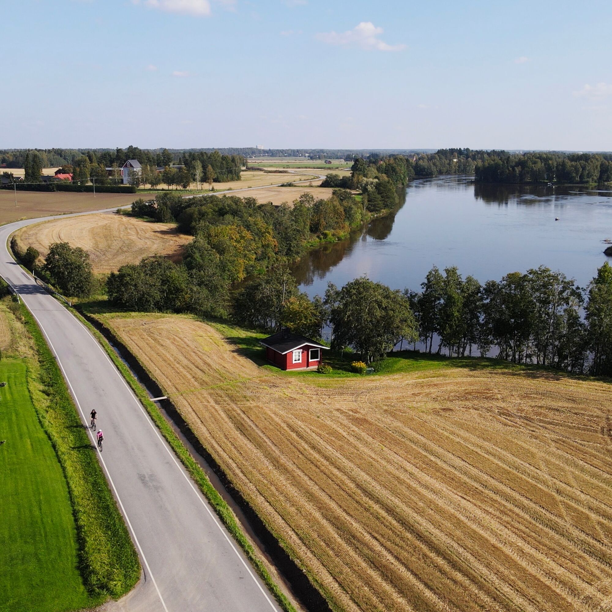
The Huittinen - Kokemäki stage is about 29 km long, mostly consisting of gravel-surfaced roads. On this stage, you immerse in the peace of the countryside and the beautiful scenery of the Puurijärvi-Isosuo National Park. This part of the river route offers you beautiful landscapes, pristine nature, and the historical riverside village idyll. Part of the stage runs right along the riverbank and through the national park’s vicinity. This stage of the river route mostly runs outside of service networks, so be prepared with water bottles and snacks as needed. However, delicious treats await at both ends of the stage!
Stage: Kokemäki - Pori (53 km)
The Kokemäki - Pori stage is about 53 km long. The route crosses beautiful bridges from one riverbank to the other, following scenic river shores and rapids. Along this stage, there are also railway stations in Pori, Harjavalta, and Kokemäki Peipohja, making arrival to the stage easy. The route connects seamlessly at the main or starting point in Pori with the Eurovelo10 route and the stunning Bothnian Sea Adventure Route. The stage is mostly very easy and flat, being mainly asphalt surfaced.
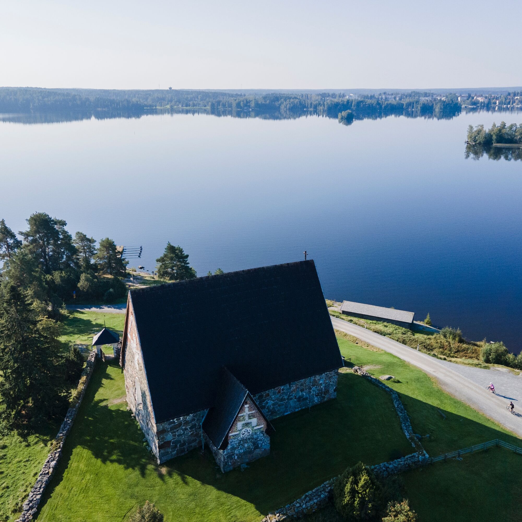
Heading towards the sea from Kokemäki, the Finnish rural landscape shows its best. The route features art experiences such as the sculptor Emil Cedercreuz museum in Harjavalta. Cyclists are also greeted by the self-made "Äijä" art works by the hosts along the route. Crossing the river at the Harjavalta power plant is unforgettable, and if the discharge is on, the sight is amazing. At the power plant’s threshold, it is also worth getting off the saddle and descending the long stairs to the short nature trail of Paratiisilehto – it is hard to get closer to a tropic atmosphere in Finland. You can also admire the power of water at Aranttilankoski in Nakkila either from the shore with a fishing rod or by paddling. From Nakkila, the journey continues towards Ulvila, Finland’s oldest settlement, where the medieval Church of St. Olaf is a worthy stop. From Ulvila, the route follows the river towards Pori city center, and the landscape changes again to a more urban feel. Just before Pori city center and its diverse services, the river is crossed several more times. A particularly fine crossing is over an old, disused railway bridge, but also the views from Porinsilta bridge are great.
We recommend downloading the 112 Finland app in case something happens along the route.
The route is used by various user groups; cyclists must take pedestrians and other travelers into account.
The route mainly runs along low-traffic rural roads and light traffic routes.
Follow general safety guidelines.
The route length offers a suitable challenge, but the terrain is suitable for cyclists of all levels.
The route can be accessed from many points and directions.
Matkahuolto (matkahuolto.fi) and VR (vr.fi) have services allowing you to take your bicycle onboard. Check availability in advance.
Along the river route, there are four railway stations: Pori, Harjavalta, Kokemäki (Peipohja), and Sastamala (Vammala).
There are many parking options along the route.
1
Cycling does not have to end when the River Route finishes; in Pori, you can continue exploring the magnificent Selkämeren Elämysreitti or Eurovelo 10.
Priljubljeni izleti v okolici
Pohodništvo in sledenje


Ne zamudite ponudb in navdiha za naslednje počitnice
Vaš e-poštni naslov je bil dodan na poštni seznam.