Alta Via dell'Anfiteatro Morenico di Ivrea - AMI
srednja
Pridobite to turo v svoj mobilni telefon
Alta Via dell'Anfiteatro Morenico di Ivrea - AMI
srednja
Mountainbike
108,12
km
Skenirajte kodo QR in začnite navigacijo v aplikaciji bergfex.

Pohodništvo in sledenje


Alta Via dell'Anfiteatro Morenico di Ivrea - AMI
srednja
Razdalja
108,12
km
Trajanje
12:10
h
Ascent
1.533
hm
Morska gladina
213 -
930
m
Prenos skladbe
Alta Via dell'Anfiteatro Morenico di Ivrea - AMI
srednja
Mountainbike
108,12
km
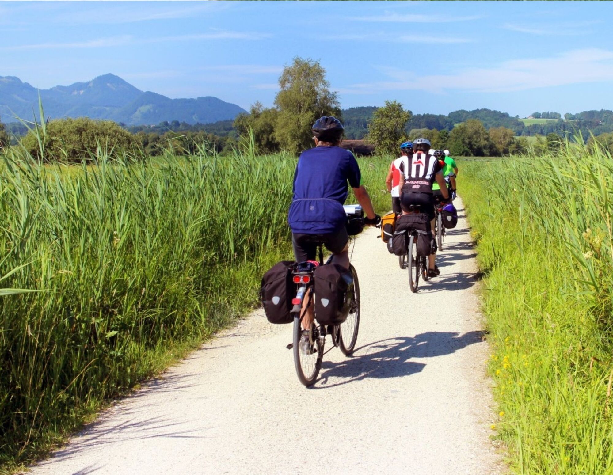
The Alta Via of the Morainic Amphitheatre of Ivrea is an impressive circular route that runs clockwise from Andrate to Brosso along the morainic amphitheatre formed in the Quaternary period by the glacier...
Opis
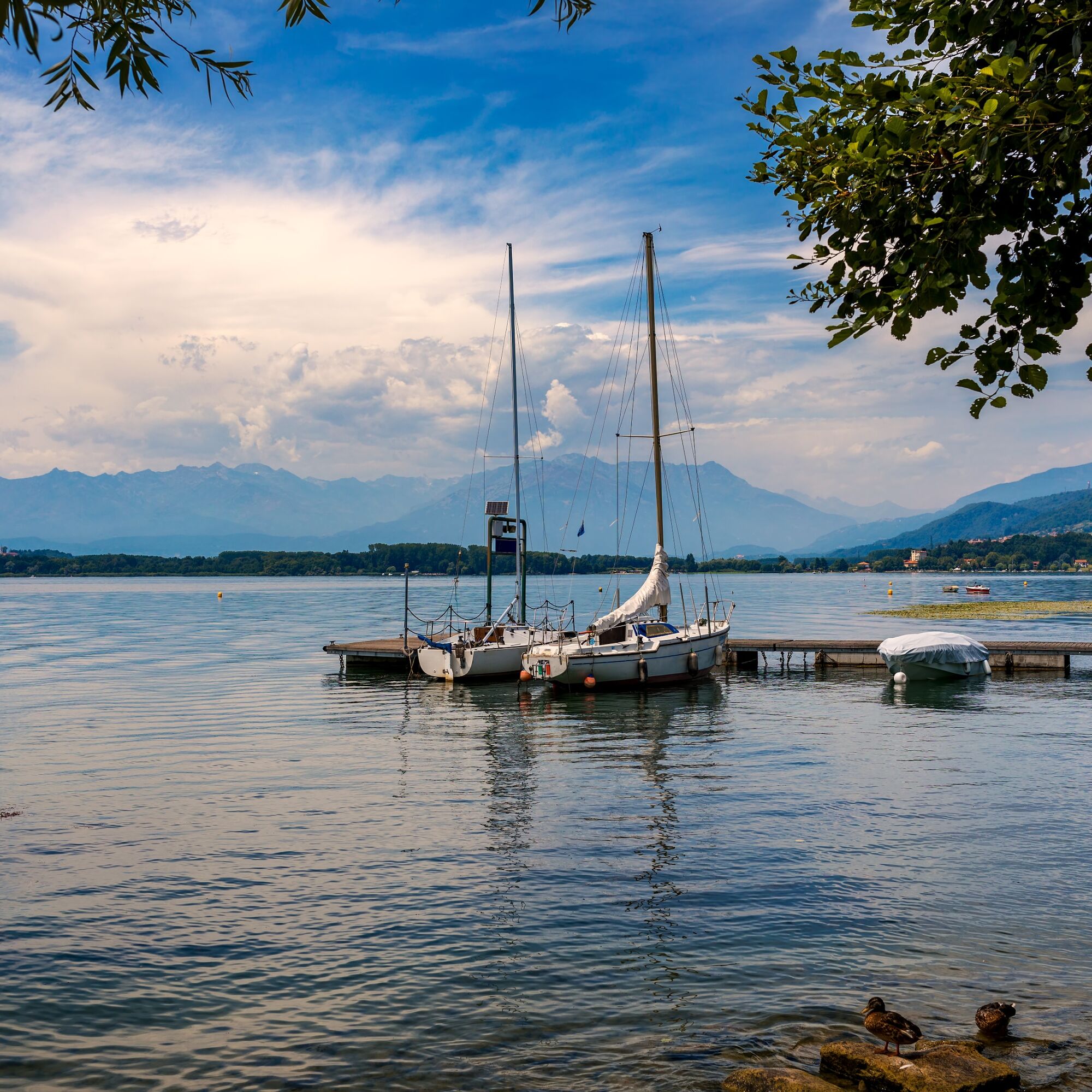
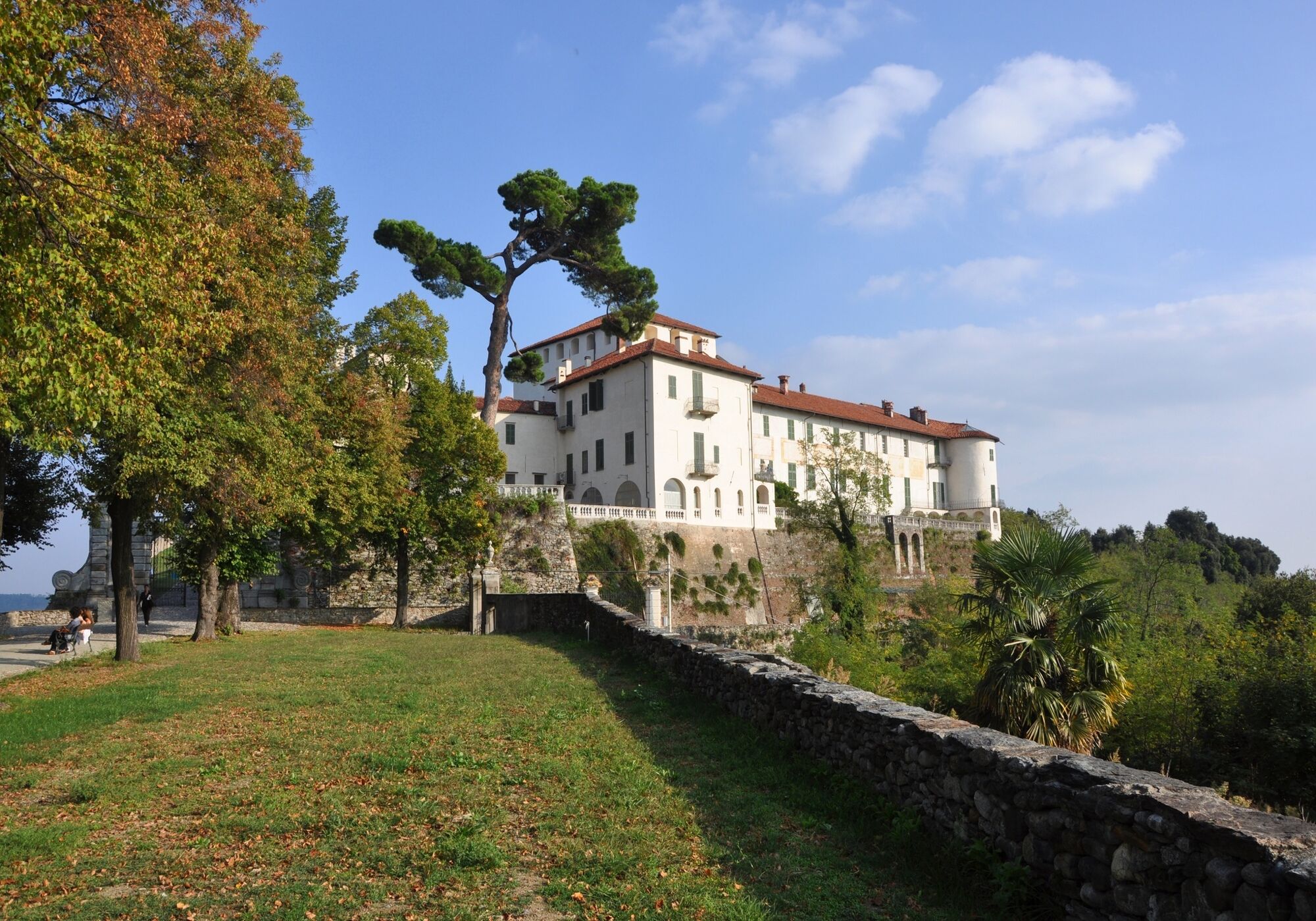
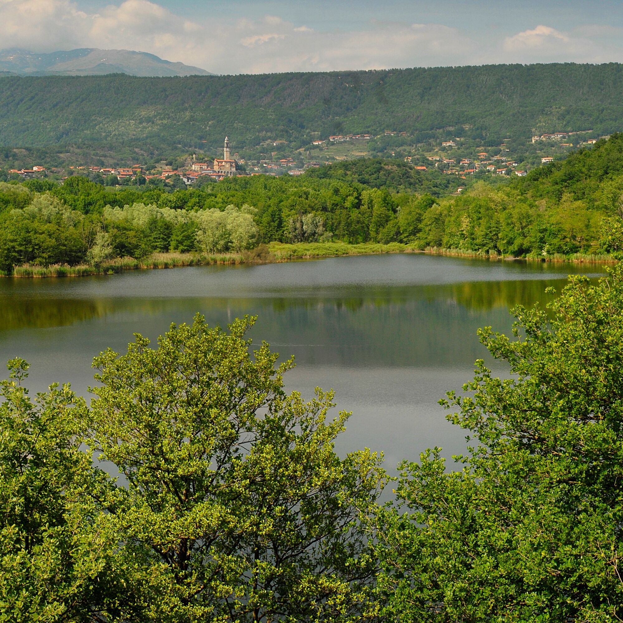
The Alta Via of the Morainic Amphitheatre of Ivrea is an impressive circular route that runs clockwise from Andrate to Brosso along the morainic amphitheatre formed in the Quaternary period by the glacier that occupied the Dora Baltea valley, at its outlet onto the Canavese plain.The glaciation has left us a structure of great geomorphological interest. Its excellent conservation has provided us with an open-air book where we can read the effects of the succession of ice ages and interglacial periods in the Pleistocene era, from 1.65 million to 130,000 years ago. Lakes nestled amid lush greenery, from Lake Viverone to the 5 lakes of Ivrea to Lake Candia, castles such as the one in Masino, admirably managed by Italy's national trust, the FAI, charming villages, woods and vineyards where excellent wines such as Erbaluce are produced: the extraordinary landscape, historical and cultural value of this rich and varied itinerary means you can combine the pleasure of a hike with countless opportunities to visit and discover the area.
The itinerary was promoted within the platform as part of the PITEM M.I.T.O. project. – Outdoor OFF - Interreg Italy-France Cross-Border Cooperation Program ALCOTRA 2014-2020.
Pot
Chiesa di San Grato
(491 m)
Kraj čaščenja
18,2 km
Sapel da Bras
(340 m)
Gorsko sedlo
32,7 km
Chiesa Parrocchiale di San Maurizio
(308 m)
Kraj čaščenja
49,0 km
Monte Chiaro
(354 m)
Vrh
70,3 km
Monte Riolo
(492 m)
Vrh
83,7 km
Chiesa di San Martino
(376 m)
Kraj čaščenja
89,1 km
Cappella di Nonani
(642 m)
Kraj čaščenja
99,2 km
Pot
Alta Via dell'Anfiteatro Morenico di Ivrea - AMI
srednja
Mountainbike
108,12
km
Andrate
(825 m)
Vas
0,2 km
Mangia e Bevi
(827 m)
Restavracija
0,2 km
Croce Serra
(853 m)
Koridor/teren
2,7 km
Rebbia
(782 m)
Poravnava
3,0 km
Broglina
(518 m)
Poravnava
11,2 km
Magnano
(536 m)
Vas
14,5 km
Chiesa di San Grato
(491 m)
Kraj čaščenja
18,2 km
Zimone
(441 m)
Vas
19,0 km
Bertignano
(383 m)
Poravnava
22,1 km
Cappella della Madonna di Oropa
(385 m)
Kraj čaščenja
22,3 km
San Vitale
(385 m)
Poravnava
23,5 km
Castello
(356 m)
Vas
24,2 km
Chiesa di San Rocco
(348 m)
Kraj čaščenja
24,3 km
Roppolo
(311 m)
Vas
24,5 km
Morzano
(298 m)
Poravnava
29,1 km
Sapel da Bras
(340 m)
Gorsko sedlo
32,7 km
Chiesa dei sette dolori e di San Rocco
(391 m)
Kraj čaščenja
39,8 km
Masino
(400 m)
Vas
39,9 km
Veduta dell'anfiteatro morenico di Ivrea
(401 m)
Pogled
40,0 km
Chiesa di San Lorenzo Martire
(413 m)
Kraj čaščenja
40,1 km
Maglione
(291 m)
Vas
48,7 km
Chiesa Parrocchiale di San Maurizio
(308 m)
Kraj čaščenja
49,0 km
Moncrivello
(304 m)
Vas
52,3 km
Chiesa di San Francesco
(308 m)
Kraj čaščenja
52,7 km
Chiesa di San Rocco
(309 m)
Kraj čaščenja
52,9 km
Caluso
(288 m)
Vas
67,7 km
Monte Chiaro
(354 m)
Vrh
70,3 km
Candia Canavese
(290 m)
Vas
70,9 km
Chiesa di Santo Stefano del Monte
(419 m)
Kraj čaščenja
71,9 km
Villate
(310 m)
Vas
77,2 km
Vialfrè
(478 m)
Vas
82,6 km
Chiesa dei Santi Pietro e Paolo
(474 m)
Kraj čaščenja
82,6 km
Chiesa di San Michele
(472 m)
Kraj čaščenja
82,7 km
Risorante Fricandò
(469 m)
Restavracija
82,8 km
Monte Riolo
(492 m)
Vrh
83,7 km
Silva
(442 m)
Vas
85,4 km
Bar Trattoria San Giovanni
(402 m)
Restavracija
88,4 km
San Giovanni Canavese
(403 m)
Vas
88,4 km
Chiesa di San Giovanni Battista
(402 m)
Kraj čaščenja
88,5 km
Cantone Pricco
(391 m)
Poravnava
88,7 km
Cantone Piana
(377 m)
Poravnava
89,0 km
Chiesa di San Martino
(376 m)
Kraj čaščenja
89,1 km
Ponte Preti
(333 m)
Vas
90,8 km
Chiesa della Madonna delle Grazie
(326 m)
Kraj čaščenja
91,0 km
Strambinello
(382 m)
Vas
91,8 km
Scala
(361 m)
Vas
95,4 km
Regione Luvera
(513 m)
Poravnava
95,7 km
Zucca
(385 m)
Vas
96,8 km
Vigna Bella
(554 m)
Koridor/teren
97,0 km
Lugnacco
(563 m)
Vas
98,9 km
Cappella di Nonani
(642 m)
Kraj čaščenja
99,2 km
L'incontro
(721 m)
Restavracija
105,6 km
Regione Ceresano
(700 m)
Poravnava
106,8 km
Chiesa del Gesù
(768 m)
Kraj čaščenja
108,1 km
Brosso
(797 m)
Vas
108,1 km
Avtor
Za ogled Alta Via dell'Anfiteatro Morenico di Ivrea - AMI poskrbi outdooractive.com.

Informacije o poti
Enosmerna tura
Da
Varnostna navodila
Cell coverage
Partial
Informacije o prihodu
Javni prevoz
All stages allow connections with public transport
Dodatne informacije in nasveti
Dodatne informacije
City of Metropolitan Turin: www.cittametropolitana.torino.it/cms/...
Še ni pregledov
Priljubljeni izleti v okolici
BALDISSERO CANAVESE The Monti Pelati nature reserve
srednjaPohodništvo 7,19 km- 3,0
Via Francigena Etappe 5
srednjaPohodništvo 36,7 km VALCHIUSELLA Lakes of Alice Superiore and Meugliano
svetlobaPohodništvo 7,99 kmCANDIA Lake Candia MTB loop
svetlobaMountainbike 10,8 kmMONTALTO DORA Terre Ballerine - In search of Lake Coniglio
svetlobaPohodništvo 5,35 kmChiaverano - Church of Santo Stefano di Sessano
srednjaMountainbike 27,4 kmTORRE CANAVESE Nature Route
svetlobaPohodništvo 6,71 kmErratic boulders trail of Vialfré
svetlobaPohodništvo 7,15 kmAncient Balteo Glacier Ring - stage 1
srednjaKolesarjenje na dolge razdalje 49,0 kmCHIVASSO Multi-stage loop of the ancient Balteo Glacier
srednjaKolesarjenje na dolge razdalje 195,4 km
Pohodništvo in sledenje

Zaradi več kot 550.000 predlogov izletov, podrobnih zemljevidov in intuitivnega načrtovanja poti je aplikacija obvezna oprema za vse ljubitelje narave.

Ne zamudite ponudb in navdiha za naslednje počitnice
Naročite se na novice
Napaka
Zgodila se je napaka. Prosimo, poskusite znova.Zahvaljujemo se vam za prijavo
Vaš e-poštni naslov je bil dodan na poštni seznam.
Izleti po vsej Evropi
Avstrija Švica Nemčija Italija Slovenija Francija Nizozemska Belgija Poljska Lihtenštajn Češka Slovaška Španija Chorvátsko Bosna in Hercegovina Luksemburg Andora පෘතුගාලය අයිස්ලන්තය එක්සත් රාජධානිය අයර්ලන්තය ග්රීසිය ඇල්බේනියාව North Macedonia Malta Norway Montenegro Moldova කොසෝවො හන්ගේරියානු සමුහාණ්ඩුව San Marino රුමේනියාව එස්ටෝනියා ලැට්වියාව බෙලාරස් සයිප්රස් Lithuania Serbia බල්ගේරියාව Monaco ඩෙන්මාර්කය Sweden ෆින්ලන්තය