


Weisstannen-Batöni-Wildsee-Pizolhütte
Stopnja težavnosti: T2


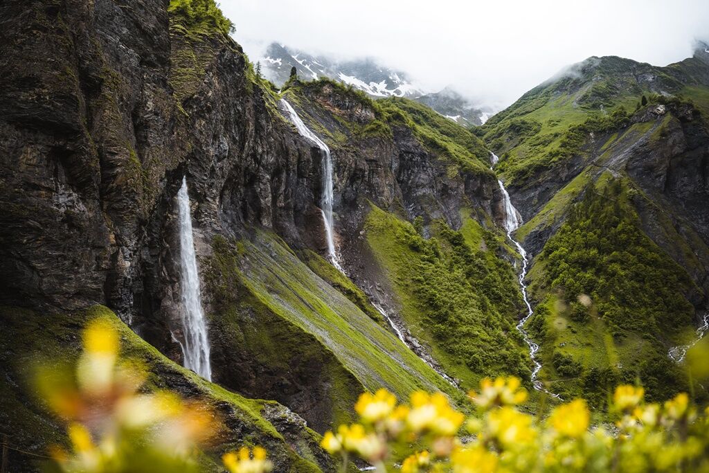
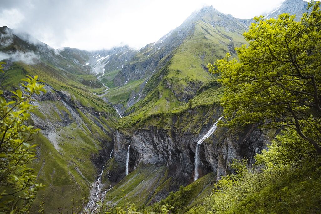
The route leads through an impressive alpine landscape, past the spectacular Batöni waterfalls where several streams converge in a wild romantic valley basin. The path rises steadily and offers breathtaking...
The route leads through an impressive alpine landscape, past the spectacular Batöni waterfalls where several streams converge in a wild romantic valley basin. The path rises steadily and offers breathtaking views of the surrounding peaks and valleys again and again.
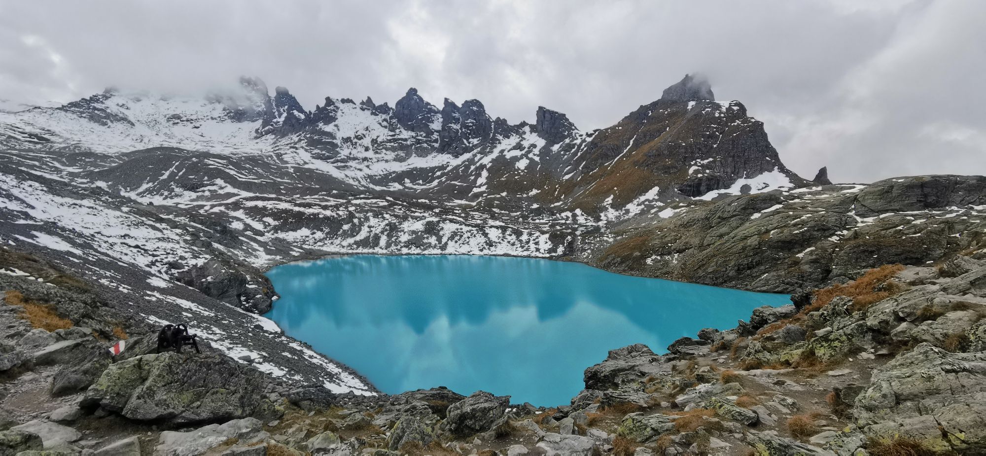
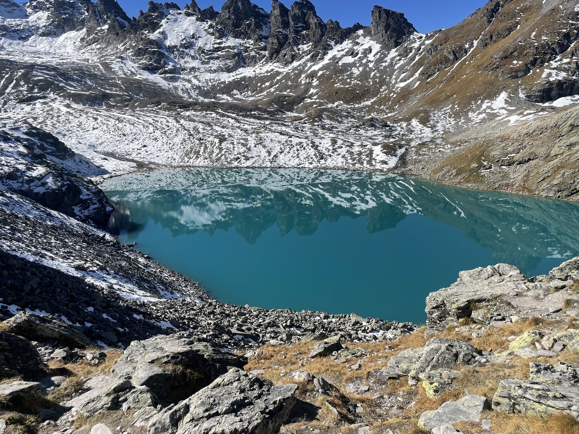
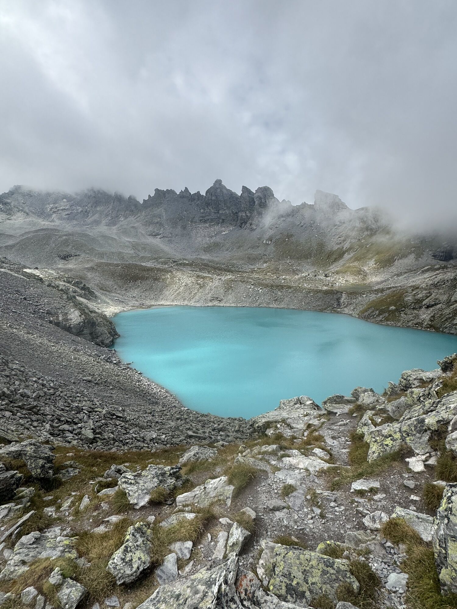
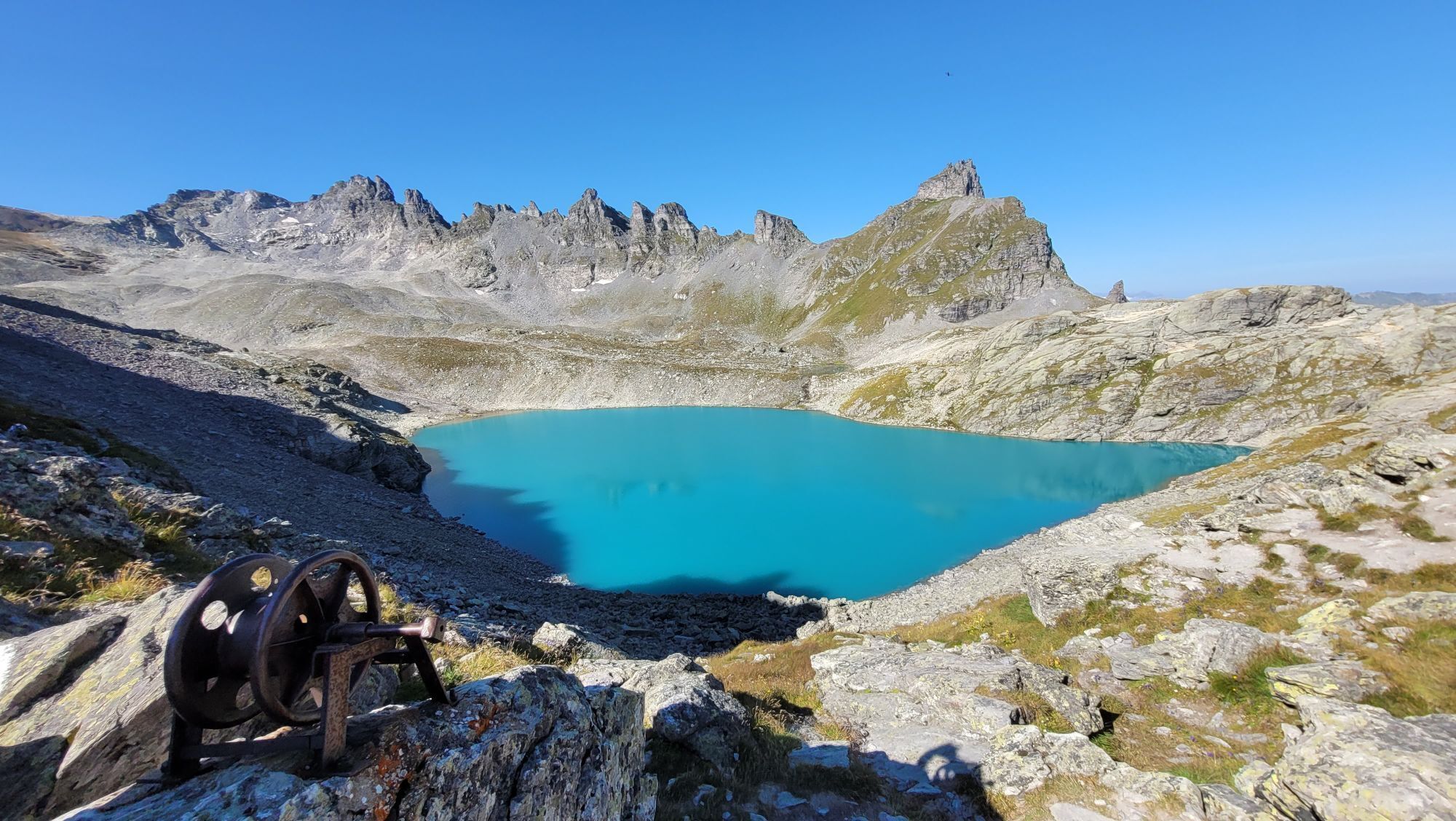
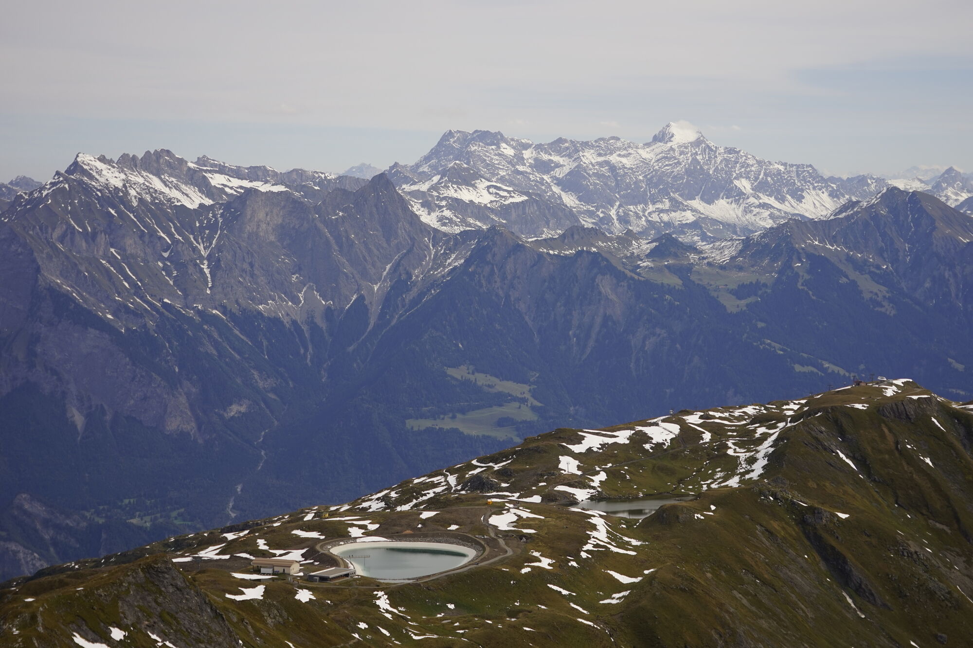
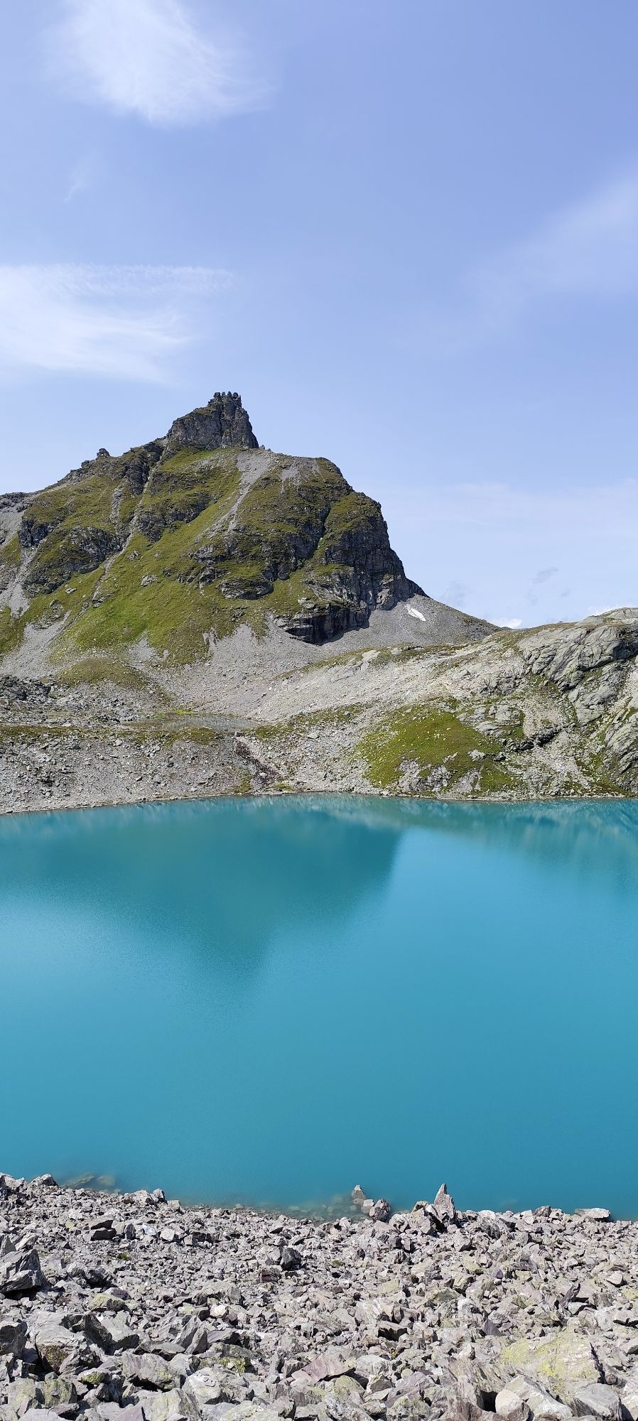
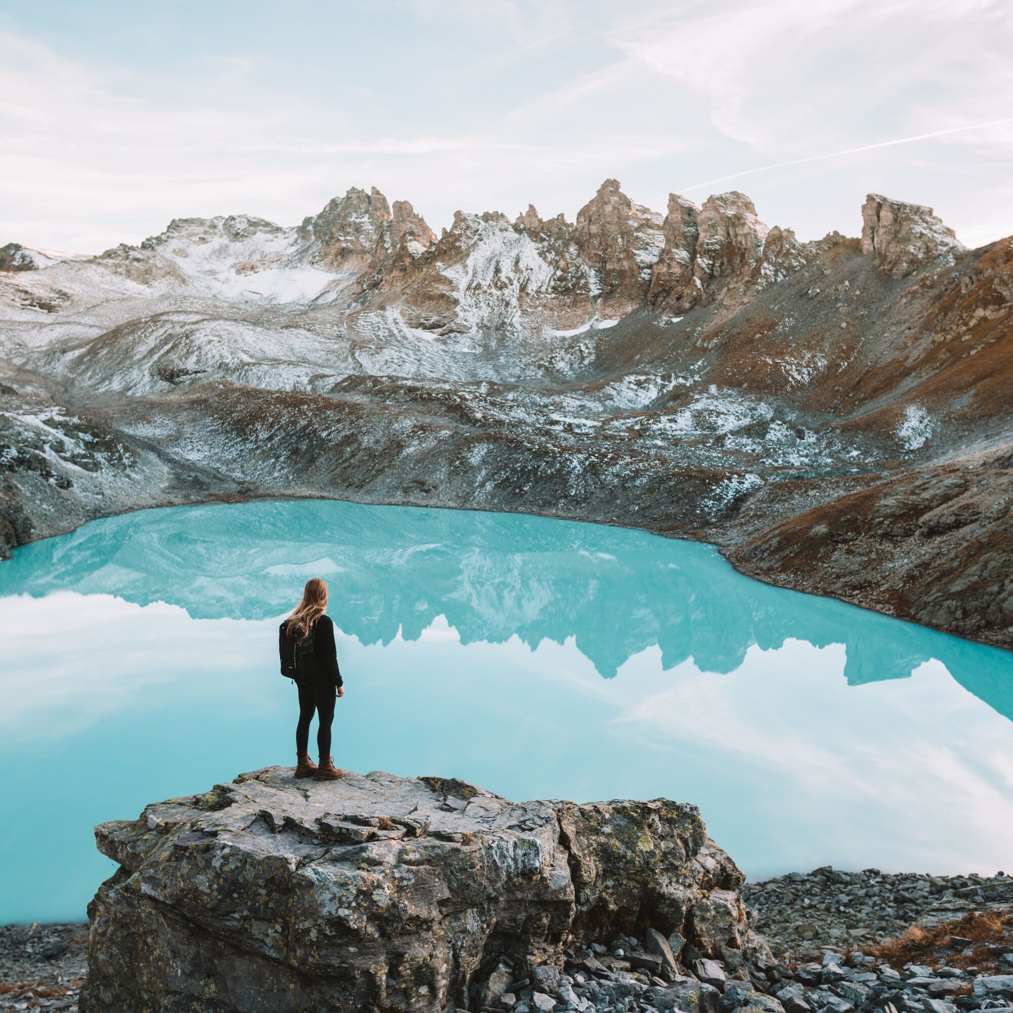
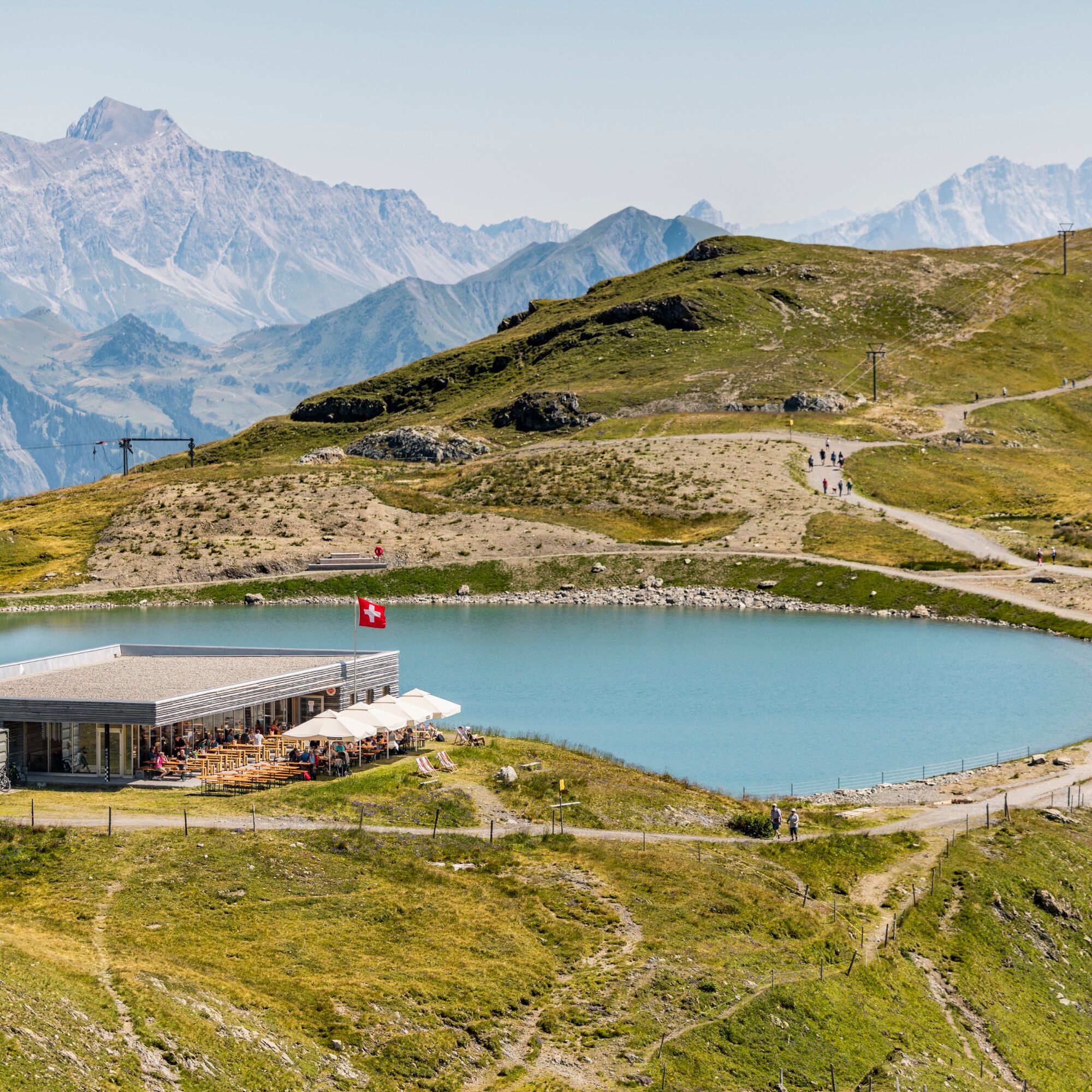
A special highlight is the Wildsee, one of the five lakes of the well-known 5 Lakes Route. Fed by the Pizol glacier, it lies embedded in a barren, high-alpine scenery and fascinates with its turquoise color. The hike combines impressive nature experiences with historical sites – for example, the area where the first alpine ibex in Switzerland were reintroduced in 1911 after these magnificent animals had been eradicated throughout the country.
This route is a true adventure for experienced hikers with good fitness and sure-footedness – and an unforgettable experience amidst the majestic mountain world of the Heidiland holiday region.

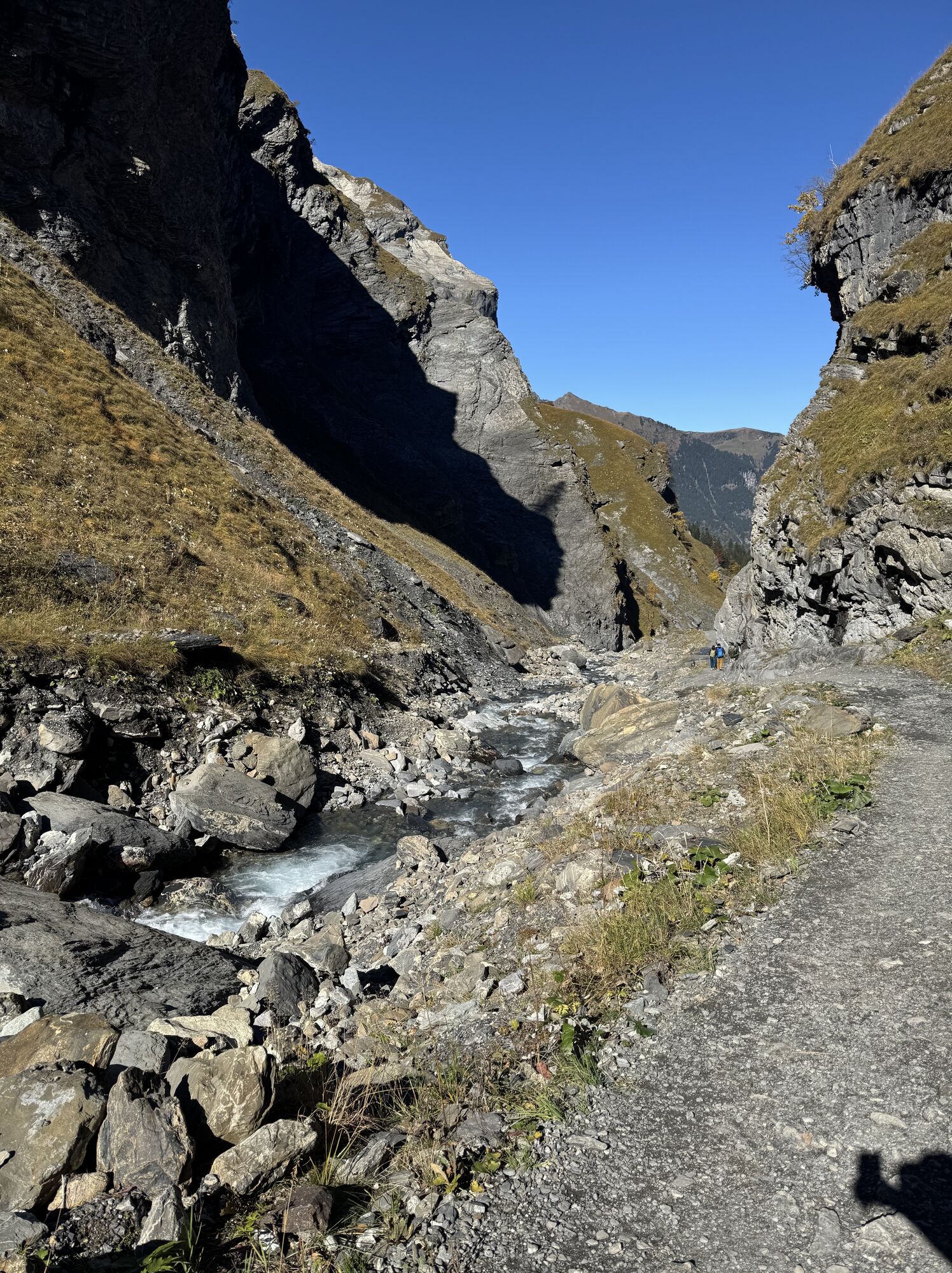
At the southern end of the village Weisstannen (1004 m), the Gufelbach is crossed. After the bridge, the hike gently ascends along the stream, the first short section on a paved road. After the end of the paved road, the first steeper ascent begins through the forest and meadows.
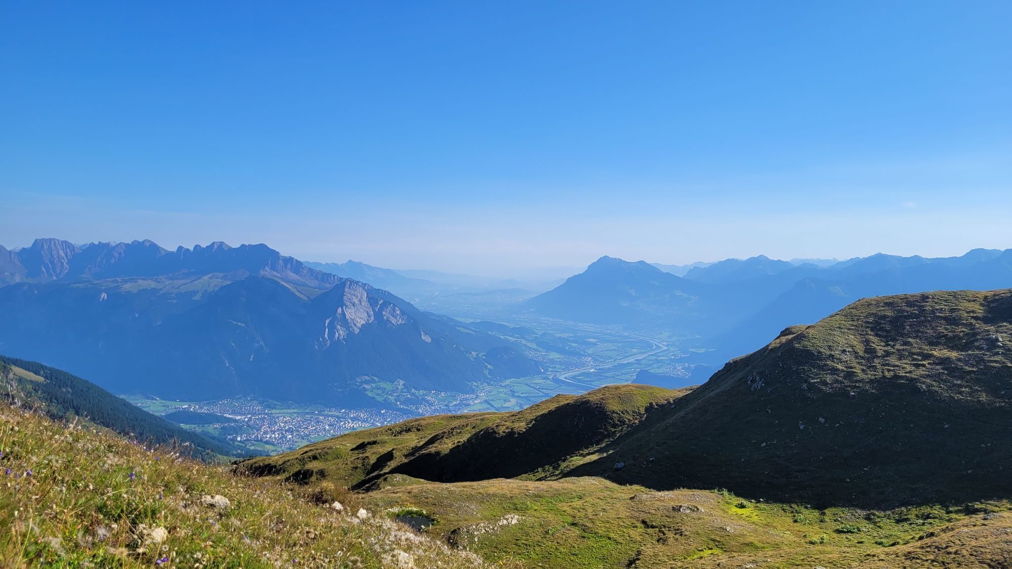
At Unterlavtina-Sässli, the valley opens up, and for the first time, you have a view of the surrounding mountains.
On the upper right lie the Rappenloch as well as the rock slopes of the Marchstein and Hühnerspitz. On May 8, 1911, the first alpine ibex were released in this area after these magnificent animals had previously been exterminated throughout Switzerland.
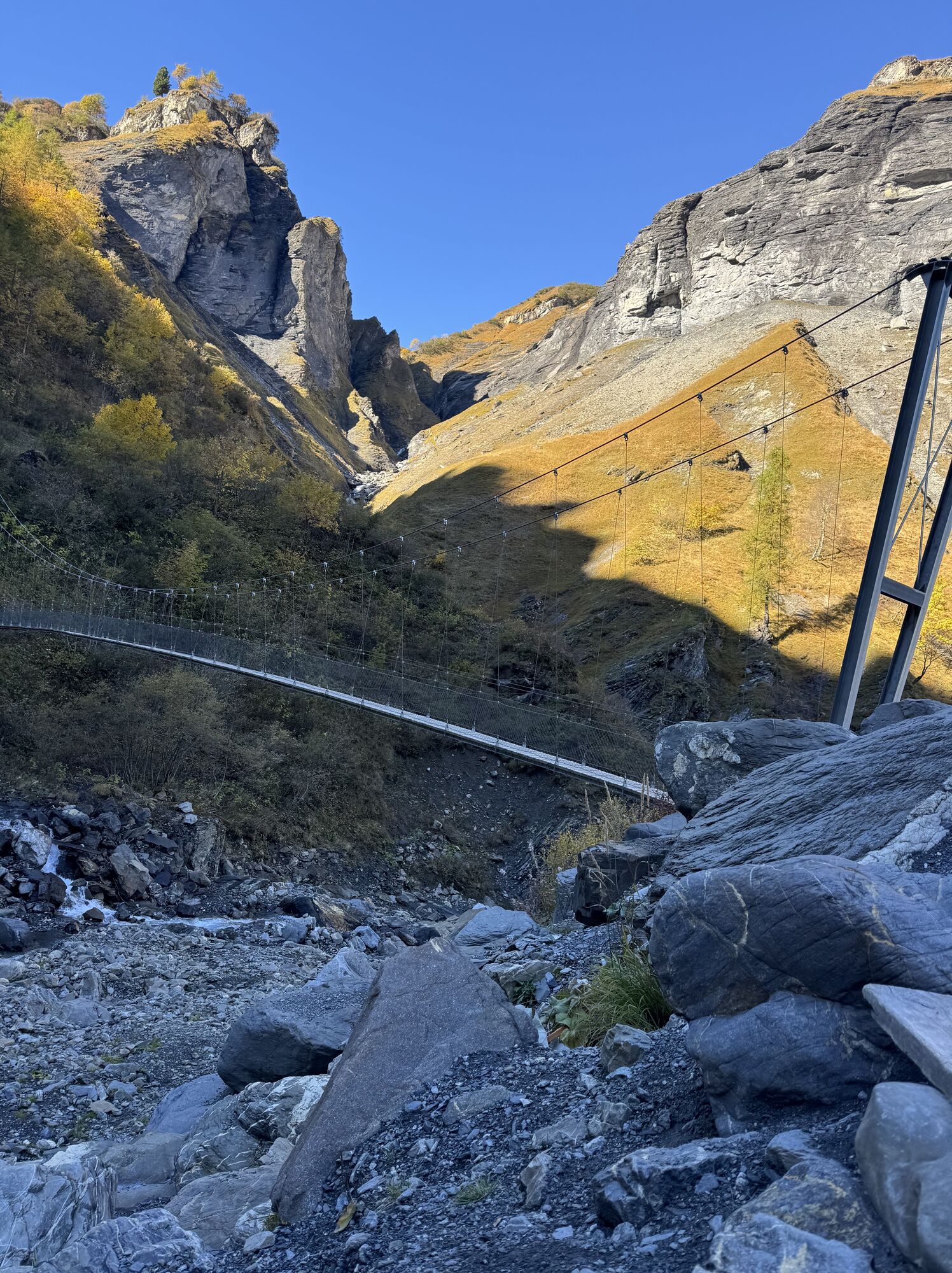
The path continues uphill towards «Batöni/Pizolhütte». A footbridge crosses the stream to the other side of the valley; the path now runs directly along the Gufelbach.
From afar, you can already see the impressive waterfalls of Batöni. These waterfalls come together from several sides in a valley basin; with plenty of water in spring, this water castle is a very special place.
Here the path splits; to the right it goes over the Heidel Pass to St. Martin in Calfeisental. The path now leads steeply and partly exposed uphill to the left.
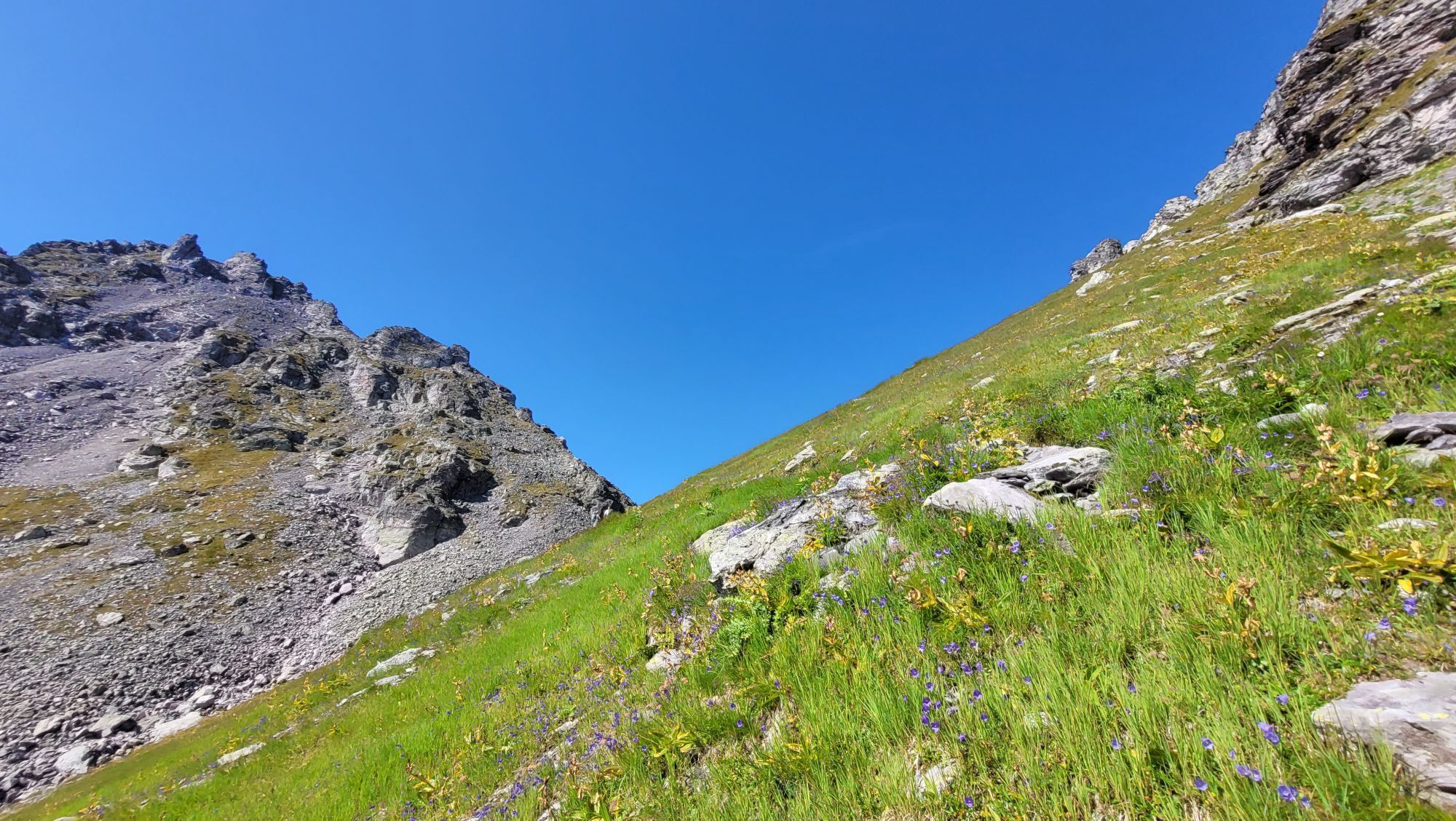
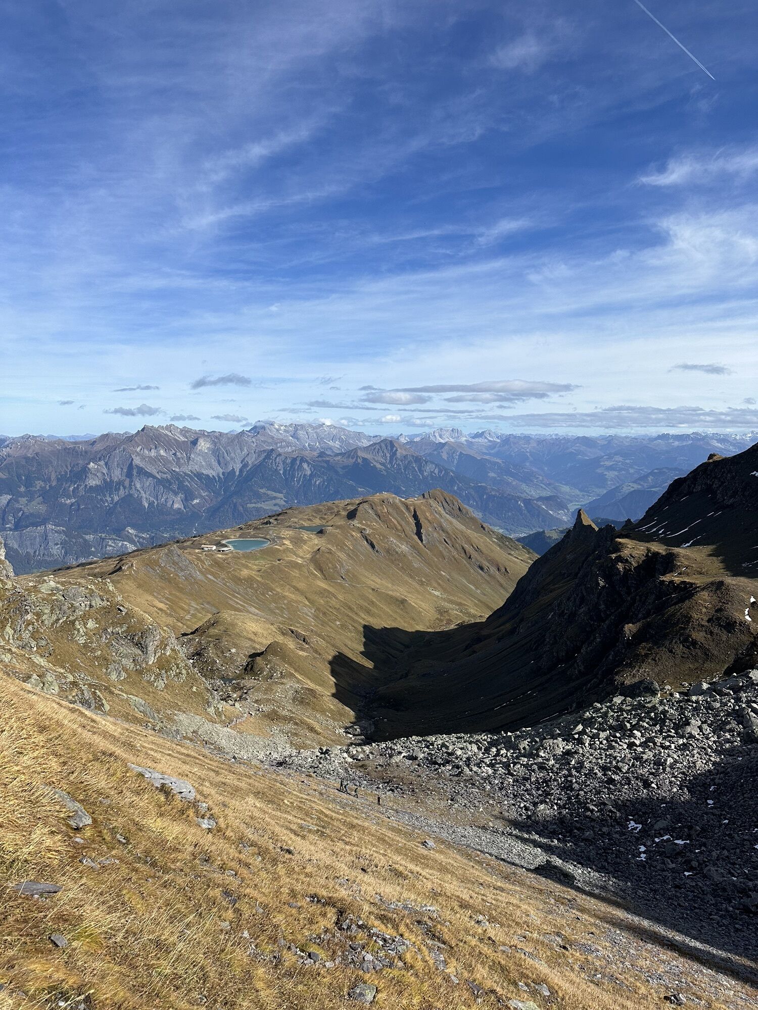
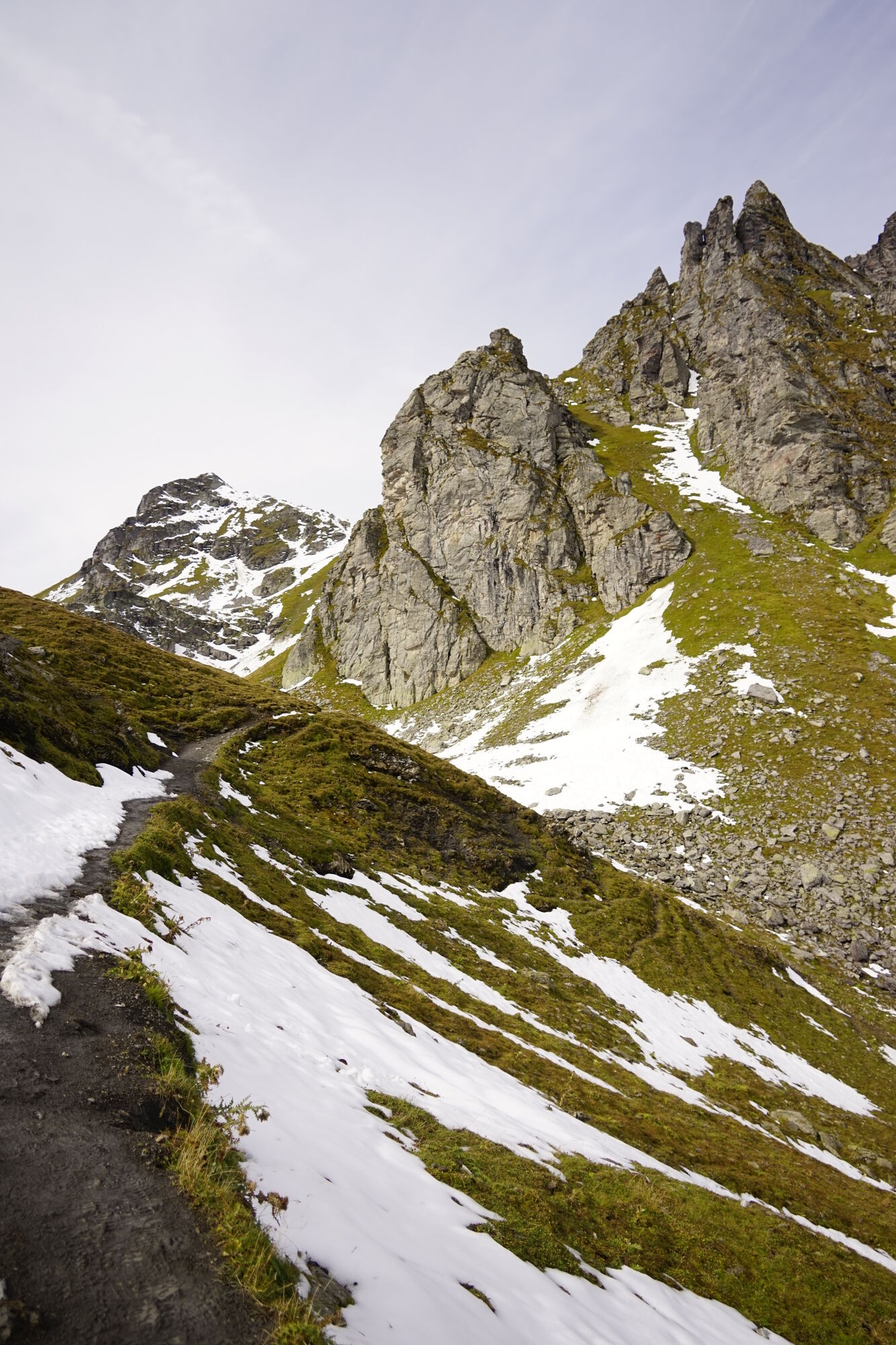
The view into the just-left valley basin and increasingly towards the surrounding mountains is magnificent. After the Stofel alp in Oberlavtina, the destination, the Lavtinasattel at the left end of the mighty group of Lavtina horns and Pizol, becomes visible.
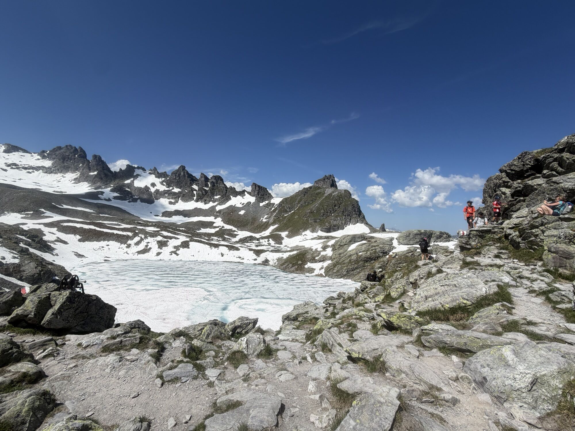
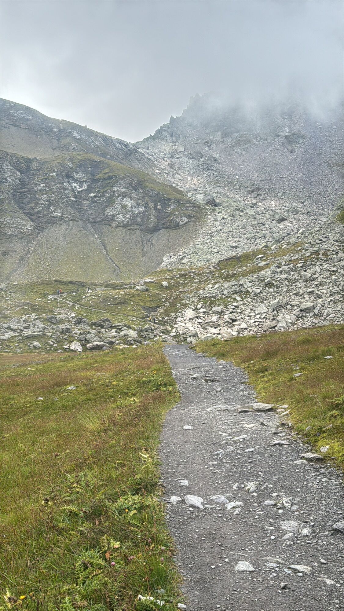
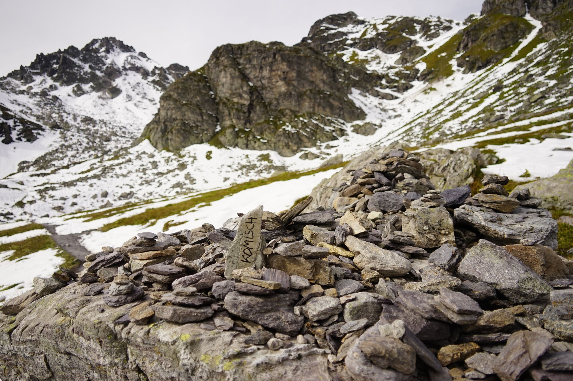
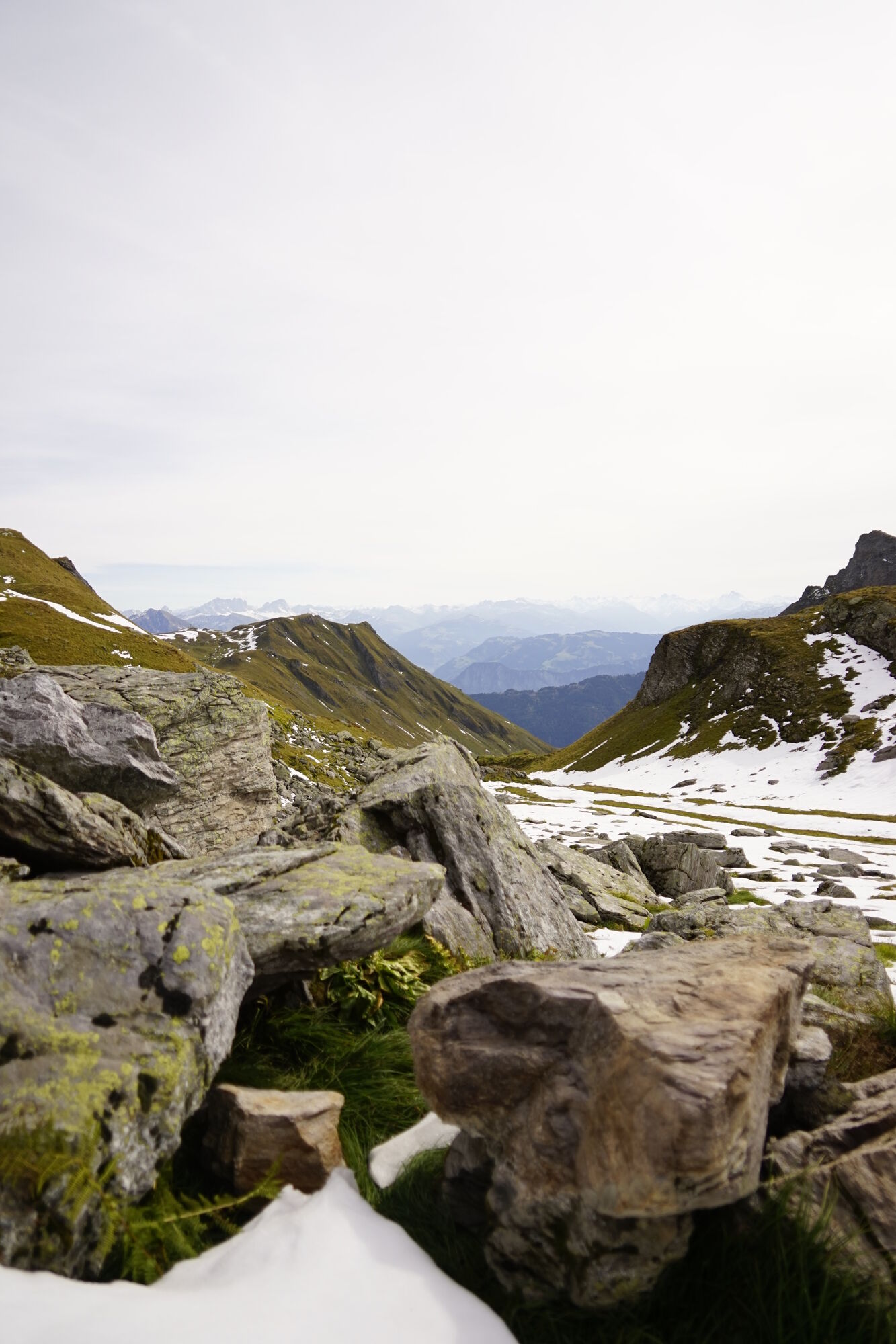
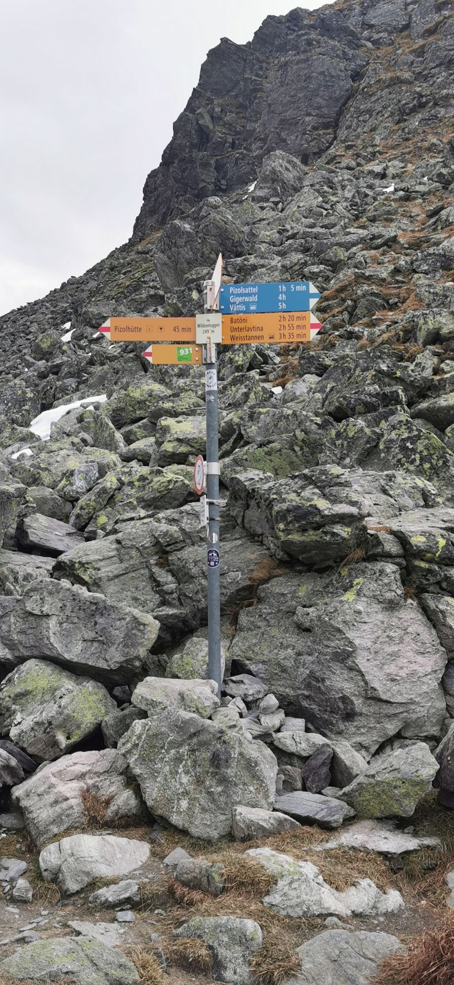
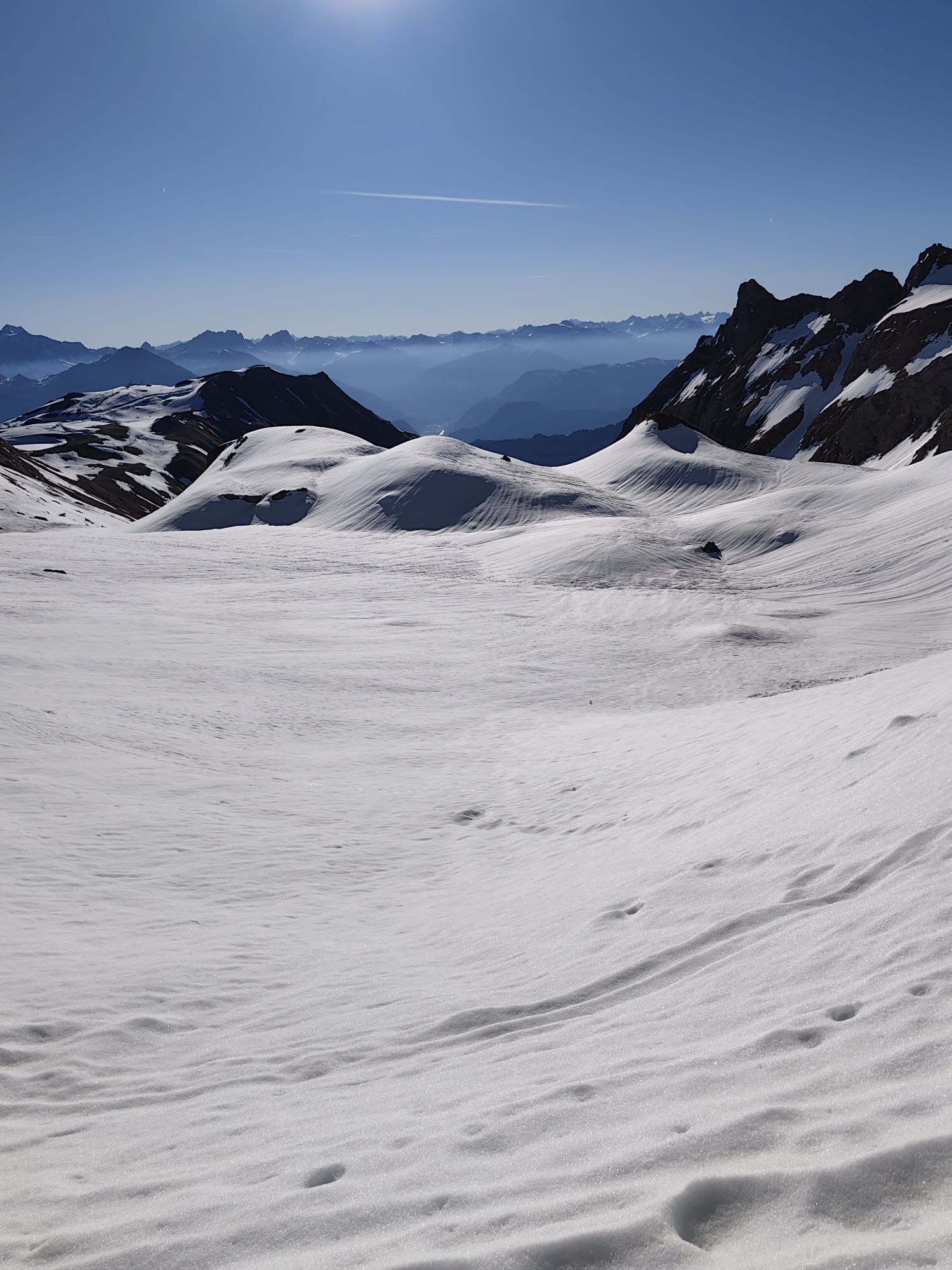
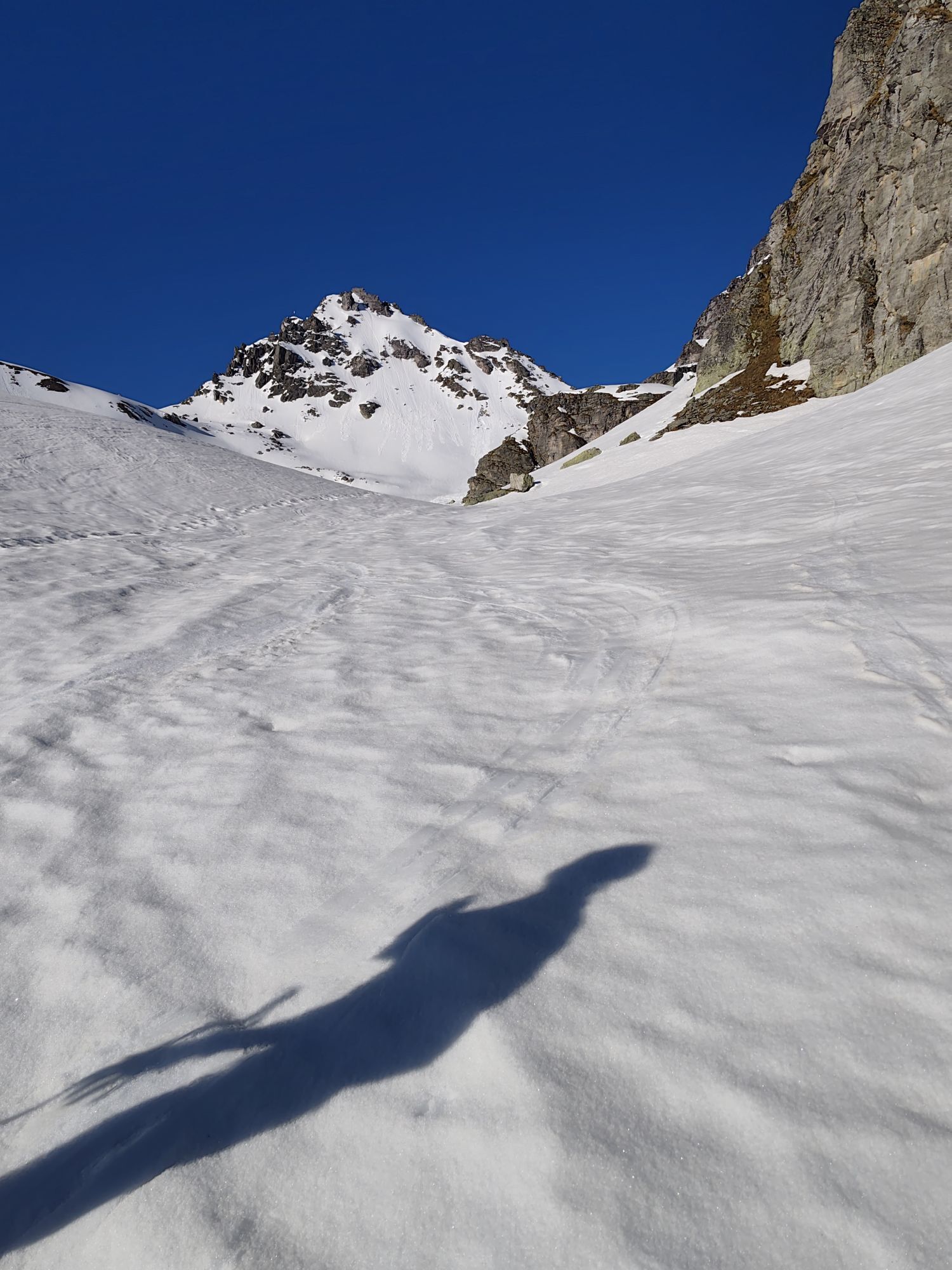
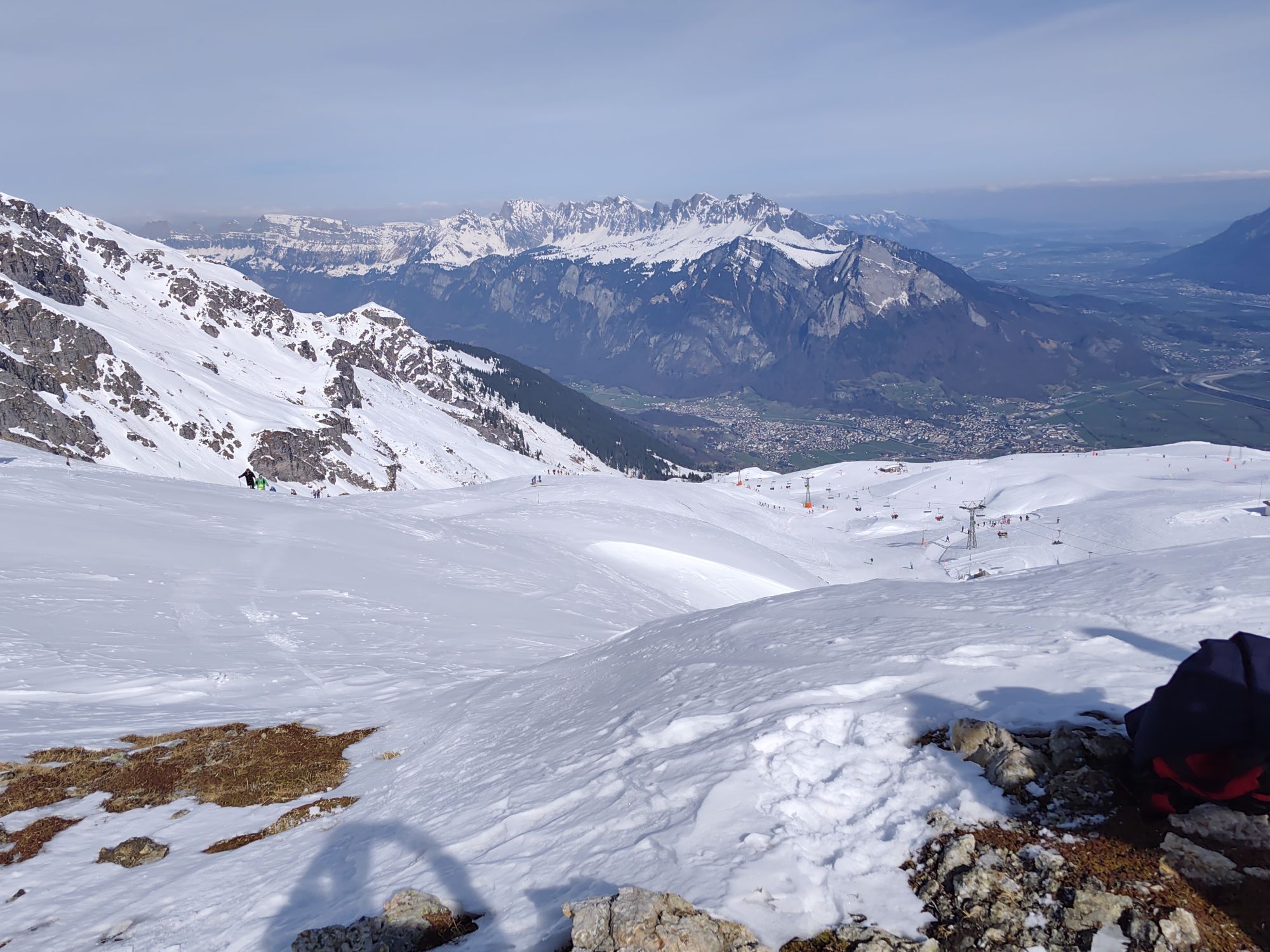
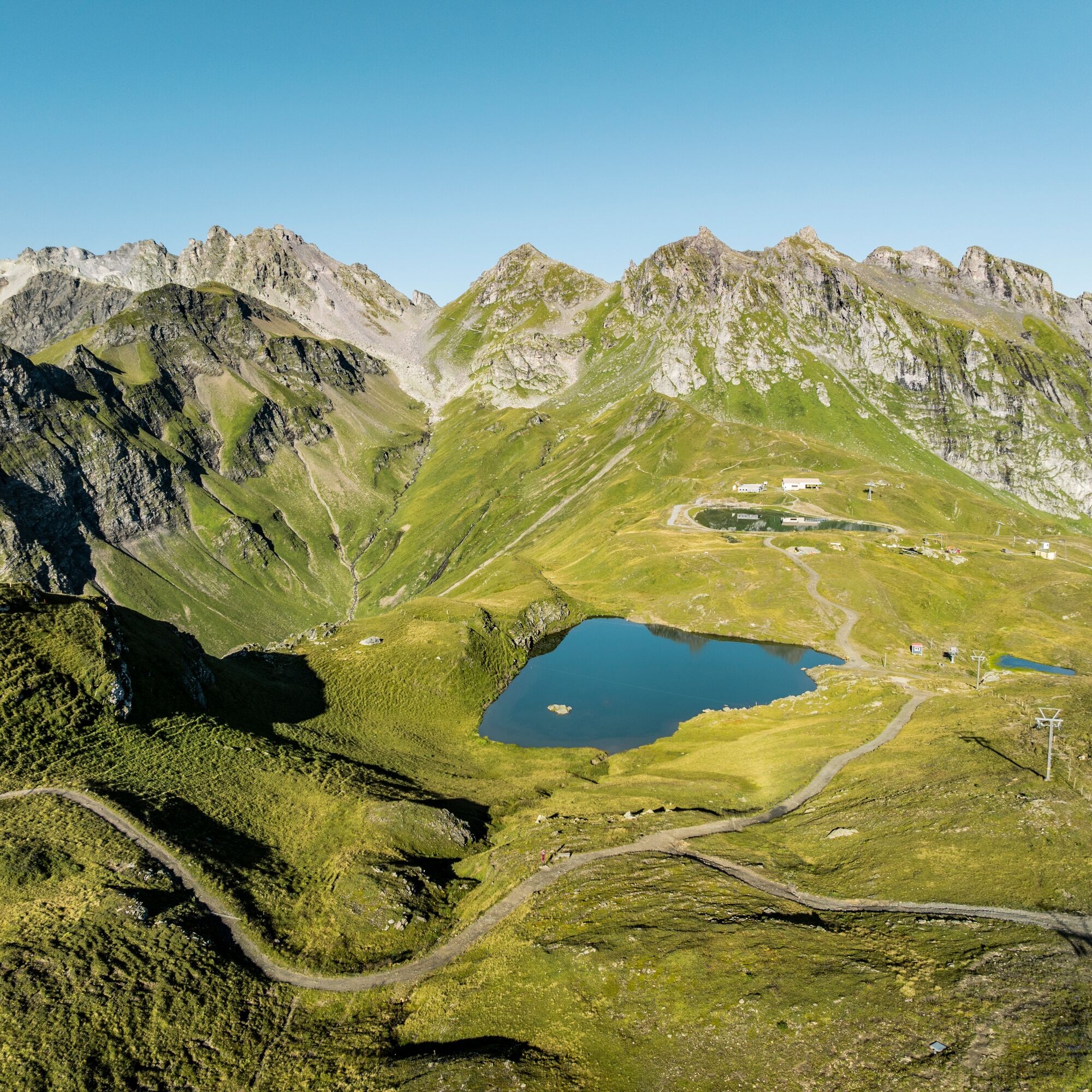
The path climbs ever steeper, first over meadows and finally zig-zagging through a scree slope. From the Lavtinasattel, you have a wonderful view back to Batöni and the ascent, but also ahead to the Wildsee, which is fed by the Pizol glacier. The Hochwart with its summit cross towers directly next to the saddle. Now follows a steep descent through rocks and scree towards the «Wildsee», where the path runs along the lake above boulders to the Wildseeluggen. The final descent leads in a zig-zag to the Pizolhütte, at the first section of the well-known 5 Lakes Route. Afterwards, take the chairlift and gondola down to the valley in Wangs.
Da
Da
Day hiking backpack (approx. 20 liters) with rain cover, sturdy and comfortable footwear, weather-appropriate and durable layered clothing, if necessary telescopic poles, sun and rain protection, provisions and drinking water, first aid kit, pocket knife, mobile phone, if necessary headlamp, maps
Check the mountain summer report at www.pizol.com. There you will find the latest information about the status of the hiking trails.
For the Wangs valley station, take the Sargans exit, and for the Bad Ragaz valley station, take the Bad Ragaz North exit. The valley stations are well signposted from the motorway exit. Both valley stations are only 5 minutes from the motorway exit and are accessible in winter without snow chains or other aids. Ideal accessibility via A3 (Zurich-Chur) and A13 (Lake Constance-Sargans-Chur).
Navigation system destination input:
Valley station Bad Ragaz: Loisstrasse 50, 7310 Bad Ragaz
Valley station Wangs: Pizolstrasse 3, 7323 Wangs
For the hike we recommend traveling to the Wangs valley station. From there, take public transport to the Weisstannen valley. This way, your car will already be at the right place for the return journey.
For a comfortable journey to the Weisstannen valley, take the post bus directly from Sargans train station to Weisstannen. This allows you to reach the starting point of the hike stress-free and without having to search for a parking space – ideal for an early start of the route.
T2
www.pizol.com
Park at the valley station in Wangs and take public transport to Weisstannen. This way, your car will already be at the right place at the end of the hike. Start the hike as early as possible to allow enough time for breaks and the demanding ascent.
Priljubljeni izleti v okolici
- 4,6
5-Seen Wanderung am Pizol
svetlobaPohodništvo 10,1 km - 4,7
Tamina Gorge Circular Route
srednjaPohodništvo 14,0 km - 4,7
Alvier
srednjaPohodništvo 3,33 km - 4,6
Pizalun circular route
svetlobaPohodništvo 7,18 km - 4,8
Mountain hike to the Strudeltöpfe on Alp Mora: Bargis-Trin
težkoPohodništvo 18 km - 4,7
Mädems Trail
srednjaSnežni čevlji 7,48 km - 5,0
Hike from Berschis to the Berschner Falls
srednjaPohodništvo 3,64 km - 5,0
Circular hike Bettlerweg & 2-Lakes Hike Pizol
srednjaPohodništvo 11,4 km - 5,0
Guscha ridge path
srednjaPohodništvo 7,96 km - 4,8
Flumserberg - panoramic bike no. 470
srednjaMountainbike 16,9 km
Pohodništvo in sledenje


Ne zamudite ponudb in navdiha za naslednje počitnice
Vaš e-poštni naslov je bil dodan na poštni seznam.