Sentier des coteaux
srednja
Pridobite to turo v svoj mobilni telefon
Sentier des coteaux
srednja
Pohodništvo
10,28
km
Skenirajte kodo QR in začnite navigacijo v aplikaciji bergfex.

Pohodništvo in sledenje


Sentier des coteaux
srednja
Razdalja
10,28
km
Trajanje
03:30
h
Ascent
165
hm
Morska gladina
183 -
296
m
Prenos skladbe
Sentier des coteaux
srednja
Pohodništvo
10,28
km
To discover:
In the 14th century, the territory of St-Julien du Puy was located to the north of the viscounty of Lautrec. It was made up of 4 rural parishes: St-Julien, St-Salvi de Sérail, St-Etienne d’Artoul...
Opis
To discover:
In the 14th century, the territory of St-Julien du Puy was located to the north of the viscounty of Lautrec. It was made up of 4 rural parishes: St-Julien, St-Salvi de Sérail, St-Etienne d’Artoul and Ste-Cécile de Lastourges. Part of the village of St-Julien du Puy was built with stones from the old castle that dominated the ridge line. It is likely that the fortification was dismantled under the orders of Richelieu during the Wars of Religion. The establishment of the village was made even easier by a vein of water that fed a thalweg on which a series of wells were dug.
The abundance of water allowed the development of a small reservoir for use as a drinking trough and washhouse.
After the hike, you can go to the village of Montdragon. A former fortified village, it offers some original features such as the Place de l’Espine, a former fairground from the time of the castrum, the house of Guilhaume Condoumiès with its arcades, the Church of St-Pierre, the public weight and its unusual dovecote with mule feet for the body and pillars for the base.
Pot
La Bartelle
(194 m)
Poravnava
0,0 km
Saint-Julien-du-Puy
(224 m)
Vas
0,6 km
Saint-Julien-du-Puy
(224 m)
Vas
9,0 km
Église Saint-Julien du Puy
(237 m)
Kraj čaščenja
9,0 km
La Bartelle
(194 m)
Poravnava
10,0 km
Pot
Sentier des coteaux
srednja
Pohodništvo
10,28
km
La Bartelle
(194 m)
Poravnava
0,0 km
Saint-Julien-du-Puy
(224 m)
Vas
0,6 km
Saint-Julien-du-Puy
(224 m)
Vas
9,0 km
Église Saint-Julien du Puy
(237 m)
Kraj čaščenja
9,0 km
La Bartelle
(194 m)
Poravnava
10,0 km

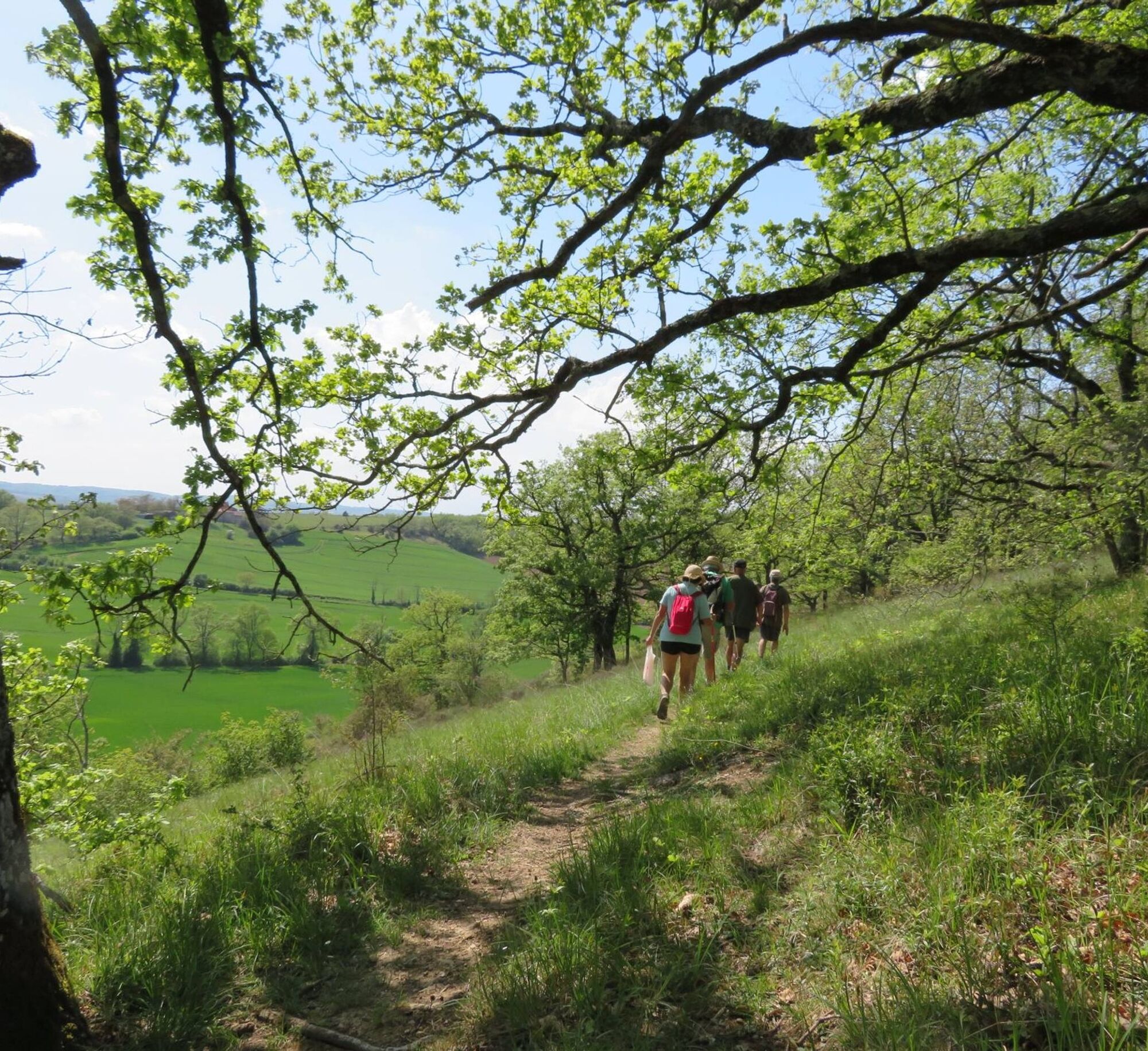
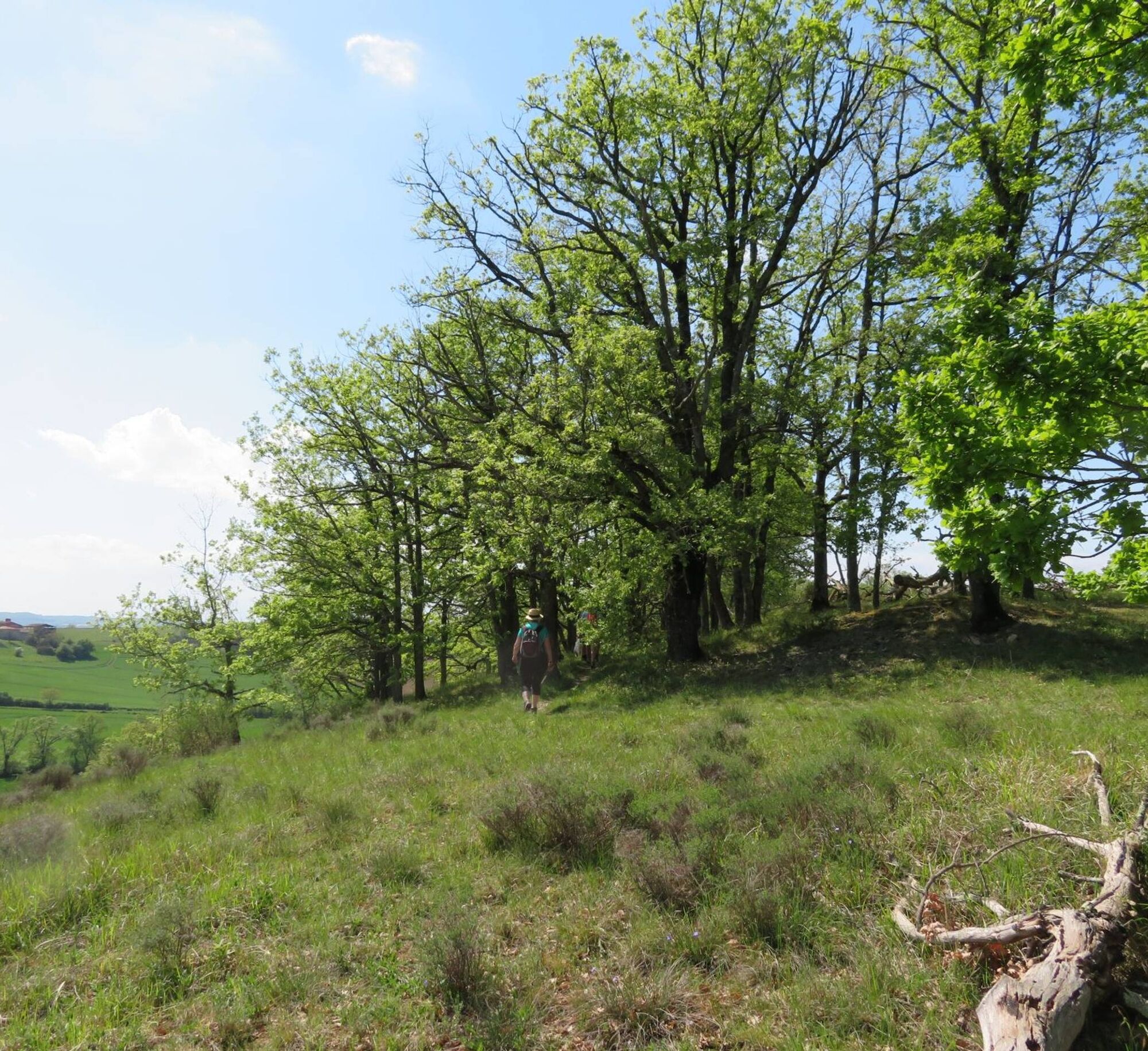
Informacije o poti
Pot
1. After crossing the D30, you will follow the Vidales stream which will take you on the goat path,
2. You will then discover old grain silos (openings in the slope),
3. You will pass next to the place called La Molière then cross the Butte des Abeillous,
4. You will then reach a magnificent viewpoint with an orientation table and a botanical trail,
5. You will find your starting point by crossing the village and its private washhouse.
Dodatne informacije in nasveti
Dodatne informacije
Intermediate
Še ni pregledov
Priljubljeni izleti v okolici
Garlic Trail
svetlobaPohodništvo 7,07 kmTour of Tarn on Horseback
srednjaJahanje 502,7 km- 5,0
Sentier des crêtes
srednjaPohodništvo 11,3 km Sentier des coteaux
svetlobaPohodništvo 10,0 kmLe circuit du pas du Loup
svetlobaPohodništvo 9,89 kmRidge Loop
svetlobaPohodništvo 5,69 km- 5,0
Three Lakes Trail - Sentier des trois lacs
svetlobaPohodništvo 8,22 km Le circuit des Devèzes
svetlobaPohodništvo 9,99 kmLe circuit boisé de la Capelle
težkoPohodništvo 18,6 kmLe chemin de l'eau
svetlobaPohodništvo 9,16 km
Pohodništvo in sledenje

Zaradi več kot 550.000 predlogov izletov, podrobnih zemljevidov in intuitivnega načrtovanja poti je aplikacija obvezna oprema za vse ljubitelje narave.

Ne zamudite ponudb in navdiha za naslednje počitnice
Naročite se na novice
Napaka
Zgodila se je napaka. Prosimo, poskusite znova.Zahvaljujemo se vam za prijavo
Vaš e-poštni naslov je bil dodan na poštni seznam.
Izleti po vsej Evropi
Avstrija Švica Nemčija Italija Slovenija Francija Nizozemska Belgija Poljska Lihtenštajn Češka Slovaška Španija Chorvátsko Bosna in Hercegovina Luksemburg Andora පෘතුගාලය අයිස්ලන්තය එක්සත් රාජධානිය අයර්ලන්තය ග්රීසිය ඇල්බේනියාව North Macedonia Malta Norway Montenegro Moldova කොසෝවො හන්ගේරියානු සමුහාණ්ඩුව San Marino රුමේනියාව එස්ටෝනියා ලැට්වියාව බෙලාරස් සයිප්රස් Lithuania Serbia බල්ගේරියාව Monaco ඩෙන්මාර්කය Sweden ෆින්ලන්තය