En Beys pond and refuge
srednja
Pridobite to turo v svoj mobilni telefon
En Beys pond and refuge
srednja
Pohodništvo
16.55
km
Skenirajte kodo QR in začnite navigacijo v aplikaciji bergfex.


Pohodništvo in sledenje





En Beys pond and refuge
srednja
Razdalja
16.55
km
Trajanje
06:00
h
Ascent
784
hm
Morska gladina
1,137 -
1,964
m
Prenos skladbe
En Beys pond and refuge
srednja
Pohodništvo
16.55
km
Access: On leaving Ax-les-Thermes, follow signs for "Orlu". Pass through the village of Orlu and continue towards the Forges d'Orlu. Continue until you reach "Fanguil-Chalet", from where you start.
Pot
Résurgence
(1,955 m)
Vir:
7.9 km
Refuge d'En Beys
(1,966 m)
Zavetišče
8.2 km
Pot
En Beys pond and refuge
srednja
Pohodništvo
16.55
km
Résurgence
(1,955 m)
Vir:
7.9 km
Refuge d'En Beys
(1,966 m)
Zavetišče
8.2 km
Avtor
Zagotavlja Ariège Pyrénées Tourismus
Za ogled En Beys pond and refuge poskrbi outdooractive.com.


Informacije o poti
Pot
0h00 - LE FANGUIL (1,140 m). Cross the Ariège on the wooden footbridge and follow a track up its left bank. At the jasse de Justiniac (1,300 m), rejoin the GR7 with its red and white markings. Follow the track to the end.
1h20 - PASSERELLE (1,400 m). Cross the footbridge and climb the right bank path to reach a large grassy false flat bordered by boulders (1,630 m). The well-marked path now tackles a steep incline. After a series of hairpin bends, the path runs S along the mountainside, through rhododendrons, cutting through couloirs and scree.
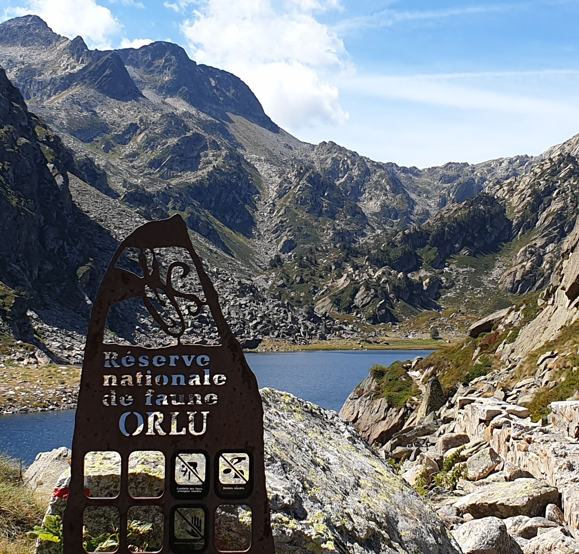
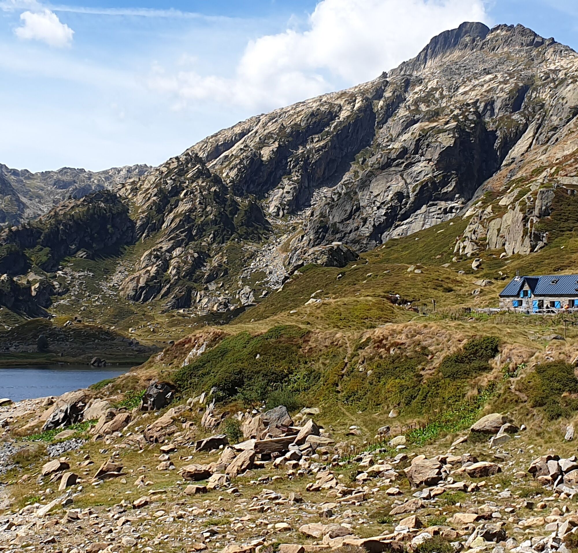
3:20 - STONE CHANNEL (1,975 m). Follow the "canalette" to the W. At its end, the view opens out onto the Etang d'En Beys and the surrounding mountains. Descend towards the pond, then follow its left bank to the right.
3h30 - EN BEYS POND AND REFUGEE (1,970 m). Return by the same route in 2h30.
1h20 - PASSERELLE (1,400 m). Cross the footbridge and climb the right bank path to reach a large grassy false flat bordered by boulders (1,630 m). The well-marked path now tackles a steep incline. After a series of hairpin bends, the path runs S along the mountainside, through rhododendrons, cutting through couloirs and scree.
3:20 - STONE CHANNEL (1,975 m). Follow the "canalette" to the W. At its end, the view opens out onto the Etang d'En Beys and the surrounding mountains. Descend towards the pond, then follow its left bank to the right.
3h30 - EN BEYS POND AND REFUGEE (1,970 m). Return by the same route in 2h30.
Enosmerna tura
Da
Še ni pregledov

Priljubljeni izleti v okolici
-
4.0
Pic de Tarbesou - Carena Runde - Etang Noir et Blue
srednjaPohodništvo 12.3 km -
Le Pic du Tarbésou
srednjaPohodništvo 2.82 km -
The Perics tour
srednjaPohodništvo 47.5 km -
Cycling route 11 - The Ariège cycle route - Stage 4: from Prades to Ax-les-Thermes
težkoCestno kolo 68.4 km -
GR10 Pyrenäenweg Etappe 45
srednjaPohodništvo v daljavo 16.9 km -
Étang des Bésines and its refuge
svetlobaPohodništvo 14.6 km -
La Grande Traversée VTT Ariège Pyrénées FFC Label
težkoMountainbike 32.5 km -
Étang du Laurenti
svetlobaPohodništvo 5.57 km -
C 3. Etappe Artigues-Tarascon, Okzitanien/Frankreich
težkoKolesarjenje 63.2 km -
La dent d'Orlu
srednjaPohodništvo 4.88 km

Pohodništvo in sledenje

Zaradi več kot 550.000 predlogov izletov, podrobnih zemljevidov in intuitivnega načrtovanja poti je aplikacija obvezna oprema za vse ljubitelje narave.

Ne zamudite ponudb in navdiha za naslednje počitnice
Naročite se na novice
Napaka
Zgodila se je napaka. Prosimo, poskusite znova.
Zahvaljujemo se vam za prijavo
Vaš e-poštni naslov je bil dodan na poštni seznam.
Izleti po vsej Evropi
Avstrija
Švica
Nemčija
Italija
Slovenija
Francija
Nizozemska
Belgija
Poljska
Lihtenštajn
Češka
Slovaška
Španija
Chorvátsko
Bosna in Hercegovina
Luksemburg
Andora
පෘතුගාලය
අයිස්ලන්තය
එක්සත් රාජධානිය
අයර්ලන්තය
ග්රීසිය
ඇල්බේනියාව
North Macedonia
Malta
Norway
Montenegro
Moldova
කොසෝවො
හන්ගේරියානු සමුහාණ්ඩුව
San Marino
රුමේනියාව
එස්ටෝනියා
ලැට්වියාව
බෙලාරස්
සයිප්රස්
Lithuania
Serbia
බල්ගේරියාව
Monaco
ඩෙන්මාර්කය
Sweden
ෆින්ලන්තය





