


HIKING MOUNT ST-LOUP, AN ANCIENT VOLCANO
INFORMATION SUMMER 2025: access to Mont Saint Loup, which is under red forest fire alert, is strictly forbidden.
Climb Mont Saint Loup! Like adventurers, discover the sumptuous panoramas and historic remains...
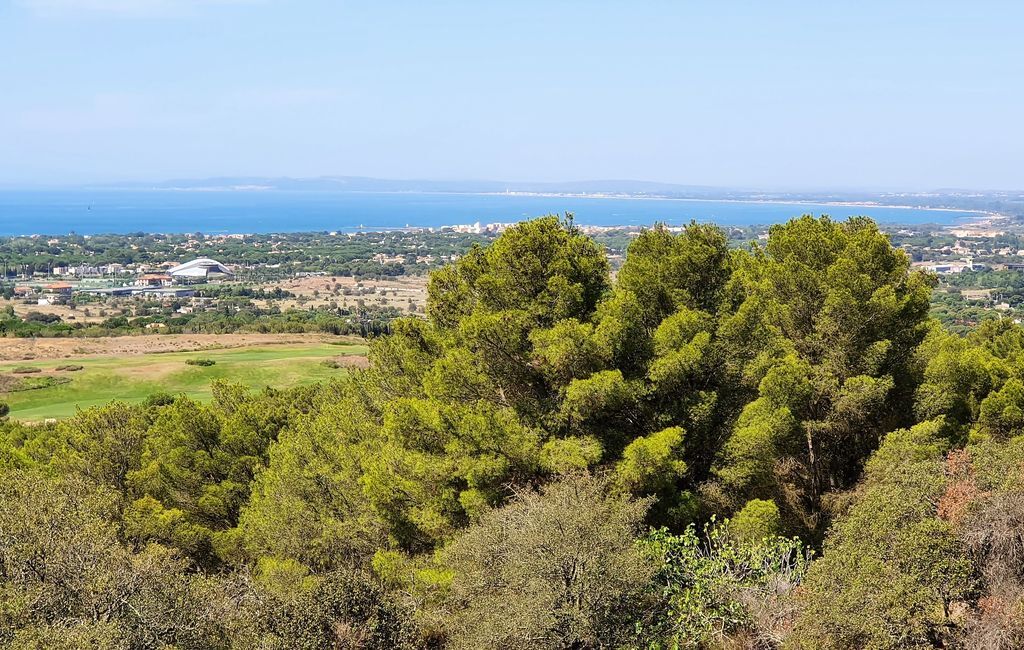
Climb Mont Saint Loup! Like adventurers, discover the sumptuous panoramas and historic remains of this ancient volcano in the Puys d'Auvergne, 113m above sea level. Passing through fragrant pine forests, discover the different colors that stand out in these panoramas like those of an artist's palette: the various blues of the Mediterranean Sea, the green expanses of the Cap d'Agde golf course and the Bagnas reserve, the brilliance of the Etang de Thau, the black of the basaltic soils and that of the "Tour des Anglais" - enough to bring back wonderful memories!

1
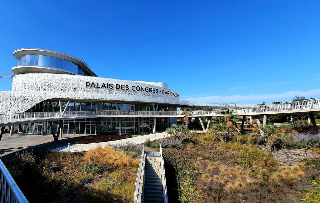
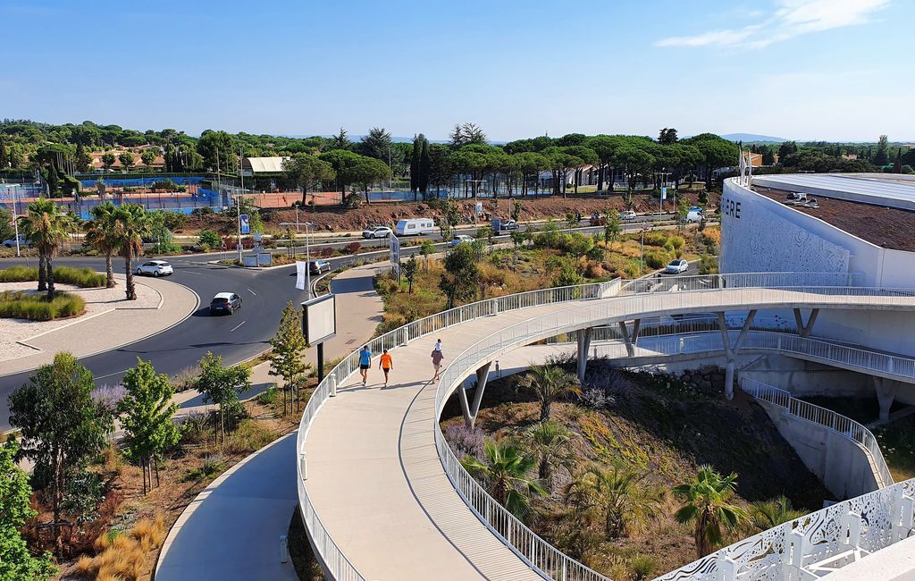
Starting point: Tourist Office - Palais des Congrès. To start the tour, take the footbridge to the roof terrace of the Palais des Congrès.
2
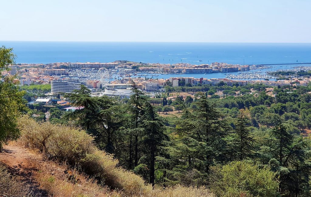
Viewpoint: from the Palais des Congrès, you can admire the panoramic view of two ancient volcanoes, Mont Saint Loup at 113 m and Mont Saint Clair at Sète at 175 m, with the Centre Port du Cap d'Agde behind the Ferris wheel and the Mediterranean Sea in the background.
3
Directional: don't take the tunnel under the road, turn left towards Domaine Saint Martin, walk to the parking lot, climb the small steps to reach the accro-branche. Follow the small dirt track to the next viewpoint.
4
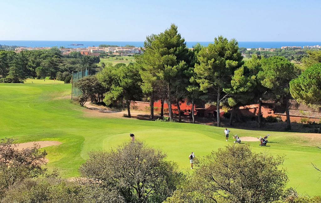
Gateway viewpoint: in the foreground, the 27-hole Cap d'Agde international golf course; in the background, a magnificent view of the Mediterranean Sea, with Fort Brescou in the foreground, built in 1856 by Viscount Guillaume de Joyeuse during the Wars of Religion with the Spanish.
5
Directional: turn right and use the crosswalk to carefully cross the road towards Mont Saint Loup.
6
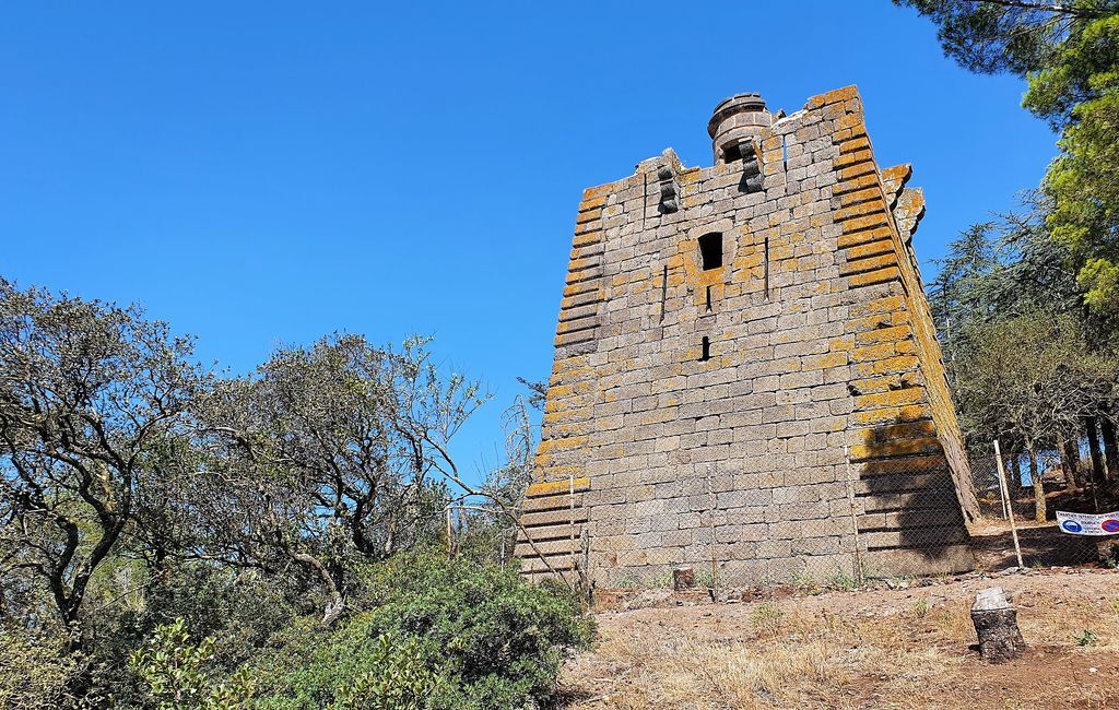
Tour des anglais (English Tower): this building was designed by engineer Mareschal, director of fortifications for Languedoc, in 1742. This pyramidal monument, built of basalt in 1750, is a veritable observation post, designed to warn off the enemy and keep them at bay. It was named "English" after an attack by the English at the time. Equipped with a platform on which the guards lit a large fire when enemy ships were visible on the horizon, it has its "twin" sister, the Tour du Castellas, located between Agde and Sète. Today, the tower has been listed as a Monument Historique since 1939 and is owned by the French State.
7
Directional: leave the main path and turn slightly right along the cypress avenue to reach the tarmac ascent.
8
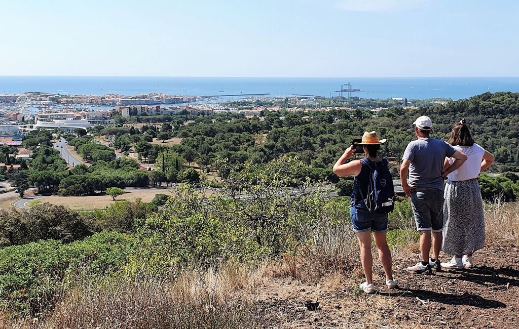
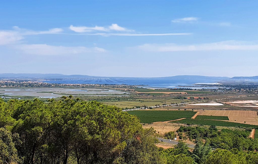
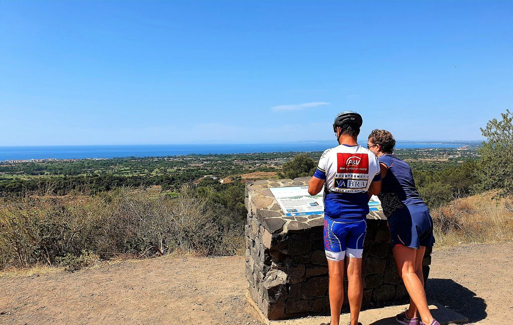
Belvedere: at the top of Mont Saint Loup, the French Navy semaphore dominates the Agatha coastline, offering a superb view of Cap d'Agde. Built in 1836, this semaphore with its rotating lighthouse was an excellent landmark for sailors, providing visual radio and radar surveillance all along the coast. Decommissioned by the French Navy many years ago, it was used by Affaires Maritimes and Cross-Med to take charge of rescue operations in the western Mediterranean. To the left is the Bagnas national reserve, a 561.3-hectare lagoon area in the communes of Agde and Marseillan, classified as a national reserve in 1983. Protecting the Bagnas lagoons and surrounding wetlands, it is home to a mosaic of many of the natural environments of the Mediterranean coast: to the north, the Grand Bagnas with a freshwater to brackish lagoon surrounded by reedbeds. To the south, Petit Bagnas, a temporary lagoon punctuated by sansouïres, is bordered by pastures and salt meadows. This green lung is separated from the sea by a dune cordon, and is a UNESCO World Heritage site, home to a well-preserved flora and fauna, with over 10,000 birds present in late summer and over 400 species of invertebrate. In the distance, you can see the Etang de Thau, with its oyster beds, which you can enjoy in Bouzigues or around the Sétoise region. To your right, the orientation table offers a magnificent panorama of the Mediterranean Sea, with views of Cap d'Agde and its harbours, as well as the Pyrenees on a clear day.
In case of emergency, call 112.
Bring appropriate footwear, water bottle, hat or cap. Respect the environment.
+33 4 67 01 04 04
Cap d'Agde Méditerranée Tourist Office
Priljubljeni izleti v okolici
-
4.0
LE BELVEDERE VOLCANIC CLIFF HIKE
svetlobaPohodništvo 7.12 km -
LA GRANDE MAÏRE HIKE
svetlobaPohodništvo 11.2 km -
MOUNTAIN BIKE CIRCUIT 21: LE GRAND SALAN - ESPACE VTT/GRAVEL CAP D'AGDE MÉDITERRANÉE
svetlobaMountainbike 19.5 km -
CIRCUIT VTT 23: GRANDE BOUCLE D'AGDE - ESPACE VTT/GRAVEL CAP D'AGDE MÉDITERRANÉE
svetlobaMountainbike 25.0 km -
CYCLO LOOP N°24 - AGDE, FRESH AND SALT WATER
svetlobaKolesarjenje 32.7 km -
THE TAMARISSIERE HIKE IN THE SHADE OF THE PINES
svetlobaPohodništvo 5.32 km -
CYCLE LOOP No. 26 - THAU POND, ABBEY OF VALMAGNE AND PÉZENAS
srednjaKolesarjenje 63.1 km -
HIKE THE TOUR OF THE VERDISSES
srednjaPohodništvo 12.3 km -
CIRCUIT VTT 19: DE LA CAVE AU MOULIN - ESPACE VTT/GRAVEL CAP D'AGDE MÉDITERRANÉE
svetlobaMountainbike 23.5 km -
HIKING THE DOMAINE DE MARAVAL
svetlobaPohodništvo 7.52 km

Pohodništvo in sledenje


Ne zamudite ponudb in navdiha za naslednje počitnice
Vaš e-poštni naslov je bil dodan na poštni seznam.