







Cyclotourism route - around Pic de Montégut

Stopnja težavnosti: 3
It is after the Chioula pass (at Sarnac pass) that the hamlets with medieval heritage, Carla de Roquefort and Lieurac, will appear. Then you will find the Douctouyre valley shaped by agricultural landscapes.
...It is after the Chioula pass (at Sarnac pass) that the hamlets with medieval heritage, Carla de Roquefort and Lieurac, will appear. Then you will find the Douctouyre valley shaped by agricultural landscapes.
To see:
Carla de Roquefort
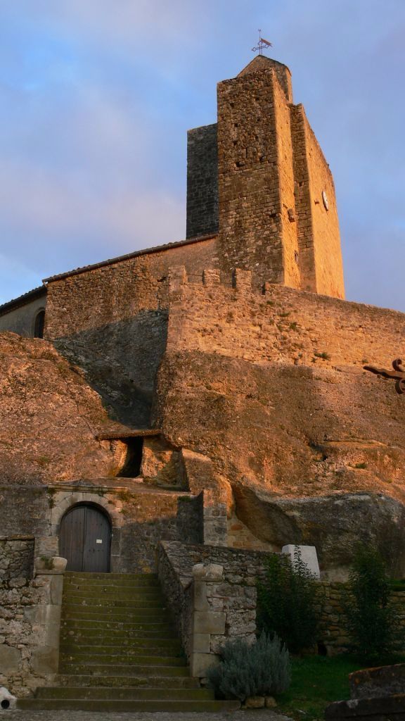
Nestled at the foothills of Plantaurel, Carla de Roquefort is built around a hilltop on which the remains of the old castle and the church dominate the Douctouyre gorges.
Lieurac
At the confluence of the Douctouyre and the Sautel stream, crowning the hill with its circular shape, the village of Lieurac seems to follow the layout of old fortifications on which the current houses lean. Not to be missed: the fortified church.
Domaine des côteaux d'Engraviès
It was in 1998 that Philippe Babin decided to plant his first vines near the Tabe in a very special terroir halfway between Mirepoix, Lavelanet, and Pamiers. The quality of the Ariège wine was soon recognized, and a few years after the plantings (1998 to 2002), the wine of the Côtea ux d'Engraviès became a favorite of the Hachette guide, cited in the Gault and Millau Guide and selected by the revue des vins de France. A departmental success, don’t hesitate to visit the estate to meet these passionate producers…


Da
Before you leave:
Ensure the bike is in perfect mechanical condition, including tires and brakes Check the bike is properly adjusted to your body Wearing a helmet is strongly recommended Bring a repair kit Remember that traffic laws apply to cyclists at all times Never ride more than two abreast and keep to a single file when traffic conditions require it Respect other road users as you would like to be respected Choose a route that matches your physical capabilities Inform your contacts of your itinerary Check the weather conditions A first aid kit is not essential, but can be very useful Know and keep emergency numbers Respect the environment by not throwing food wrappers on the roadside If you need to return at dusk, make sure you can see and be seenEmergency number: 112
Start of the route: Dun, head north, taking the D12, then head towards Vira.
Parking near the starting point
3
To learn more about the destination, visit our site
Main difficulties:
Calzan pass: 4.8 km at 4% (Calzan - Calzan pass 8% over 1.6 km) Chioulade pass: 5 km at 2%Priljubljeni izleti v okolici
-
The path of the 3 waterfalls
srednjaPohodništvo 7.20 km -
Les terrasses du Pech
svetlobaPohodništvo 3.22 km -
Cyclotour de l'Ariège in 5 days
težkoCestno kolo 441.0 km -
The Grande Traversée VTT de l'Ariège
težkoMountainbike 208.5 km -
Cyclosport route 10 - The three bumps near Foix
težkoCestno kolo 78.8 km -
Die Runde von Vals
svetlobaPohodništvo 7.25 km -
Saint-Sauveur Walk
svetlobaPohodništvo 3.17 km -
Grande Traversée VTT Ariège Pyrénées
težkoMountainbike 207.3 km -
Le Pic de Montgailhard
svetlobaPohodništvo 3.26 km -
Balade du Pech de Montgailhard
srednjaPohodništvo 6.94 km
Pohodništvo in sledenje


Ne zamudite ponudb in navdiha za naslednje počitnice
Vaš e-poštni naslov je bil dodan na poštni seznam.





