






MTB route no.17 Saint-Paul
You will explore the village of Penne and its 13th-century castle, a significant site of Catharism and the Albigensian (from Albi) Crusade, perched on its rocky spur overlooking the Aveyron. You will climb...
You will explore the village of Penne and its 13th-century castle, a significant site of Catharism and the Albigensian (from Albi) Crusade, perched on its rocky spur overlooking the Aveyron. You will climb up to the edge of the Forêt de Grésigne. Covering 3,530 hectares, this state-owned forest is the largest in the Tarn and one of the largest oak forests in Europe. Finally, you will return to Penne via the hamlet of St. Paul de Mamiac.

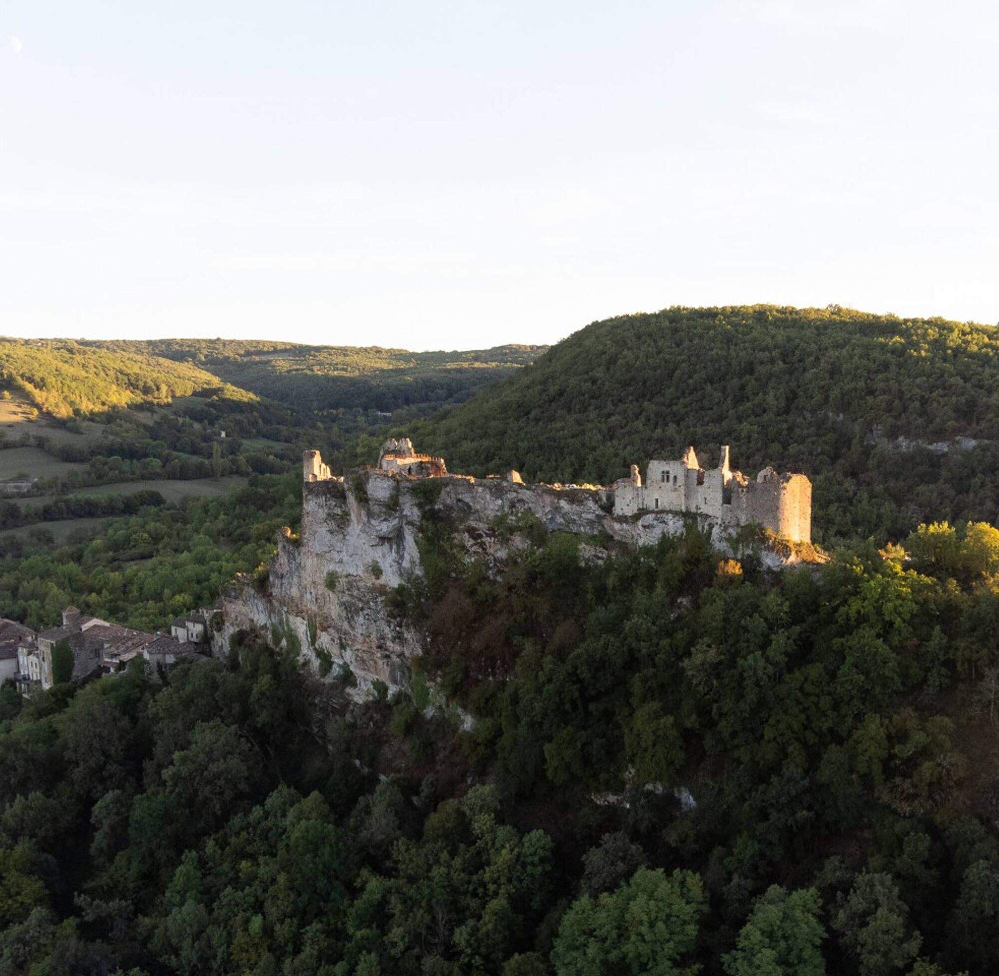

Starting from the village hall of Penne, you climb via the Bayès path to the Pas de la Lignée, following the GR de Pays Cordes-Penne-Coustous, while enjoying beautiful views of the village, its fortress, and the valley. You then descend to the hamlet of St. Paul de Mamiac and Penne through the hills of the Causse. To finish, you cross the small Cap stream via an ancient little bridge that takes you back to the village.
Intermediate
Priljubljeni izleti v okolici
-
Maraval Trail - Short Variant
srednjaPohodništvo 5.02 km -
Sentier des dunes de Maraval aux Touardes
srednjaPohodništvo 8.57 km -
The Suquets of Penne
svetlobaPohodništvo 10.3 km -
Maraval trail - dune section
svetlobaPohodništvo 1.72 km -
From the Cérou to the Aveyron
srednjaPohodništvo 10.2 km -
Sentier de Mespel
srednjaPohodništvo 5.73 km -
GR46 ® - The Albigensian Bastides
težkoPohodništvo 115.0 km -
Circuit VTT n°27 Bonnan Vert
svetlobaMountainbike 8.18 km -
Tarn Horse Route: Puycelsi / Bruniquel
srednjaJahanje 11.9 km -
Tour du Tarn à cheval : Bruniquel / Roussayrolles
težkoJahanje 28.9 km

Pohodništvo in sledenje


Ne zamudite ponudb in navdiha za naslednje počitnice
Vaš e-poštni naslov je bil dodan na poštni seznam.





