


FROM MILLAU TO CARCASSONNE BY MTB ON THE GTMC AND THE PASSA MERIDIA
Fotografije naših uporabnikov
-
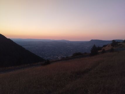
 © Ab ZazaUstvarjeno na 15.05.2026
 -
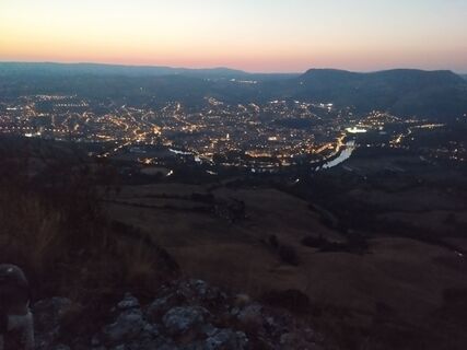
 © Ab ZazaUstvarjeno na 21.08.2025
 -

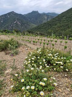
 © Adrien GarnironUstvarjeno na 28.12.2025
 -
 © Adrien GarnironUstvarjeno na 28.12.2025
 -
 © Adrien GarnironUstvarjeno na 28.12.2025
 -
 © Adrien GarnironUstvarjeno na 28.12.2025
 -
 © Adrien GarnironUstvarjeno na 28.12.2025
 -
 © Ab ZazaUstvarjeno na 29.11.2025
 -
 © Ab ZazaUstvarjeno na 31.10.2025
 -
 © Ab ZazaUstvarjeno na 31.10.2025
 -
 © Ab ZazaUstvarjeno na 19.10.2025
 -
 © Ab ZazaUstvarjeno na 19.10.2025
 -
 © Ab ZazaUstvarjeno na 29.08.2025
 -
 © Ab ZazaUstvarjeno na 29.08.2025
 -
 © Ab ZazaUstvarjeno na 24.08.2025
 -
 © Ab ZazaUstvarjeno na 24.08.2025
 -
 © Ab ZazaUstvarjeno na 24.08.2025
 -
 © Ab ZazaUstvarjeno na 18.08.2025
 -
 © Ab ZazaUstvarjeno na 18.08.2025
 -
 © Ab ZazaUstvarjeno na 18.08.2025
 -
 © Ab ZazaUstvarjeno na 18.08.2025
 -
 © Ab ZazaUstvarjeno na 18.08.2025
 -
 © Ab ZazaUstvarjeno na 18.08.2025
 -
 © Ab ZazaUstvarjeno na 07.08.2025
 -
 © Ab ZazaUstvarjeno na 07.08.2025
 -
 © Ab ZazaUstvarjeno na 07.08.2025
 -

 © W B MAUstvarjeno na 02.05.2025
 -
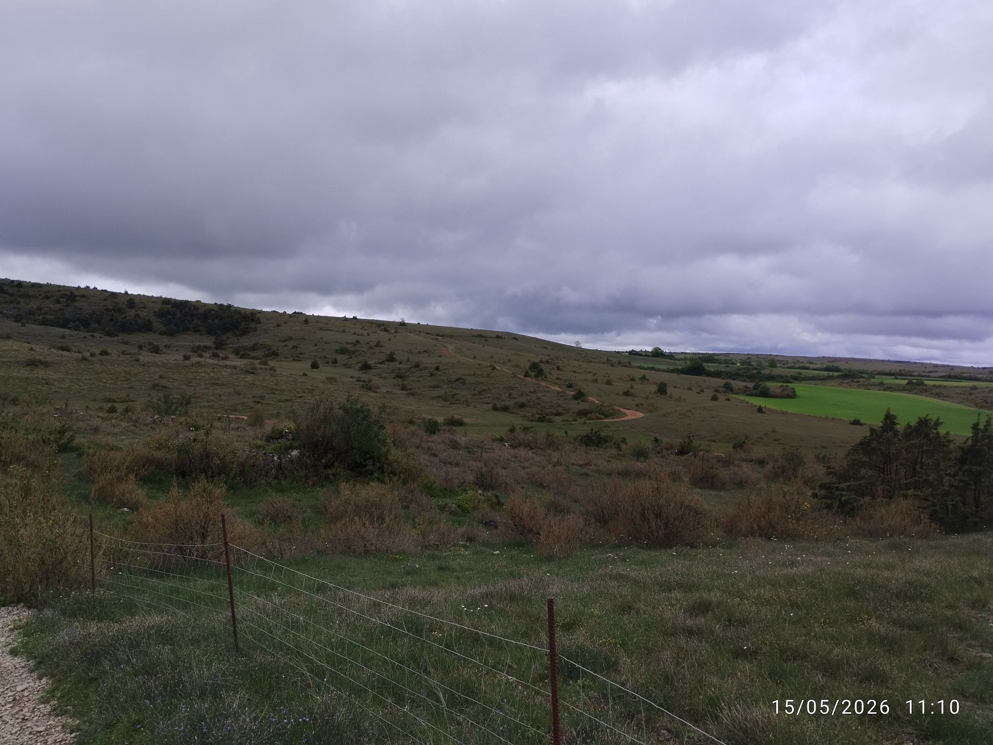
 © W B MAUstvarjeno na 02.05.2025


This MTB route links Millau to Carcassonne through a great diversity of landscapes, from the Larzac plateau to the vineyards of Minervois. The departure from the Grands Causses offers vast panoramas and...
This MTB route links Millau to Carcassonne through a great diversity of landscapes, from the Larzac plateau to the vineyards of Minervois. The departure from the Grands Causses offers vast panoramas and a steady climb towards the reliefs of Haut-Languedoc.
Along the stages, the route alternates rolling trails, forest sections, and narrower valleys, particularly along the Orb. Character villages like La Couvertoirade, Roquebrun, Olargues, or Minerve are major points of interest and structure the itinerary.
The transition to the limestone plateaus of Minervois marks a shift to a more Mediterranean ambiance before reaching the banks of the Canal du Midi and the medieval city of Carcassonne. A progressive and contrasting itinerary, designed for mountain bikers seeking a sporting and coherent crossing, accessible by classic or electric MTB.

1
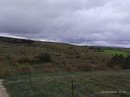
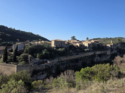
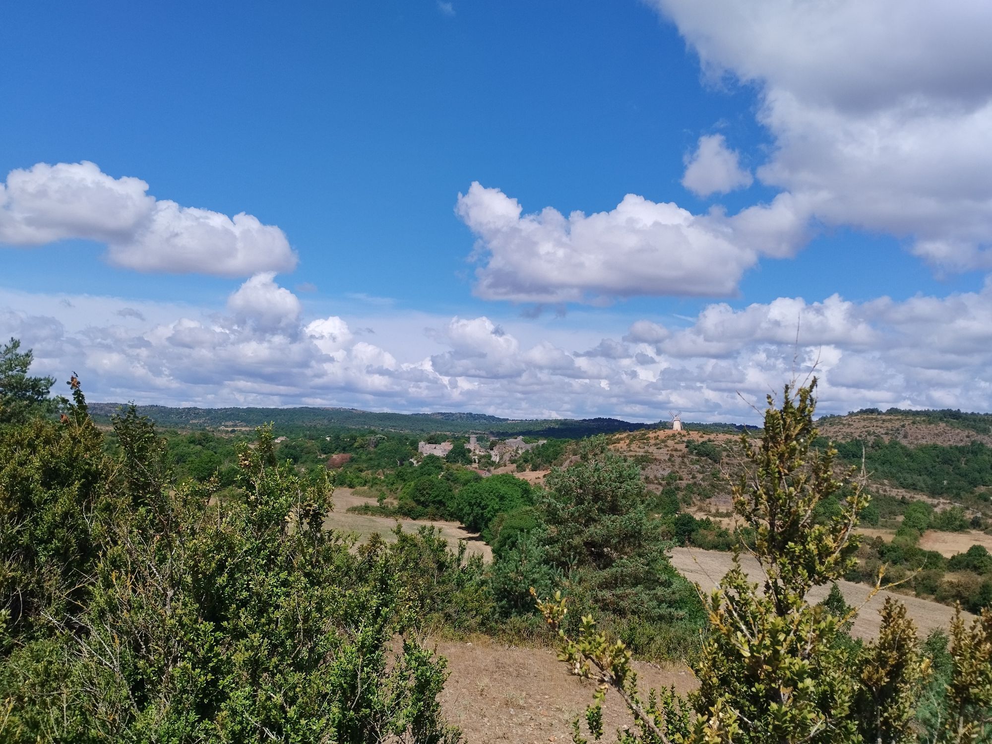
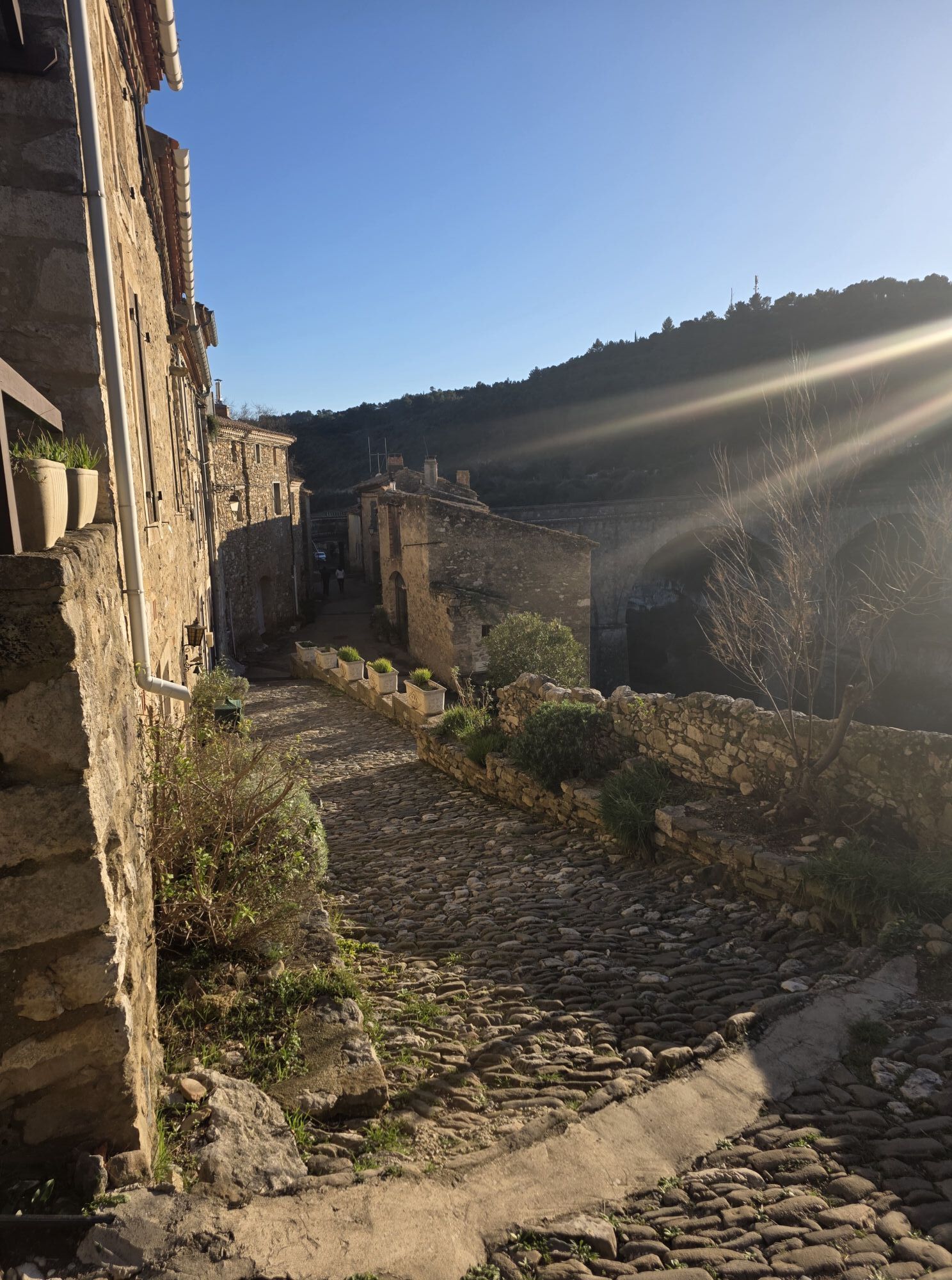
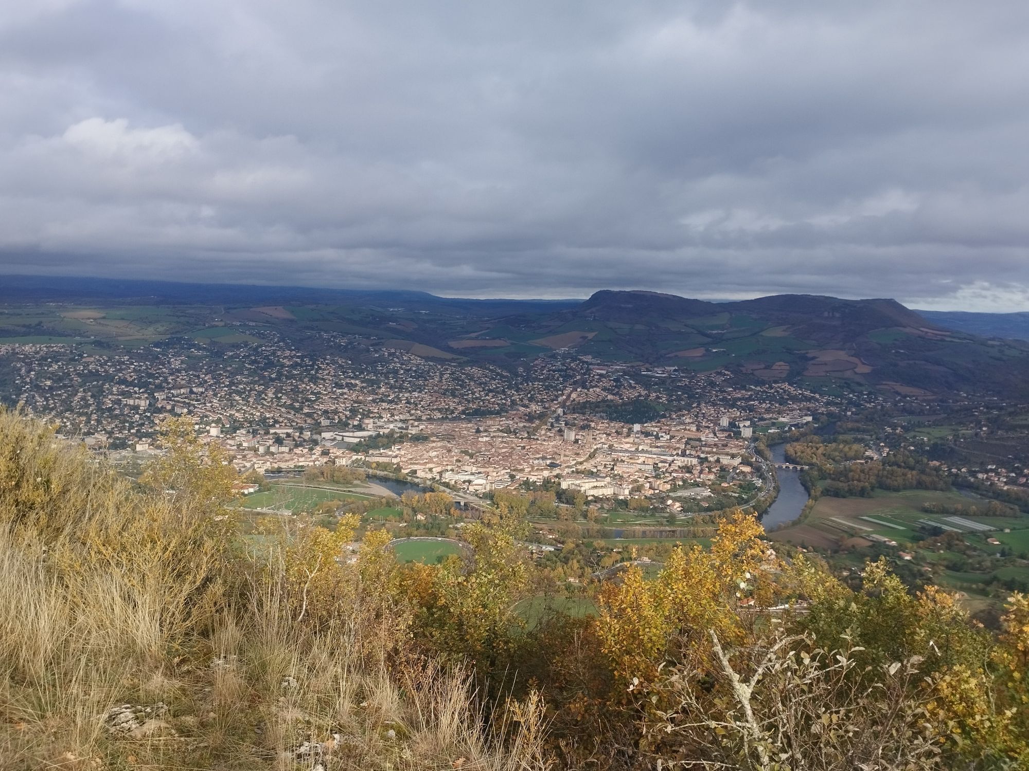
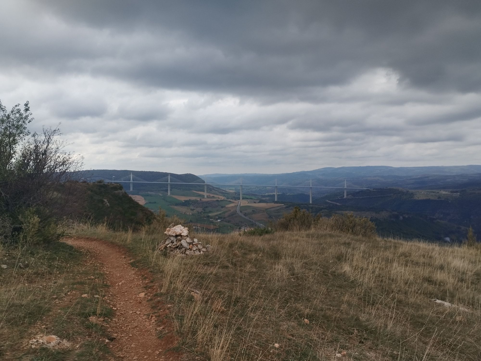
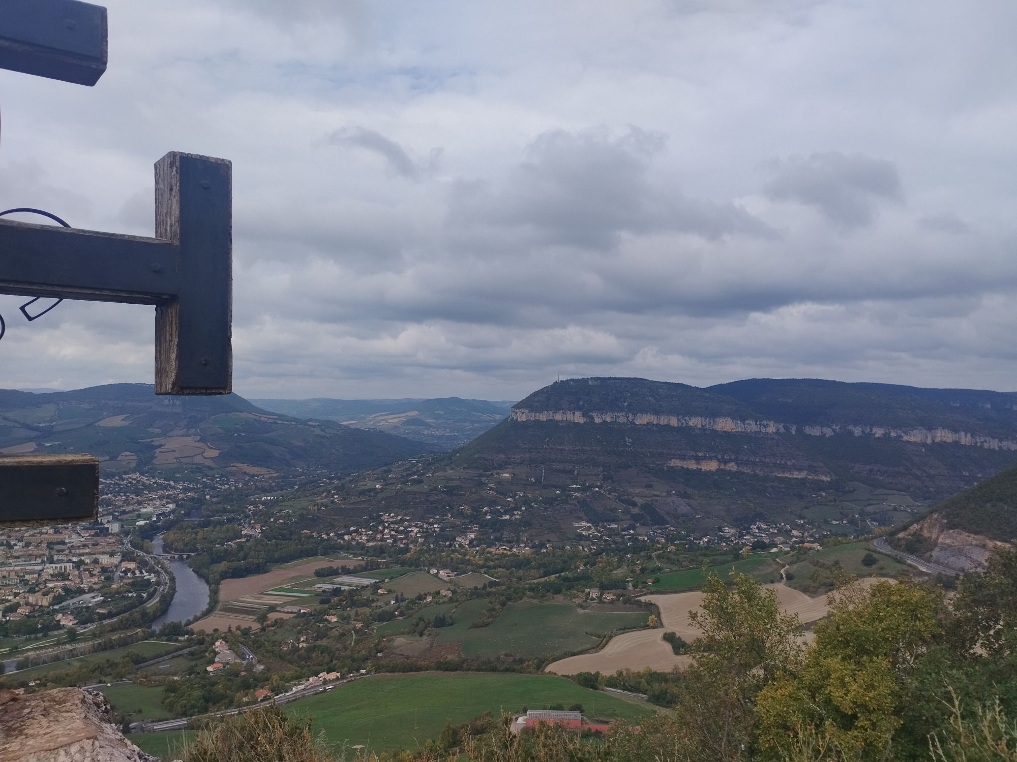
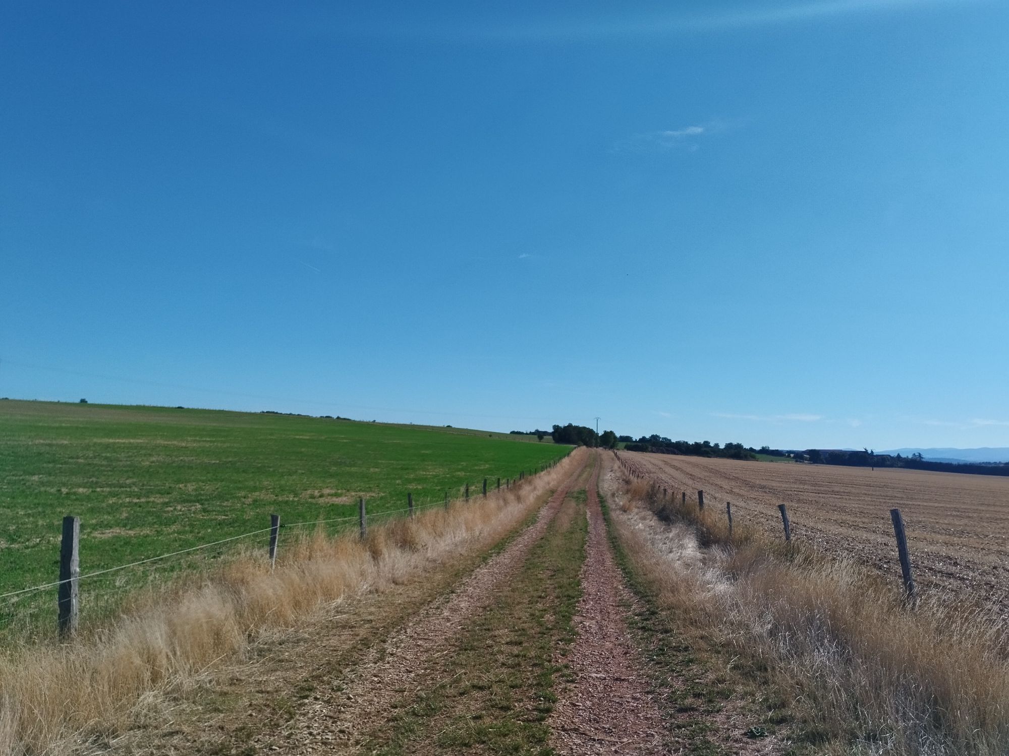
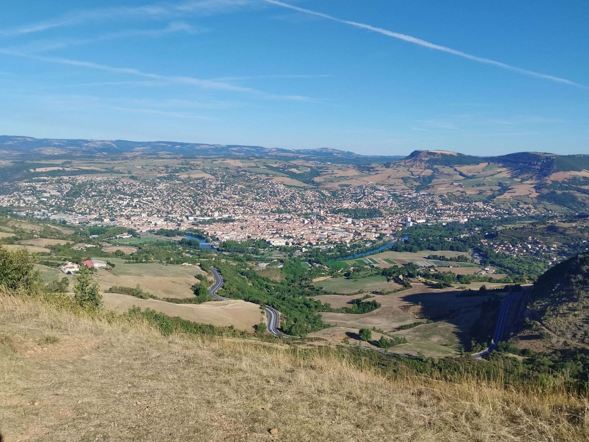
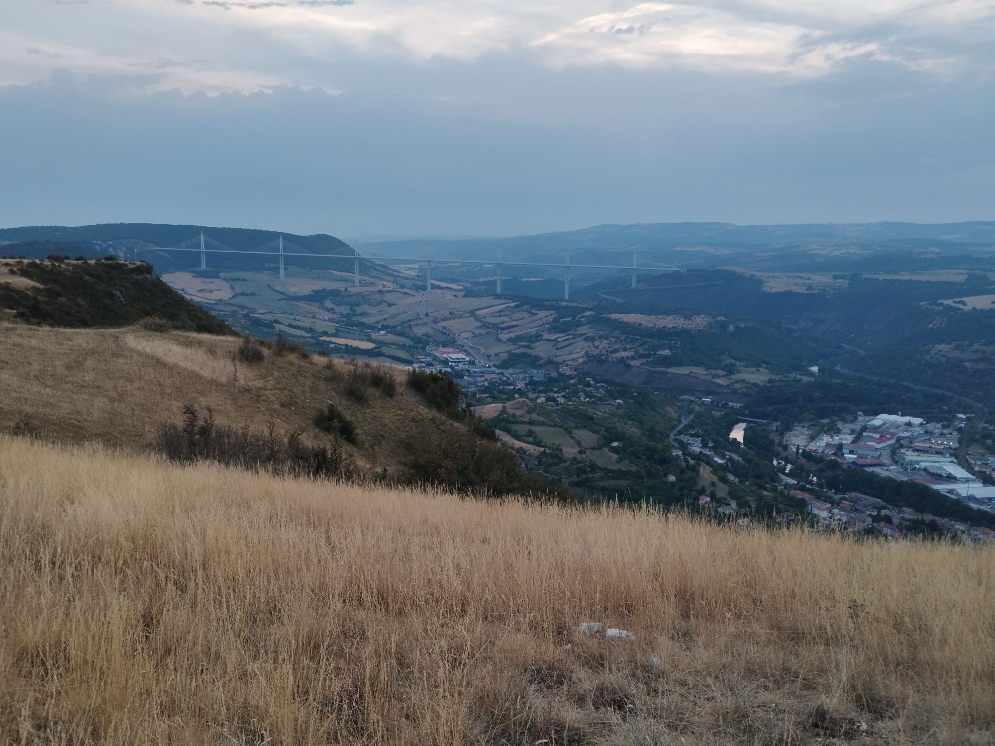
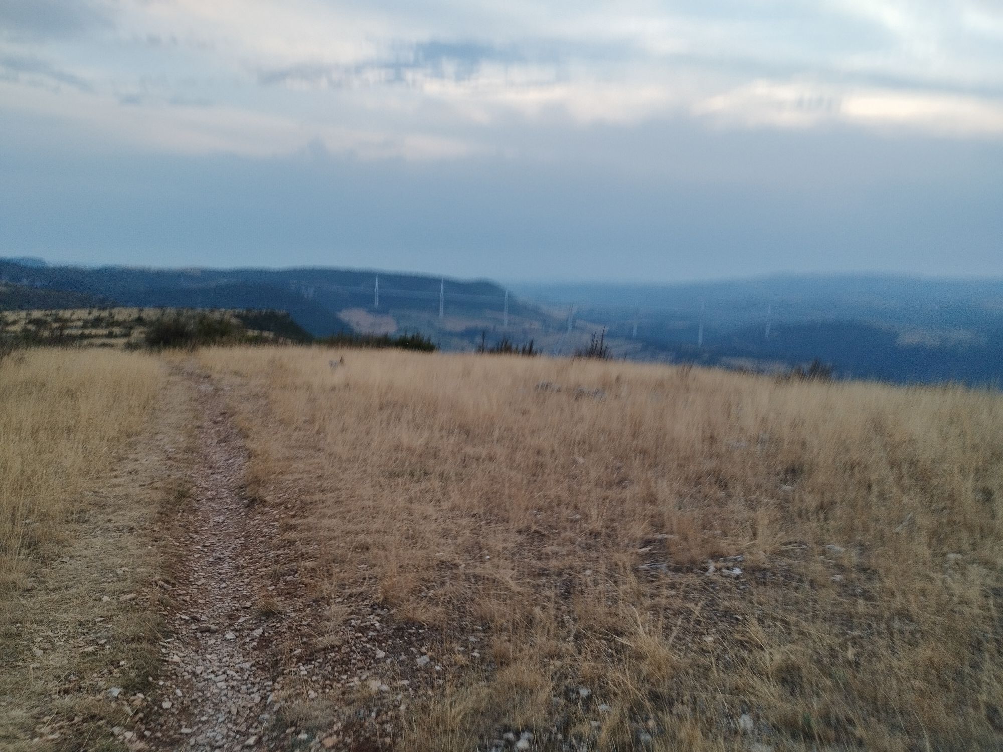
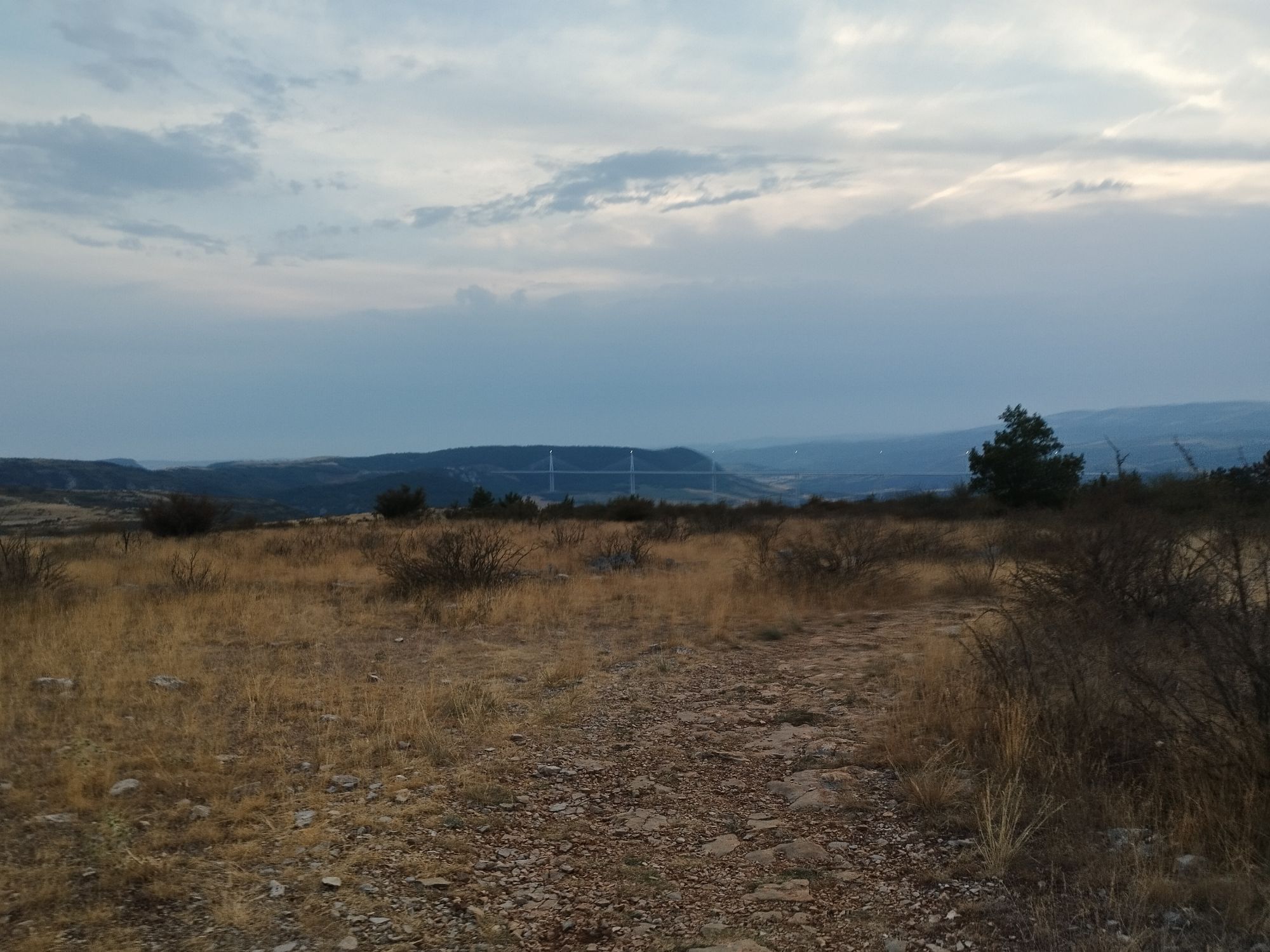
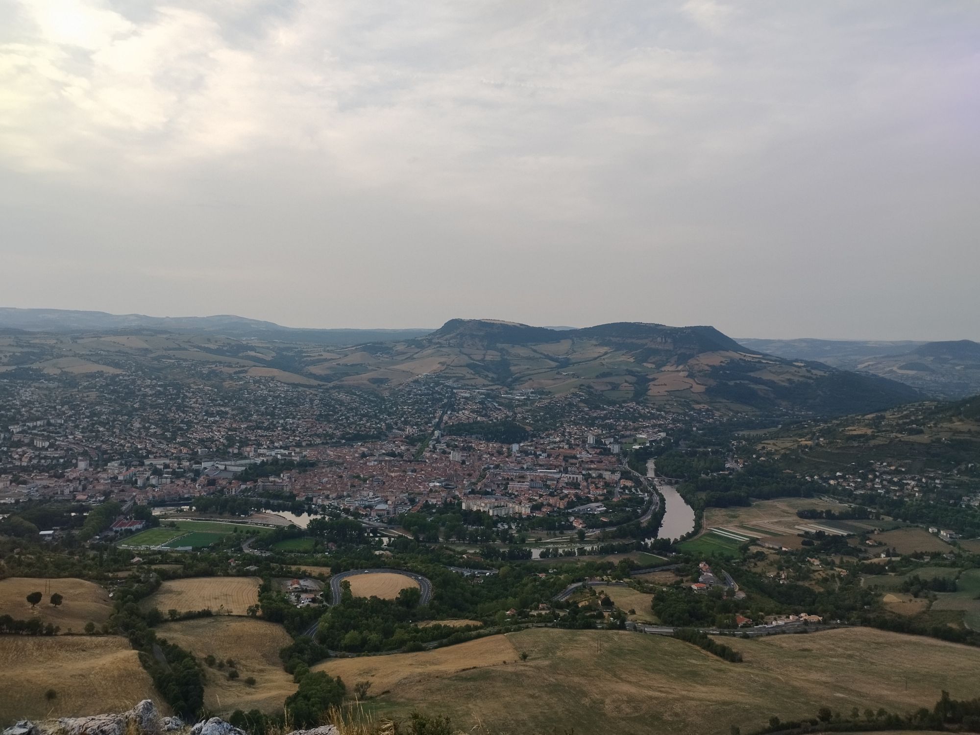
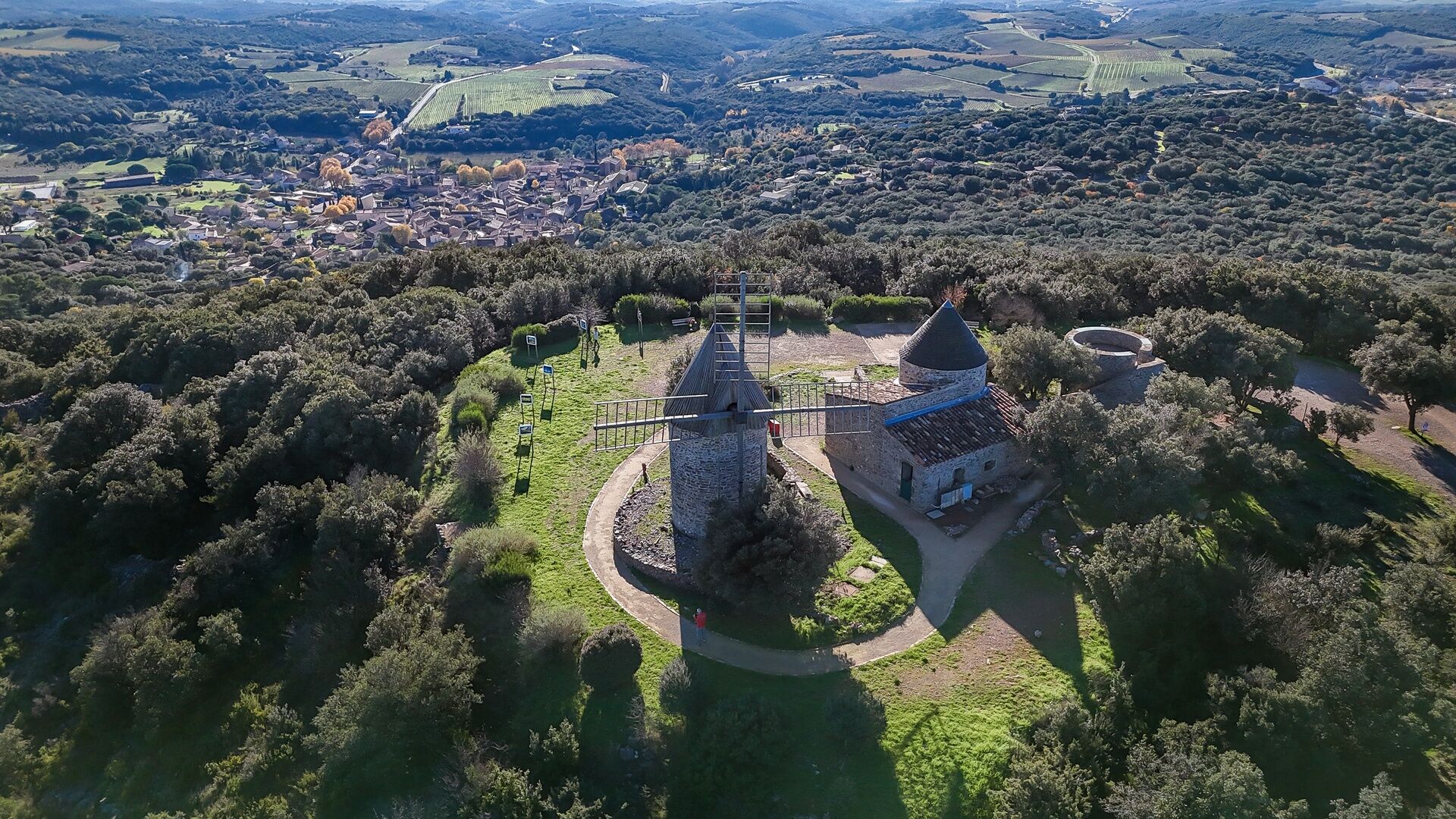
Departing from Millau, a symbolic town of the Grands Causses, the route gradually climbs to offer wide panoramas over the Tarn valley and the Millau viaduct, a contemporary work set in a magnificent landscape. Very quickly, the path reaches the vast spaces of the Larzac plateau, a mineral and open territory shaped by centuries of agropastoralism. The crossing of the Templar villages of La Cavalerie and L’Hospitalet-du-Larzac paces this first day, between medieval heritage and vast steppe expanses. The paths alternate rolling tracks and quieter singles, at the heart of a landscape inscribed as a UNESCO World Heritage site. The passage through the fortified city of La Couvertoirade marks a highlight before the arrival at Caylar, a stopover village located at the gates of Haut-Languedoc.
2
From Caylar, the route gradually leaves the open landscapes of Larzac to enter the Haut-Languedoc Regional Natural Park. The path snakes towards Labeil cave then dives into the Escandorgue forest, creating a cooler and shaded atmosphere, characteristic of the Terres d’Hérault Geopark. The journey reveals a great diversity of landscapes, punctuated by unique places and open viewpoints on the surrounding reliefs. A long descent leads to the Gravezon valley before reaching the village of Joncels, dominated by its abbey. The final climb towards the Dio plateau offers a striking contrast between the light limestone cliffs and the darker lands of the Languedoc piedmont, marking the end of this transition stage.
3
Leaving Dio, the route is set in a mid-mountain ambiance, alternating open plateaus and more enclosed valleys. The itinerary crosses landscapes marked by vineyards and the volcanic reliefs of the Avants-Monts, offering distant views of the Haut-Languedoc summits. Passing near La Tour-sur-Orb and Faugères immerses the hiker in a wine-growing territory with character, where dry stone walls and dark soils tell the unique geological story of the area. Arrival at Cabrerolles is in a more intimate atmosphere, in the heart of a village nestled between hills and vineyards.
4
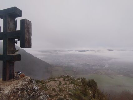
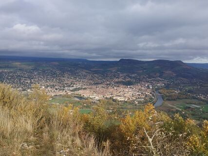
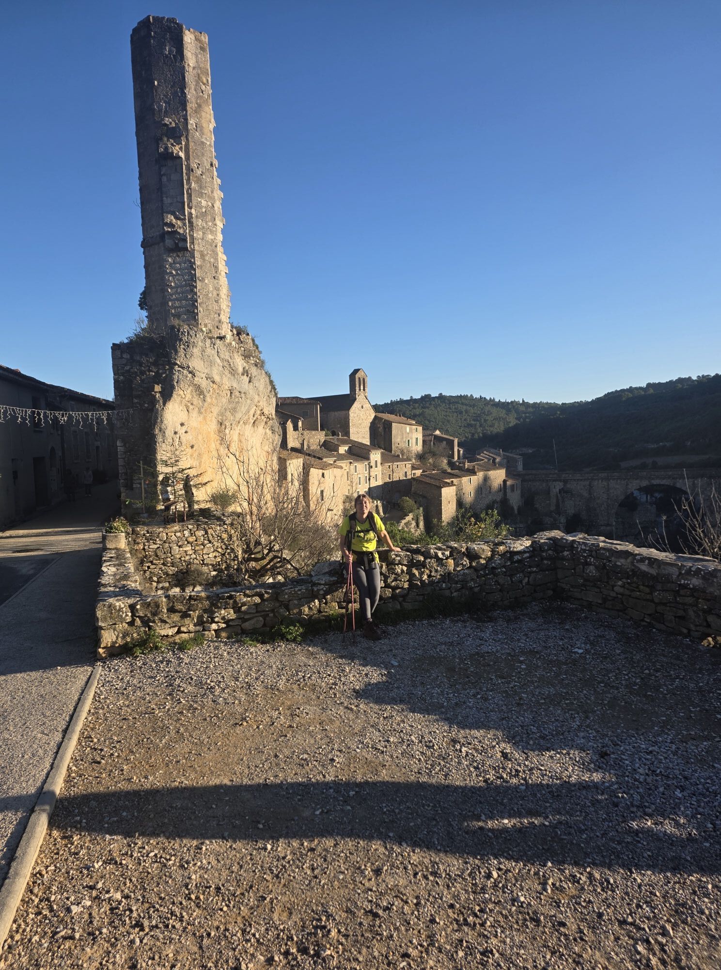
This stage opens with a crossing of the wine-growing reliefs of the Avants-Monts, alternating steady climbs and panoramic descents. The landscapes become more Mediterranean, mixing scrublands, vineyards, and oak forests. Passing near Roquebrun and Ceps allows one to appreciate the Orb gorges and the mild southern valleys. Depending on the route taken, the ascent to Pardailhan and its castle offers beautiful viewpoints over the surrounding reliefs. Arrival in Olargues, ranked among the Most Beautiful Villages of France, marks a highlight of the journey, with its medieval bridge and spectacular location at the foot of the Caroux massif.
5
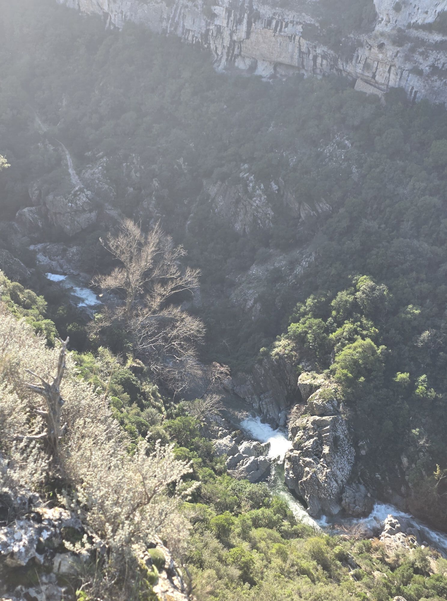
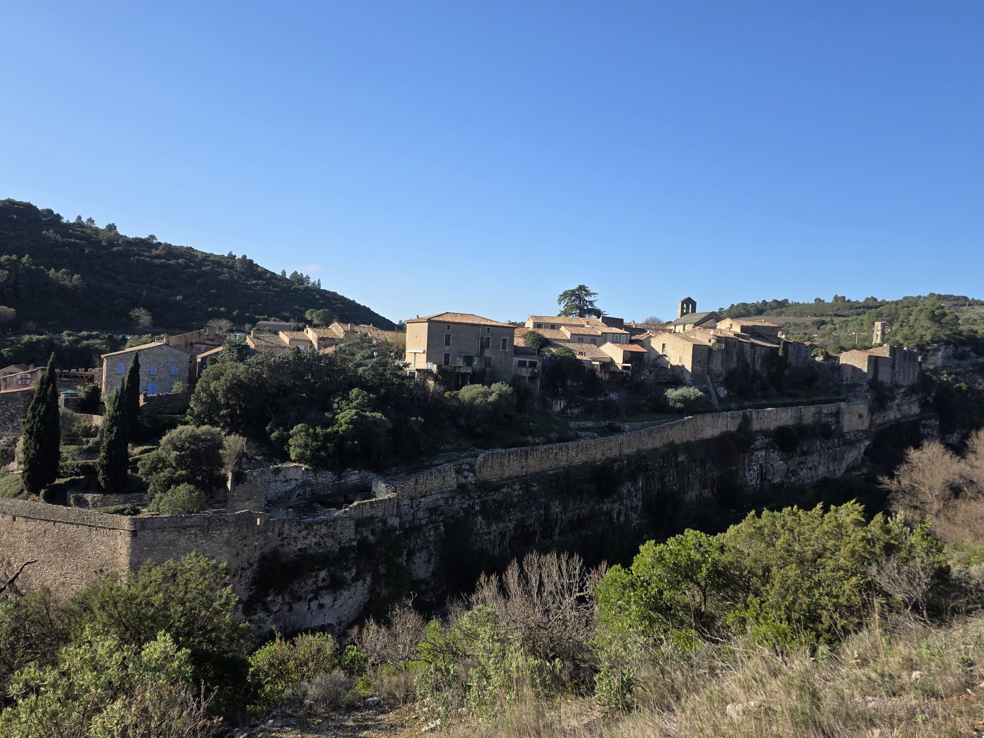
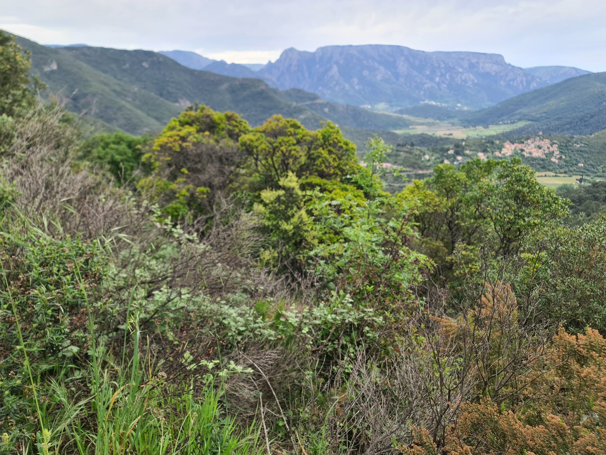
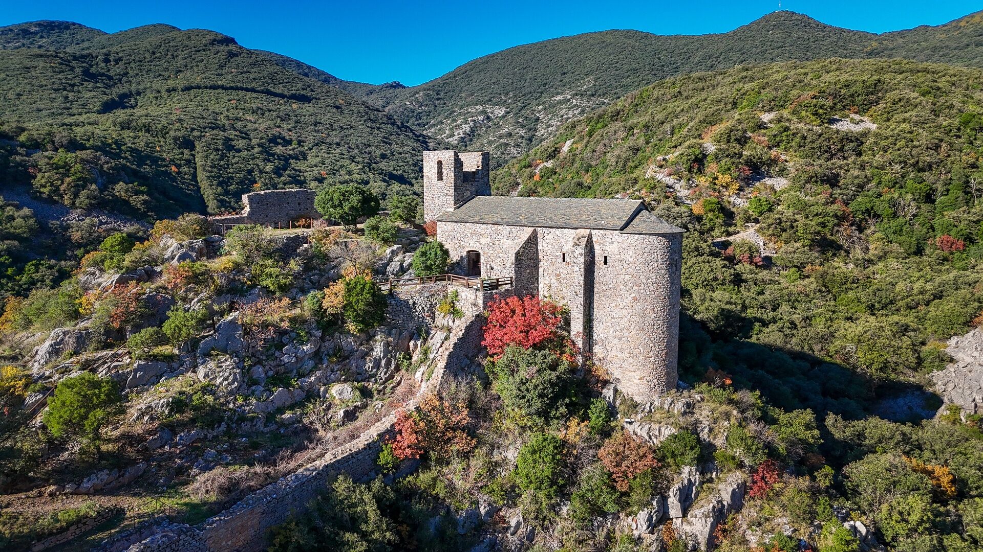
From Olargues, the route quickly rises to the Bacoulette pass, offering wide panoramas over the Cévennes valleys and the first foothills of Minervois. The path alternates long forest tracks and more open sections within the Avants-Monts state forest. Gradually, the landscapes change to give way to limestone plateaus and Minervois vineyards. After crossing quiet hamlets, the path leads to Minerve, a heritage jewel set at the confluence of the Cesse and Brian gorges. Classified as a Grand Site of France, the village offers a spectacular arrival, between cliffs and Cathar heritage.
6
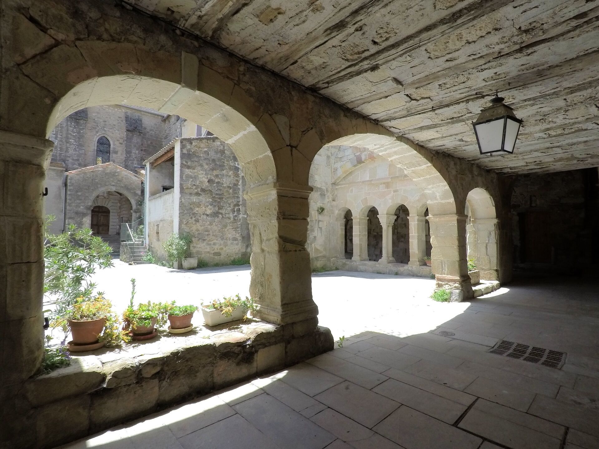
Departing from Minerve, the path winds between limestone plateaus, scrublands, and wooded valleys, in a typically Mediterranean ambiance. The landscapes alternate open spaces and more secluded passages, punctuated by small hamlets and pastoral areas. As you approach Caunes-Minervois, vineyards become omnipresent, signaling entry into a territory marked by stone and local craftsmanship. Arrival at the village, famous for its Benedictine abbey and red marble, constitutes a strong cultural stage before the final crossing to the Aude.
7
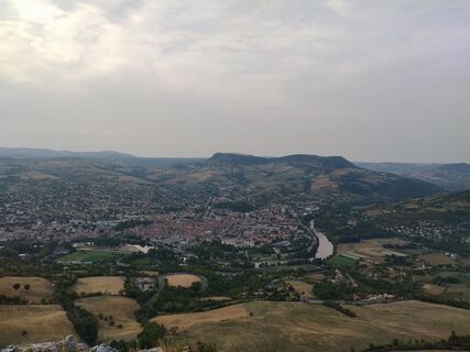
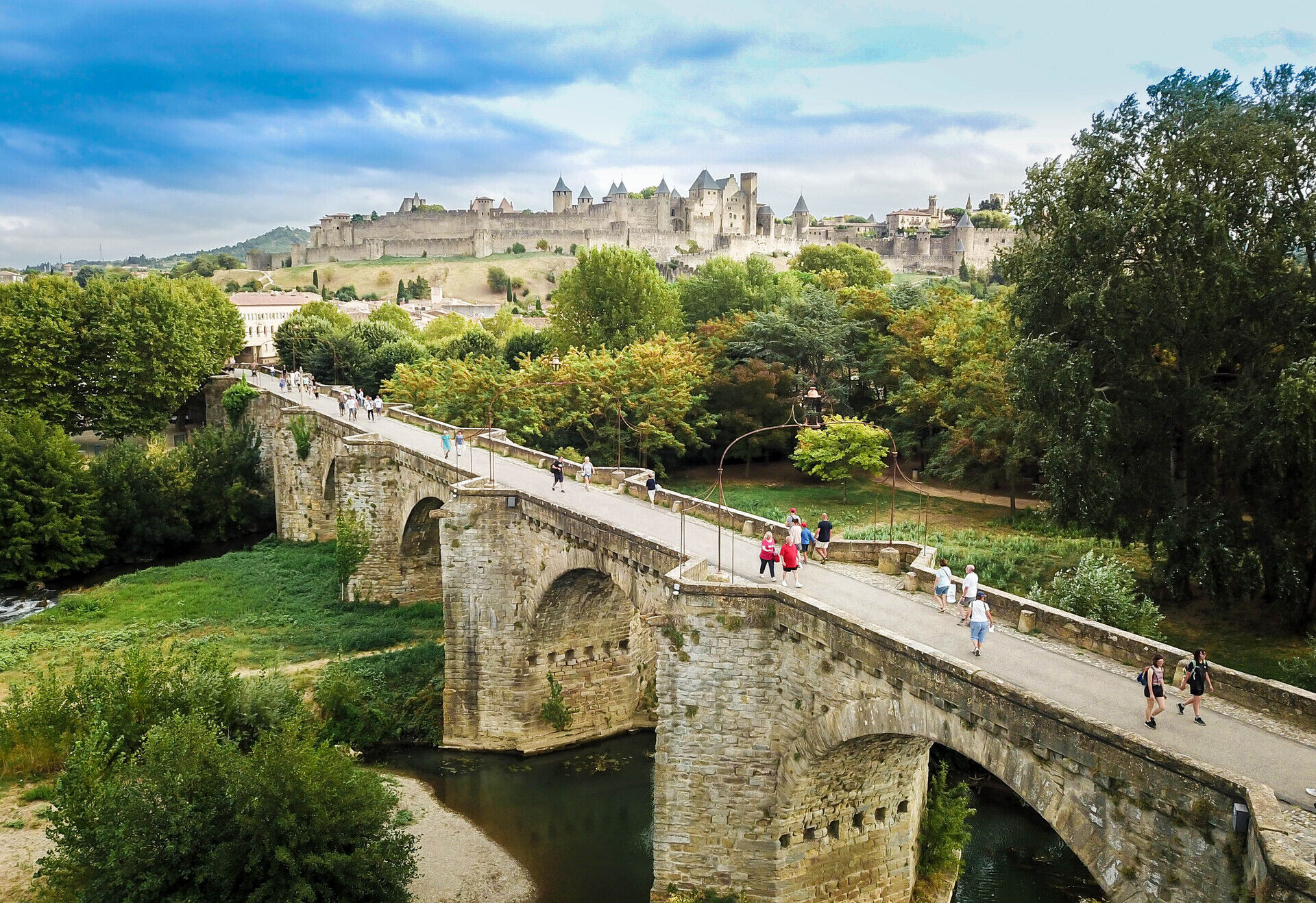
This last stage offers a gentler journey, connecting Minervois to the city of Carcassonne. The route takes quiet country roads and peaceful paths through vineyards, before gradually reaching the banks of the Canal du Midi. This itinerary is not waymarked on the ground: it is essential to follow the provided GPX track to progress smoothly from point to point. Passing through Rieux-Minervois, Laure-Minervois, and Trèbes allows one to enjoy a more riverside and peaceful atmosphere, suitable for the end of the trip. Arrival in Carcassonne, with its medieval city classified as a UNESCO World Heritage site, offers a majestic conclusion to this crossing. Take time to discover the city and its ramparts before your return, the station allowing easy connections for a car-free stay.
Millau Station
Tip: to adapt your itinerary to your level, some stages can be shortened or adjusted according to the possibilities of intermediate accommodations. The stations of Millau and Carcassonne also allow you to organize a departure or return by train for a car-free stay.
The route is usable most of the year: – however, avoid the summer period: the heat can be significant on the Larzac plateau and in Minervois, and some forest massifs may be closed due to fire risk – in mid-winter, considering the altitudes on the Larzac and Haut-Languedoc parts (up to about 800–900 m), conditions can be cold and windy – prefer spring and autumn. Temperatures are more suitable for effort and the landscapes particularly pleasant for the journey
Red MTB markers
Green signposts
+33 4 67 67 71 71
Fixed line phone Hérault Tourism
Grande Traversée VTT-FFC
Priljubljeni izleti v okolici
-
4.0
GORGES DE COLOMBIERES HIKE
srednjaPohodništvo 12.0 km -
5.0
HIKING OF THE HÉRIC GORGES VIA THE ORIENTATION TABLE
srednjaPohodništvo 16.3 km -
5.0
HIKING ROUTE OF THE TERRASSES DE L'ESPINOUSE
srednjaPohodništvo 16.8 km -
4.0
LEGENDS TRAIL HIKE
srednjaPohodništvo 11.4 km -
5.0
OENORANDO® THE VALLEY OF AROMAS
srednjaPohodništvo 13.7 km -
3.0
CYCLE LOOP No. 29 - FROM THE VALLEYS TO THE PEAKS OF HAUT-LANGUEDOC
srednjaKolesarjenje 64.3 km -
HIKE OF SAINT MICHEL DE MOURCAIROL
srednjaPohodništvo 11.7 km -
CAROUX SUMMIT HIKE
srednjaPohodništvo 7.94 km -
TOUR DE LAC DE VESOLES HIKE
svetlobaPohodništvo 6.27 km -
HIKING OF THE UPPER VALLEY OF THE MARE
srednjaPohodništvo 16.2 km

Pohodništvo in sledenje


Ne zamudite ponudb in navdiha za naslednje počitnice
Vaš e-poštni naslov je bil dodan na poštni seznam.