
Kempfenberg-Rundweg
srednja
Pridobite to turo v svoj mobilni telefon
Kempfenberg-Rundweg
srednja
Pohodništvo
16.60
km
Skenirajte kodo QR in začnite navigacijo v aplikaciji bergfex.


Pohodništvo in sledenje



Kempfenberg-Rundweg
srednja
Razdalja
16.6
km
Trajanje
04:53
h
Ascent
356
hm
Morska gladina
413 -
723
m

V aplikaciji si oglej pot
Brezplačno namestite aplikacijo in spremljajte pot z GPS-navigacijo in sledenjem.
bergfex zdaj uporabljaj v aplikaciji
S kamero poskeniraj QR-kodo
Ko je aplikacija nameščena, se vsebina odpre takoj. Če aplikacije še nimaš, te bo preusmerila na stran za brezplačen prenos.
Prenos skladbe
Kempfenberg-Rundweg
srednja
Pohodništvo
16.60
km
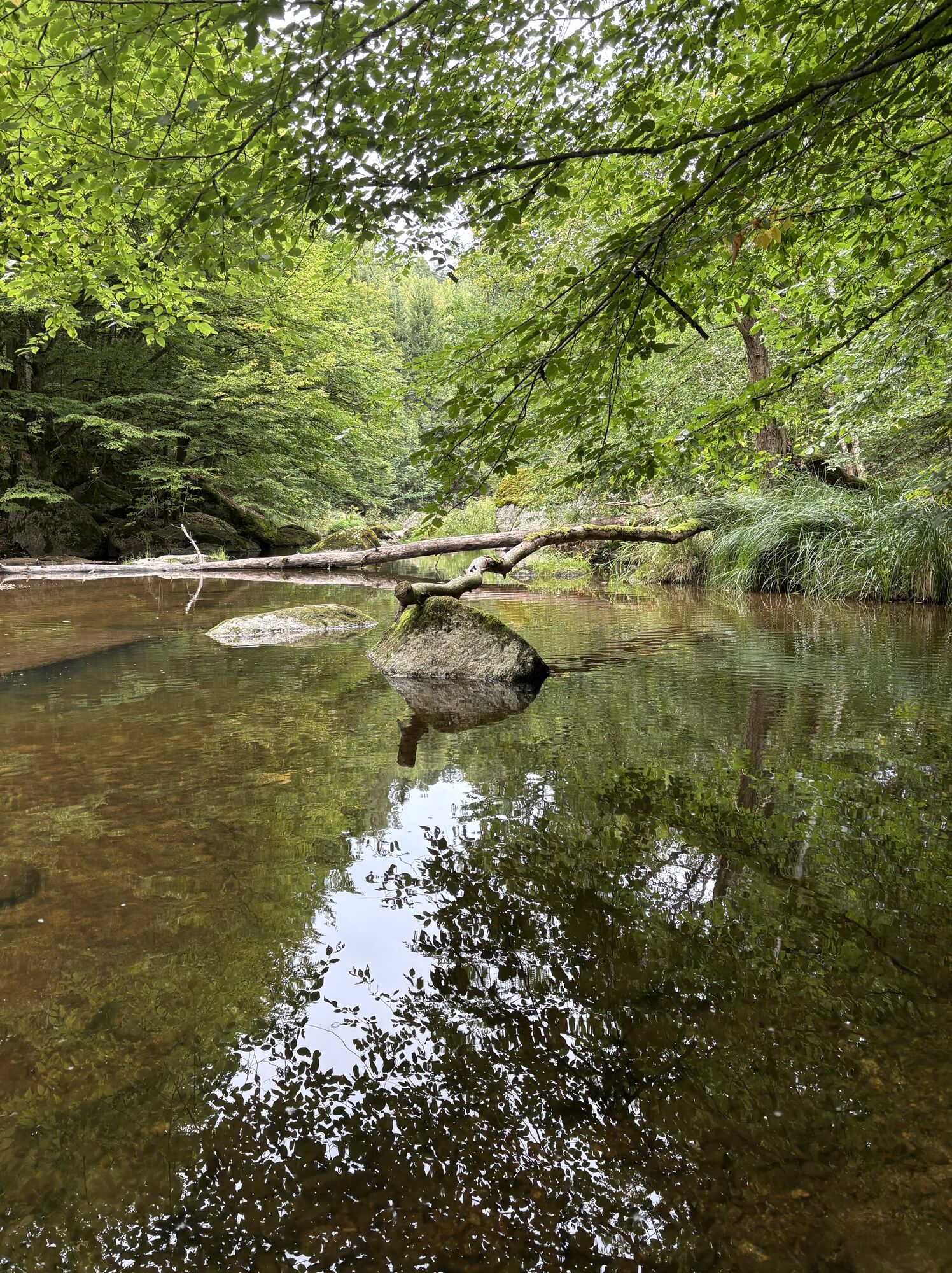


The Kempfenberg circular route starts at the war memorial. You cross the main road behind the war memorial and walk along Raiffeisenstraße to the end of the settlement, from here a beautiful path leads...
Opis
The Kempfenberg circular route starts at the war memorial. You cross the main road behind the war memorial and walk along Raiffeisenstraße to the end of the settlement, from here a beautiful path leads into the Aist valley to the Kumpfmühle (Venetian gate). The Aist is crossed at the Kumpfmühle and hiked upstream. The path leads past the Wintermühle (sawmill) and the Hammerschmid Leitner to the Pöllamühle. Here we leave the Aist and hike up to Dingdorf on a forest path. In half an hour we reach the highest point of Hagenberg, the Kempfendorfer Berg at 729 metres. A summit cross has adorned the peak since 2005. After the ascent, you hike downhill via the rural villages of Au, Schiernersdorf and Schmidsberg and descend to the Veichterwald forest. A forest path now leads us to the district of Veichter and then back to the village centre of Hagenberg. Throughout the hike, you will be rewarded with views of the Mühlviertel hills and, on clear days, you can see as far as the northern chain of the Alps.
Pot
Hagenberg im Mühlkreis
(440 m)
Vas
0.1 km
Kempfendorfer Berg
(729 m)
Vrh
8.7 km
Au
(650 m)
Poravnava
9.4 km
Schiernersdorf
(580 m)
Poravnava
10.5 km
Schmidsberg
(529 m)
Poravnava
12.4 km
Veichter
(473 m)
Poravnava
15.4 km
Hagenberg im Mühlkreis
(440 m)
Vas
16.5 km
Pot
Kempfenberg-Rundweg
srednja
Pohodništvo
16.60
km



Še ni pregledov
Priljubljeni izleti v okolici
-
4.6
Schwertberg: Weltstoarunde
srednjaPohodništvo 11.4 km -
4.8
Tragwein - Lebensquell-Runde
svetlobaPohodništvo 12.8 km -
4.8
Ruine Prandegg
srednjaPohodništvo 15.6 km -
4.7
Aisttalrundweg + P6
svetlobaPohodništvo 9.36 km -
4.6
3Gipfelweg 07 mit Klimaanpassungsthemen
srednjaPohodništvo 21.3 km -
4.4
Wartberg Ob der Aist, Natura Aist Trail Rundwanderung
svetlobaPohodništvo 8.37 km -
4.7
Steyregg Donau-Höhen-Rundwanderweg Pulgarn - Hohenstein (und zurück)
svetlobaPohodništvo 7 km -
4.7
Unterweitersdorfer Sagenweg
svetlobaPohodništvo 5.87 km -
4.1
Wanderung Kefermarkt Buchberg
svetlobaPohodništvo 8.33 km -
3.9
Brandtnerhöhe - Waltersberg Runde
svetlobaPohodništvo 9 km
Pohodništvo in sledenje

Zaradi več kot 550.000 predlogov izletov, podrobnih zemljevidov in intuitivnega načrtovanja poti je aplikacija obvezna oprema za vse ljubitelje narave.

Ne zamudite ponudb in navdiha za naslednje počitnice
Naročite se na novice
Napaka
Zgodila se je napaka. Prosimo, poskusite znova.
Zahvaljujemo se vam za prijavo
Vaš e-poštni naslov je bil dodan na poštni seznam.
Izleti po vsej Evropi
Avstrija
Švica
Nemčija
Italija
Slovenija
Francija
Nizozemska
Belgija
Poljska
Lihtenštajn
Češka
Slovaška
Španija
Chorvátsko
Bosna in Hercegovina
Luksemburg
Andora
පෘතුගාලය
අයිස්ලන්තය
එක්සත් රාජධානිය
අයර්ලන්තය
ග්රීසිය
ඇල්බේනියාව
North Macedonia
Malta
Norway
Montenegro
Moldova
කොසෝවො
හන්ගේරියානු සමුහාණ්ඩුව
San Marino
රුමේනියාව
එස්ටෝනියා
ලැට්වියාව
බෙලාරස්
සයිප්රස්
Lithuania
Serbia
බල්ගේරියාව
Monaco
ඩෙන්මාර්කය
Sweden
ෆින්ලන්තය


