


Donausteig stage 1_S04 Schlögen - Aschach: "From the Schlögener Schlinge into the Eferding Basin"
Fotografije naših uporabnikov
-
 © josef duermoserUstvarjeno na 10.04.2026
 -
 © josef duermoserUstvarjeno na 10.04.2026
 -
 © josef duermoserUstvarjeno na 10.04.2026
 -
 © josef duermoserUstvarjeno na 10.04.2026
 -
 © josef duermoserUstvarjeno na 09.04.2026
 -
 © josef duermoserUstvarjeno na 09.04.2026
 -
 © josef duermoserUstvarjeno na 09.04.2026
 -
 © josef duermoserUstvarjeno na 09.04.2026
 -
 © josef duermoserUstvarjeno na 09.04.2026
 -
 © josef duermoserUstvarjeno na 09.04.2026
 -
 © Josef KauschingerUstvarjeno na 19.03.2026
 -
 © Klaus JantschekUstvarjeno na 29.10.2025
 -
 © Klaus JantschekUstvarjeno na 29.10.2025
 -
 © Thomas SikoraUstvarjeno na 05.04.2025
 -
 © Kateřina KozováUstvarjeno na 13.08.2025
 -
 © Kateřina KozováUstvarjeno na 13.08.2025
 -
 © Kateřina KozováUstvarjeno na 13.08.2025
 -
 © Kateřina KozováUstvarjeno na 13.08.2025
 -
 © Christian Haik 1Ustvarjeno na 04.05.2024
 -
 © Christian Haik 1Ustvarjeno na 04.05.2024
 -
 © Christian Haik 1Ustvarjeno na 04.05.2024
 -
 © Emanuel Kis PálUstvarjeno na 17.03.2024
 -
 © Emanuel Kis PálUstvarjeno na 17.03.2024
 -
 © Erwin KrumböckUstvarjeno na 27.09.2023
 -
 © Agnes KohlUstvarjeno na 13.05.2023
 -
 © webrchUstvarjeno na 30.10.2022
 -
 © webrchUstvarjeno na 30.10.2022
 -
 © Johann SpielUstvarjeno na 10.10.2022
 -
 © Johann SpielUstvarjeno na 10.10.2022
 -
 © Johann SpielUstvarjeno na 10.10.2022
 -
 © Johann SpielUstvarjeno na 10.10.2022
 -
 © Johann SpielUstvarjeno na 10.10.2022
 -
 © Johann SpielUstvarjeno na 10.10.2022
 -
 © Johann SpielUstvarjeno na 10.10.2022

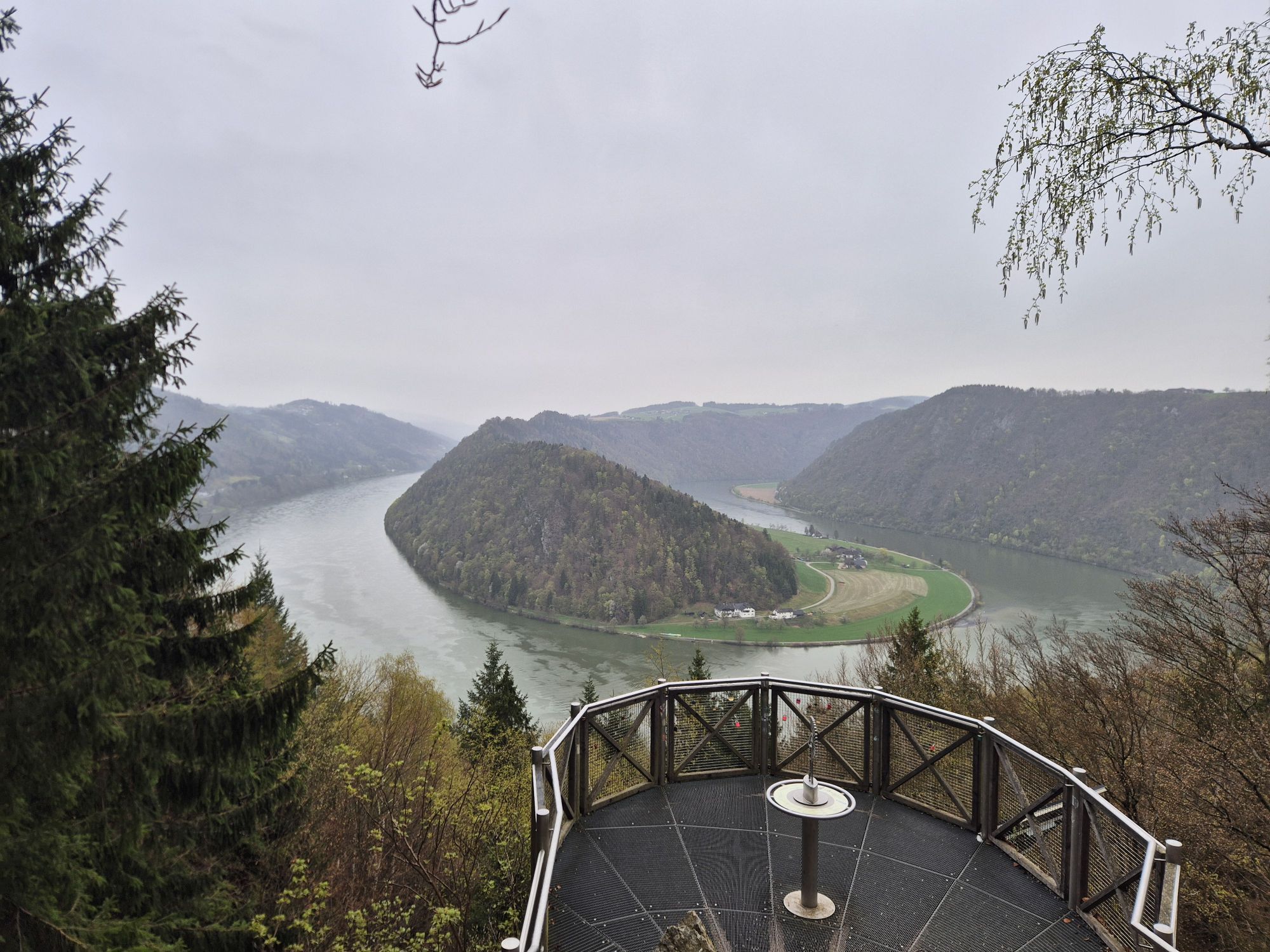

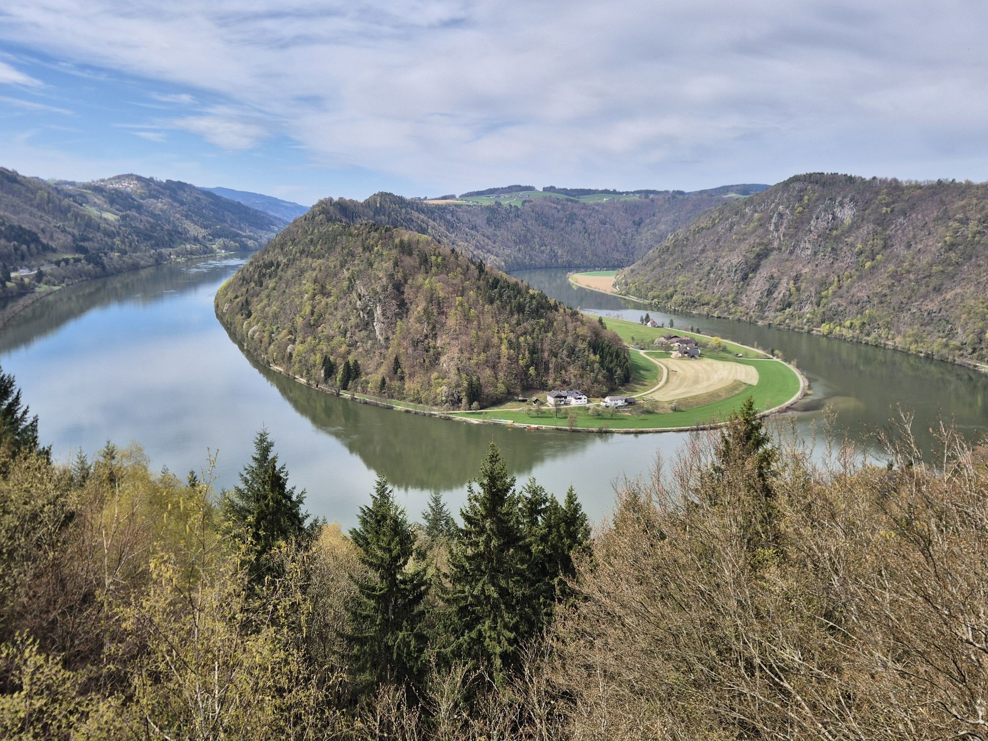

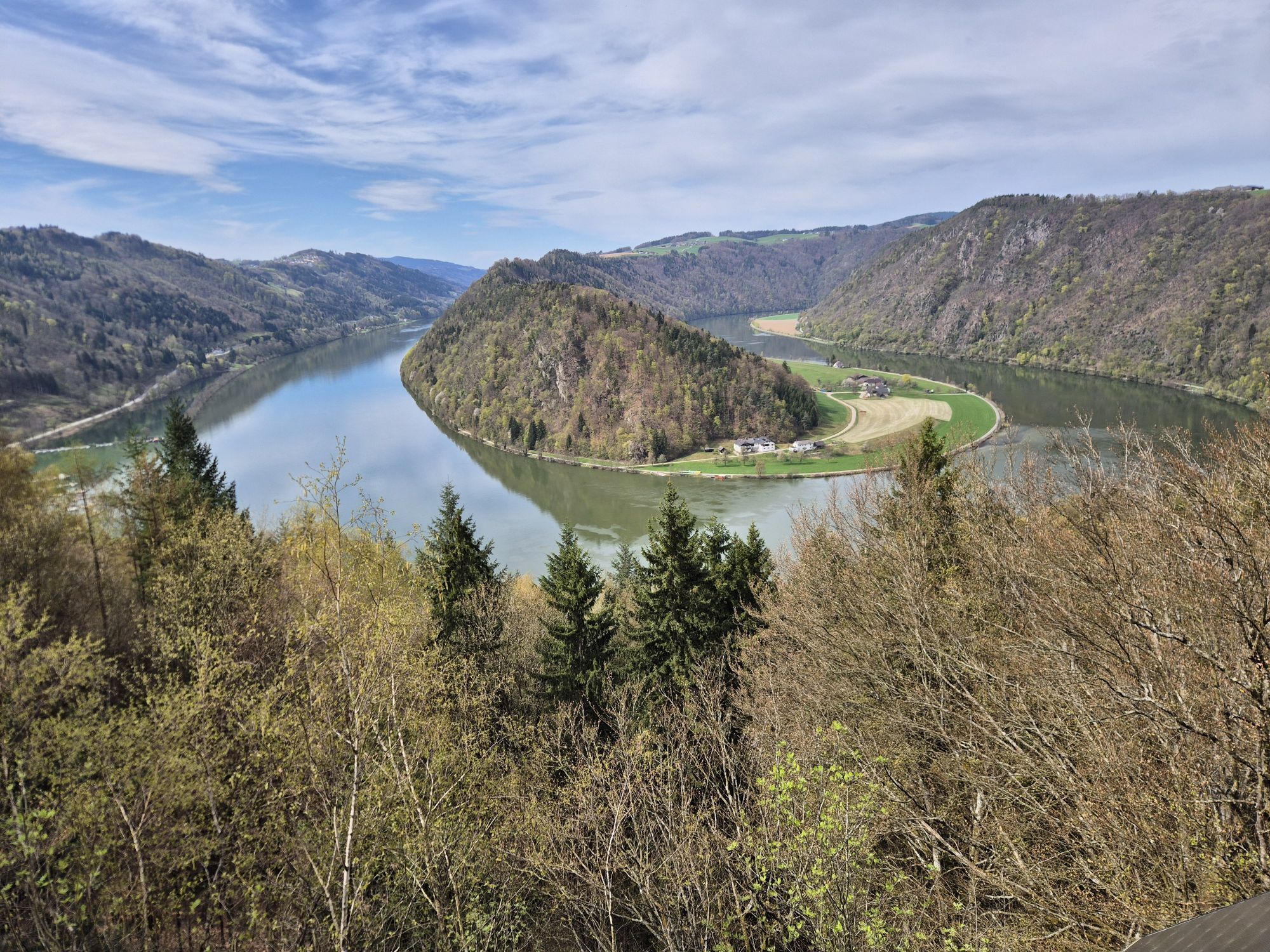
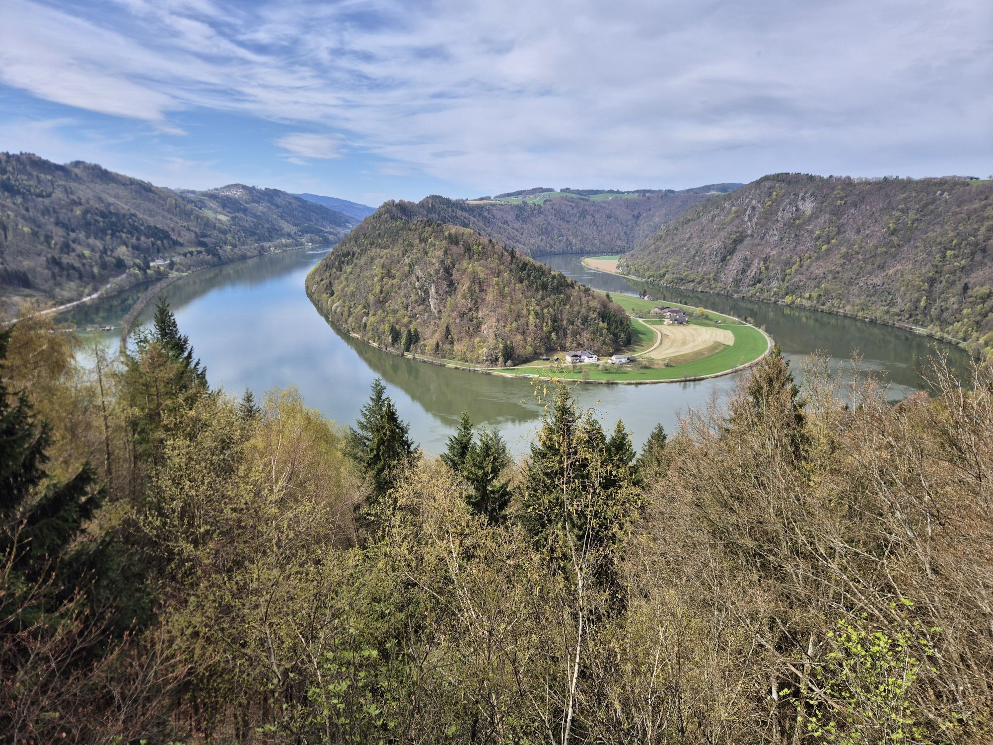
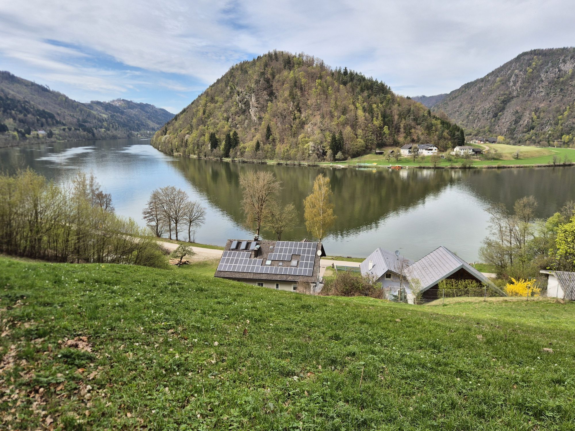


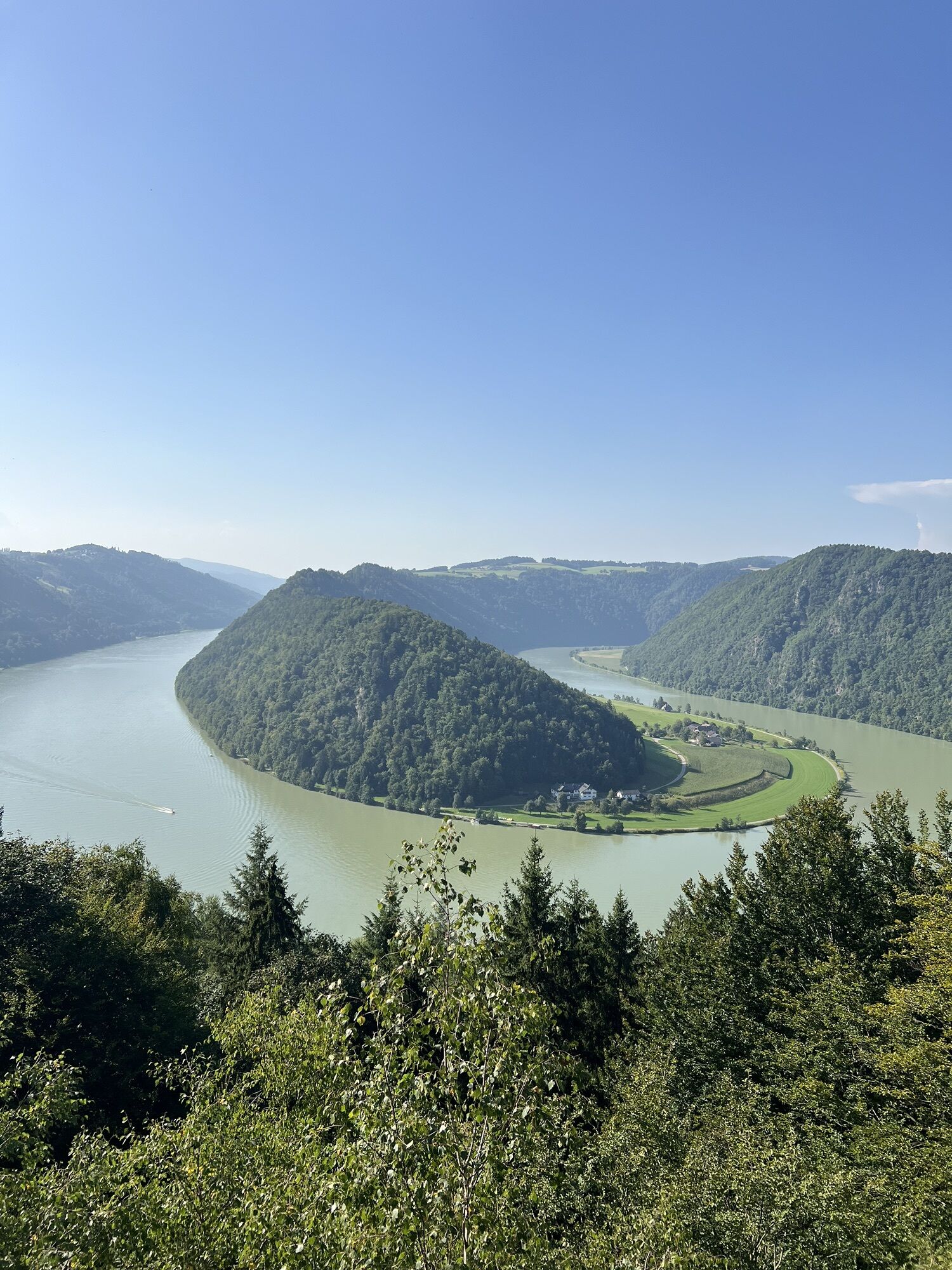


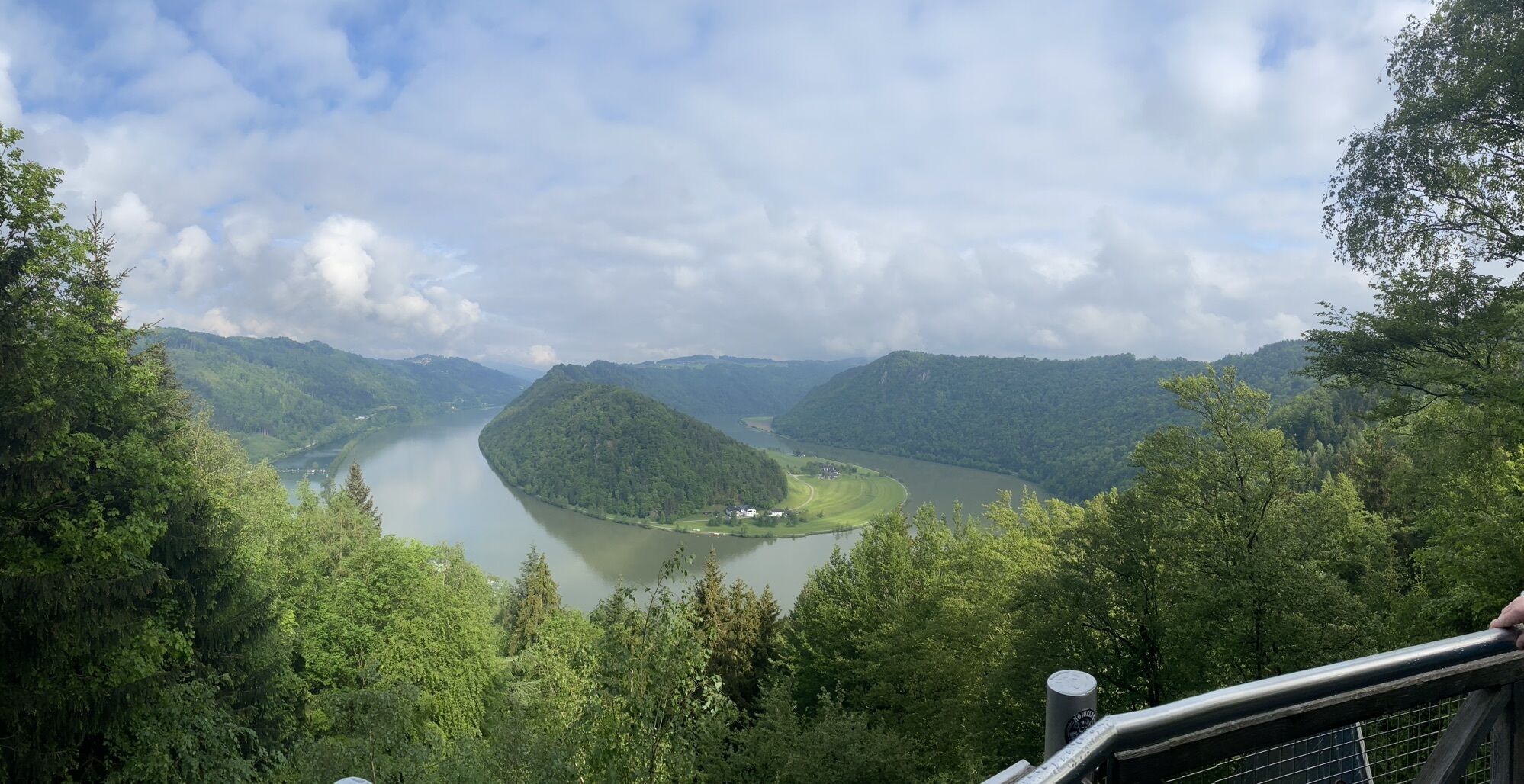


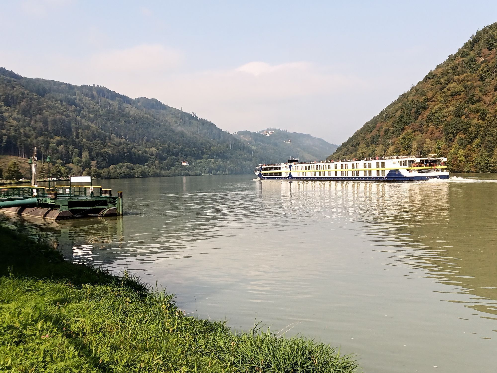


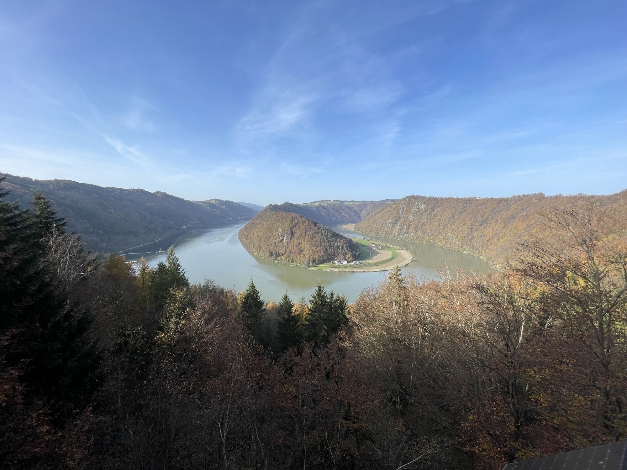


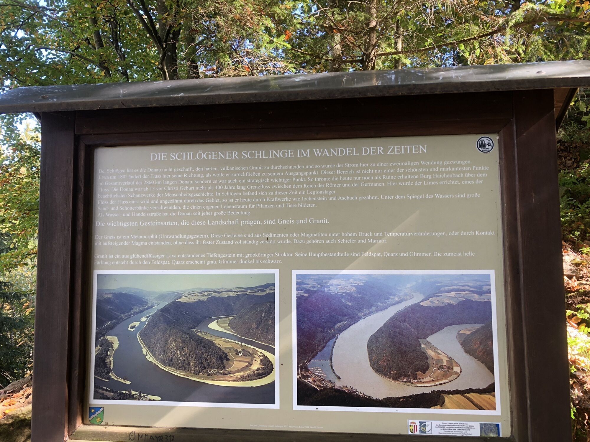
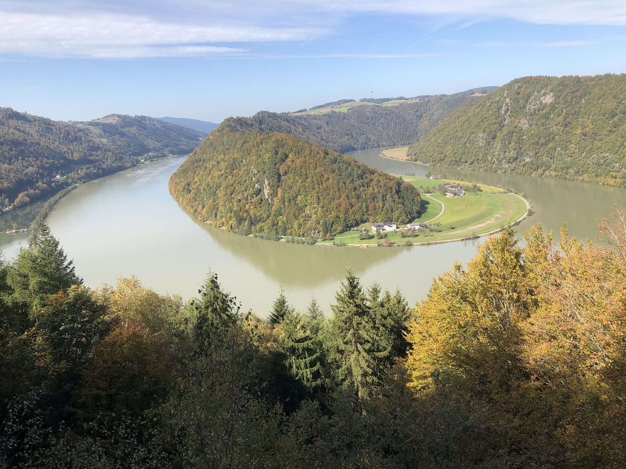
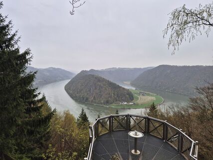
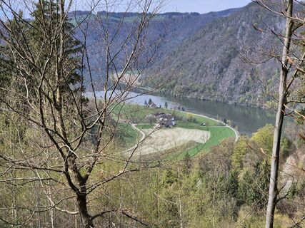
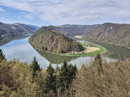
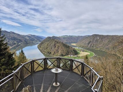
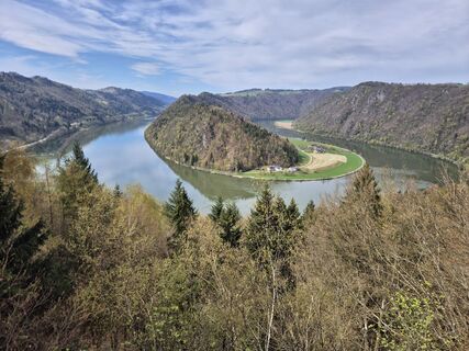
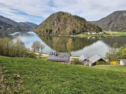
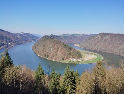
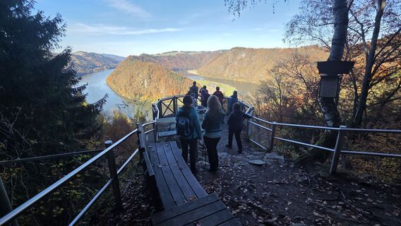
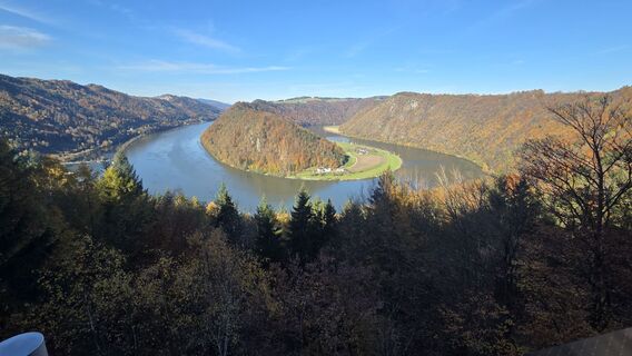
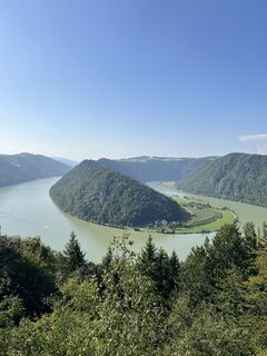
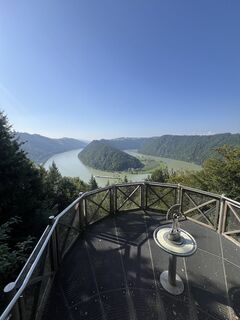
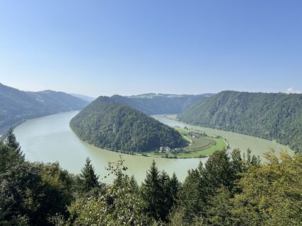
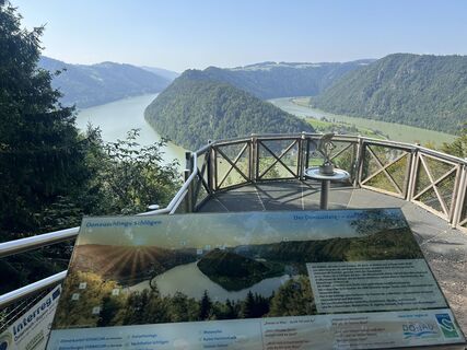
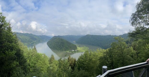
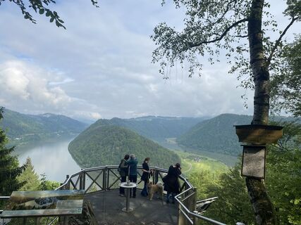
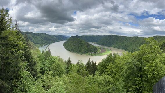
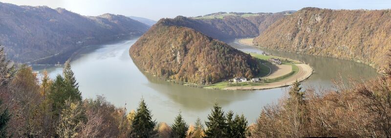
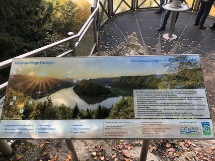
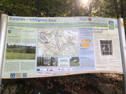
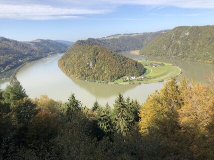
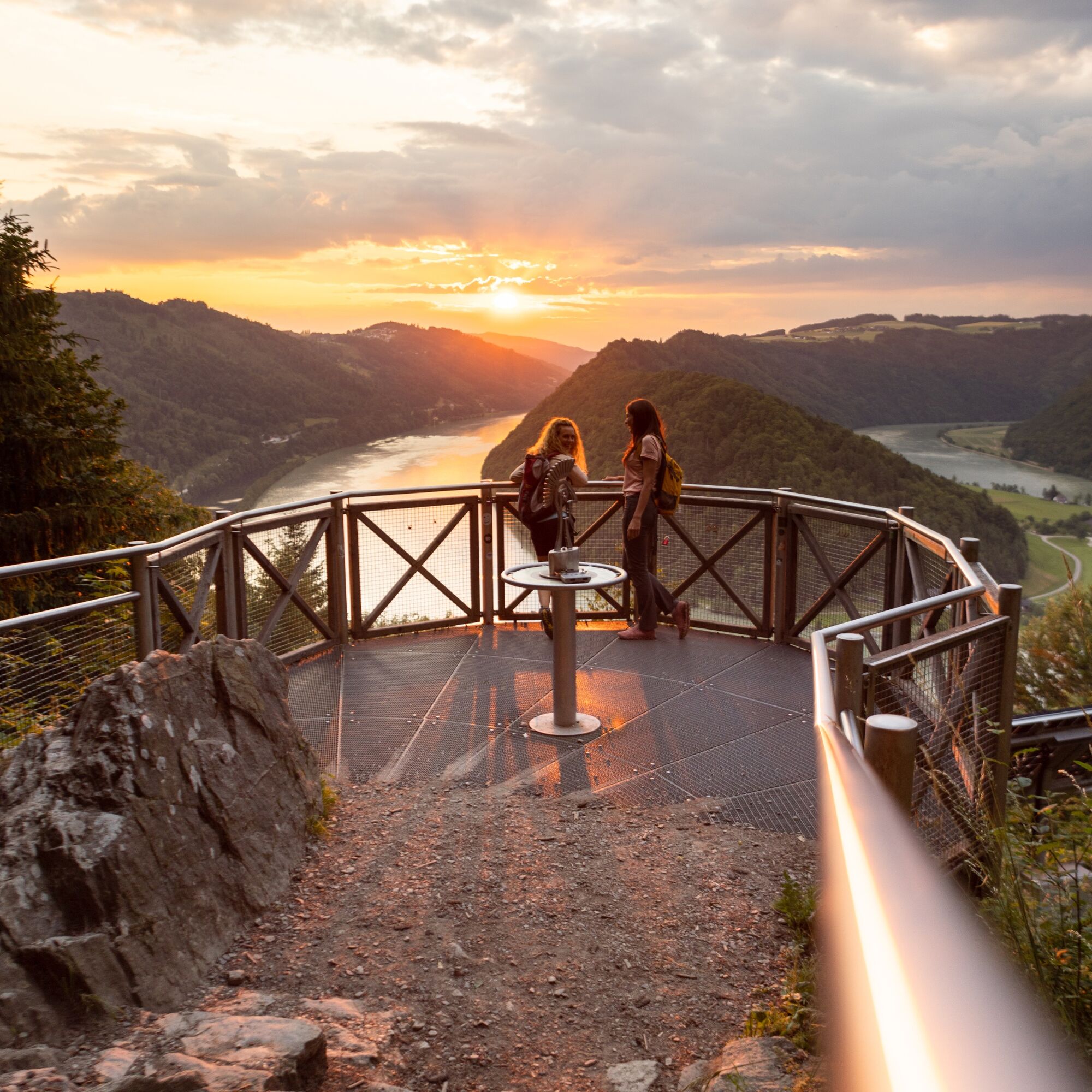
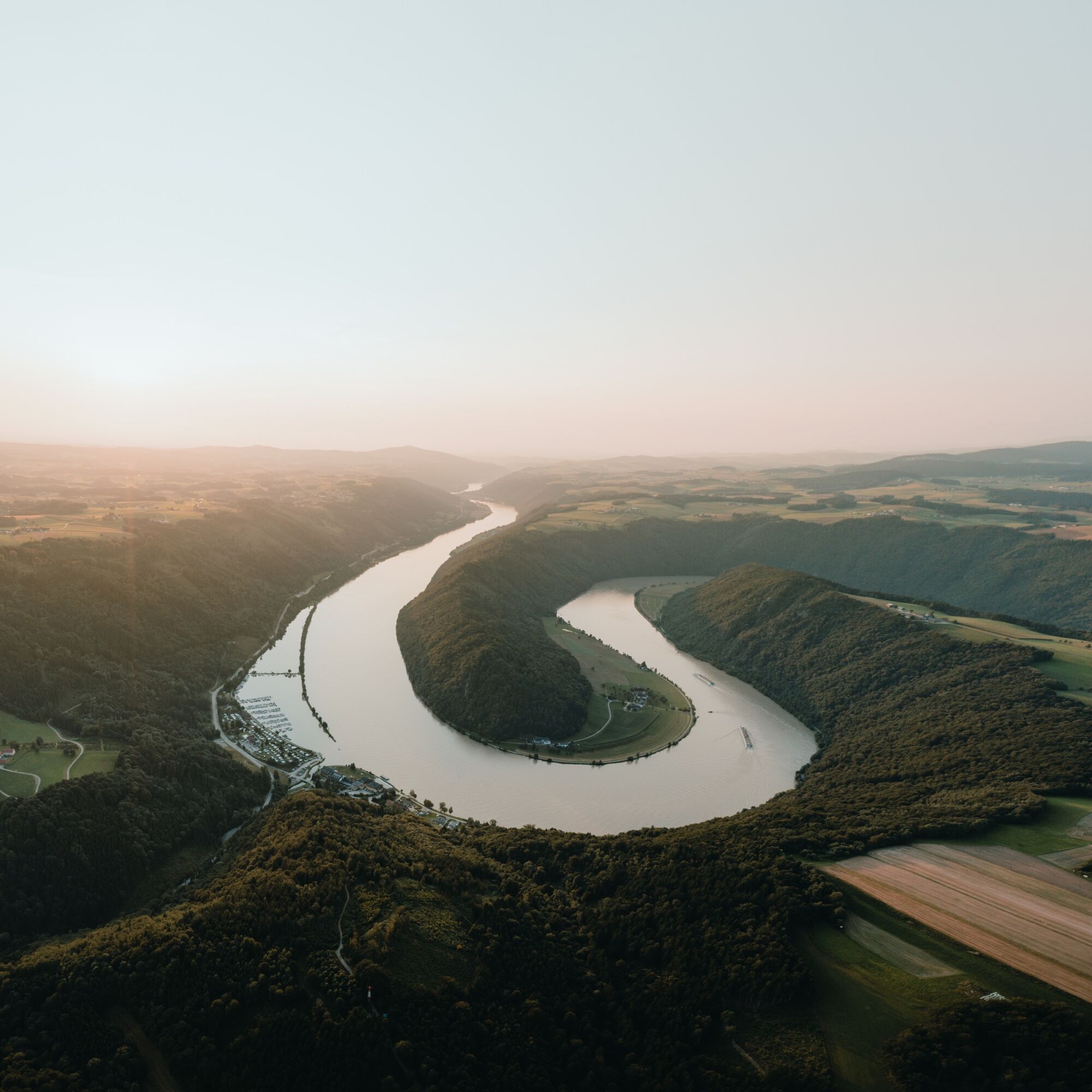
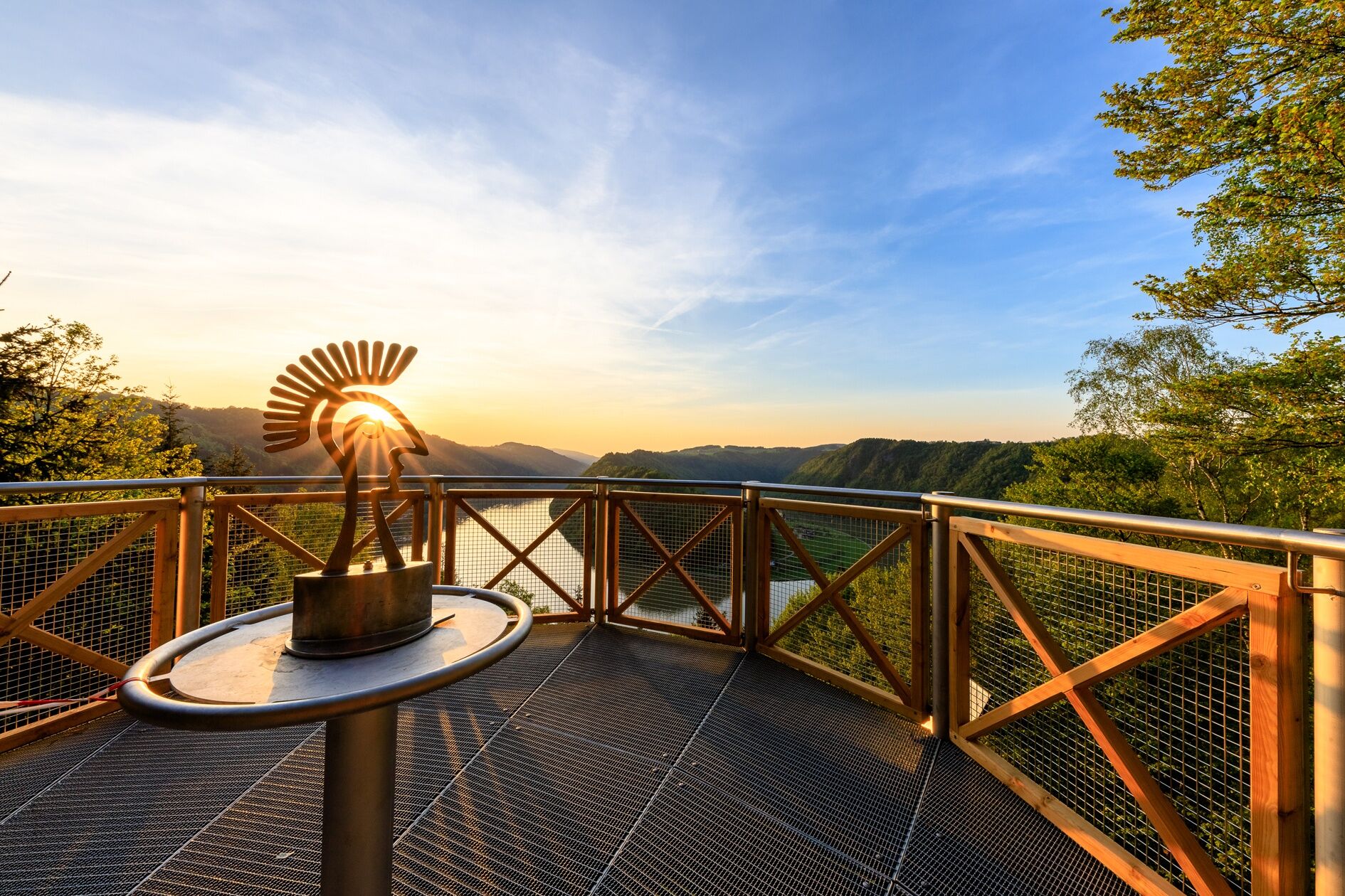
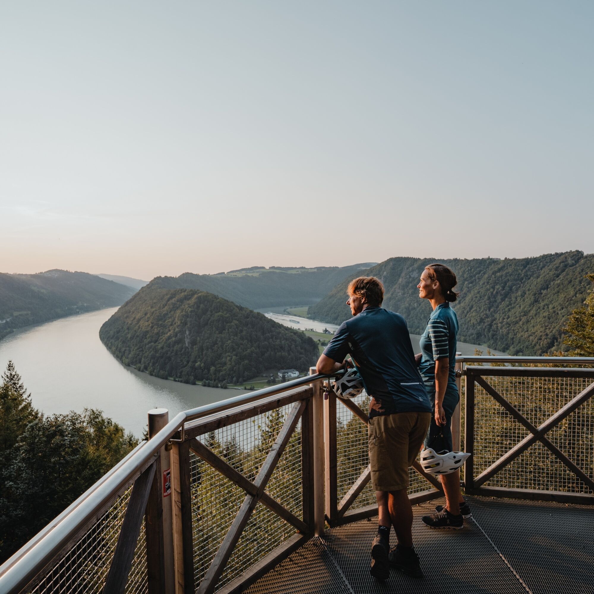
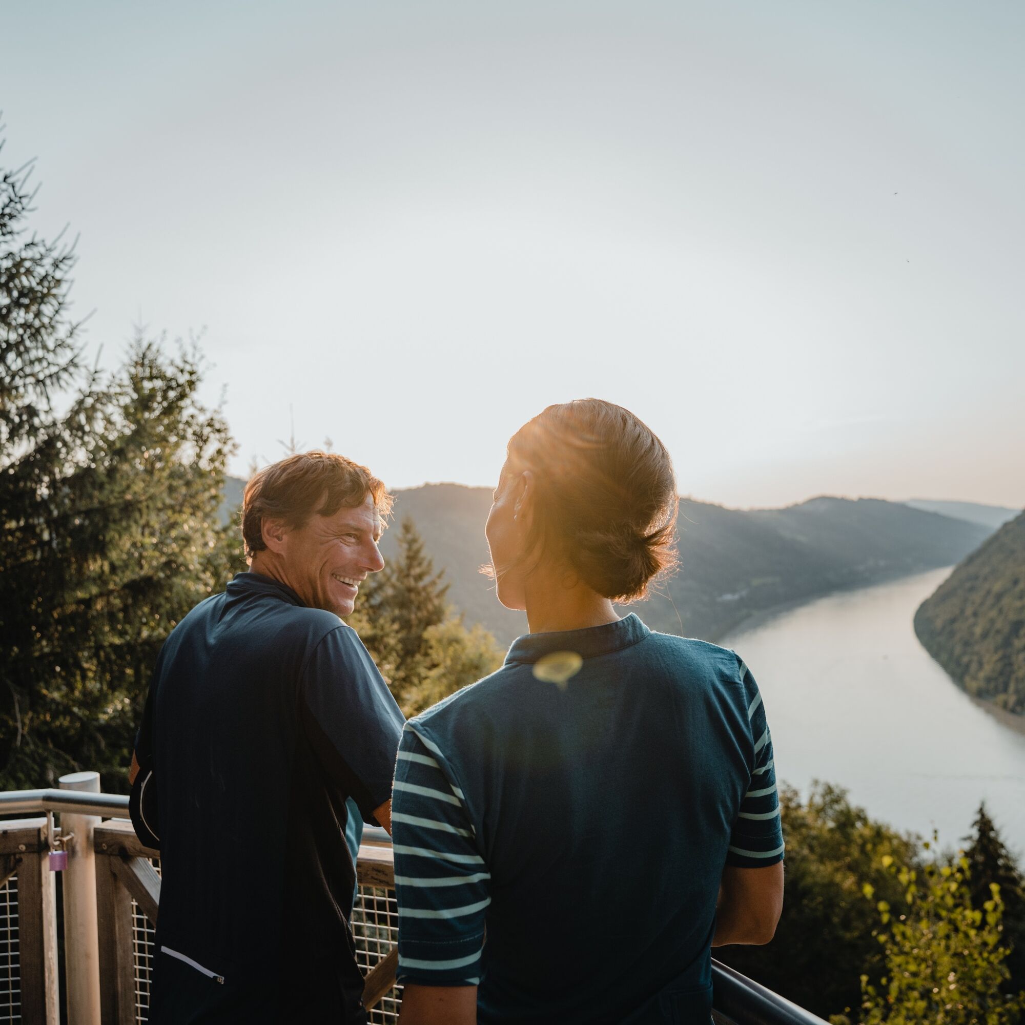
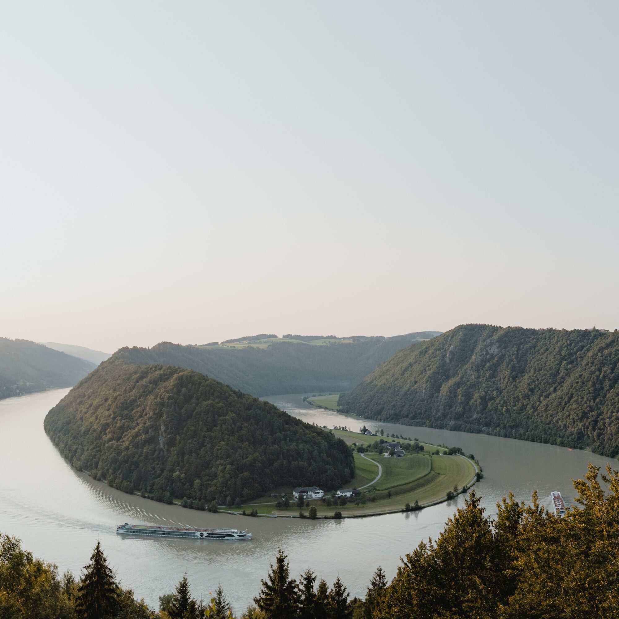
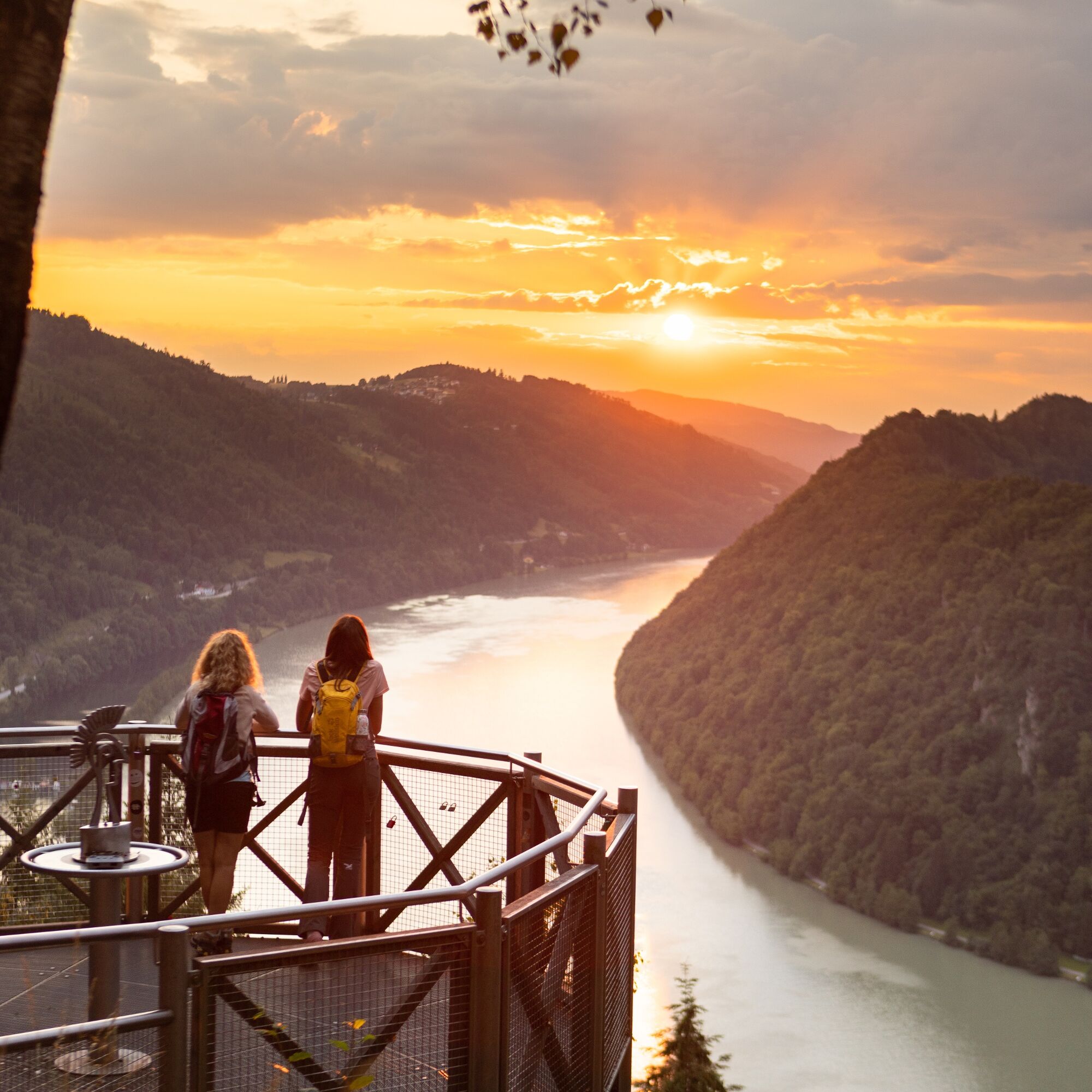
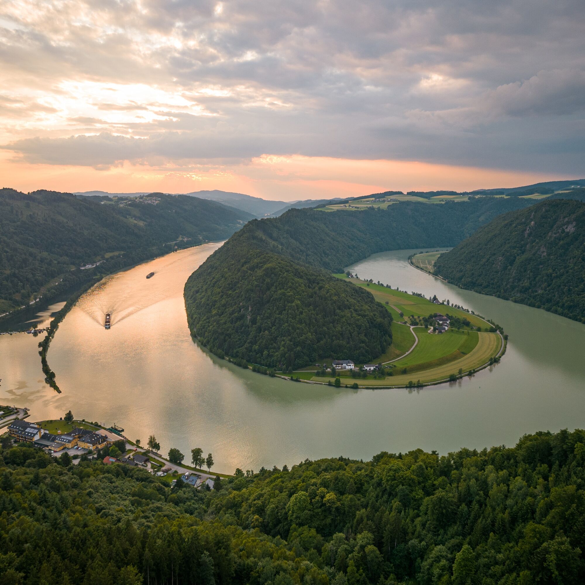
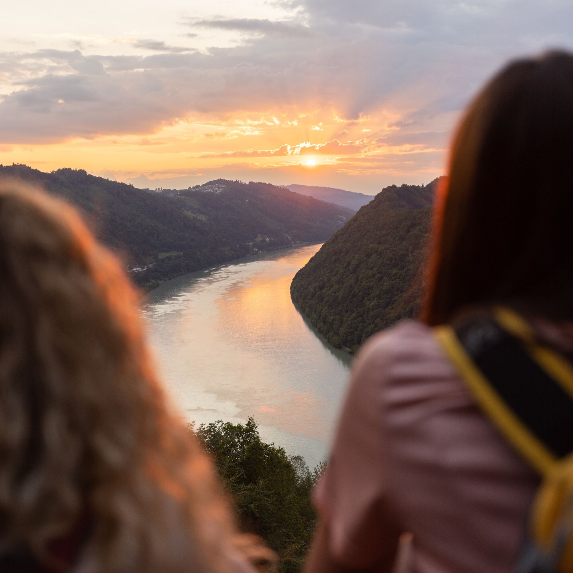
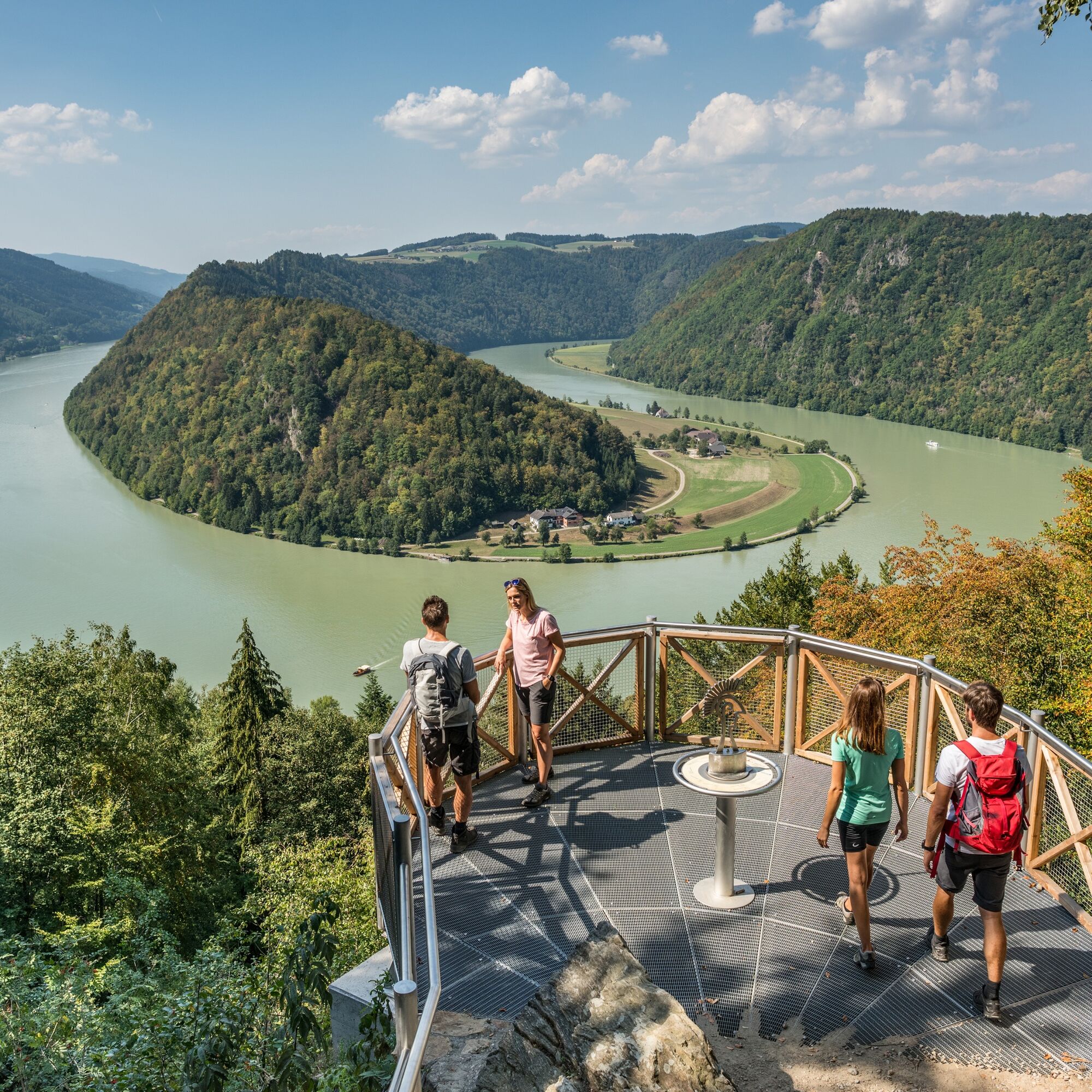
The famous natural wonder "Schlögener Schlinge" is the starting point of this Donausteig stage. The Danube bend is deeply embedded in the long breakthrough stretch of the upper Danube valley and changes...
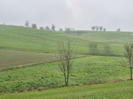
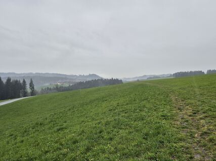
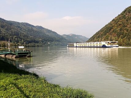
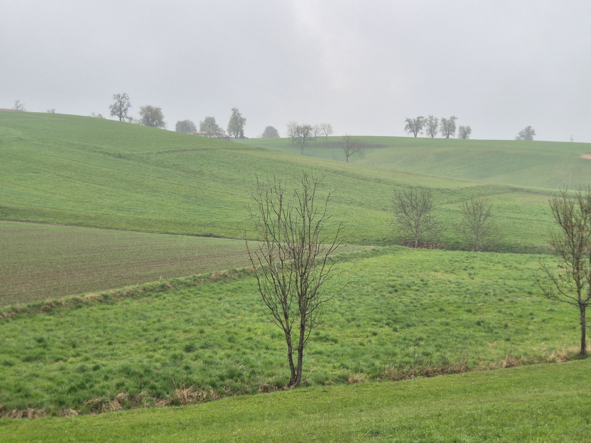
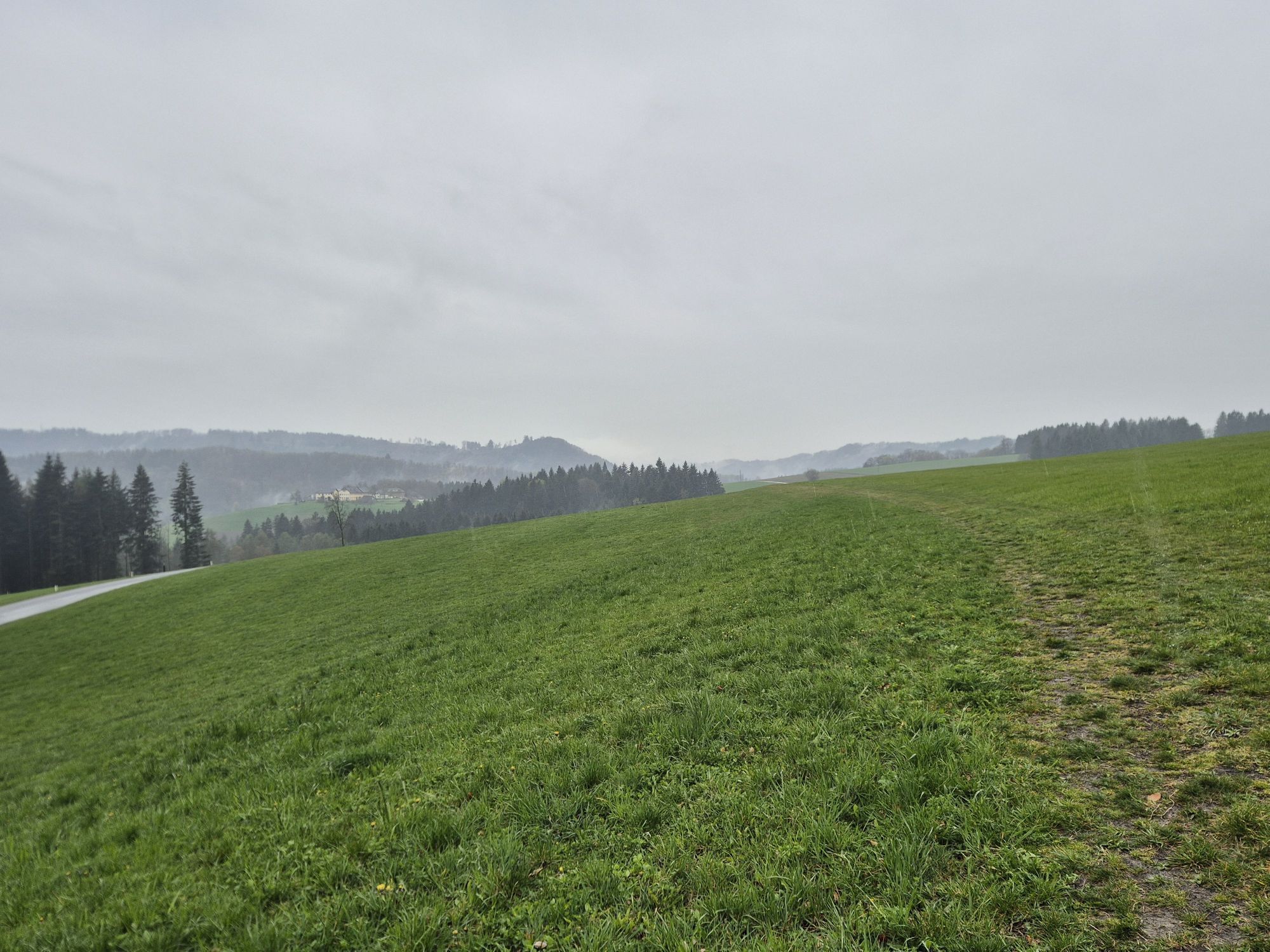
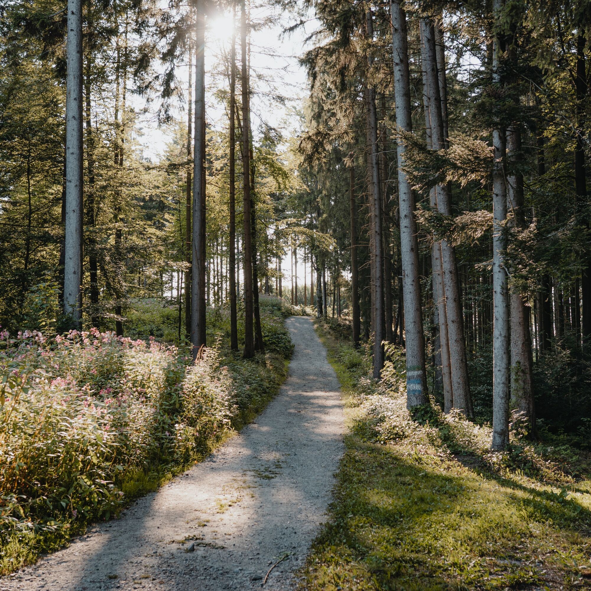
The famous natural wonder "Schlögener Schlinge" is the starting point of this Donausteig stage. The Danube bend is deeply embedded in the long breakthrough stretch of the upper Danube valley and changes its flow direction almost twice by 180° within a few kilometers - simply amazing! From Schlögen on the Danube, we hike along stations of the nature trail "Ciconia" through the steep hillside forest of the Danube slopes up to the "Schlögener Blick". This viewing platform opens up the famous view of the Danube bend – simply magnificent! Only here does the fascination and uniqueness of this natural spectacle become fully aware. It is no wonder that this view has become the main viewpoint of the entire Donausteig. Continuing uphill through the hillside forest, we soon reach the atmospheric high plateau of the Sauwald. Now a rolling cultural landscape shapes the scenery: vast forests, lush meadows, well-kept fields, beautiful hedges, scattered farmsteads... pure Sauwald idyll! Via field paths and farm roads, we hike in a relaxed up and down to Haibach, the home community of the farmer leader Christoph Zeller. A short detour to the rural parish church is worthwhile! The Donausteig turns here shortly before the town center and leads back down into the forested Danube slopes. On wonderful forest paths, later on a forest road, we follow the mighty river high above the Danube. Hidden deep views into the Danube gorge remind us of this natural oasis in the surrounding cultural landscape. At a Danube bend, we again reach the Sauwald high plateau. Now begins a long, pleasurable high-level hike. On a hill ridge, we hike gently up and down through the rural cultural landscape of the Sauwald. Hidden wide views open up to the Alps. Initially over wonderful meadow paths, then frequently over paved farm roads, we finally reach the last hill near Dorf - a true viewing balcony! Here the entire Eferding basin lies at our feet, and above it, the majestic Alpine giants rise on the horizon – simply wonderful! Now begins the long, panoramic descent into the Eferding basin. Over paved farm roads, occasionally also over field paths, we hike down through a beautiful rural cultural landscape to Aschach on the Danube, the crowning conclusion of this stage. A landscape experience of a special kind!
Discover the following special features with the Donausteig diary:
- Donausteig starting point "Schlögen"
- Schlögen and the Danube limes
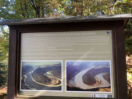
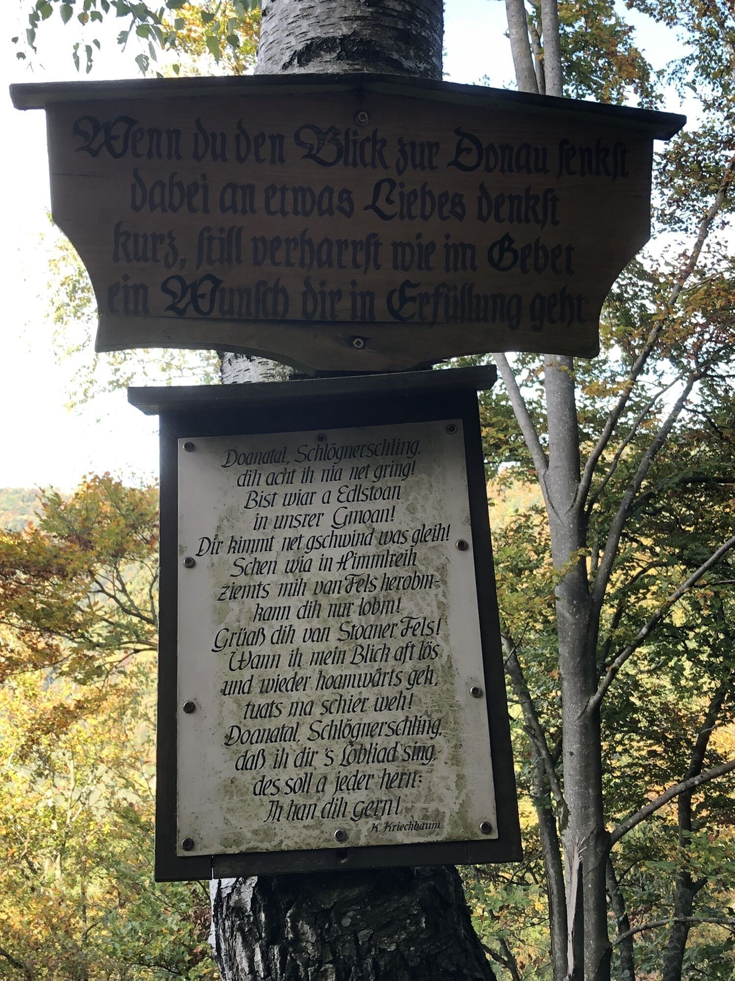
- Natural wonder "Schlögener Schlinge"
- Life nature project "Slope and ravine forests in the upper Danube valley"
- Ciconia panel "A realm of fungi"
- Ciconia panel "Ferns and mosses"
- Ciconia panel "The wonders of streams"
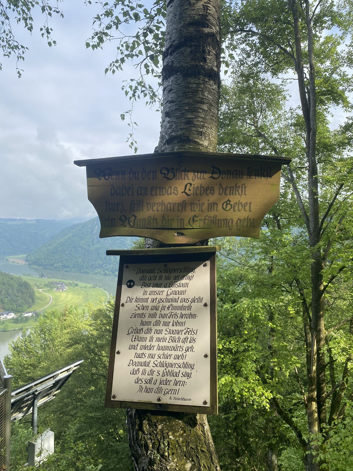
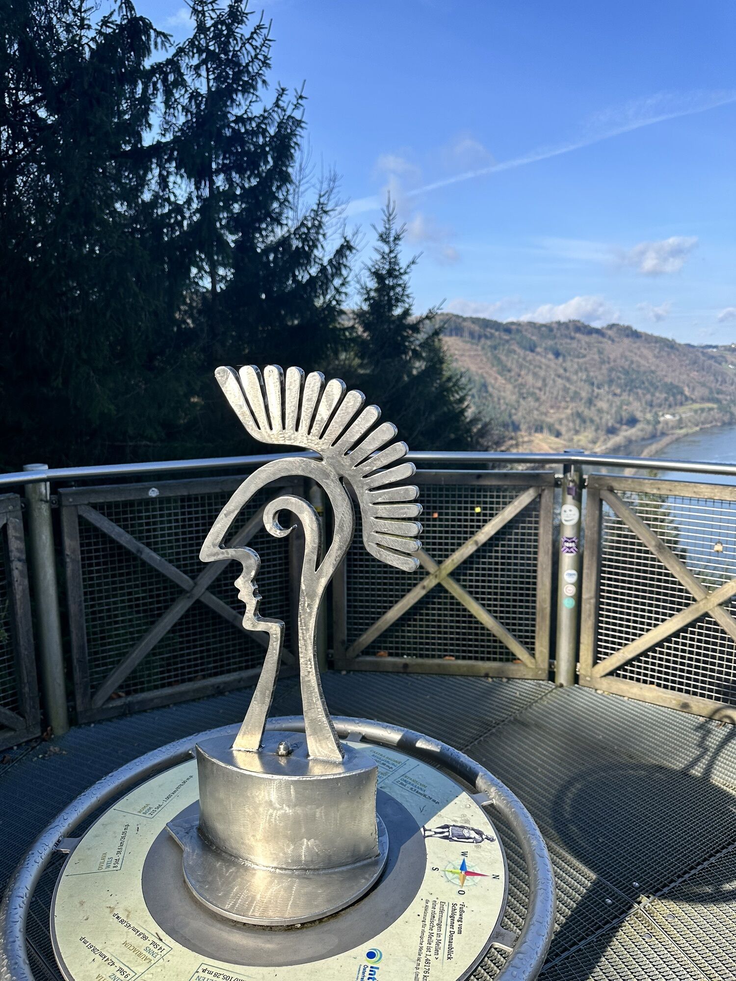
- Donausteig rest area "Schlögener Blick"
- ...
Download: Donausteig diary stage 1_S04 Schlögen-Aschach


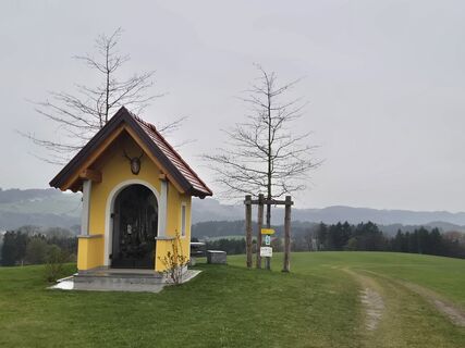
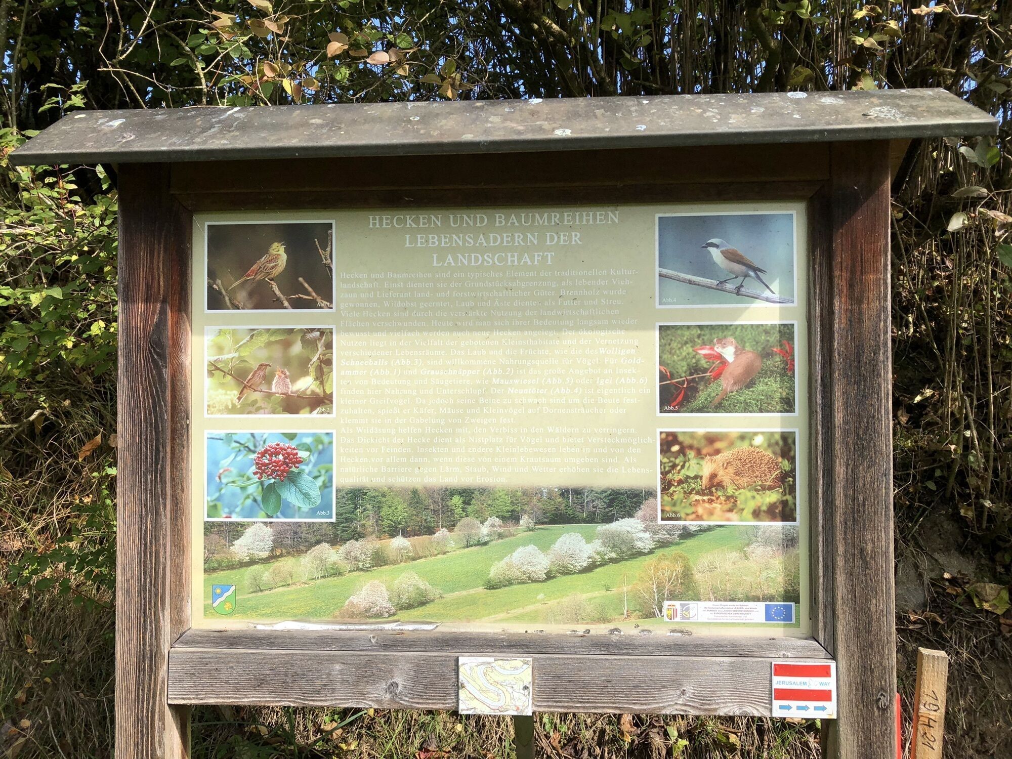
From the Donausteig starting point "Schlögen" we walk a few meters toward the Danube at the parking lot, then a gravel driveway leads uphill on the right, which shortly afterwards plunges into the steep hillside forest. High up in the Danube slopes, a hiking trail finally turns sharply right to the Donausteig rest area "Schlögener Blick". From there we reach in a left curve over a ridge to the Red Cross at the edge of the hillside forest. Now begins the rolling cultural landscape of the Sauwald high plateau. The left driveway leads through a short forest section to a crossroads (Ciconia panel "Hedges and tree rows ...") shortly before Linetshub. Over the right meadow path, it goes on here to an asphalt road, which we then follow to the right to the next intersection (Wohlfahrtnerhof). There shortly left and then immediately right again. The asphalt road quickly becomes a field path. Initially over meadows, later through forest, we hike down to the Fuchsbach, cross it, and walk uphill again on the opposite slope. At the birch with bench on the right. In a left curve, we reach the Roman road (asphalt road), which takes us right to the municipal depot (on the left side) in Haibach. From here, we reach the parish church, the town center of Haibach, straight ahead. The Donausteig runs through the community. After the town center, we turn right at the fork and after about 130 m turn left onto Reith. After about 450 m, a field path branches off to the right, from which we later turn left onto Hinterberg. Here we go straight ahead to the district road, on which we remain for 250 m. Turning left leads a path into the forest and down from the Danube slopes. On the asphalt road "Haibach-Haizing" left, past the farm until after about 300 m a field path branches off to the left. Soon we hike gently up and down over meadow paths along the edge of the forest. At a farmstead, we come across a cart track that leads us through a short forest section to Hinteraigen. There, cross the intersection straight ahead. Now the asphalt road leads uphill. After a farm and a short forest section, there is a larger intersection on the ridge. From here, a short detour to the left takes us to the chapel of Dorf. However, the Donausteig turns right and leads to our last hill. From there, follow the asphalt road for about 2 km straight downhill, past the most tavern Arthofer Gut and the fire station Oed in Bergen. At the last farm before the forest, continue downhill to the right on the gravel road. After a forest section (high-voltage line), we reach an asphalt road in a forest clearing. Turn left here. Again through the forest, turn right at the next intersection. A side road now leads through Vornholz, past the inn Fadingerstüberl, to Kellnering, where we turn left. With a right curve, the road bypasses two houses (swimming pool) and then leads straight uphill. At the end of the following right curve, we go straight on the hollow path. At first slightly uphill, we reach over meadows, fields, and a short forest section the asphalt road "Am Kobl". Turn right downhill there. At the next intersection, continue right and finally, at the next opportunity (Brunnengasse), turn left down to the Danube promenade. Now we stand in the center of Aschach. From here, we come right along the Danube to the Donausteig starting point "Aschach".
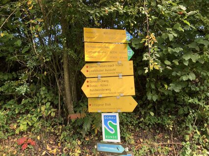
To help you with orientation, the Donausteig has been equipped with its own orientation system - the description can be found here .
Da
In addition to personal hiking equipment, there are no special requirements.
The starting point of this stage is directly in front of the Hotel Donauschlinge (GPS: A-4083 Haibach, Hotel Donauschlinge/Schlögen 2).
Next to the Donausteig starting point is the spacious parking lot of the Hotel Donauschlinge - parking here is free and unlimited.
WGD Donau Oberösterreich Tourismus GmbH
Lindengasse 9
4040 Linz, Austria
Tel. +43(0)732/7277-800
Fax. +43(0)732/7277-804
info@donausteig.com
Tourism Association Haibach ob der Donau
4083 Haibach 40
Tel.: +43(0)72798235
Fax: +43(0)7279/8235-16
haibach@oberoesterreich.at
www.haibach-donau.at
Tourism Association Aschach
4082 Aschach a. d. Donau
Tel: +43(0)664/4082 200
tourismus@aschach.at
www.aschach.at
Donautaler Mostkellerei
Riverresort Donauschlinge
Priljubljeni izleti v okolici
-
3.8
Kerzensteinwanderung im "Naturschutzgebiet Pesenbachtal"
srednjaPohodništvo 4.16 km -
4.4
Haibach: CICONIA circular route
srednjaPohodništvo 11.2 km -
3.8
Waldkirchen: 4/4 View Round | Large Danube Resonance Path Round
srednjaPohodništvo 12.9 km -
4.8
Hofkirchen: Waterfall round
srednjaPohodništvo 8.43 km -
4.8
Danube Cycle Path Stage 2 South Bank: Schlögen - Linz
svetlobaKolesarjenje na dolge razdalje 53 km -
2.9
Alm-Mühlen-Runde
svetlobaPohodništvo 5.12 km -
5.0
Wilson Holz Pesenbach Round Trail
svetlobaPohodništvo 7.53 km -
3.8
Großer Hopfensteig
srednjaPohodništvo 12.8 km -
4.0
R1.05 Sauwald Panorama Route
srednjaKolesarjenje 57.8 km -
4.6
St. Agatha: It must be - Trail
srednjaPohodništvo 20.7 km

Pohodništvo in sledenje


Ne zamudite ponudb in navdiha za naslednje počitnice
Vaš e-poštni naslov je bil dodan na poštni seznam.