


Hirschweg

The beautiful hikes are also described in the hiking map of the municipality of Kaumberg as Froschweg, Hahnweg, Burgweg, Hirschweg and Fuchsweg. The village of Kaumberg itself has plenty to see with the...
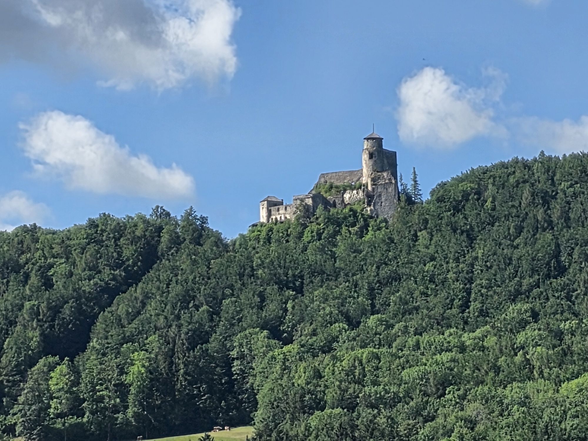
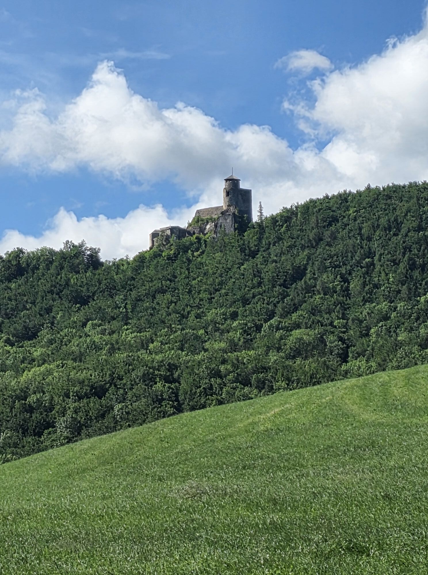
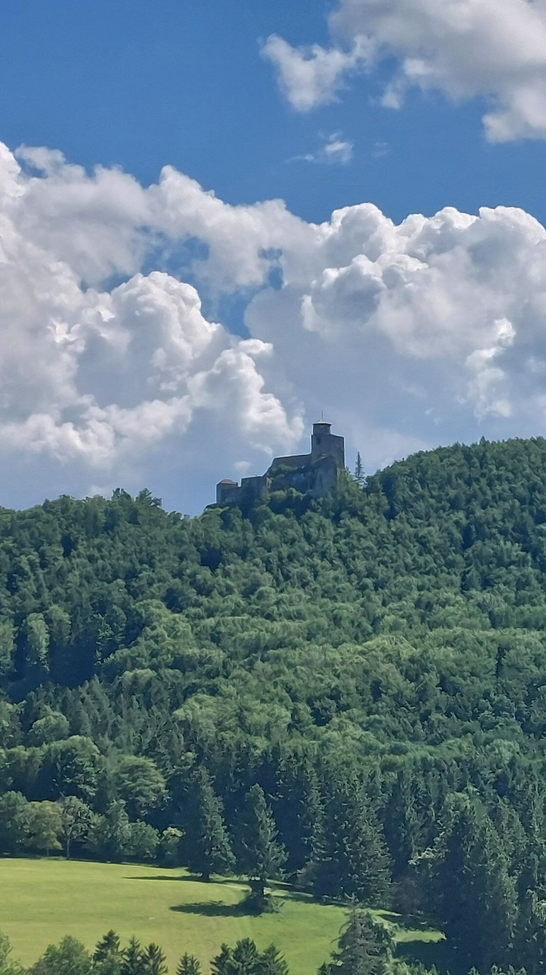
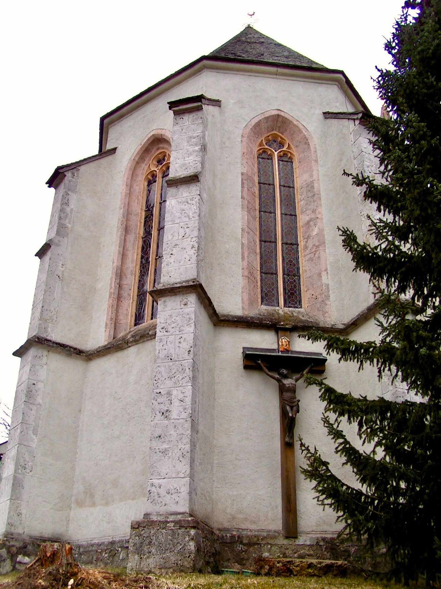
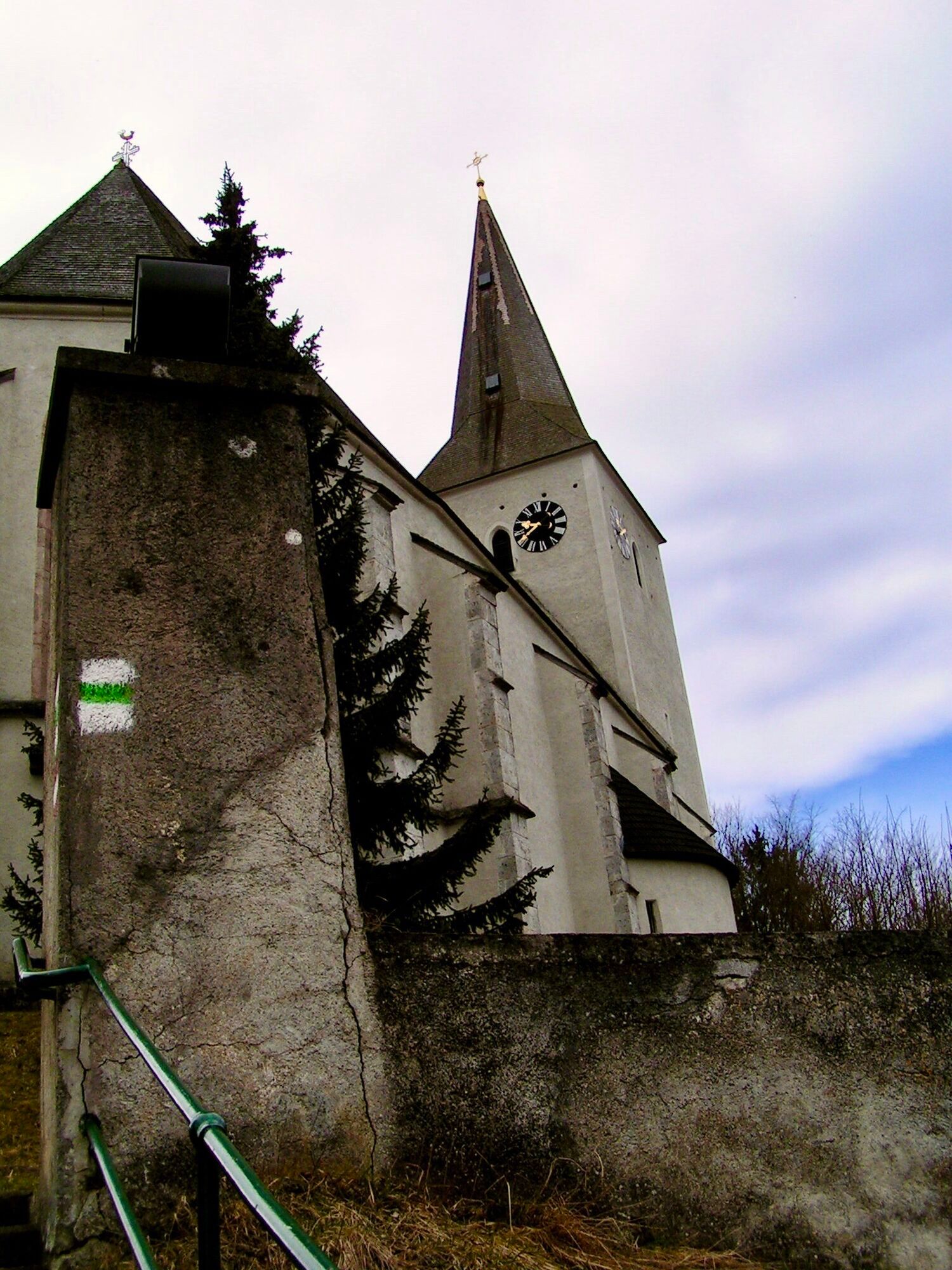
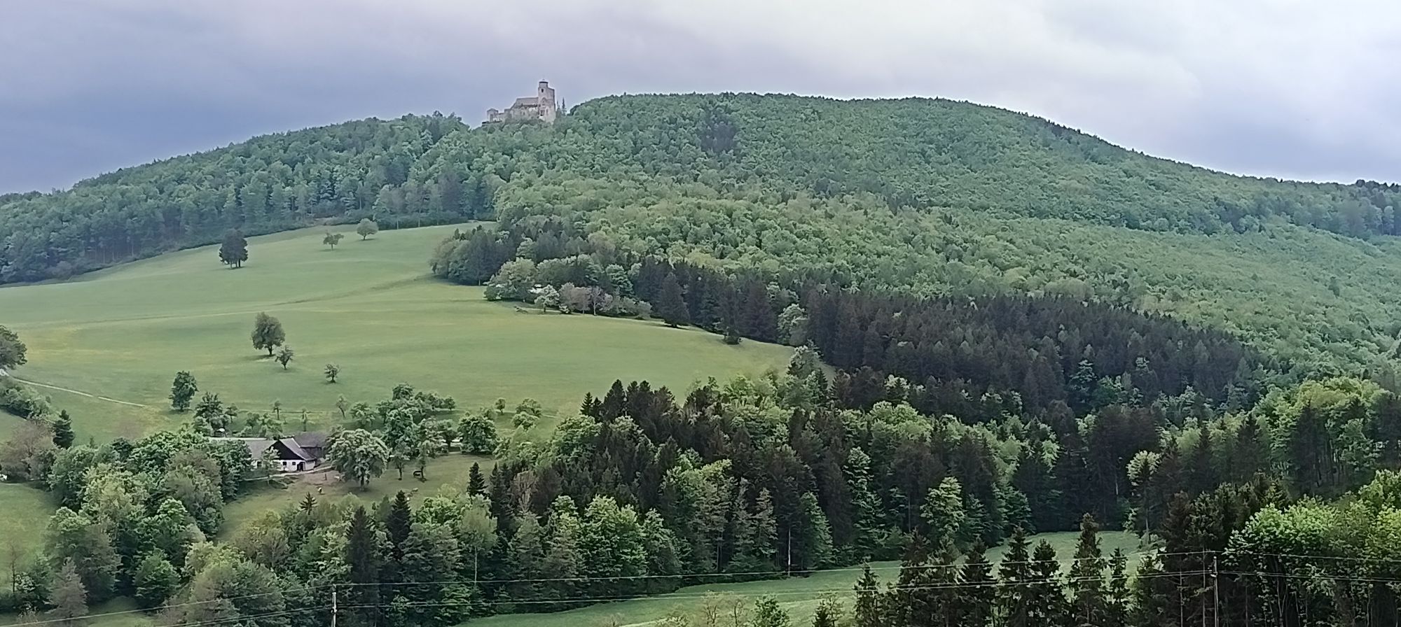
The beautiful hikes are also described in the hiking map of the municipality of Kaumberg as Froschweg, Hahnweg, Burgweg, Hirschweg and Fuchsweg. The village of Kaumberg itself has plenty to see with the barrel fountain on the main square, the Gothic parish church of St. Michael and the local history museum . A particular highlight of the municipality and a very popular excursion destination is the ruins of Araburg Castle, which can be seen from afar.
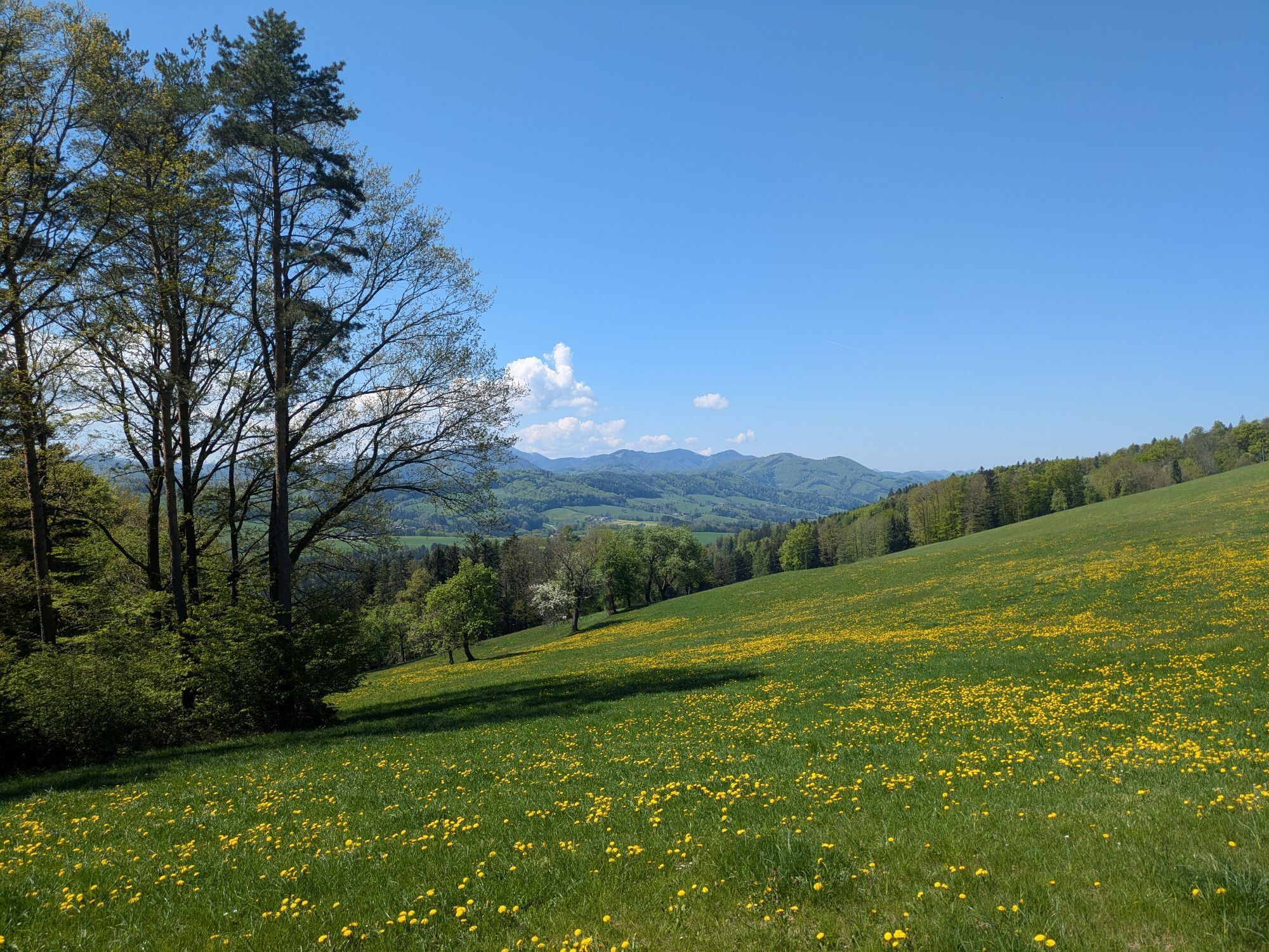
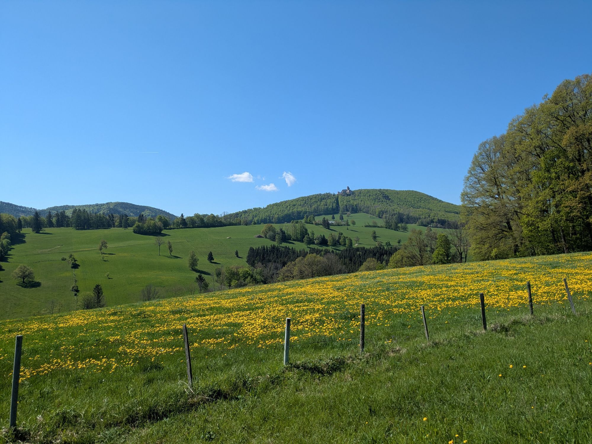
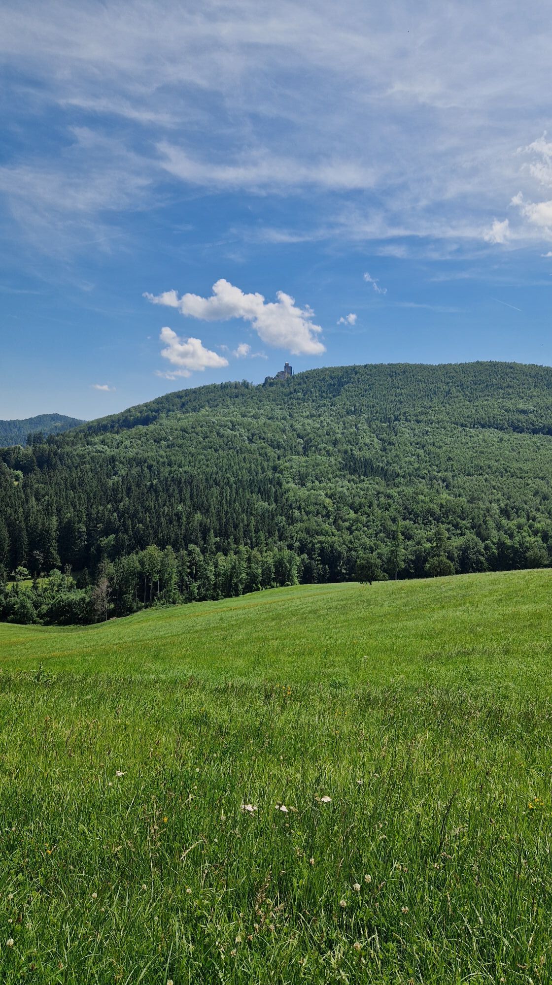
The Hirschweg trail leads across meadows and sometimes through woodland, offering great views. During the hike, mountains such as Eisernen Tor, Schneeberg and Ötscher come into view. From Kaumberg, the Hirschweg trail first leads uphill via Sonnenhang to Brennhof. You can already enjoy beautiful views of the Araburg during the ascent. From here, it crosses an almost flat asphalt road to Gerichtsberg, the watershed between Triestingtal in the east and Gölsental in the west. Here you can stop off at the "Gasthaus am Gerichtsberg" (fresh sheep's cheese). After crossing the B18 main road, the trail follows the farm access road (asphalt road) to the Herbst farm, which you do not reach, however, as the trail turns east into the forest at the Bramerkapelle chapel. Through the forest, the trail leads north past the Bramerhöhe (740 m) and the Bramerkreuz until it crosses meadows again before the Großreith farm (Berg-Heuriger Großreith). After a stretch of asphalt road past the Stadlmann, the trail leads straight downhill to the starting point with beautiful views of Kaumberg.

Vom Hauptplatz wendet man sich nach Westen, am Cafe Maria Theresia vorbei und folgt der Mariazeller Straße (Triestingtalradweg Nr. 42) bis nach 150 m links der Sonnenhang abzweigt (Markierung gelb, Tafel Hirschweg). Steil führt die Straße nach oben, bis es nach den letzten Häusern flacher wird. Immer gerade auf der Straße bleibend, leicht bergauf und bergab, durch kleine Wälder und über Wiesen führt die Straße zu einem Rastplatz mit Infotafel unterhalb des Brennhofs. Hier den Radwegtafeln nach rechts folgen bis zu einem Wegweiser „B 18, Gerichtsberg, Gsth. Petzl, 800 m). Die Straße führt anfangs flach dann fallend zum Gerichtsberg, wo die B 18 überquert wird. Gegenüber folgt man dem „Güterweg Herbsthof“ in 4 Kehren durch Wald und über Wiesen bergauf, bis die Steigung nachlässt. Wenn der Sattel erreicht ist, biegt man rechts ab zur Bramerkapelle. Von hier bietet sich ein Panorama übers Mostviertel bis hin zum Ötscher. Den Wegweisern „Hirschweg“ folgend auf dem „Forstweg Bramer“ für 100 m in den Wald, dann die rechts abzweigende, aufwärtsführende (ca. 20 hm) Forststraße wählen (Tafel Hirschweg) und tw. auf feuchtem Forstweg bis zu einer kleinen Lichtung. Hier den Forstweg verlassen und nach rechts zum Kreuz. Am Kreuz vorbei wendet man sich nach Osten in einen Waldweg, der nun die Nordflanke der Kleinreitherhöhe absteigend querend zu den Wiesen beim Hof Großreith (Most, Fruchtsäfte, Edelbrände) führt. Links am Hof vorbei zur Asphaltstraße und dieser bergab folgen bis zur Kreuzung beim Hof Stadlmann.
Von hier der blauen Markierung bergab folgen, bis nach 250 m der Wegweiser „Kaumberg Ort“ und die blaue Markierung nach links auf einen Wiesenweg leiten. Zuerst führt der Weg durch eine Baumzeile, dann über freie Wiesen zu einer mächtigen Eiche mit Bildstock. Weiter über die Wiesen – auf die Kirche zuhaltend - erreicht man bald den Weg, der zu B 18 und unter dieser hindurch wieder in die Mariazeller Straße führt.
Normale Wanderausrüstung
A2 Südautobahn Abfahrt Leobersdorf, auf der Hainfelder Bundesstraße B 18 bis Kaumberg, hier links in den Ort, Parken am Hauptplatz
Direkt am Marktplatz gibt es eine Bushaltestelle (Kaumber/Triesting Marktplatz), von dieser ist der Startpunkt 2 minuten entfernt.
Parkplatz direkt am Hauptplatz beim Gemeindeamt, Markt 3
Wienerwald Tourismus
Hauptplatz 11, 3002 Purkersdorf
Tel. 02231/62176
E-Mail: Webseite: www.wienerwald.info
Leader Region Triestingtal
Leobersdorfer Straße 42, 2560 Berndorf
E-Mail:
Webseite: www.triestingtal.at
Machen Sie noh weitere Wanderungen oder besuchen Sie doch noch Highlights aus dem schönen Triestingtal. Mehr Infos dazu finden Sie hier!
Folgende Einkehrmöglichkeiten liegen direkt an der Strecke:
Café Maria TheresiaKirchenwirt Familie HalbwaxAktualisiert am: 25.06.2021
Priljubljeni izleti v okolici
-
4.5
Erlebnisweg Peilstein...auf den Spuren der Kletterer
srednjaTematska pot 6 km -
4.7
Schöpfl
svetlobaPohodništvo 9.52 km -
4.6
Wienerwald: Maria Raisenmarkt - Peilstein
svetlobaZimsko pohodništvo 6.82 km -
4.6
Kieneck über Enziansteig & Mareschsteig
svetlobaPohodništvo 13.8 km -
4.6
Panorama hike Hafnerberg
svetlobaPohodništvo 8.78 km -
4.5
Kieneck über den Enziansteig
svetlobaPohodništvo 12.6 km -
4.7
Circular hike Steinwandklamm
srednjaPohodništvo 11.3 km -
4.5
Myrafälle + Steinwandklamm
srednjaPohodništvo 9.53 km -
4.2
RAMSAU Sägewerk Wittmann Kieneck Reingupf retour 02.11.2017
srednjaPohodništvo 14.6 km -
4.3
Unterberg vom Adamstal
srednjaPohodništvo 14.6 km
Pohodništvo in sledenje


Ne zamudite ponudb in navdiha za naslednje počitnice
Vaš e-poštni naslov je bil dodan na poštni seznam.