


Herzsteinweg - St. Oswald
Fotografije naših uporabnikov
-
 © ElkeAUstvarjeno na 08.03.2026
 -
 © ElkeAUstvarjeno na 08.03.2026
 -

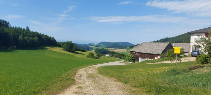
 © zirberlUstvarjeno na 26.09.2025
 -
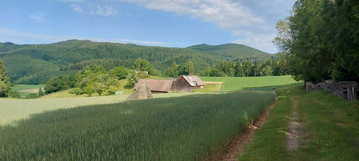
 © Thomas FraterUstvarjeno na 10.08.2025
 -

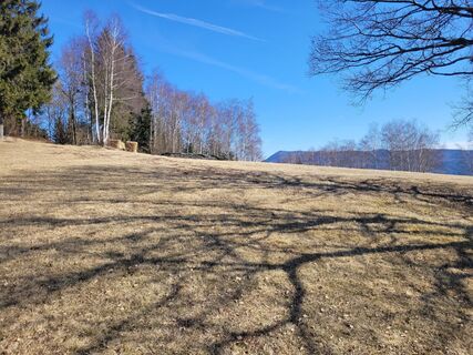
 © Franz SchönbichlerUstvarjeno na 07.08.2025
 -
 © Franz SchönbichlerUstvarjeno na 07.08.2025
 -
 © Klaus Gruber 3Ustvarjeno na 01.06.2025
 -
 © Klaus Gruber 3Ustvarjeno na 01.06.2025
 -
 © Klaus Gruber 3Ustvarjeno na 01.06.2025
 -
 © Klaus Gruber 3Ustvarjeno na 01.06.2025
 -
 © Karl EtlingerUstvarjeno na 09.03.2025
 -
 © Karl EtlingerUstvarjeno na 09.03.2025
 -
 © Balázs ZeleyUstvarjeno na 15.02.2025
 -
 © Balázs ZeleyUstvarjeno na 15.02.2025
 -
 © Balázs ZeleyUstvarjeno na 15.02.2025
 -
 © Balázs ZeleyUstvarjeno na 15.02.2025
 -
 © Balázs ZeleyUstvarjeno na 15.02.2025
 -
 © Balázs ZeleyUstvarjeno na 15.02.2025
 -

 © Uli OttoUstvarjeno na 05.05.2026

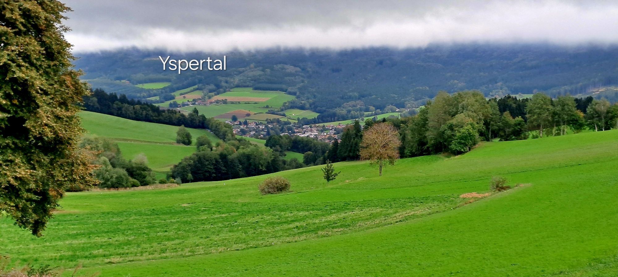


The 3-hour hiking trail leads to the viewpoint "Hauptmann-Mayer-Ruhe", Stone Grain Man (legend), Death's Head Stone (audio play CD available at the town hall - accessible via steps), Weißberg viewpoint...
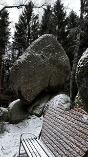
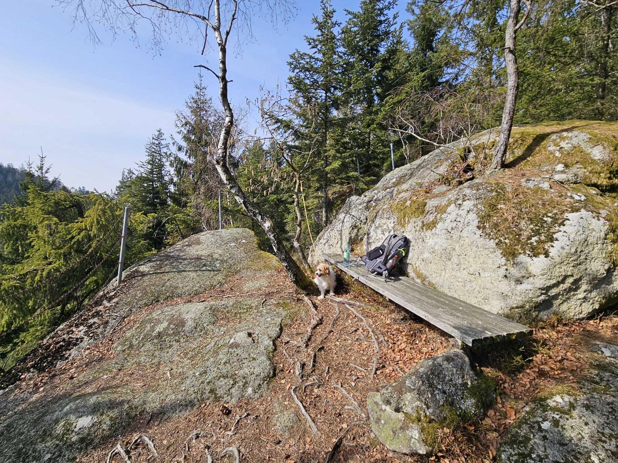
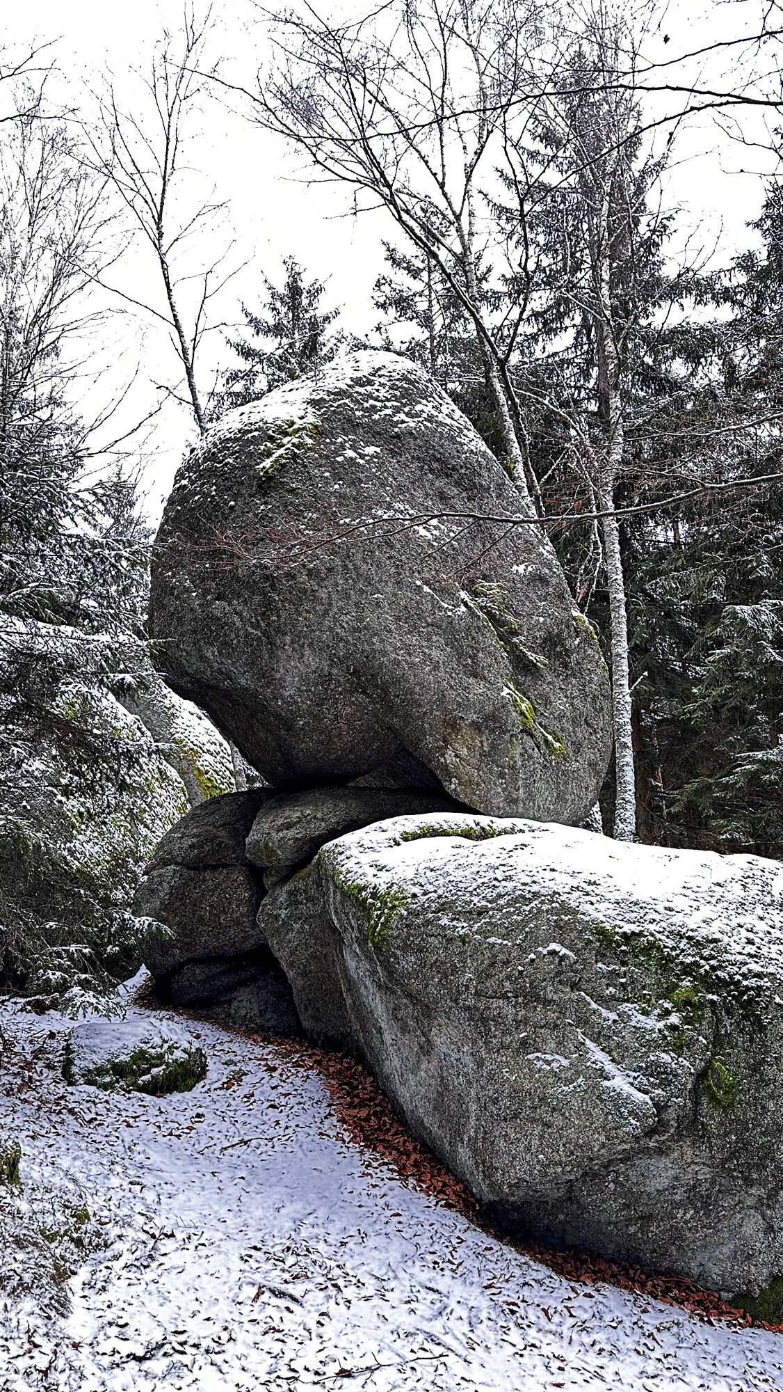
<p>The 3-hour hiking trail leads to the viewpoint "Hauptmann-Mayer-Ruhe", Stone Grain Man (legend), Death's Head Stone (audio play CD available at the town hall - accessible via steps), Weißberg viewpoint (summit cross with summit book - wonderful view over Yspertal and Ostrong), Herzstein (5 m high crawl-through stone) past carved wooden figures along the forest path "Süß" back to St. Oswald.</p><p>On the Herzsteinweg, 10 stations have been set up where special values for life are to be conveyed. From the successful "Heart Education" project of the St. Oswald primary school, hikers are to be offered not only information but also special values at 10 stations:</p><strong>Happiness</strong>, (at the viewpoint "Hauptmann-Mayer-Ruhe")<strong>Gratitude</strong>, (at the Stone Grain Man)<strong>Mindfulness</strong>, (at the Death's Head Stone)<strong>Humor</strong>, (at the Weißberg cross)<strong>Contentment</strong>, (at the three oaks near Windhag)<strong>Love</strong>, (at the Herzstein)<strong>Joy of life</strong>, (forest edge, forest path Süß)<strong>Health</strong>, (water reservoir)<strong>Optimism</strong> (at the Wackelstein) and<strong>Cozy atmosphere</strong> (start and finish at the four inns in the municipality of St. Oswald)

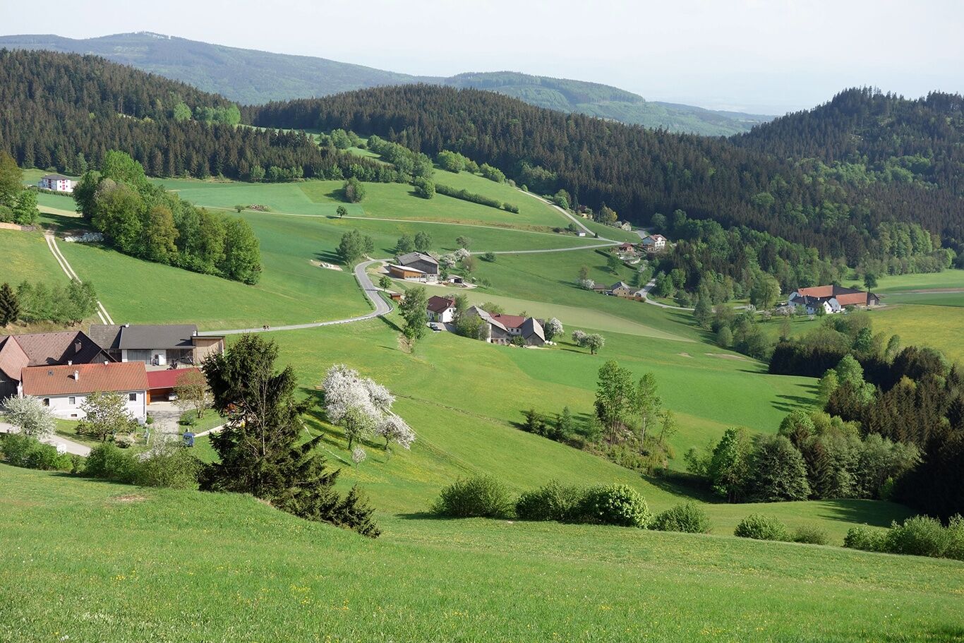
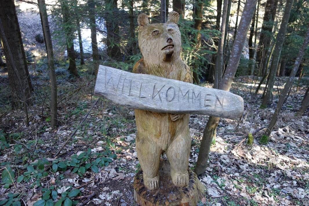
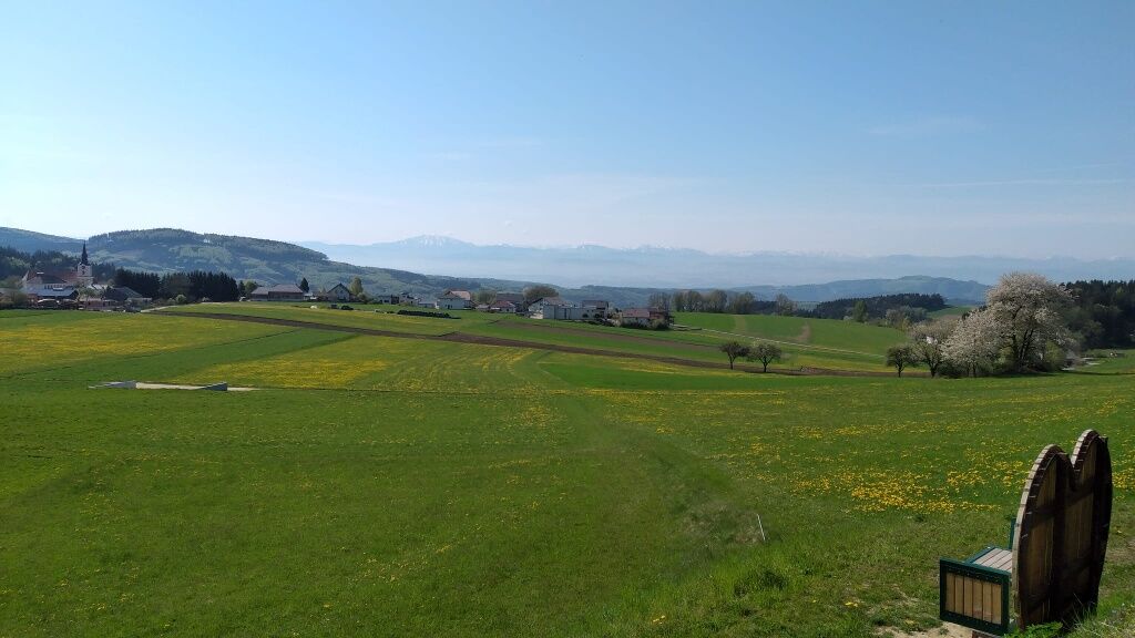

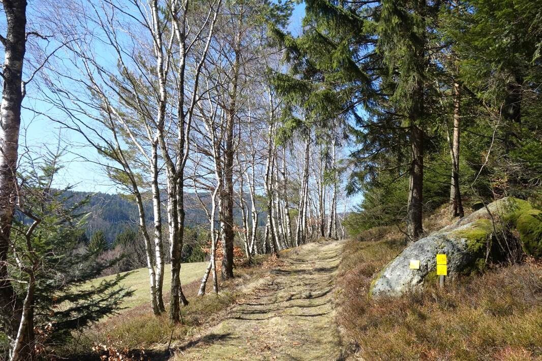
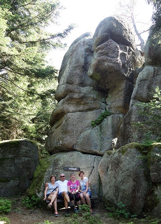
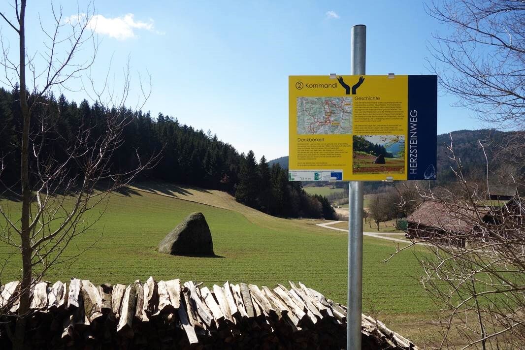
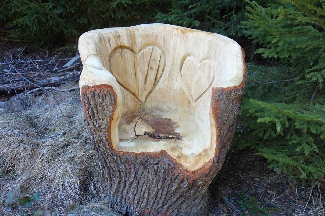

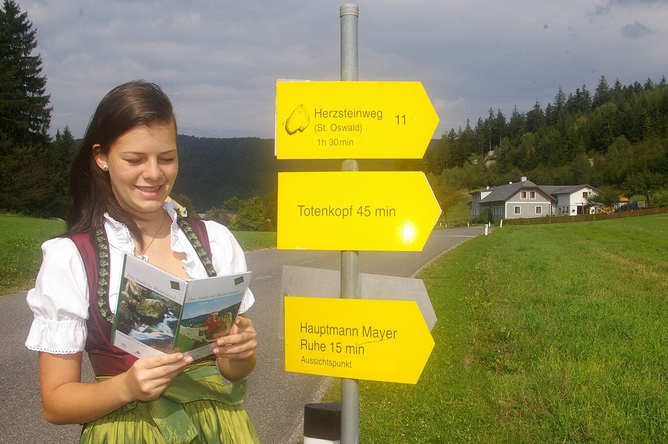
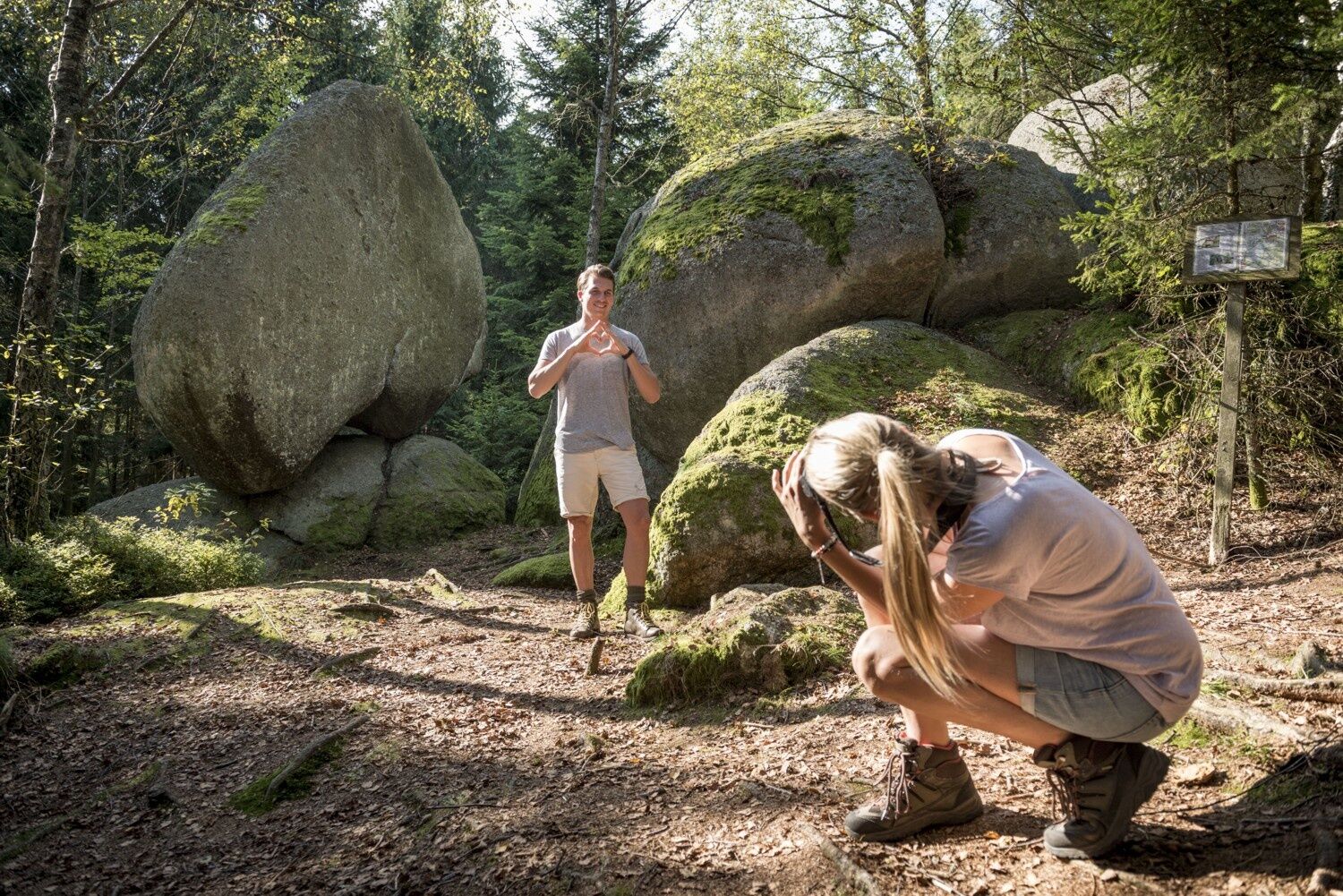
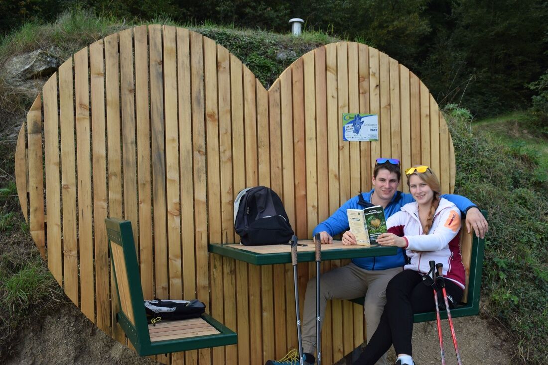
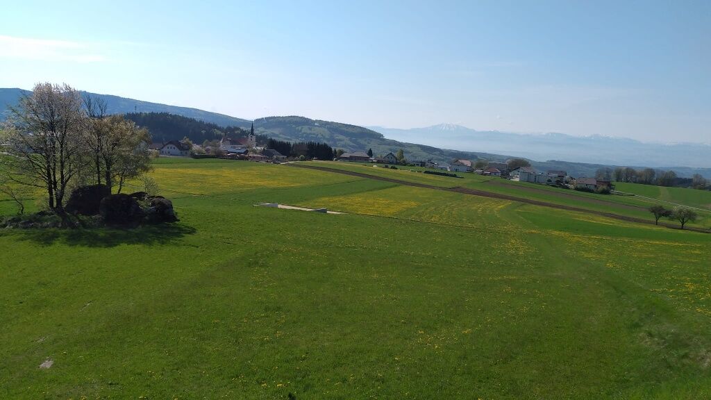
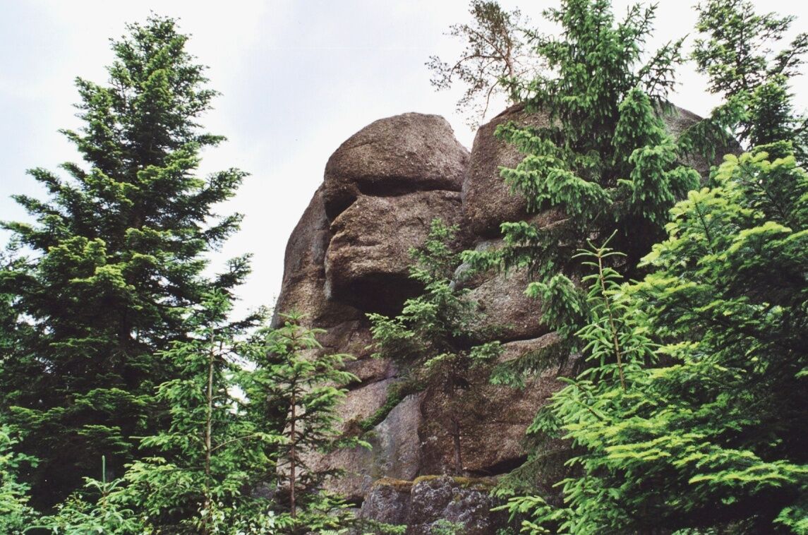
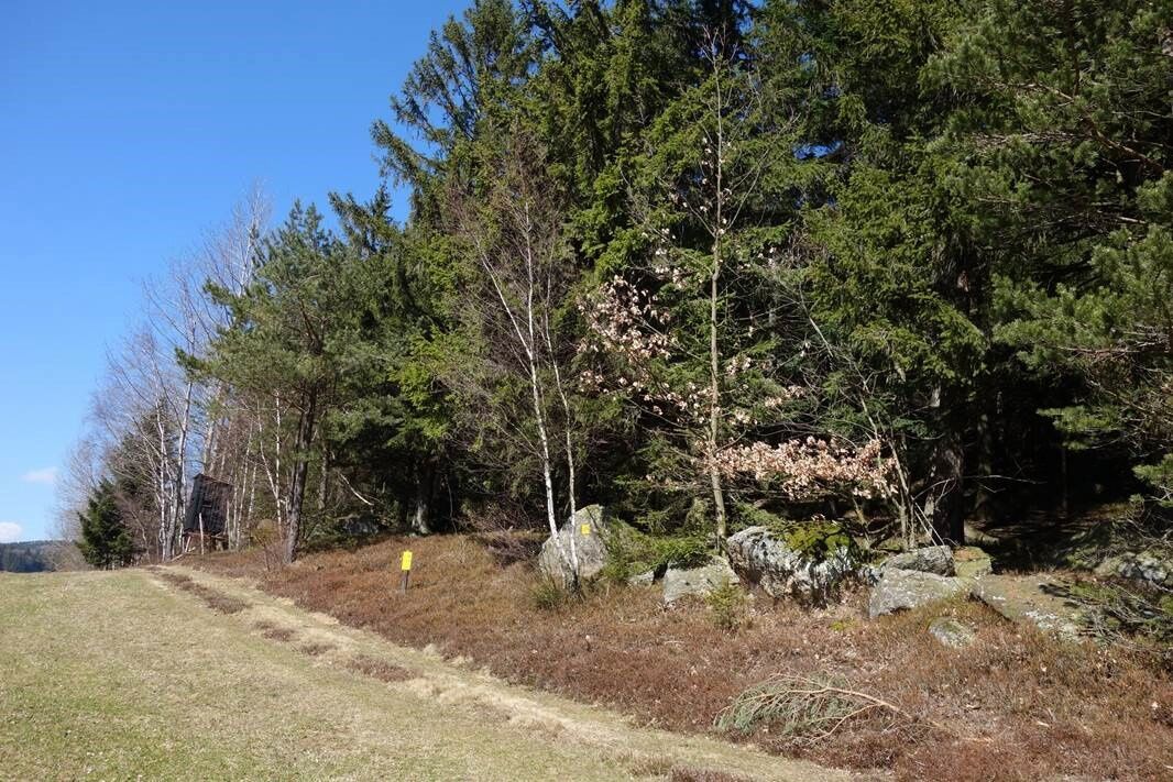
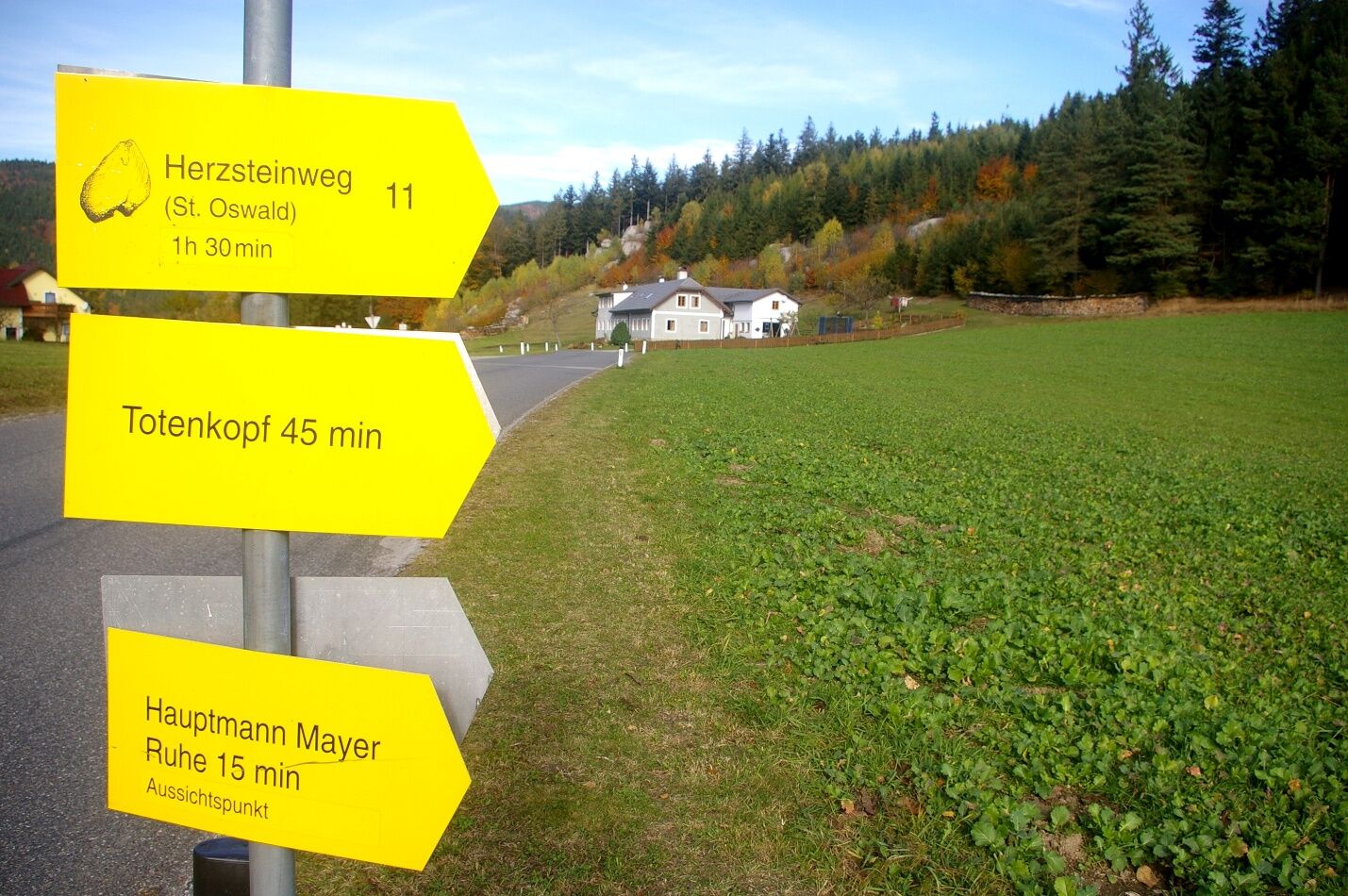

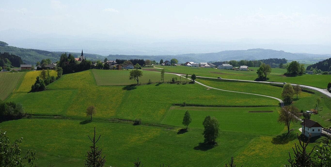
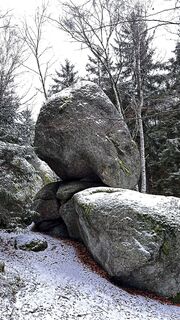
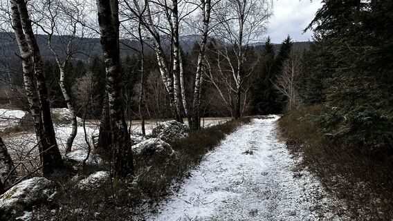
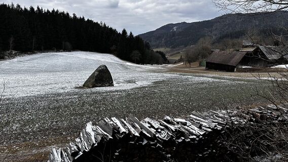
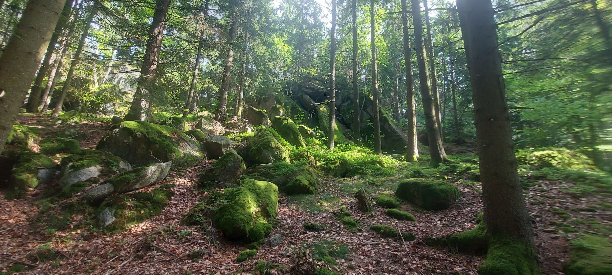
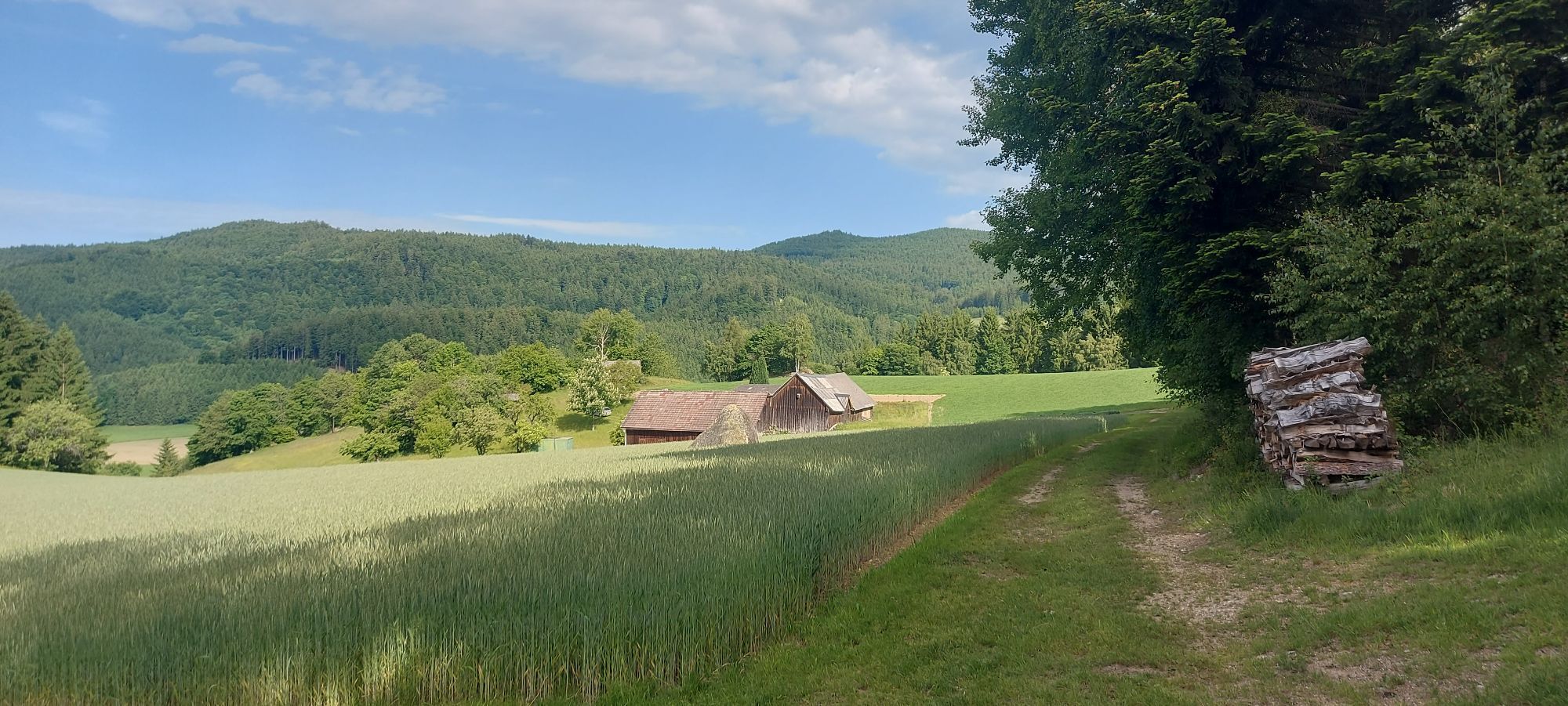
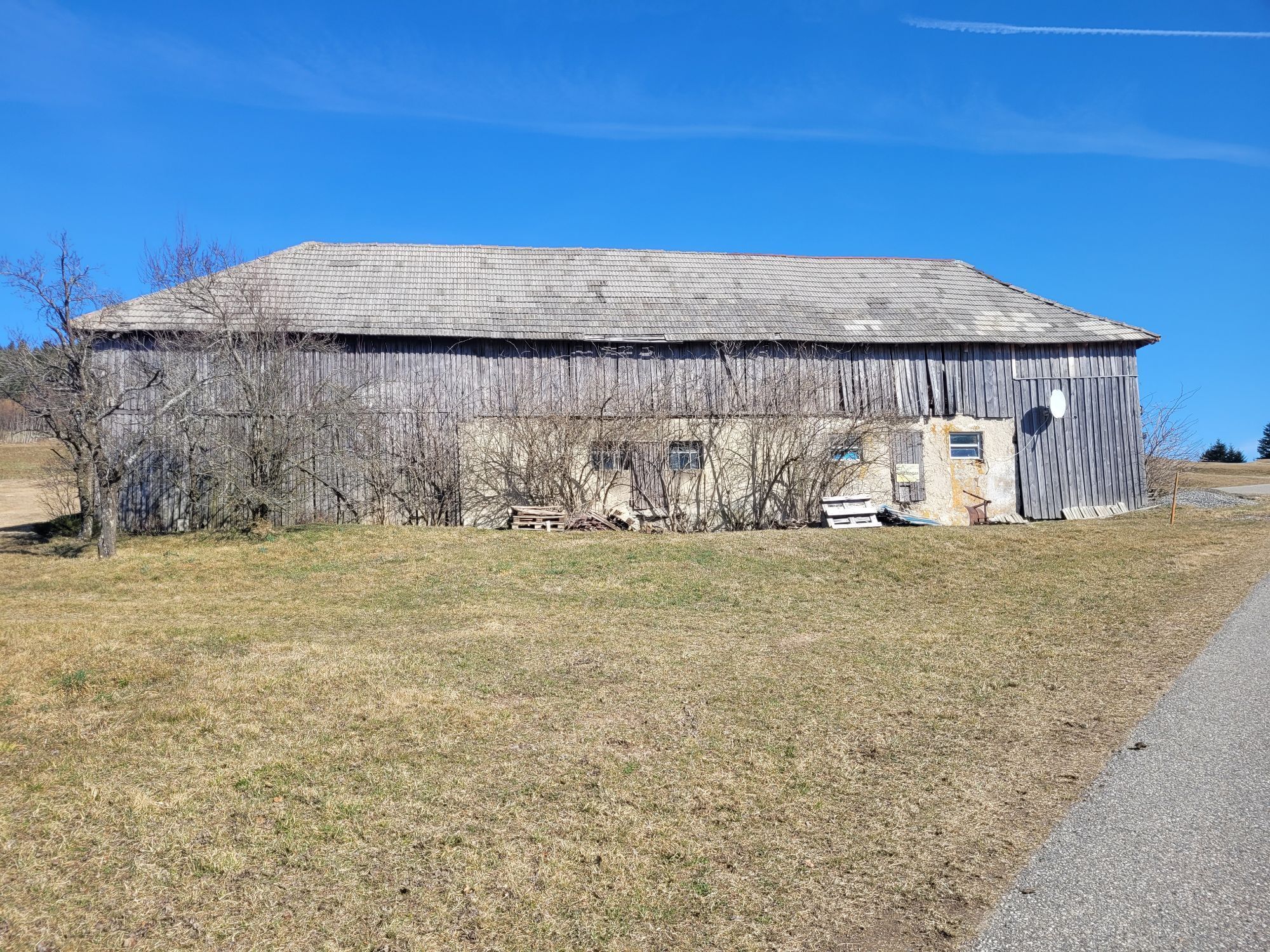
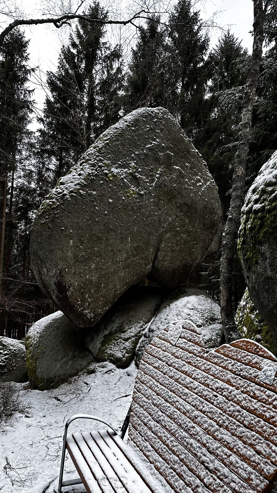
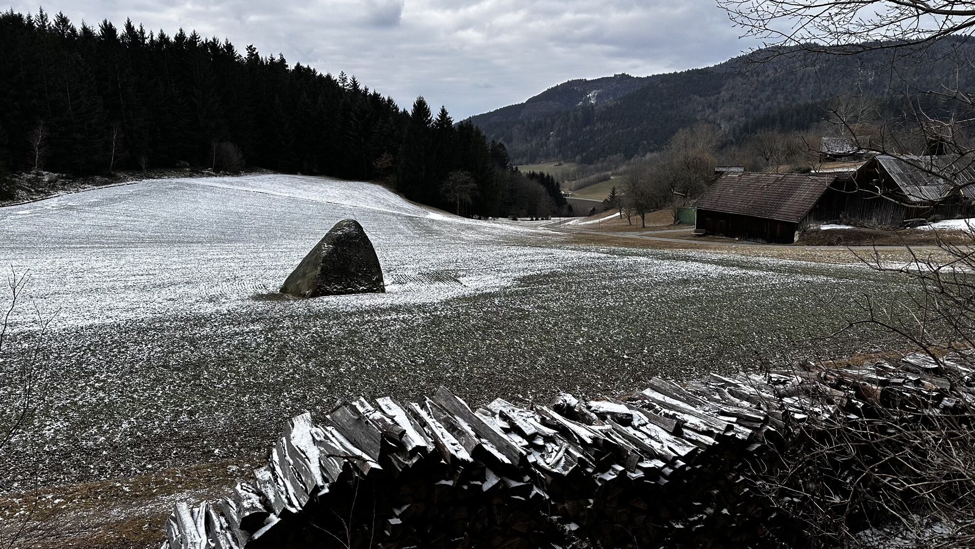
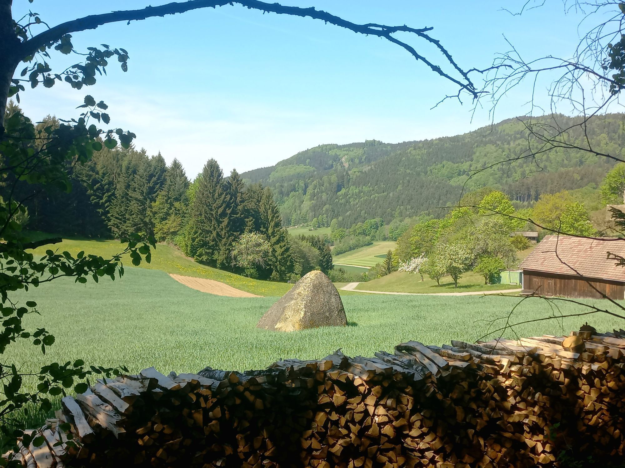
<p>From the church square, the path leads north, turns right shortly before the Wackelstein until it reaches the Yspertal-Dorfstetten intersection. There you walk about 50 m towards Dorfstetten and then right to the Hauptmann-Mayer Ruhe (secured viewpoint). From there you hike through a young forest again northward along a flat forest path and reach a meadow (from here the path leads jointly with the Herzsteinweg-Yspertal (No. 34) to Herzstein). After 100 m along the forest edge path, you reach the “Stone Grain Man” (a pyramid-like stone in the middle of a field, which according to legend is a petrified grain man, because the farmer cursed the meager harvest. It is also considered the so-called calendar stone – the oldest sundial in the Ysper-Weitental). Above the Pireitsteiner farmhouse, a trail branches off right to the “Death's Head Dragon Stone” (death’s head with empty eye sockets looking directly north, where according to Germanic belief the gods' castle and the realm of the dead are located) and Weißberg with summit cross and summit book (782 m). Back at Pireitsteiner, you hike along the forest to the Windhager house, then right up to the “Herzstein” (at Hinterberg 838 m). The Herzstein represents a female double cult site and is a crawl-through stone. There the shared path also splits and you continue straight to the federal road No. 11, then left and at the Mosgöller house right 50 m into the Undeutsch farm road. Here the hike turns left into the Süß forest road. Along the forest road are numerous carved wooden figures. At Süßenhof left, along the federal road to the intersection towards St. Oswald, after 300 m right into the forest path, left at the farm road and before the intersection with the federal road right along the forest path to the water reservoir (large heart station for resting and enjoying the view towards St. Oswald and the Alpine foothills). Then to the “Wackelstein”, back to St. Oswald. Additional hiking option from the reservoir further along the forest road up to Stockberg (761 m, where there is a “blood bowl”).</p>
<p>Access from the West Autobahn A1 via Ybbs on the Danube either via B 36 through Yspertal to St. Oswald or via Ybbs along the Danube west near Ysperdorf, towards Yspertal via Fell to St. Oswald.</p>
<p>Parking in front of the primary school or the depot is free. E-charging station at the "Leithenweg" parking lot free to use.</p>
Municipality of St. Oswald
3684 St. Oswald, Untere Hauptstraße 3
(T) +43 7415 7291
(E) gde.stoswald@wvnet.at
(I) www.stoswald.com
(Webcam) http://www.stoswald.com/Aktuelles/Webcam
Tourism Association Ysper-Weitental
3683 Yspertal, Hauptstraße 9
(T) +43 7415 6767-25
(E) info.yw@waldviertel.at
Waldviertel Tourism
3910 Zwettl, Sparkassenplatz 1/2/2
(T) +43 2822 54109
(E) info@waldviertel.at
(I) www.waldviertel.at


Priljubljeni izleti v okolici
-
3.8
Yspertal: Druidenweg - Ysperklamm
srednjaPohodništvo 9.56 km -
4.6
Waldhausen: Outlook circuit
srednjaPohodništvo 14.0 km -
4.9
Stillensteinklamm, Grein
svetlobaPohodništvo 10.4 km -
4.5
Ausgedehnte Peilsteinrunde
srednjaPohodništvo 13.7 km -
4.6
Brandstetterkogel über Matras Steig
svetlobaPohodništvo 6.28 km -
4.4
Durch die Steinwandklamm von Maria Taferl aus
svetlobaPohodništvo 8.26 km -
4.9
Stillensteinklamm Rundweg über Struden
svetlobaPohodništvo 12.6 km -
4.9
Herzsteinweg Ysper und Burgsteinmauer
srednjaPohodništvo 14.7 km -
4.5
R1.14 Moonstone Circuit
srednjaKolesarjenje 27.0 km -
3.9
Burgstall-Wanderweg Nr. 3
srednjaPohodništvo 11.8 km

Pohodništvo in sledenje


Ne zamudite ponudb in navdiha za naslednje počitnice
Vaš e-poštni naslov je bil dodan na poštni seznam.