


Ascent to Mount Pea by alpine pastures FAI property
Stopnja težavnosti: T2
The climb to Monte Pisello (M 2,272) has important measures, it is a real ascent: about 1,750 m of elevation gain in just under 8 km. The trail is also interesting for runners and in fact is "home" to...
The climb to Monte Pisello (M 2,272) has important measures, it is a real ascent: about 1,750 m of elevation gain in just under 8 km. The trail is also interesting for runners and in fact is "home" to a race, the K2 Valtellina Extreme Vertical Race.
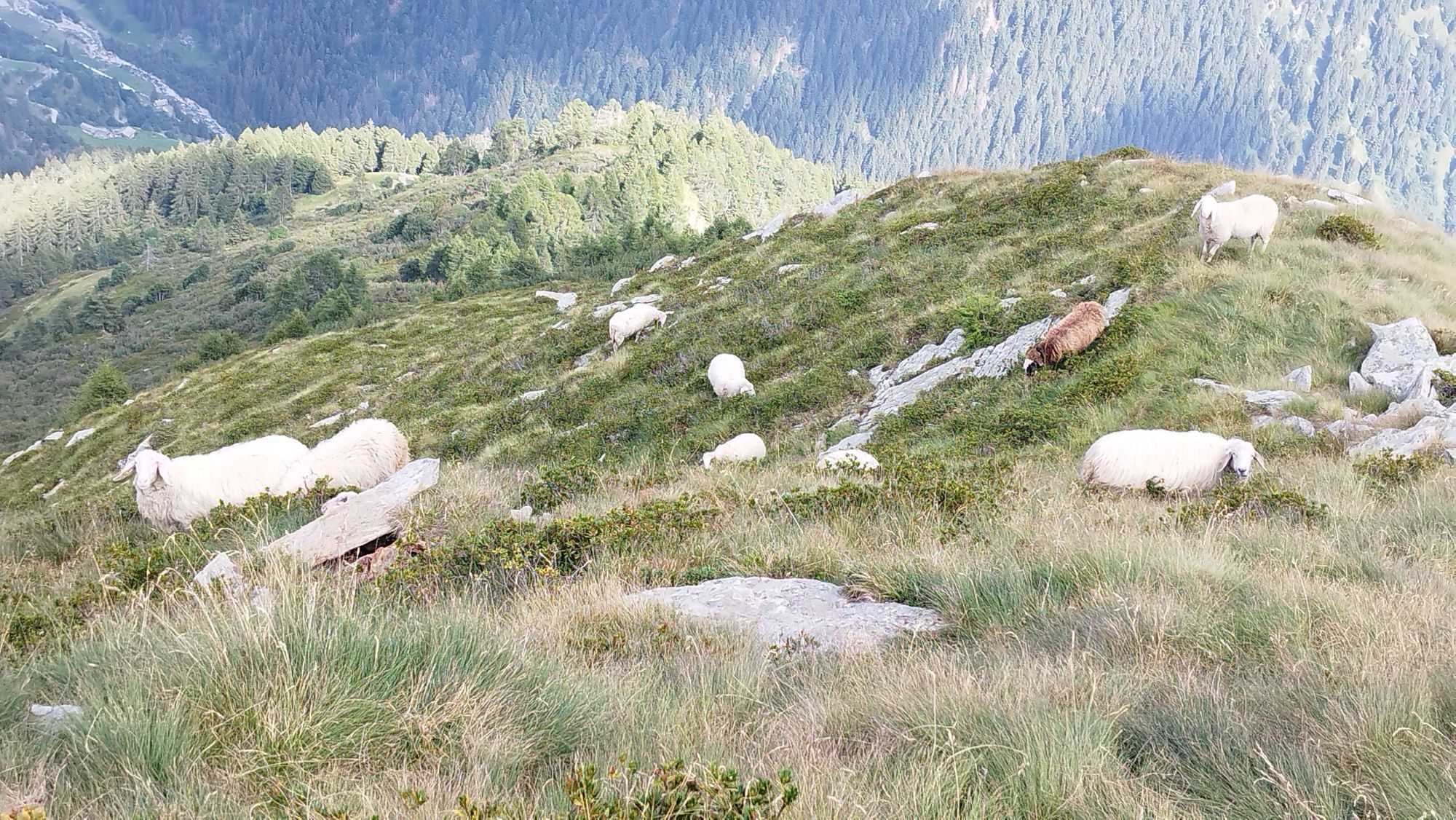
The route-always well marked-begins near the small church of San Gregorio, Tempietto degli Alpini. The Friars' Bridge crosses the Roncaiola stream, then the second detour to the right (cemented road) is to be followed. The first crossing points are Prato dell'Acqua (M 617), San Giorgio (M 770), with its 14th-century church and bell tower more than 30 meters high, and Crocette (M 822). The trail climbs into the groove of the Valleno (or Valena) Valley and-after crossing a dirt road-is marked with the number 162. Glades with huts, such as that of Bgianc (M 1,296), are the gateway to the pastures and forests Beni del FAI (Fondo Ambiente Italiano). The two hundred hectares includeAlpe Madrera (M 1,435) andAlpe Predoria (M 1,928), a heritage of nature and traditions in the process of restoration. Trail number 101v crosses the Pedroria basin along a hump, then climbs the steep gully in a zig-zag pattern, always on its left side, to an elevation of about 2,100 m; from here a short traverse to the east to reach Culìi Pass (M 2,221). The final section is on an easy grassy ridge. The fenced summit of Monte Pisello-with a cross and altar-is at 2,272 m (7,760 ft). There is a 360-degree panorama over Orobie and Retiche, with the Adamello Group in the distance.
The return follows the same route.

San Gregorio Church - San Giorgio Church - Alpe Madrera - Alpe Pedroria - Culìi Pass - Monte Pisello
Da
Talamona: from Viale Stelvio (ex-SS38) follow Via alla Provinciale, then Via Roncaiola and Via San Giorgio
T2
Priljubljeni izleti v okolici
-
The mountain microcosm of Sostila in Val Fabiolo
srednjaPohodništvo 1.39 km -
Panoramic circular route between the Lower Valtellina and the Val Tartano
srednjaPohodništvo 4.44 km -
Laghetti di Ponteranica e passo Tri Omen
srednjaPohodništvo 9.60 km -
Branzi Scalata
Drugi 3.09 km -
Cima Piazzotti Rifugio Benigni
Drugi 15.5 km -
Pizzo dei tre Signori da Ornica
Drugi 15.7 km -
Valgerola Lakes Route
težkoPohodništvo 14.9 km -
Goldtoni - Alpenbogen A139 Dubino - Filorera
težkoPohodništvo v daljavo 31.6 km -
Alpe Piazza and Monte Lago in the heart of the Valtellina Orobie
težkoPohodništvo 6.11 km -
Costiera dei Cech among forests, vineyards and villages
srednjaPohodništvo 5.43 km

Pohodništvo in sledenje


Ne zamudite ponudb in navdiha za naslednje počitnice
Vaš e-poštni naslov je bil dodan na poštni seznam.