


AVBM Classic
Fotografije naših uporabnikov

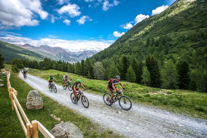
Departure at the stadium Alta Valtellina bike village in the locality 'Rasin Isolaccia; Launch section passing through the heart of the town of Isolaccia; Start climb to Pedenosso Alto S.Antonio tot. Km...
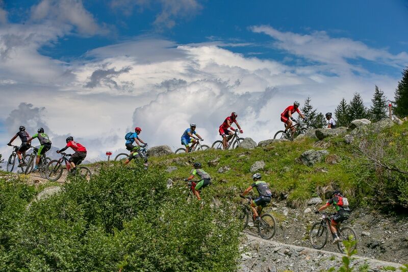
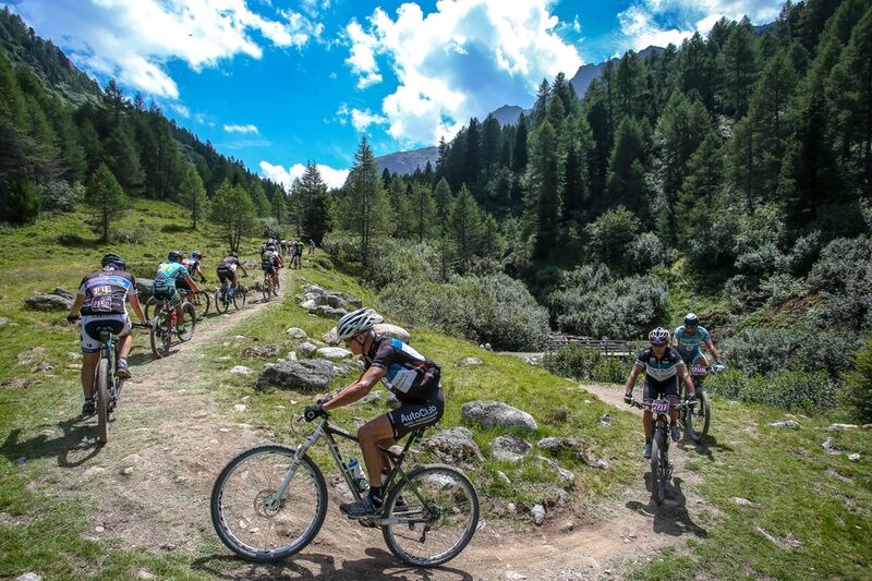
Departure at the stadium Alta Valtellina bike village in the locality 'Rasin Isolaccia; Launch section passing through the heart of the town of Isolaccia; Start climb to Pedenosso Alto S.Antonio tot. Km 7 5 km on asphalt and then start dirt road Scollinamento on the white road of Decauville keeping the left proceed towards Arnoga about 8 km completely pineggianti on wide dirt road. Passage in Arnoga locality, crossing the state road to Livigno in the direction of Val Viola; a valley dominated by the mountains that are part of the Cima Piazzi and Corna di Campo group: Cima Piazzi, Cima Viola and Cima Dosde' stand out; A first uphill stretch km 1 leads to Val Verva; In Baite Verva Bassa, on a newly built path, proceed on 3 km of fun ups and downs; The track becomes wider and after 1 km you pass through Val Cardonne' to then turn left and after crossing the bridge you climb for 500 mt; A smooth descent for 1 km and a detour to the right for Paluetta uphill km 1; From Paluetta km 1 on varied terrain you reach Alpe Boron mt 2057; Short descent and immediately turn right to face a climb of about 1.300 km at times very challenging wall of Prei; You get off the hill in loc. Prei particularly scenic place where the view can 'sweep over all the surrounding valleys traveled in the first part of the track; through a fun new flat path and slightly downhill you reach Alpe Pone; Still on a newly built path, you skirt the alpine ski slopes of Valdidentro to the entrance of the road of Palancana, a long flat stretch immersed in thick pine forests between which open spectacular panoramic windows on the district of Bormio; Breathtaking descent to the historic-naturalistic area of the Venini military fort and the Paluaccio di Oga reserve Taking advantage of the fun trails built for the Oga bike park, one flies to the Motte, the Corva, and with passage on the winter cross-country ski trail and the Isolaccia bike path one has arrived
AVB Classic
Spletne kamere s turneje
Bormio 2000
Piste Stelvio
Bormio 2000
Bormio 2000
Bormio 2000
Bormio 2000
Bormio 2000
Bormio 2000
Bormio 2000
Bormio Terme
Bormio Terme
Bormio Terme
Parterre Pista Stelvio
Parterre Pista Stelvio
Piazza Kuerc
Piazza Kuerc
Piazza Kuerc
Piazza Kuerc
Uzza - Valfurva
Arrivo Cabinovia Cima Piazzi
Arrivo Cabinovia Cima Piazzi
Arrivo Cabinovia Cima Piazzi
Arrivo Cabinovia Cima Piazzi
Arrivo Cabinovia Cima Piazzi
Teleir - Oga
Teleir - Oga
Teleir - Oga
Teleir - Oga
Teleir - Oga
Priljubljeni izleti v okolici
- 3.4
Sta.Maria, Prà da Vau - Lai da Rims - Alp Sot - Prà da Vau
težkoPohodništvo 14.7 km - 5.0
Crap da la Pare' with Joëlette
svetlobaPohodništvo 4.58 km - 4.5
Stelvio Epic Rides: Stelvio Pass
težkoCestno kolo 20.9 km - 5.0
TIP Panorama Road Tyrol ➤ Stelvio Pass
svetlobaMotorno kolo 40.8 km - 2.0
Military Historical Hiking Trail "Scorluzzo"
srednjaPohodništvo 9.52 km - 5.0
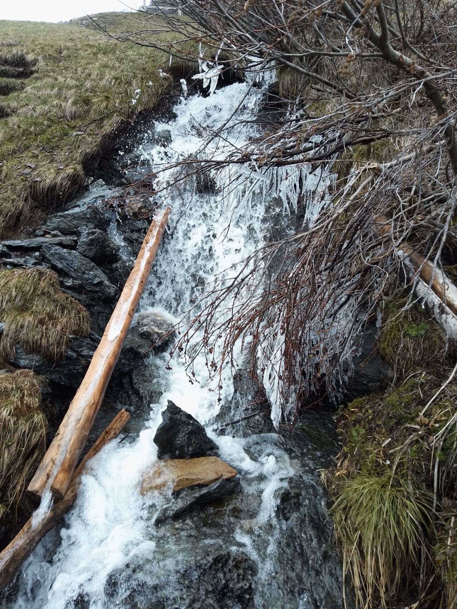
Cascate della val nera
svetlobaPohodništvo 5.70 km - 5.0
Piz Umbrail und Abstieg zum Lai da Rims
težkoVisokogorska tura 15.0 km - 3.0
Val Mora - A sense of the Canadian wilderness
srednjaPohodništvo 21.6 km - 5.0
444.02: Nationalpark Bike-Tour 2. Etappe
težkoMountainbike 39.6 km Mount of Mines
srednjaSmučarska tura 4.78 km
Pohodništvo in sledenje


Ne zamudite ponudb in navdiha za naslednje počitnice
Vaš e-poštni naslov je bil dodan na poštni seznam.