





Short circular hike around the Presa de los Perez from the Hermitage of San Antonio de Padua
Stopnja težavnosti: T2
The Risco Caído - Charming Circular Route SL 4
The Risco Caído is a fascinating hiking trail on Gran Canaria, offering a variety of impressions for all sports and nature lovers. The route, classified as...
The Risco Caído is a fascinating hiking trail on Gran Canaria, offering a variety of impressions for all sports and nature lovers. The route, classified as SL 4, takes you through an impressive landscape that offers both cultural and natural highlights. Over about 10 kilometers, you have the opportunity to discover the unique flora and fauna of the region while immersing yourself in the history and culture of the Canary Islands.
Route and RequirementsThe trail starts near the small hamlet La Culata and winds through a diverse landscape marked by rugged rocks, deep ravines, and lush green valleys. The path is rated as moderate and requires good basic fitness, as some sections are steeper and challenging through uneven terrain. Overall, you should plan about 4 to 5 hours for the hike, depending on your pace and frequency of breaks.
Key Points of the RouteOn the Risco Caído circular route SL 4, there are many key points you should not miss. The most notable include:
The Risco Caído: This impressive viewpoint offers breathtaking views of the surrounding landscape and the Tejeda valley. Here you have the chance to admire the geological formations and the unique vegetation of the region. The Cave Dwellings: Along the route, you will find ancient cave dwellings used by the original inhabitants of Gran Canaria. These historic sites are not only fascinating but also offer insights into the lives of the island’s first settlers. The View of Roque Nublo: During your hike, you will repeatedly see the iconic Roque Nublo, one of Gran Canaria’s best-known rocks. This natural monument rises majestically over the landscape and is a popular photo subject. Special HighlightsBesides the rugged rocks and impressive nature, there are many highlights that make your hiking trip unforgettable. The region’s mild climate ensures that the walk is pleasant at any time of year. The varied flora, including endemic plant species, will continually surprise you, and the animal life delights with bird species calling this home.
Another highlight is the opportunity to enjoy the silence and seclusion of nature. You can hear the sounds of nature, breathe the fresh air, and, if you’re lucky, observe the native wildlife.
Tips for the HikeTo make the most of your adventure on the Risco Caído, you should consider a few tips:
Hiking Clothing: Wear comfortable, weatherproof clothing and sturdy footwear suitable for uneven terrain. Equipment: Bring enough water, snacks, and possibly a camera to capture the spectacular views. Safety: Check weather conditions before your trip and do not plan the hike during dusk or poor visibility. ConclusionThe Risco Caído - Charming Circular Route SL 4 is one of the best ways to explore the natural beauty and cultural treasures of Gran Canaria. With its unique landscapes, historical sites, and the opportunity to immerse yourself in nature, this trail offers an unforgettable experience for every nature lover and adventurer. Whether you are a local or a visitor, this hike will surely inspire and delight you!
Sights La Paja and Risco Caído
Trail network
GR 138 - World Heritage of Gran Canaria S-96 S-97Spain | Canary Islands | Las Palmas | Gáldar | Artenara

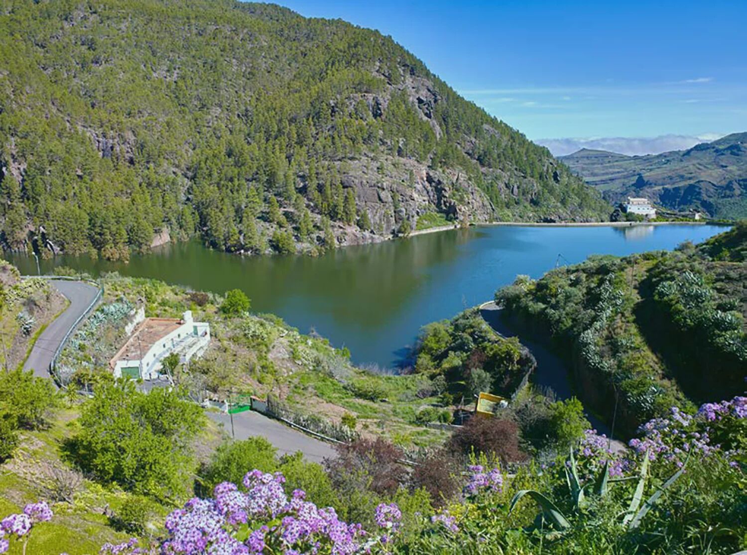
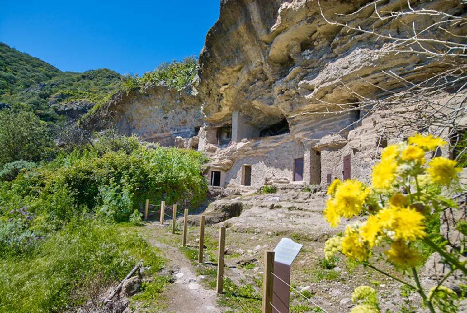
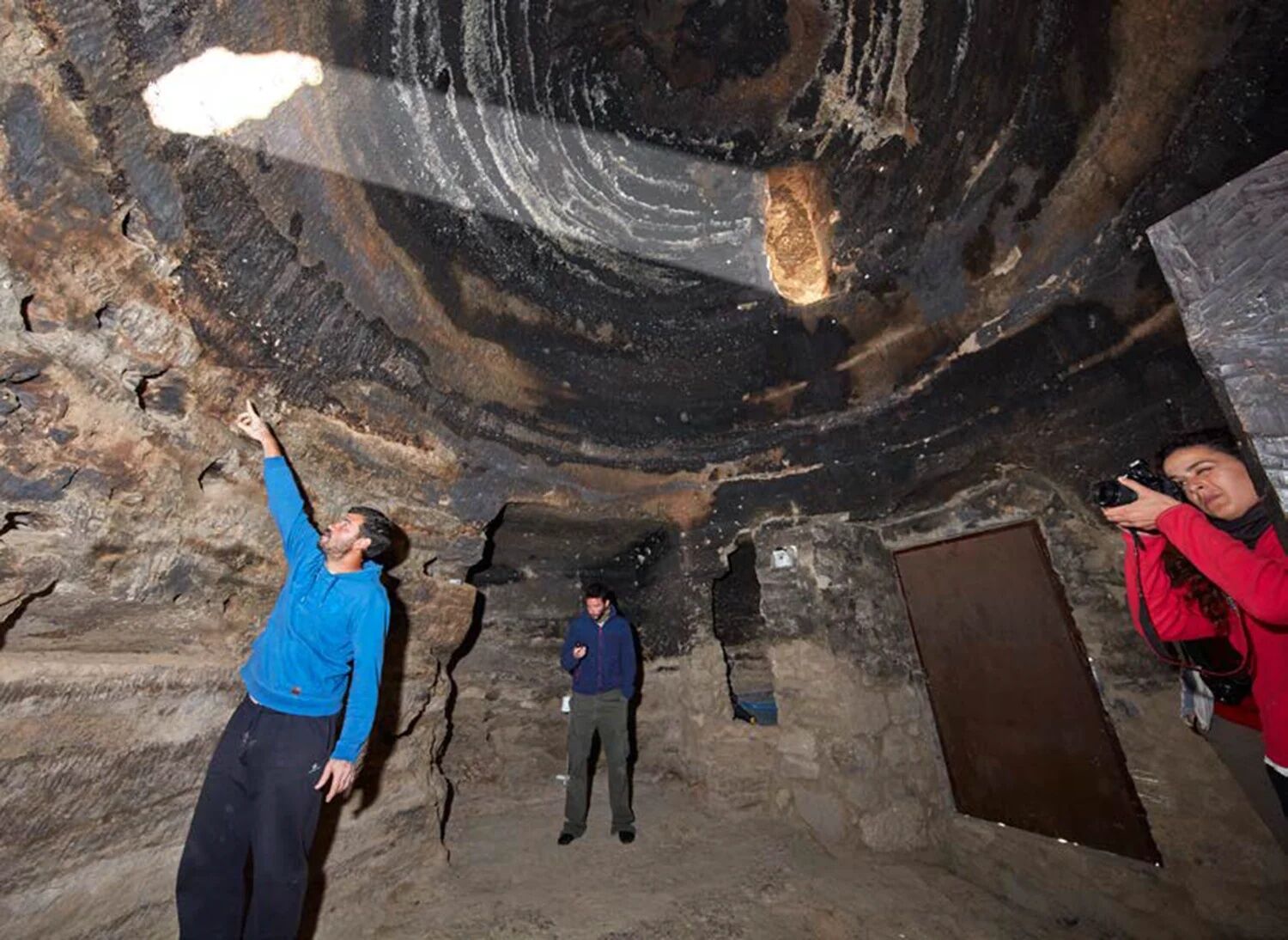
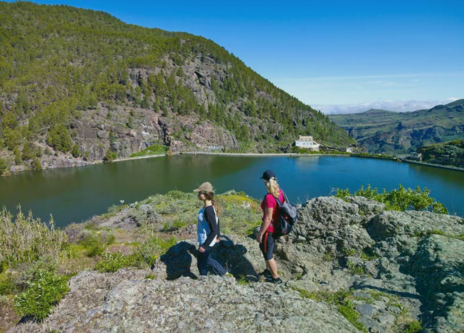
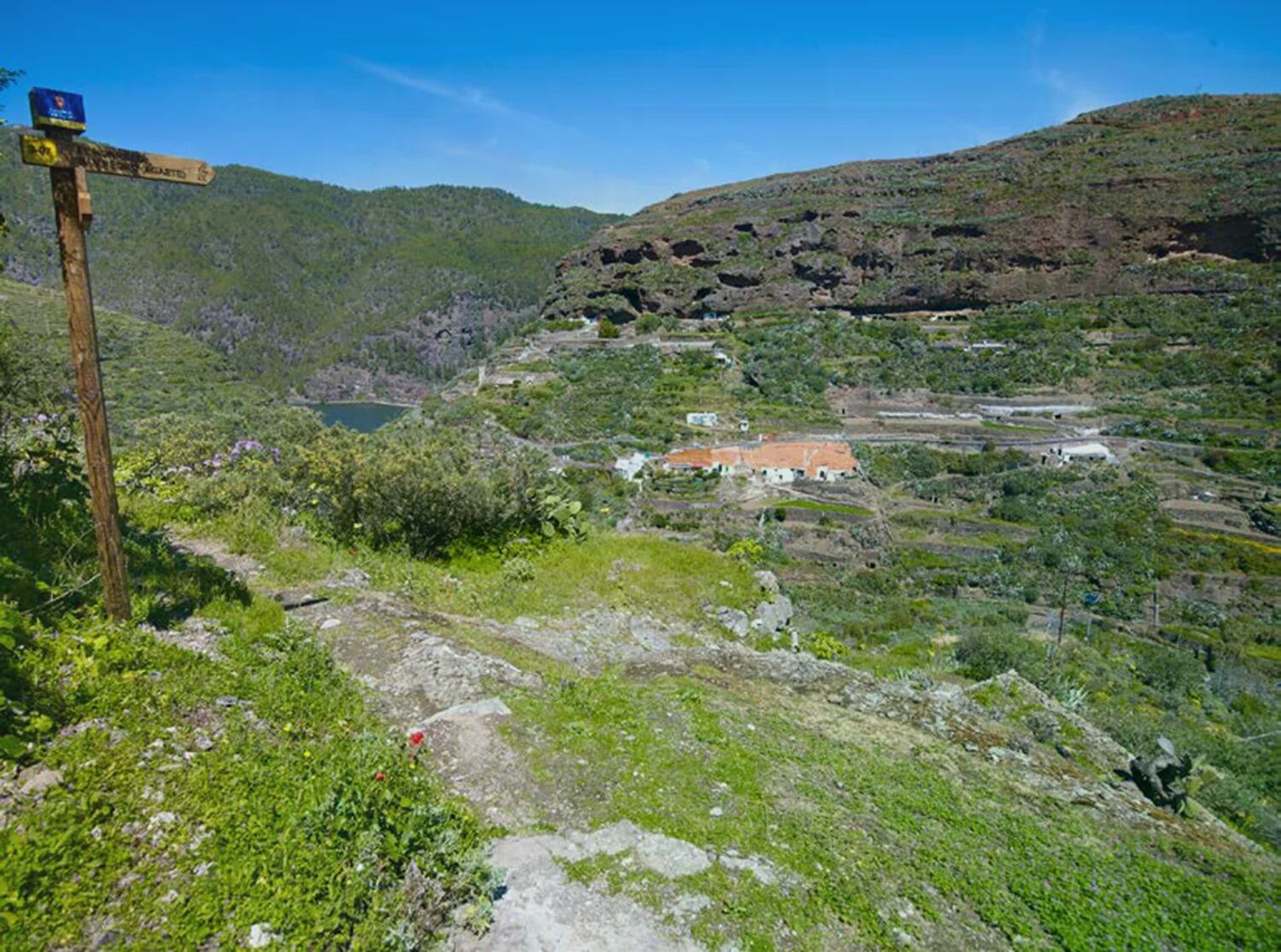

Presa de Lugarejos - Hermitage of San Antonio de Padua - Casas de las Hoyas - Lugarejos - Lugarejos - Presa de los Perez - Risco Caído - La Paja
General note: The municipal administration provides this information for the convenience of the users of these pages. In no way does it guarantee the current status of the routes, the offer, quality, owners of the areas they cross, etc. Moreover, the municipal administration assumes no responsibility for errors, omissions, or poor orientation that may occur due to user mishaps with these texts.
For example: from Maspalomas - Route Google Maps
Follow GC-1 to GC-191 in Ingenio, take exit 18 on GC-1 Take GC-120, GC-130, and GC-150 to GC-15 in Cruz de Tejeda Follow GC-15 to Artenara Follow GC-215 to the destinationFor example: from Las Palmas - Route Google Maps
Take GC-23 from Av. Ansite and Calle Dr. Manuel Pescador Sánchez Follow GC-23 to the destination in ArtenaraStops
ArtenaraConnections:
There are bus lines that go directly to Artenara, such as line 220 from Teror or other connections from Las Palmas.
Parking spaces are available
T2
Please respect the environment. Carry your ID and documentation, water, warm clothing. Do not discard cigarette butts and avoid lighting fires. Do not pick plants, nor collect animals or other natural elements. Avoid noise and respect the tranquility. Hike accompanied on the existing trails. Remember that you hike at your own risk.


Priljubljeni izleti v okolici
- 4.7
Roque Nublo from all sides
srednjaPohodništvo 6.10 km - 5.0
Roque Nublo, Gran Canaria, Spanien
svetlobaGorski pohodništvo 1.50 km - 4.8
Rundtour auf den höchsten Gipfel Gran Canarias (1.954m)
svetlobaPohodništvo 7.41 km - 5.0
Pico de las Nieves und Roque Nublo
srednjaPohodništvo 15.5 km - 5.0
Roque Nublo Panoramatour by Wilson Holz
svetlobaPohodništvo 10.1 km - 4.5
Zu den Höhlen des Herren, Cruz de Tejeda nach Cuevas del Caballero, Gran Canaria
srednjaPohodništvo 7.01 km - 4.0
Sehr schöne Runde durch das Tal von Agaete
svetlobaPohodništvo 6.98 km - 4.0
Eindrucksvolle Tour von Soria ausgehend
srednjaPohodništvo 9.56 km Pico de Nieves, Gran Canaria
srednjaGorski pohodništvo 5.20 km- 5.0
Moya, Kanarischer "Regenwald"
svetlobaPohodništvo 2.05 km
Pohodništvo in sledenje


Ne zamudite ponudb in navdiha za naslednje počitnice
Vaš e-poštni naslov je bil dodan na poštni seznam.





