


Scenic circular hike on GR 138 - Patrimonio Mundial de Gran Canaria from Degollada de las Lajas
Stopnja težavnosti: T1
Hike Tamadaba – Altavista Mountain Range - SL 3
The Tamadaba – Altavista hike in the mountain range of Gran Canaria is one of the most impressive routes that will excite passionate hikers and nature lovers...
The Tamadaba – Altavista hike in the mountain range of Gran Canaria is one of the most impressive routes that will excite passionate hikers and nature lovers alike. This route combines breathtaking views with the diversity of Canarian flora and fauna and offers you the opportunity to experience the unspoiled nature of the region.
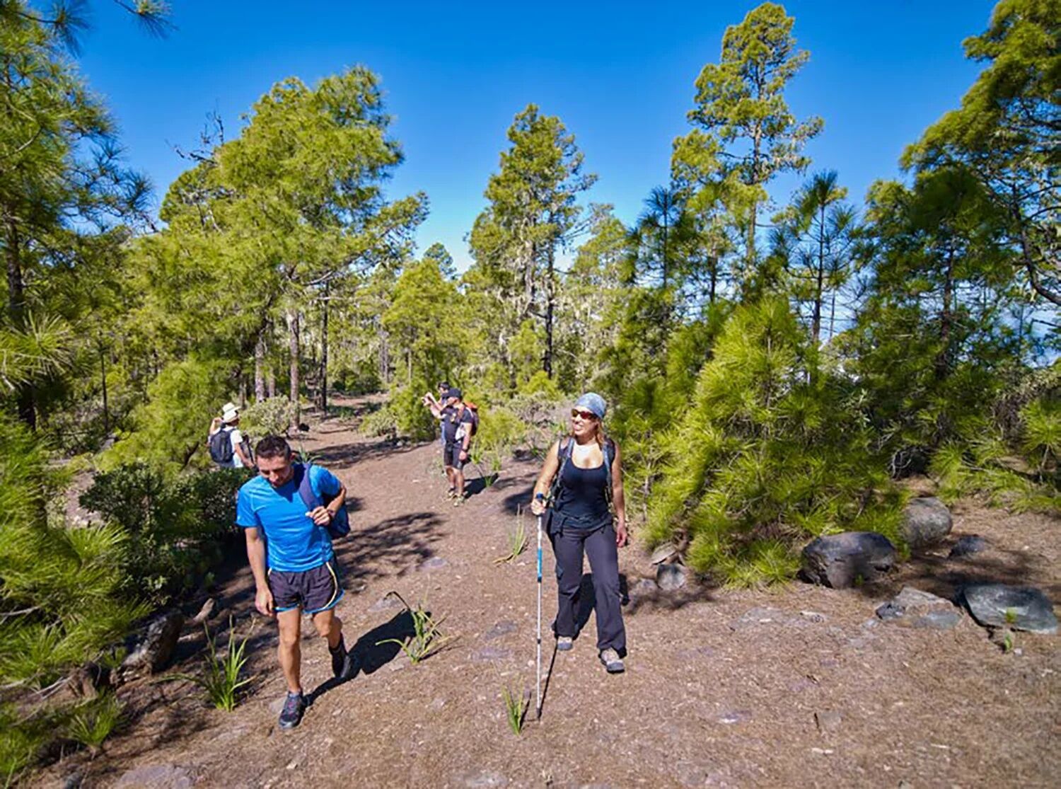
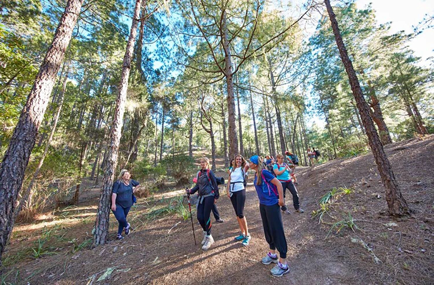
Route DescriptionThe SL 3 trail extends over about 10 kilometers and is set as a circular hike. It begins in the Tamadaba Natural Park, one of the island’s protected natural areas. The route is well-marked and suitable for both experienced hikers and beginners seeking a moderate challenge. The hike usually lasts between 3 and 5 hours, depending on your pace and breaks you take.
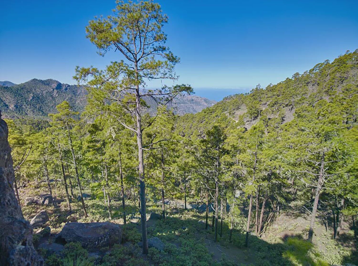
Key Points of the Hike Starting Point: The hike starts near Tamadaba, easily accessible by car. Parking facilities are available here. Elevation Difference: The route takes you through different elevation levels, with a maximum elevation difference of about 600 meters. This means you hike both uphill and downhill, making the tour varied and exciting. Viewpoints: Along the hike, you will encounter numerous viewpoints offering spectacular panoramas of the Gran Canaria coast and surrounding mountains. Especially the view from Altavista point is an unforgettable experience worth photographing. Special HighlightsThe hike leads you through dense pine forests, blooming shrubs, and various endemic plants. A special highlight is the encounter with the unique wildlife of the region, including different bird species that live in this protected area.
Another highlight is the historic trail guiding you through the remains of traditional land use. Here you can discover traces of the island’s former inhabitants, who often lived in harmonious balance with nature.
Hiking RequirementsAlthough the hike is accessible for most, you should consider some points:
Difficulty Level: The path is rated moderate. Some basic fitness is beneficial, especially for steeper sections. Equipment: Sturdy, good footwear is essential to safely walk the uneven and sometimes slippery sections. Hiking gear and sufficient water are also recommended. Weather Conditions: The best time for this hike is in spring and autumn when temperatures are milder and nature is especially beautiful. Pay attention to the weather forecast, as sudden weather changes in the mountains are not unusual. ConclusionThe Tamadaba – Altavista hike is not only a physical challenge but also an opportunity to experience the impressive nature of Gran Canaria up close. From gentle hills to the dramatic cliffs of the coast, this route offers a perfect mix of adventure and relaxation. Pack your hiking boots, enjoy the fresh air, and discover the beauty of this unique island!
Mountain passes
Degollada de las Lajas (1221 m)Protected areas
Parque Natural de TamadabaTrail network
GR 131 GR 138 - Patrimonio Mundial de Gran Canaria S-90 S-93Spain | Canarias (Canary Islands) | Las Palmas | Agaete | Artenara


Parque Natural de Tamadaba - Degollada de las Lajas
Da
The municipal administration provides this information for the convenience of users of these pages. It does not imply the current state of the routes, the offer, quality, owners of the areas they cross, etc. Furthermore, the municipal administration assumes no responsibility for errors, omissions, or poor orientation that may occur due to mishaps by users of these texts.
e.g.: from Maspalomas - Google Maps Route
Follow GC-1 to GC-191 in Ingenio, take exit 18 on GC-1 Take GC-120, GC-130, and GC-150 to GC-15 in Cruz de Tejeda Follow GC-15 to Artenara Follow GC-215 to the destinatione.g.: from Las Palmas - Google Maps Route
Take GC-23 from Av. Ansite and Calle Dr. Manuel Pescador Sánchez Follow GC-23 to the destination in ArtenaraStops
ArtenaraConnections:
There are bus lines that serve Artenara directly, such as Line 220 from Teror or other connections from Las Palmas.
Parking spaces are available
T1
Be considerate of the environment. Carry your ID and documentation, water, warm clothing. Do not discard cigarette butts and avoid lighting fires. Do not pick plants, animals, or collect other natural elements. Avoid noise, respect the peace. Hike accompanied on existing trails. Remember that you hike at your own risk.
Priljubljeni izleti v okolici
-
4.7
Roque Nublo from all sides
srednjaPohodništvo 6.10 km -
5.0
Roque Nublo, Gran Canaria, Spanien
svetlobaGorski pohodništvo 1.50 km -
4.8
Rundtour auf den höchsten Gipfel Gran Canarias (1.954m)
svetlobaPohodništvo 7.41 km -
5.0
Pico de las Nieves und Roque Nublo
srednjaPohodništvo 15.5 km -
5.0
Roque Nublo Panoramatour by Wilson Holz
svetlobaPohodništvo 10.1 km -
4.5
Zu den Höhlen des Herren, Cruz de Tejeda nach Cuevas del Caballero, Gran Canaria
srednjaPohodništvo 7.01 km -
4.0
Sehr schöne Runde durch das Tal von Agaete
svetlobaPohodništvo 6.98 km -
4.0
Eindrucksvolle Tour von Soria ausgehend
srednjaPohodništvo 9.56 km -
Pico de Nieves, Gran Canaria
srednjaGorski pohodništvo 5.20 km -
5.0
Moya, Kanarischer "Regenwald"
svetlobaPohodništvo 2.05 km
Pohodništvo in sledenje


Ne zamudite ponudb in navdiha za naslednje počitnice
Vaš e-poštni naslov je bil dodan na poštni seznam.