


4 Peaks Panorama Route
Stopnja težavnosti: T2
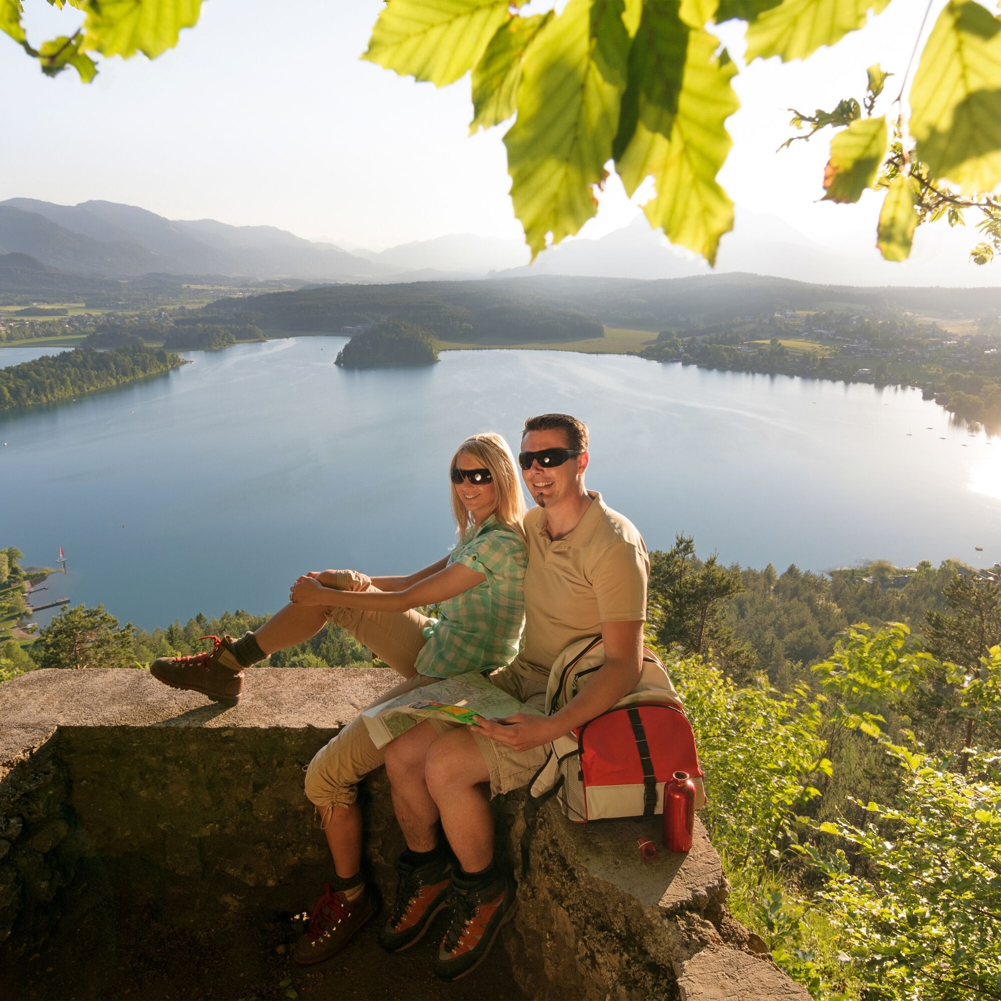
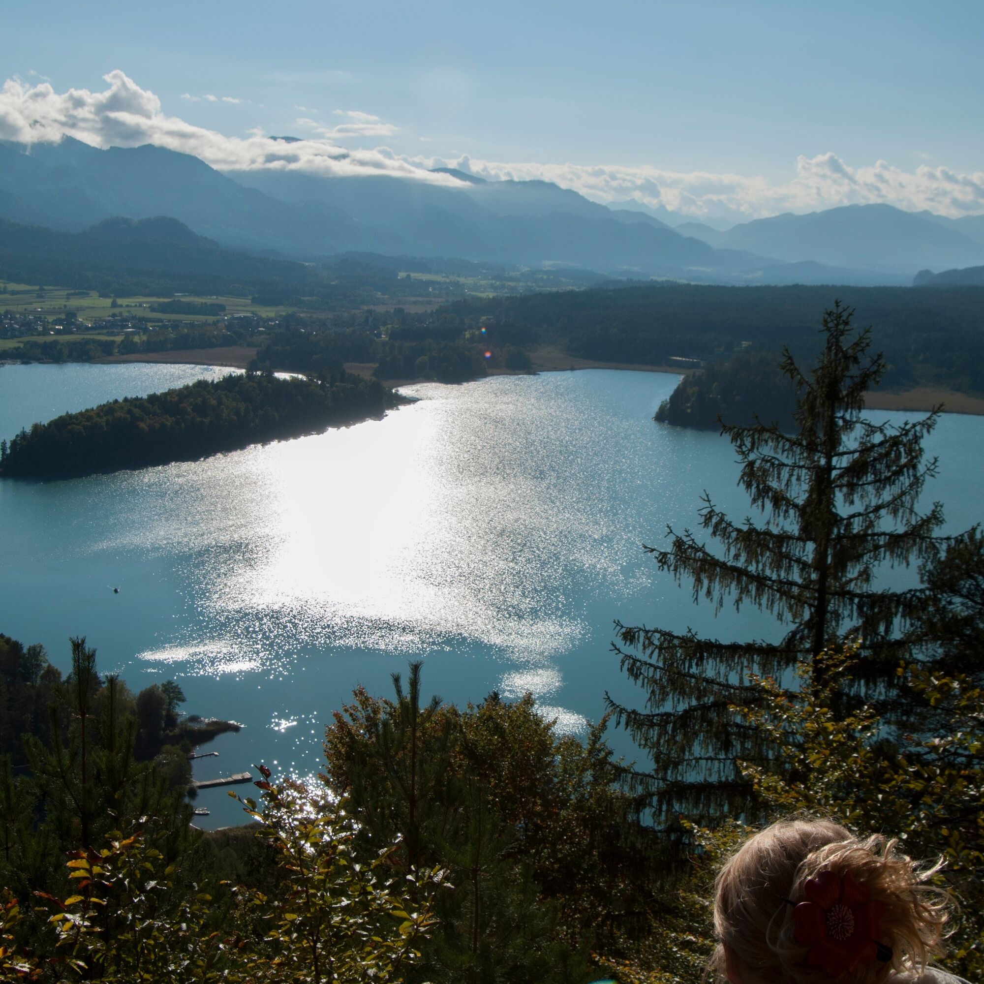
Fotografije naših uporabnikov
 © Glanzer JuliusUstvarjeno na 22.04.2026
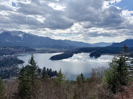
 © Andrea GamnigUstvarjeno na 06.04.2026
 © Andrea GamnigUstvarjeno na 06.04.2026
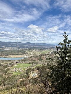 © Andrea GamnigUstvarjeno na 06.04.2026
 © Andrea GamnigUstvarjeno na 06.04.2026
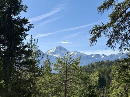 © Andrea GamnigUstvarjeno na 06.04.2026
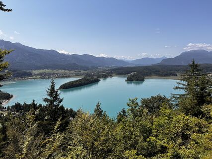
 © Przemek BaranUstvarjeno na 07.08.2025
 © Susanne LinzbacherUstvarjeno na 31.05.2025
 © Susanne LinzbacherUstvarjeno na 31.05.2025
 © Susanne LinzbacherUstvarjeno na 31.05.2025
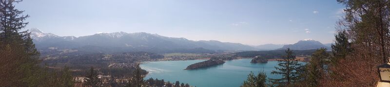
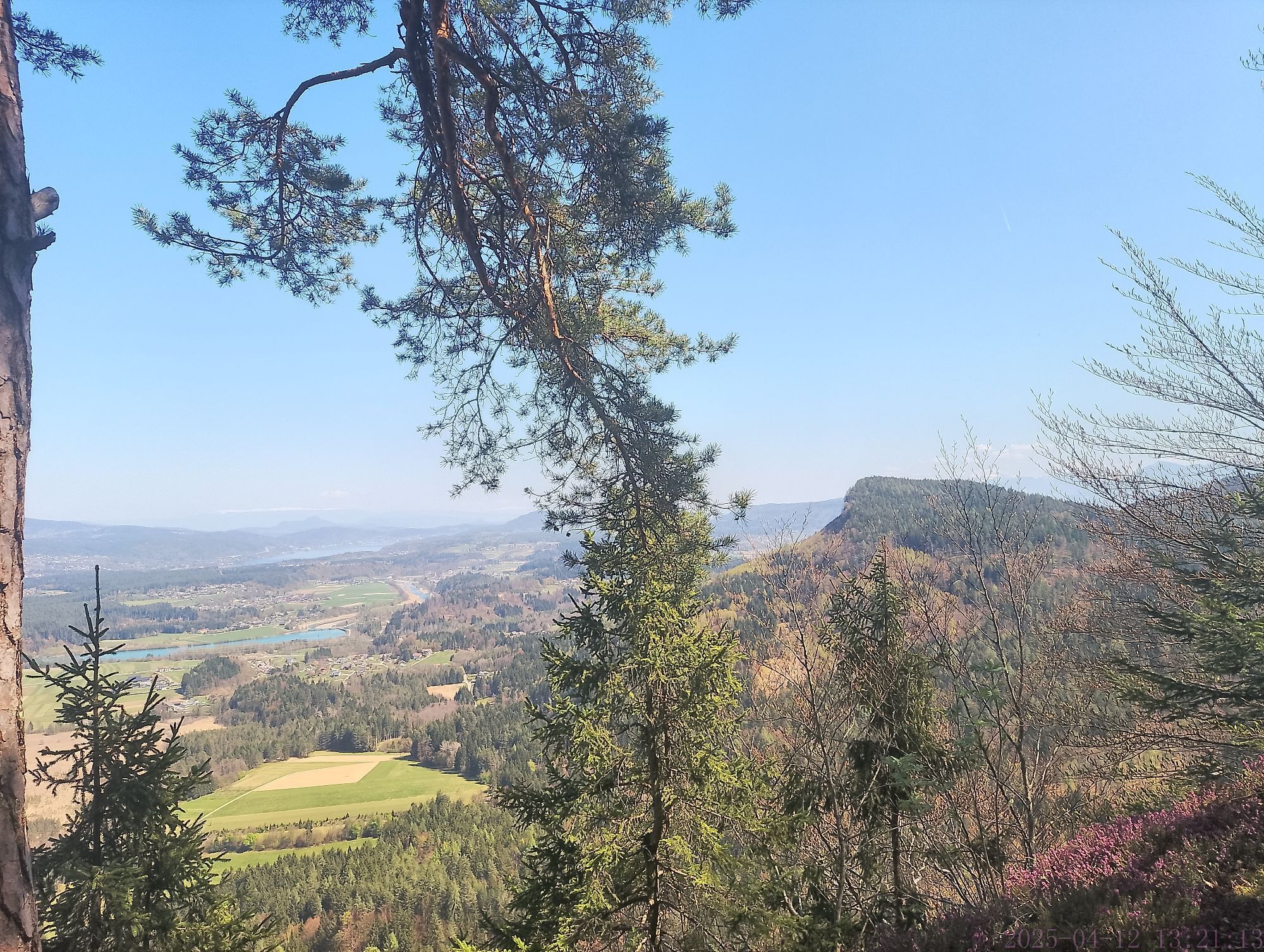
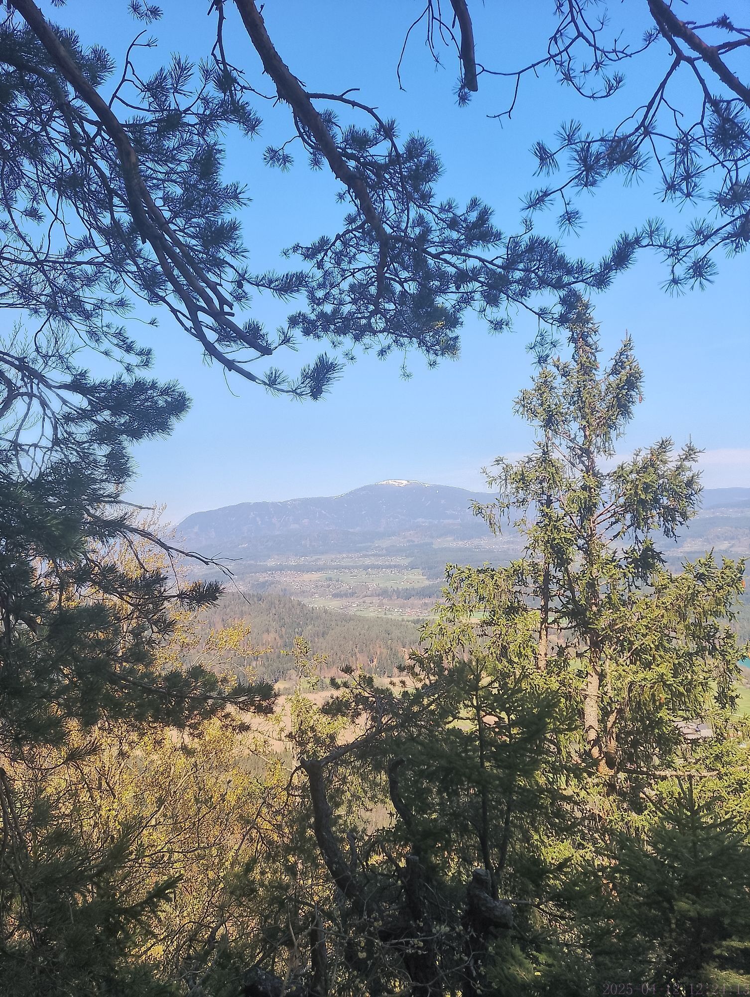
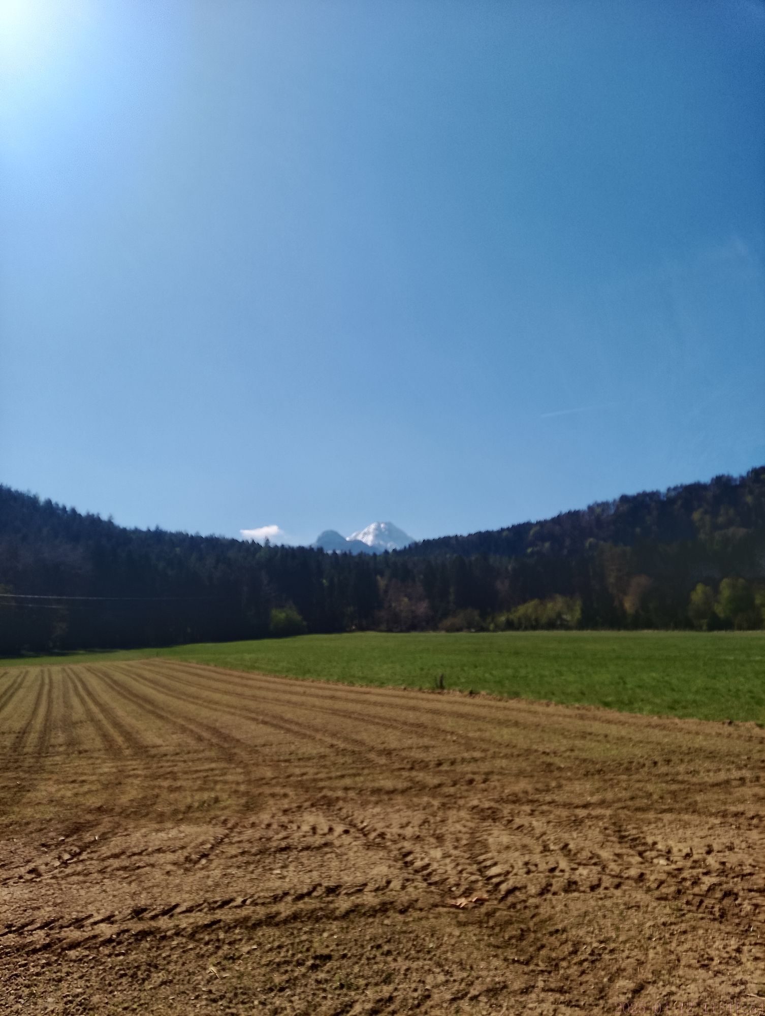
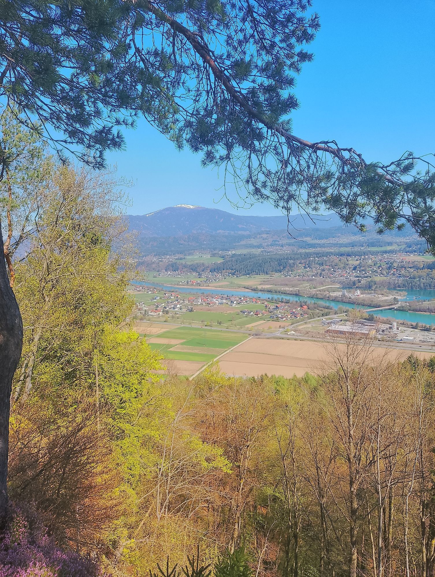
 © Franz G.Ustvarjeno na 12.04.2025
 © Franz G.Ustvarjeno na 12.04.2025
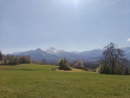 © Franz G.Ustvarjeno na 12.04.2025
 © Franz G.Ustvarjeno na 12.04.2025
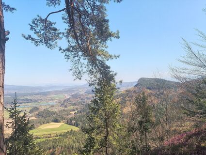 © Franz G.Ustvarjeno na 12.04.2025
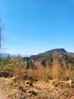 © Franz G.Ustvarjeno na 12.04.2025
 © Franz G.Ustvarjeno na 12.04.2025
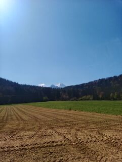 © Franz G.Ustvarjeno na 12.04.2025
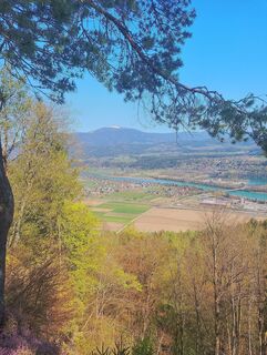 © Franz G.Ustvarjeno na 12.04.2025
 © Franz G.Ustvarjeno na 12.04.2025
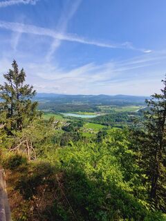 © Kathrin MaurerUstvarjeno na 04.05.2025
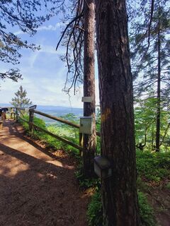 © Kathrin MaurerUstvarjeno na 04.05.2025
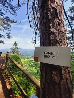 © Kathrin MaurerUstvarjeno na 04.05.2025
 © Thomas ReinerUstvarjeno na 29.12.2024
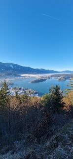 © Thomas ReinerUstvarjeno na 29.12.2024
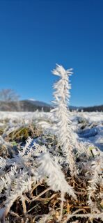 © Thomas ReinerUstvarjeno na 29.12.2024
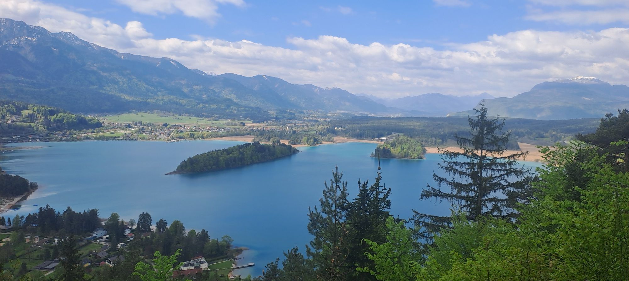
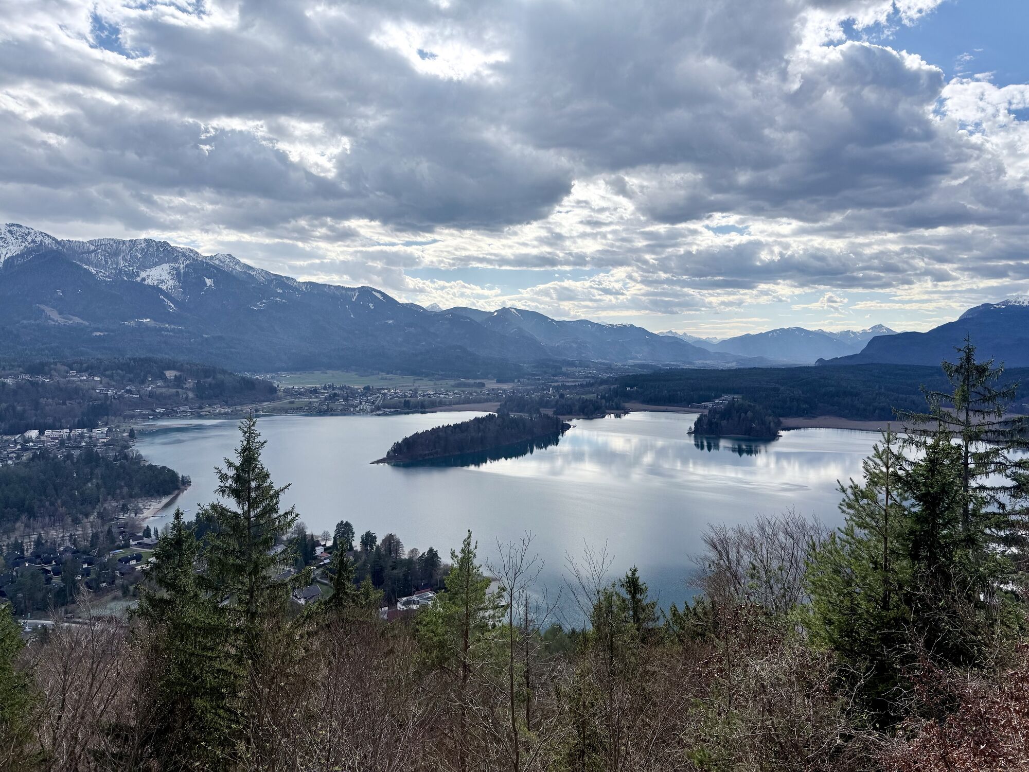
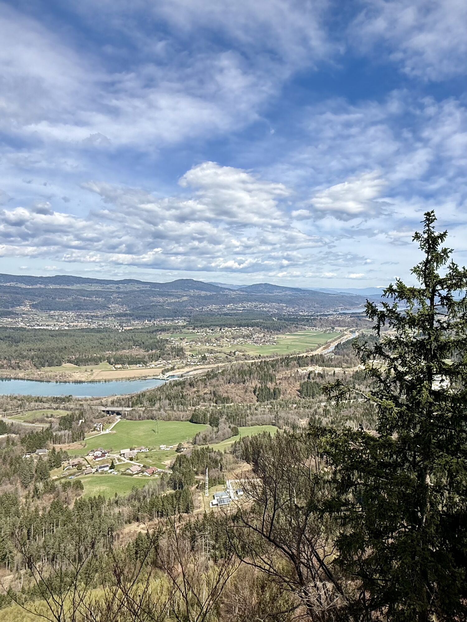
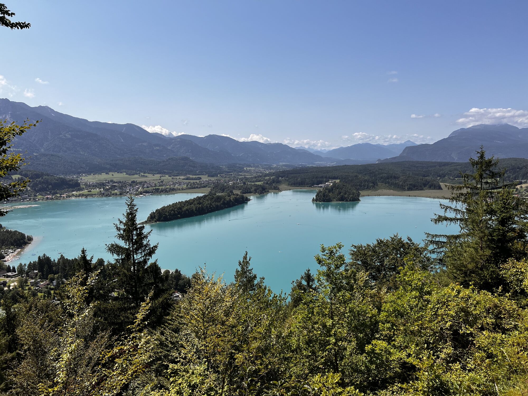


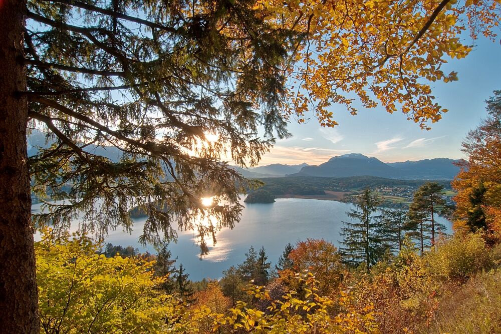
Mysterious mountain landscapes, hidden places of power, legendary forest areas, and the four panoramic peaks Wauberg, Petelin, Bleiberg, and Tabor. The adventure begins right at Faaker See. We dive into...
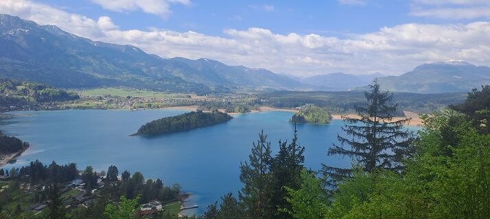
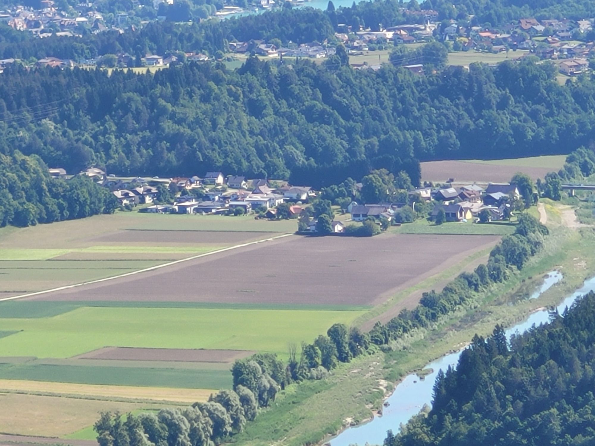
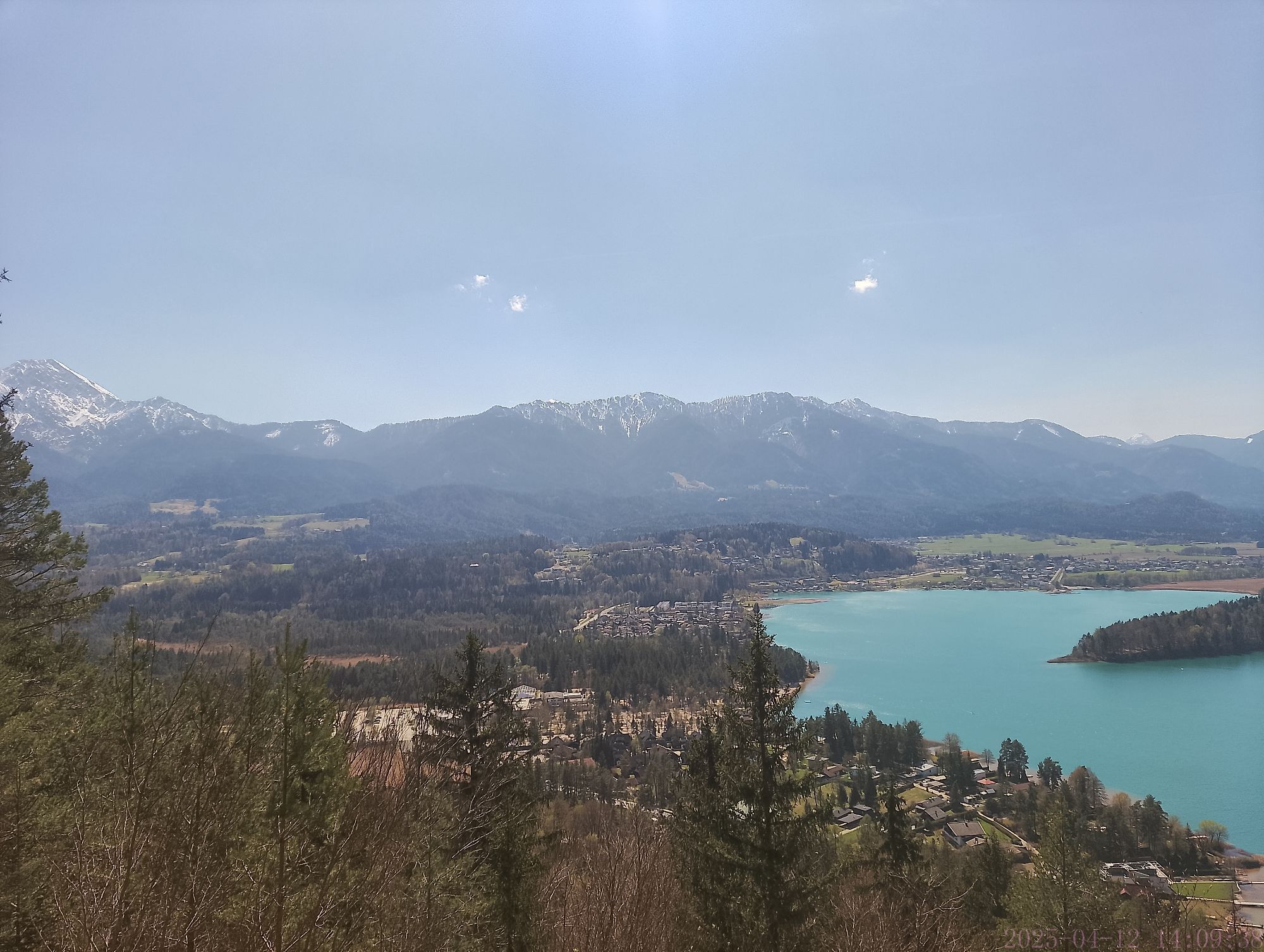
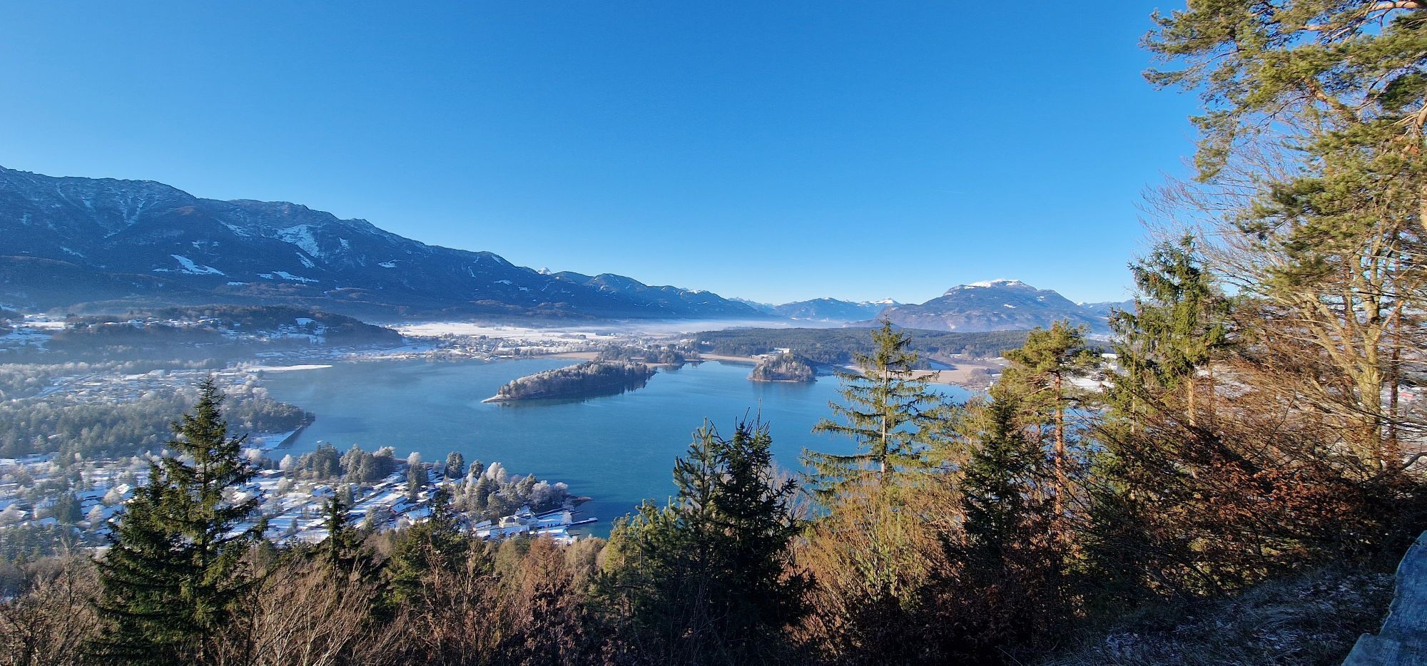
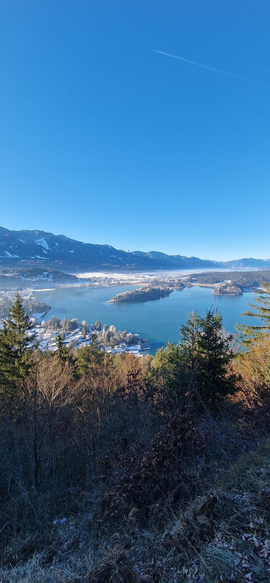
Mysterious mountain landscapes, hidden places of power, legendary forest areas, and the four panoramic peaks Wauberg, Petelin, Bleiberg, and Tabor. The adventure begins right at Faaker See. We dive into a mountain landscape with places of power, surrounded by legends and myths, almost overgrown by forest, heavily marked by erosion, mysterious, and almost forgotten. Tales are told of hard-to-access caves, old refugee castles, and collapsed tunnels. Five mountains watch over Faaker See and the entrance to Rosental. Four of them are our goal.

Starting from the parking lot in Neuegg at Faaker See (opposite Camping Arneitz), you can reach the start of the "Tabor Circular Route" at Taborstraße (N 46.577718/E 13.940486) within a few minutes on foot. This can be used as a beautiful shaded approach to the "4 Peaks Panorama Route" (http://alpregio.outdooractive.com/ar-villach/de/alpregio.jsp#i=10289540&tab=TourTab).
Follow the Tabor Circular Route for about 20 minutes towards Egg (not included in the stated walking time!) and reach the Tabor path near the last houses. Here starts the signage of the "4 Peaks Panorama Route" and it leads the hiker clockwise continuously marked Red-White-Red over the peaks Wauberg, Petelin, Bleiberg, and Tabor.
The first peak is quickly reached after the playground and the turnoff to Tabor. The Wauberg 689 m (N 46.5865069/E 13.9471167) is a cone-shaped mountain, steeply falling away in all directions. Mysterious, a single question mark. On the small summit area, there are both prehistoric (late Neolithic ceramics) and Roman finds, a circular, masonry depression as well as visible wall remains under the turf. The vague assumptions of historians range from a pre-Roman cult site, a late Roman facility, to a Lombard castle or an early medieval fortress.
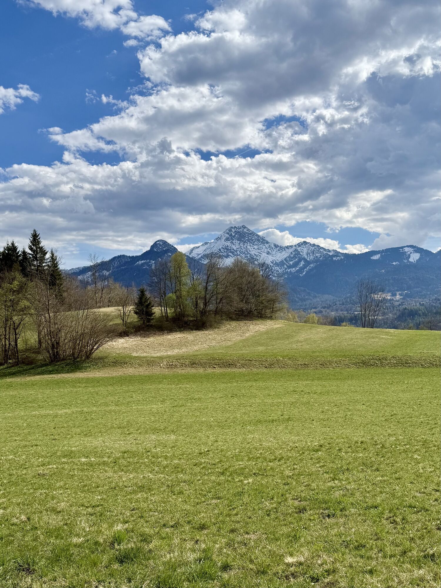
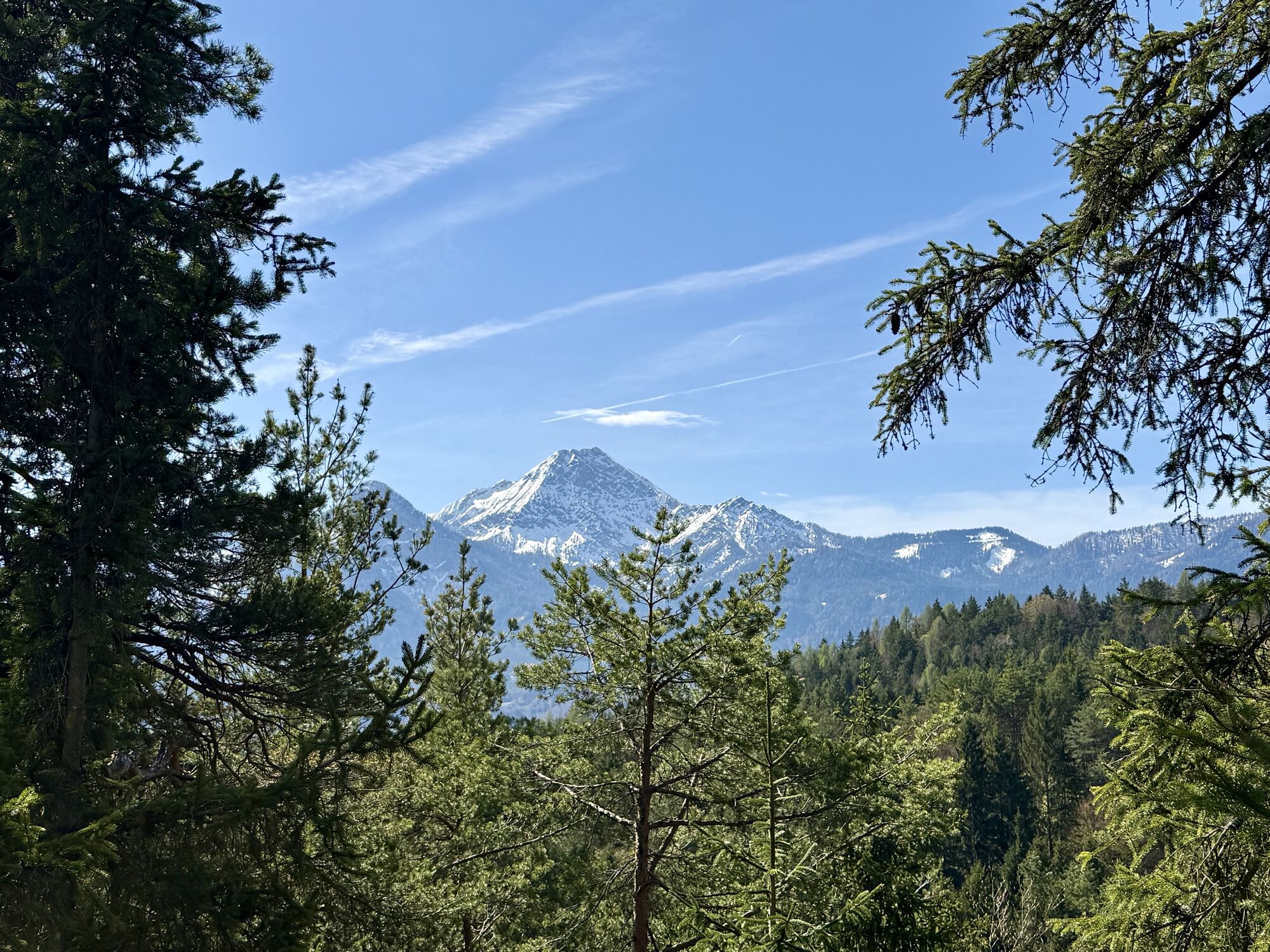
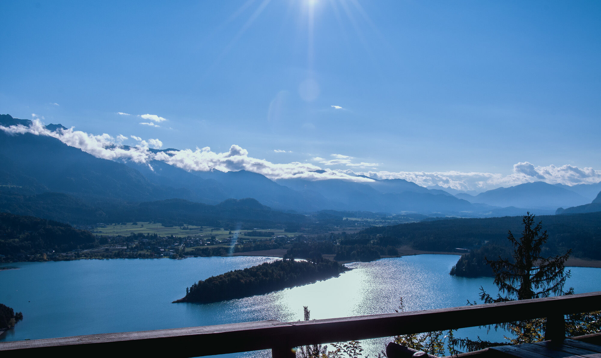
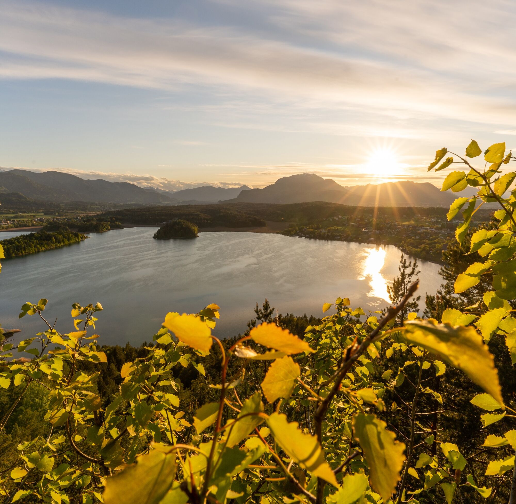
In between, there is plenty of room for legends, myths, and a fairytale view of the Karawanks and the Drava.
From Wauberg, return via the ascent path to the junction and then gently descend eastwards; shortly before Petschnitzen, turn left towards St. Martin. A wild romantic gorge leads past the fore-mountain of Rudnik (717 m) (Rudnik = Slovenian for mine). The walls of the fore-mountain are perforated with tunnels that unfortunately are no longer accessible.
Then you reach the idyllic wet meadows near St. Martin, and the former miners' house at the Techuana scout camp is also worth mentioning (a few minutes' walk off the trail).
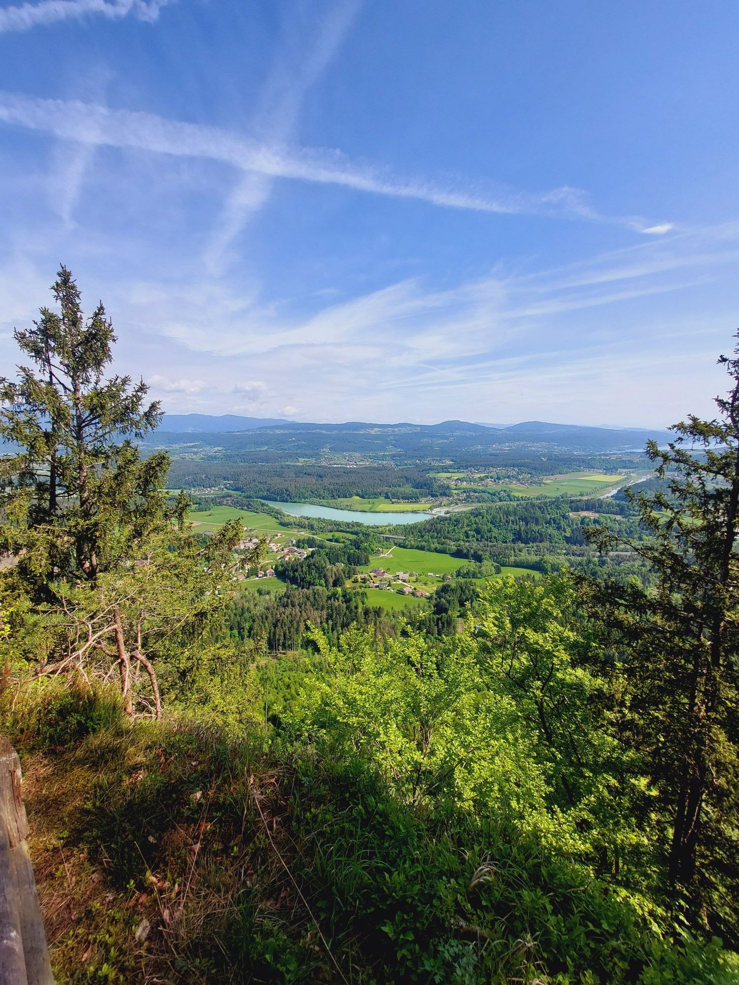
North of the scout camp, the path leads along the edge of the wetlands to St. Martiner Straße, and the next peak is clearly in the hiker's view. Petelin is the highest peak of the group of four and will cause some calf burning due to its steep northern ascent.
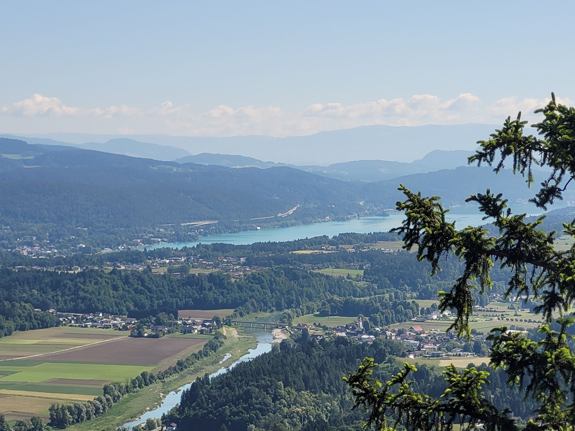
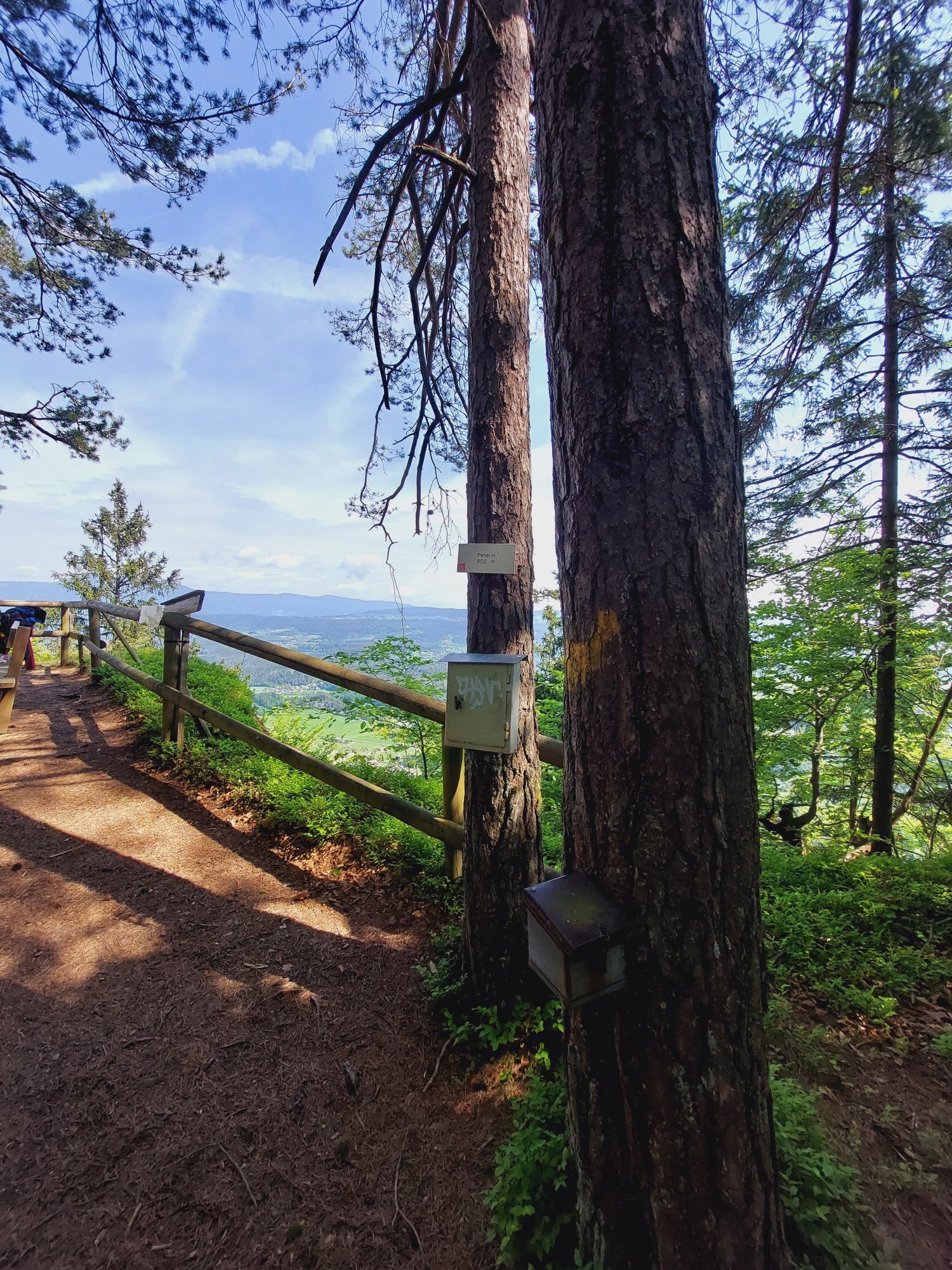
At St. Martiner Straße, turn left and follow the road to the first two houses. Here, turn right again onto the gravel path, which gently ascends to the spring catchment (former geology educational trail). The Red-White-Red marking (NOTE: The yellow-green marking is for a pilgrimage route starting from Rosegg! The routes are identical except for Petelin.) leads to a forest road, here keep left for a few meters and then turn right again at the signpost onto the pleasant forest path, reaching the second forest road. Cross it simply, and now you must grit your teeth once more. The steep root path (NOTE: Caution when wet!) leads to the edge of the terrain of Petelin. Parallel to this edge, we reach the summit of Petelin 802 m (N 46.573952/E 13.9844799) by steep ascent. It rewards us with a magnificent view of the Wörthersee, the Drava, and the St. Martin moor.
The descent takes place via the idyllic forest path to the forest road, turning right along the gravel road to the Humkirche junction. Here, DO NOT turn left but follow the gravel road to Drainbergsattel on the St. Martiner Landesstraße above Ledenitzen (Forellenhof).
On St. Martiner Straße, turn right, follow the asphalt road and turn left into Römerweg, which leads into the forest path after about 100 m. Here, follow the marking again to reach the third peak named Bleiberg 770 m (N 46.5749034/E 13.9631617).
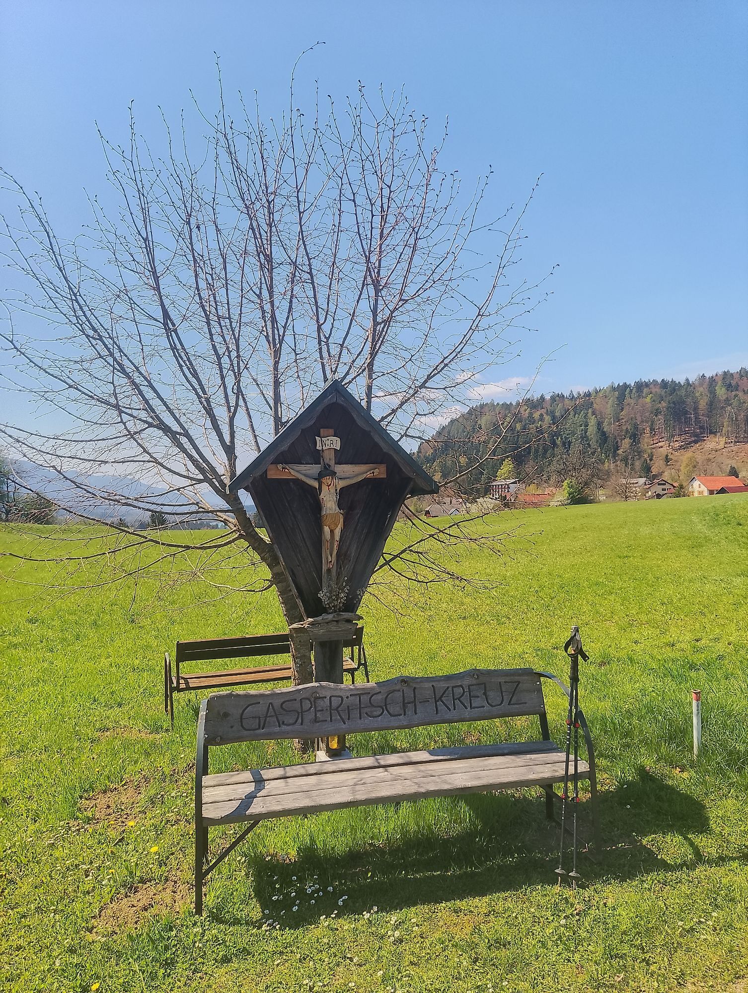
After a worthwhile break, the leisurely descent to Petschnitzen begins. The route is clearly marked, and after several forest road crossings, you reach the meadows in front of Petschnitzen with a striking Materl. It is only a few minutes on foot to the T-junction at Taborhof in the middle of Petschnitzen.
At Taborhof, briefly follow Taborstraße to the right and immediately turn left back into the forest. Not directly, but certainly via the most beautiful route, you go to the last peak. The Tabor 725 m (N 46.5818724/E 13.9393544) is a table mountain with brittle conglomerate rock walls. A magnificent viewpoint and truly a fitting and culinary conclusion to the route (NOTE: Ask for a blackberry omelet at the Tabor hut!).
The descent to the starting point leads briefly over Taborstraße; at the second bend near the Tabor hut, turn left - steeply descending - to the already known section to the playground and then to Egg at Faaker See.
Alternatively, you can descend via the known ascent route and a shortcut directly back to Petschnitzen to Taborhof and then hike on the paved Taborstraße back to Neuegg at Faaker See.
Da
Good shoes with treaded soles, daypack, rain protection, map material, binoculars, sufficient drinks and snacks.
It is recommended to walk the route as described in a clockwise direction! Pay attention to slippery spots and wet leaves near the cliffs in wet weather. Due to the steep section on Petelin and the long walking time, the route is classified as challenging (not suitable for children under 12 years). The entire route is equipped and signposted with a RED-WHITE-RED marking.
Faaker See is best reachable via the A2 exit "Villach-Faaker See".
Neuegg is accessible by post buses.
Neuegg at Faaker See - parking lot opposite Camping Arneitz (N 46.5752132/E 13.9372784)
or alternatively in Egg at Faaker See - parking lot next to Billa - paved parking (N 46.587823/E 13.9351273)
T2
On Taborhöhe, there is a great forest rope park: www.hochhinauf.at (0699 / 18601607) and the Tabor hut as a place to stop for food and drinks.

Priljubljeni izleti v okolici
- 4,5
Pyramidenkogel path Maria Wörth
srednjaPohodništvo 10,8 km - 4,4
Finsterbach Waterfalls - Circular route
srednjaPohodništvo 3,87 km - 4,2
Slow Trail Bleistätter Moor (Variant A)
svetlobaPohodništvo 7,22 km - 4,6
Rotschitza Klamm Klettersteig B/C
srednjaVia ferrata 3,73 km - 4,9
4 Huts Route
srednjaPohodništvo 8,96 km - 4,5
Baumgtn. Höhe, Mallestiger Mittags- und Schwarzkogel
težkoZimsko pohodništvo 10,7 km - 4,4
Mallestiger Mittagskogel
srednjaPohodništvo 8,17 km - 3,8
Lake Ossiach cycle path - R2 and R2A
srednjaKolesarjenje 28,2 km - 4,3
Mittagskogel - Rundwanderung
težkoPohodništvo 14,5 km - 4,9
Gratschenitzen Kreuz
težkoVisokogorska tura 3 km
Pohodništvo in sledenje


Ne zamudite ponudb in navdiha za naslednje počitnice
Vaš e-poštni naslov je bil dodan na poštni seznam.